Bradford’s “Conceptual” Canal

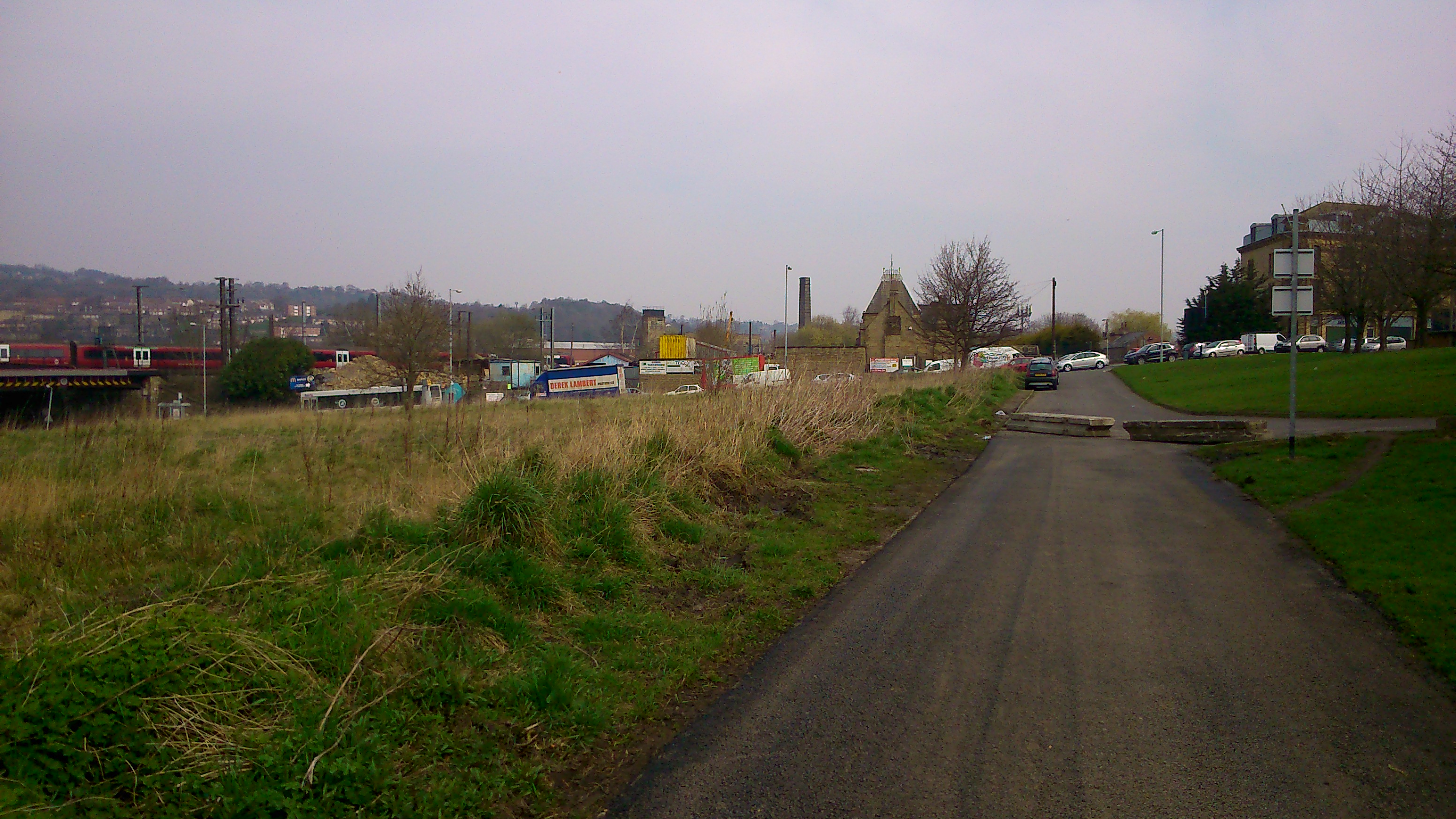
Just last week, the new cycle route between Shipley and the centre of Bradford was officially opened. Broadly speaking, it runs parallel with the line of Bradford Beck — which also means that it traces the former route of the Bradford Canal.2015-04-10 11.05.16

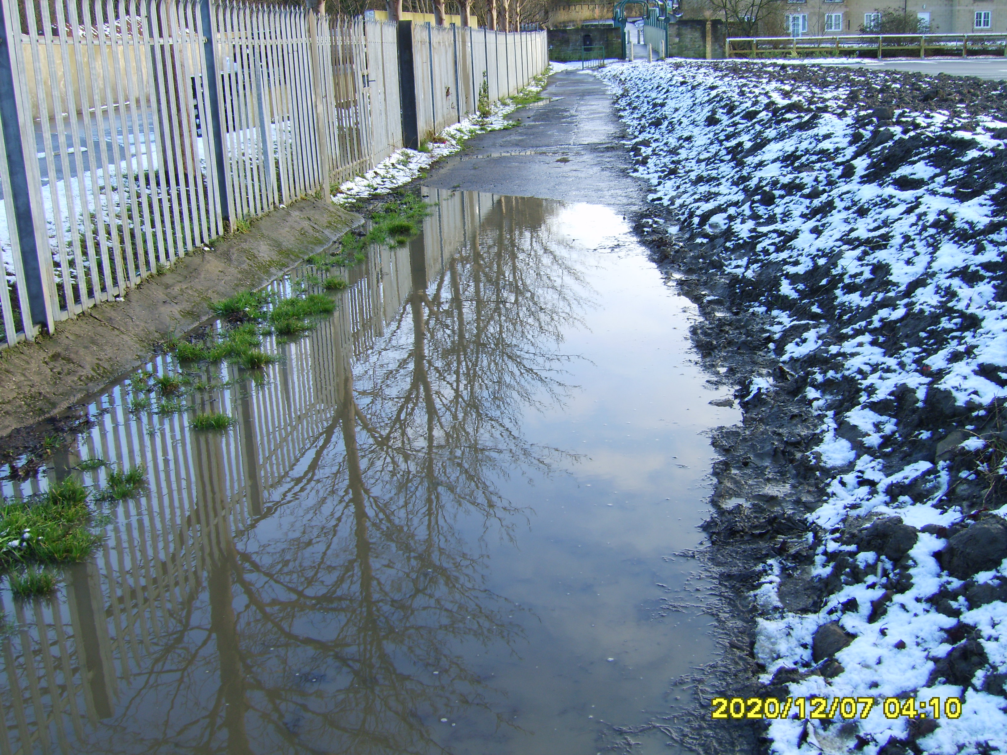
This shot looks south down the green space that runs alongside the Canal Road towards Bradford. The canal itself would (as I understand it) have run along on the left, roughly where you see the path, while the Beck — then as now — ran at the bottom of the valley. This is the spot, in fact, where my short film Wading to Shipley begins from – except that in 2012 when we shot that material there was no such clear access to the Beck at this point (that new bit of fence demonstrates that access might be a bit too clear without it!). This next shot is a few yards further downstream past the bridge…
2015-04-10 11.03.42
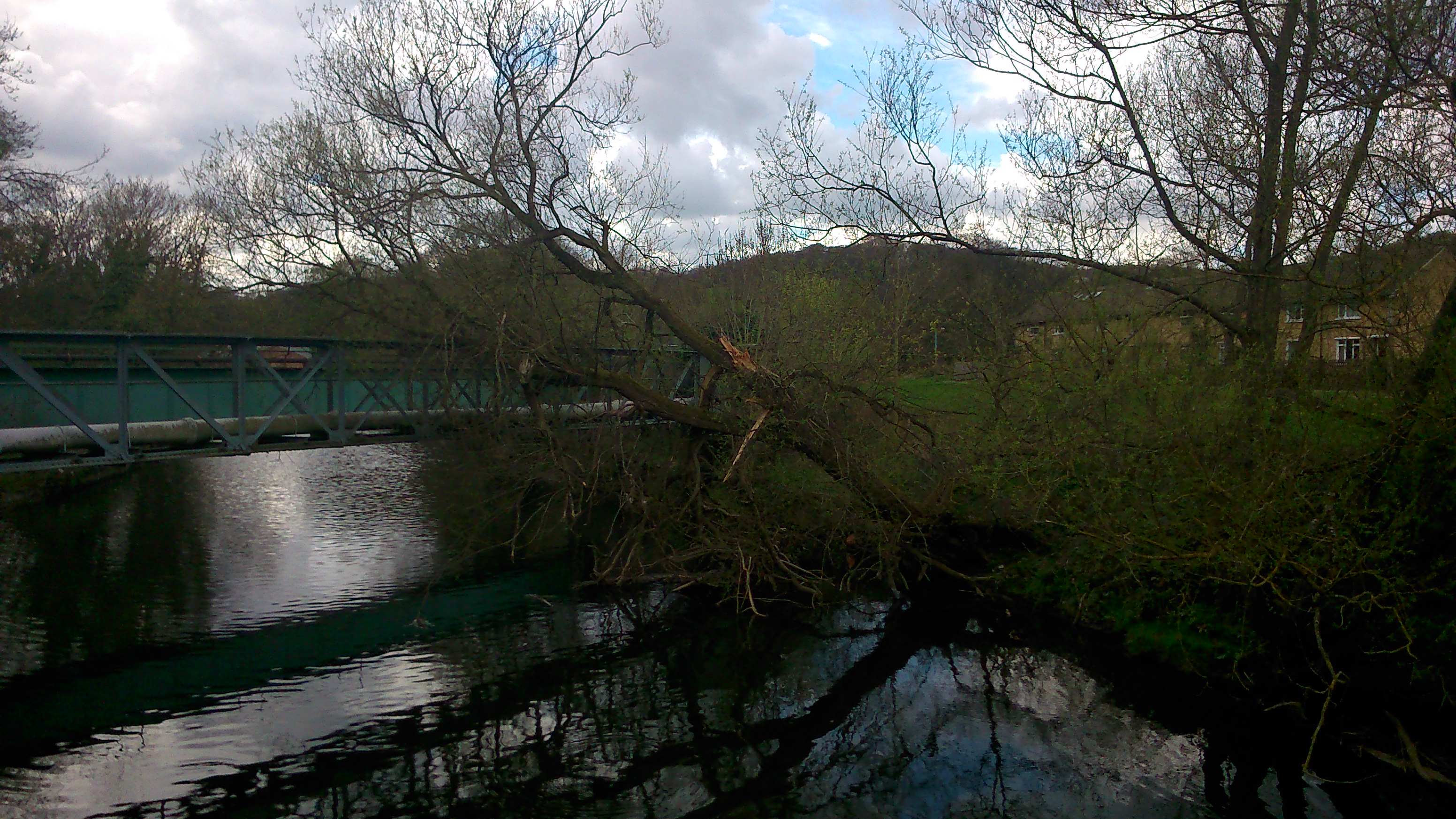
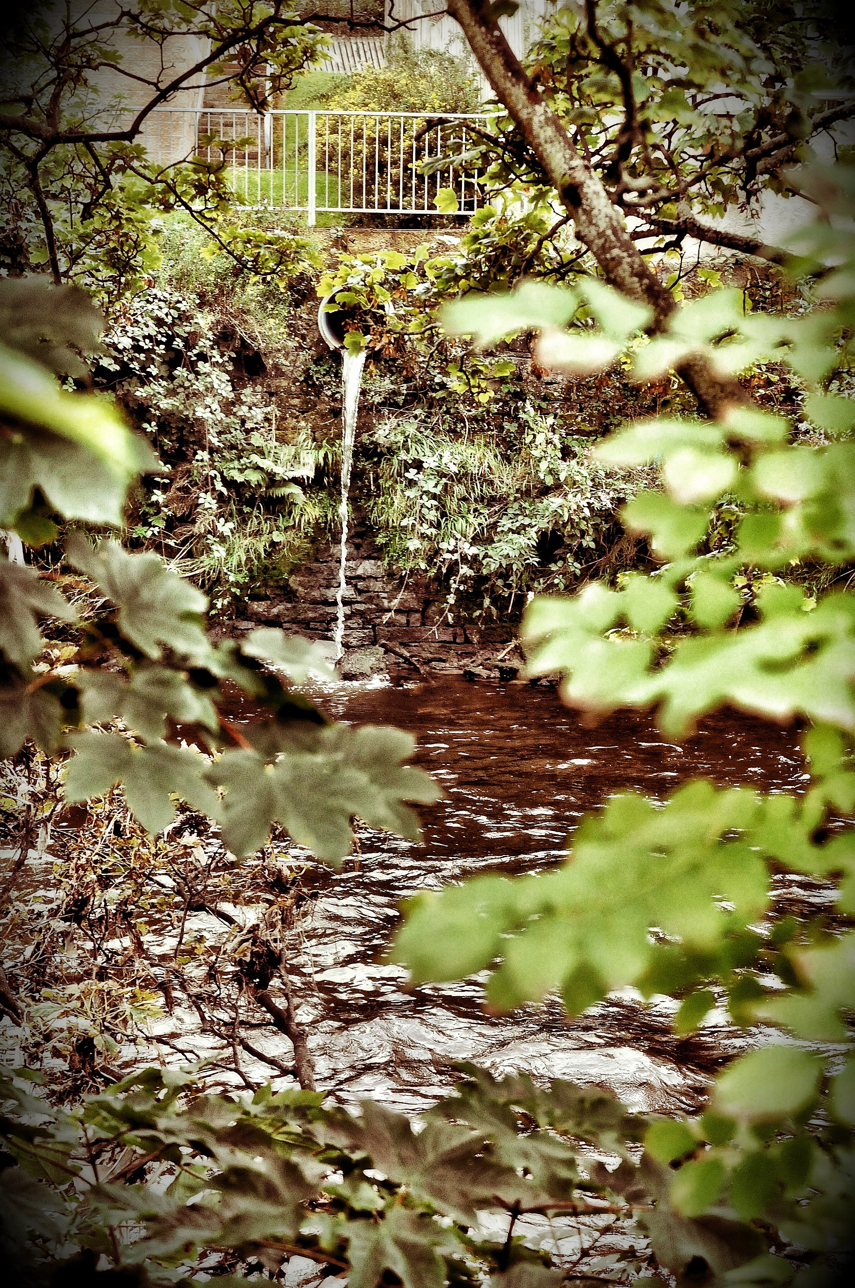
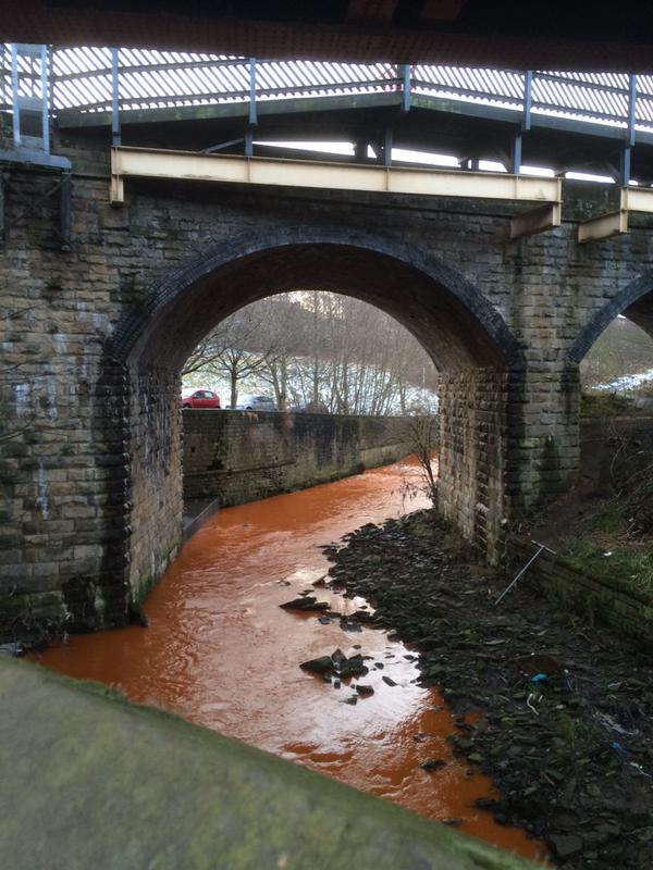
Here you can see the high retaining wall/flood defence that pens the Beck in at this point. The area to the left (east) used to be an impassable area of undergrowth…

2015-04-10 11.03.03

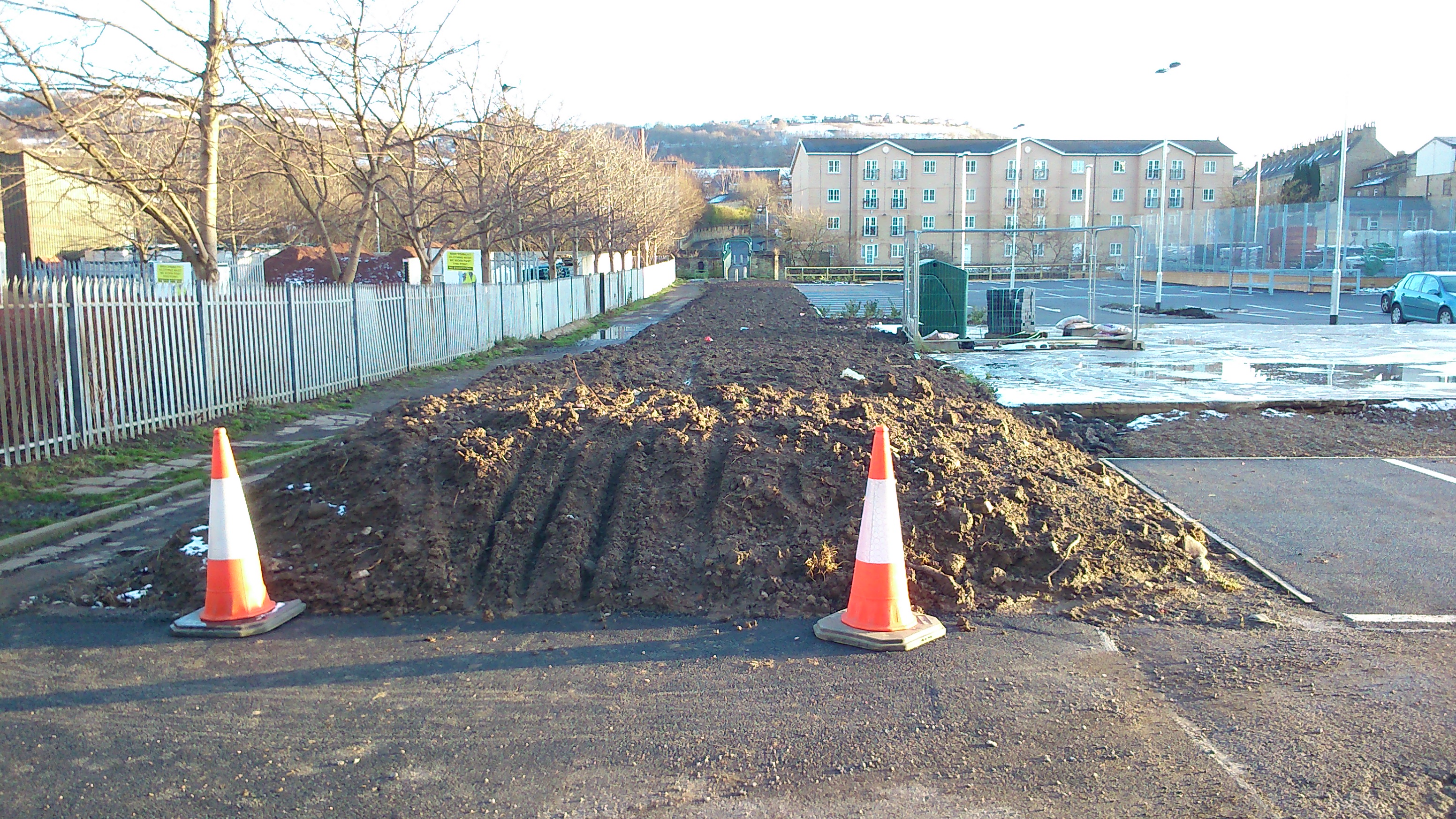
But it’s now been cleared out completely in the construction of this path. Hopefully in due course there’ll be some replanting and other improvement because it looks a wee bit bleak just here…

2015-04-10 11.00.43

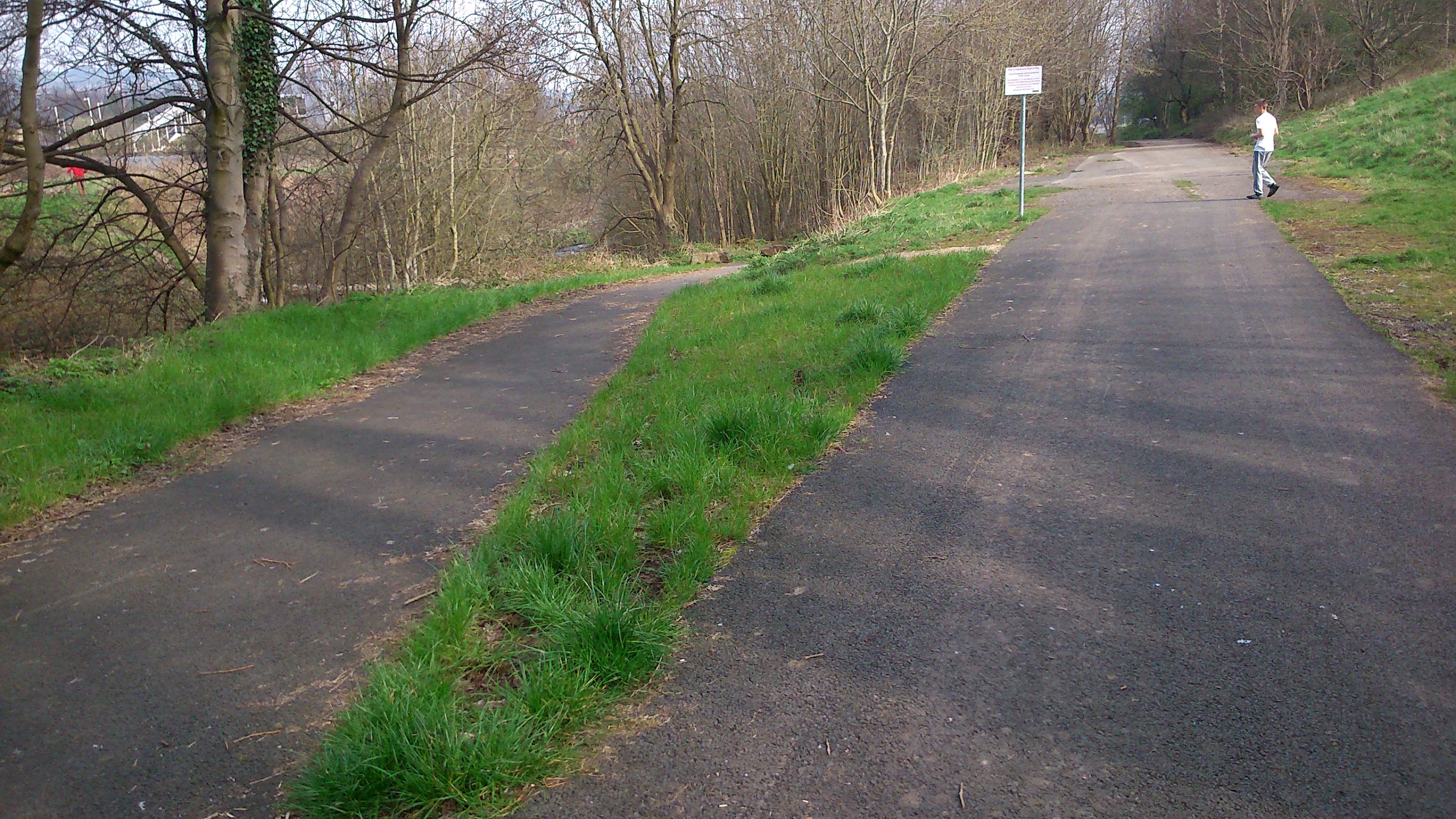
As you begin to walk towards Shipley, the new path forks neatly in two directions. The main path follows what would have been the route of the canal, while the lower path heads down to a small footbridge across the Beck…

2015-04-10 10.59.49
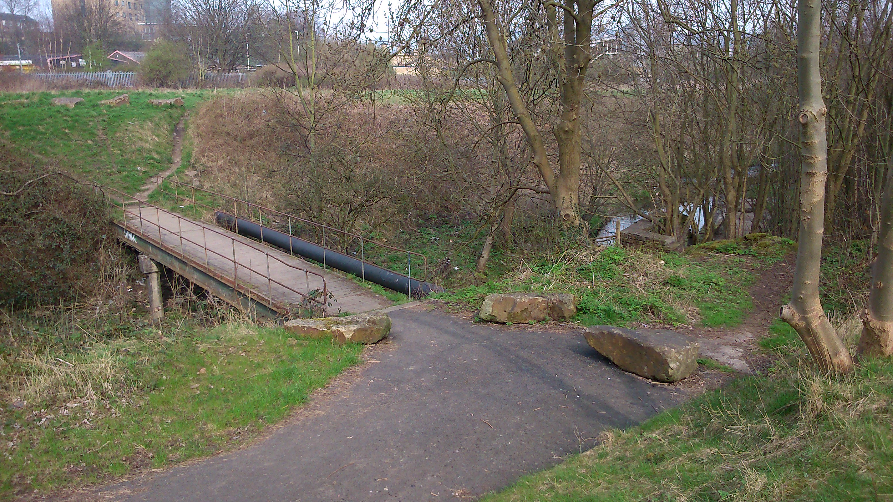
The bridge has been there for a long time, but access to it — and across towards the station — is now much clearer… also making the Beck that bit more accessible.

2015-04-10 11.00.24
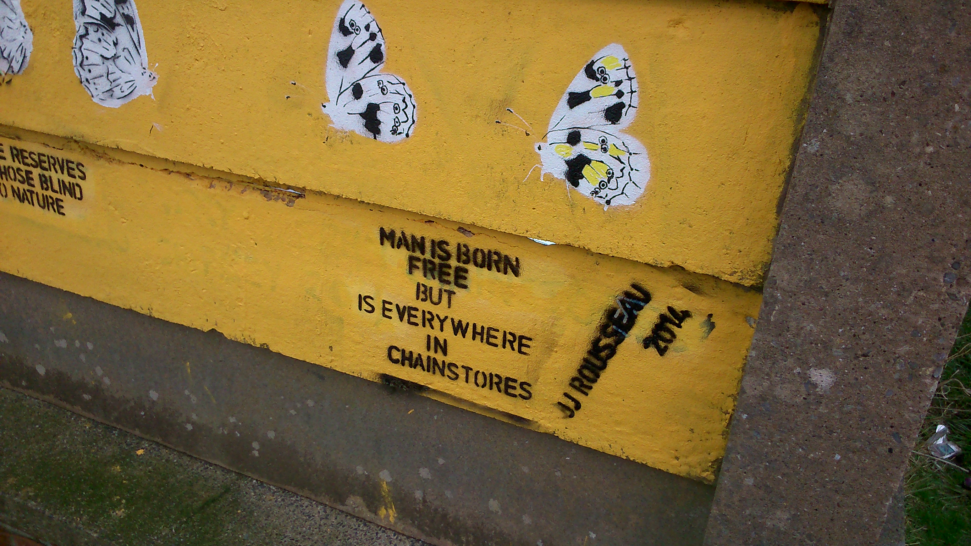
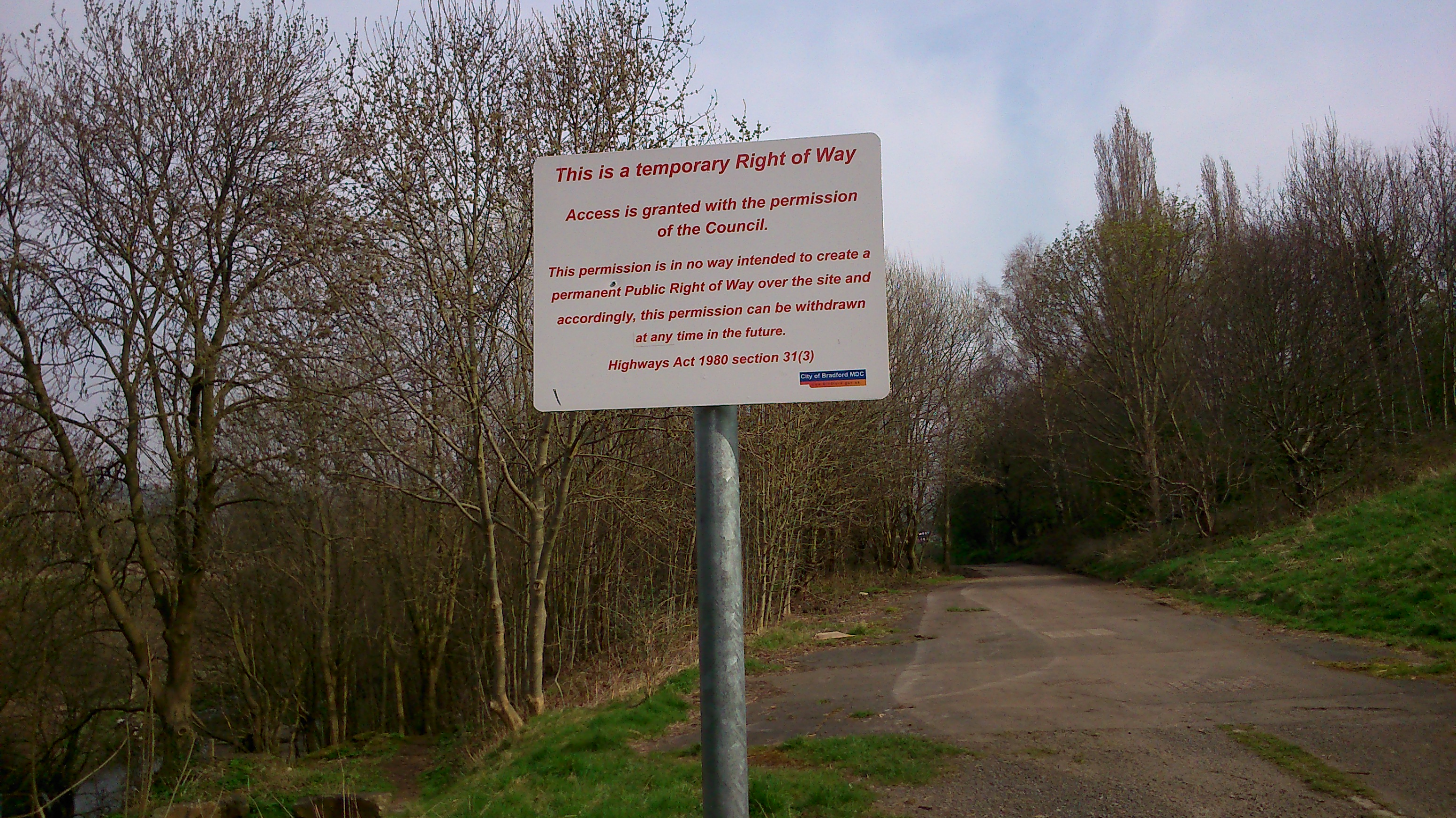
Here’s a close-up of the notice in the last-but-one picture above. Bradford Council (as it has done in other places flagged up on this blog) has taken care to ensure that this new path is designated as a temporary right of way — that no precedent is being set which might, through use and custom, establish this as a permanent public right of way. This means that, in the future, they can choose to close the path, build over it, whatever. An understandable disclaimer perhaps, but a rather disappointing one for anyone dreaming of a greater sense of “public commons” rather than slightly grudging “permission”…

2015-04-10 10.59.08This shot, taken further along, looks back down the path towards the back of the sign, and Bradford beyond. This might become quite a pleasant, wooded walk in time…

2015-04-10 10.58.26
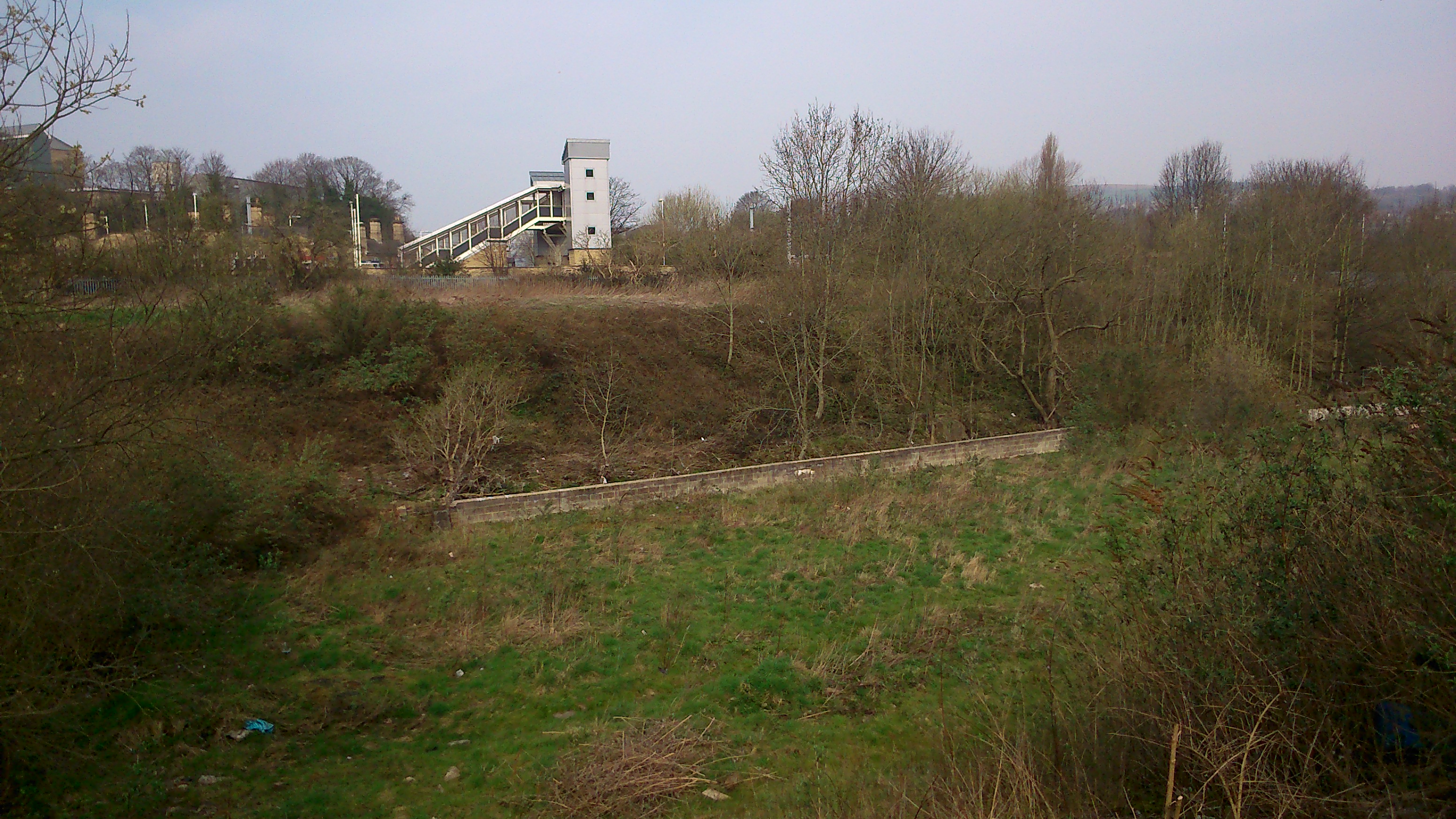
Further along still, the trees open out and you can look across the valley to Shipley station. Here the Beck is only visible via the retaining wall that cuts across the land…

2015-04-10 11.11.08
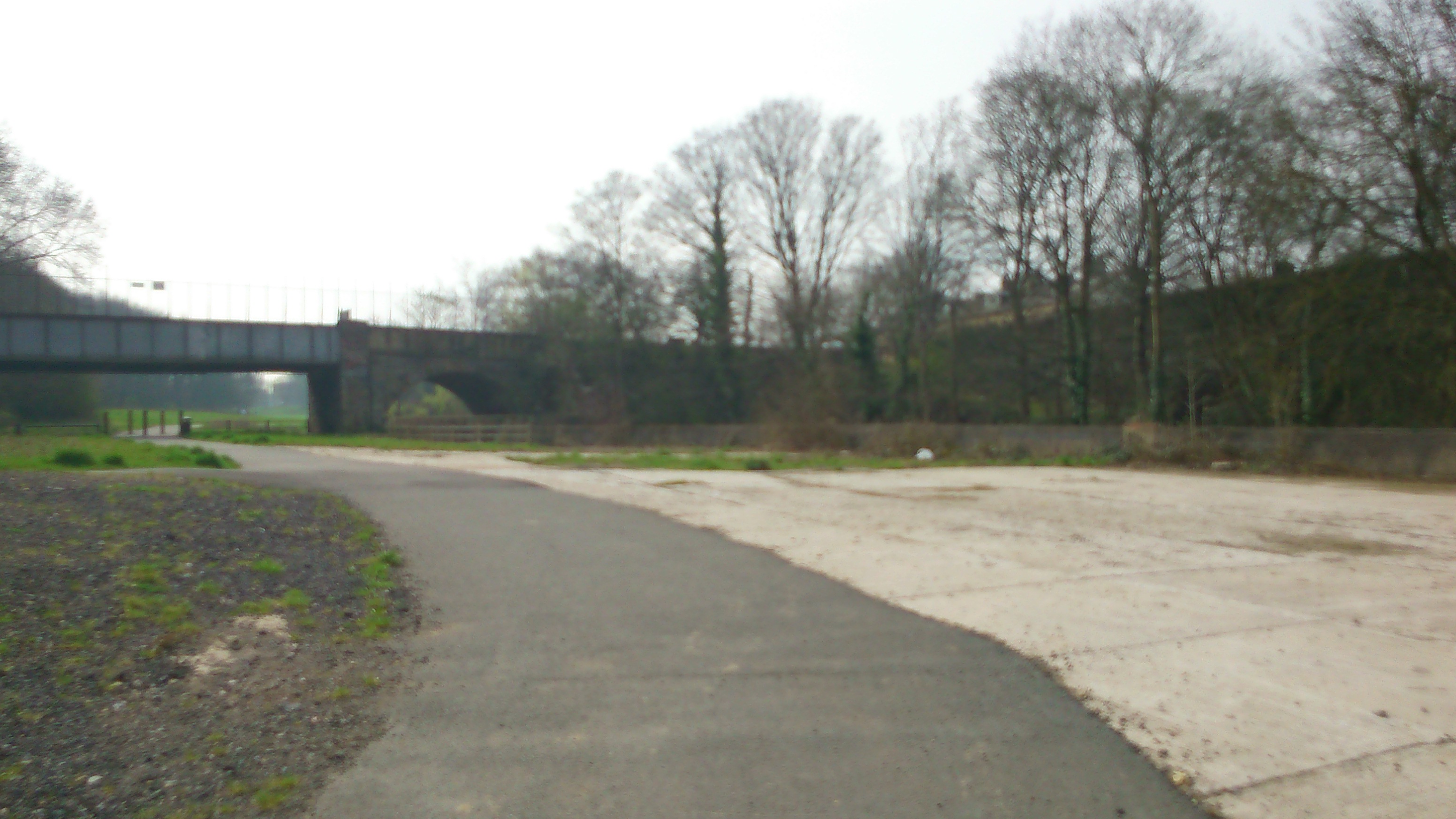
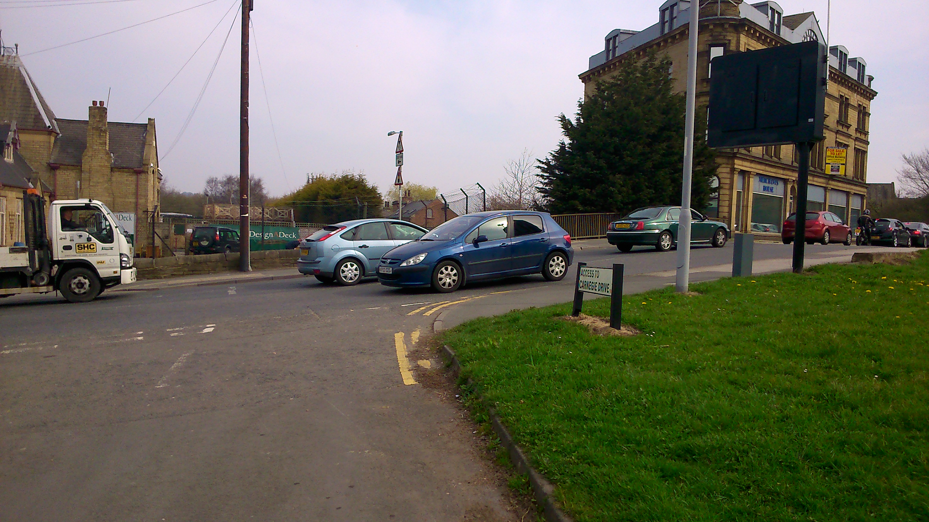
And here the path brings us out onto Carnegie Drive, Windhill, looking towards the main Leeds Road — with the railway crossing the bridge to the left… Remember again, this is roughly the trajectory of the old Bradford Canal. And now, closer still to the road, take a look across to the red-brick building just visible, in the middle distance, between the two blue cars pictured below…

2015-04-10 11.12.21

2015-04-10 10.55.31

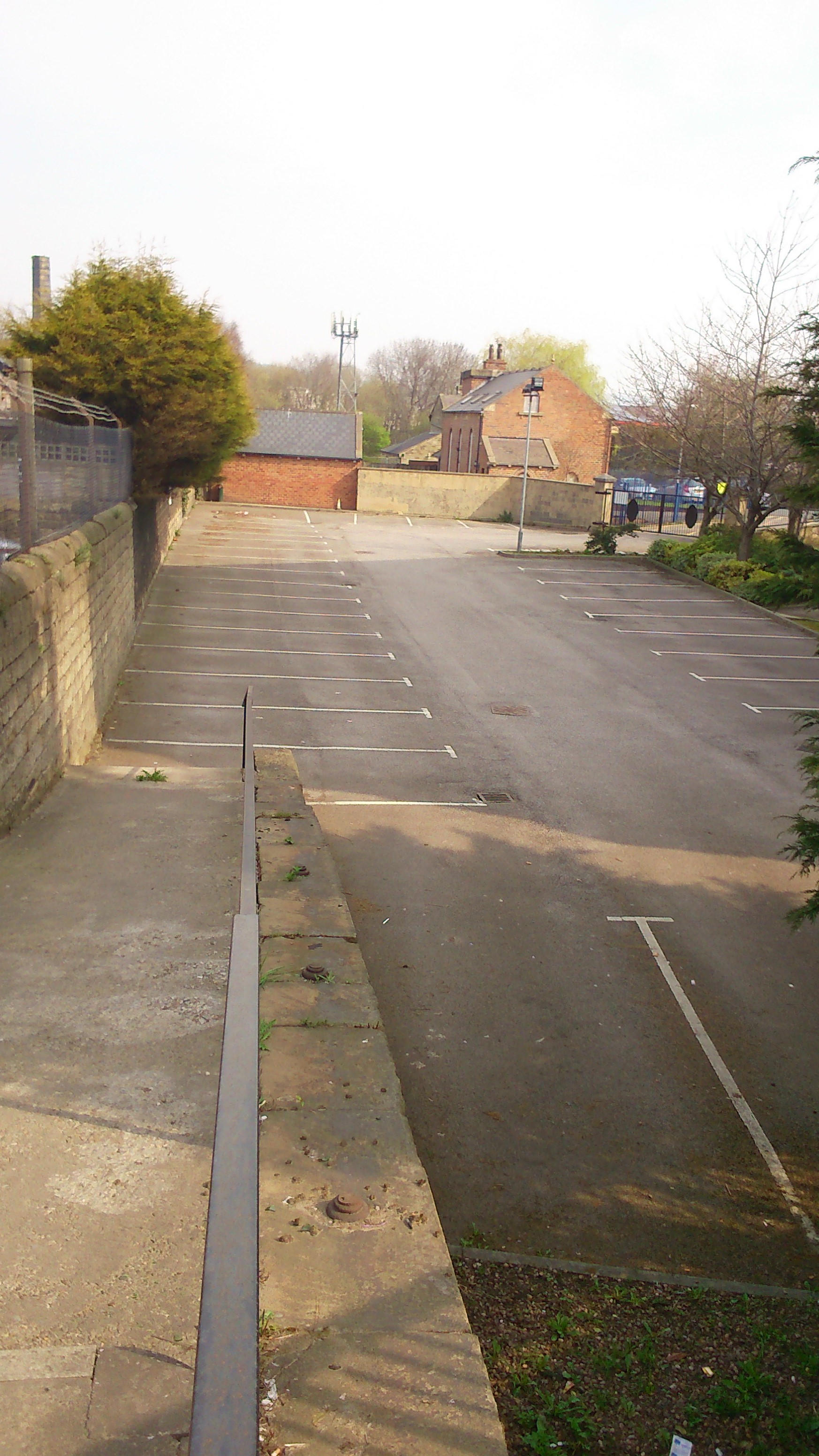
The red-brick building, pictured again on the right here (this time we’ve crossed the Leeds Road to the other side), is the old pump house for the Bradford Canal… and the path marked out down the middle of the car park you see here would have been the line of the canal itself… connecting towards the route we’ve just traced.

The pumphouse was built in 1872, by the Leeds-Liverpool Canal Company, after they took over the Bradford Canal. It had been closed for some years, following a major canalside cholera outbreak! The seriously polluted condition of the water was in part due to the poor water supply from central Bradford, as it trickled down through the many locks on the way to Shipley… So the LLCC’s solution in the late nineteenth century was to establish a pumping system that re-cycled water from the Leeds-Liverpool end all the way back up to the Hoppy Bridge end in Bradford….

2015-04-10 11.15.42
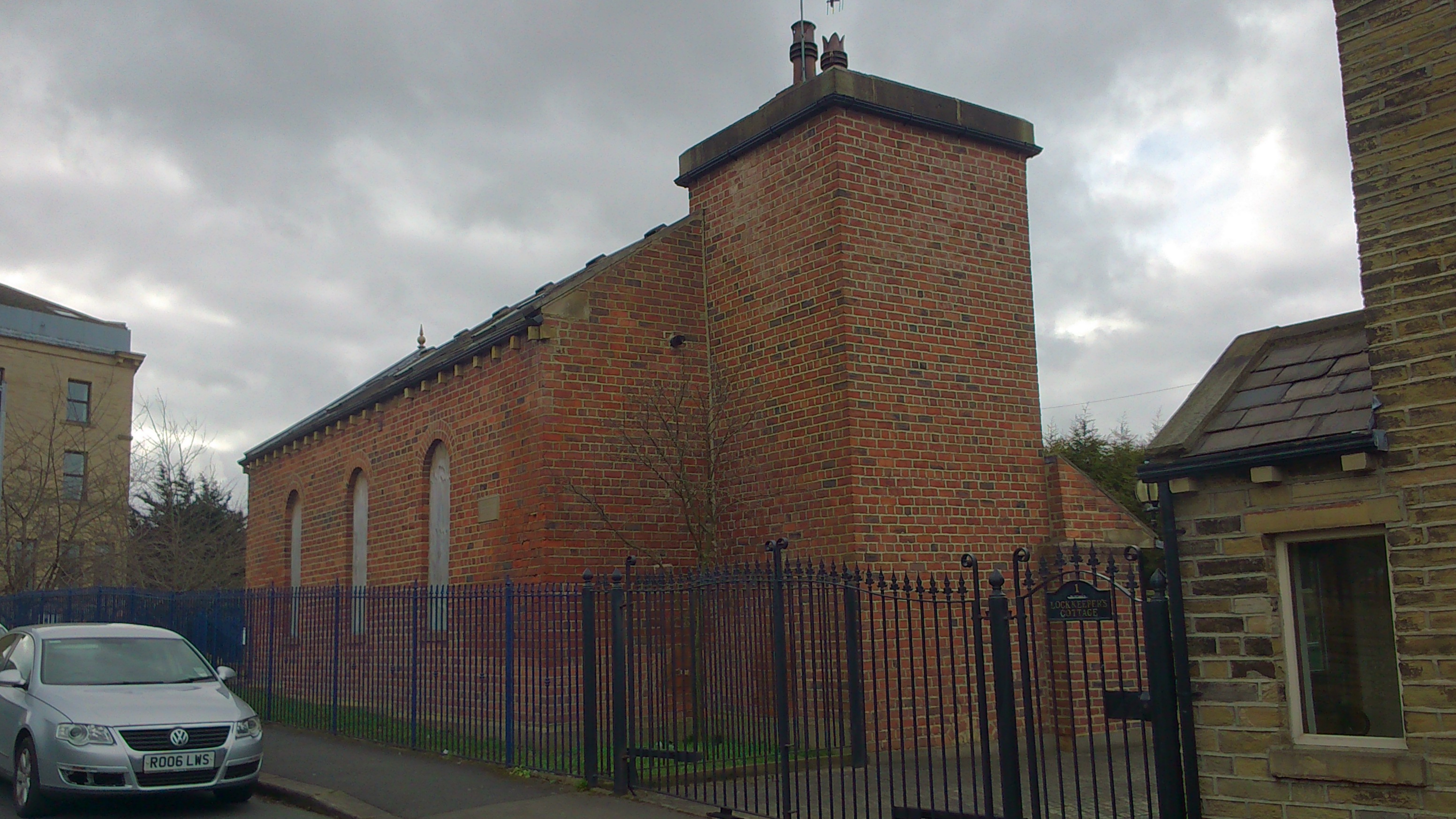
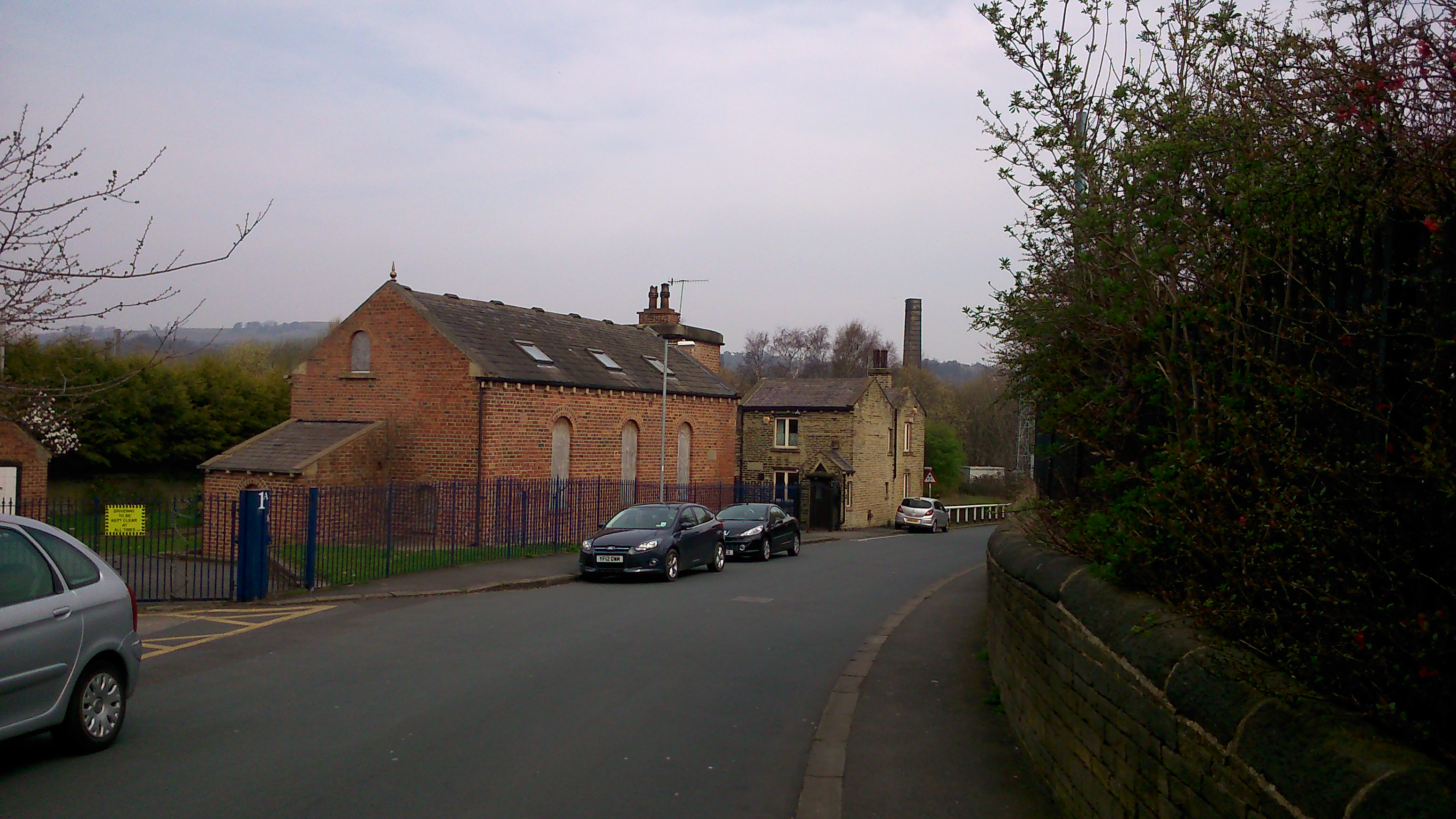
Here’s the pumphouse viewed closer up, on Dock Lane — and beyond it the original lock-keeper’s cottage, built in 1774 when the canal first opened. (The first sections of the Leeds-Liverpool canal to be cut in 1773 and 1774 were those between Shipley and Skipton: together with the Bradford Canal branch line, this allowed the first cargoes to be shipped between Bradford and Skipton…)

2015-03-05 13.35.50And here is all that’s now left of the Bradford Canal — the stumpy-looking mouth opening out onto the Leeds-Liverpool Canal, just a little further down Dock Lane from the pumphouse. So although the new cycle route stops rather abruptly when you hit the Leeds Road, all cyclists need to do is cross over it, whizz down Dock Lane, and then join the LLC towpath on the other side of the swing-bridge… They can then follow the towpath all the way to Leeds if they want — meaning a clear cycle route from Bradford to Leeds, via this northern hinge at Shipley (exactly what the canal system used to do, and what the Leeds to Bradford Forster Square train route still does…). But let’s head back to the pumphouse…

2015-03-05 13.41.05
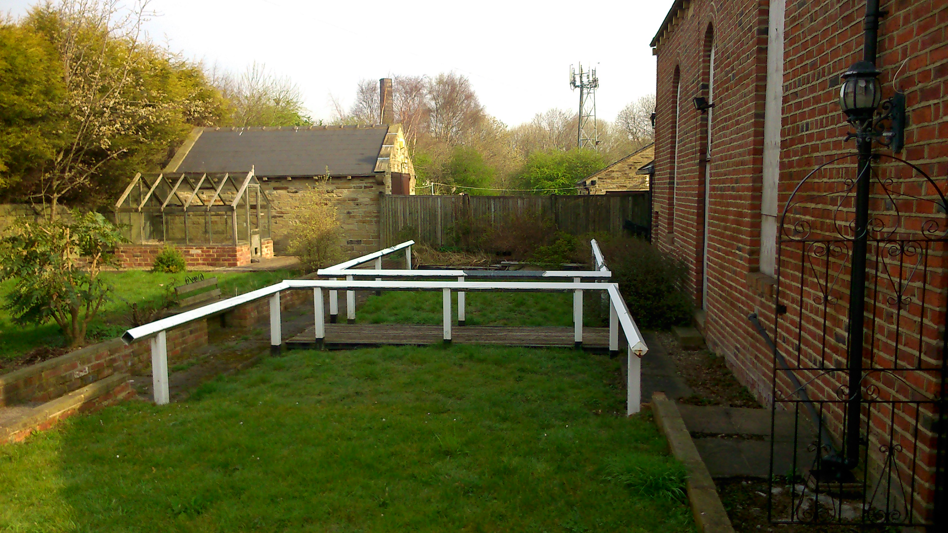
It’s a simple but also rather beautiful, chapel-like structure which currently stands empty. It had been converted for private residence a few years ago, but then it came up for sale and Bradford Council purchased it strategically — with a view to the so-called “Bradford Masterplan” scheme of 2003 (by architect Will Alsop) which would have involved re-opening the Bradford Canal. So for example the lock chamber behind the pumphouse — pictured below — would have been dug out again and filled with water.

2015-04-10 09.59.32The white barriers here aren’t original canal furniture – apparently they were put in by the people who last owned the pumphouse, for a bit of, well, fake authenticity… Anyway the point is that nobody is now talking seriously about re-opening the canal, which would be ludicrously expensive (in an age of austerity…) and of dubious economic, cultural or ecological benefit… Much better to treat the Beck properly if you want to make a feature of water along this particular valley… But people in the Council are apparently still talking about the notion of a “conceptual canal” — marking the line of where the canal once stood, by interventions such as the new cycle path. So the pumphouse stands at a strategically important juncture in this “concept”… Let’s take a look inside…

2015-04-10 10.13.01
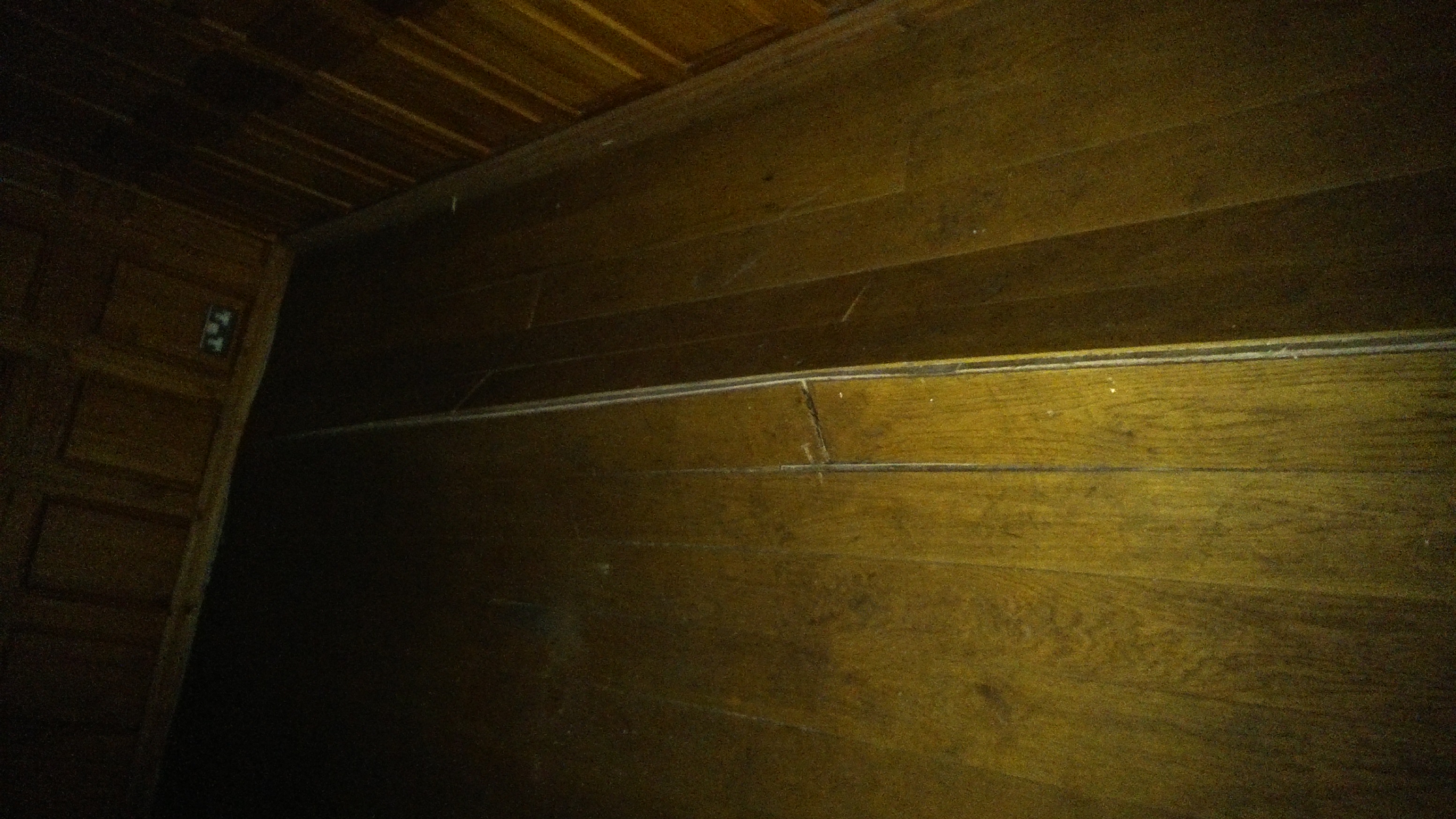
The building is now subdivided into upper and lower floors, where once it would have just been a single chamber housing a pump engine. The lower floor is currently without light (the windows are shuttered; electricity cut off), but in torchlight you can see some serious bowing in the floorboards that will need sorting out if the building is ever to be useful again… Upstairs it’s much brighter and more welcoming…

2015-04-10 10.17.00
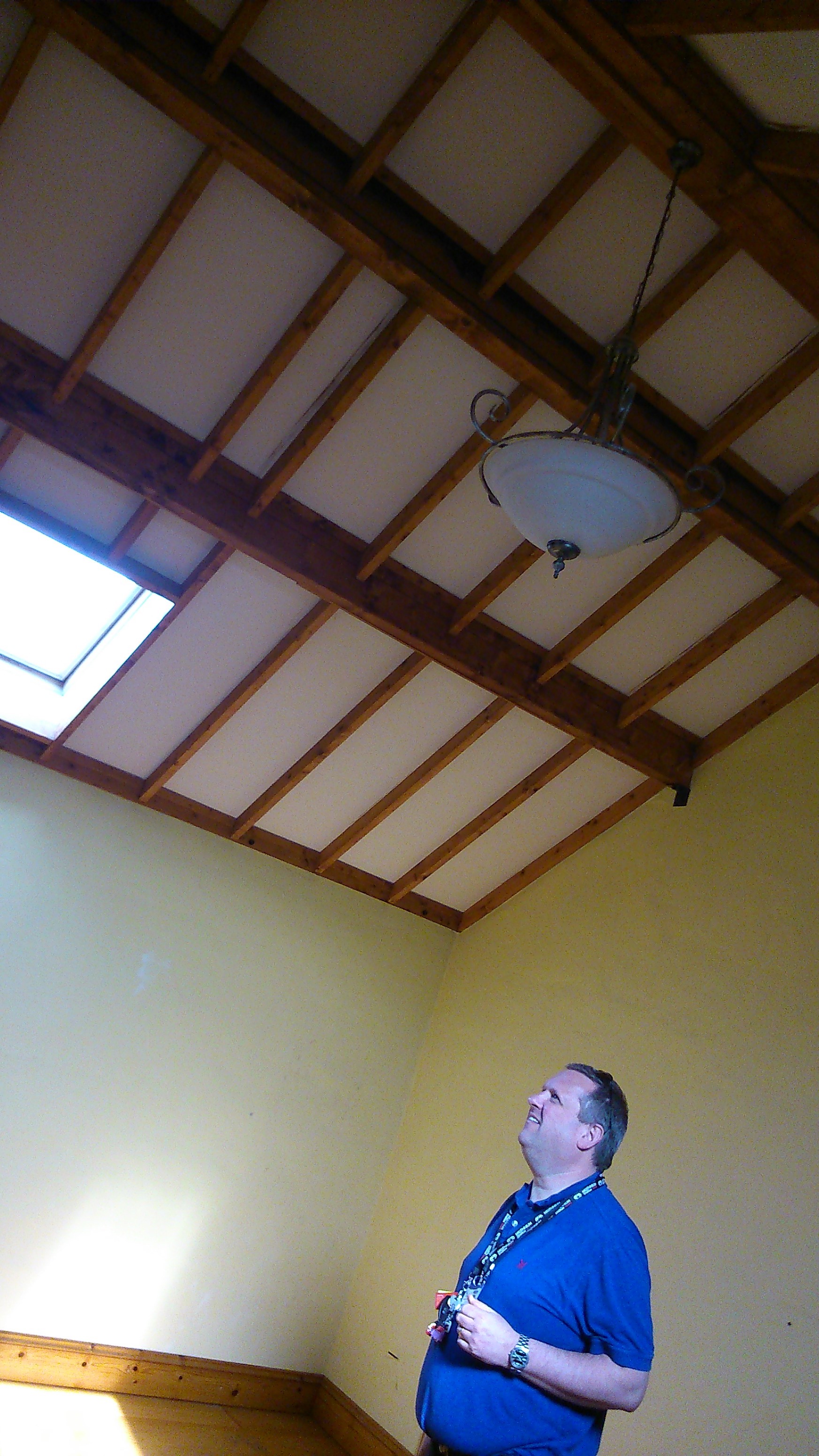
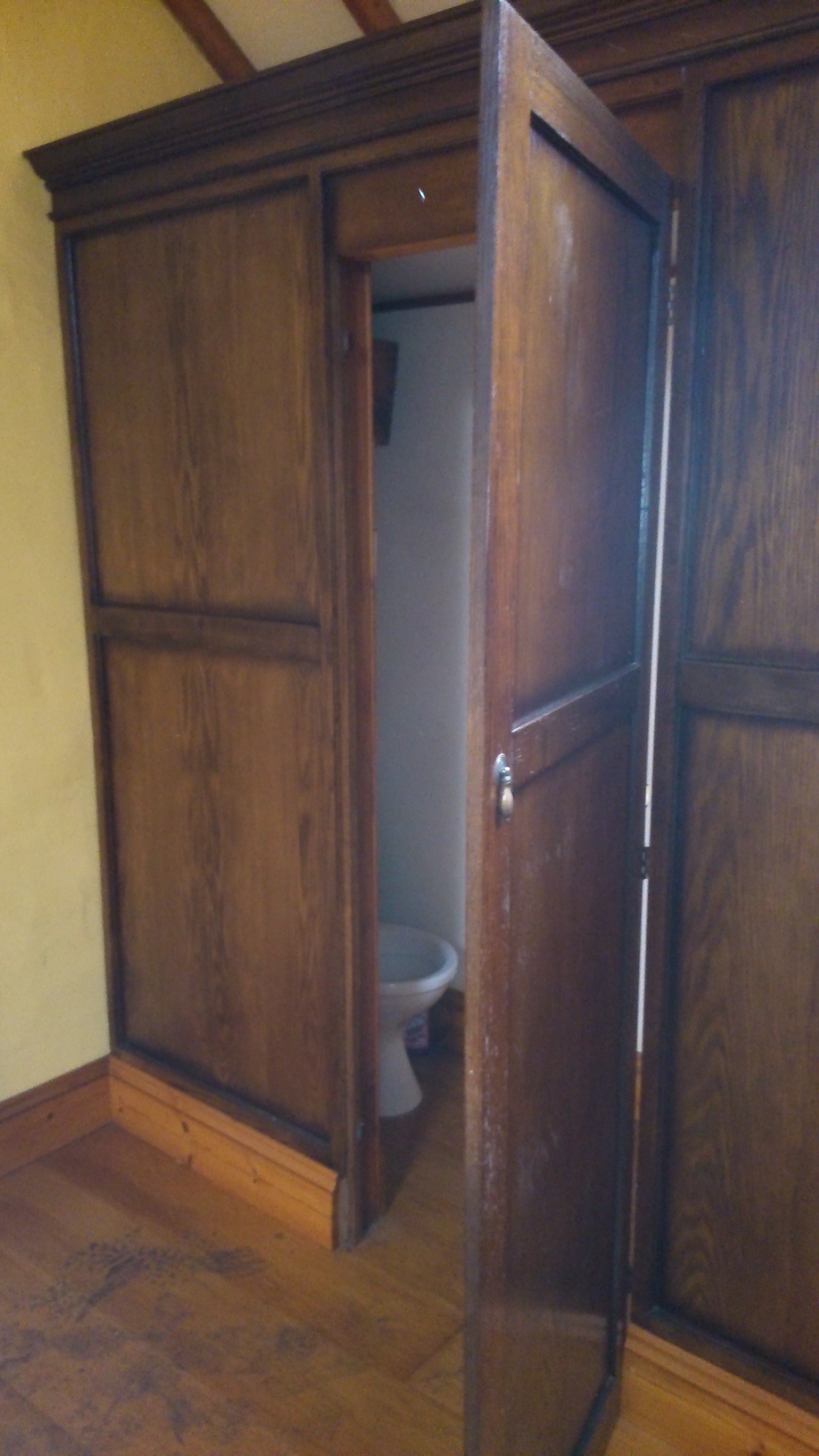
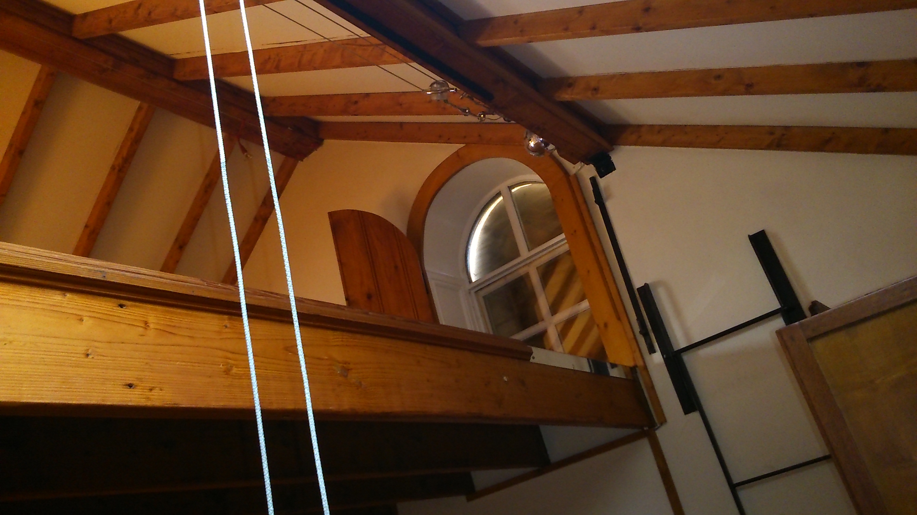
xx… except that it is weirdly subdivided by things like this mezzanine, presumably added to create an extra bedroom space. The master bedroom, pictured in the two images below, is the largest room, but has a very peculiar-looking WC in one corner…

2015-04-10 10.18.37

2015-04-10 10.18.23

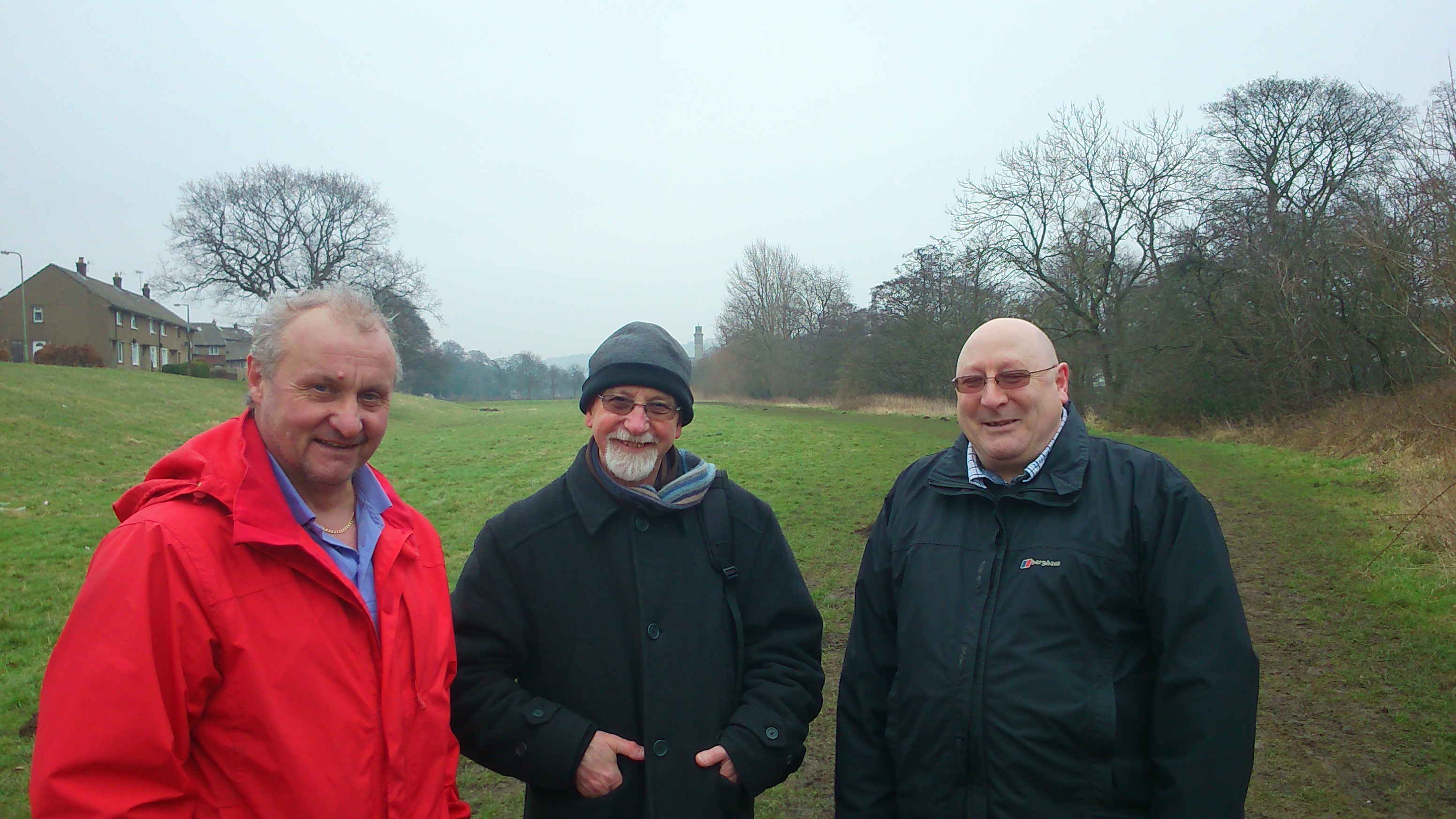
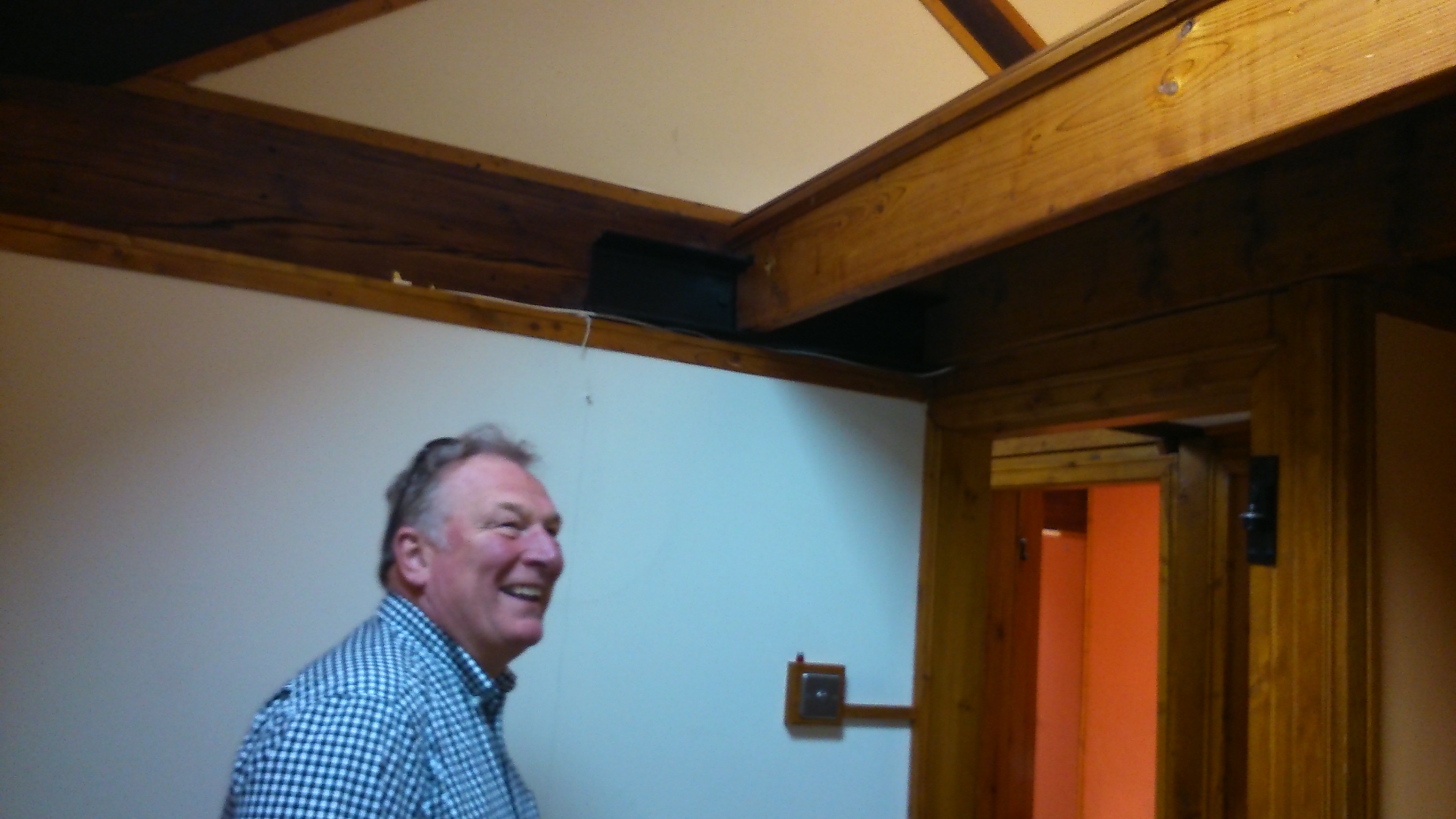
Pictured on the left here is Dave Partridge, Economic Development officer with Bradford Council, who kindly showed us around the building. Dave is interested in the building being used for socially constructive purposes, in line with the “conceptual canal” idea… and so my colleague Trevor Roberts, pictured below, is concocting a little scheme to put the pump house back into use…

2015-04-10 10.17.09Trevor runs a social enterprise called Canal Connections, which is all about using the waterways to reconnect people and places in novel ways. He sees the pump house as a potential meeting place — a site for conversations, exhibitions, and so forth — that highlight the importance of the waterways to the history, heritage, and perhaps futures of not just Shipley but also — by extension to the south and east — Bradford and Leeds. The pumphouse stands at an axis point, a conceptual hinge if you like. It has spaces that could be put back into social use, both inside and outside. What would you dream up for it, if you were planning Bradford’s “conceptual canal”…?

Higher Coach Road Dreaming…

If you live on the Higher Coach Road estate, you should have been invited (this week) to a neighbourhood meeting at the rowing club on the morning of Saturday 18th April, from 10.30am. Organised by Shipley’s Kirkgate Centre, in conjunction with the Multi-Story Water project, this an opportunity for residents to share their thoughts and concerns about the neighbourhood and maybe dream up some future improvements… We also have some suggestions for a bit of a community festival to take place on the flood plain area in June, which we’d really like your input on.

DSC_0163This is Stewart Gledhill, of Troutbeck Avenue, standing in his front garden in front of the “bug hotel” he has built for the remarkable new nature reserve that Hirst Wood Regeneration Group have been developing on the other side of the canal. Stewart and his wife Pat (of whom I also had a really good photo that has somehow got accidentally deleted!) have been actively volunteering on that project, but they have also dreamed up a solid plan for what they’d like to see happen on the Baildon side of the river. Stewart sent me a detailed letter this week, which you can read here, accompanied by a sketch diagram of the esate, which you can see here. (Uploaded with his permission.)

Responding to an earlier discussion, Stewart has come up with a proposal to turn the muddy, uneven track beside the river (running the length of the Higher Coach Road estate) into a proper path. His suggestion is to use the same impacted hardcore surface that has been used on the footpath running past the rowing club, and indeed on the paths in the new Hirst Wood nature reserve. Stewart has proposed 3 stages that this could be accomplished in, and has even come up with a rough costing. His plan is a great conversation starter… will other people want to get onside with this idea, or maybe propose alternatives?

Stewart’s plan would be to build the path pretty much where the existing track is, and not do too much to disturb the trees and bushes along the riverbank (which provide important habitat for local wildlife). Pat, though, added a suggestion for a pond area with a view of the river, near the footbridge. She points out that some of the trees on the riverbank do need managing, if they’re not to becoming hazardous. She pointed this out to me, for example…

DSC_0227This tree came down, Pat says, in just the last week or so, given the high winds and rain we’ve been having. It has fallen across the pipe bridge of the Graincliffe Acqeduct (which carries Shipley’s water supply down from the moor and across the Aire at the end of the estate). If this large tree ends up in the river — as seems inevitable — it could end up causing a serious obstacle in the water … it might catching on Saltaire weir, where another tree has also lodged recently… If it got downstream as far as Baildon Bridge, it could create a serious damming hazard there (a recurring problem there, which has caused flooding in the past). The question is, though, who is responsible for clearing the tree? If it was actually in the river, it would be the Environment Agency’s job to clear it — but placed where it is, suspended on the acqueduct, it may be Bradford Council’s… One of those tricky jurisdictional issues that often don’t get solved easily. All the more important, maybe, that local community members take the initiative sometimes?

Dockfield Memories

DSC_0125

This is Chris Uttley, who grew up on Dockfield Road. He’s holding up a 1970s photo showing himself (the little one), his brother, and his grandmother, standing in front of Junction Bridge on the Leeds-Liverpool canal — where it intersects with the now filled-in Bradford Canal. This photo is taken from the opposite bank to the one Chris is holding, since there are new-build flats occupying the space in that photo now. But you can still clearly see the bridge, and Junction House to its left, in both pictures. It’s disheartening to realise that the sorry state of disrepair into which Junction House has fallen has been within Chris’s lifetime. (And those trees now in front of it are clearly younger than him.)

Chris lives in Stroud now, in Gloucestershire, and works professionally in water and environmental management. He says that this has everything to do with having grown up on Dockfield Road — sandwiched between the canal and the river. With Bradford Beck to the west and fields to the east, residents used to think of the area as an “island”. Chris came across our project accidentally, online, and we arranged to meet up with him recently when he came back up north to visit his parents. Chris combined walking his dog and talking with us…

As it happens, this coincided with a day of knocking on doors in Dockfield Road and Dockfield Terrace that we (my colleague Lyze and I) were doing as part of our research — and in conjunction with Kirkgate Centre’s community development initiatives. So we got the perfect start when Chris ran into his old neighbour Sue, hanging out washing in the yard, and we were invited in for a cup of tea and a trip down memory lane. Sue’s a little older than Chris, so they weren’t quite remembering the same generation of childhood antics in the area — but their memories were very similar. All kinds of malarkey got up to along the canal and, to a lesser extent, the river… “We were poor economically,” Sue remarked, “but we were rich in every other way.”

Sue feels now that the sense of community in the area is not what it used to be, which is perhaps inevitable when you have strong memories of what it was like when everyone living around you was also working in the local mills and factories (rather than commuting into Leeds, etc., as happens now). Still, the impression Lyze and I had from our initial round of doorknocking was of a friendly, engaging community of residents who often knew each other well. More on this to follow.

DSC_0108Meanwhile… this graffiti patch on the wall beside the canal, on the approach to Junction Bridge and Dockfields, has become a bit of a local battlefield. You can see from the paintwork that the more political statements have been painted over — presumably by the Council (?) — and then RE-stencilled again by the activists. What’s interesting here is that nobody attempted to just erase the whole thing… It’s a nice patch of colour on a nasty grey wall, after all, with pretty butterfly pictures on it… So if we just take away the complaints about capitalism, maybe it’ll all be OK? The yellow has of course been chosen, though, because of it’s connection to the yellow livery of Bradford-based retail chain Morrisons… who are planning to build a big old supermarket next to Bradford Beck only a couple of hundred yards from this spot…

DSC_0109


World Water Day: 22nd March

Sunday 22nd March is World Water Day (a date marked annually since 1993 by the United Nations). To mark the occasion, why not join us for a special evening event at Shipley’s Kirkgate Centre – from 7pm? We’ll be showing two films, and hosting a bit of an informal discussion about them. How does the water in our local area relate to the global scene?

imagesThe main feature is Watermark (2014), the award-winning documentary film full of stunningly beautiful images. It brings together diverse stories from around the globe about our relationship with water: how we are drawn to it, what we learn from it, how we use it. We witness how humans are drawn to water, from the U.S. Open of Surfing in Huntington Beach to the Kumbh Mela in Allahabad, where thirty million people gather for a sacred bath in the Ganges at the same time. We see massive floating abalone farms off China’s Fujian coast and the construction site of the biggest arch dam in the world. We visit the barren desert delta where the mighty Colorado River no longer reaches the ocean, and the water-intensive leather tanneries of Dhaka. Watermark immerses the viewer in a world defined by a magnificent force of nature that we all too often take for granted.

MSW RED AR 07As a short “curtain-raiser”, we will also be screening a much more local film, Wading to Shipley (2013), which has been available to view on this site for a while, but which you might not have seen on a big screen…. It traces a journey along the hidden reaches of Bradford Beck as it flows towards Shipley, revealing a surprising landscape…

We do hope you can join for a drink, a chat, and a movie… We’d love you to join us!


Making Space for Water?

DSC_0097Spotted through the trees yesterday just downstream of Hirst Weir…  Members of West Yorkshire Fire and Rescue Service (with their big red engine parked up in the car park of Bradford Rowing Club). I’m hazarding a guess that this was a training exercise for coping with flood conditions. A couple of weeks I heard a presentation from Humberside Fire and Rescue about how poorly prepared firemen are for working in flood conditions — even though flooding is likely to become an increasing problem in coming years, with climate change. Hull, of course, has an ongoing, near-annual problem with flooding (the presenter described it as “the plughole of England”), but since flood conditions are so difficult to simulate in normal circumstances, training is an issue. Presumably this is why these WYFR folk were stomping around near the roiling waters of Hirst Weir, but in Hull they have an altogether more elaborate plan – to build The Ark. No, not Noah’s ark, but a big water simulator… a kind of theatre for flooding… which sounds quite exciting!

We don’t have any project plans on that scale, alas, but here’s a few updates on what we are up to. First off… I was passing Hirst weir on a walk with sound artist Jon Tipler, who is working with me to complete the downloadable Salt’s Waters audio-guide that will lead listeners from Salts Mill up to the ruins of Titus Salt Jr’s Milner Field house – via various waterways big and small. (This has been in development for a while, but we’re aiming to have it finished for Saltaire’s World Heritage Weekend in April.) Among other things, this guided walk passes along the grassy flood plain that runs next to the Higher Coach Road estate – and (as in our live performances of 2012-13) makes a case for seeing this 1950s estate as integral to the local heritage narrative. And in the last couple of weeks, we’ve also started to get back in touch with residents on the estate about another, related project. My colleague Lyze Dudley has been knocking on doors, chatting to people about our plans for a sort of festival event on the flood plain in June. The idea will be to try to get a real conversation going about what people would like to see done with this grassy area which gets so boggy, and which the Council now can’t afford to mow regularly either (what with the swingeing cuts they’ve had to implement). Various residents have put various dream schemes to us in previous discussions, so we’re going to see if we can facilitate any kind of agreement being reached, with a view to taking it forward. Of course, if the consensus is just to leave it alone, then we’ll do exactly that, and – as Lyze has found – there are certainly people who think that, since that area is always going to flood, it’s best just left as vacant as possible. But it’s also possible to design imaginative green spaces that are intended to flood — “making space for water”, they call it.

DSC_0088Here’s a picture I took last week on a walk along the flood plain in question. To the right is Dave Horsman, Shipley ward officer for Bradford Council, and to the left is John [didn’t get his surname] who works out of Northcliffe Park and is responsible for all the mowing and maintenance of Council grassland in the area. (The park keeper at Roberts Park is retiring, and – again thanks to the cuts – won’t be directly replaced, hence John now taking on this remit.) In the middle is Baz Kershaw, an old friend and colleague of mine who was visiting to look at the site, with a view to creating a “meadow meander” in the long grass as one of our events in June. It’s a sort of interactive art installation that invites you to take a maze-like walk specially prepared in areas of long grass. Baz has done this in a number of places now (he started off doing it in his own home in Devon), and it always gets great responses. We’re hoping it will help spark discussion about whether people want long or short grass, a wildflower meadow, etc.

DSC_0096And here’s another picture from a meeting last week, this time taken in the Rose Wharf headquarters of the engineering firm ARUP, in Leeds city centre. This graffiti art hoarding celebrates some of the major projects ARUP has been involved with recently – including (as you can see) the Leeds Arena, and the Rosebowl at Leeds Beckett University. (In Bradford, ARUP were also the key engineering consultants behind the City Park’s Mirror Pool.) They’re also involved with plans for the HS2 rail link (a bit controversial, that one), and are lead consultants on the Leeds Flood Alleviation Scheme (or FAS), which is now under construction, as of this month — and is due for completion in about two years. It was this that I was at ARUP to learn more about…

As you might expect, the Flood Alleviation Scheme is — at root — also based on the premise of “making space for water”. Specifically, the big old industrial weirs in Leeds central are going to be removed, and replaced by new, moveable weirs. In normal conditions, they’ll operate just like the old ones did (so that the navigation of the river using locks etc. can continue as it has done). But in flood conditions, these new weirs will basically collapse (they’ll be held up by the equivalent of deflatable air bags…), thereby dropping the water level and alleviating flood risk to the city centre. This will help obviate the need and the expense of building higher concrete walls, as in the earlier scheme vetoed by government a few years back (although there will also be some new riverside construction designed to complement the work of the new weirs).

Apparently, collapsible weirs have been used elsewhere in the world for the sake of hydro power installations, but to date they have not been used as part of a flood alleviation scheme — so this is a first. I find it intriguing, though, that this scheme basically confirms that there can be a relationship between weir removal and lowering flood risk. This is the exact same logic that our friends at Baildon Woodbottom Working Men’s Club have used to argue for taking out the weir just downstream of Baildon Bridge — so as to mitigate their own risk of flooding at the club, and to help prevent the Bridge itself from becoming impassable as it last did in 2000. To date, though, the responsible agencies haven’t seemed very interested in this weir removal suggestion… That’s another little project we’re working on, if we can get the scientific data needed to show whether or not this is a viable proposition.

So, to sum up – we have various irons in the fire at the moment, each attempting to respond to ideas put to us by people living near the river. It remains to be seen which of these strands will produce any useful results, but I guess that is the nature of an exploratory research project like this one…

‘Hydro-Citizens’ visit Shipley

DSC_0049Taken yesterday: an evocative shot of Salts Mill and New Mill from the deck of the Lady Jane… a working boat run by the JAMES project. At the front, you see one of the crew members with a barge pole attempting to break up the surprisingly thick ice that had formed on the surface of the canal as we made our way west.

DSC_0020In the shot below, a beer bottle just out of the ice at a jaunty angle – not quote sure of the physics there (how did the water freeze around it with most of the weight of the bottle above the surface?) – but I guess that’s the laws of nature (and litter) for you…

DSC_0042The occasion for this chilly but stunningly beautiful boat ride (perfect blue sky, crisp air, stunning light) was the visit of the full national team of the ‘Towards HydroCitizenship’ project — the three-year research project around water, communities and arts practice for which Multi-Story Water in Shipley is one of four, regional case studies (the others are in Mid-Wales, Bristol, and London). The team convened for two days of discussion and provocation, sharing what we’ve been doing so far and looking at future plans (the project kicked off last year but we’re still mostly in the developmental stages, starting to decide of activities and events). On Day 1 (Thursday 5th) we met at Yorkshire Water’s complex in Esholt … which took some of us quite a while to find (!) … where we heard from some YW staff about various innovative initiatives, before moving into our own project discussions. Then that evening, after dinner at the Waterside restaurant on Shipley Wharf (to keep with the theme…) we headed down to Baildon Woodbottom Working Men’s Club — on the banks of the Aire — where club secretary Philip Moncaster hosted a pub quiz event, for ‘our university friends’ and some regulars too. Teams of four, and some utterly random questions generated by the quiz machine that the club has apparently had for years but never used. Philip, it turns out, is a skilled host/DJ and it was great to see him perform. Much fun had by all (thanks Philip!) and I won’t gloat too much in mentioning that my team won…

Tom Payne and Sara Penrhyn Jones (both Aberystwyth University) share a pint with Anthony Lyons (Bristol-based artist) at Baildon Woodbottom

Tom Payne and Sara Penrhyn Jones (both Aberystwyth University) share a pint with Anthony Lyons (Bristol-based artist) at Baildon Woodbottom, prior to their failure to win the quiz.

The next morning we were up bright and early and back across the other side of the river, where the owner and developer of the Victoria Mills residential complex, Andrew Mason, talked us through the complexities of building luxury apartments in a flood zone.

DSC_0010Here is Andrew, central, entertaining Ozlem Edizel (Middlesex University) and – to the left, Peter Coates (Bristol University). (The red-head is our own Lyze Dudley, who co-ordinated the programme for the two days with great aplomb.) It was somewhat surreal for me to see Andrew telling us about the Victoria Mills site, given that in 2012 and 2013, for our Multi-Story Water performance tours of the area, two different actors performed as Andrew — using edited, verbatim transcriptions from an interview I had conducted with him indoors. So to see him now acting the role himself (and repeating some very similar lines – he clearly has a good ‘spiel’ worked out) was, at least for me, a little bizarre as well as thoroughly entertaining. Even the most sceptical of our visitors was won over by Andrew’s obvious passion for the site, and his extraordinary grasp of detail in discussing every aspect of its construction. (His formidable powers of memory were also apparent when he instantly recognised and greeted me – even though we’ve only actually met once, in 2012, when I interview him…)

Anyway, after the Victoria Mills visit we reconvened at Kirkgate Centre in the centre of Shipley for more conferencing discussions about various aspects of the ongoing project. Overall I think we struck a pretty good balance this kind of broad, conceptual stuff and the more locally-specific events showing our visitors something of the water locality. The last of these was of course our boat trip on the Leeds-Liverpool canal, yesterday afternoon (Friday 6th). The JAMES project, based at Shipley wharf, generously offered two boats to carry the assembled Hydro Citizens — and like myself, these brave gentlemen (below) chose the Lady Jane, on the grounds that an open working boat might give us better views as we travelled, even if we got a little chilly on the way…

DSC_0017Here are Peter Coates again, Simon Read (Middlesex University) and Iain Biggs (Bristol-based artist/researcher), as we’re about to set out from Shipley Wharf. Note how low in the water the boat sits — only our upper bodies were above water level. Meanwhile, another group of us travelled on the larger “Two Shires” boat, which had a lovely warm stove going inside, to compensate for having less all-round views! The Two Shires actually ended up taking over from the Lady Jane as lead ‘ice-breaker’, since its greater width and more powerful engine meant that it could get through more easily. Anyway, here is the Two Shires coming into Hirst Lock, at the end of our upstream journey…

DSC_0056We had come to visit the site immediately adjacent (and south) of the lock, where Hirst Wood Regeneration Group is transforming a neglected piece of marshy land into a nature reserve complete with bird hide and pond. Here’s the site viewed from the top end, looking east back towards Saltaire. Lyze (again viewed from behind!) is here seen walking down with Pauline, the secretary of Hirst Wood Regeneration Group, and Jason (?) from the JAMES boat crew…

DSC_0058Pauline is a really remarkable woman, the driving force behind a number of transformational projects in this area. I’d heard a lot about her but never actually met her before: before we left I arranged to come back and talk with her in more detail about the group’s work, as part of our research. Pauline gave a great introduction to the nature reserve project from the warmth of the Two Shires, before we went for this reccy.

DSC_0070Here’s a closer-up shot of the viewing platform for the pond area, which as you can see is still under construction! (The platform is necessary because this area is essentially wetland, and gets very marshy underfoot in wet weather.) I’m looking forward to seeing how this project develops… Speaking of construction, here’s a shot I snapped on the way back down the canal of the Italianate tower of New Mill, partially covered in scaffolding. Presumably some kind of restoration/maintenance work going on – but I was primarily struck by the light, the shadows, and the colours of sky and stone. Quite pleased with this shot…

DSC_0080As the light began to die, we made our way back towards Shipley Wharf, at the end of a memorable couple of days. Our visitors all professed to have enjoyed their trip very much – Shipley has much to be proud of! Next time we all meet, it’ll be Wales, in the summer…

DSC_0081

Bradford Beck, running orange

So apparently this was what Bradford Beck looked like last Friday (Jan 30), running under the railway arches in Shipley…
B8leUOwIMAAkC4SBright orange water flow… Looks a little apocalyptic! I didn’t see this myself (though I wasn’t far away that day), but I pinched this picture from the Telegraph and Argus website, which has lots of other images and video too, under the title “Why has Bradford Beck turned bright orange at Shipley?” Of course the headline is misleading: the river turned bright orange across a great deal more of its catchment than the section in Shipley — and the Environment Agency (EA) eventually traced the source of the pollution to Clayton Beck (tributary running through Clayton, obvs.). But given how much of Bradford Beck runs underground through the city, it’s only in Shipley that people really noticed the problem!

Barney Lerner, chairman of the Friends of Bradford’s Becks, yesterday circulated this explanation from the EA’s Stuart Jenkinson:

I can confirm that on Friday 30th January we received several reports of pollution of Bradford Beck. Environment Agency officers attended the scene. It was traced to the vicinity of Clayton Beck. We believe it was due to a ‘blow out’ of iron ochre from historically abandoned coal workings. We have classified the event as category 1 under our incident classification scheme. That is to say it had a major effect on water quality, albeit for a relatively short period of time. The iron contained in such discharges is largely insoluble and so chemically has little impact on ecology.  Chronic events can however harm the aquatic ecology through their ‘smothering’ effect on the stream bed. The Environment Agency is aware of disused mineral workings in the Clayton / Queensbury area, however we are not aware of them ever giving rise to such a noticeable discharge. We are not planning to take any enforcement action as result of this incident. In general water pollution from abandoned coal mines is dealt with by the Coal Authority. Treatment plants are expensive however and limited funding is allocated on a priority basis.

So now you know. Big mess, nothing to be done about it.

The problem seems to have gone away now, but I would briefly draw attention to this picture that I took almost 3 years ago now, shpwing a small confluence on the Red Beck tributary in the Norwood Avenue area of Shipley (which flows down into Bradford Beck by Canal Road) …

shipley & frizinghall 071Iron ochre looks to be popular around here…

Lower Holme: unfinished business?

I had a very productive day in Shipley-Saltaire-Baildon today, with a series of meetings with interesting people. First off, at the bakery in Saltaire, I met Neill Morrison, energy manager at Bradford Council, who is responsible for the Saltaire hydro scheme, for an update on progress with that (it’s gone to planning, and there were no objections arising as a result of last autumn’s consultation at Shipley library). Next I was off to Troutbeck Avenue, on the Higher Coach Road estate, to catch up with Stewart and Pat Gledhill (Stewart is a part-time pirate, battle re-enactor, wood bodger, you name it…). Then it was back into Saltaire, this time downstairs from the bakery at the Victoria tea room, to meet Carol Buchan from the Canal and River Trust (and, briefly, Helen Thornton, the World Heritage Site officer). Lots of ideas being discussed although nothing solid enough to report here yet. Finally, though, I went to visit Margaret Wright and Heather and Les Moxon, residents of the former mill cottages at Lower Holme…

DSC_0002Here’s Heather, Margaret, and Les (left to right), standing outside Margaret’s house, next to the street that has been newly tarmacked by the property developers, CDP, who recently redeveloped the former mill site. The residents are grateful for the tarmacking, which was essentially a gesture of goodwill on the part of CDP’s James Marshall — since the actual ownership of and responsibility for this bit of road remains a source of contention (Bradford Council refuse to adopt it, but since the terraced cottages are now partly private owned, partly run by a housing association, it is legally unclear whether the road is the responsibility of the residents or the mill-site owners (now CDP). That said, though, the residents are more than a little concerned that the tarmacking appears to have been carried out rather hastily — with the result, for example, that one of the drains in the road has simply been tarmacked over. Drainage has always been an issue here — on a site classified as flood plain — and that issue looks particularly unresolved when one looks south from Margaret’s house towards the river…

DSC_0003To the left here you can see part of the (still unadopted) road that leads down to the footbridge (at the end of the row of trees — the modern-build flats you can see are on the other side of the river). This road has to be left clear because it provides a public right of way across the river, but as you can see, a large part of it is currently covered by a massive earth pile that has been left by the developers — with no clear indication as to when it will be removed. The narrow navigable path to the right (only about half the width of the full road) is prone to surface flooding — you can see a big puddle there and it wasn’t a wet day today — and this is being exacerbated by the earth pile since it is effectively channeling run-off into the narrow pathway. Heather sent me this picture taken a few days earlier [the date signature is misleading] which shows how bad it can easily get… This is basicaly impassable unless you have wellies on…

So who is responsible for sorting this out? Well, clearly a large part of the problem would disappear if that soil stack was removed. The longer term solution is less obvious though. Heather and Margaret recall promises having been made to properly tarmac the whole road down to the river, and they are upset that CDP’s James Marshall denies this. However, reviewing my own account on this blog of earlier meetings between Mr Marshall and the residents, I found this diagram from autumn 2012, which indicates that the limit of the area he had offered to tarmac (marked in pink) was indeed around the houses, and not down to the river… (which is off to the right of this image) index That said, this same diagram indicates that the road would be left clear to its full width, not left covered with a mound of earth. Moreover, this diagram clearly indicates two planning commitments that have not been carried through on by CDP. The first is the area in red, which is designated as representing the old cobbled street surface that would be retained for heritage purposes. The key on the diagram (if you can read it) states that the cobbles will be repaired/replaced where necessary. But this is what has actually happened:

DSC_0007The extant cobbles have been left in place, but the remaining width of the road has simply been blacked over in a manner that looks — quite frankly — bizarre. One can well imagine why residents are not happy about this. What had been discussed and agreed was that the cobbling here would be restored by removing the remaining cobbles from the road running across the bottom end of the houses (since this was to be “pink” = tarmac). But as you can see from this photo taken next to Margaret’s house, those cobbles too have been left exactly where they were, and the new tarmacking has simply skirted around them in a very unsightly way…

DSC_0006This kind of finish is clearly not what was agreed. But then nor is the image below… If you’re looking out from the front doors of the even-numbered houses on Lower Holme, what you’re looking at is KFC…

DSC_0009The small shrubs planted in the dividing area, and the few spindly trees, do not in any way constitute the masking hedge that was promised by CDP. That “hedge” is clearly marked on the diagram above, all nice and thick and bushy (!), and I specifically recall promises from James Marshall at the meetings recorded on this blog that this masking (to consist of trellising with climbing plants, as I recall it) was to be at least six feet high — to prevent residents having to look at KFC, and indeed to prevent KFC patrons from staring across into the residents’ homes. This has not happened. A particularly distressing consequence of this lack of effective masking is that residents are left exposed to the full glare of KFC’s massive night-time halogen lamps…

2015-01-12 17.09.39Again, my record of the 2012 meetings clearly indicates that residents raised concerns very early on about light pollution as well as stray litter from KFC. James Marshall gave what I documented as “sensible” assurances that these issues would not be a problem, because of measures planned in. But despite these assurances, both light pollution and litter are already an issue for the residents… Indeed, note Heather and Les, something about the way the wind blows around the site means that KFC litter has begun accumulating outside their own front door, even though they live on the odd-numbered side, facing away from KFC…

The good news is that many of the concerns residents have can still be effectively addressed. The earth pile can be removed. Proper fence masking can still be installed. Signage can still be put up at either end of the residential street to indicate “Residents Only” (at present people are driving around it as a rat-run, just as had been feared). Decent locks can be installed on the KFC bins to stop lids coming off and stuff blowing around (the litter Heather has retrieved has included the blue hairnets worn by staff… clearly not dropped by littering pedestrians!).

But of course, the tarmacking and cobbles issues are altogether harder to remedy at this point. And that road down to the River Aire, the most neglected part of the site, which CDP apparently never planned to do anything about – on the grounds that it is someone else’s responsibility – remains neglected and too easily flooded. Come in Bradford Council, your time is up…

Up in Salts Mill… JBA

Last week I had an intriguing meeting with Steve Maslen, of JBA Consulting — an engineering company based in offices on the top floor of Salts Mill. They’re right in the northwest corner, looking down directly over the Victoria Road canal bridge, with the slightly lower roof of the Visitor Centre building down to the left, and a grandstand view of Saltaire’s weir just to the right (I really should have taken a picture, but it felt a bit rude to ask!). This is the company that has consulted on the actual hydrological designs for the proposed hydro-electric turbine on the weir – and there it is right outside their window! Also in their “current” file, here in the Shipley area, is a consultation being carried out for Friends of Bradford’s Becks (with the blessing of Bradford Council) looking at the logistics of removing the box culvert over Bradford Beck (the covered bit on the green space next to Canal Road, just as you’re getting from Shipley to Frizinghall). Watch this space on that one.

Anyway, Steve Maslen (who used to run his own separate company, Maslen Environmental) is a very interesting and helpful man, and he gave me this Youtube link to a film about the work of JBA Trust — a not-for-profit organisation established to help educate and inform the public about environmental issues. When I asked if this was a form of corporate tax avoidance (as their charitable trusts often are), Steve politely but firmly said no. This is a company that prides itself on its ethical approach to business — so giving something back and sharing knowledge is a key part of what they do. “We’re not just an engineering company,” as Steve put it. Anyway, here’s the video (blog post continues below…).

xx

New Year: Lower Holme is open for business!

2015-01-12 17.09.39It could be Main Street America. KFC stands proudly in the night surrounded by halogen lamps. But this isn’t America, it’s Lower Baildon, and the cars are exiting (right) onto Otley Road. The long-overdue development at the site of Lower Holme mill now appears to be all done (except for a bit of work on the cosmetics) and KFC is open for business. Pan round to the right slightly from the view above and you get this…

2015-01-12 17.09.51The Lower Holme mill cottages and their half-street of surviving cobbles, separated from the new access road by a verge that will eventually have hedging to mask them off (according to the plans). Spin back to the left through 150 degrees and we have the monolithic box of the new Wickes with its back to the banks of the River Aire…

2015-01-12 17.09.23The stray road cones and other bits and pieces tell of a site not quite finished, but this is basically it… The long-suffering residents of Lower Holme are now looking at carparks and shiny new buildings instead of the rubble, weeds and shabby metal fencing that they had to live with for several years (see previous Lower Holme posts under ‘Categories’). I’ll be intrigued to talk to some of them about how they feel now the place is open for business… But for now, a happy new year to you all, especially Margaret, James, Lynda, Sean, Josh, Heather and Les. x