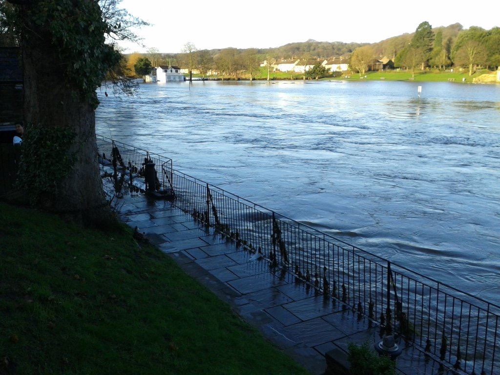
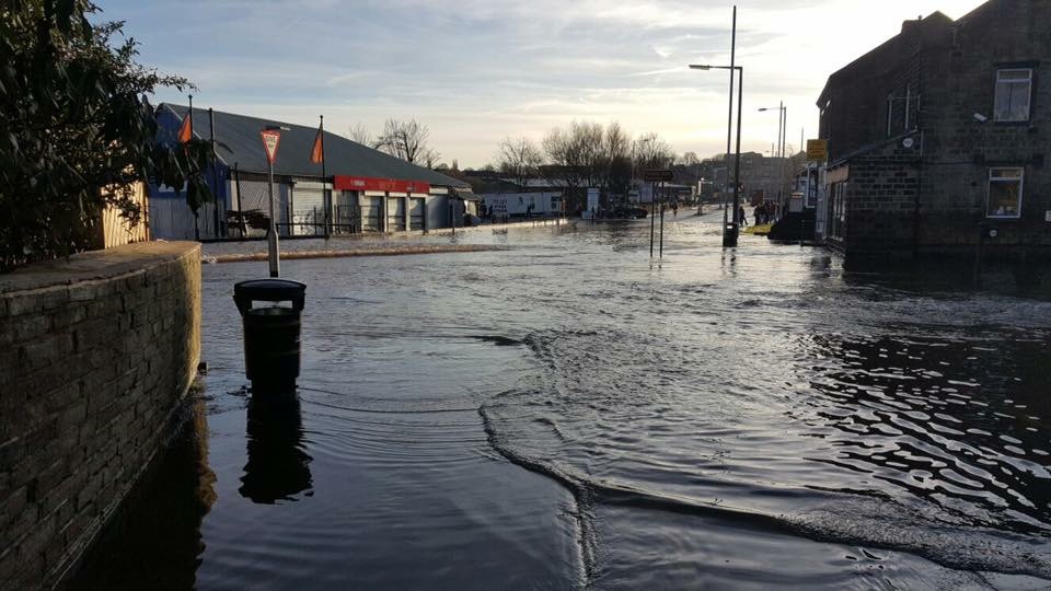
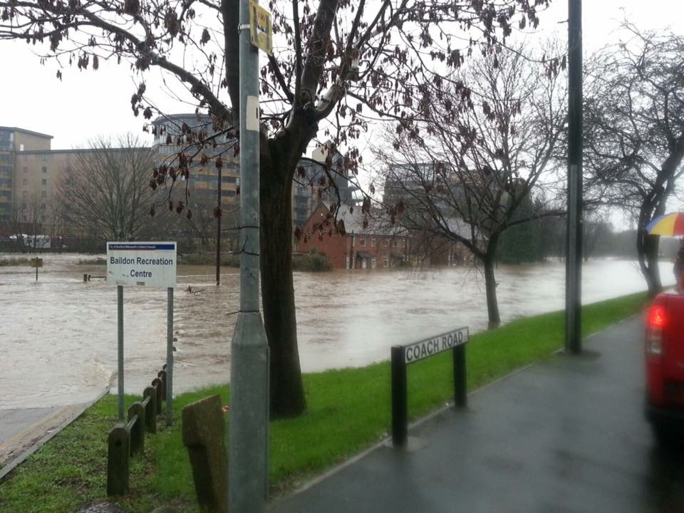
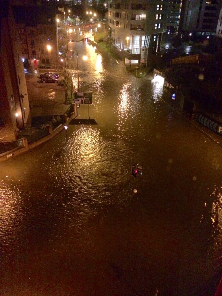
Continuing to reflect on water stories…

Although the funded period of our Multi-Story Water research is now officially over, we’ve been busy in September with a number of “legacy” activities – relating particularly to our work around flood narratives. This three-part blog looks at some of these activities, under the headings (1) Reviving, (2) Recycling, and (3) Reflecting…

1. Reviving
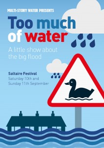
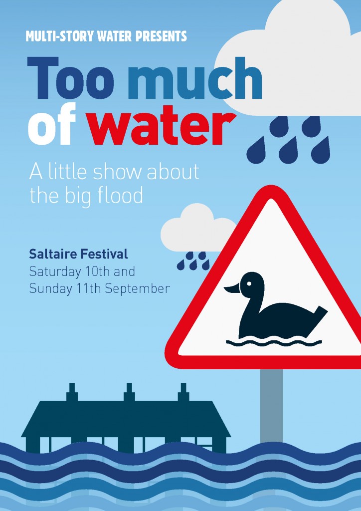
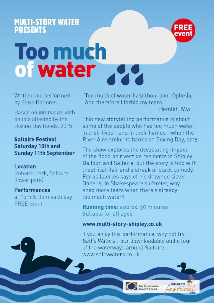
At the start of the month, I presented Too Much of Water, my one-man storytelling show about the impact of the 2015 Boxing Day floods in Shipley, at the 7th International Conference on Flood Management (icfm7). This was held at Leeds University, and having been asked by the conference organisers to present the piece as part of their “cultural programme” (alongside all the more technical conference talk), I liaised with my former colleagues at the University’s Workshop Theatre to present the piece there (many thanks, especially, to technical director Lee Dalley).

This was the first of several new engagements for TMoW this autumn, so I took the opportunity to do a slight “upgrade” on the show. Despite having been very well received in previous performances, I have always felt there was something slightly missing: the piece focuses on the stories of six families whose homes were affected by the flood, but until now did not acknowledge the impact on any local businesses — which, in its own way, can be just as devastating. So I’ve now worked in a seventh storyline, that of Brian Tuxford of Northway Vehicle Sales – the van hire business next to Baildon Bridge. I told a little of Brian’s story in this blog last autumn, having met him after the first version of Too Much of Water premiered at Saltaire Festival. It felt important to include his story, and the show now feels more “resolved” to me as a result.

After the Workshop Theatre performance, we held a Q&A session about issues arising, to which I’d invited two excellent guest speakers – Jonathan Moxon, who is Leeds City Council’s chief flood officer (formerly of the Environment Agency, he has featured on this blog before) and Rosa Foster, who lives in Shipley, and is the Environment Agency’s lead FCRM officer for the Upper Aire Catchment (i.e. Leeds and everything up… FCRM = Flood and Coastal Risk Management – though there’s not much coastline on the Upper Aire!). The Q&A was videotaped and I’m delighted to be able to show it off above – it makes for an interesting discussion. (Though it’s a little difficult to hear the audience questions on the recording, due to the mic direction, the answers should hopefully clarify…).

2. Recycling

Our connections with colleagues such as Jonathan and Rosa has led our Multi-Story Water project to quite an active involvement with telling the story of the Leeds Flood Alleviation Scheme (this despite the fact that our project was centered in Shipley/Bradford! The Aire keeps flowing regardless of local government jurisdiction…). At the Leeds Waterfront Festival in 2016, in collaboration with Common Chorus Theatre, we presented After the Flood – a promenade performance that attempted to provide audiences with an engaging sense of some of the issues involved in planning for flood alleviation – and this included a brief synopsis of the “FAS” scheme (its brand new, collapsible weirs represented on this occasion by a [comically crap] demo involving a clipboard and a balloon…). A year on, at the 2017 Waterfront Festival, we worked more directly with the FAS scheme and its main engineering contractors, BAM Nuttall, to present Weir Science – an entertaining, in-depth look at the new weir construction at Crown Point. On this occasion, we collaborated with Phil Marken’s Open Source Arts – an important hub for the voluntary flood response in the Kirkstall area.

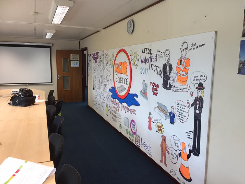
The FAS partners (including the EA, City Council, BAM) were hugely pleased with the extent to which we engaged festival-goers with the weir scheme – so much so that they’ve installed Jon Dorsett’s improvised mural, created over the course of the festival weekend in June – in their site offices! (I snapped this picture mid-September)

So, bouncing off the success of that event, we’ve been invited to get involved with the “consultation” phase for FAS2…. i.e the second stage of the Leeds Flood Alleviation Scheme, which will look beyond the city centre to help protect upstream neighbourhoods such as Kirkstall, Horsforth, Rodley…  The broad outline of plans for this scheme has now been unveiled, though many of the details are still being determined, and the FAS team are interested to gather public responses about how planned alterations to the river landscape might also benefit local communities’ experience of the river. A series of consultation events, in the form of pop-up information stalls in public places, has been planned for October – starting this Monday 2nd in Horsforth (see this link for full list of dates and venues) – and a team from Multi-Story Water will be present at each location. This time, we’re working in collaboration with both Common Chorus Theatre and Open Source Arts…

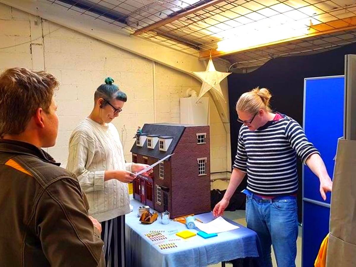
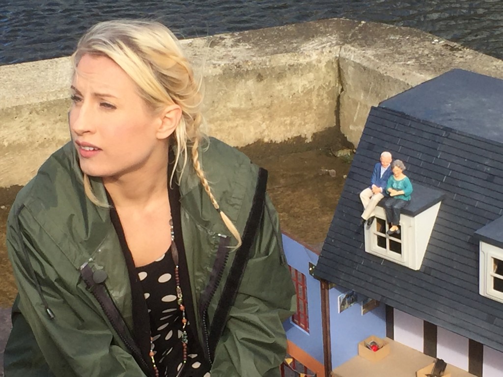
In this photograph, taken during rehearsals at Open Source last Wednesday, you can see Phil Marken on the left and Common Chorus director Simon Brewis on the right (with performer Alice Boulton-Breeze in the middle). That doll’s house will be familiar to anyone who saw After the Flood, and that’s because – on this occasion – we’ve taken the decision to carefully recycle and redeploy key aspects of previous performances, rather than trying to devise anything completely new. Reusing certain props will save us a bit in financial terms – because, after all, this is a public consultation, not a “show” with a production budget… More importantly, the consultation context is also distinct from the festival contexts we’ve previously worked in, and that’s affected our planning here…

There’s a serious point to the FAS team wanting to share their thinking about the new scheme – and to seek feedback – and we can’t upstage or disrupt that with anything too “showy”. So we’ve come up, instead, with a sort of “modular” presentation – composed of different props, arranged on a display stall, that all offer different talking points. The strategy will be to draw people into conversation around whatever catches their eye from our display. (The doll’s house and other components have been carefully integrated design-wise by Simon’s colleague Ellie Harrison.) We’ll then to seek their responses to the various ideas we’re opening up for discussion. We’re not thinking of this as a “performance”, as such, but as a series of unique, person-to-person conversations – led by Alice and fellow presenter Jaye Kearney — which use props and images as a stimulus for discussion. The conversations might roam between the different “modular” elements, or not, as the mood dictates … they can be as long or as short as suits the individual passer-by. The main thing will be to whet people’s interest, and thus – perhaps — encourage them to engage in conversations with the FAS team themselves (who can then offer more involved, technical detail if people want it). Some respondents would engage with them anyway, of course, but the thinking is this creative engagement approach might help to “soften the landing” for people more wary of uniformed officials… (even if the uniforms are just FAS-branded T-shirts).

We’re also hoping that our conversations will also generate some interesting feedback “data” for the FAS team. In particular, it’s hoped that a hand-drawn map of the Aire between Apperley Bridge and Leeds city centre – which we’ve commissioned from Jon Dorsett, who also did the Weir Science mural pictured above – will provide a usefully interactive way to visualise the proposed FAS2 innovations, and to encourage public responses…

Anyway, one way or another, we shall see how this works out. Further blogging to follow!

3.Reflecting

And finally… it’s perhaps worth mentioning that the Multi-Story Water project was discussed across Yorkshire’s airwaves last weekend (Saturday 23rd or Sunday 24th September, depending on your area). I was interviewed on the Paul Hudson Weather Show, which is syndicated across all the BBC North local radio stations – in Leeds, York, Sheffield, Lincolnshire… The whole programme is available for a month on the BBC iPlayer – with my bit starting almost exactly 30 minutes into the hour-long show. But I’ve also pirated the sound from the relevant section and uploaded here as a permanent record…

The interview experience was slightly odd. It involved very quickly spewing out ideas that I’ve been thinking about for a long time, and which really needed more detailed treatment. But of course, this was a local radio show and nobody wanted to listen to me banging on at length when there was an old Peter Cetera track called “The Glory of Love” to get to…

I say that with tongue in cheek, of course, and I’m genuinely grateful to Paul Hudson’s producer, Trisha Cooper, for inviting me onto the show and giving me the unexpected opportunity to discuss our research project. This came about because, after having me briefly trail the Weir Science performances on Johnny Ianson’s Radio Leeds breakfast show back in June, Trisha decided that listeners might be interested to hear more about the wider project that this had been part of.  Although it’s quite difficult to try to sum up several years’ work in five minutes flat… And I did, apparently, gab on a bit too long, which explains the oddly compressed editing toward the end of my segment of this pre-recorded show (the last bit, which refers to the other matters discussed in this blog post, doesn’t make much sense as a result).

Anyway… if you have read this post as far as this, you apparently don’t mind me gabbing on a bit… So thanks for indulging me, and enjoy the broadcast!

 

Weir Science (Part 1): Hold Back the River

This is me, taking a selfie, rocking head-to-toe orange. Something of a contrast to my usual look, but this is a blog post about contrasts. I’ll explain the new look shortly, but first…

The last couple of weeks have seen striking contrasts in weather patterns (climate change? wot climate change?). At the peak of a mini-heatwave that had us all sweating, June 21st was the hottest June day in the UK in 40 years. But only a week later, after several days of persistent rain, Bradford was once again facing flood warnings across the district — with water at perilously high levels in the Shipley area along both Bradford Beck and the main River Aire. Appropriate, then, that we also saw the publication this week of a long-awaited council report on Bradford’s preparedness for future flooding — which concludes that the serious budgetary cutbacks Bradford has experienced in recent years has left it vulnerable and exposed to “accelerating climate change risks”.

This report, from a committee chaired by Shipley’s own Green party councillor (and all-round lovely human) Kevin Warnes, is far better-informed than another report published last autumn by a different committee (which I critiqued in this previous blog post), and took advice from local figures who really do know what they’re talking about (such as the chairmen, respectively, of the Aire Rivers Trust and the Friends’ of Bradford’s Becks, Geoff Roberts and Barney Lerner). And while the report is frank about some of the council’s own failings, its key conclusion about insufficient funding points the finger (implicitly) right back at central government — since Bradford is among those councils who have been most disproportionately hit by austerity-era cutbacks (and faces another £32 million in cuts over the next couple of years). My last post on this blog was – in part – about the desperate under-funding of social housing in the area, but the shortage of adequate flood defences is symptomatic of related economic disparities…

Speaking of which… if we’re looking for contrasts, let’s head 12 miles downstream to Leeds, where a very expensive bit of flood engineering is still under construction…

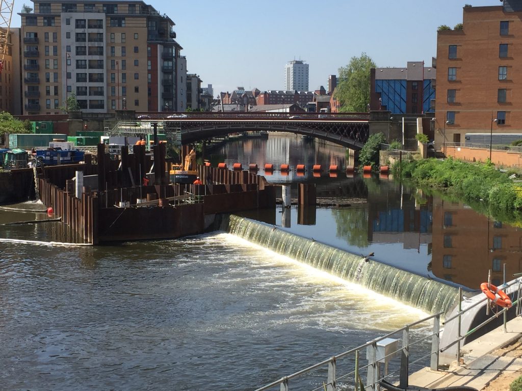
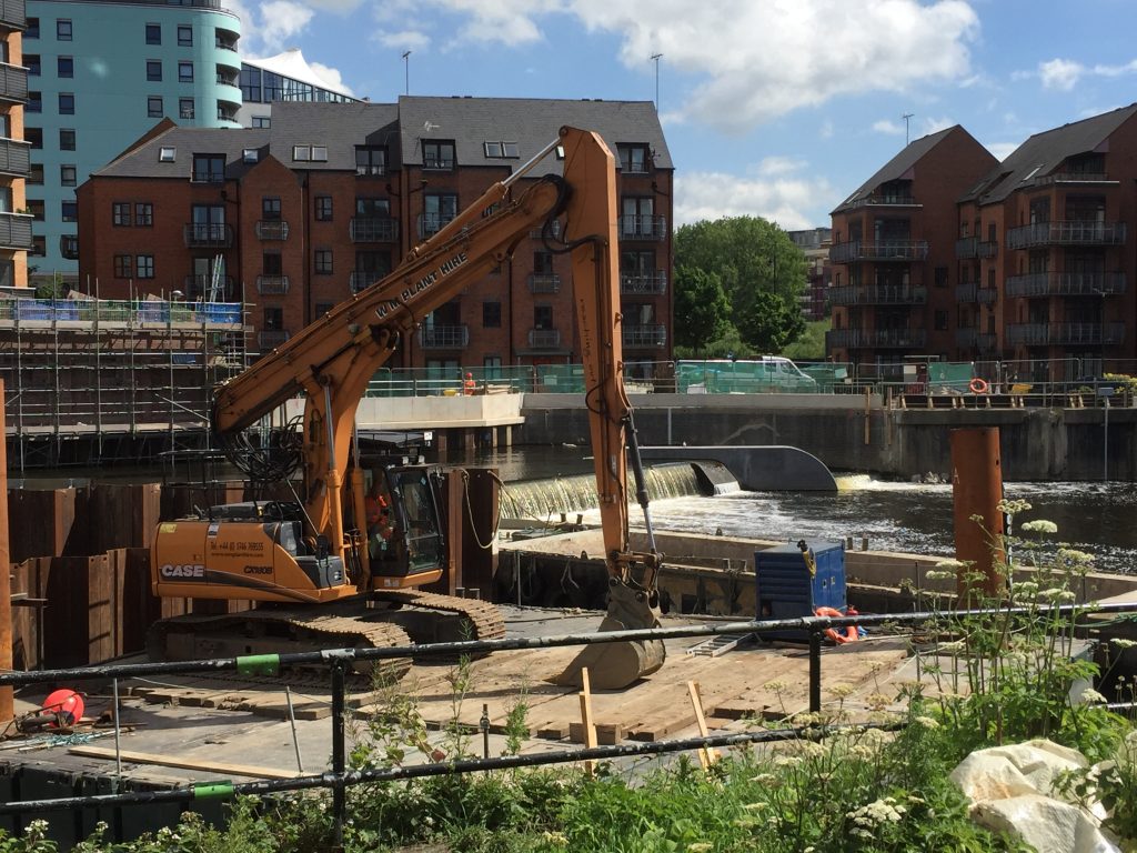
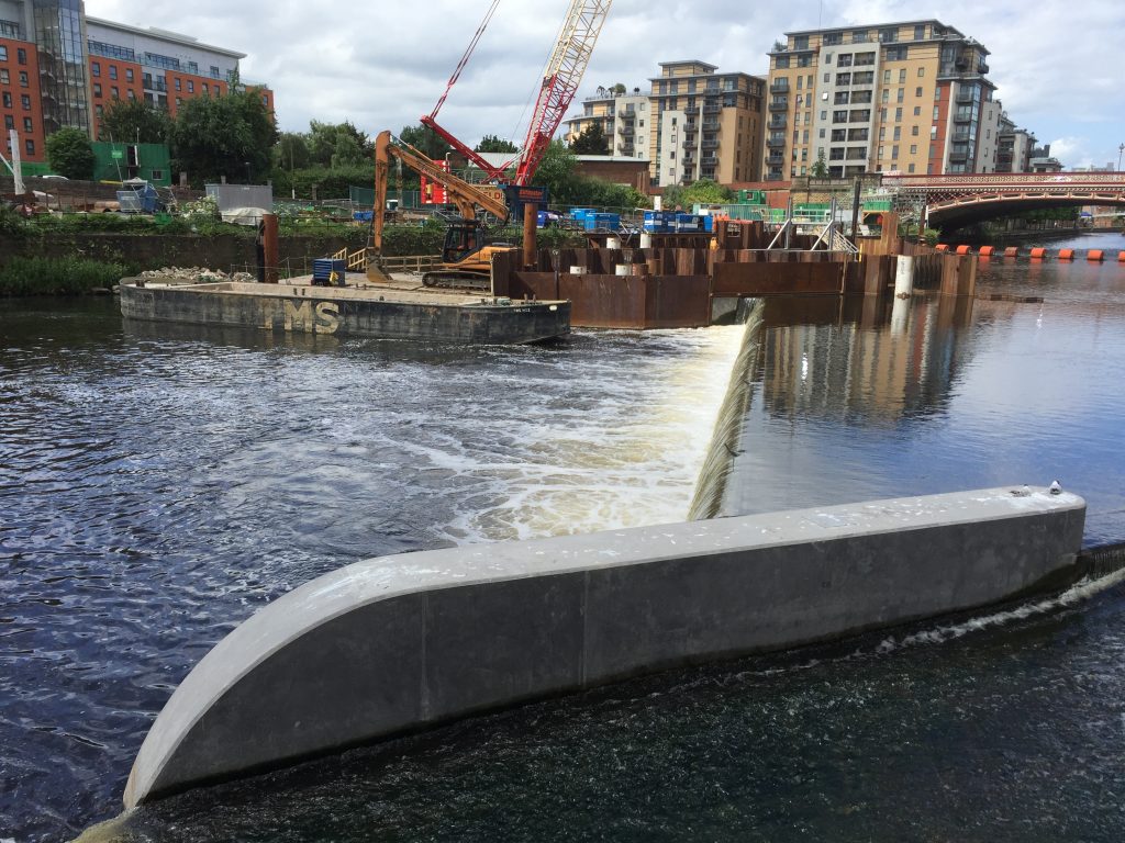
This is the weir at Crown Point — aka Leeds Dam. The rather aesthetically appealing waterfall effect on the right of the picture (i.e. the north side of the river) is created by the brand-new, state-of-the-art weir installation that has replaced the old industrial weir (versions of which have held up water here for about 700 years). The idea with this new weir is that it gets lower – or even disappears completely – in high water conditions, thanks to the pressurised air bladders underneath it, which can simply be deflated to lower the level of the water on the upstream side. It’s the first time this technology has been used in the UK as a flood alleviation measure – and it’s being installed not just here at Crown Point but downstream (on an even larger scale) at Knostrop weir. These weirs, combined with the new flood walls running through the city centre, up as far as the railway station, comprise Phase 1 of the Leeds Flood Alleviation Scheme (FAS).

This £47million scheme (underwritten by the City Council, with central government support) will soon be followed by the even more expensive Phase 2 – covering points east through Kirkstall to Horsforth – using money provided by then-Chancellor George Osborne in the aftermath of the Boxing Day floods of 2015. Bradford, by contrast, was offered nothing — and the big difference of course is that money follows money. Or, to mis-paraphrase the biblical parable of the talents: “To those that have shall be given more.”

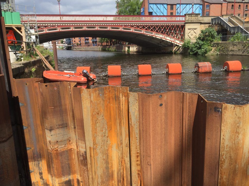
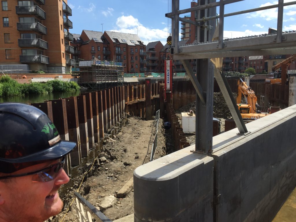
It’s apparently quite unusual, in the world of flood defences, for so many millions to be spent on such a specific, geographically-limited scheme as this. It’s reckoned that the new Crown Point weir, when lowered, will reduce upstream river levels on the Aire about as far as Victoria Bridge — so not even quite as far as the station. That’s a fairly short stretch of river, but it’s an extremely high value stretch of river. Better flood protection here will mean greater peace of mind for the major businesses and residential complexes on either side of the river — and will make it more likely that further inward investment will flow in to the city (especially in terms of the mooted regeneration of the South Bank area). So that’s why this investment has been made… and the results are, let’s be honest, pretty awe-inspiring… That coffer dam is quite literally holding back the River Aire, so that contractors have access to the riverbed.

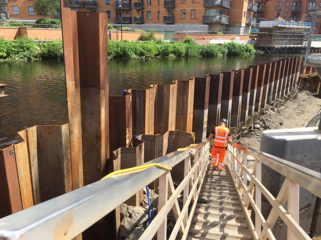
This is FAS foreman Mark Pheasey, descending the gangway into the coffer dam, where the second section of the new collapsible weir is currently under construction (it’s now due for completion around September). Mark, also pictured below, is one of my new favourite people — helpful, generous, knowledgeable — after being assigned by his employers, the engineering contractors BAM Nuttall, to show me around the site…

I was granted this privileged access (and required to wear orange) as part of my preparation and research for Weir Science — our latest Multi-Story Water performance project, which I’ll document in the promised “Part Two” of this blog post. For now, though, just check out the big boys’ toys…

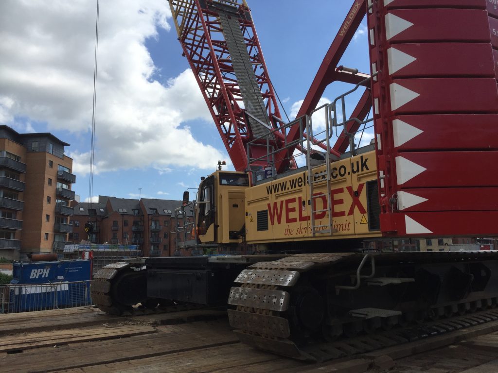
This is the main crane on site, weighing in at a modest 250 tonnes. The counter-weight alone (the big red bit on the back) is 86 tonnes. Mark laughed when I expressed amazement at this behemoth, because BAM deals with much bigger cranes on other sites. But still, it is way too big to have been driven here… It had to be assembled, here on Fearns Island (in the middle of the river), through the use of a smaller, mobile crane (a mere 110 tonnes) that was driven across to the island via a temporary stone bridge – erected across the narrowest part of the navigation. The big crane is basically being used as a very large coat-hanger from which to suspend equipment like this… (press play and insert fingers in ears…)

This hammer is pile-driving sheet metal… It’s the stuff the coffer dam is made of, but the row going in here is part of the permanent foundations for the new weir. This is “heavy metal” in action, and it’s being installed by a team of highly skilled contractors. BAM workers get assigned to work around the country in teams, where they’re most needed (Mark’s home is in Hartlepool – so mostly he only gets back to see his family at weekends). The guy you see in the video above, lining up the hammer so it falls just right, has been doing work like this for decades. (I didn’t catch his name, sorry…)

But if you’re not easily impressed by scale and power, you might prefer this bit of video instead…

Here we see the River Aire having a minor disagreement with the coffer dam holding it back, and leaking through the cracks to make a new, miniature river along its own river-bottom… A pump system is in operation to deal with this, 24/7.


Further along Fearns Island, we can glimpse the new weir doing its thing, while – across on the far side of the river – the new flood walls are still under construction (that white concrete will eventually have red-brick facing on it to blend in with the surrounding buildings). And to the left, also across on the far side, that scaffolding-covered block is the operations booth for the new system. Though the building itself isn’t finished yet, the key machinery has already been installed inside, as Mark showed me…

That touch-screen computer has adjacent settings on it for the two weir plates that will form part of the new weir. Since one of those plates is already operational, all the relevant readings are visible. But since the second plate is not yet installed (inside the coffer dam), that simply shows as being offline.

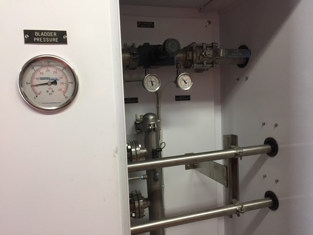
Whatever. I must admit that I was more drawn to the old school, lower-tech look of the pipes and dials below. And, yes, sadly, my inner child found some measure of amusement in the notice on the left…

Many thanks to Mark and BAM for a fascinating tour of the weir works. It gave me much of the material I needed for Weir Science, which we presented as part of the Leeds Waterfront Festival last weekend (June 24th/25th)… [see Part 2 of this blog].

Though based primarily in Shipley, the Multi-Story Water project has made annual forays downstream along the Aire to present performances at the LWF (see After the Flood and Seven Bridges under the Performance tab on the menu bar above). Working in Leeds has always felt like a different, but related context to Shipley, but this year the contrasts have seemed especially pronounced. Last year, an investigation led by this project established that there would be little to be gained, in terms of flood mitigation, by removing Shipley’s old industrial weirs. (Even if the money was available, which it isn’t.) In Leeds, though, they’re transforming a centuries-old landmark into contemporary art…

Last Christmas: a view from the air

DCIM100MEDIADJI_0019.JPG

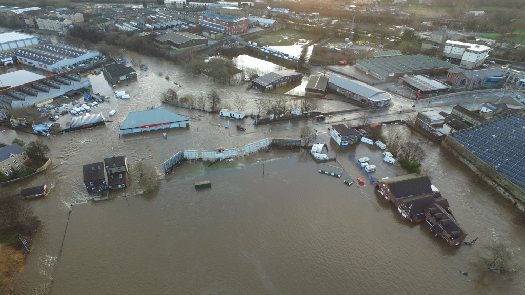
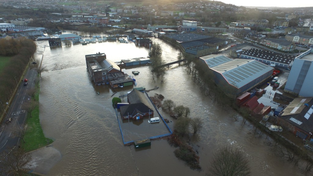
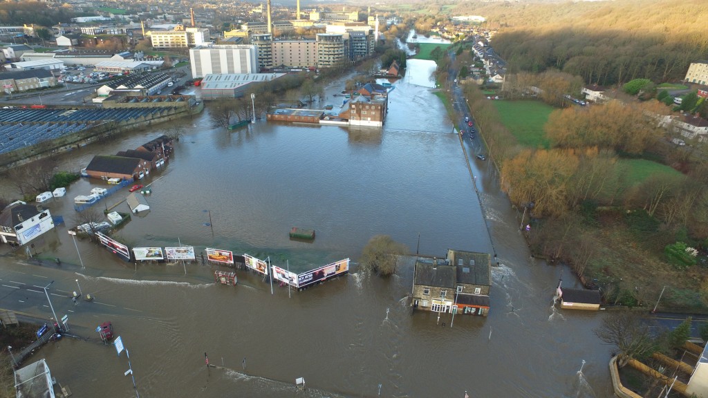
Tomorrow, Sunday 18th December 2016, we’re holding a Christmas party at Baildon Woodbottom Working Men’s Club for the Higher Coach Road Residents Group — and other invited members of the local community. We held a similar event around this time last year, shortly before the club was devastated by flooding on Boxing Day. That’s the club’s buildings, there, on the lower right of the photo above. The ‘proper’ river is to its right, and the lake that was Woodbottom cricket pitch is to the left. This was 27th December 2015, as the flood water was starting to recede.

DCIM100MEDIADJI_0006.JPG

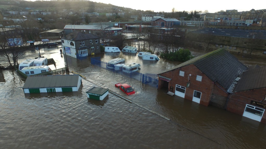
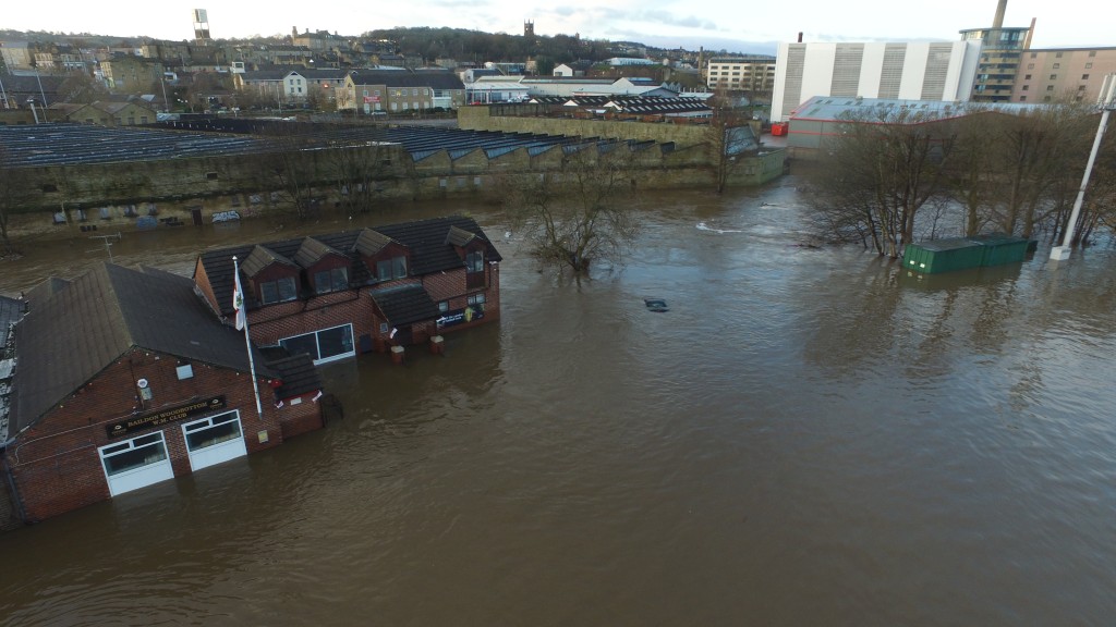
Here’s a closer view of the club and adjacent caravan park… And below, another view as the aerial drone camera turns clockwise to show the rest of the club and the upstream area.

DCIM100MEDIADJI_0007.JPG

Below, moving further upstream but looking back — a higher and wider shot of the whole area. Here, the main course of the river is much clearer, just off to right of centre. The club is in the middle towards the back of the shot, and in the foreground, Baildon Rec and the local Sea Cadets hall.

DCIM100MEDIADJI_0014.JPG

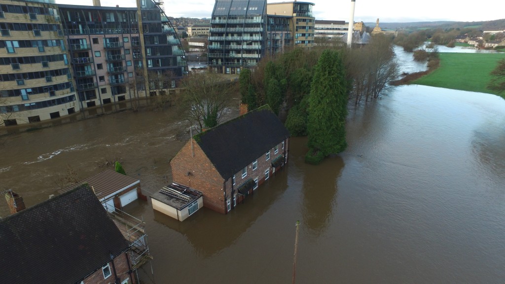
Then, below… just a little further upstream still, and turning clockwise again to look west, we have the four houses of Aire Close — right next to the river — and the Victoria Mills complex on the opposite “bank”. In the distance, to the west, is Saltaire. Notice the visible watermark on the buildings in this shot, since the water is already well down on where it had been the previous day:

DCIM100MEDIADJI_0009.JPGI’m very grateful to Brian Tuxford, of Northway Vehicle Sales (on Baildon Bridge) for sharing these images with me and allowing me to put them up on the blog. I featured Brian a few weeks ago, in this blog post, but it’s taken me a while to get these images up (because the CD he gave me had got corrupted somehow, and I had to get technical support to recover the photo files). Anyway, it seems appropriate to share them at Christmas — one year on.

DCIM100MEDIADJI_0029.JPG

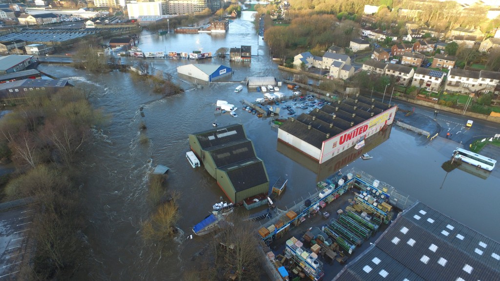
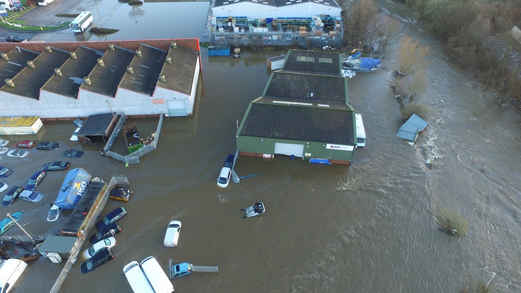
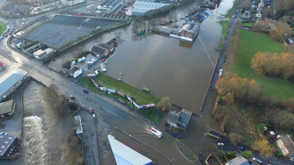
Above, we see the view from just downstream of Baildon Bridge, looking west. The cricket pitch etc are to the back of the shot now, and in the foreground we see the retail area east of the bridge, off Otley Road… United Carpets, and in the bottom right, the garden centre section of B&M. The river channel proper is to the left. The collection  of white vans in the middle of the shot is part of the Northway Vehicles fleet — the part that hadn’t been swept away by the flood — and you can see here just why Northway’s compound was in exactly the worst place as far as the flood was concerned… right in harm’s way as the water diverted across the cricket pitch tries to find its way back into the main channel. Below we see the same scene in reverse (i.e. the other side of United Carpets is now to the left; the river is to the right), and here you can get a very clear sense of the trajectory that would have been taken by the 37 vehicles swept downstream off the Northway lot…

DCIM100MEDIADJI_0035.JPG

The shot below gives some sense of how bright and sunny it was, on the day after the storm. Again we’re looking west, with the club to the left and the Rec in the centre of the shot. In the lower foreground is Otley Road, coming away from Baildon Bridge…

DCIM100MEDIADJI_0027.JPG

If you compare the shot above with the shot below — which seems to have been taken later in the day, when the water level had further receded — you can see how more of the road is now visible. And how the worst flooded part of it is actually around the junction with Green Lane… The bridge itself, to the left, and everso slightly raised to cross the river, is by this point comparatively dry. Which may be why the vehicle trying to ford through the flood water had thought it safe to ignore the road closure signs at the other side…

DCIM100MEDIADJI_0027.JPG

Particularly clear from this photo above is the way that the main river channel goes through a noticeable curve or bend as it comes under the bridge. Hardly surprising, then, that in high water — and with the channel under the bridge itself partially blocked by debris — the river diverts itself straight across this area, in a sort of “short cut.”

DCIM100MEDIADJI_0023.JPG

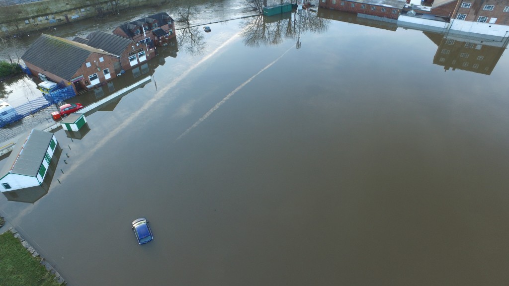
Finally, then, back to the club. And the vapour trails in the sky, reflecting in the standing water on the cricket pitch. And one, stranded blue car, which is not going anywhere fast.

Merry Christmas, one and all.


Flood Response @ Armley Mills

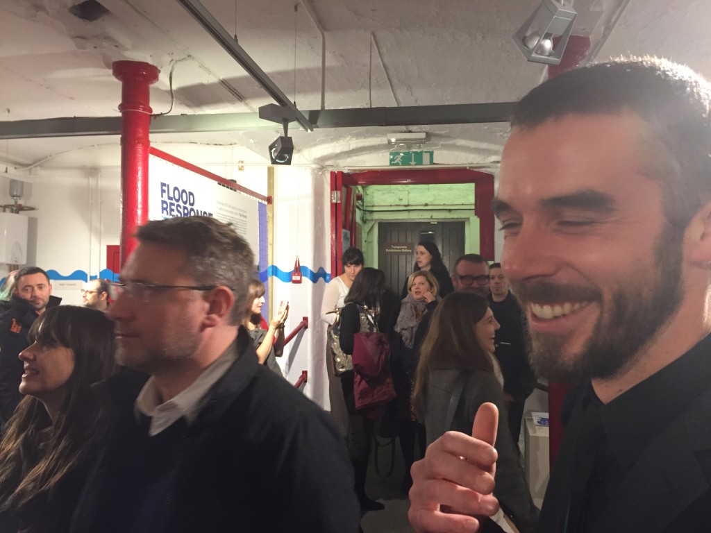
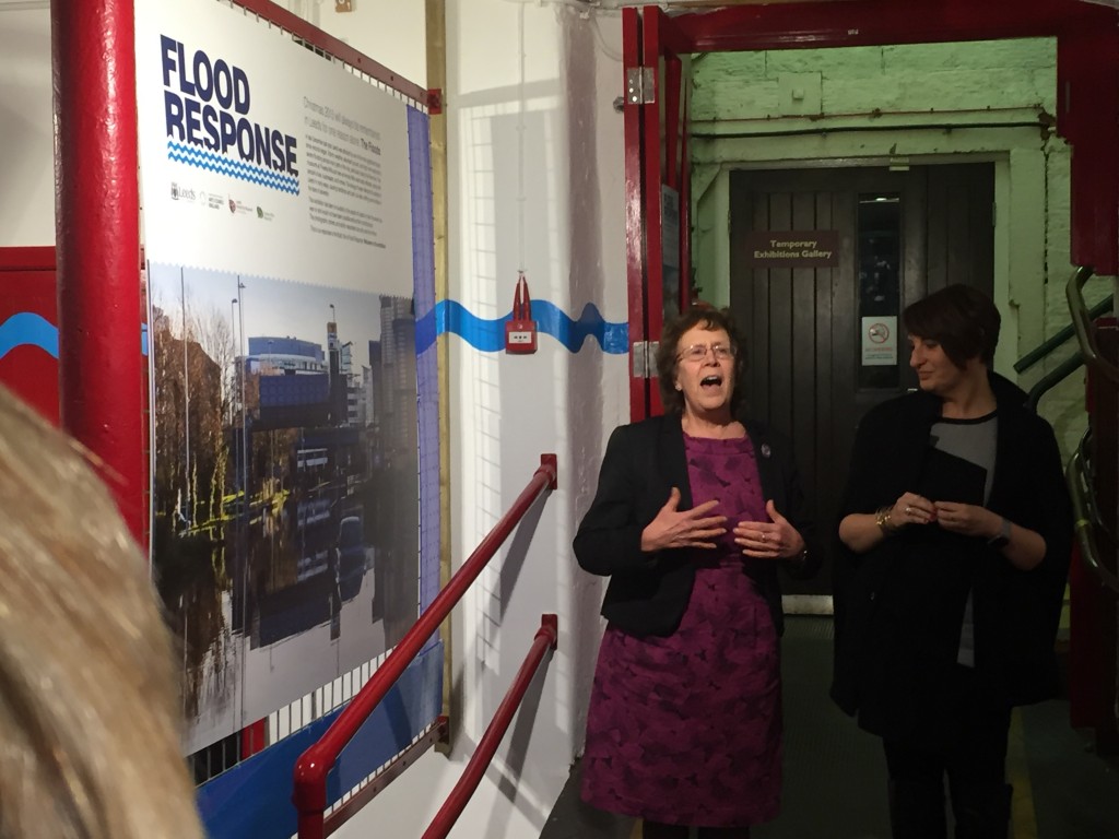
It was a pleasure and a privilege this last Thursday evening, December 8th, to have the opportunity to perform Too Much of Water, my one-man show about the Shipley flood last Christmas, at Leeds Industrial Museum — aka Armley Mills. The occasion was the opening of a special exhibition titled Flood Response. A single room in the basement of the museum is jam-packed with varied, colourful, striking exhibits documenting the impact of the Boxing Day flood in (mostly) Leeds. As the title implies, the exhibition looks at how communities in Leeds, especially in Kirkstall and Armley (the mill itself was directly hit by flooding), responded to the flood, often by showing a surprisingly festive spirit of resilience and co-operation, and thereby turning a crisis into a form of community-building. In the same spirit, the exhibition itself is labelled a “community exhibition”, and as such is composed largely of material donated by members of the public, rather than being professionally produced or commissioned.

IMG_2096

The curator of this rather remarkable display is Chris Sharp, pictured here on the right — his first big project for Leeds City Museums. He’s done a tremendous job (I really do recommend you visit). The exhibition was officially opened by Councillor Judith Blake, leader of Leeds City Council, pictured below during her speech, during which she spoke with real passion about the city’s response to the flood crisis..

IMG_2097
IMG_2103
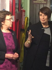
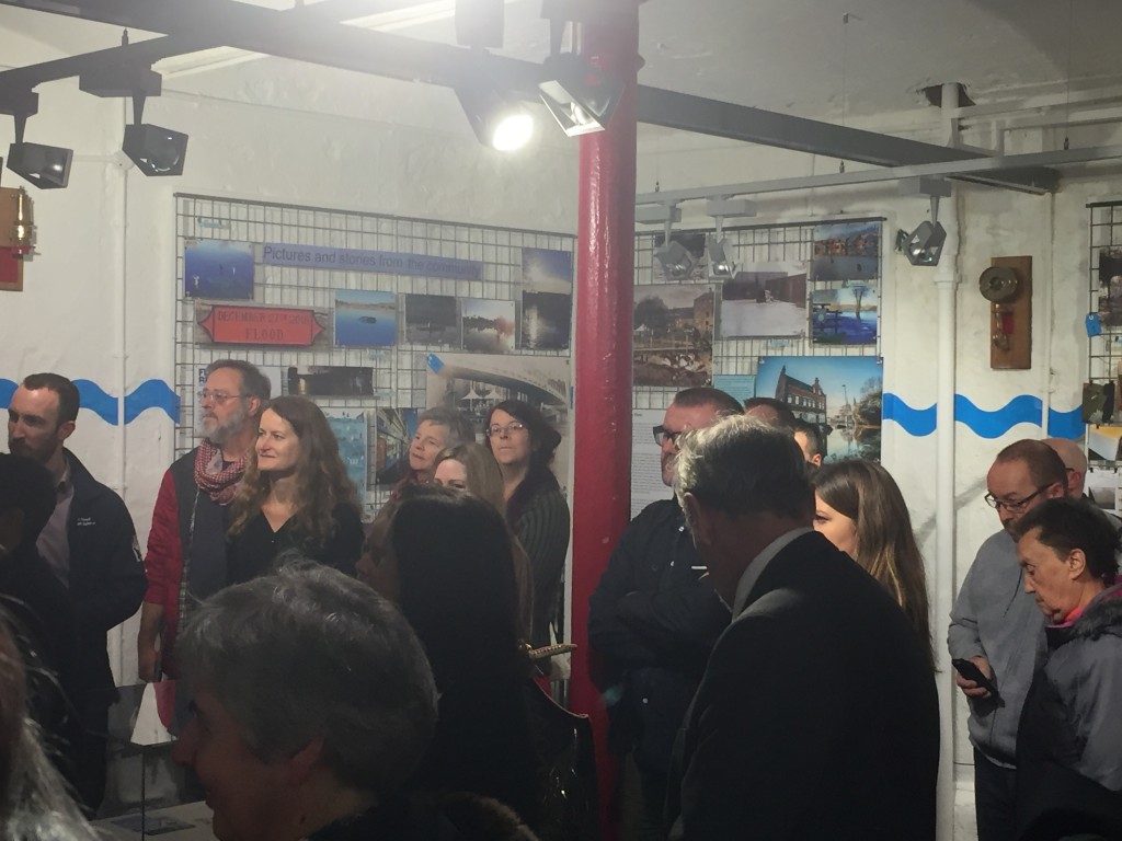
To Councillor Blake’s right here is Councillor Lucinda Yeadon, deputy leader of the council and (more to the point in this context) the ward representative for Kirkstall. As such, she was directly involved in the community response to the flooding along Kirkstall Road, and she really does seem to be one of those (rather too rare) politicians who inspires the confidence and affection of her local community. The exhibition opening itself was attended by quite a diverse crowd of invitees, enough to pack out the exhibition space, but here too the spirit of inclusion was apparent. This wasn’t just the predictable collection of luvvies and bigwigs you might expect to see at an exhibition opening, but a cross-section of people from the local community who had got involved in the flood response effort, in one way or another. (And here’s a few of them…)

IMG_2099

IMG_2095

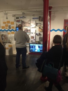
I’m very pleased to say that Multi-Story Water’s own contribution to telling the story of the Leeds flood response is on display as part of the exhibit (which will run for six months). Our promenade performance After the Flood — devised for Leeds Waterfront Festival in June — is on display in a new film version. We completed editing just in time for the exhibition opening. And OK, yes, some kind of technical glitch meant that the film file wasn’t playing on the digital screen designated for it on Thursday (i.e. the one to the left of this chap’s head, in the picture on the left), so it had to be temporarily installed on  an alternative screen at ground level. This hiccup should be resolved soon, though. And in the meantime you can also view the film online… Just look for After the Flood under the “Films” tab on the menu bar above… 

IMG_1737

This is actor Kat Martin — who you can just about see on the screen in the exhibition shot above — performing ‘live’ in After the Flood, as “Poppy”, a young woman whose family’s business on Kirkstall Road was badly affected by the flood. (The doll’s house represents the business, and the small figures are Poppy’s parents…) I’m really rather proud of this piece, made in collaboration with Simon Brewis’s Common Chorus Theatre, but on Thursday night, attendees at the opening were too busy milling and chatting to concentrate long on a video screen… Instead, after the speeches were over, they were invited upstairs to the museum’s cafe space for my live storytelling performance, Too Much of Water (both it and the ATF film were requested by Chris Sharp for the exhibition and opening – thanks for the opportunity, Chris).

Anyway, here I am, as pictured/tweeted by Geoff Roberts…

CzLAY1BWQAAtTAf

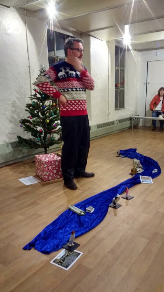
When I originally performed this piece in Roberts Park, for Saltaire Festival, it was mid-September and the Christmas tree and jumper seemed amusingly quirky. Since then, I have performed it around the country (Exeter, London, Cambridge, Manchester, Leeds), and I’m aware that by now — in December — I’m in danger of looking like I’m just trying too hard to be seasonal. Be that as it may, the performance was very well received by attendees at the opening, several of whom made a point of introducing themselves afterwards and thanking me personally (which was very nice – thankyou!).

What people find moving, I think, is the piece’s focus on some of the smaller, more human details of how people were affected by the flooding (the script draws from interviews with a number of people in the Shipley area, who are represented by the small wooden figures). I was especially flattered by the suggestion of one senior flood risk officer, who saw the piece on Thursday, that anybody who works with people affected by, or at risk of flooding (be it for the Environment Agency, local council, or whatever) ought to see this piece, because it will help them reflect on what it’s really like to be in those circumstances. High praise indeed.

On the other hand, I heard on Friday — from another friend who couldn’t attend the opening — that a couple of his colleagues at the Environment Agency, who had been at Armley Mills to represent on Thursday, had felt slightly uncomfortable watching the piece. They wondered if I was attacking the EA’s warning efforts in Shipley around the time of the flood. I’d just like to say, publicly, that I’m really sorry if they felt that way, because this was never my intention. Yes, certain details are documented in the show, as seen from the point of view of my interviewees, that might perhaps be seen as not reflecting all that well on the EA, but I was very careful in writing the piece not to make any comment either way — simply to represent the facts as best I could establish them, and let spectators draw their own conclusions. And I do make the point in the show that the Agency too, in its own way, was inundated on Boxing Day — struggling to keep up with the pace of events as the crisis unfolded in multiple towns, in multiple catchments, simultaneously. They, too, are only human.

With that in mind, I’ll close here by pasting in Scene 5 of our After the Flood film — “the Agency Man”. Hopefully this provides some sense of just how tricky the EA’s job is, in terms of Flood Response – often having to be all things to all people. In my (finite) experience, they usually do a great job, in often very difficult circumstances.

Mud of the Aire / Mud of the Somme… (Down at Denso’s)

This week I visited the Nature Reserve at Denso Marston’s, in Lower Baildon (Charlestown) to meet the warden there, Steve Warrillow. My visit was motivated by my research into how the Boxing Day floods have affected people and places in the Shipley/Baildon area. In my mental mapping, Denso’s is the most easterly point of interest on this stretch of the river —  with Branksome Drive and Dowley Gap at the westernmost end. Steve, though, is a fascinating interviewee and we talked about many things besides the flooding…

IMG_1417

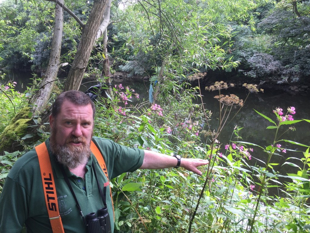
Here he is down on the riverbank, pointing out to me the extent of what was lost to the river as a result of the flood. He estimates that, last year, there was eight to ten feet more banking between the river and the main footpath through the reserve — but as you can see, at this point there’s barely any gap at all. Given that much of the nature reserve is a fairly thin strip of land between the Aire and Denso’s working factory site, Steve can’t necessarily afford to lose whole chunks of it to the river… although of course he is the first to admit that it is the nature of rivers to alter their course over time.

IMG_1422

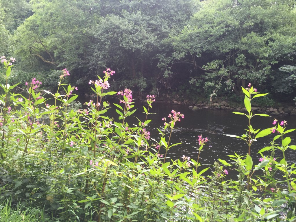
So severe has the banking collapse been, Steve notes, that he has decided to leave a small forest of Himalayan balsam in its (self-seeded) place, to provide a kind of safety barrier along the sharply sloping banking next to the path. (The balsam is of course visible in the photo above — as is, on the opposite side of the river, some of the flood debris still hanging in trees some seven months later.) Balsam grows tall enough that it masks and deters, but it is also of course (as discussed in my last blog but one) an invasive species that wreaks havoc with native plants and soil integrity along riverbanks. Some would no doubt be appalled that Steve has allowed so much of it to remain in place — rather than trying to pull it all up before it can release more seeds downstream — but he adopts a more philosophical attitude, seeing balsam as just one issue among many he has to deal with, rather than in terms of the tabloid-style hysteria that it sometimes attracts.

IMG_1421

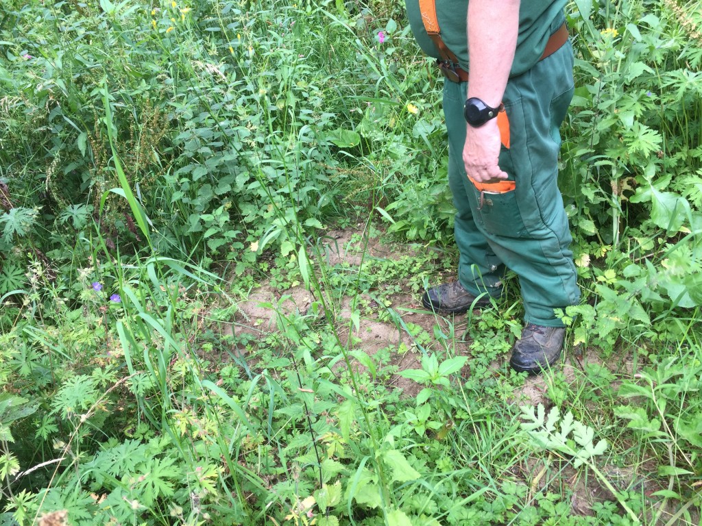
Away from the river, evidence of the flood is also to be found underfoot. This, Steve points out, is river sand — left behind by the receding waters. It’s the kind of stuff that householders affected by the flood tried to get rid of straight away, not least because of the likely contaminants in it (e.g. raw sewage from up at the Dowley Gap sewage works). But of course, in a more natural setting like this one, anything organic can be left to rot down and provide nutrients for the earth. The big problems Steve had to deal with on the nature reserve, post-flood, was the huge quantity of inorganic debris that was swept downstream and left on site — everything from cars and freezers down to plastic bags and tampons. There were also quite a few dead animals, large and small … organic matter, yes, but not what you want left about to rot!
When you’re dealing with a sizeable patch of land like this, which was ten feet under water at the worst of the flooding, and has plenty of trees to act as barriers/obstacles to things being swept along, its unsurprising that so much was left behind. Fortunately, though, most of the debris was cleared away quite quickly by a major volunteer clean-up effort in January — when the Friends of Denso Marston’s customary volunteer force was joined by others from the area including the Friends of Roberts Park, Hirst Wood Regeneration Group, and Mat Holloway’s ADRI (Aire Debris Removal Initiative). Steve recalls the amazingly positive initial response to the Reserve’s calls for help — but also notes that this positive burst of energy tailed off quite quickly… He has been frustrated, in the months since, by the thoughtless remarks of visitors wondering why everything is not as perfect with the reserve as they would expect it to be… (We can all have very short memories.)

IMG_1423

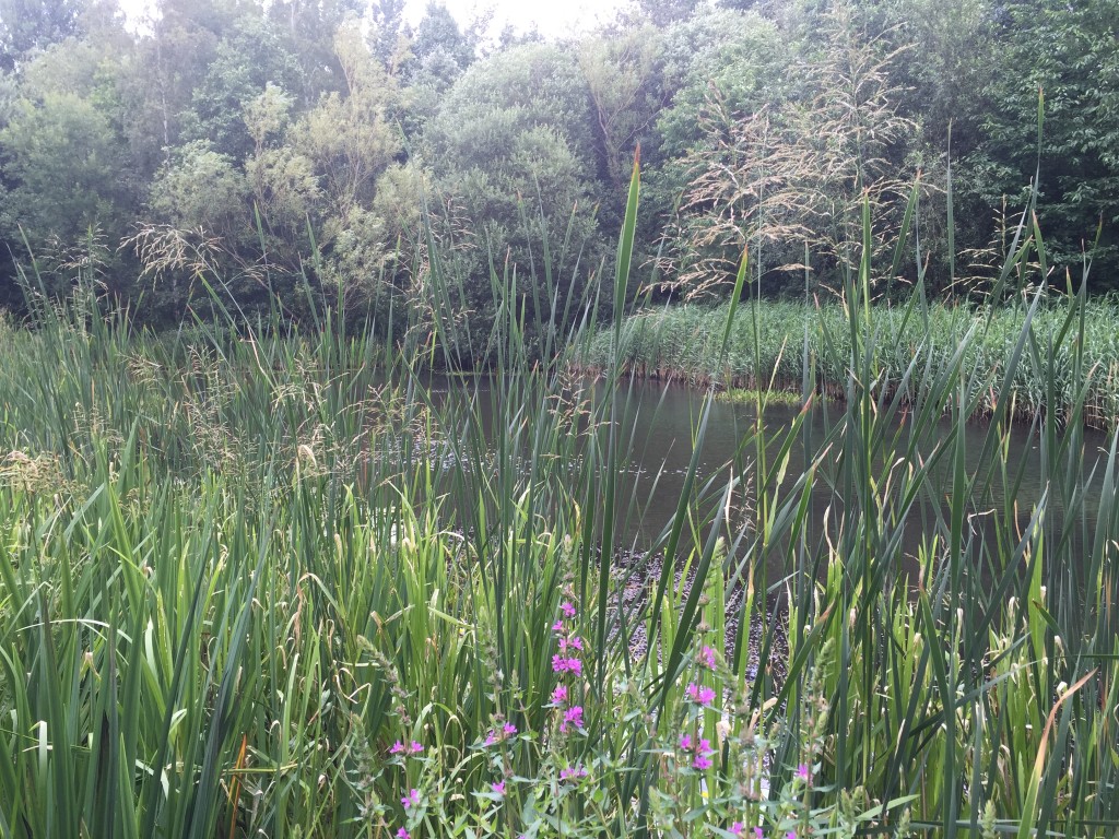
Looking at the site today, it would indeed be easy to forget about the recent flooding, given that Steve and his volunteers have done such a great job cleaning it up and restoring it to former glories. This photo of the reserve’s wetland pond — the heart of its wildlife habitats — looks positively idyllic, and belies the hard slog that has gone into managing its restoration in the months since the flood. Moreover, Steve notes, the banking all the way around the pond is perilously soft, just as it is along the river.

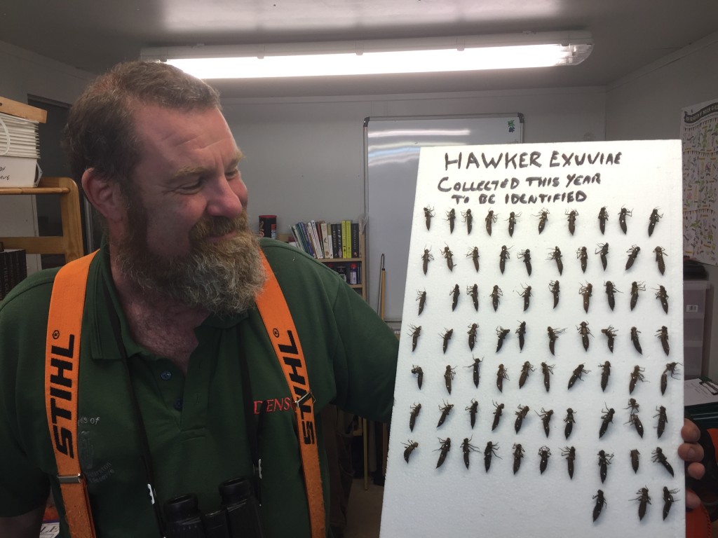
He has been cheered, though, by the signs of wildlife making a resurgence on the site even after so much of it was rudely displaced at Christmas. In the reserve’s education hut (a new one now located some way up the hill, at a safer distance from the river than the old one, which was wrecked by the flood), Steve proudly showed me this display of dragonfly chrysalises that he has collected from around the site this year. There had been fears that the dragonfly population would be badly affected by the flooding and its aftermath, so this little exhibition is evidence of very good news…

IMG_1424

Even so, the reserve’s dragonfly population is also indicative of wider changes in the natural world that would be foolish to ignore. If the flooding, as many have argued, is symptomatic of a changing climate in this 21st century, so too is the fact that Steve regularly observes dragonfly species on this site that he would never have seen twenty years ago, when the reserve was establishing itself. The warming climate is pushing many species north in search of more temperate climes. (Although the chrysalises preserved in this display appear to be from species that are more “natural” residents of Yorkshire.)

IMG_1410

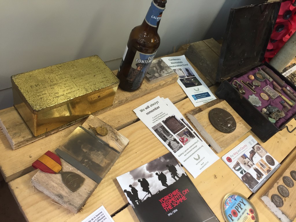
Also on display in the education hut is Steve’s personal collection of First World War memorabilia — set out to mark the hundredth anniversary of the Battle of the Somme at the beginning of this month. Aside from being a keen birder and insect expert, Steve is fascinated by story of the Somme — as well he might be, given that his great-grandfather was one of the lucky soldiers to survive the slaughter (had he not… no Steve). Among the treasures collected here are his great-grandfather’s first-aid box (the black tin to the right of this shot, now displaying bullet fragments etc), and a still-unopened tin of Tommy’s rations (the gold box to the left). It’s pretty weighty! Steve has heard tell of one such box being opened quite recently, and its contents still being perfectly intact (presumably because it was completely airtight). So strange what changes, and doesn’t, over time.
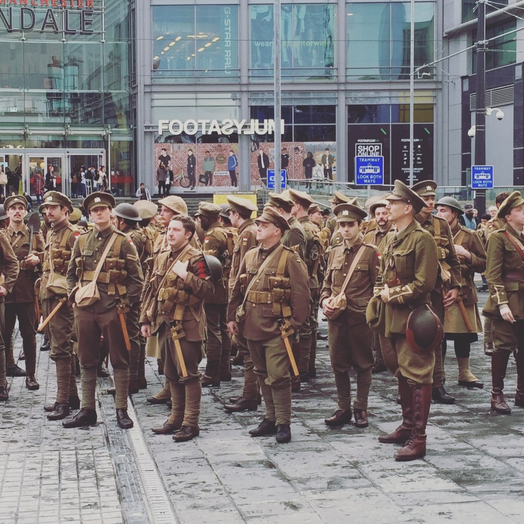
Steve’s interest in the war extends to having booked a package tour to the Somme, which he is heading off on in August. It’ll be his second visit. We spoke quite a bit about all this, as well as about the reserve and the flood, and I mentioned that — on July 1st, the centenary of the Battle — I had been fortunate enough to witness the eerie presence of World War I soldiers on the streets of Manchester… I promised to post some pictures on this blog, so Steve could see them…

IMG_1218

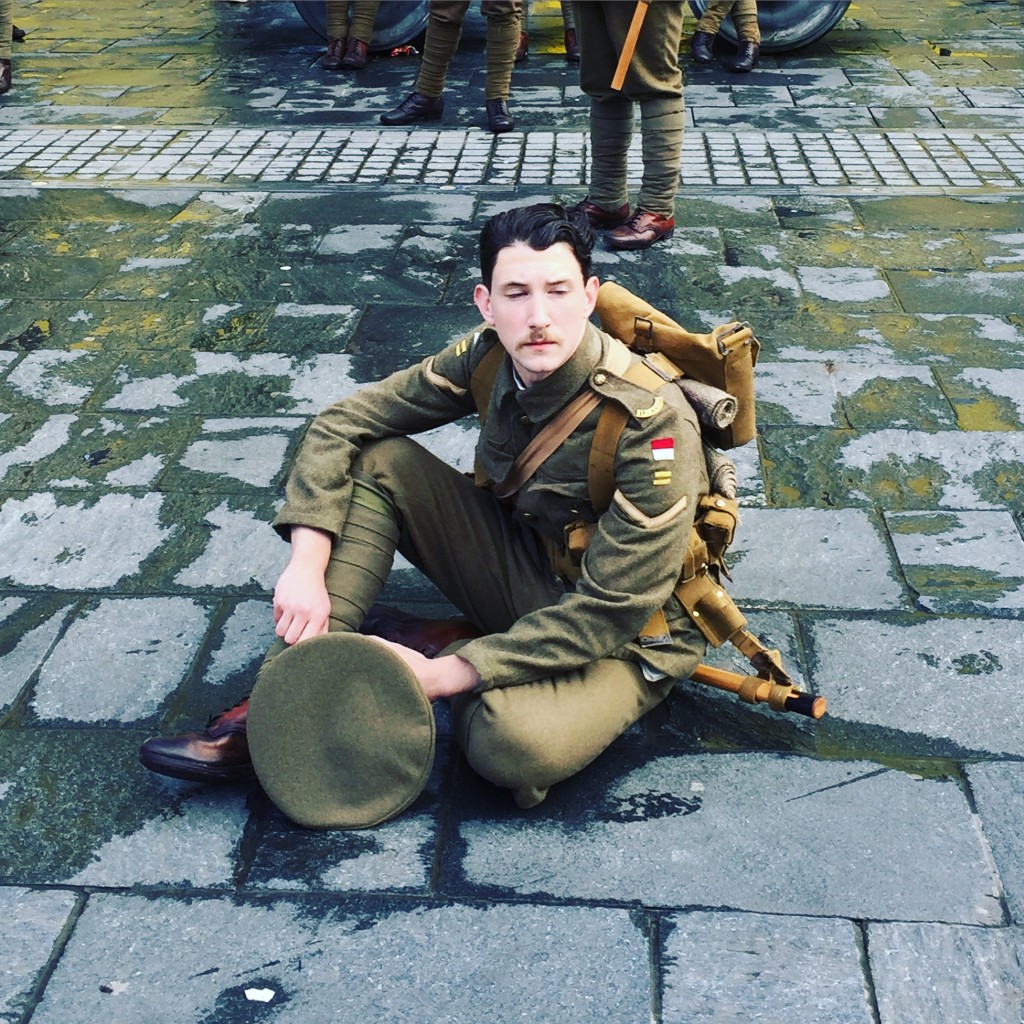
This was Exchange Square, towards the end of the day, as all the “soldiers” who had been positioned in different parts of the city, ever since the morning rush hour, gathered together for the event’s understated conclusion…The appearance of silent soldier figures in cities up and down the country that day was part of a commemmorative art event conceived by the artist Jeremy Deller (who in 2001 famously staged a reconstruction of the 1984 police vs. miners clash at the “Battle of Orgreave”). Titled simply “We Are Here” (after the song “We’re here, because we’re here…”; there wasn’t much more rationale for the trench warfare…), the piece consisted simply of perfectly attired actors standing — or sitting — as a silent presence within the everyday lives of commuters and shoppers. A little like the traditional “two minutes silence”, but played as an interruption in space rather than time.

IMG_1216

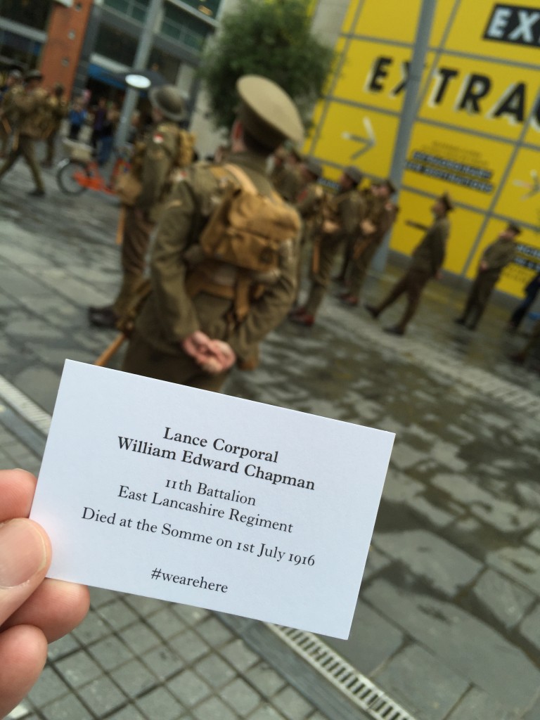
Each soldier had a collection of “business cards” indicating the identity of the man he was representing (and thus, literally, re-membering). They didn’t offer them around, but if you went up to one of them to ask what was going on — or simply to ask who he was — then he would give you a card and simply walk away. Like a ghost.

IMG_1211


It’s not just water that can sweep people away.

Thanks Steve, for a memorable visit.

More on the Aire in flood (inc. selected video links)

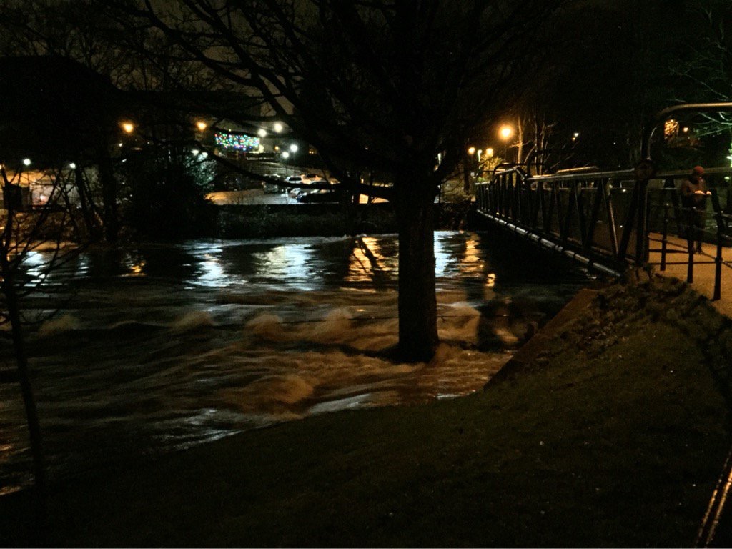
IMG_0243This was the scene last night, looking across the Aire from Roberts Park towards Saltaire… And then this morning, this strangely beautiful image of Cricket Pitch Lake in the sunshine was tweeted by Saltaire Festival. Note that the path in the foreground, in front of the Boathouse Inn, is no longer under water was it was yesterday…

IMG_0254It’s been reasonably dry today (Dec 27th), so the water has receded a bit, but it looks bad for Tuesday with more rain forecast to fall on already sodden ground. Fingers crossed.

Geoff Tynan posted this short video edit of the flooding in Shipley and Saltaire yesterday on Youtube. It really captures something of what was going on in the area. Begins with footage of Baildon Bridge’s arches completed obscured by water.

Another striking bit of video is this widely-screened BBC clip (I can’t paste it in as it doesn’t have an embed code… but you just have to click on the link). This shows the Aire just east of Baildon Bridge, flowing past the back of Wickes and up to the footbridge that runs between Dockfields and Lower Holme. A massive something is carried rapidly downstream until it crashes into the bridge with an almighty noise: the BBC say it’s a caravan but it looks to me more like a mobile burger stall or something of that sort? Anyway, this incident recalls residents’ memories of the exact same thing happening with a skip back in 2000… the fact that the river in flood flows north across the Green Lane cricket pitch and then back into the main channel via commercial/industrial properties means that some pretty big pieces of debris find their way into the river at this point. (Very dangerous!!) It can’t have come from any further upstream, because Baildon Bridge forms a barrier for large debris… as this next clip clearly demonstrates! Thanks to Rob Walsh for drawing my attention to this incident…

The area around Baildon Bridge was a bit calmer today, but here is an eerily silent Otley Road, at the junction with Green Lane, still covered by water in the sunshine…

IMG_0257And here was the scene just to the right of here, going west up Green Lane to junction with Coach Road…

IMG_0255As you can see, the area outside Baildon Rec is still a lake, and the four riverside houses of Aire Close are cut off completely. We send best wishes and hope for speedy return to normal for the residents there.

Downstream in Leeds, the Aire was at the highest level anyone can remember, but interestingly the new flood walls that have been being constructed this year as part of the Leeds FAS (Flood Alleviation Scheme) seem to have been doing their job. In this next video from Moss Travel TV, look particularly at the low wall in the foreground between 2.23 and 2.31 in the time coding… that’s been built recently around the edge of the Direct Line building (across the river from Granary Wharf, south of Leeds Station) and it seems to have been just high enough…?


The more severe flooding problems in Leeds were further downstream, it seems, in the area between Leeds Bridge and Clarence Dock, where the new defences have not yet been completed… (they’re scheduled for completion early next year). This video by Laurie Cooper-Murray captures that area after dark last night. It’s powerful not just for the visual footage but also for the eerie quietness of the soundtrack. There’s no added music or commentary, you just hear wind and water… 

This still aerial image captures the extent of the flooding last night on East Street — a major link road just adjacent to the river on the north side (acr

IMG_0238Perhaps most startling for many Leeds residents, though, was the way that Kirkstall Road turned into a river last night. This is captured in full by Lauren Potts in her twitter feed… Look especially for the eerie “morning after” video she’s posted under the heading “Unbelievable scenes down here on Kirkstall Rd – it’s like something from an apocalypse film.” Many people were perhaps unaware that Kirkstall Road runs directly parallel with the Aire at valley bottom, since you can’t usually see the river for all the buildings. Not so last night… (Random fact: Lauren Potts is a BBC journalist based in Leeds, but also coincidentally a graduate of Manchester University’s Drama department, where I teach)

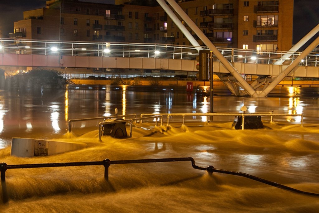
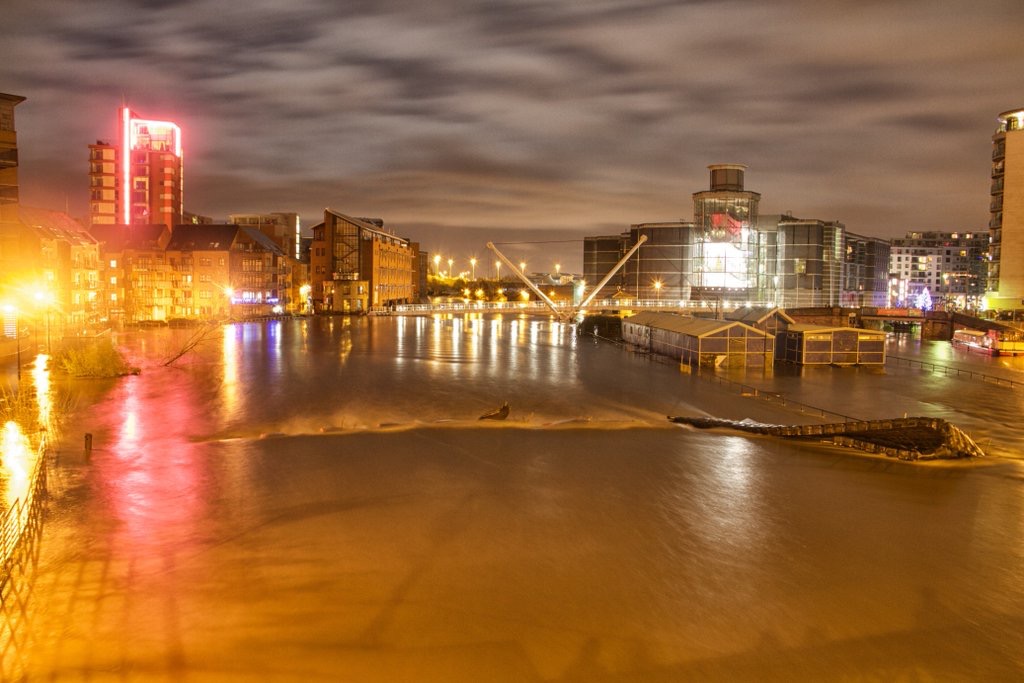
Finally for now, a couple of very artistically composed shots of the extent of flooding around Clarence Dock – and Leeds Lock adjacent to it. That’s the Knights Way Bridge in both shots. (Grabbed these off twitter… hope the photographer doesn’t mind!)

IMG_0242

IMG_0241

Don’t miss Shipley Street Arts Festival!

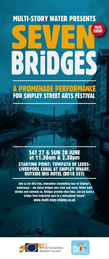
The weekend of June 26-28th is the Shipley Street Arts Festival, co-ordinated by our good friends over at Q20 Theatre. There’s lots of activities and performances for all tastes and ages, many of them taking the river and canal as a watery theme…  We’ve got a hand in various events including the water flume demonstration near Shipley Library (from noon on Saturday 27th), and the duck race from Baildon Woodbottom Working Men’s Club (1pm, same day), and on Sunday 28th there’s a special screening of our short film Wading to Shipley at the Ibis Hotel. Multi-Story Water‘s main contribution to proceedings, though, will be this:

SevenBridges-leaflet-HiResThis new, interactive promenade performance will be directed by Simon Brewis, and performed by David Smith and Lynsey Jones. All three were part of our original, 2012 Multi-Story Water performances, and we’re delighted to have them back for this project. The Seven Bridges include some obvious ones and some less obvious ones, so do come along and discover the trail… (it’ll end up not very far from where it starts, you’ll be reassured to know!)

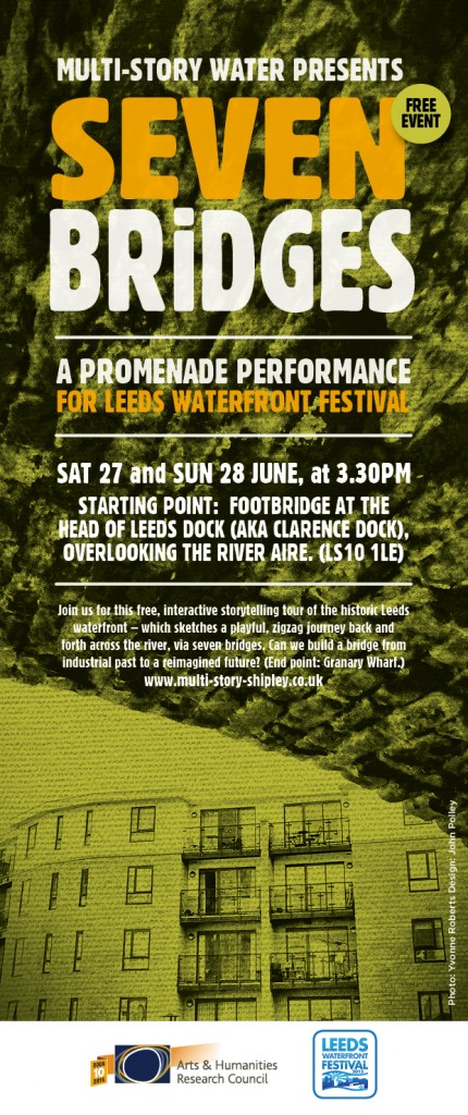
Meanwhile, on the very same weekend, just a few miles downstream, the Leeds Waterfront Festival is taking place. So to create a bit of a conceptual “bridge” between the two festivals — and between Shipley and Leeds — we are also presenting this:

SevenBridges-leaflets2Now that’s actually a photograph from Shipley (Amber Wharf flats viewed from under Junction Bridge, at Dockfield) but the designer liked the picture, and it sort of works for Leeds too… where there’s a whole lot of new build flats by the water!

Anyway, the Leeds piece will be performed by Steve Bottoms, who will be supported musically by the very wonderful Eddie Lawler (the Steve and Eddie partnership is now a recurring one, and also dates back to our 2012 MSW performances). In theory, it’s possible to see both Seven Bridges pieces in the same day, if you do Shipley at 11.30am and Leeds at 3.30pm. Or you can do them different days. You don’t have to do both, of course, but they will, we hope, complement each other in interesting ways… And it is all free, so you can’t go wrong!


Seven Bridges, Two Cities

The Shipley Street Arts Festival is coming up at the end of June (26th-28th), and this year is taking the river and canal as a linking theme. We’re delighted to announce that the Multi-Story Water project is working actively with Q20 Theatre to make this happen. In case you’re wondering whether there is any “street art” in Shipley, well lookee here…

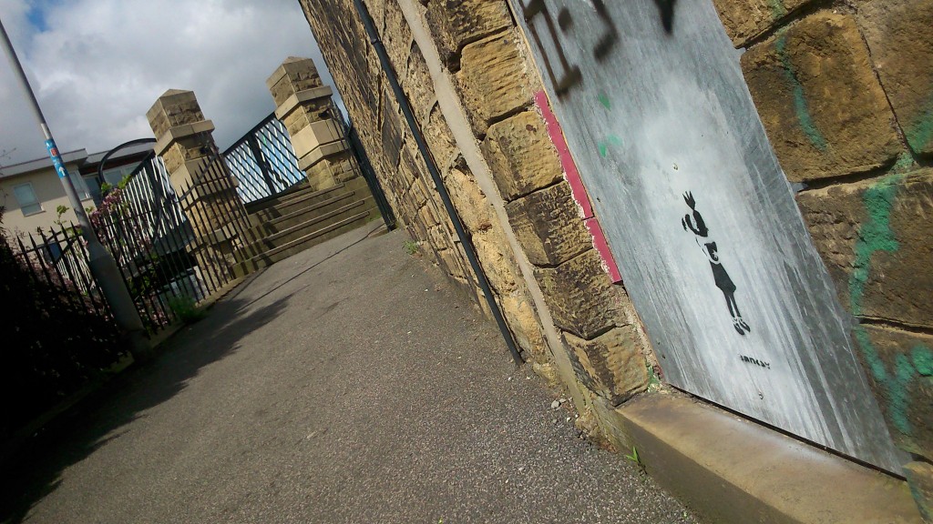
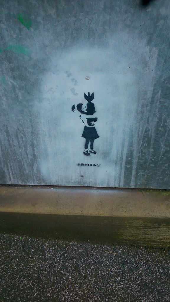
DSC_0320A genuine (as far as I can tell) piece of Banksy graffiti, tucked away on the footpath that goes up to Gallows Bridge – across the canal – just up the hill from where Aldi and McDonalds sit by Bradford Beck. In case you don’t know his work, Banksy is a famously anonymous, Bristol-based artist whose graffiti has become internationally renowned. People sometimes rip down entire walls so as to be able to flog things he’s painted on them… This particular metal panel looks like its secure enough where it is, though. I’m not sure how long the painting has been there, but it’s tucked away in this wonderfully unassuming location… Here’s the image in close-up:

DSC_0318OK, that’s all I have to say about Banksy. But Gallows Bridge will be featuring as one of Seven Bridges in the Shipley area that will be linked by a looping promenade performance that we are making for the Street Arts Festival. I’m pleased to confirm that this will be performed by David Smith and Lynsey Jones (both of whom co-created and performed in our original Multi-Story Water tours back in 2012), and will be directed by Simon Brewis (who directed them). Always nice to keep things in the family…

Meanwhile, though, we are getting delusions of grandeur. Because simultaneously with the water-themed Street Arts Festival in Shipley, the Leeds Waterfront Festival will be running the same weekend. So to provide a kind of conceptual “bridge” between the two festivals, we will also be presenting another performance — with the same title, Seven Bridges — in Leeds. If you’re really keen, you might want to see both… (!)

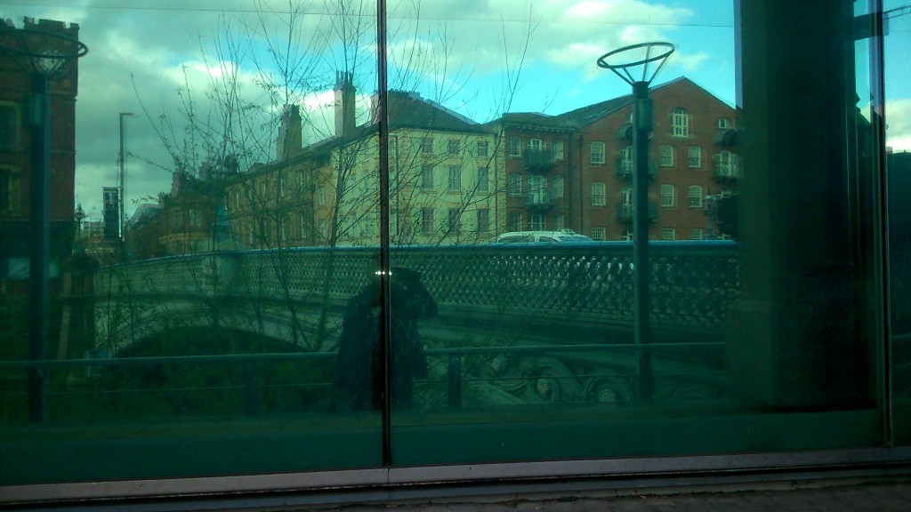
DSC_0285This is me being anonymously artsy (if not banksy) while researching the Leeds end the other week. That’s Leeds Bridge you can see reflected in the plate glass — the crossing where the city began. Leeds’s whole history was built around the river, which is why it’s so strange that the city has sort of turned its back on the waterfront: you can live there for years and barely even be aware of its existence…

DSC_0304Here’s another of the Seven Bridges — Victoria Bridge, which was built (unsurprisingly) in the 19th Century to replace a longstanding ferry service. It’s one of the major road links to Leeds station … right beside Bridgewater Place — the unnecessarily tall building better known as “the Dalek”! But even though there’s a clue in the name — Bridge — water — place — you can drive across Victoria Bridge a thousand times and barely even notice that you’re crossing a river…

Now… notice the white, ‘canal style’ railings to the right of the shot above. That’s because this image was taken at the junction where the River Aire (aka the Aire-Calder Navigation) connects with the Leeds-Liverpool Canal. And here it is…

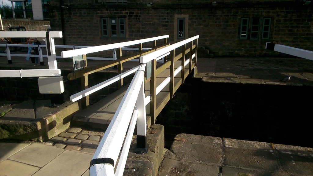
DSC_0303… the footbridge that crosses the end of Lock 1 on the Leeds-Liverpool… the very, very beginning of the 109 miles of canal, that goes through Shipley and all the way to the Mersey… Meanwhile, if you turn through 180 degrees and move upstream on the Aire a little (also in the direction of Shipley, of course…) you come to this…

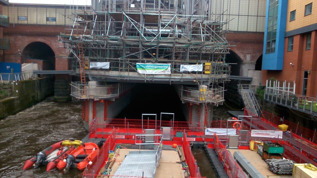
DSC_0298This is the brand new entrance to Leeds Station, currently being built by Carillion. I like the sign on it: “this is civil engineering“! (as opposed to uncivil engineering…?) Notice that because space is so tight around the station, the building materials are having to be floated upstream on pontoons (in the foreground of the shot) in order to get to the site. Notice also the angle this shot is taken from… I was standing on – you guessed it – a bridge. Granary Wharf Bridge, to be precise — quite a new, modern one… That’s the western end of our Seven Bridges route… and here’s (almost) the eastern end…

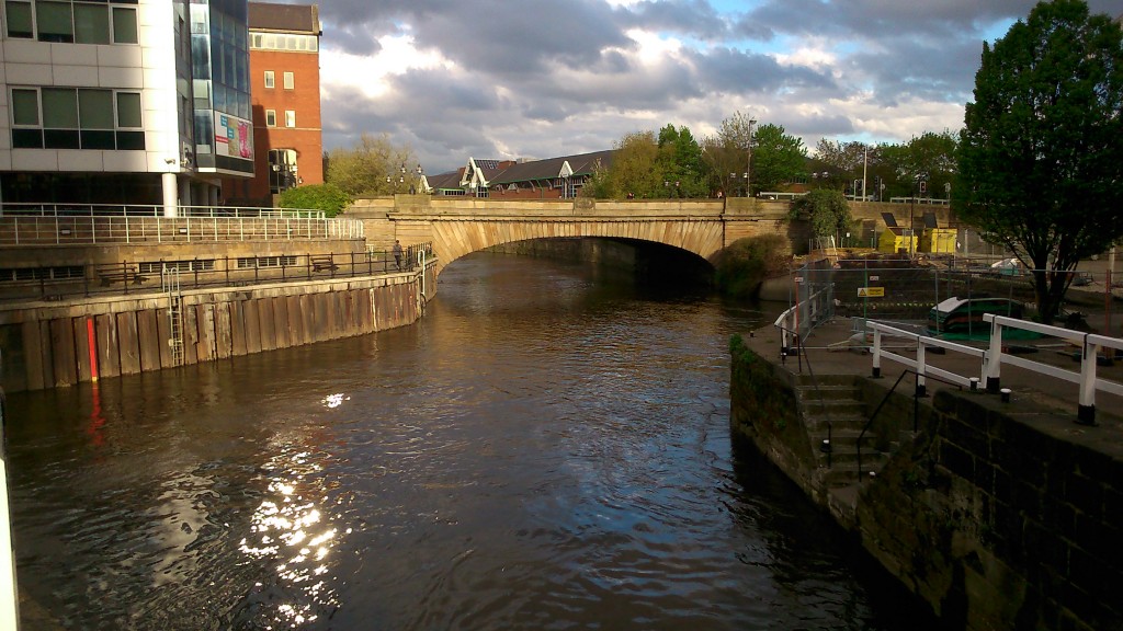
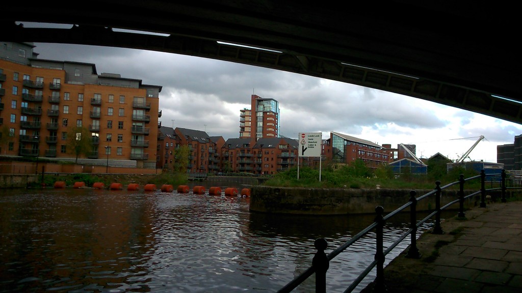
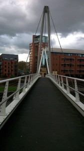
DSC_0256This is the entrance to the weir and lock at Crown Point (Clarence Dock), with the Crown Point Bridge arcing overhead… another road bridge that you can merrily drive across without ever noticing the river… And in the shot below is the weir itself, viewed a little further downstream from Knights Bridge (footbridge)…

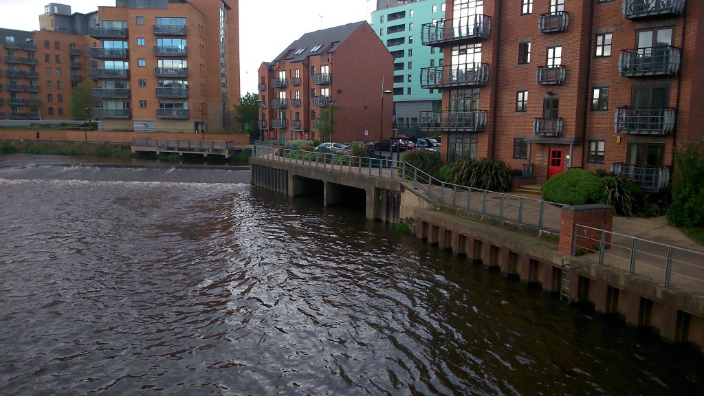
DSC_0261Notice the black holes in the middle of the shot here. Not technically a “bridge” perhaps, but this is where Meanwood Beck enters the Aire… a rather lovely beck that flows down through Meanwood Park and its attractive, surrounding valley, but then disappears into underground culverts before it gets close to the city centre (shades of Bradford…).

DSC_0259

This is Knights Bridge itself, viewed from the Clarence Dock side, and looking across to the building that operates as the headquarters for the Canal and River Trust in Leeds (hub of the CRT Northeastern partnership, if that means anything to you). Some very nice people work there… This bridge, as you can tell, is pretty modern, but I need to do some more research about it…

What strikes me here is the proliferation of white-painted metal, which even extends to these cage-like railings in front of the CRT building itself…

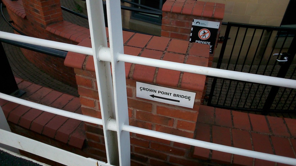
DSC_0262I like the little bit of signage here, pointing you to the next bridge (“hey, you’ve just crossed the river, fancy doing it again in the opposite direction?”). But there’s no shortage of signage in the vicinity of the river in Leeds… Check these out, for instance…

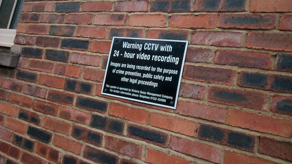
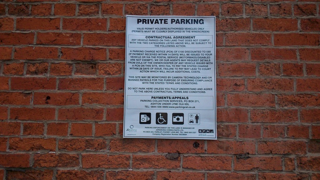
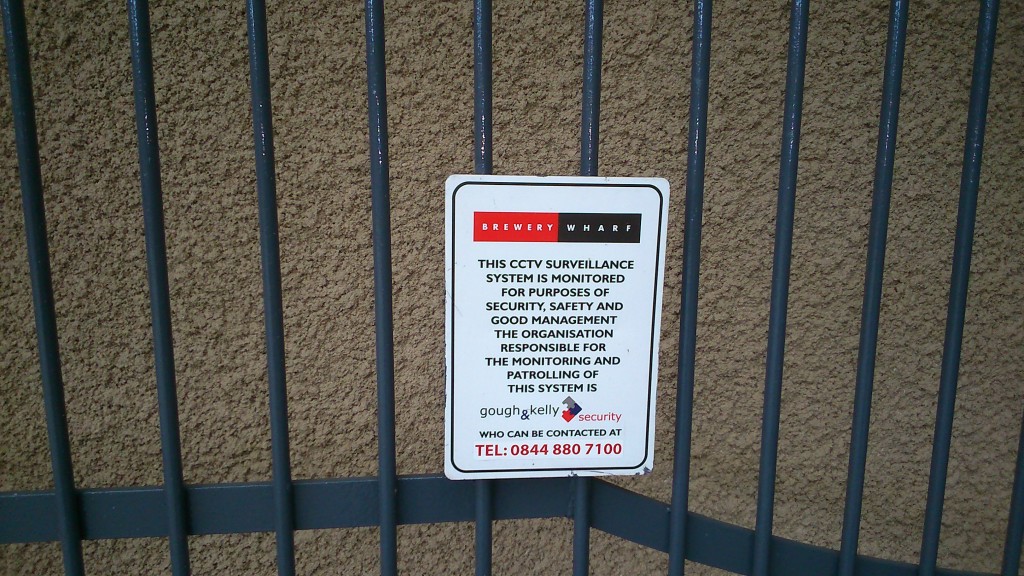
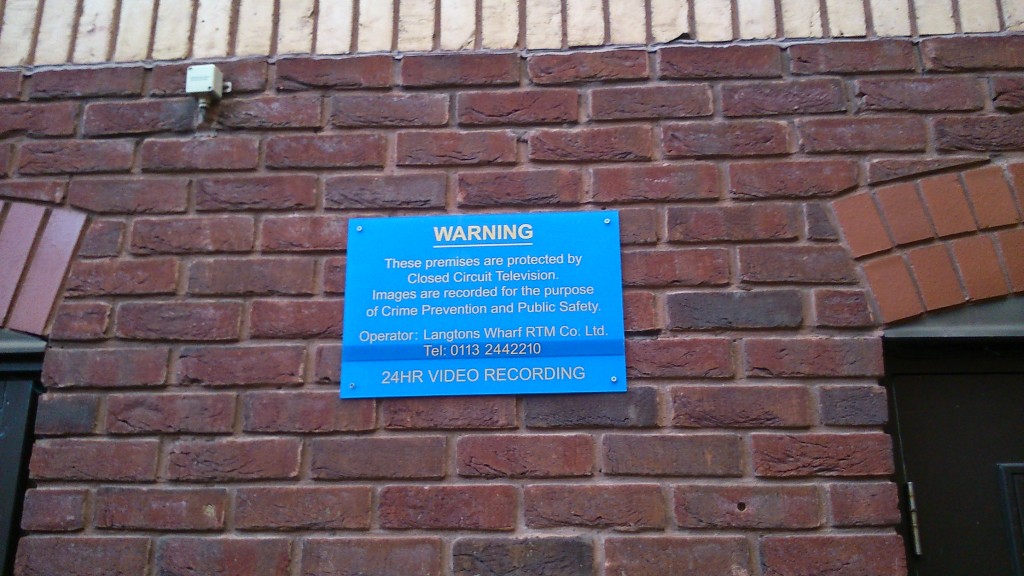
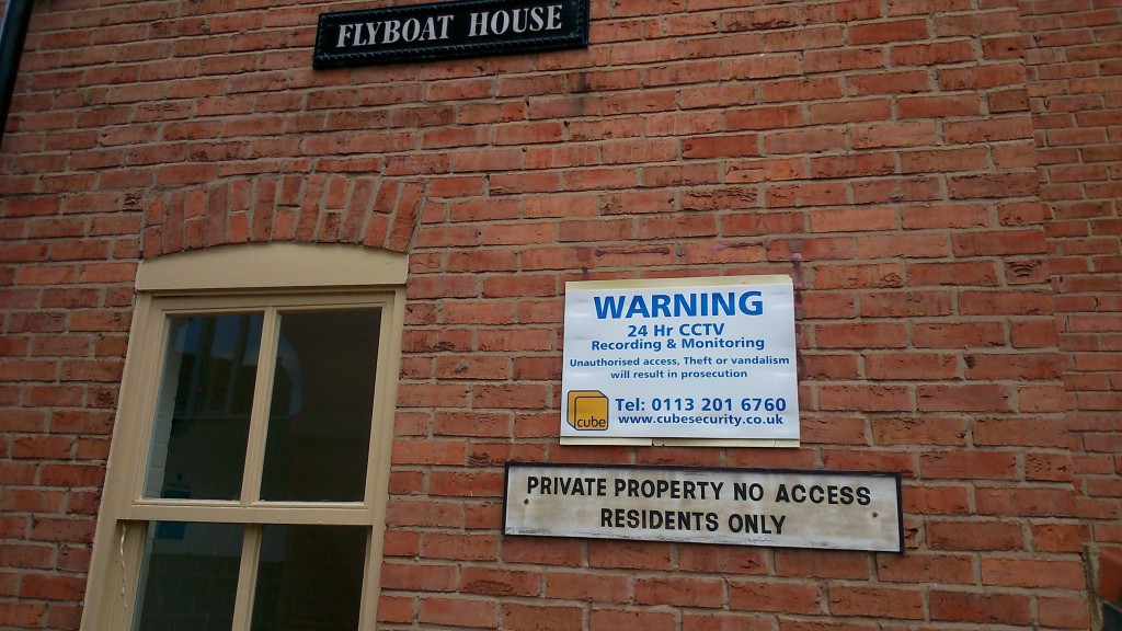
DSC_0239DSC_0242DSC_0251DSC_0272 DSC_0243Everywhere you go, it seems, you’re being warned that you’re on private property… that you are walking at the permission and indulgence of property owners… that you are on CCTV… There’s no sense in Leeds at all that the banks of a river might be public space, for anyone to walk along. The riverside paths are constantly broken up, interrupted by buildings or private spaces that you can’t enter. There is no “ancient right of way” here, in the way that there is in Shipley… And then the city wonders why people don’t engage more with the waterfront…

O Banksy, where art thou…?


Dark Arches, Leeds

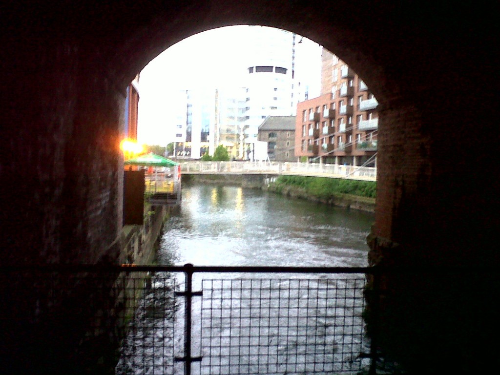
So here’s the River Aire as it runs through the centre of Leeds — a dozen or so miles downstream from Shipley and Baildon… This is the view out from beneath the Dark Arches under Leeds Station. Only the Victorians would have decided to build a train station across a major river…

Anyway, point is, the other weekend Leeds played host to OVERWORLDS AND UNDERWORLDS (May 18-20) — the city’s contribution to the Cultural Olympiad (whatever that is), on which around £1.2 million had allegedly been spent bringing in the international art duo, the Quay Brothers, to present a large scale installation and performance event around the City Centre. A centrepiece of this was the various things happening under the dark arches in a kind of Tim Burton-esque gothic fantasy…

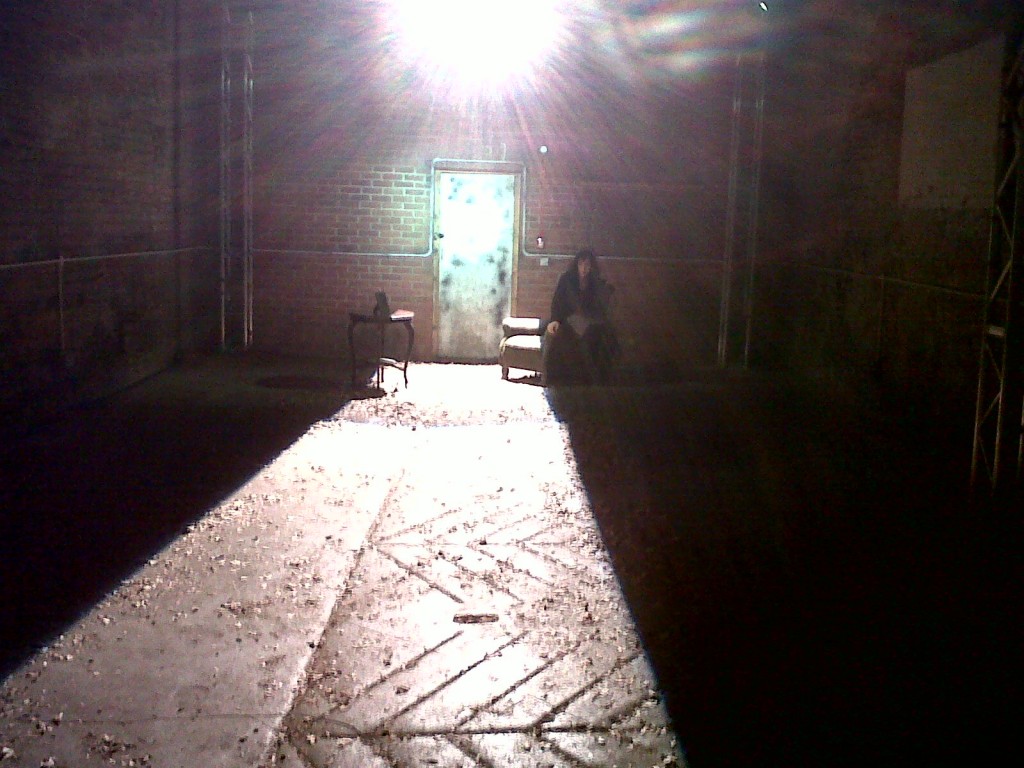
There were various rooms with various strange, dance or movement activities going on, lit with stark and moody lighting (the woman in this image went on to do a passionate little dance duet a moment later, with some random bloke who turned up to join her). These bits and pieces felt a bit unsatisfactory to me, and they paled into insignificance next to the way that the space itself — and the river — had been lit for theatrical effect…

This photo (like all of these, shot on my mobile phone) doesn’t do any justice to the spectacle of the swirling, gurgling River Aire as it rushed through the Victorian archways, cut by chiaroscuro lighting and accompanied by eerie, ambient music.

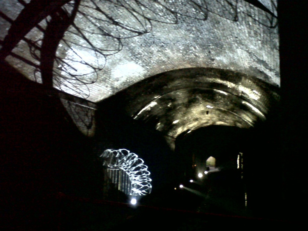
In this shot you can’t quite make out the river itself for the lighting, but I loved the way that an old security feature — this coil of ancient, cobwebbed barbed wire — had been picked out and turned into a kind of shadow opera on the ceiling…

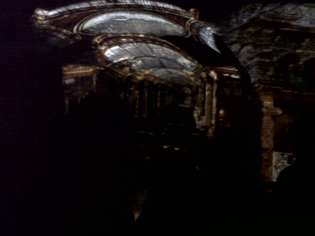
And then there was this bit — the centrepiece of the installation — where a whole row of arches had been lit up with projections. The glass ceiling of the Victoria Quarter — the covered shopping arcade at the other end of the Quays’ city centre installation zone — had been transplanted through light onto the stone ceiling of the Dark Arches. This was a really extraordinary thing to behold (again, the photo doesn’t do it any justice), and I really liked this idea of “site specific art” being made “specific” by trading the features of related sites!

Having said all that, though… and leaving aside the question of where exactly the million quid went (!?) … the whole experience seemed kind of inadequate as an expression of the river and the architecture. We were provided with spectacle, certainly, but that was about it — there was little to no sense of narrative involved here, and I learned nothing about this amazing location and its history other than what I could see visually. Still more problematic was the sense that this installation had just been flown in by outsiders. Had the people of Leeds had been consulted in any way over its development, or involved in its delivery? (except perhaps to wear hi-vis vests and mind the doors)  There was a vital sense in which the human dimension of the site was therefore lacking, even as the river ploughed on regardless….

All of which is by way of saying: I hope we can do something rather different in Shipley, on that bit of the Aire, come September. We’ve a miniscule fraction of the budget to work with, but the people and their stories are already giving us vastly more content….  (Hope we don’t blow it.)