This Tuesday I was treated to stories of “water inundation” at opposite ends of the housing spectrum. I’ll explain why I’ve used that term in a moment, but first let me introduce you to Andrew Mason, an old friend of the Multi-Story Water project (we had an actor playing him back in 2012) who kindly spared me some time to discuss flood damage…
 Andrew, who grew up in Shipley, is the property developer behind the Victoria Mills apartment complex on the south bank of the Aire, between Saltaire and Baildon Bridge. He built the place about a decade ago — converting existing mill buildings and also constructing from scratch three distinctive, curved apartment blocks: Northern Lights, to the left in the image above; and VM1 and VM2, in the background of the shot below, which stand on the bank of the river itself.
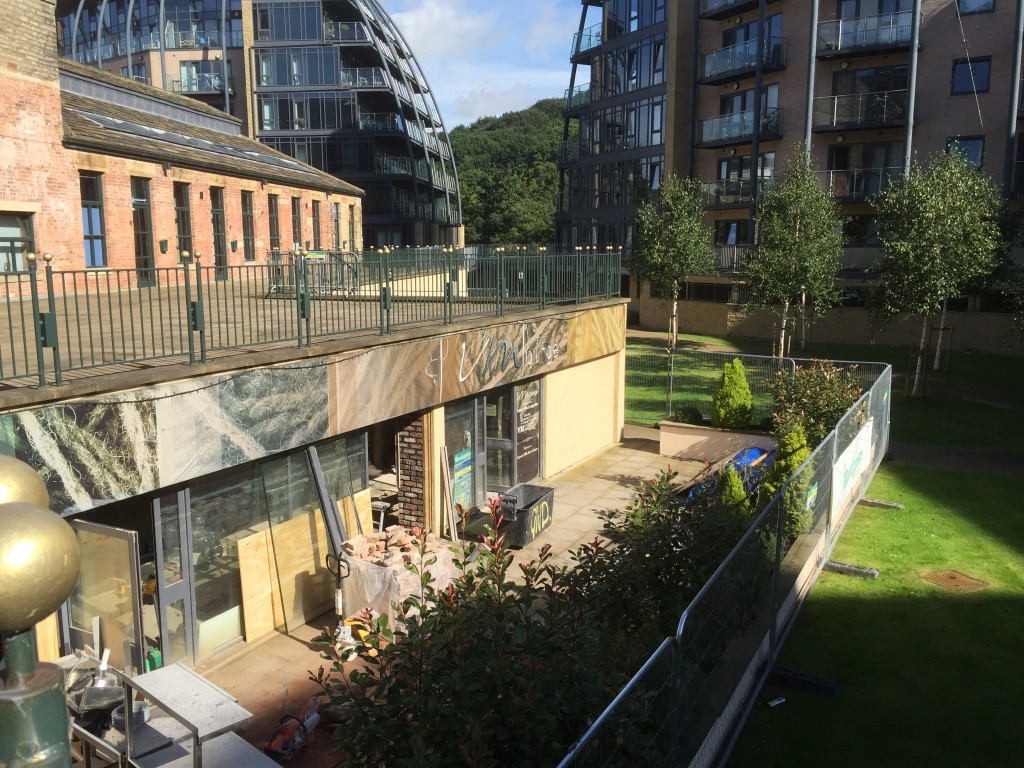 Victoria Mills was badly hit by the Boxing Day floods last year, and eight months on, the site is still in the process of rebuild and recovery. Actually, the first six months were occupied largely by endless debates with the insurance company, due to the extent and complexity of the damage, so the repair work only really began in the last couple of months. In these images you can see work continuing on the site’s bar, VM Lounge. As is apparent from the watermark on the windows in the shot below, the place was under 1.8 metres of water on Boxing Day.
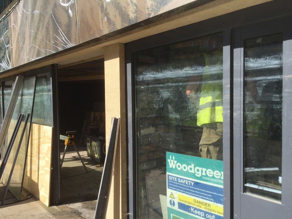 VM Lounge has been completely redesigned following the flood, and like other businesses and homes in the area, there’s been something of a learning curve… The refit will be consciously more “flood resilient” than the bar’s previous incarnation, in terms of its fixtures and fittings: the pillars below, for example, will be left as exposed (albeit coated) masonry in the new design, partly as “post-industrial chic” and partly because this will avoid the need ever to repeat the process of stripping away flood-soaked plaster from the brickwork.
 Despite this new eye to resilience, though, it’s important to note that VM Lounge and the grassy courtyard area it fronts onto were always designed and expected to flood in the development’s original plans. The rationale for putting the bar at this lower level was that, well, at least nobody lives there. If this gets wrecked, it’s less serious than someone’s home being impacted.
Indeed, the courtyard is specifically designed as a “compensatory flood storage” area — meaning that, in order to get planning permission for the development, Andrew and his colleagues had to provide a contained area on site for high water to flow into (in order that the defended buildings don’t just displace all the water downstream). In short, the courtyard is designed to become a temporary lake, while the actual living spaces are higher up, safely out of harm’s way. At least in theory…. Yet at 4pm on Boxing Day, while away at the coast in Whitby, Andrew received a call from a resident informing him that apartments were under water…
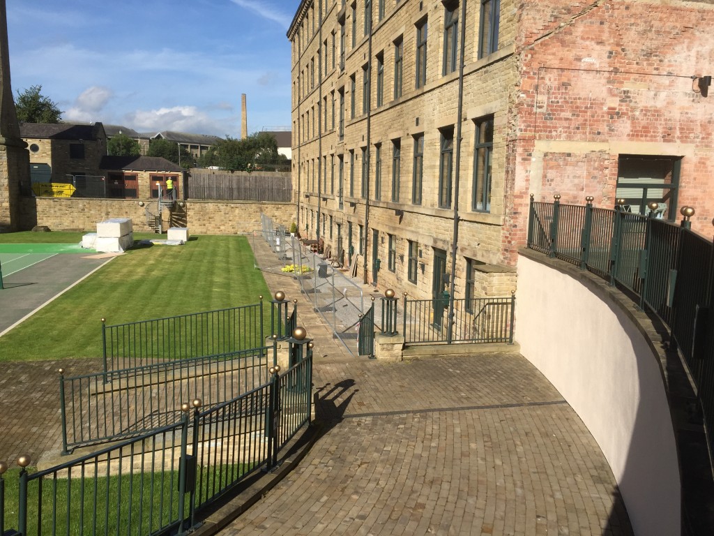 What went wrong? Well, this picture above tells something of the story. The wall to the right (which supports the walkway from which I took the first shot above of VM Lounge) is a flood wall. It’s designed to store displaced water away on the other side, where the bar is, while keeping this grassy tennis court area safe and dry. So it was thought safe to install apartments at ground level in the block you see here (Masons Mill) and in the one facing it (Old Mill). It was these apartments that were hit on Boxing Day.
Interestingly, though, the insurance company insists that these apartments (unlike the bar), were not “flooded”. Rather, they were affected by “a water inundation event”. The technical difference, Andrew tells me, is that flooding is what happens when the river flows into your property… whereas in this area the water came up through the ground. “Like something out of a science fiction movie”, Andrew remarks.
Basically, the land in this area was so completely waterlogged during the flood that pressure from the swollen river pushed water up through the ground itself. The irony is that Andrew’s tennis courtyard was particularly vulnerable, because — in line with the best current design thinking — it was created to provide “sustainable urban drainage”; i.e. to let water sink down into the ground rather than it simply draining off impermeable surfaces and being channeled away elsewhere (back into the river). So for instance, the tennis court itself is made of “tenniscrete”, a form of porous hard surface that allows water down through it. Yet the twist here, of course, is that what goes down can also come up. The ground’s porosity also allowed water to rise through it. It’s an issue that, Andrew notes, nobody thought to raise when the Victoria Mills complex was being designed — not the architects, not the engineers, not the Environment Agency. And now it’s too late to do remedial work to solve the problem. All that can be done is to make those ground floor flats, like the bar, more resilient to future “inundation”.
Now meet my other interviewees from Tuesday. Jenni M. and her son Dylan…
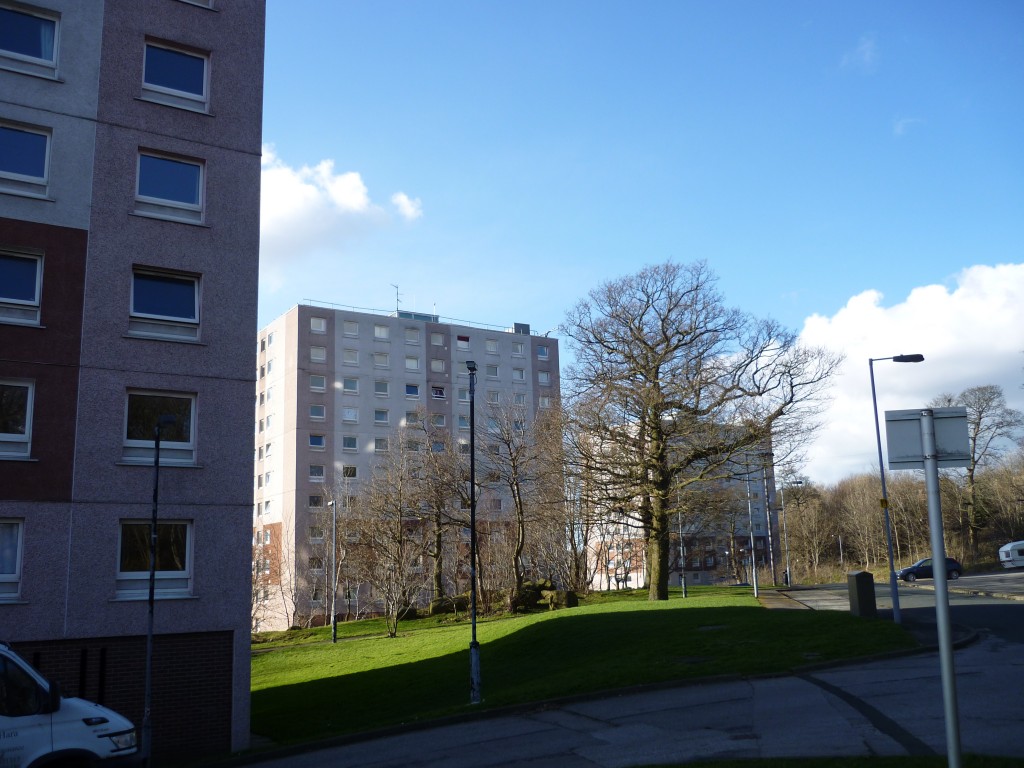
 They’re pictured here on the bench at Dowley Gap locks, on the canal, which is just a five minute walk from their home in the Crosley Wood housing estate (at the east end of Bingley – close to Baildon and Shipley). If Victoria Mills styles itself as luxury apartment living, Crosley Wood is the polar opposite — a council estate, now run by Bradford’s social housing quango In Communities, which nobody who lives there has a good word for. The three concrete tower blocks that make up the estate were built back in the 1960s, and should probably have been demolished long ago…
Although the setting for the estate is beautifully green and wooded, and right next to the canal, the buildings themselves are in a terrible state. Jenni and family had a “water inundation event” of their own only a few weeks ago, when the badly plumbed piping under the kitchen sink sprang a leak and deluged the floor, leaving them paddling around in several centimetres of water. Jenni knows of almost identical incidents that have occurred in neighbours’ flats — and she has also had water pouring through her bathroom ceiling from a leak in the flat above. (Her own leak, of course, flowed down to the flat below… so there’s a kind of cascade effect – like an indoor waterfall!) But the real problem in terms of “living with water” in these buildings is the persistent damp from condensation in the external walls and in the walls around ventilation shafts. Dylan has lived his entire life at Crosley Wood, and has an asthmatic condition that his parents are convinced is related to the black mould spots on his bedroom wall. Yet every attempt that the family have made to get In Communities to pay serious attention to the condition of the flat — or to relocate them to alternative accommodation — has fallen on deaf ears.
Despite these struggles, though, Jenni and her family remain the most positive and community-minded people you could wish to come across. For instance, she and Dylan were active in the flood clear-up attempts organised by Bingley Flood Support in the aftermath of the Boxing Day deluge. They could see that other people needed help, and — as Jenni says — that is what community is for. Her approach is perhaps summed up by a phrase that’s been quoted to me by several other volunteer flood responders this year: “Do as you would be done by.” (These words are, of course, from Charles Kingsley’s Victorian children’s novel, The Water Babies — which is itself set in West Yorkshire, in Airedale and Wharfedale.)
I got to know Jenni and Dylan a little during recent visits to Crosley Wood’s regular Wednesday afternoon community meal (in the prefab hut that passes as a centre for residents). My colleague Lyze, and Paul Barrett of Kirkgate Centre, have been engaging with that group for some time now. I’ve been wanting, somehow, to reflect creatively on the circumstances that residents find themselves living in, and it occurred to me that Jenni’s story might make a good one focus for a short documentary film. She’s so passionate and articulate about their circumstances – and Dylan so sly and funny – that the film will require no editorialising commentary from me. We spent two days this week shooting footage in and around Bingley, at Crosley Wood, and inside their flat — working from a rough outline plan that uses water as a connecting thread (from the Bingley Five Rise to the Crosley Wood ten-rise…). Maybe, just maybe, it will make somebody pay attention to their situation?
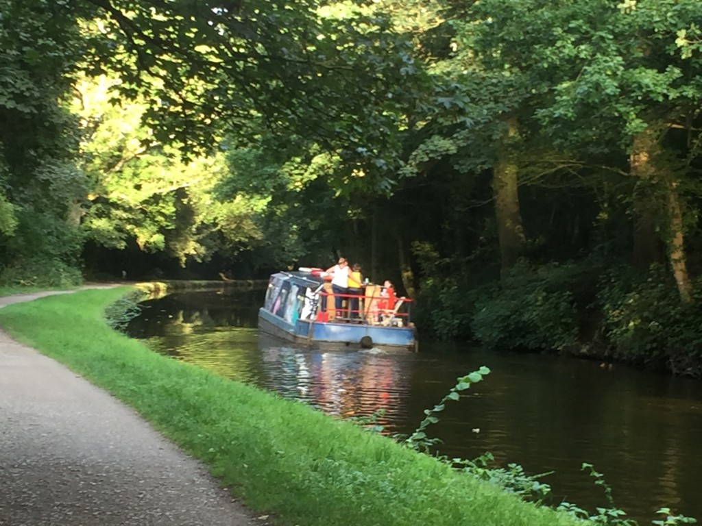
 The final scene of the film will be a playfully imagined escape from the flats, as Jenni and Dylan disappear off into the sunset towards Saltaire, along the Leeds-Liverpool Canal. My colleague Trevor Roberts had one of his Canal Connections boats, the Out and About, coming through Dowley Gap locks on Tuesday evening, so we hitched a little ride… (That’s skipper Katrina at the tiller – she let Dylan have a go too.)
Thanks so much to Jenni and Dylan for a memorable and enjoyable couple of days filming. I really hope they’ll be proud of the results when we’ve finished editing the footage. Thanks to Andrew Mason, too, and of course to Canal Connections. Out on a boat, on a gorgeous summer’s evening like Tuesday’s, it was possible – at least temporarily – to forget the problems with wet flats…

