Bubbling and Babbling with Bradford’s Becks

After a year largely spent doing other things, it was a pleasure to return to the Bradford area this weekend to reprise my ongoing, water-themed double-act with singer-songwriter Eddie Lawler at not one but two local festivals. In the end, I think it’s fair to say that our Sunday gig (September 9th) was more enjoyable than Saturday’s — but ironically enough that’s mainly because of water… On Saturday (8th) it was pouring down out of the sky with enough force and frequency to, er, dampen anyone’s fun…
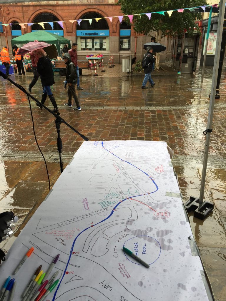
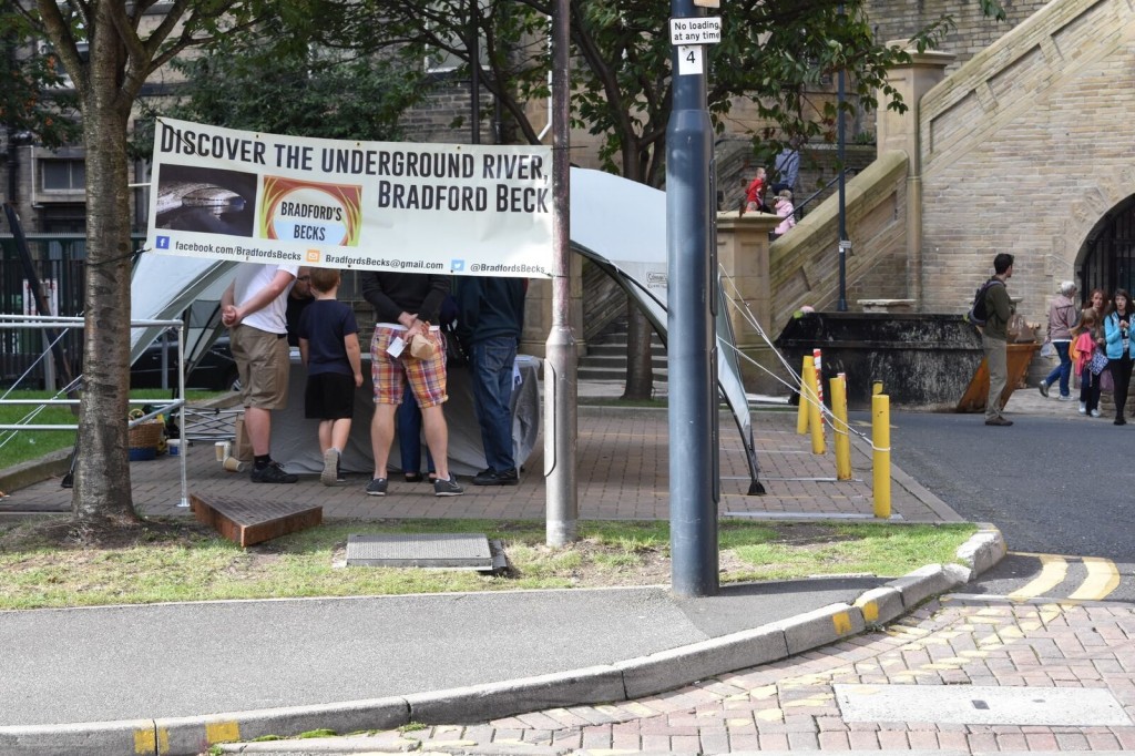
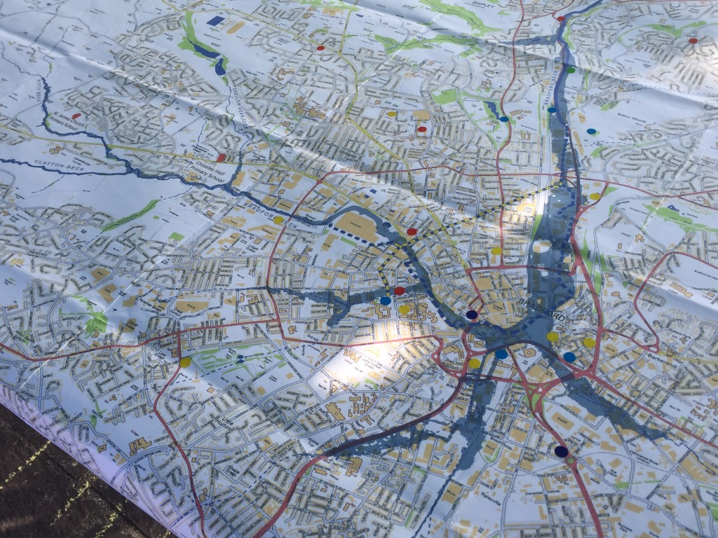
This was my vantage point on Tyrell Street for much of the afternoon. Eddie and I were supposed to be singing songs and telling tales of Bradford Beck, as part of the weekend’s Bubble Up festival — a water-themed arts extravaganza which had events dotted all around Bradford’s city centre. I was also attempting a bit of story-gathering as well as telling, by using a hand-drawn map of the city centre — showing the Beck’s hidden journey under its streets — and inviting passers-by to add their own annotations about memories of city centre locations. The memories added went as far back as 1968, but the map didn’t get nearly as populated with text as I had hoped, because (as the picture tells you) the footfall from shoppers was poor and getting poorer all afternoon — even as the rain poured and kept pouring…
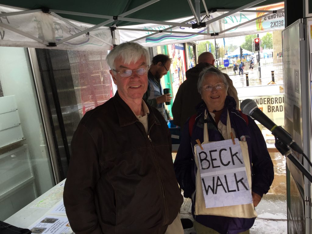
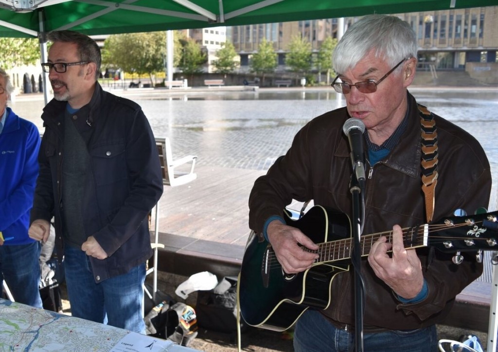
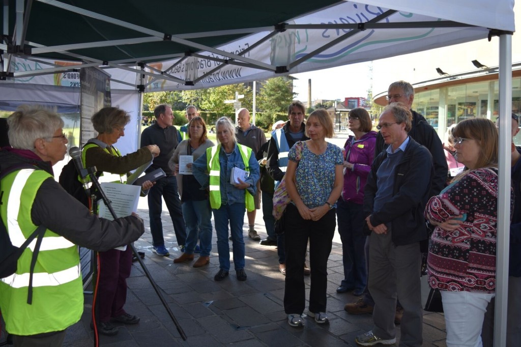
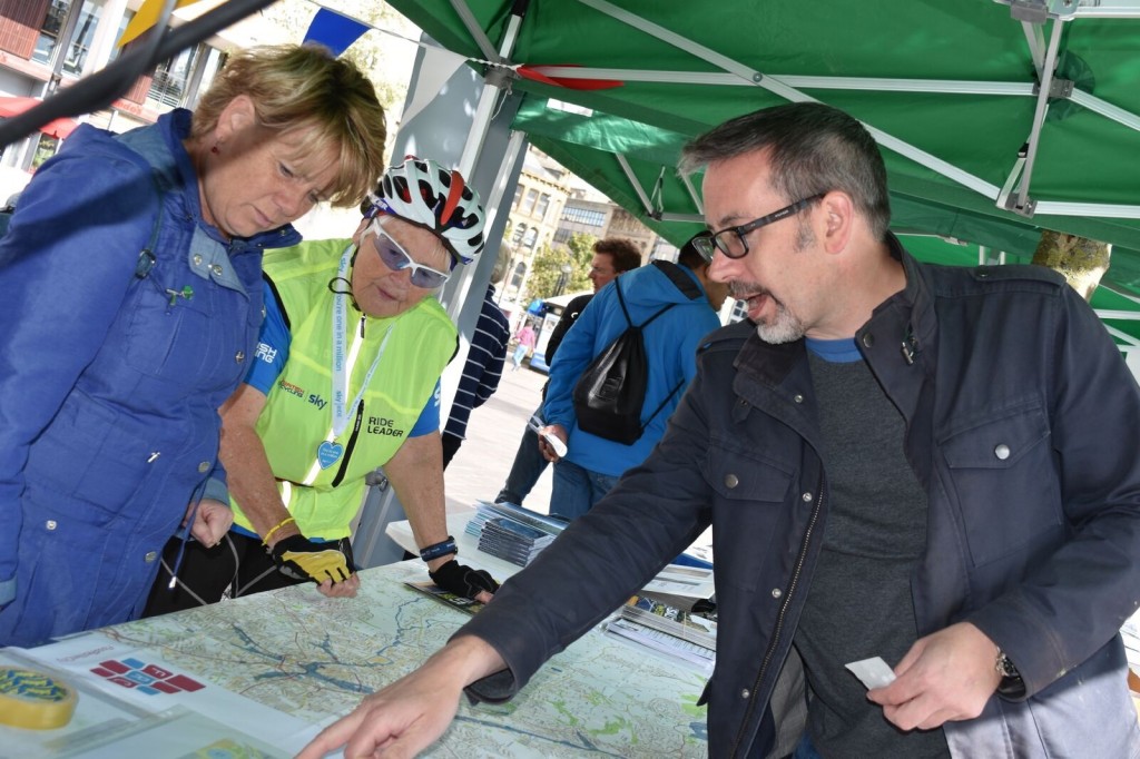
Here’s Eddie, smiling as ever, and undaunted by the weather, even though there wasn’t — in the end — much meaningful opportunity for him to use that microphone to sing. He’s huddled under the Friends of Bradford’s Becks’ portable gazebo, along with fellow Friend Elizabeth, who was timetabled to lead walks along the route of the Beck through the city centre — via the plaques that are now placed in the pavements at key intervals.
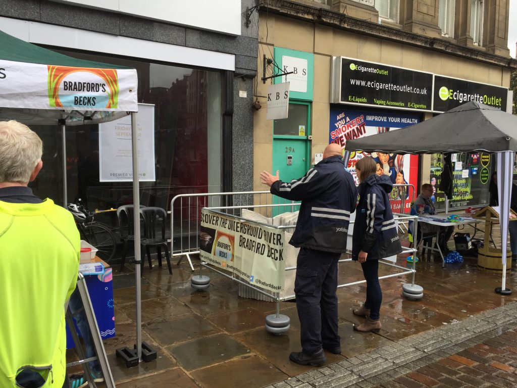
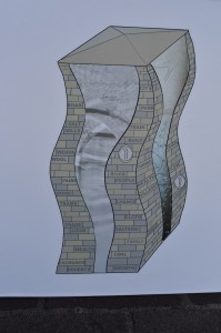
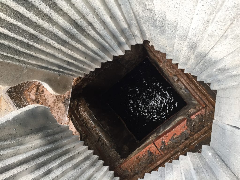
Just past the gazebo, FoBB had opened up a manhole cover and surrounded it with a safety fence — as well as a polystyrene mock-up of a slate sculpture by Alex Blakey that’s being planned as a permanent feature… By looking down the hole, you can see Bradford Beck streaming by beneath the street. Although only the most educated observer would be able to distinguish the beck from a storm drain, passers-by were nevertheless intrigued when told that this was the hidden river around which the city was first built….
Across the street in Bradford’s City Park area, there were more under-trafficked gazebos and marquees, including the one from which Bradford Community Broadcasting (BCB) was live-casting for the day. Eddie and I took time out from our stall location to speak with host Mary Dowson — who was as engaging and on-the-ball as ever — about how and why we both got involved in using the arts to talk about water.
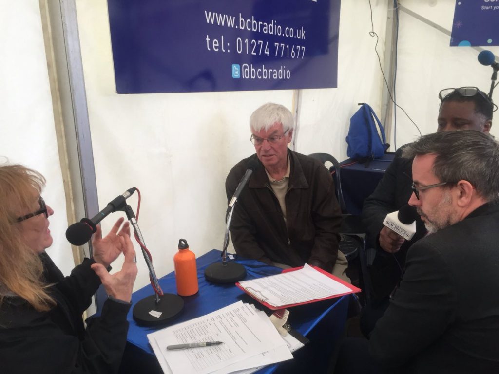
It was actually really interesting to talk with Mary immediately after she’d interviewed David Clapham (below, left). David is a scientist and water specialist who used to work with Bradford Council: he was really excellent at talking about the material and dynamic properties of water, in an engaging rather than a “dry” way (sorry). Eddie and I were then able to follow up from the cultural point of view, by talking not about “water” singular but about “waters” plural — as they were traditionally thought of, in the days before H2O was seen as a unified resource. (Of course waters still do vary in property and character from place to place, depending on mineral qualities etc.) Eddie’s songs often give particular watercourses personal identities, by singing in the first person: “My name is Bradford Beck… If you’re wondering what the heck I’m doing singing this song, it’s cos I have to roll along, incognito… Beneath the city streets, with no credibility…”
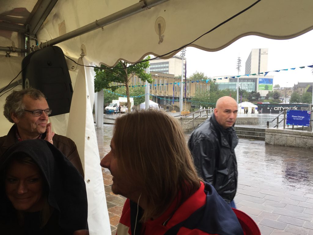
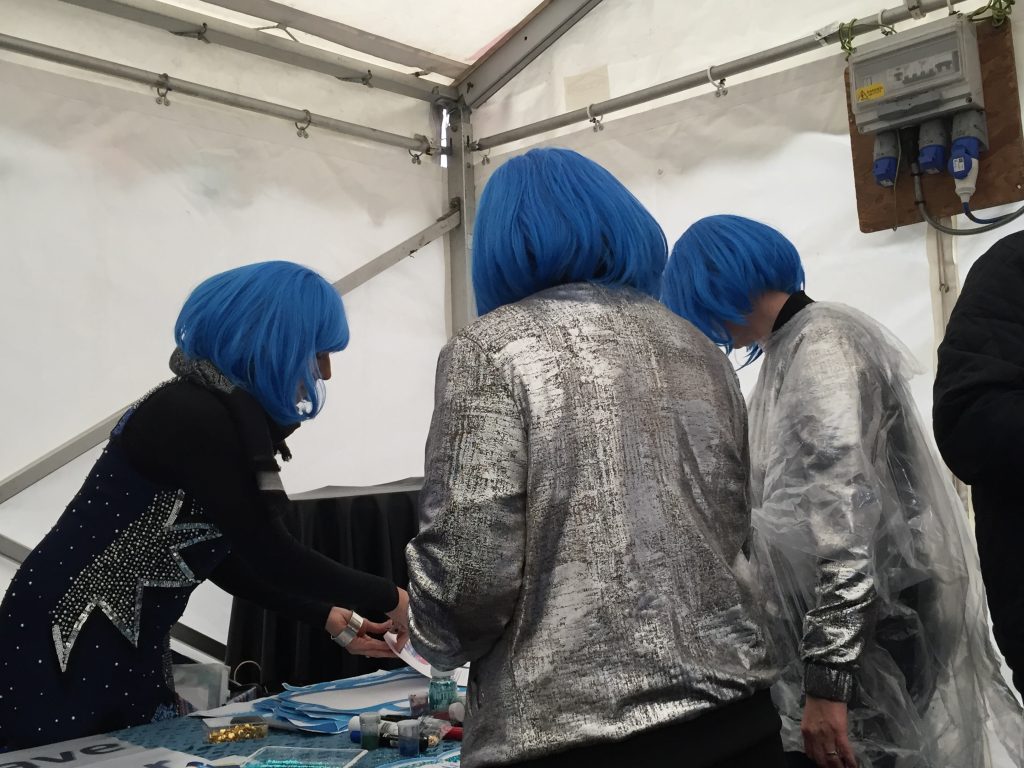
Alas, as you can see from this shot, our time in the BCB tent coincided with one of the heaviest of the afternoon’s downpours, which left City Park itself pretty much deserted. I do hope this wasn’t too disappointing for Bubble Up’s organisers, from the Brick Box community arts organisation. Some of the Brick Box team were there, in the BCB tent, in their distinctive water-themed wigs, trying to make the best of the situation… The weather was generally a lot better on Sunday (yesterday) than Saturday, so I do hope Bubble Up bubbled a bit better with some sunshine… By then, though, Eddie and I were off on our other festival weekend mission. presenting a musical walking tour for Saltaire Festival, titled The Ballad of Little Beck.
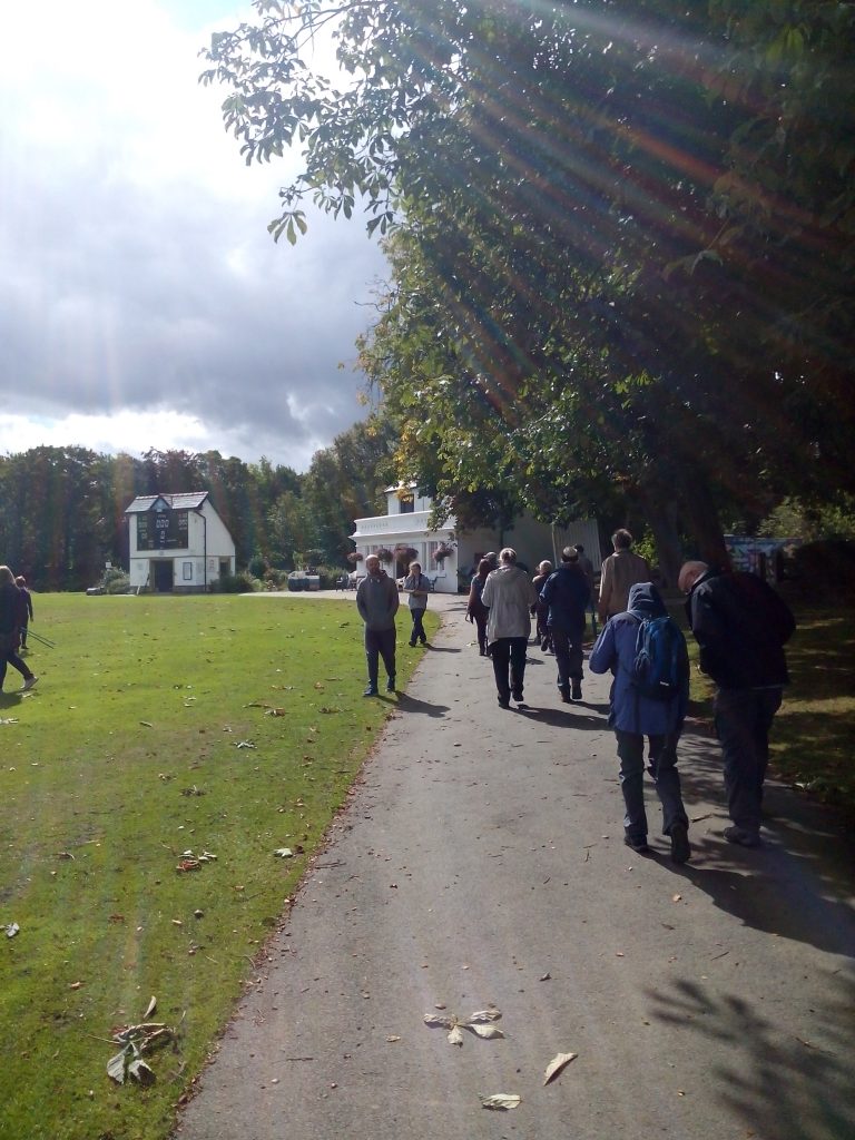
This was Roberts Park, in Saltaire, shortly before 12 noon, with the sun very much shining. Starting at the park’s bandstand, Eddie and I welcomed an audience of 15 or 20 intrepid walkers, who had come along to journey with us along long watercourses towards the ruins of Milner Field mansion — the “lost” country home of Titus Salt Jr.
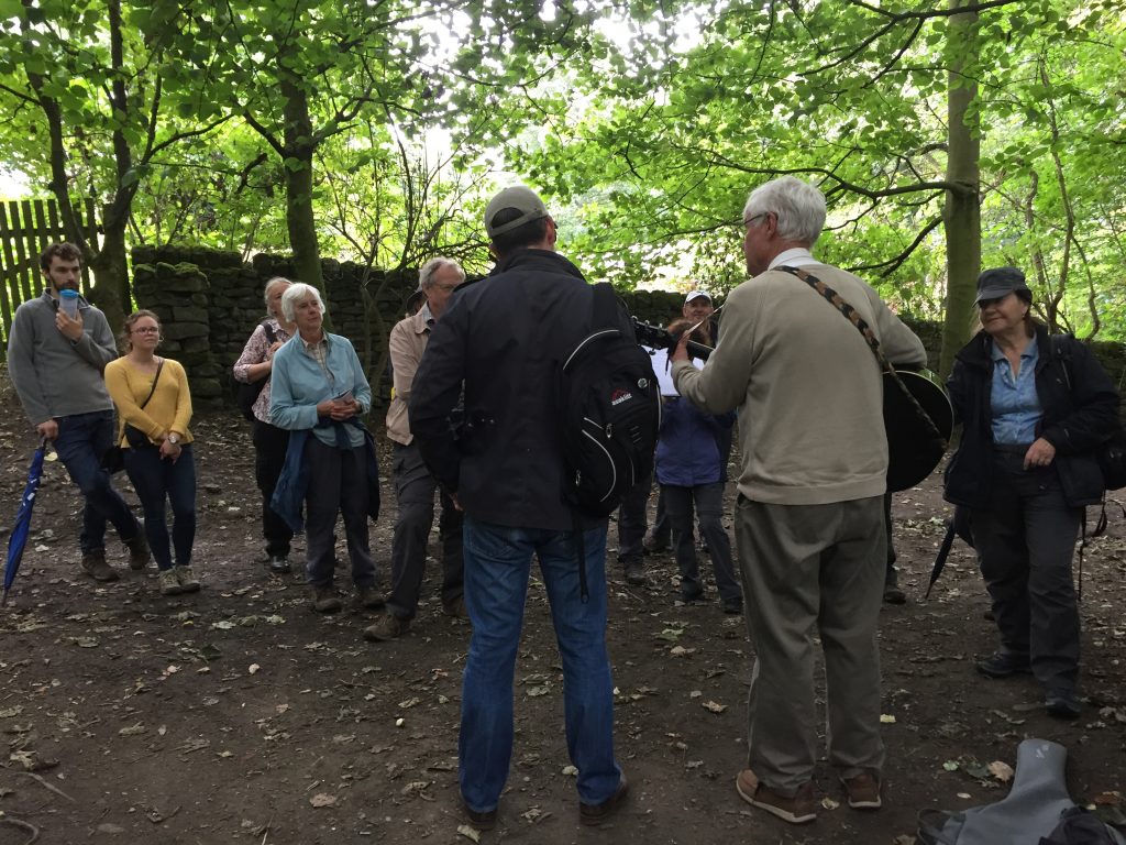
The walk was in some ways a “live remix” of parts of the Salt’s Waters audio tour (still available for download!) that Eddie and I made the other year. Our title, The Ballad of Little Beck, came from the song of the same name that Eddie wrote for the audio guide, and which tells the story of the Milner Field mansion from the point of view of the small brook that flows through the grounds and was once dammed by the Salts to make a boating lake (again: river songs in the first person!). But the balladeering theme was taken in a different direction for this new walk, as we performed a selection of poems along the way, by local poets of the Salts’ era. In the picture above, Eddie is singing — to a tune of his own devising — the poem “Come to Thy Granny” by dialect poet Ben Preston, who built the Glen pub in Eldwick. We didn’t go quite as far as Eldwick (that would have been a long walk), but instead performed this on the path towards Eldwick, just before we turned off in another direction.
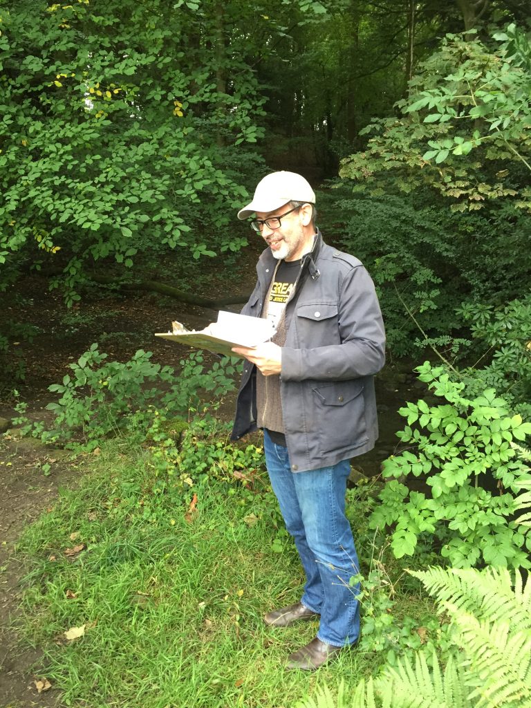
A little further along the route, here I am performing John Nicholson’s poem “Bingley’s Beauties”. (Thanks to Ruth Bartlett for these pics, by the way.) Nicholson was a mill worker and poet apparently loved by Titus Salt Sr., but he died in 1843, before Saltaire itself was built, when he drowned while crossing the River Aire en route to visit his aunt in, yes, Eldwick (we had traced his steps in this direction from Saltaire). As you can see from the picture below, at this point we were standing directly over Little Beck itself — halfway along Sparable Lane, heading towards Gilstead (in the parish of Bingley).

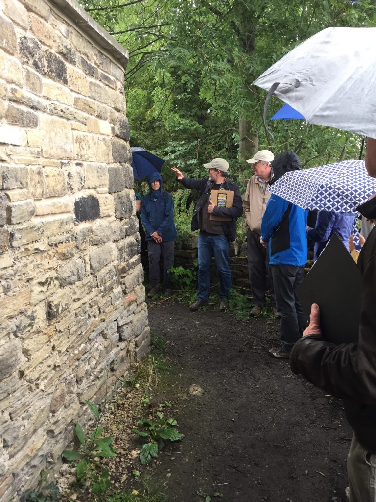
Heading further along Sparable Lane, we turned at corner of the walled gardens on the edge of the Milner Field mansion estate (below). By this stage, the weather had turned towards rain — as you can see from the umbrellas — but we were largely sheltered by trees and it was actually rather nice to get the cooling rain after the walk uphill. The rain then subsided soon enough (unlike the day before…).

Having reached Gilstead, we paused momentarily to consider the blue plaque commemorating Sir Fred Hoyle — famous son of Gilstead, world-leading scientist, and a poet of a different kind… (On radio in 1949, he coined the term “Big Bang” as a put-down to the recently-developed theory, only for it to stick as a descriptor!) Then finally we came to the Milner Field estate…
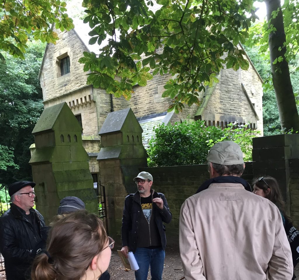
… here we paused at the entrance gate and gate lodge (‘North Lodge’), which is the best remaining indication of the architectural style of the now ruined mansion. And then it was into the woods to find the ruins themselves… Some of what we found there is recorded on some video clips collected here.
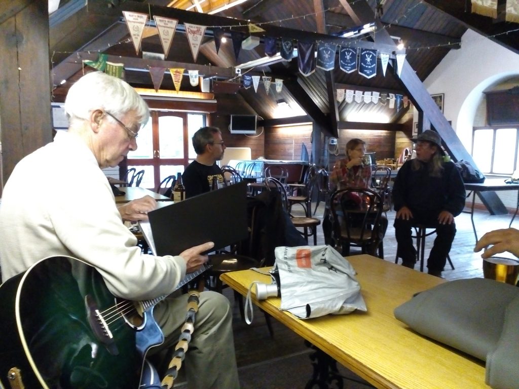
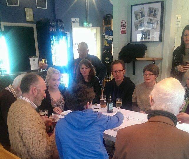
After making our way back downhill through the Milner Field estate, we finished up the walk with a visit to Bradford Amateur Rowing Club’s clubhouse — where we shared a drink and were treated to a number of additional songs from Eddie (who even took requests). The picture above (showing Eddie, me, Molly Kenyon, Rob Martin … others were at the bar at this point!) is courtesy of Denise Boothman, who sent it over to me by email with a note saying “Thanks once again for a fascinating and enjoyable afternoon.” We certainly enjoyed presenting it… Thankyou Saltaire Festival for inviting us to present.

Happy New Year: Beck to the Future?

It’s New Year’s Eve. We’re about to wish a fond farewell to 2017 (or not so fond, depending on your year…) and welcome in 2018. Since our Multi-Story Water project officially concluded this year, I don’t expect this blog to be very active in the coming twelve months… And yet you never know. Rivers keep on flowing, and time has a funny way of looping back on itself for all of us.

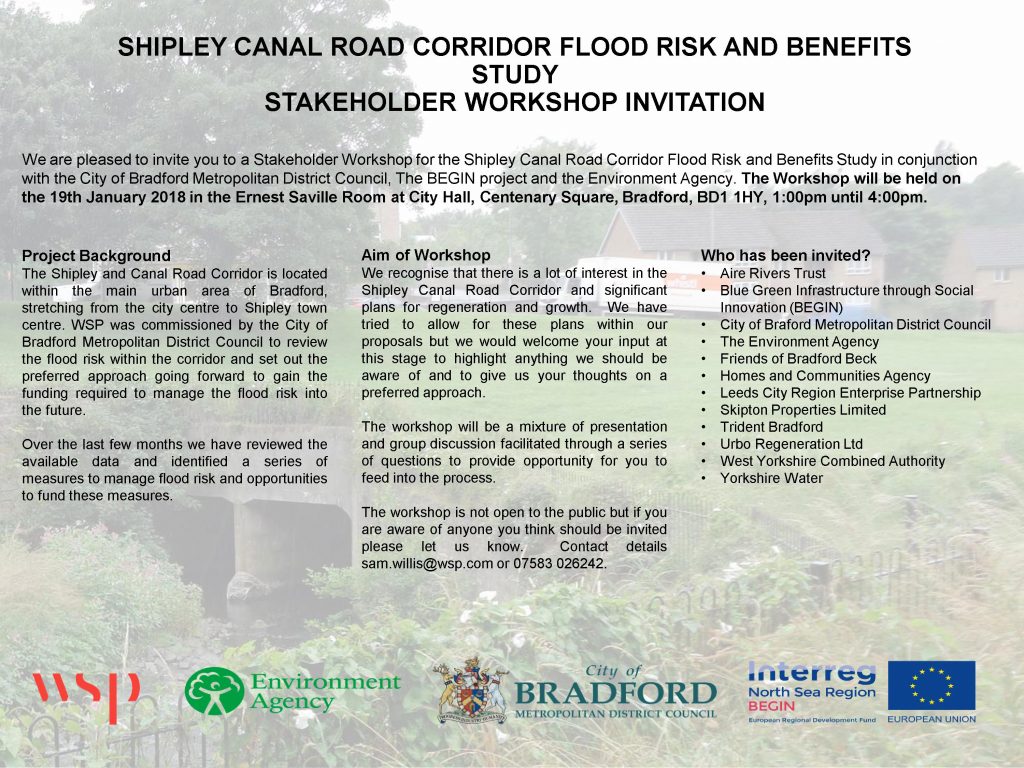
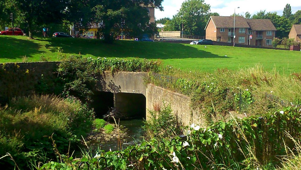
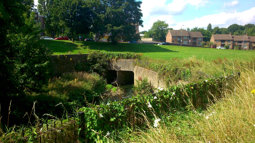
In January, for example, I will be attending this meeting at Bradford City Hall to discuss possible futures for Bradford Beck — or more specifically, for the “Shipley Canal Road Corridor”, the ribbon of green space and river that runs north from Bradford into Shipley alongside Valley Road. The photograph that shadows the background of the invitation above is taken from almost the exact same spot as the picture below: it shows the mouth of the “box culvert” into which the Beck flows for a short distance underneath the greensward near the bottom of Wharncliffe Road. The main concern of the January meeting will be to discuss the possibility of removing this culvert — and thus “daylighting” this short, underground stretch of the Beck.

If there’s a slight sense of time-looped deja vu for me here, it’s because I first heard this possibility mentioned back in 2012, at the very beginning of the MSW project, when I was first getting to know Shipley’s rivers. During that same year, Barney Lerner of the Aire Rivers Trust was undertaking a DEFRA-supported catchment assessment of Bradford Beck, looking at ways to improve the condition of the river. Barney came up with a number of recommendations, ranging from “soft options” like setting up a “Friends of” group (and of course he has chaired the Friends of Bradford’s Becks since its inception, as the group has undertaken everything from clean-ups to a walking guide to a poetry book) to more costly, technical options for daylighting the river. The end-game, for Barney and FoBB, would be for the Beck to be visible again all the way through Bradford city centre. That, of course, is still a very long way from being feasible, but the removal of the Shipley box culvert has often been mooted as a potential first step — a move that might “light the way” towards further renaturalisation. Below is one visualisation of what this stretch might look like in future…
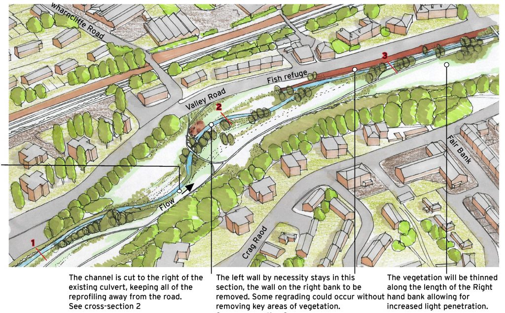
This image, and the drawings below, are reproduced with Barney’s permission from a feasibility study which FoBB commissioned from JBA Consulting, at Salts Mill, back in 2015. As you can see, there’s a pleasing, serpentine flow to the river in the picture above. The schematic drawing below shows how this more natural meander (which would including new tree planting around the Beck) would be created by removing the “straight-jacketing” of the box culvert…
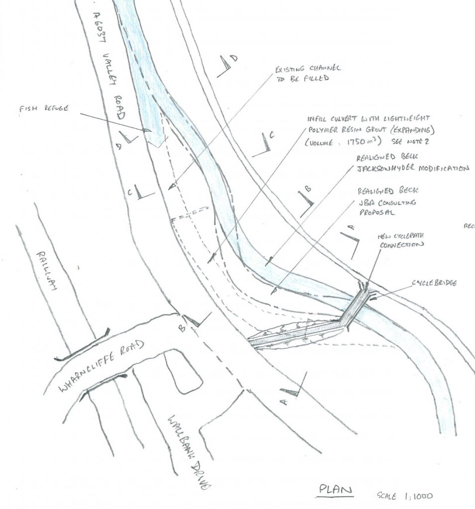
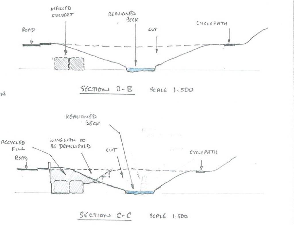
It’s clear, I think, that this open meander would represent a considerable improvement on the aesthetics of what’s currently there. Unfortunately, major public spending is not often considered purely for its aesthetic benefits… but potential flood alleviation is a way to attract funding, and it’s this agenda that underlies the January meeting. As is pretty clear from the cross-section diagrams below, the box culvert is a very limited, closed channel through which a high volume of water is trying to pass in a flood situation…

… at present, what that means is that excess water, which cannot get down the culvert, spills out all over the green space and onto the road. But if, instead of forcing the Beck through a closed pipe, you restore it to a more natural valley situation, with gradually sloping sides, then the Beck can just naturally rise up those valley sides in high water conditions. And thus, it will keep on flowing safely downstream, rather than spilling out all over the place.

The irony here, from a planning point of view, is that “offset” measures will be needed, in order to justify this restoration to the natural way of things. Since the removal of the culvert would mean less water spilling out of bounds, and more carrying on downstream, this becomes a concern for places downstream (like Shipley station) where that extra water might end up. So as well as planning to take out the culvert, the Council needs to offset the impact of that change by putting in other measures that will provide “flood storage capacity” along the Canal Road corridor, in high water conditions… Or something like that.

Now, obviously, I’m no technical expert. I’m talking here in layman’s terms, and I’ll certainly welcome the further clarification on these points that the meeting will no doubt bring. I do, however, have some professional competence as a historian, and in light of these plans for potentially daylighting the Beck in this spot, I wanted to draw attention to this document here…

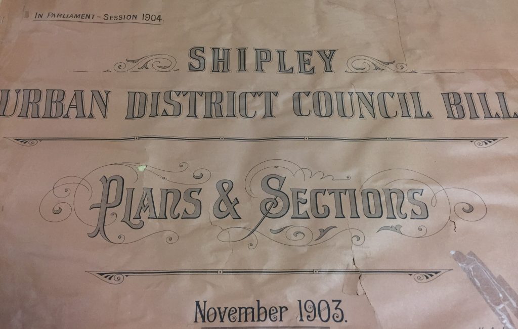
This is the front cover to a big, map-size document book that I found in the Local Studies section of Bradford Central Library. In 1903/04, Shipley Urban District Council was a pretty new entity, having evolved from the old Shipley Local Board, and it had big plans for Shipley’s regeneration (this involved, for example, a lot of development in the Dockfield area, as discussed in a blog from this time a year ago, and featured in our micro-theatre performance This Island’s Mine). Interestingly, one of the schemes that the SUDC planned at this time was a revamp of the Canal Road Corridor…
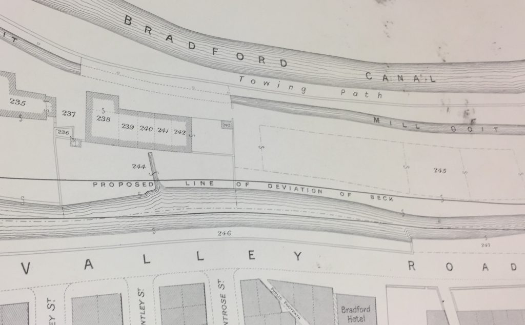
In the map diagram above, you can again see Valley Road, and the Beck running alongside it…. together with a plan for re-routing the Beck slightly further east (“Proposed line of deviation of Beck”), further from the road. At the top of the picture runs the then-still-extant Bradford Canal (eventually filled in after its closure in 1922). Now look at the next image, which shows the next segment of Beck/Canal/Road on the way south towards Bradford…
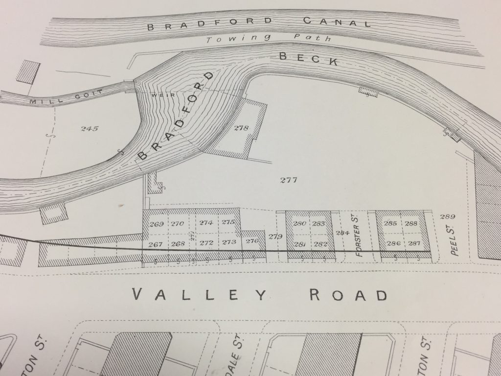
This is the same curve in the Beck that is now being proposed for renaturalisation. Notice how, back in 1903, it came so close to the Canal that they were almost touching… Notice, too, that in these pictures, there is no box culvert. It wasn’t there then — I’m told it was built during the 1920s or 30s (perhaps around the same time they filled the canal in?). But perhaps that comment signalling a “proposed deviation” of the Beck is the first sign of plans afoot. And check this out…

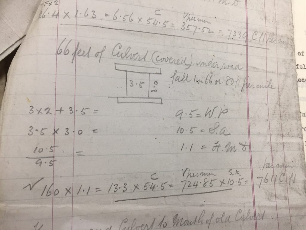
These pencil-sketched engineers’ calculations almost look as if they could have been written yesterday. Don’t ask me what all the numbers mean, but the plan is for “66 feet of Culvert (covered)” — so about 20 metres. I found these sheets of calculations among the Shipley Urban District Council papers held by West Yorkshire Archive Service (to whom, thanks for permission to reproduce this image). The notes are undated, but they’re in amongst other papers relating to SUDC’s early 20th C. redevelopments, and they also provide detailed specifications about other sections of open culverting that this closed culvert will connect to (just as is indeed the case along Valley Road). Is this perhaps a handwritten plan for the construction of the box culvert in question?

Note that the writing in this picture states that the proposed culvert will run “under road”. The box culvert beside Valley Road does not, of course, run under the road — it simply continues next to it. But could these two words provide us with a clue as to why that culvert was built in the first place? Why would you cover over this section of the river, unless you were planning to put something on top of it? This has always been a bit of a mystery to me (what’s it for?), but it seems plausible that there was originally an intention to build a cross-street across the valley, linking what’s now Wharncliffe Road over to Crag Road. Whatever the intention, it never came to fruition … perhaps the Great Depression intervened in the 1930s, just as — more recently — the 2008 financial crash put paid to more recent dreams of rebuilding the Canal itself

Now, I could be barking up the wrong tree entirely here, of course, but who doesn’t enjoy a good mystery? And what appeals to me most here is the sense of time circling back on itself, into the new year…

… Once upon a time the river meandered, and we decided to “deviate” it from its course and hem it in. A century later, we want to un-do what we did before and renaturalise it.

Shall we their fond pageant see? Lord, what fools these mortals be.”

(Puck, A Midsummer Night’s Dream III.ii)


Postcards from South Africa: Leandra

As I write this, I’m sitting in a hotel room in Pretoria — once the capital of apartheid. The Multi-Story Water project has taken me to many, varied places over the last few years — mostly without needing to leave Shipley — but this week it’s brought me all the way to South Africa. I’ve been invited, as an observer, to join an expedition run by a related research project (“Patterns of Resilience”), which has also been looking at the relationship between water and community — only this time in a town threatened by drought, rather than flood. Strange as it might sound, I want to suggest in this blog that, in addition to the glaring differences between these research contexts, there are also some odd similarities…

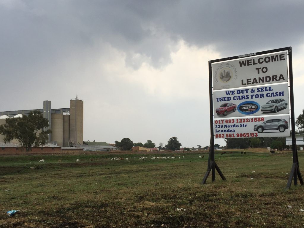
The location for this research has been Leandra, a township in the Govan Mbeki region (a couple of hours from Pretoria and Johannesburg). As you drive into town, passing this welcome sign, you come immediately to another hoarding warning residents and visitors to save water.
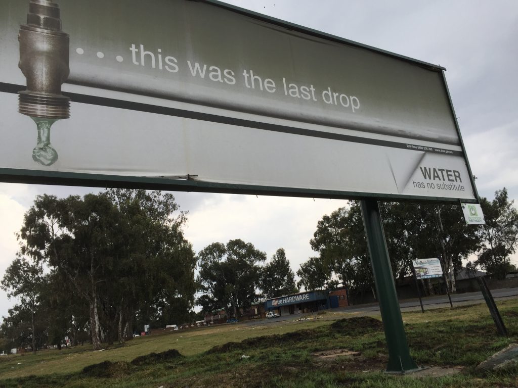
What if … this was the last drop?” is a question that, thankfully, I’ve never had to ask myself living in the UK. But it’s a very real issue in Leandra: we arrived on a cloudy day which briefly turned rainy (complete with thunder and lightning), but in 2015-16 they had a significant drought period that impacted severely on the community.
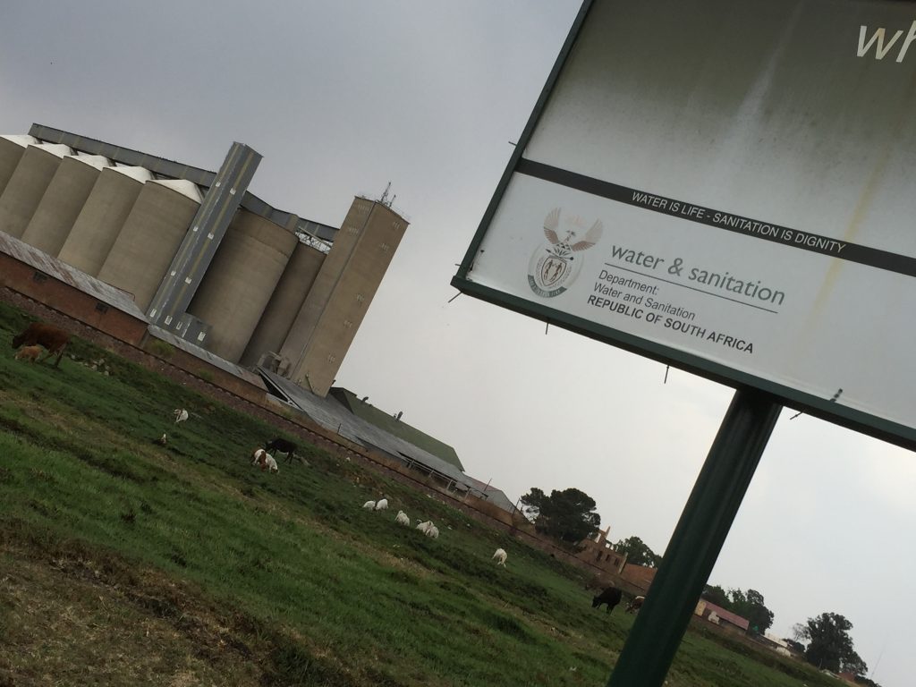
“Water is life – sanitation is dignity”, reads the small print on the poster. But life and dignity are impacted by more than just water shortage when water is short here. This is a predominantly rural area, whose residents traditionally survived through subsistence farming. Nowadays, what with industrialisation and globalisation, the farms have become big commercial enterprises – with giant maize silos like the ones you see here. In drought conditions, workers on the farms and at the silos simply get laid off because there is not enough work for them to do. And that leaves them unable to buy the food supplies that they would once have grown for themselves…
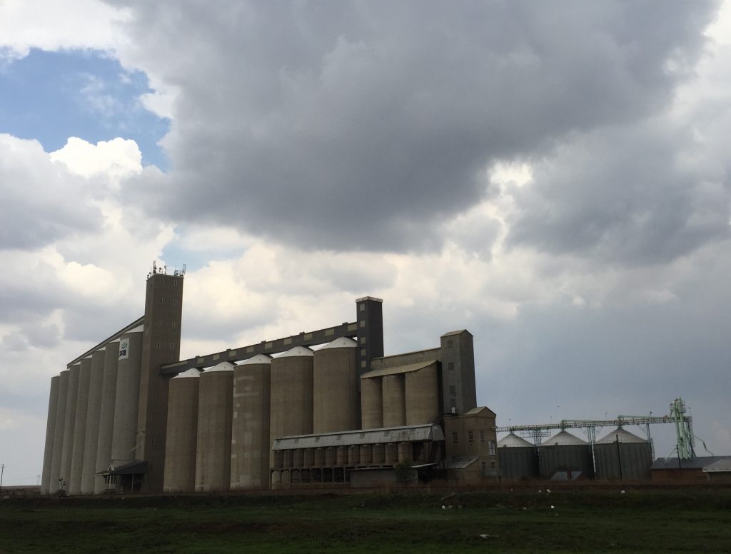
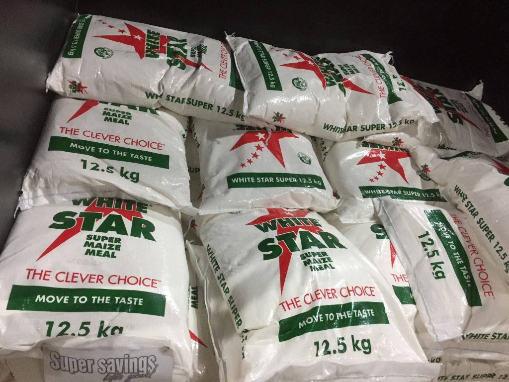
The research in Leandra has established that, although the recent drought was less severe in strictly physical terms (i.e. low rainfall) than some previous recorded droughts, the community experienced it as more acute than in the past. That is, they have in some ways become less resilient as a consequence of this greater dependence on a buying economy. In the past, families knew how to save emergency supplies of maize from their subsistence farming, for use in times of scarcity. The stored maize might have tasted sour, one man told me, but at least it was edible. But when you’ve become accustomed to simply buying in bulk from your local Spar, then when it’s gone, it’s gone…

Let’s get back to that question of water and dignity, though. Because on the face of it, there isn’t much dignity to be had in Leandra. The vast majority of residents live in homes like this… if they’re lucky…… or like this, if they’re not so lucky…
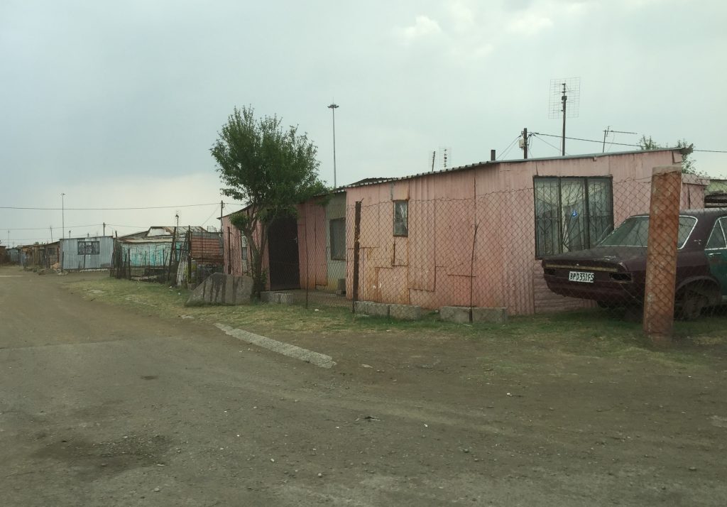
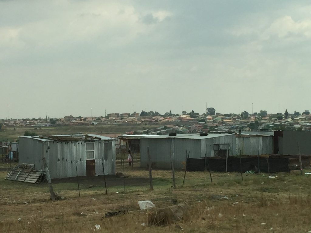
In South Africa, they call it “informal housing”. Shacks built of corrugated metal — or anything else lying to hand — get put up without consent or planning permission on land that has simply been appropriated by people too poor to aspire to anything else. Such homes, as you would expect, do not have proper plumbing or sewerage, of the sort we simply take for granted in the UK. Most people have to walk to get water, and the distances they walk get exponentially longer in times of drought. Little wonder, then, that people here are regularly lectured about saving water by the authorities — via billboard messaging of the sort pictured above, as well as by lessons in school, and so forth.
Those same authorities, however, seem unwilling or unable to do anything to address the enormous infrastructural difficulties facing communities like this. It’s not just that better facilities are greatly needed: according to residents, even the existing water supply infrastructure is riddled with problems. Old supply pipes get broken or burst, and water is simply lost… In fact, one of the key points to come out of the research here is the awareness that residents do not always know very clearly whether water shortages are the result of actual drought or of these failures in infrastructure…

An added issue here is that people are dependent on piped or stored supplies, in a way that — again — wasn’t necessarily the case in the past. An older resident I spoke to recalled a drought back in the late 1970s which was made worse by a plague of locusts attacking crops. Even then, though, the water deprivation was not as severe as in the recent drought, because people could still find water in ground-springs in certain places. Those springs, he said, simply don’t exist any more.

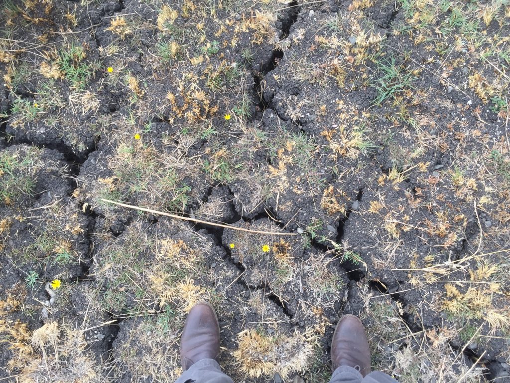
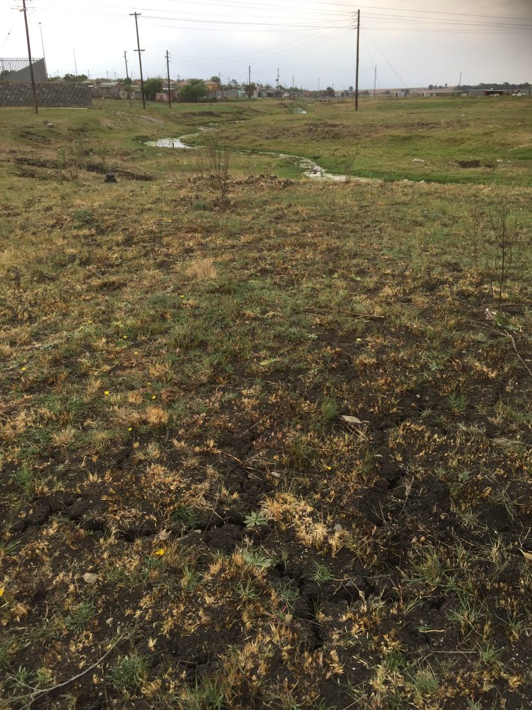
I’m no expert on groundwater, but I can’t help wondering whether this experience of springs drying up is another consequence of the area being subjected to more industrialised farming. (It’s well established that the water table will drop if land is mined more intensively for water supplies.) Whatever — it’s clear for anyone to see that the ground here is extremely dry, even in a relatively drought-free year like 2017. I put my size 11 feet in the photo above to highlight the scale of the cracks in the landscape. And this is land that should be relatively wet, since it lies close by to the one small stream we found on our reccy of the area…
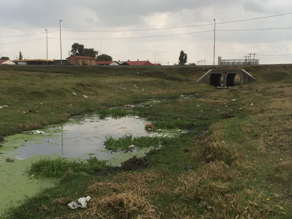
A closer look at the stream itself provides further evidence of why only the most desperate of drinkers would consider taking water from this “natural” source rather than from a piped supply.

Yes, that green is the actual colour of the water — I dread to think what’s been emptied into it (perhaps from the silos you can see upstream…?). What with the concrete culvert you can also see here, supporting the main road, I was put in mind of Bradford Beck, and all the stories that used to be told about how filthy and toxic it once was….

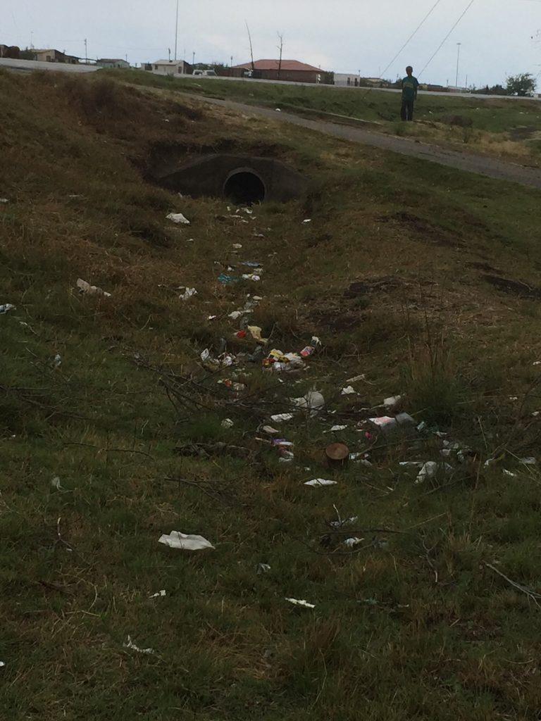
It’s not just the flowing water that’s polluted, either… Just look at this drainage channel, with the line of rubbish that’s been carried along it, and remains even when there’s no water…

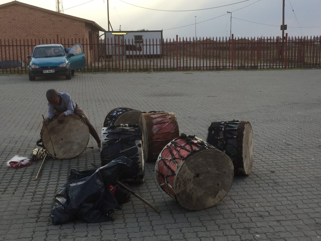
Almost everywhere you go in Leandra, there is litter like this. I guess when the environment is already poor — in every sense of the word — there’s not much incentive to keep it clean. Apparently such littering is a problem all over South Africa, but nobody really knows what to do about it — and in the great scheme of the problems here, it probably doesn’t rank that high on the priority list.

But here is the thing…

The people here do not mirror the landscape and the housing conditions. All the stereotypical expectations you might have about “what poverty looks like” are thrown out of the window when you meet the young people from this community, who have grown up in this environment. Most of them live in “informal housing”, with large families, crammed several to a room, and in normal times (never mind drought) they expect to eat only one meal a day. But they are all immaculately turned out, and indeed very fashion-conscious!

This is a “selfie” of me with Thato — one of the young people from Leandra who has been particularly involved with the “Patterns of Resilience” project. We’re comparing our Converse Chuck Taylor’s, but beyond that, she’s actually much more stylishly dressed than I would know how to be! (And check out the Chanel logo on the person next to her…) I’m told Thato is also a talented artist in her own right — an amazing drummer and percussionist — and while I didn’t get to see her perform, the project event we attended at the local community centre did conclude with an extraordinary demonstration of collective, local talent by the Umdzabu Cultural Group — some of them pictured here in their more traditional performing costumes…

In this picture, these performers look like what they are — kids! — but in performance they were nothing short of awe-inspiring. On the small stage of the community centre, they presented a sequence of drumming, dancing and choral singing — and every possible combination of the three — which ran for over 15 minutes without a pause. Every time a particular sequence finished (a pounding high-kick routine replaced by a quiet, reflective song, for example) they moved from one phase into the other with such tightness and precision that there wasn’t even time for applause. And the sound of the pounding drums and thumping feet was almost overwhelming in that small hall. I was, as you can probably tell, blown away by the whole thing!
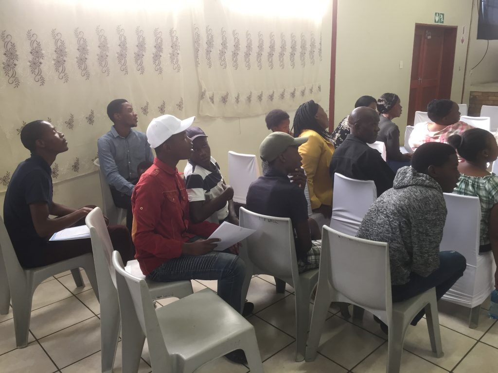
Now, you might think that I’ve got a bit off the topic of drought here, but far from it. In fact one of the key findings of the research here has been establishing the importance to the community of what they call “positive distractions” in times of hardship. Distractions including singing and dancing, the playing of collective games, and so forth. As one young person summed it up to me: “when children are playing happily, they forget to eat.” True enough — and in times of drought, that means that they forget (at least temporarily) that they can’t eat. I struggled at first to see the significance of simply being “distracted” from the elephant in the room, but when you think about it it’s obvious: the mental and emotional effects of hunger and thirst can impact on people just as can the physical, but if you can find collective ways to keep your spirits up and avoid sliding into depression or despair, you are — quite simply — going to survive longer.

The “Patterns of Resilience” project — run by the remarkable Angie Hart, from the University of Brighton, in collaboration with colleagues at the University of Pretoria and elsewhere — has focused specifically on engaging 43 young people from Leandra as “co-researchers” in learning about resilience to drought. They were even paid something to take part (an ethical way for the research team to put some of their funding into the community itself, while also valuing the young people as co-workers, not just volunteers). The research has included arts-based activities that have helped the young people to process and reflect on their own thoughts, feelings and coping strategies during the recent drought of 2015-16. It has also involved training them up as interviewers, to go and talk to elders within the community, such as grandparents, about their memories of drought over the longer term. Through this process, the young people have learned valuable things about themselves and their community, as well as providing the university researchers with important insights (some of which I’ve already mentioned in this blog).
I will admit to being sceptical, at first, about the real commitment of some of these young people to the project. And indeed, I did get a sense that some of the (perhaps less engaged) participants interpreted these activities as another version of the familiar encouragement, from the powers that be, that they need to “save water” – through rainwater harvesting, etc. (Let’s not pretend that universities do not have “power” in a situation like this.) But the more I talked to Thato and her peers — some of whom also came here to Pretoria this week for a two-day “think tank” event — the more clear it became to me that the real value of this project has simply been in asking the young people what they thought. 

Over and over again, I heard this from them: that nobody has ever been interested in their ideas before, let alone people from overseas (and “England” is a kind of fantasy land to these young people). The very fact of being consulted, they said, and of being asked to think actively about how drought impacts on themselves and their community — rather than simply having “messaging” about behaviour change foisted on them — has changed their own sense of perspective, and enhanced their own sense of value in themselves. That is not nothing. It might not give them any more food or water, but it might — again — help make them more resilient, or even – more activist
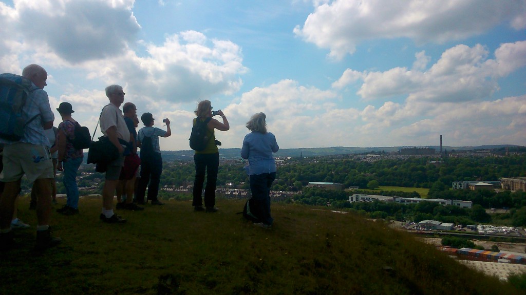
I said at the start of this blog that I saw similarities between Shipley and Leandra. Obviously, these are not nearly as pronounced as the huge differences. But I’ve seen here — in a more concentrated, life-and-death way — some of the same patterns we identified during our Multi-Story Water research. To put it bluntly:

  1. The authorities perceive a problem that needs addressing… whether of flood risk or, in this case, potential water shortages.
  2. The authorities try to provide “messages” to local communities about what actions they need to take to protect themselves (in the form of pamphlets, posters, or whatever).
  3. On the end of such one-way messaging, residents sometimes feel more “talked at” than engaged with. There’s even a sense, sometimes, that they feel condescended to… They’ve perhaps been stereotyped as “hard-to-reach communities” (a euphemism for being deprived or marginalised in some way), but nobody has really tried very hard to reach them.
  4. Meanwhile, there’s also a justifiable sense among residents that the authorities are not always doing all the things that they could be doing to address the problems – at an infrastructural level. In South Africa, where there is a widespread problem with political corruption, the lack of practical solutions is especially endemic.
  5. Creative research projects that try to create a more two-way dynamic with local residents, and seek to value their insights and expertise on what it means to live in a particular place, can help to provide fresh insights and change perceptions a little on all sides… What they can’t do, however, is fix the problem…

The problems in Leandra are, quite clearly, massive and intractable. I couldn’t live there, and wouldn’t even know how to begin to. But the people who do live there, for all the life-and-death difficulties they face, have developed very real forms of personal and collective resilience that need to be valued, honoured, and paid attention to.


Of photos, films and beer mats… (opening our closing)

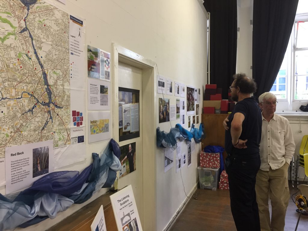
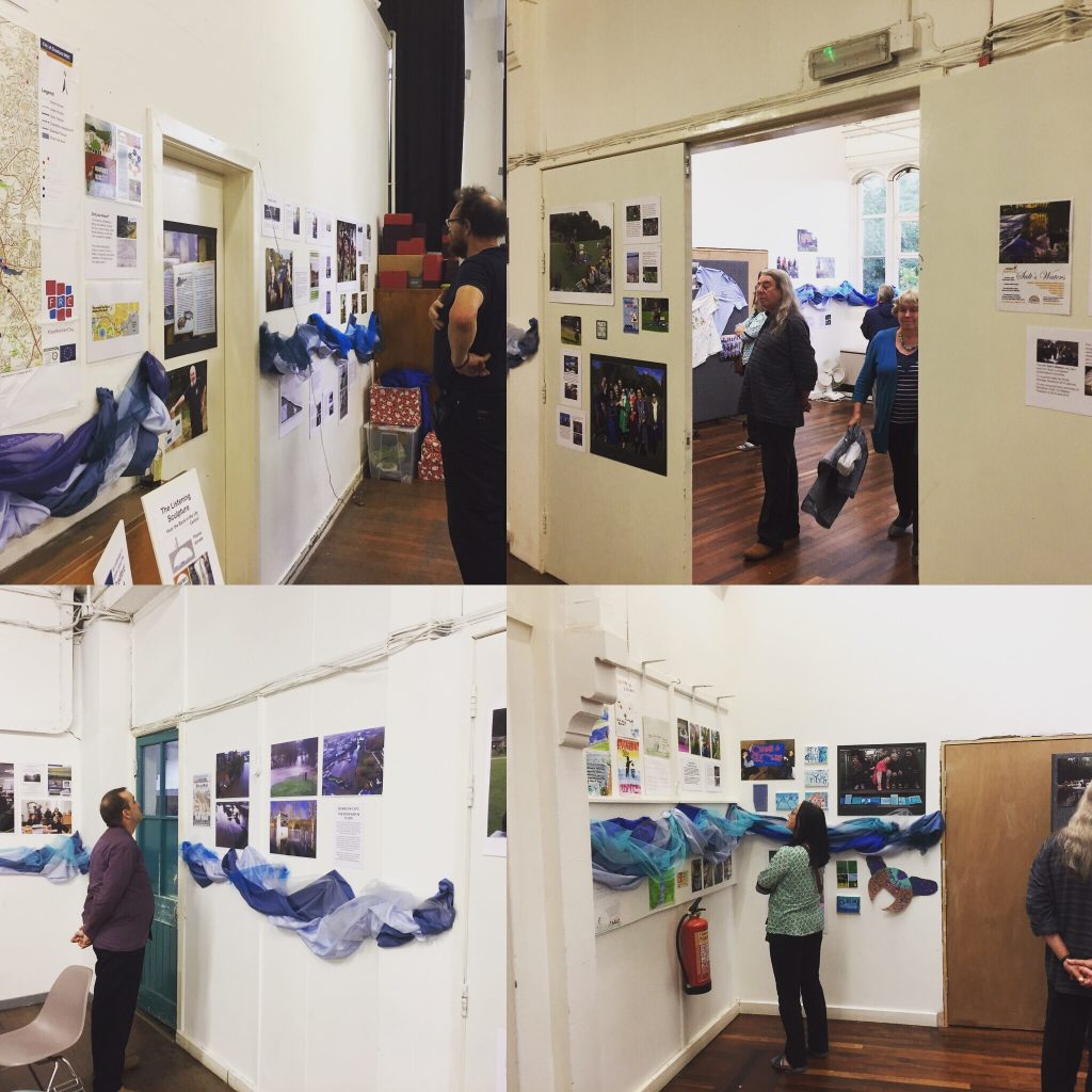
“If you build it, they will come…” In the composite image above, we see different corners of Shipley’s Kirkgate Centre last Saturday night, as visitors peruse the walls at the opening of our exhibition, “Celebrating Shipley’s Waterways” (a phrase borrowed from the tagline to this website). It was a real delight to see so many familiar faces that evening, helping us celebrate the official end-point of Multi-Story Water’s project work in Shipley. That’s five years of work, on and off (in two stages: 2012-13, and 2014-17).

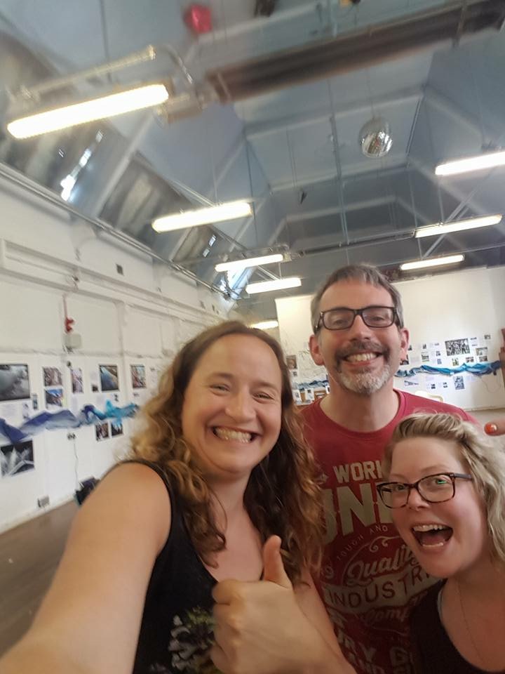
One way or another, many of those there on Saturday have been involved in the project in one way or another over that period, although it was also really nice to make some new acquaintances among people simply drawn by word of the evening’s events. This was especially rewarding given that — if I’m honest — I had worried that mounting a retrospective exhibition was slightly self-indulgent, and might be perceived as such! I was, however, talked into going along with it by these two wonderful women…

That’s Ruth Bartlett on the left, of Higher Coach Road Residents’ Group, who has also been working in a part-time capacity this year to support other aspects of the MSW project. And on the right, my “research associate” for the last three years, Lyze Dudley. (And me looking like a loon in the middle.) If we’re looking pleased with ourselves in this selfie, it’s because we had just finished “hanging” the exhibition with about an hour to spare before our visitors began arriving. The whole thing was done somewhat “on the fly”, with a tiny budget, but thanks to Lyze’s efforts in particular (with her winding river of fabric round the building, and her carefully mounted A2 photographic prints as key visual features) it actually looks pretty decent. Just professional enough to look like a proper exhibition, but just “home made” enough to reflect the community centre setting and the simple, people-centred aesthetic of the project as a whole. (One whole room of the exhibition, in fact, is about our work in and with local waterside communities.)

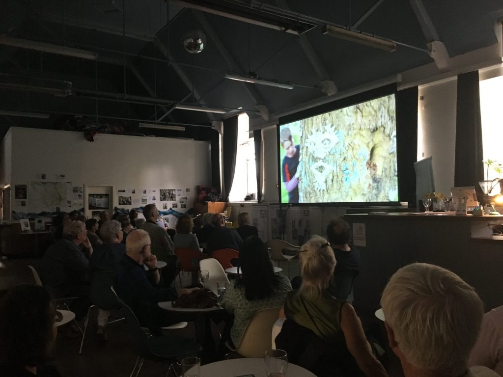
Visitors for the evening first had the opportunity to view the exhibition and mingle a bit, and then we screened three short films to represent different aspects of the project: first, Floody (made this year with the Young Artists of Higher Coach Road, for Saltaire Arts Trail weekend), then Wading to Shipley (from way back in 2013, documenting a walk down Bradford Beck), and finally High Rise Damp (from 2016, our film about social housing conditions in Bingley, which has a particular resonance now, in the wake of the Grenfell tower fire last month). I had not, personally, had the opportunity to see this last one screened properly on a large screen before (although it has been screened on several occasions by Kirkgate Centre’s Paul Barrett), and it was particularly gratifying to see that it had a real impact on the audience, prompting much discussion in the interval that followed.

Then it was on to the live performances. I presented my one-man storytelling show about the Boxing Day flood, Too Much of Waterwhich was also very well received. (A friend who had seen it before made the astute point that its account of flood victims’ struggles with faceless bureaucracy resonated in fresh ways by following on from the difficulties described in High Rise Damp.) And then finally, after another short interval, we rounded things off with Salt’s Watersmy double-act with the Bard of Saltaire himself, Eddie Lawler, which we presented at Half Moon Cafe for the Saltaire Festivals of 2014 and 2015. Since then, it’s had outings further afield in Scotland and Manchester, and has been honed with the addition of projected images, so it was really nice to bring it back home to Shipley for this one last time… (I don’t have images of the live performances, but here is Eddie on the right, earlier in the evening, dwarfed by his fellow Friend of Bradford’s Becks, David Brazendale…)

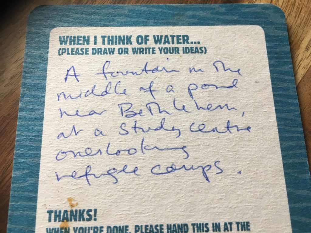
So yeah, it turned out to be a real pleasure to present all this material – as a small, retrospective sample of what we’ve made over the last few years. And the warmth of the responses and feedback from those gathered was really gratifying. Moreover, as ever with this project, it’s the responses and the participation that are just as important as anything we might make… and on this occasion that point was represented beautifully through the medium of beer mats…

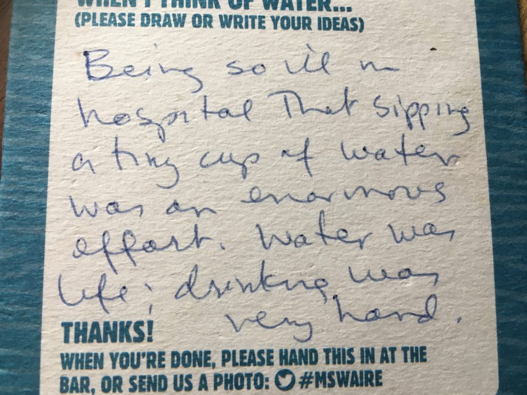
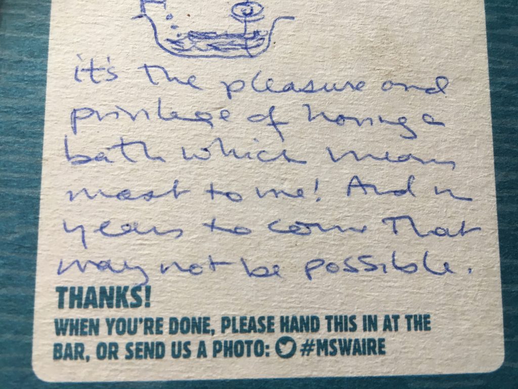
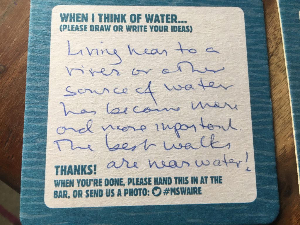
We’ve actually had these beer mats knocking around for a couple of years — with the MSW logo on the front, and this invitation to respond with words or pictures on the back. We’ve tried deploying them in a few different contexts but, frankly, without much useful take-up. Until this Saturday, I would have put this down as a failed experiment in data-gathering — somehow we’d never quite found the right context for them. But this evening, quite by accident, that context seems finally to have arisen, as this particularly engaged, responsive audience shared some intriguingly personal responses to the prompt “When I think of water…”

One striking factor in the responses is the way that water is associated by some respondents with occasions a long time ago, and far far away… As in the childhood memory, above, of a waterfall in Switzerland, or this recollection of the holy land…

Water is also associated in the responses with simple, everyday pleasures like drinking and bathing, although these are thrown into sharp perspective by the respondents:

The mat below refers not to past memories but to the fear of losing the (privileged!) life we have now, in an era of prospective water shortages thanks to climate change:

Finally, here’s a sentiment that I can personally identify with very strongly…

… In the years I’ve been working on this project, I’ve moved from Leeds to Manchester – where I’ve lived first in Sale, right next to the Bridgewater Canal, and now in Altrincham, where the house hugs the edge of a tiny stream with the delightful (twee?) name of Fairywell Brook. These choices on my part to live near water (and even, in the latter case, on a flood plain) have been deliberate, self-conscious choices arising from an intensifying sense of personal connectedness. Who knows, maybe this will turn out to be the most longest legacy of the whole project…

Thanks for coming, everyone. And for joining in the storytelling…

This Island’s Mine – performing Dockfield

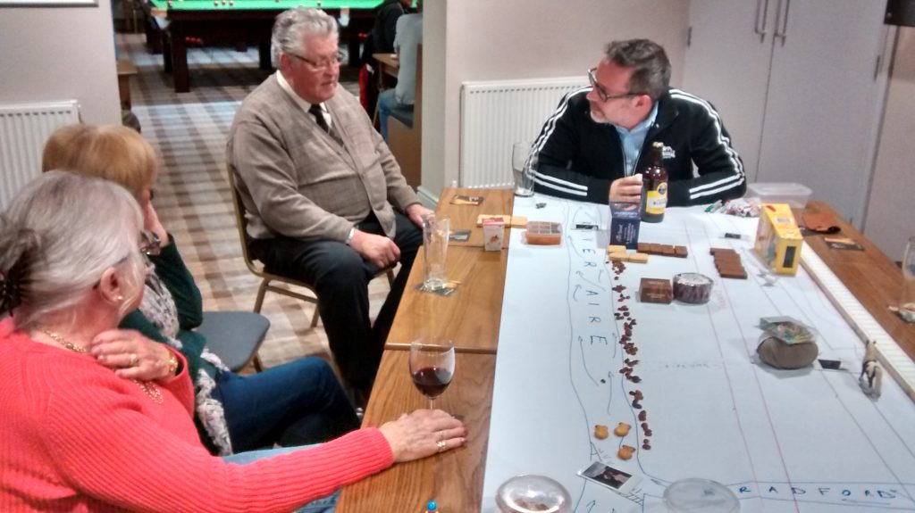
This was the scene just last night, in one of the flats at Amber Wharf. That’s the new-build properties next to the canal, in the Dockfield area of Shipley.

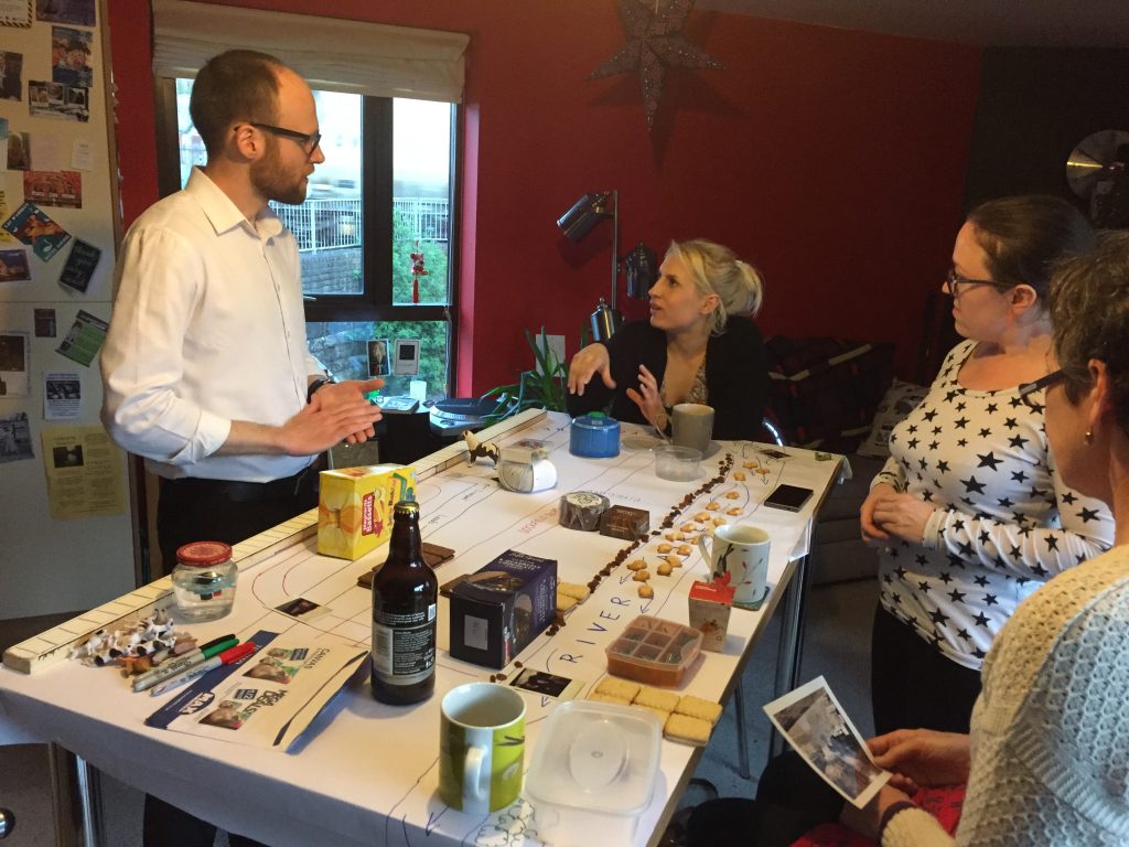
Sitting at the end of the table is Kat Martin, my co-performer in This Island’s Mine, the two-person play that we’ve devised and written about the history of Dockfield, and the close relationship that industry and residents have always had here with the River Aire, the Bradford Beck, and the Leeds-Liverpool Canal. This was the latest in a series of performances we’ve been giving in homes and pubs/clubs over the last week or so.

The other folk in the picture are last night’s audience (who prefer not to be identified by name, but were happy for me to share this pic), and strewn across their kitchen table is the “stage” of our drama — a map of Dockfield built up during the course of the play, using ordinary household objects from Kat’s shopping bags. Meanwhile, this was the view out of the window…

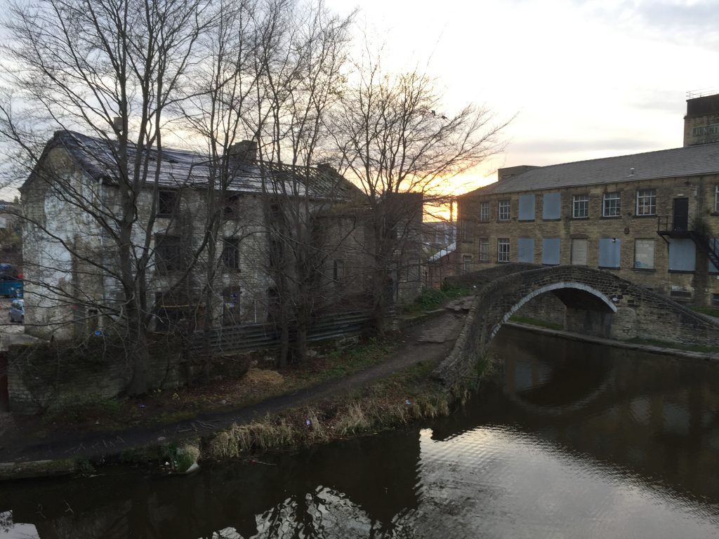
This particular flat overlooks what was once the junction of the Leeds-Liverpool and Bradford Canals. That’s Junction Bridge, built in 1774 at the same time as these sections of the canal network, to allow horses to get across from one tow-path to the other. This junction features prominently in our story, during the play, and it’s been one of the fun things, in performing it, to be able to point directly to where we are “on the map” as we speak. We’re talking about places and things that our audiences know well, but bringing a different perspective to them. So far, the reactions have been great!

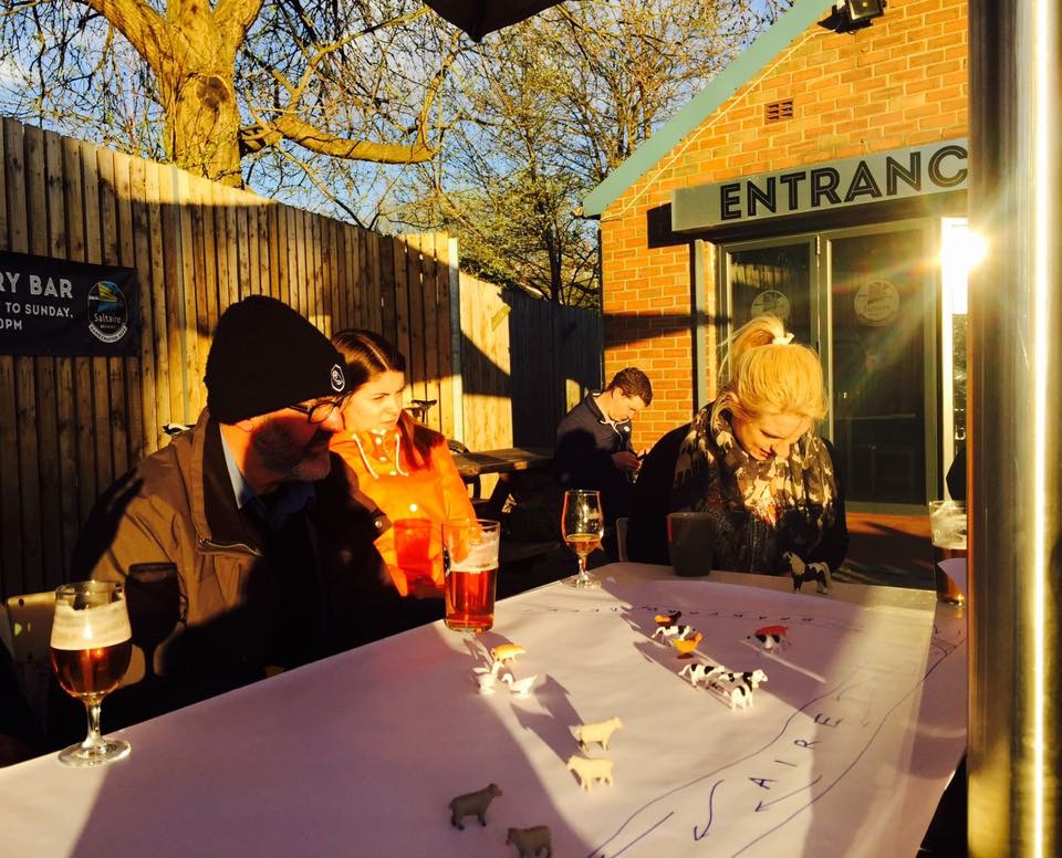
One of the key locations on our map is Saltaire Brewery, whose main buildings were built as an electricity works for Shipley Council at the beginning of the 20th Century (later nationalised under Yorkshire Electricity Board). We were privileged last week to present a public performance of the play in the beer yard outside the Brewery Tap — on a gorgeous April evening in the setting sun (which kept everyone just warm enough!).

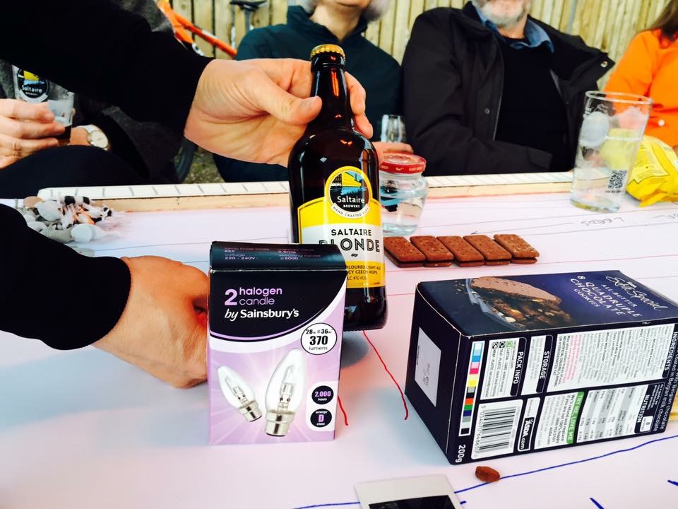
The picture above was snapped early in the performance (at a historical moment when the fields of Dockfield-to-be are farmers’ fields, yet to be built on… hence the animals) by Janet Wojtkow, one of our spectators… Janet is the partner of Tony Gartland, the Brewery’s founder and owner, so she took particular pride in snapping this picture…

… at the moment when we talk about how the former electricity works (represented by the light bulbs) is now the Brewery (represented by the bottle of Blonde). I actually had to pause mid-performance for a moment while Janet took the picture — much to everyone’s amusement. But that’s one of the nice things about the informal, round-the-table set-up for this play… there is a script we’re following, but people can also interrupt, ask questions, make observations, and we try to improvise satisfactory responses. It gives the show a lovely sense of liveness and one-off-ness every time we do it.

This conversational approach is also designed to elicit further contributions from the audience after we complete our story. The talking continues… At the Brewery, for instance, Janet shared the full story of why Saltaire Brewery is not in fact located in Saltaire but in Dockfield (it would have been in Salts Mill, it seems, but for the untimely death of its owner Jonathan Silver – and the subsequent hesitations of the interim manager). And this was just one of the additional tales we’ve been told… Take Geoff Roberts, for instance, pictured here in blue just behind my head on the right of the picture…

Geoff worked for decades in water quality control — for Yorkshire Water and its predecessors — and following our tales of Dockfield’s sewage works and plumbing, he told us how his very first work assignment, as a new employee in 1973, was to visit the pumping station next to the footbridge at the bottom of Dock Lane (again – very much part of our map!) in order to remedy a fault. It was quite the trip down memory lane. This performance at Shipley’s Kirkgate Centre was also attended by some with even longer memories, who told tales of Shipley and Bradford in childhoods before World War II.

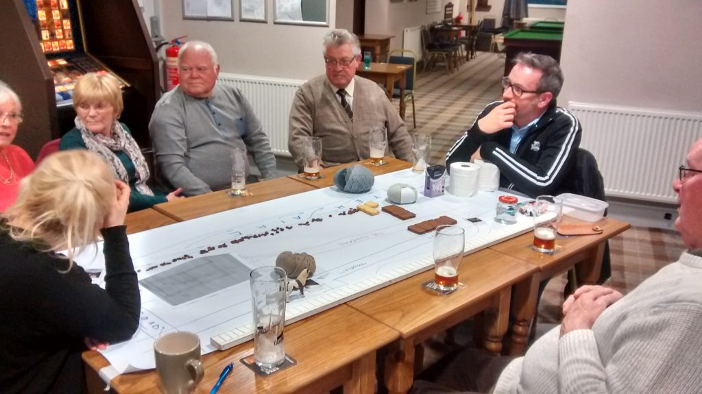
Our most responsive and vocal audience so far was at Baildon Woodbottom Working Men’s Club last week, where our audience was almost entirely made up of people who grew up in Dockfield itself, in the 1940s, 50s and 60s. Since the characters that Kat and I play — Barbara and Danny — are amalgams based on interviews with a number of folk of this sort of age (and also a bit younger… we’re deliberately vague about exactly how old the characters are), the performance sparked especially vivid memories from those watching. In the picture below, on the right, Tony Brannon is offering an observation, mid-performance…

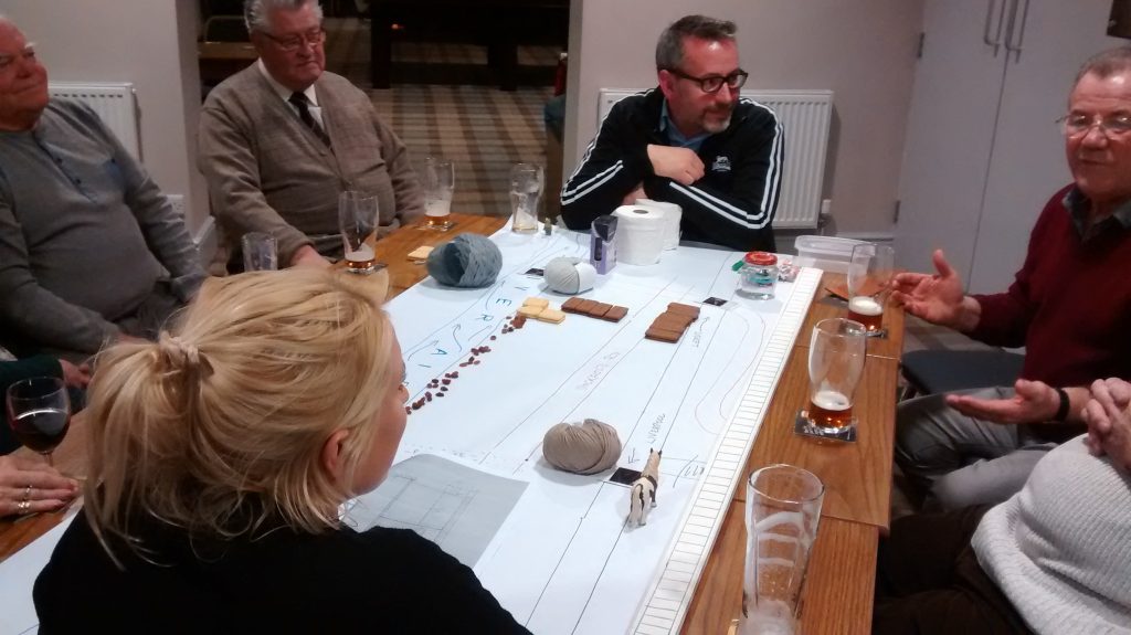
… and you can tell its mid performance because the objects on the table are different from those we end up with at the end (see below!). Truth to tell, Tony had been one of my interview sources, and he’s also a regular at the club, so for him the performance really was like an extension of our previous conversations. He and the others became as much a part of the show as we were — in fact our 30 minute running time stretched to more like an hour, with all the interjections, observations, and debates prompted by our script! Personally, I loved the way that the line between ‘play’ and ‘audience’ became almost indistinguishable…

… and for all that they corrected — or at least disputed — some of our “facts” (as Tony said, everyone remembers things differently anyway), this audience was also especially appreciative of what we’d made. Mary (in the foreground on the left in the picture above) was especially keen, after the play, to know why we’d chosen to focus on Dockfield. She seemed delighted by the thought that the place she grew up in — the landscape of her own childhood, if you like —  was being celebrated and remembered in  a play (however low-key and informal it might be as a play). I had the sense that her own sense of pride in the specialness of that place was somehow being confirmed by this outside intervention. And she had a few additional stories to tell of her own — like the way that the railings along Dockfield Terrace had been cut down during the war, to feed the urgent need for metal for the war effort…

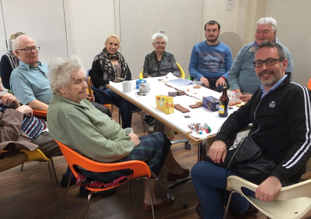
What I’m really proud about with this play, so far, is that it seems to “work” in different ways for different audiences. For these people at Woodbottom Club, it provided an opportunity to look back and remember together — they carried on talking for hours (literally) after the performance, but were still thanking us for this “special evening” when they left. Conversely, our hosts last night at Amber Wharf are relatively new arrivals in Dockfield, and so the play helped to ground them in the history of the place and answer some of the questions they had about it. In the end, I suppose, that’s the great thing about storytelling… a story has a shape of its own, but it can mean different things to every spectator, depending on the interests and experiences they bring to it.

++++

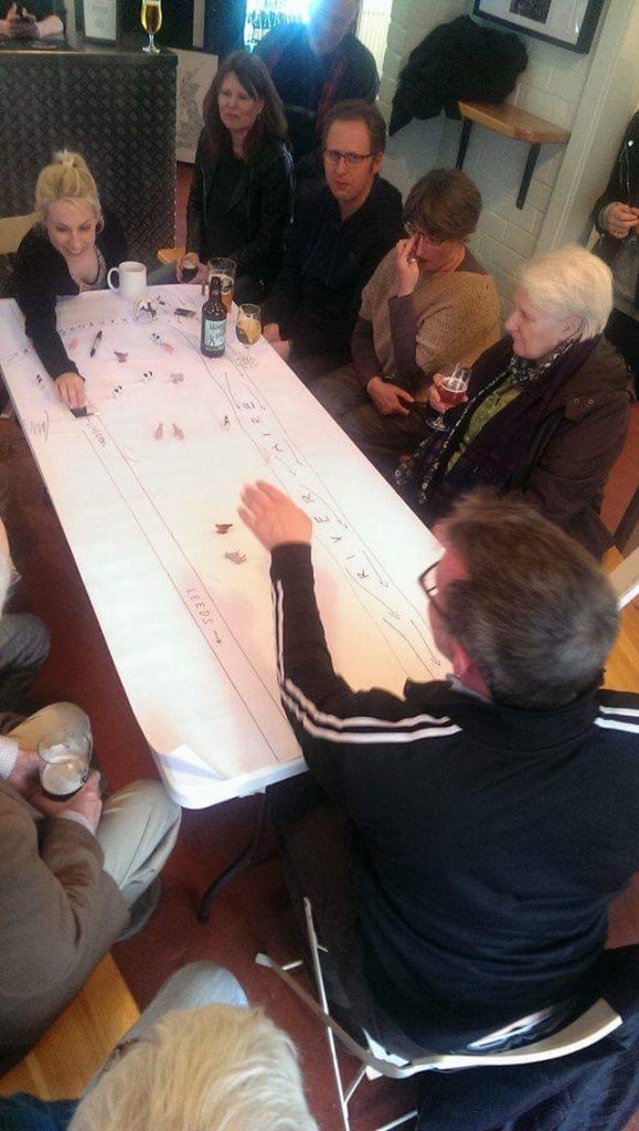
Postscript. This was tonight’s performance — Wednesday April 19th — at Saltaire Brewery Tap. This week we came inside (no setting sun to warm us this time), and were joined by the biggest and most diverse audience we’ve had yet… Diverse in terms of both age and background. Gathered in two rows around our table, they included long-term Dockfield residents, more recent arrivals, and visitors from right out of town!

Indeed, among those present were a family from the Midlands… theatre and cinema enthusiasts who had come up to see the “magic lantern” collection at the Bradford Media Museum (an old-fashioned form of colour slide projection), only to discover that the collection has been shunted off down to London. They seemed delighted by our show, though (as if reassured that the North had managed to keep some culture of its own!). Despite knowing nothing about the Shipley area, they said that the history of industrialisation — that we tell through the microcosm of Dockfield’s story — was one they very much recognised from their own Black Country background.

“You’ve invented a new paradigm”, one of them told me afterwards. I confessed to not knowing what he meant. “A new model for doing plays,” he explained. “You could take this format and tell the story of anywhere.” And I suppose you could…  Personally, I wouldn’t claim to any enormous originality in the format of this piece: the component parts come from a range of theatre forms. But it’s true I haven’t seen them combined in quite this way before, or for quite this purpose (telling the up-close story of a place, through the use of characters, rather than the story of characters, that’s set in a place). As I say, though, what’s most special to me about this piece is the way that it seems to invite such spontaneous, conversational responses — even as we’re performing it.

Acknowledgements: Special thanks are due to Kat Martin, my wonderful co-performer in this piece, and to Simon Brewis – our director, who also guided us skilfully through the play’s development phase, from my initial draft script. Simon also took the pics of the Woodbottom performance. Thanks also Janet Wojtkow (whose pics I pinched off our Facebook feed, where she’d uploaded them), Paul Barrett (for the Kirkgate Centre pic), and Ruth Bartlett (for tonight’s Brewery pics).

Beck memories on World Rivers’ Day

This Sunday, September 25th, was World Rivers’ Day. Not to be daunted by the fact that Bradford’s river is largely invisible — culverted underground through the city centre ever since the later nineteenth century — the Friends of Bradford’s Becks (FoBB) organised a special celebration in City Park to mark the occasion. It’s time that modest Bradford Beck (formerly mucky Bradford Beck) takes its place alongside the cherished rivers of the world! I was there to represent Multi-Story Water on one of the many stalls that FoBB had arranged around the edge of the Mirror Pool…

Steve and Eddie

Here I am at our “songs and stories” stall with my good friend Eddie Lawler, who performed, among other compositions, his song “Bradford Beck” — which calls for the river to be “resurrected from its rat-ridden cave”, and “to be a treasure, be a pleasure….” The song dates back almost 15 years now, to a time when very few people were even talking about the Beck, but it has now become kind of a signature tune for FoBB. (Most of the pictures in this post were taken by Geoff Roberts, of Aire Rivers Trust — thanks Geoff!)

rose starting walk

The central action of the day was at the FoBB stall itself, which served a number of purposes including being the starting point for a well-attended walking tour — presented by Rose Reeve and Pauline Ford — of the 15 plaques that FoBB has had installed in pavement sites over recent months, to mark the underground course of the Beck through the city centre. (See this previous blog post.) Along the way, walkers also encountered this little spot, just a block away from the City Park area…

bottoms and beck

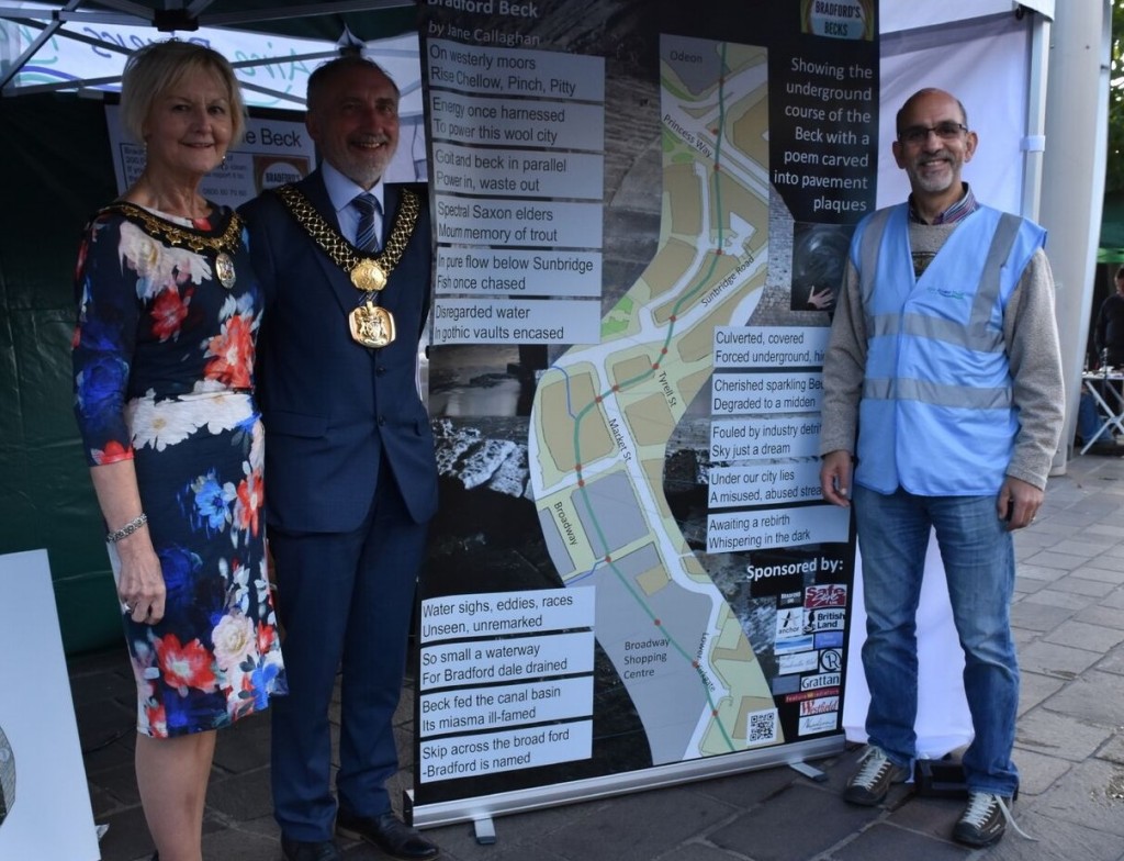
Yes, it’s an open manhole cover! The only way to check out the Beck in the city centre… Still, the city seems serious about treating its watery heart a bit more thoughtfully in future, and the presence of the Lord Mayor of Bradford at the Rivers Day event was one sign of this. Here he pictured is with the Lady Mayoress and, to the right, Barney Lerner — Chair of FoBB and the main co-ordinator of the day’s events. Barney, who lives safely uphill from the local rivers in Baildon, recently retired from Sheffield University and is really dedicating his retirement to pushing for further progress for the Beck. (Go Barney!)

Mayor and Barney

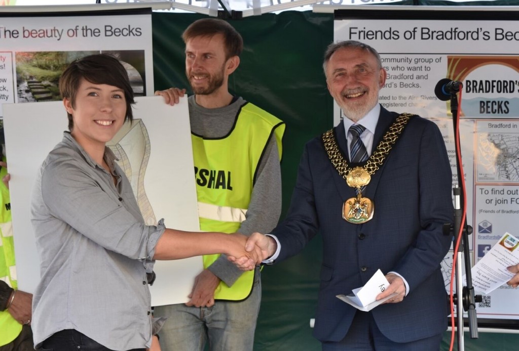
The Lord Mayor’s speech, at the FoBB tent, concluded with him awarding a prize to artist Alex Pavey

Lord Mayor shakey Blakey

winning sculpture design

Alex is the designer of the winning entry in a FoBB-run competition to design a “listening sculpture” for the Beck — the sketch for which is pictured here to the right (and is part-hidden by her body in the photo above!). The competition organisers came up with a shortlist of the best entries, which were then put to a public, online vote — which Alex won. The challenge now will be the realise the sculpture in reality — completion is scheduled for some time next year. There will be various engagement activities around the building/opening of the sculpture, which Multi-Story Water will hopefully involved with. Our involvement might even lead on directly from what I was up to with Eddie…

I’ve been doing quite a bit of story-telling lately (see, for example, my last blog post on the Too Much of Water performance for Saltaire Festival), and as a contrast — on this occasion — I was story gathering… with a view to possibly using some of what came up in future presentations. Using a map of the Bradford Beck system that was kindly provided to me a while ago by Bradford Council, I was inviting people to locate themselves on the map, sticking on different coloured dots to represent different things…

Steve pointing

So a red dot was “where I live” (or used to live), a yellow dot was “where I work” (or used to), a green dot signified environmental improvements, a blue dot was for places associated with happy memories, and finally a purple dot was for problem spots or issues. I snapped the shot below relatively early in proceedings and we’d accumulated a good deal more dots by the end of the afternoon!

IMG_1718The map served as a real drawer for passers-by, many of whom were fascinated to see the city like this — with the river system (and possible flood risk areas) highlighted as central and prominent, rather than merely forgotten underground. Visitors to the stall with longer memories told me about their recollections of the 1968 flood, for example, when the city centre was partially underwater and the subway passages underneath main roads were completely impassable. Another visitor, remembering even further back, recalled the flooding in 1947, when she was a child. Her recollection was that a stretch of the Beck to the west of the city centre was not, at that time, culverted underground as it is now (so the culverting does not all date back to the 19th Century!). A brother and sister, both now in early middle age, recalled growing up in the vicinity of Bradford University and how, as kids, they would enter the Westbrook culvert and explore it with candles lighting their way… Since that time, the beck has been fenced over in the University area — perhaps partly to discourage such explorations — but also contributing further to the general sense of the river as something dangerous, poisonous, hostile, rather than something to be embraced. These now-grown-up childhood explorers clearly recalled their adventures with real affection and nostalgia… In today’s world, perhaps, we’ve taken the obsession with health-and-safety a little too far, at the expense of natural curiosity?

fishing demo

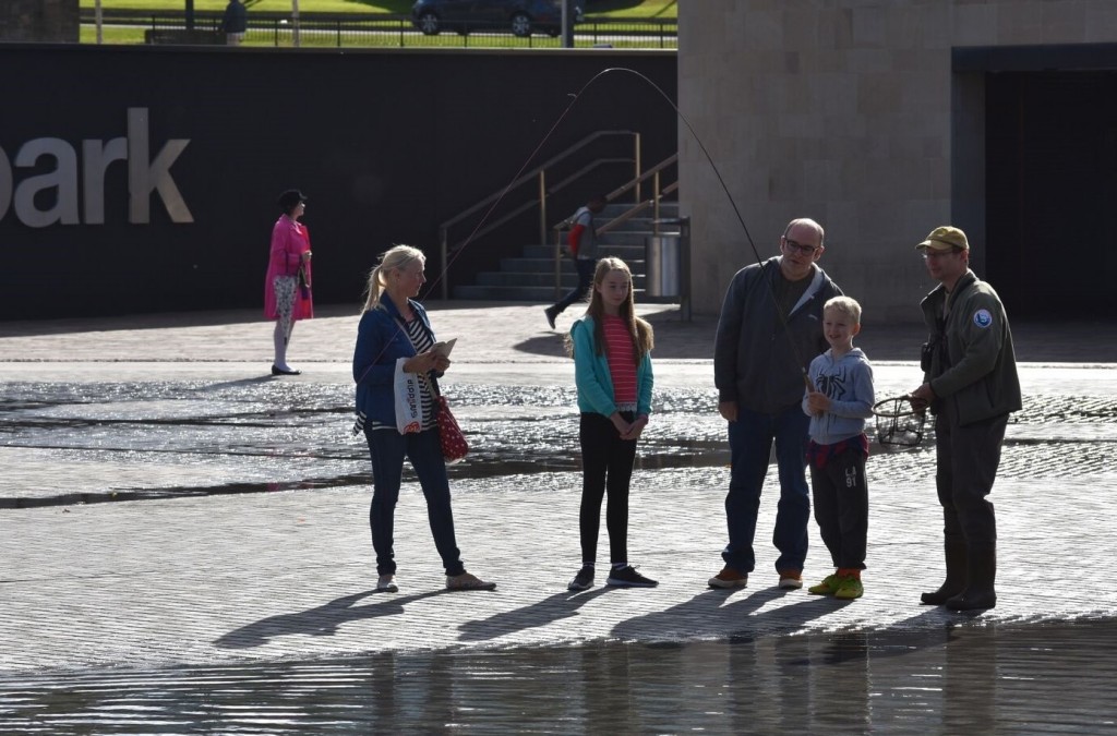
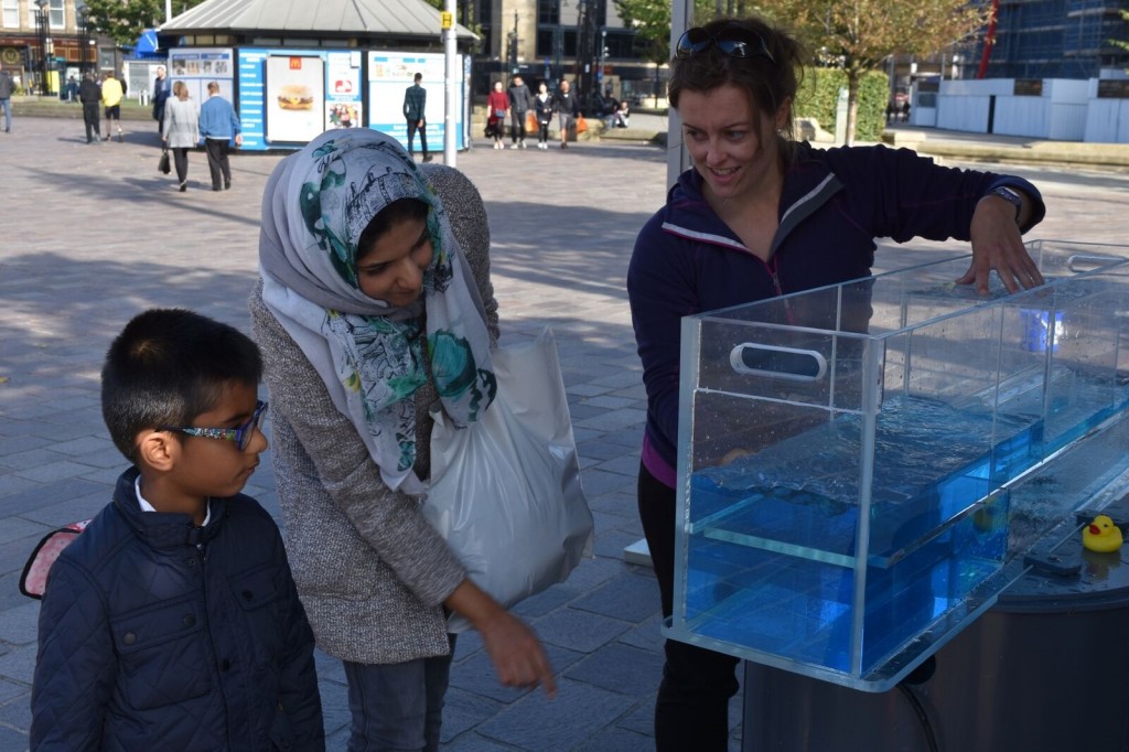
Fortunately, a number of the other events and presentations at this World Rivers Day celebration provided interactive opportunities for curiosity and exploring new things… The Wild Trout Trust, for example, laid on a fly fishing demonstration in the Mirror Pool (or, at least, the small part of it that wasn’t drained on this occasion…). I don’t think anyone caught anything (!) but kids of all ages seemed to be having fun learning how to use that rod… Meanwhile, JBA Trust were on hand with their water flume demonstration (below), to show passers-by how water flow works, and how it is affected by installing different constructs that modify flow patterns (weirs, tunnels, etc.). On one level, this is quite technical, but its also a really accessible demonstration that people find genuinely intriguing…

JBA demo

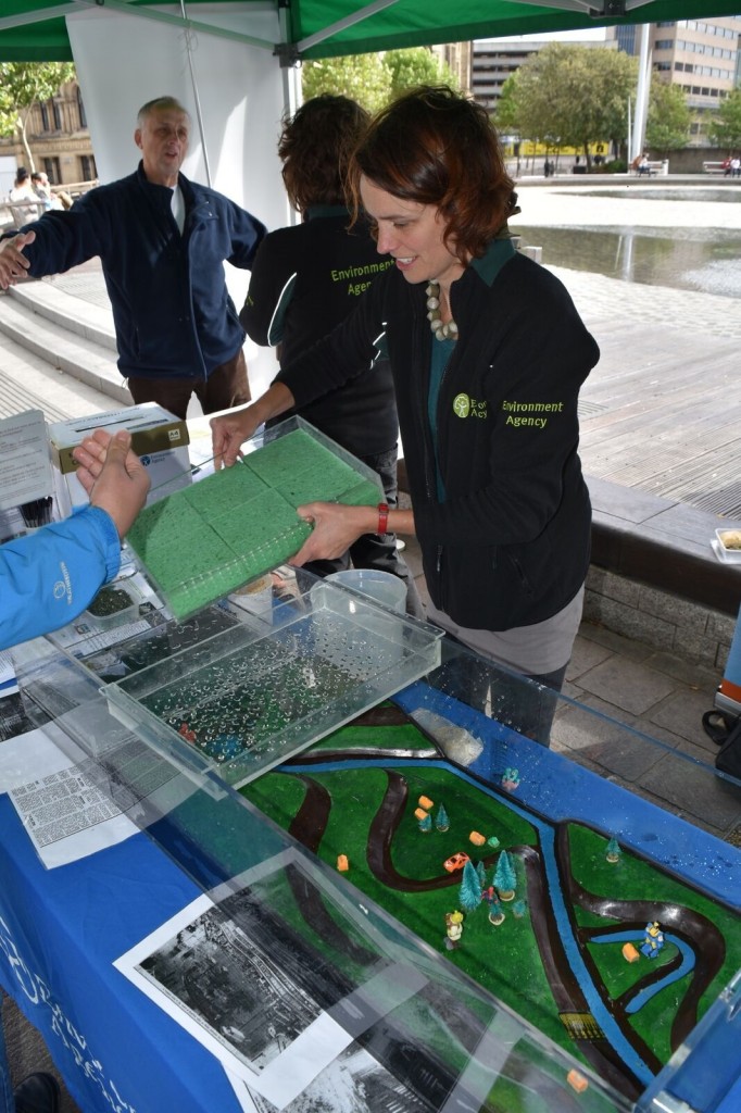
Another interactive demonstration model was provided by the Environment Agency, on the stall next door to ours. This one has a miniature landscape in it, with a river channel, and you can use dripping trays to demonstrate the effects of rainfall on the landscape, where the water runs off to, and so on. The rainfall is heavier or lighter depending on how big the sponges in your trays are… Great fun. This model is populated, rather mysteriously, by Marvel superhero figures (I spotted Iron Man and Wolverine, for starters)

EA Rachel

In the foreground of the shot here, you can see photographs of the 1968 Bradford flood also on display… At our story/memory stall, though, there was also much discussion of the more recent floods in Shipley, Bingley and the wider Aire valley, and about the possibility of future events of this sort. Indeed, it wasn’t just memories that passers-by were sharing, but some very current concerns about recently-announced Bradford Council plans for building new houses — on green spaces to the west of the city centre, not far from the Beck and its tributaries. Were these flood plain areas, people wanted to know? Was there any joined-up thinking going on? In light of Bradford Council’s quite critical “scrutiny report” on its own handling of floods last Christmas — published just this week — there are clearly still some questions to be addressed… But that’s a topic for another blog.

A big round of applause, then, to Barney Lerner and all at FoBB, the Aire Rivers Trust, and other contributing organisations, for creating a memorable day in City Park. Let’s hope that progress on the Beck’s future can “kick on” from here…

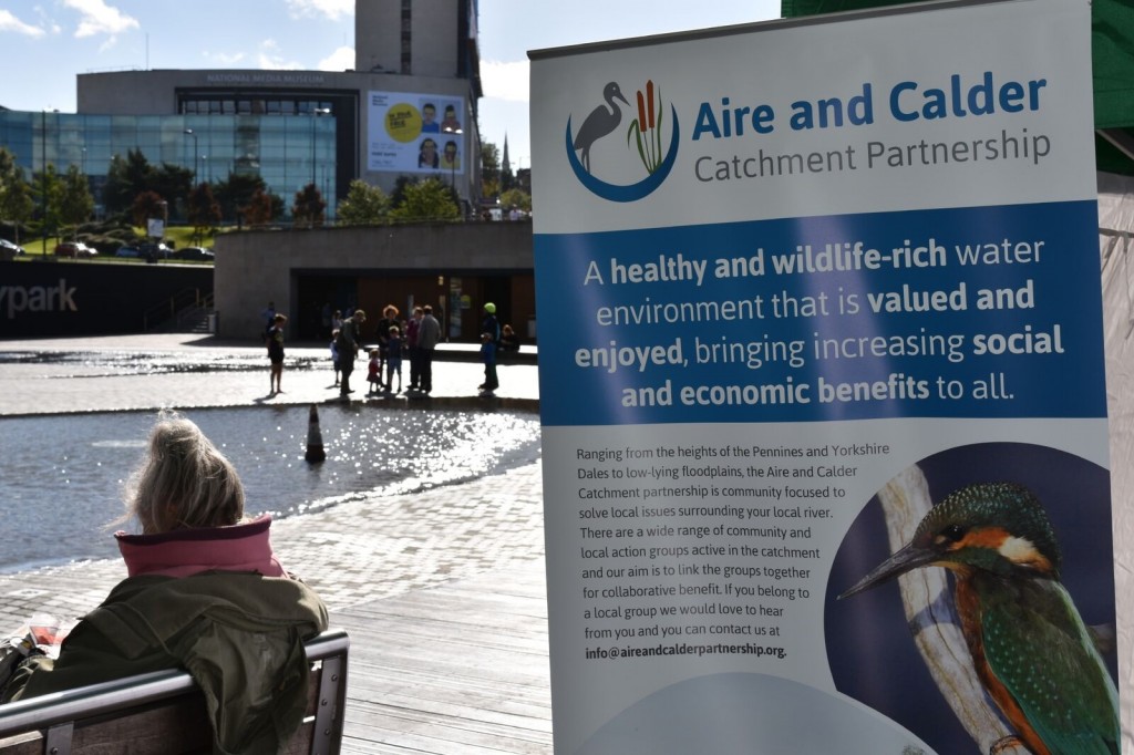
Mirror pool and catchment poster


The Bradford Underground…?

Yesterday I was with some of the Friends of Bradford’s Becks, representing the Beck in the city centre as part of the, er, Ilkley Literature Festival’s contribution to this weekend’s Bradford Festival. Thanks to Geoff Roberts for this group photo of the contributors…

DSC_1087

This was a poetry event, presented in Waterstone’s (in Bradford’s historic Wool Exchange), and hosted by FoBB chairman Barney Lerner (second on left). This year FoBB has published a book of poems about Bradford Beck, by a range of local poets, and has even recorded a CD of many of them being read. It’s all part of an ongoing attempt to raise awareness of the Beck, to speak of it in language even when it can’t be seen with the eyes…

DSC_1071

It should be noted, though, that Eddie Lawler and I were cheating slightly, by (1) presenting song and narrative rather than poetry as such… (though nobody seemed to mind!), and (2) by offering “The Ballad of Little Beck” rather than a meditation on Bradford Beck itself. Eddie’s song written was for Salt’s Waters (a double act we have twice presented at Saltaire Festival), and features my narrative interjections about the ruined Milner Field House. (Soon to be part of a new downloadable audio tour available at www.saltswaters.co.uk)

Still, in an effort to direct our attentions back to the city’s main watercourse, Eddie and I headed outside following the poetry presentation (as heard by a small but appreciative audience). We set out to hunt down the trail of plaques that have recently been installed by FoBB to trace the underground route of Bradford Beck through city centre. This one below, located on Bank Street, is typical: it bears the FoBB logo and the name of a supporting sponsor (Feature Radiators) in opposite corners, with a striking visual in the centre. Each plaque has a slightly different choice of wording – this one speaks of the beck “whispering in the dark … waiting for a rebirth” — perhaps a return to daylight; a “resurrection from this rat-ridden cave”, as Eddie’s song Bradford Beck so memorably puts it…

IMG_1271

The map below tracks the 15 plaque positions — and Eddie, his wife Olga and I tracked them backwards from number 15 (near the end of Canal Road) towards the first one by the Odeon cinema — which is built directly over the top of the Beck. We discovered, however, that only plaques 8 through 15 have so far been installed. We hunted high and low for the others, but they’re not in place yet.

1302BFDBECKgraphic

Hopefully the others will be in place by September, when FoBB is planning a number of activities for World Rivers Day. Among them will be guided tours of the plaques route — and Eddie and I were scouting them out with a view to planning such a tour.

IMG_1267

As this picture shows, the plaques can be unobtrusive — barely noticeable even, unless you’re looking for them — but that is part of their charm I think. They’re subtle reminders of the presence of something that is literally invisible… buried 2 or 3 metres beneath our feet. A tour will, I think, have to play with that question of the visible or invisible, absent or present… We will also be hoping, frankly, for better weather in September than we’ve had this weekend. Water is a wonderful thing, but when it’s drizzling out of the sky, it doesn’t half put a dampener on “festival” spirits…

IMG_1283

xx

A walk in Bradforddale?

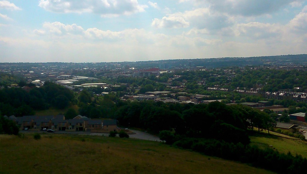
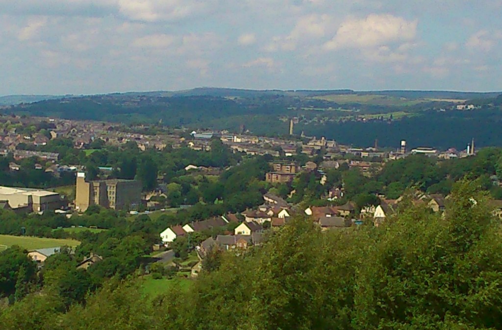
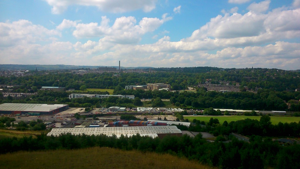
DSC_0038A spectacular view out across the valley of the Bradford Beck, taken last Saturday. On the far hillside is the unmistakable outline of Lister’s Mill at Manningham (complete with its Urban Splash- designed roof bubbles). On this side, a scrubby bit of non-descript moorland uphill from Bolton Woods. But what a view!

DSC_0036Here’s a more direct shot looking across to Lister’s, with the valley in between. The line that you can make out across the middle of this shot is of course the line of the Canal Road and its attendant industrial estates. Bradford Beck itself is invisible here, tucked away along the edge of that green area to the right of the shot, and then disappearing underground on the left. But this is the valley of the Bradford Beck, which Irene Lofthouse — poet, storyteller, and last Saturday, walking companion — should therefore be called Bradforddale. (If you Google Bradforddale, though, you get Bradford Dale in Derbyshire. If you Google Bradfordale, you get – unsurprisingly – Bradford Ale…)

DSC_0037Here is Bradford, by the way… a view looking south along the valley, with Valley Parade football ground the most prominent feature… And below, looking north, you can make out (despite the low-ish quality of my cameraphone) Shipley and Saltaire, where the Beck meets the Aire. The white box of the Shipley clock tower to the left, the unmistakable chimney of Salts Mill slightly to the right… Puts the town perspective a bit!

DSC_0040

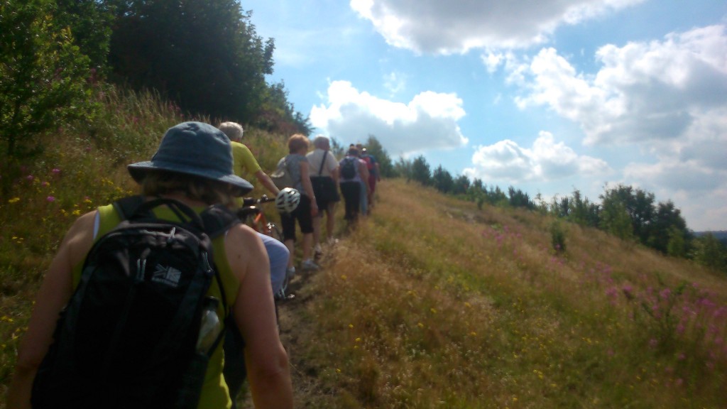
These views from this Bolton Woods promontory were a particular highlight of an organised walk run by a very smart, lovely man called Bob Davidson, as part of the Baildon Walkers’ Weekend. We started out from Baildon roundabout (somewhere across from, up the hill and to the left of Shipley, in relation to the shot above!) and then made our way downhill into the Aire Valley to pick up the Bradford Beck as the spine of our walk (guess that makes Baildon the brain and Shipley the shoulders?). The photos below track some of the highlights along the route, all the way into Bradford.

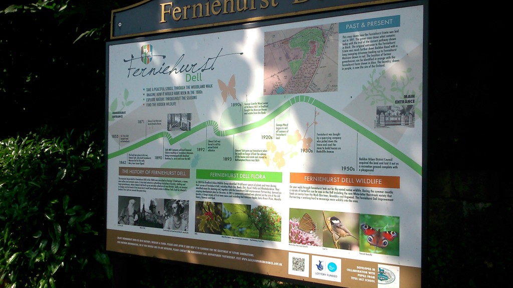
We walked down from Baildon via Ferniehurst Dell (where Titus Salt's son Edward once had a mansion...)

We walked down from Baildon via Ferniehurst Dell (where Titus Salt’s son Edward once had a mansion…)

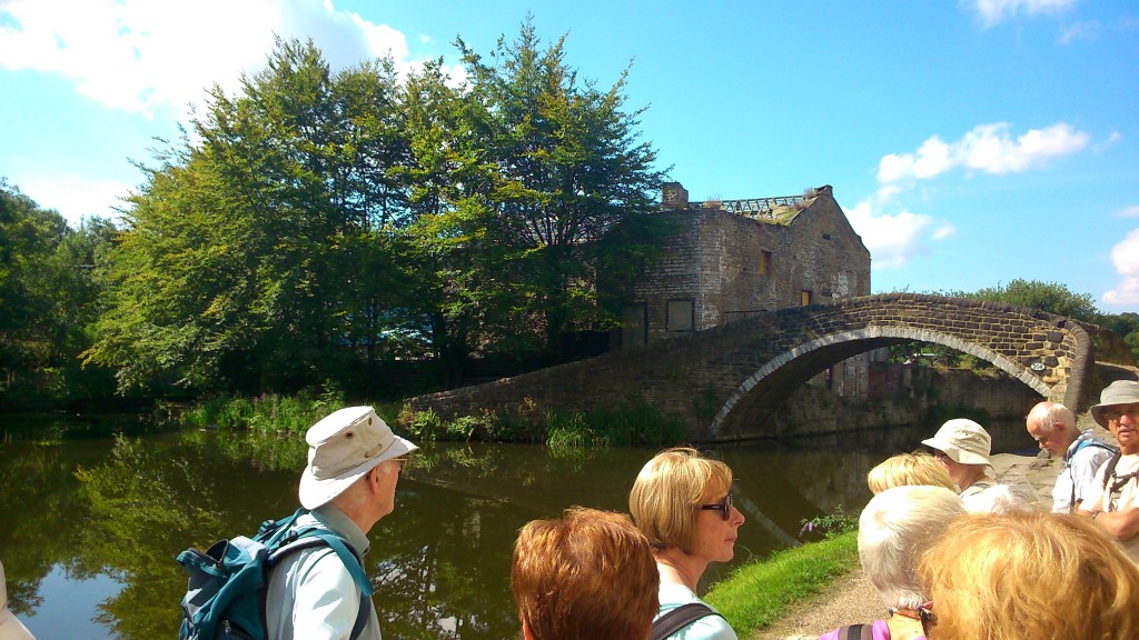
... via the Leeds-Liverpool Canal at Shipley (this shot is at the junction of the former Bradford Canal)

… then headed towards Bradford Beck via the Leeds-Liverpool Canal at Shipley (this shot is at the junction of the former Bradford Canal)

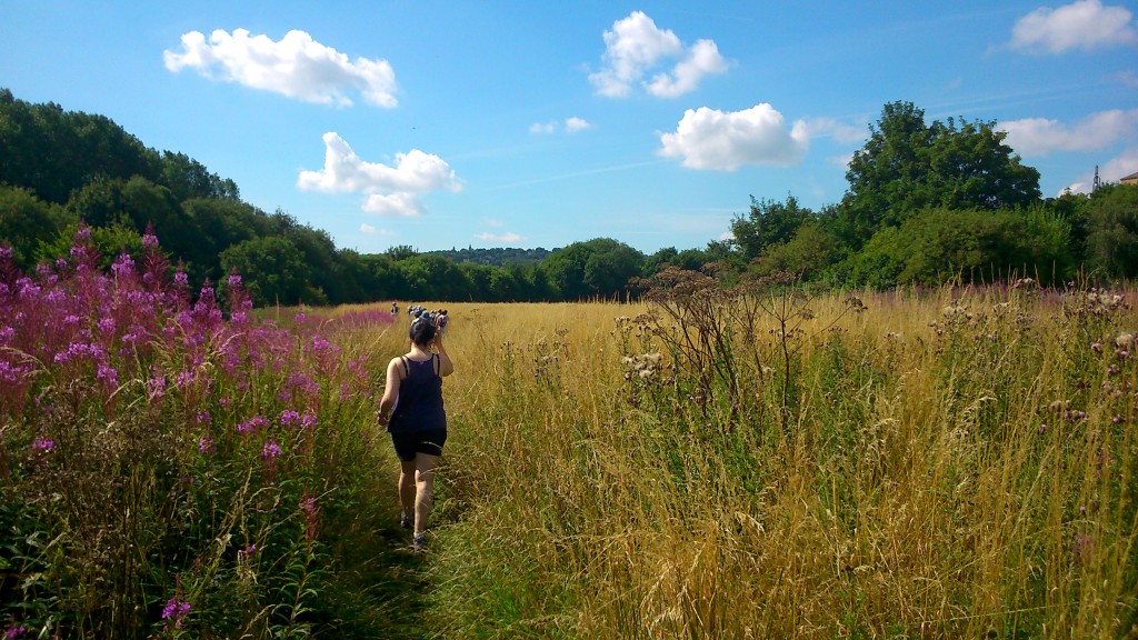
Heading out across the savannah... (aka the meadow between Bradford Beck and Shipley station, currently threatened by Morrisons)

Heading out across the savannah… (aka the meadow between Bradford Beck and Shipley station, currently threatened by Morrisons)

Tracking the Beck upstream along the greenway on Canal Road... Barney Lerner, chairman of the Friends of Bradford's Becks, told us about plans to remove this "box culvert" that the river currently runs through - if the money can be found!

Tracking the Beck upstream along the greenway on Canal Road… Barney Lerner, chairman of the Friends of Bradford’s Becks, told us about plans to remove this “box culvert” that the river currently runs through – if the money can be found…

We stopped for a little liquid refreshment in Bolton Woods, across the valley from Frizinghall.

We stopped for a little liquid refreshment in Bolton Woods, across the valley from Frizinghall. (and fell over drunk, hence the sideways photo…) (or is it a technical glitch…?)

... from Bolton Woods we climbed up to the top of the hill for the views at the top of this blog post...

… from Bolton Woods we climbed up to the top of the hill for the views at the top of this blog post…

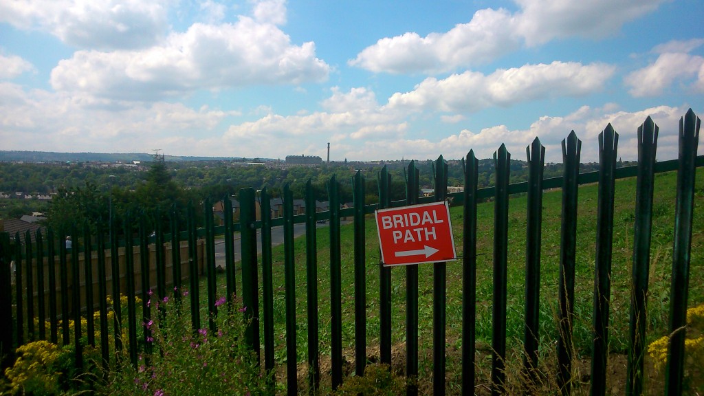
Down from the hilltop via a path warning of weddings!

… and then down again from the hilltop via a misspelt path warning of weddings!

Working our way down through the woods, we came to the Boar's Well, where Irene Lofthouse told us the ancient tale of the Last Boar of Bradford.

Working our way down through the woods, we came to the Boar’s Well, where Irene Lofthouse told us the ancient tale of the Last Boar of Bradford.

Irene Lofthouse and Eddie Lawler at the Spink Well - another of Bradford's ancient water sources...

Irene with Eddie Lawler at the Spink Well – another of Bradford’s ancient water sources…

... we finally popped out of the (thin end of the woods, almost in Bradford city centre!

… we finally popped out of the (thin end of the woods, almost in Bradford city centre!

Thanks to Bob, Barney and everyone involved in the walk for a very enjoyable few hours. Definitely a route to recommend! 


Bradford’s “Conceptual” Canal

Just last week, the new cycle route between Shipley and the centre of Bradford was officially opened. Broadly speaking, it runs parallel with the line of Bradford Beck — which also means that it traces the former route of the Bradford Canal.2015-04-10 11.05.16

This shot looks south down the green space that runs alongside the Canal Road towards Bradford. The canal itself would (as I understand it) have run along on the left, roughly where you see the path, while the Beck — then as now — ran at the bottom of the valley. This is the spot, in fact, where my short film Wading to Shipley begins from – except that in 2012 when we shot that material there was no such clear access to the Beck at this point (that new bit of fence demonstrates that access might be a bit too clear without it!). This next shot is a few yards further downstream past the bridge…
2015-04-10 11.03.42Here you can see the high retaining wall/flood defence that pens the Beck in at this point. The area to the left (east) used to be an impassable area of undergrowth…

2015-04-10 11.03.03

But it’s now been cleared out completely in the construction of this path. Hopefully in due course there’ll be some replanting and other improvement because it looks a wee bit bleak just here…

2015-04-10 11.00.43

As you begin to walk towards Shipley, the new path forks neatly in two directions. The main path follows what would have been the route of the canal, while the lower path heads down to a small footbridge across the Beck…

2015-04-10 10.59.49The bridge has been there for a long time, but access to it — and across towards the station — is now much clearer… also making the Beck that bit more accessible.

2015-04-10 11.00.24Here’s a close-up of the notice in the last-but-one picture above. Bradford Council (as it has done in other places flagged up on this blog) has taken care to ensure that this new path is designated as a temporary right of way — that no precedent is being set which might, through use and custom, establish this as a permanent public right of way. This means that, in the future, they can choose to close the path, build over it, whatever. An understandable disclaimer perhaps, but a rather disappointing one for anyone dreaming of a greater sense of “public commons” rather than slightly grudging “permission”…

2015-04-10 10.59.08This shot, taken further along, looks back down the path towards the back of the sign, and Bradford beyond. This might become quite a pleasant, wooded walk in time…

2015-04-10 10.58.26Further along still, the trees open out and you can look across the valley to Shipley station. Here the Beck is only visible via the retaining wall that cuts across the land…

2015-04-10 11.11.08And here the path brings us out onto Carnegie Drive, Windhill, looking towards the main Leeds Road — with the railway crossing the bridge to the left… Remember again, this is roughly the trajectory of the old Bradford Canal. And now, closer still to the road, take a look across to the red-brick building just visible, in the middle distance, between the two blue cars pictured below…

2015-04-10 11.12.21

2015-04-10 10.55.31

The red-brick building, pictured again on the right here (this time we’ve crossed the Leeds Road to the other side), is the old pump house for the Bradford Canal… and the path marked out down the middle of the car park you see here would have been the line of the canal itself… connecting towards the route we’ve just traced.

The pumphouse was built in 1872, by the Leeds-Liverpool Canal Company, after they took over the Bradford Canal. It had been closed for some years, following a major canalside cholera outbreak! The seriously polluted condition of the water was in part due to the poor water supply from central Bradford, as it trickled down through the many locks on the way to Shipley… So the LLCC’s solution in the late nineteenth century was to establish a pumping system that re-cycled water from the Leeds-Liverpool end all the way back up to the Hoppy Bridge end in Bradford….

2015-04-10 11.15.42Here’s the pumphouse viewed closer up, on Dock Lane — and beyond it the original lock-keeper’s cottage, built in 1774 when the canal first opened. (The first sections of the Leeds-Liverpool canal to be cut in 1773 and 1774 were those between Shipley and Skipton: together with the Bradford Canal branch line, this allowed the first cargoes to be shipped between Bradford and Skipton…)

2015-03-05 13.35.50And here is all that’s now left of the Bradford Canal — the stumpy-looking mouth opening out onto the Leeds-Liverpool Canal, just a little further down Dock Lane from the pumphouse. So although the new cycle route stops rather abruptly when you hit the Leeds Road, all cyclists need to do is cross over it, whizz down Dock Lane, and then join the LLC towpath on the other side of the swing-bridge… They can then follow the towpath all the way to Leeds if they want — meaning a clear cycle route from Bradford to Leeds, via this northern hinge at Shipley (exactly what the canal system used to do, and what the Leeds to Bradford Forster Square train route still does…). But let’s head back to the pumphouse…

2015-03-05 13.41.05It’s a simple but also rather beautiful, chapel-like structure which currently stands empty. It had been converted for private residence a few years ago, but then it came up for sale and Bradford Council purchased it strategically — with a view to the so-called “Bradford Masterplan” scheme of 2003 (by architect Will Alsop) which would have involved re-opening the Bradford Canal. So for example the lock chamber behind the pumphouse — pictured below — would have been dug out again and filled with water.

2015-04-10 09.59.32The white barriers here aren’t original canal furniture – apparently they were put in by the people who last owned the pumphouse, for a bit of, well, fake authenticity… Anyway the point is that nobody is now talking seriously about re-opening the canal, which would be ludicrously expensive (in an age of austerity…) and of dubious economic, cultural or ecological benefit… Much better to treat the Beck properly if you want to make a feature of water along this particular valley… But people in the Council are apparently still talking about the notion of a “conceptual canal” — marking the line of where the canal once stood, by interventions such as the new cycle path. So the pumphouse stands at a strategically important juncture in this “concept”… Let’s take a look inside…

2015-04-10 10.13.01The building is now subdivided into upper and lower floors, where once it would have just been a single chamber housing a pump engine. The lower floor is currently without light (the windows are shuttered; electricity cut off), but in torchlight you can see some serious bowing in the floorboards that will need sorting out if the building is ever to be useful again… Upstairs it’s much brighter and more welcoming…

2015-04-10 10.17.00xx… except that it is weirdly subdivided by things like this mezzanine, presumably added to create an extra bedroom space. The master bedroom, pictured in the two images below, is the largest room, but has a very peculiar-looking WC in one corner…

2015-04-10 10.18.37

2015-04-10 10.18.23

Pictured on the left here is Dave Partridge, Economic Development officer with Bradford Council, who kindly showed us around the building. Dave is interested in the building being used for socially constructive purposes, in line with the “conceptual canal” idea… and so my colleague Trevor Roberts, pictured below, is concocting a little scheme to put the pump house back into use…

2015-04-10 10.17.09Trevor runs a social enterprise called Canal Connections, which is all about using the waterways to reconnect people and places in novel ways. He sees the pump house as a potential meeting place — a site for conversations, exhibitions, and so forth — that highlight the importance of the waterways to the history, heritage, and perhaps futures of not just Shipley but also — by extension to the south and east — Bradford and Leeds. The pumphouse stands at an axis point, a conceptual hinge if you like. It has spaces that could be put back into social use, both inside and outside. What would you dream up for it, if you were planning Bradford’s “conceptual canal”…?

Bradford Beck, running orange

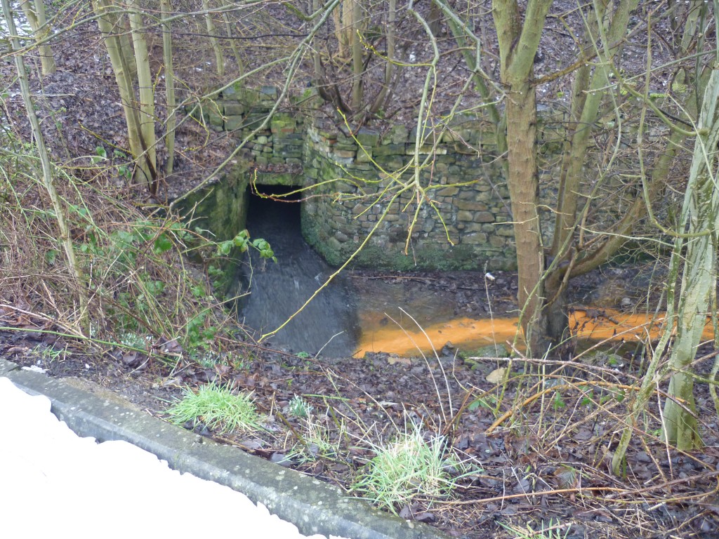
So apparently this was what Bradford Beck looked like last Friday (Jan 30), running under the railway arches in Shipley…
B8leUOwIMAAkC4SBright orange water flow… Looks a little apocalyptic! I didn’t see this myself (though I wasn’t far away that day), but I pinched this picture from the Telegraph and Argus website, which has lots of other images and video too, under the title “Why has Bradford Beck turned bright orange at Shipley?” Of course the headline is misleading: the river turned bright orange across a great deal more of its catchment than the section in Shipley — and the Environment Agency (EA) eventually traced the source of the pollution to Clayton Beck (tributary running through Clayton, obvs.). But given how much of Bradford Beck runs underground through the city, it’s only in Shipley that people really noticed the problem!

Barney Lerner, chairman of the Friends of Bradford’s Becks, yesterday circulated this explanation from the EA’s Stuart Jenkinson:

I can confirm that on Friday 30th January we received several reports of pollution of Bradford Beck. Environment Agency officers attended the scene. It was traced to the vicinity of Clayton Beck. We believe it was due to a ‘blow out’ of iron ochre from historically abandoned coal workings. We have classified the event as category 1 under our incident classification scheme. That is to say it had a major effect on water quality, albeit for a relatively short period of time. The iron contained in such discharges is largely insoluble and so chemically has little impact on ecology.  Chronic events can however harm the aquatic ecology through their ‘smothering’ effect on the stream bed. The Environment Agency is aware of disused mineral workings in the Clayton / Queensbury area, however we are not aware of them ever giving rise to such a noticeable discharge. We are not planning to take any enforcement action as result of this incident. In general water pollution from abandoned coal mines is dealt with by the Coal Authority. Treatment plants are expensive however and limited funding is allocated on a priority basis.

So now you know. Big mess, nothing to be done about it.

The problem seems to have gone away now, but I would briefly draw attention to this picture that I took almost 3 years ago now, shpwing a small confluence on the Red Beck tributary in the Norwood Avenue area of Shipley (which flows down into Bradford Beck by Canal Road) …

shipley & frizinghall 071Iron ochre looks to be popular around here…