
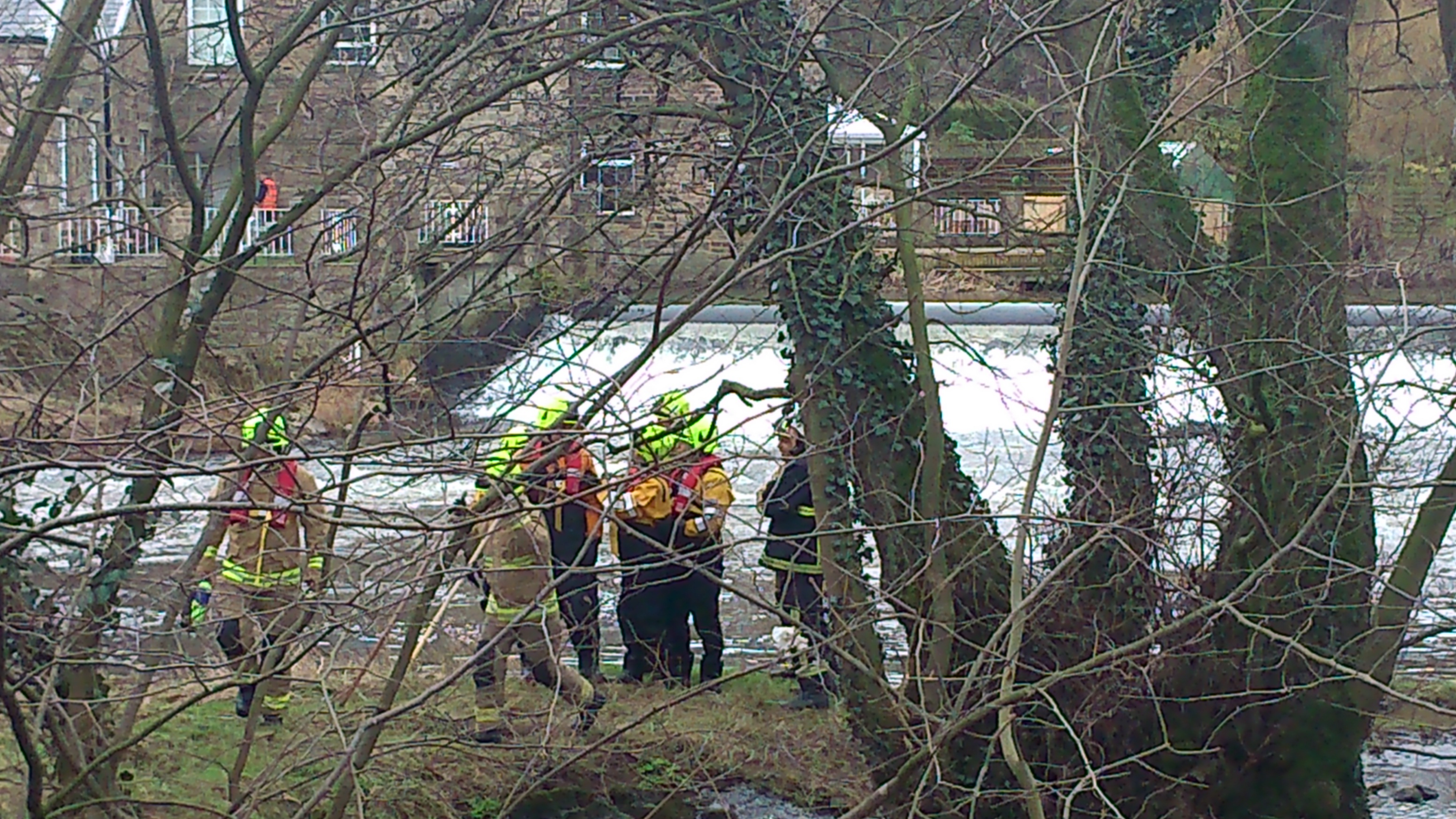
 Spotted through the trees yesterday just downstream of Hirst Weir… Members of West Yorkshire Fire and Rescue Service (with their big red engine parked up in the car park of Bradford Rowing Club). I’m hazarding a guess that this was a training exercise for coping with flood conditions. A couple of weeks I heard a presentation from Humberside Fire and Rescue about how poorly prepared firemen are for working in flood conditions — even though flooding is likely to become an increasing problem in coming years, with climate change. Hull, of course, has an ongoing, near-annual problem with flooding (the presenter described it as “the plughole of England”), but since flood conditions are so difficult to simulate in normal circumstances, training is an issue. Presumably this is why these WYFR folk were stomping around near the roiling waters of Hirst Weir, but in Hull they have an altogether more elaborate plan – to build The Ark. No, not Noah’s ark, but a big water simulator… a kind of theatre for flooding… which sounds quite exciting!
We don’t have any project plans on that scale, alas, but here’s a few updates on what we are up to. First off… I was passing Hirst weir on a walk with sound artist Jon Tipler, who is working with me to complete the downloadable Salt’s Waters audio-guide that will lead listeners from Salts Mill up to the ruins of Titus Salt Jr’s Milner Field house – via various waterways big and small. (This has been in development for a while, but we’re aiming to have it finished for Saltaire’s World Heritage Weekend in April.) Among other things, this guided walk passes along the grassy flood plain that runs next to the Higher Coach Road estate – and (as in our live performances of 2012-13) makes a case for seeing this 1950s estate as integral to the local heritage narrative. And in the last couple of weeks, we’ve also started to get back in touch with residents on the estate about another, related project. My colleague Lyze Dudley has been knocking on doors, chatting to people about our plans for a sort of festival event on the flood plain in June. The idea will be to try to get a real conversation going about what people would like to see done with this grassy area which gets so boggy, and which the Council now can’t afford to mow regularly either (what with the swingeing cuts they’ve had to implement). Various residents have put various dream schemes to us in previous discussions, so we’re going to see if we can facilitate any kind of agreement being reached, with a view to taking it forward. Of course, if the consensus is just to leave it alone, then we’ll do exactly that, and – as Lyze has found – there are certainly people who think that, since that area is always going to flood, it’s best just left as vacant as possible. But it’s also possible to design imaginative green spaces that are intended to flood — “making space for water”, they call it.
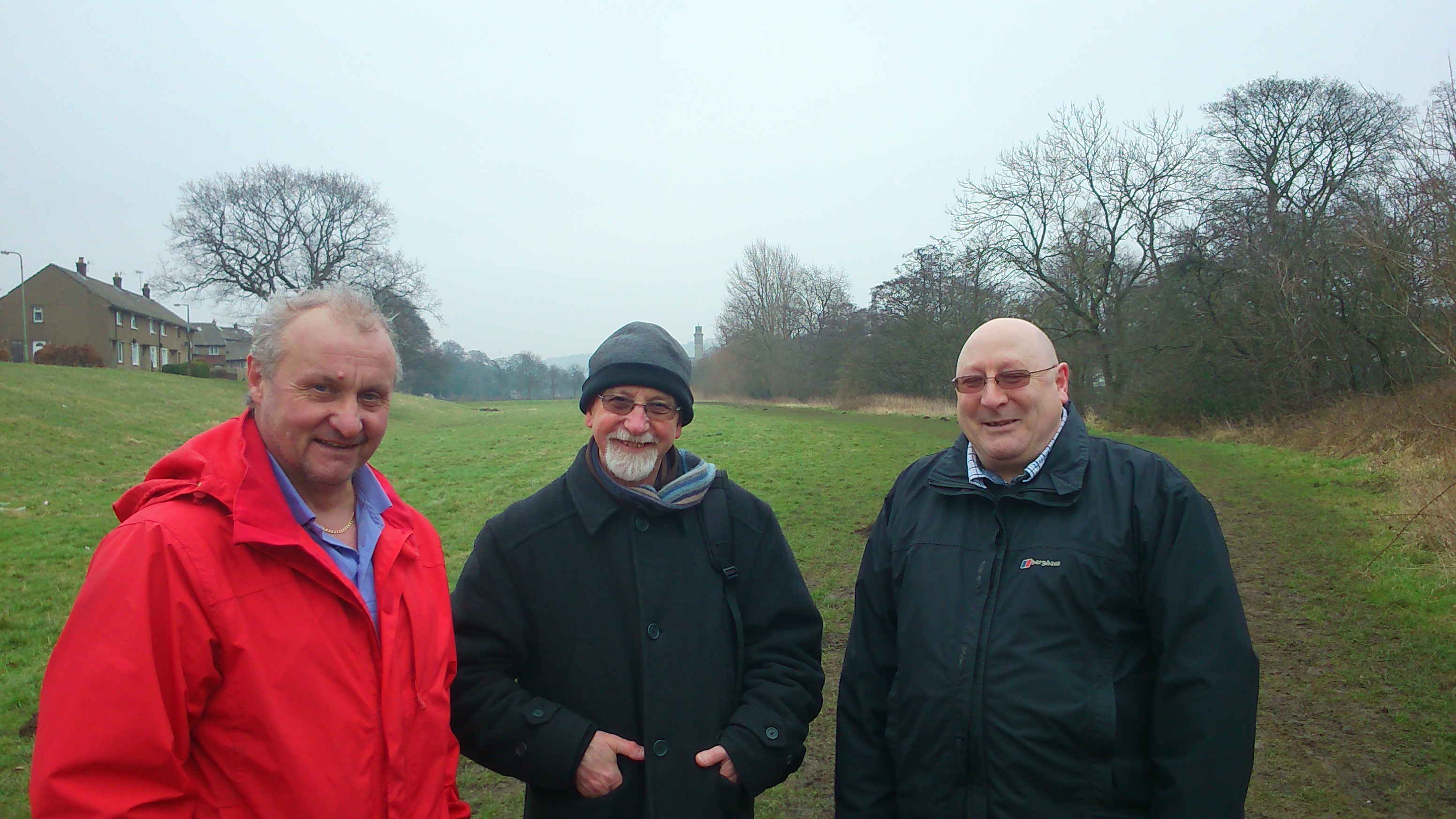 Here’s a picture I took last week on a walk along the flood plain in question. To the right is Dave Horsman, Shipley ward officer for Bradford Council, and to the left is John [didn’t get his surname] who works out of Northcliffe Park and is responsible for all the mowing and maintenance of Council grassland in the area. (The park keeper at Roberts Park is retiring, and – again thanks to the cuts – won’t be directly replaced, hence John now taking on this remit.) In the middle is Baz Kershaw, an old friend and colleague of mine who was visiting to look at the site, with a view to creating a “meadow meander” in the long grass as one of our events in June. It’s a sort of interactive art installation that invites you to take a maze-like walk specially prepared in areas of long grass. Baz has done this in a number of places now (he started off doing it in his own home in Devon), and it always gets great responses. We’re hoping it will help spark discussion about whether people want long or short grass, a wildflower meadow, etc.
 And here’s another picture from a meeting last week, this time taken in the Rose Wharf headquarters of the engineering firm ARUP, in Leeds city centre. This graffiti art hoarding celebrates some of the major projects ARUP has been involved with recently – including (as you can see) the Leeds Arena, and the Rosebowl at Leeds Beckett University. (In Bradford, ARUP were also the key engineering consultants behind the City Park’s Mirror Pool.) They’re also involved with plans for the HS2 rail link (a bit controversial, that one), and are lead consultants on the Leeds Flood Alleviation Scheme (or FAS), which is now under construction, as of this month — and is due for completion in about two years. It was this that I was at ARUP to learn more about…
As you might expect, the Flood Alleviation Scheme is — at root — also based on the premise of “making space for water”. Specifically, the big old industrial weirs in Leeds central are going to be removed, and replaced by new, moveable weirs. In normal conditions, they’ll operate just like the old ones did (so that the navigation of the river using locks etc. can continue as it has done). But in flood conditions, these new weirs will basically collapse (they’ll be held up by the equivalent of deflatable air bags…), thereby dropping the water level and alleviating flood risk to the city centre. This will help obviate the need and the expense of building higher concrete walls, as in the earlier scheme vetoed by government a few years back (although there will also be some new riverside construction designed to complement the work of the new weirs).
Apparently, collapsible weirs have been used elsewhere in the world for the sake of hydro power installations, but to date they have not been used as part of a flood alleviation scheme — so this is a first. I find it intriguing, though, that this scheme basically confirms that there can be a relationship between weir removal and lowering flood risk. This is the exact same logic that our friends at Baildon Woodbottom Working Men’s Club have used to argue for taking out the weir just downstream of Baildon Bridge — so as to mitigate their own risk of flooding at the club, and to help prevent the Bridge itself from becoming impassable as it last did in 2000. To date, though, the responsible agencies haven’t seemed very interested in this weir removal suggestion… That’s another little project we’re working on, if we can get the scientific data needed to show whether or not this is a viable proposition.
So, to sum up – we have various irons in the fire at the moment, each attempting to respond to ideas put to us by people living near the river. It remains to be seen which of these strands will produce any useful results, but I guess that is the nature of an exploratory research project like this one…