A statement of intent at Higher Coach Road

WP_20150823_14_58_05_Pro

In July we had an event on the grassy flood plain between the River Aire and Higher Coach Road. It involved a “meadow meander” for which we acquired a number of stake-posts to mark out the space used. Those posts this week went back into the ground, now re-purposed to carry the signs pictured above (just before they went out). They’re the work of Stewart Gledhill, of Troutbeck Avenue, who did both the carpentry and the notices/artwork. Here’s Stewart with the first of the posts, after we post-creted it into the ground, close to the start of the riverside path leading from Roberts Park…

DSC_0015

Stewart is shortly to get that beard shaved off — he’s been growing it for sponsorship. (The jury is out on whether he looks more like Captain Birdseye or Uncle Albert from Only Fools and Horses…). Anyway, this first post — which will be mirrored by a similar one at the other end of the estate, when we get round to purchasing a couple of additional stakes — tells the story of why they’re here…

DSC_0016

You can enlarge the picture to read the full text, but the gist of it is that Stewart is now chairing a group of estate residents who want to campaign for better use of this stretch of riverbank next to the estate. It tends to be neglected or ignored from the outside (in fact Stewart’s statement opens with a protest at the estate being “screened out” from the park…). But what if this riverside path could become a properly laid link route between the park and Hirst Wood? What if the field could become an attractive feature to walk through with, for example, wildflowers amongst the grass, and occasional river views cleared through the bankside undergrowth?

DSC_0020

In this next notice, next to which you can glimpse a bit of the river, Stewart has included a statement about the Aire — its source and destination, and about the way that the water quality has improved over the years, a change he has observed first hand…

DSC_0018

Most of the other notices — like this one, about riverside bird life — then draw attention to aspects of the natural world surrounding us in this area, which we so often overlook as we march past… Look closer, Stewart seems to be suggesting.

DSC_0011

Now of course, at present, a closer look at this field doesn’t really inspire. Bradford Council, facing massive cuts, has stripped back its manpower and mower provision, and this particular area of green has been left to grow wild all summer. For a while it looked rather lovely, with buttercups and long green grasses (see this previous post), but now the field has been taken over by these rapidly spreading, browning dock plants, which make it look almost apocalyptic. Simply leaving nature to take its course isn’t necessarily a great idea if the bits of nature already present are going to go to war like this. There needs to be a plan, and some careful stewardship, if mowing really is going to be less frequent in future years.

That said, even as we were post-creting these notices in, we got chatting to passers-by (both residents on the estate and walkers-through) who were commenting on the benefits of leaving the grass to grow. For instance Peter, from Park Way, was telling me about the swirls of swallows he’s seen diving down on the field outside his window — many more than in previous years — who have been drawn by the plenitude of insects living in the grass (bird food!). With a little care from residents and other interested locals, and a little co-operation from the responsible authorities, maybe a plan can be found that gives the best of both worlds… making the field look tended, cared for and attractive, while also leaving sufficient leeway for grass and plant growth to attract the wildlife people like…

There’s a new facebook page — Higher Coach Road River Link — about this campaign. Do please visit it, and ‘Like’ it! Thanks.

To finish with, here’s an image that sums it up. A single poppy, one of the flowers that a group of residents sewed earlier in the summer as an other small gesture towards future intent… It stands alone, but it’s growing strong — a flash of colour at ground level as you walk by. And as you can see from this image, it’s also of interest to insects… who are of interest to birds… and so on. A small intervention into the great cycle of life…?

DSC_0002


A walk in Bradforddale?

DSC_0038A spectacular view out across the valley of the Bradford Beck, taken last Saturday. On the far hillside is the unmistakable outline of Lister’s Mill at Manningham (complete with its Urban Splash- designed roof bubbles). On this side, a scrubby bit of non-descript moorland uphill from Bolton Woods. But what a view!

DSC_0036Here’s a more direct shot looking across to Lister’s, with the valley in between. The line that you can make out across the middle of this shot is of course the line of the Canal Road and its attendant industrial estates. Bradford Beck itself is invisible here, tucked away along the edge of that green area to the right of the shot, and then disappearing underground on the left. But this is the valley of the Bradford Beck, which Irene Lofthouse — poet, storyteller, and last Saturday, walking companion — should therefore be called Bradforddale. (If you Google Bradforddale, though, you get Bradford Dale in Derbyshire. If you Google Bradfordale, you get – unsurprisingly – Bradford Ale…)

DSC_0037Here is Bradford, by the way… a view looking south along the valley, with Valley Parade football ground the most prominent feature… And below, looking north, you can make out (despite the low-ish quality of my cameraphone) Shipley and Saltaire, where the Beck meets the Aire. The white box of the Shipley clock tower to the left, the unmistakable chimney of Salts Mill slightly to the right… Puts the town perspective a bit!

DSC_0040

These views from this Bolton Woods promontory were a particular highlight of an organised walk run by a very smart, lovely man called Bob Davidson, as part of the Baildon Walkers’ Weekend. We started out from Baildon roundabout (somewhere across from, up the hill and to the left of Shipley, in relation to the shot above!) and then made our way downhill into the Aire Valley to pick up the Bradford Beck as the spine of our walk (guess that makes Baildon the brain and Shipley the shoulders?). The photos below track some of the highlights along the route, all the way into Bradford.

We walked down from Baildon via Ferniehurst Dell (where Titus Salt's son Edward once had a mansion...)

We walked down from Baildon via Ferniehurst Dell (where Titus Salt’s son Edward once had a mansion…)

... via the Leeds-Liverpool Canal at Shipley (this shot is at the junction of the former Bradford Canal)

… then headed towards Bradford Beck via the Leeds-Liverpool Canal at Shipley (this shot is at the junction of the former Bradford Canal)

Heading out across the savannah... (aka the meadow between Bradford Beck and Shipley station, currently threatened by Morrisons)

Heading out across the savannah… (aka the meadow between Bradford Beck and Shipley station, currently threatened by Morrisons)

Tracking the Beck upstream along the greenway on Canal Road... Barney Lerner, chairman of the Friends of Bradford's Becks, told us about plans to remove this "box culvert" that the river currently runs through - if the money can be found!

Tracking the Beck upstream along the greenway on Canal Road… Barney Lerner, chairman of the Friends of Bradford’s Becks, told us about plans to remove this “box culvert” that the river currently runs through – if the money can be found…

We stopped for a little liquid refreshment in Bolton Woods, across the valley from Frizinghall.

We stopped for a little liquid refreshment in Bolton Woods, across the valley from Frizinghall. (and fell over drunk, hence the sideways photo…) (or is it a technical glitch…?)

... from Bolton Woods we climbed up to the top of the hill for the views at the top of this blog post...

… from Bolton Woods we climbed up to the top of the hill for the views at the top of this blog post…

Down from the hilltop via a path warning of weddings!

… and then down again from the hilltop via a misspelt path warning of weddings!

Working our way down through the woods, we came to the Boar's Well, where Irene Lofthouse told us the ancient tale of the Last Boar of Bradford.

Working our way down through the woods, we came to the Boar’s Well, where Irene Lofthouse told us the ancient tale of the Last Boar of Bradford.

Irene Lofthouse and Eddie Lawler at the Spink Well - another of Bradford's ancient water sources...

Irene with Eddie Lawler at the Spink Well – another of Bradford’s ancient water sources…

... we finally popped out of the (thin end of the woods, almost in Bradford city centre!

… we finally popped out of the (thin end of the woods, almost in Bradford city centre!

Thanks to Bob, Barney and everyone involved in the walk for a very enjoyable few hours. Definitely a route to recommend! 


Not-quite-natural wetland: a sneak preview at Hirst Wood nature reserve

The other day I was treated to a guided tour of Hirst Wood Regeneration Group‘s new nature reserve area (next to Hirst Lock at the bottom of Hirst Lane) by the group’s secretary Pauline Bradley Sharp. The reserve has its official opening on Saturday 12th September from 1pm — on the first weekend of Saltaire Festival. (The opening will, we hope, be visited by our promenade performance for the festival, Pleasant Valley Saltaire – which kicks off at 2pm from Saltaire Visitor Information Centre. See festival info.)

DSC_0006Here’s Pauline with most of the reserve area behind her – the more natural, wetland area to the left of the path, and the more orderly areas and fresh planting to the right. The whole thing is beautifully laid out, and while there are some finishing touches to complete before the opening, it’s already a wonderful space to wander around and spend time in.

DSC_0012This welcome board stands at the entrance to the site, providing a map … you can see how the Leeds-Liverpool Canal provides the northerly boundary, to what is essentially a hollow in the landscape, no use for building on, because of the way it collects water.

DSC_0009But as is clearly indicated by this second interpretation board — in the heart of the site, on the approach to the pond area — this area is brilliant for wildlife, in terms of birds, insects, an so forth. A perfect location for a nature reserve: all that was needed was a bit of planning and a bit of love.

DSC_0008

Here’s the pond from a bit more of a distance, and a sign indicating all the sponsors and supporters who have contributed to the project (a lot of love, as I mentioned!). The whole thing got going because of a £25,000 grant that Pauline researched and applied for — the Biffa Award scheme (designed to create sites compensating for Biffa’s landfill activities elsewhere!). It’s the latest and most ambitious in a series of area improvement schemes that HWRG has pursued in the last few years. They’re an amazing example of what a community interest group can achieve when they put their minds and wills to something.

DSC_0005Here’s the pond area again from a bit more of a distance. Most of what you see in this shot is land that will be quite boggy in most seasons and weather conditions — although that’s not especially the case just now after a fairly dry summer. One of the things I like best about the nature reserve is how nature is being left to take its course in areas like this — but it never looks scruffy or uncared for.

Pauline tried to show me the French drain that feeds the wetland area. I hadn’t heard the expression before, but apparently its a stone-lined drainage channel that guides surface water in a particular direction downhill. We couldn’t find it amidst the undergrowth, but Pauline then led me out of the nature reserve site and along its northern perimeter…

DSC_0014

Here she is walking down the edge of the lock’s bywash, with the nature reserve to the right. A little further along, she showed me the crack in the wall where water runs out of the bywash and down towards the not-quite-natural wetland area! Now, it wasn’t quite clear to me why someone would construct a French drain instead of just repairing the wall, but maybe it’s all about taking advantage of opportunities that present themselves…

That;s exactly what a lot of local groups and organisations have done, in getting involved with the nature reserve scheme. Pauline told  me about a sort of snowball effect that has occurred (more so with this scheme than any previous HWRG initiative): the more people have got interested and involved, the more this has drawn in others…

DSC_0004This little garden area, at the west end of the site, is a good example. It’s planted in the colours of Saltaire Primary School, because the school has adopted it and will take responsibility for it. In the background of the shot, you can see the little outdoor classroom area they’ll also be using. And just below is a mosaic the children have made as a covering for an old manhole cover that was found on the site, and that has to remain in situ. So they decided to beautify it a bit…

DSC_0007

Pauline joked that she’s not good with art like this, though the tree, pond and flowers look fairly clear to me (good job kids!). In this short Youtube video the children explain how the made it — and there are also some images of the site before it began to be redeveloped. There’s quite a radical difference.

DSC_0010Everyone is welcome at the nature reserve — even bugs! This is one of two bug hotels on the site. The other one (pictured in this previous blog post with its maker, when it was still in his front garden) is more of a traditional ‘house’ shape, but this one’s more ‘modernist’ — reminds me of a Frank Lloyd Wright building I saw in America once…

DSC_0011And here is Pauline (on her side for some reason – can’t get this picture to stand up straight!) with a log bench that has been made out of one of the tree trunks that, very controversially, were cut down from Victoria Road in Saltaire. It’s good to see that a new use has been found for it, despite the upset caused to some.

DSC_0003

And no, this sign isn’t a comment on the Saltaire trees being cut down (!). Posted on the gate of the nature reserve, it records the fact that — a few weeks ago — some “idiots” could apparently find nothing better to do with themselves than smash up parts of a site lovingly prepared by volunteers… I’ve left this to the end of the blog post because I didn’t want to sour the main story, which is one of real endeavour and achievement. And thankfully, nothing was broken that can’t be repaired or replaced. But there’s a salutary reminder here that a place like this can only survive if there really a will from everyone in the community to protect and preserve it. Come September 12th it will be open to everyone, at all hours. Still, I’m confident that, once people see the value of what is on offer here – as a place to visit, hang out, watch the world go by — it will indeed be respected and cared for. Let’s hope so, anyway…

My thanks again to Pauline, for this sneak preview and for her excellent company.


Meadows and Bridges (…Looking back on a very busy few weeks…)

The Multi-Story Water team have had an extremely busy few weeks, so this blog has got a little behind with updates… We’ve had two big weekends — this last one, July 11th-12th (of which more shortly), and a fortnight before that, June 26th-28th, we were involved with two simultaneous water-themed festivals — in Shipley and downstream in Leeds.

The Shipley Street Arts Festival, co-ordinated by our friends at Q20 Theatre on Dockfield Road, was an ambitious attempt to combine traditional street entertainments in Shipley’s town square (jugglers, stiltwalkers, and the like) with a thematic emphasis on the town’s rivers and canal… So a second ‘hub site’ for the festival was down on the canal towpath beside the Ibis Hotel. Here’s what it looked like with the big letters SHIPLEY on display…

Picture1

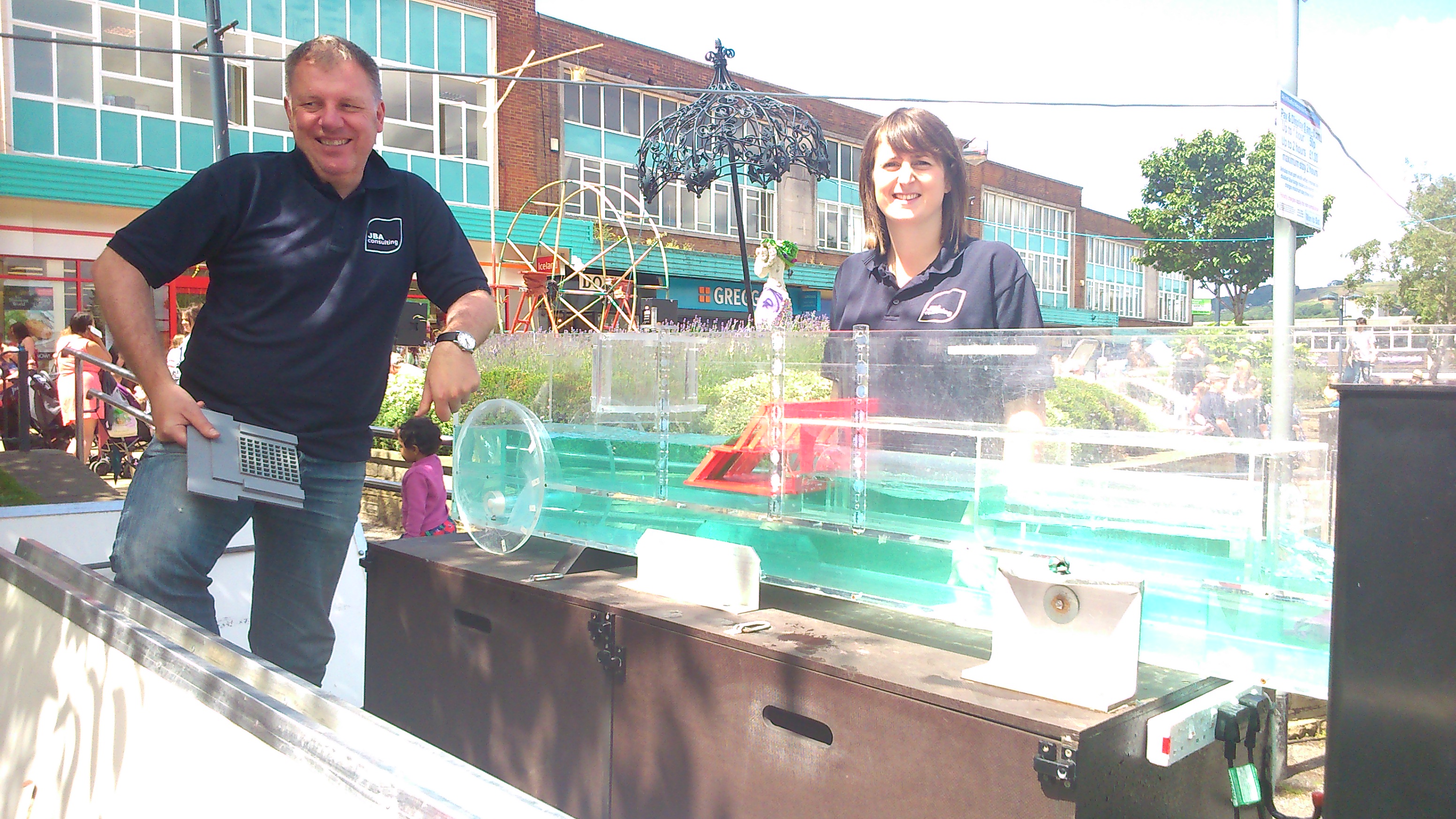
Multi-Story Water was involved in various aspects of the festival — for example, there was a successful screening of our short film Wading to Shipley at the Ibis on the Sunday, and we’d also arranged with JBA Trust (based at Salts Mill) to display their water flume in the town square… It demonstrates different forms of water flow, when you place different kinds of constructions or obstacles in a channel. On one level quite technical, it’s actually really interesting to watch, and there was a lot of curiuos interest from passers-by…

DSC_0028

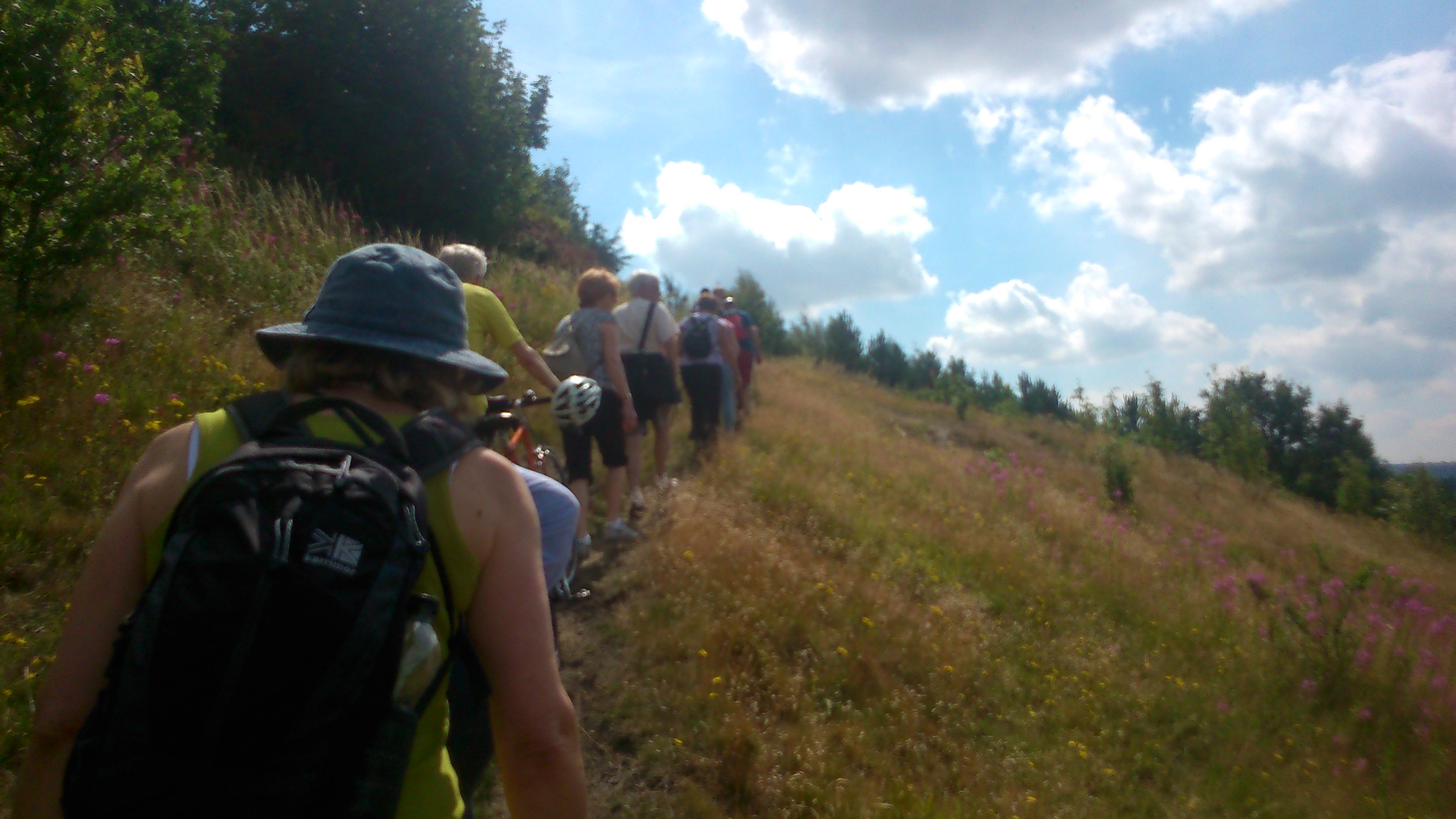
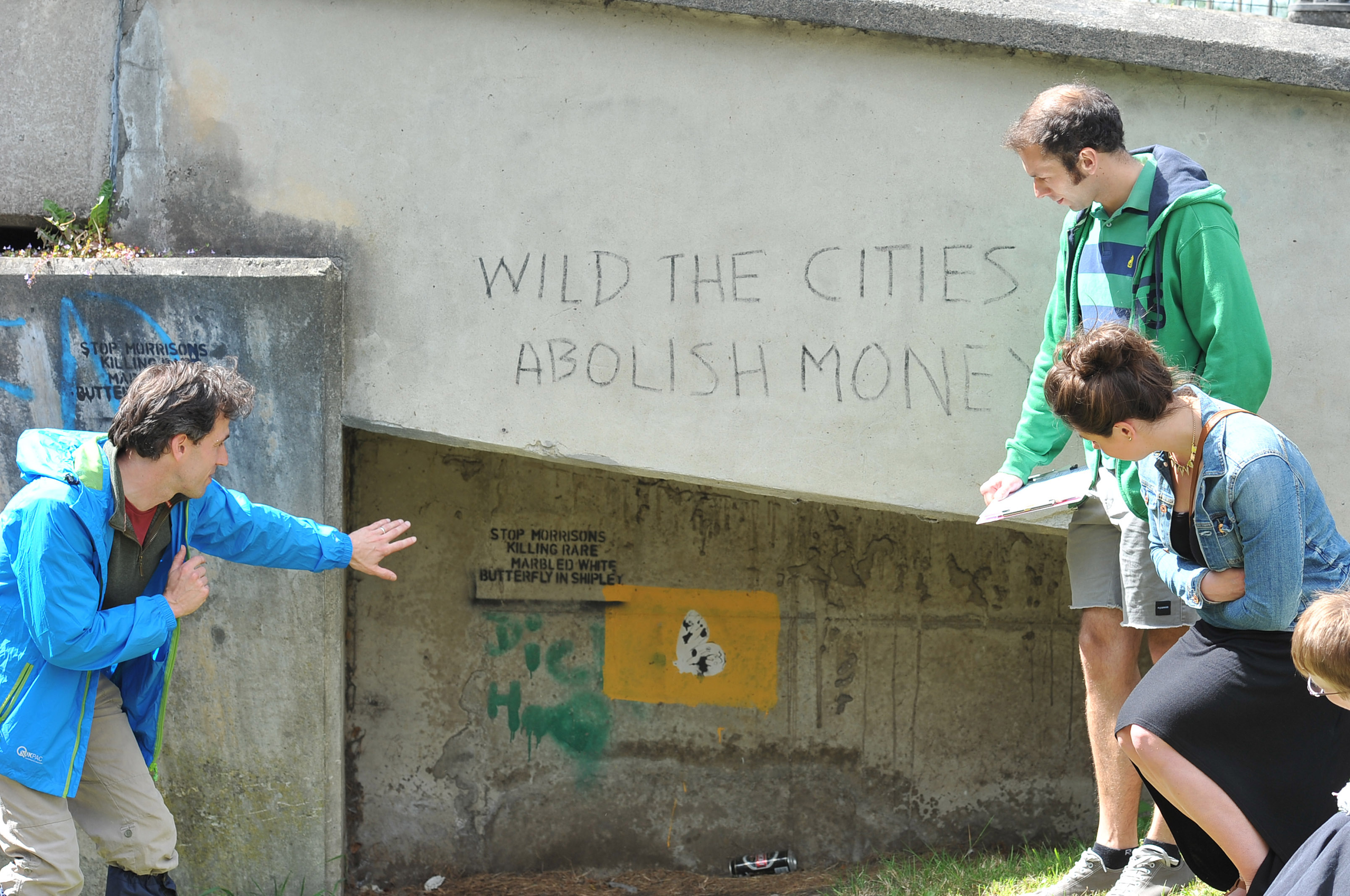
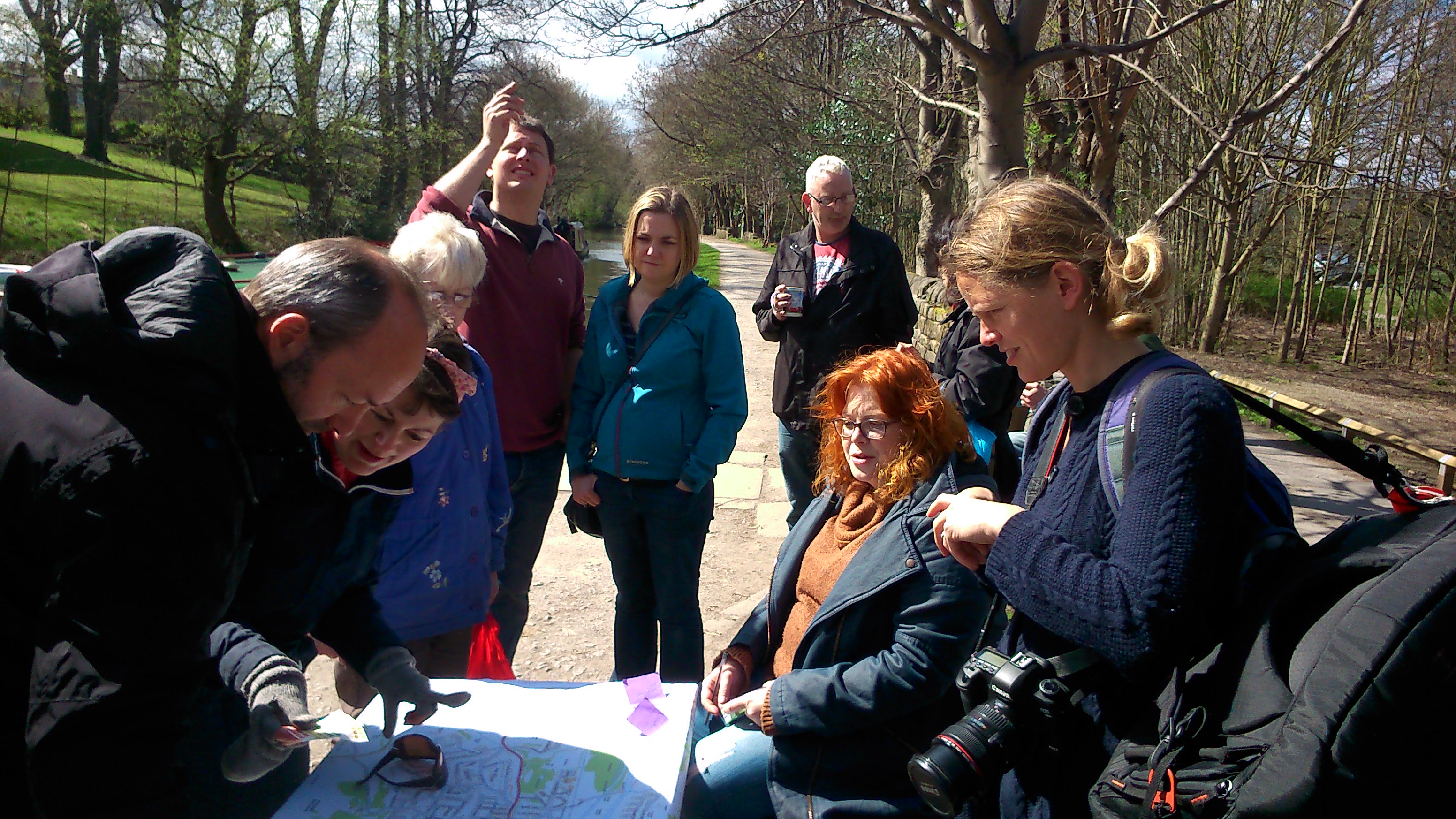
Our main contribution to the festival, though, was an interactive performance piece called Seven Bridgeswhich used the Ibis as its starting point. Spectators (participants, is probably a better word) toured themselves east along the canal towpath towards Dockfields in groups of 4 or 5, and along the way they were given some game-like challenges to complete. They also would encounter various performers. Here’s David Smith, for example, as a heritage tour guide from three hundred years in the future (2315), dressed as an ordinary canal buff from 2015 (geddit?), and pontificating about the significance of the “art” (aka graffiti) on Otley Road Bridge:

Shipley Arts Festival. 28.06.15

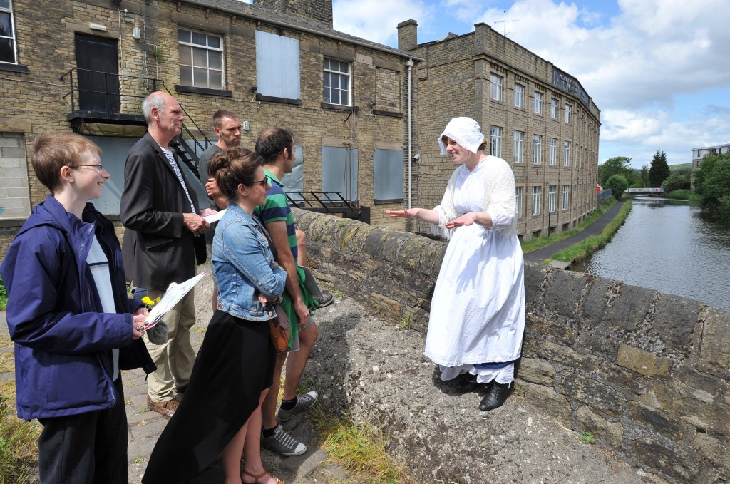
And here’s Lynsey Jones, as a Victorian lock-keeper’s wife (who did all the work opening the locks…), talking to spectators on Junction Bridge…

Shipley Arts Festival. 28.06.15Participants would make their way as far as the old Bradford Canal pumphouse, on Dock Lane, where they would share what they had gathered en route, before returning the way they had come, accompanied by the performers…

Shipley Arts Festival. 28.06.15

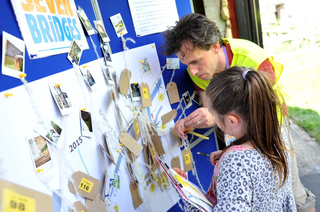
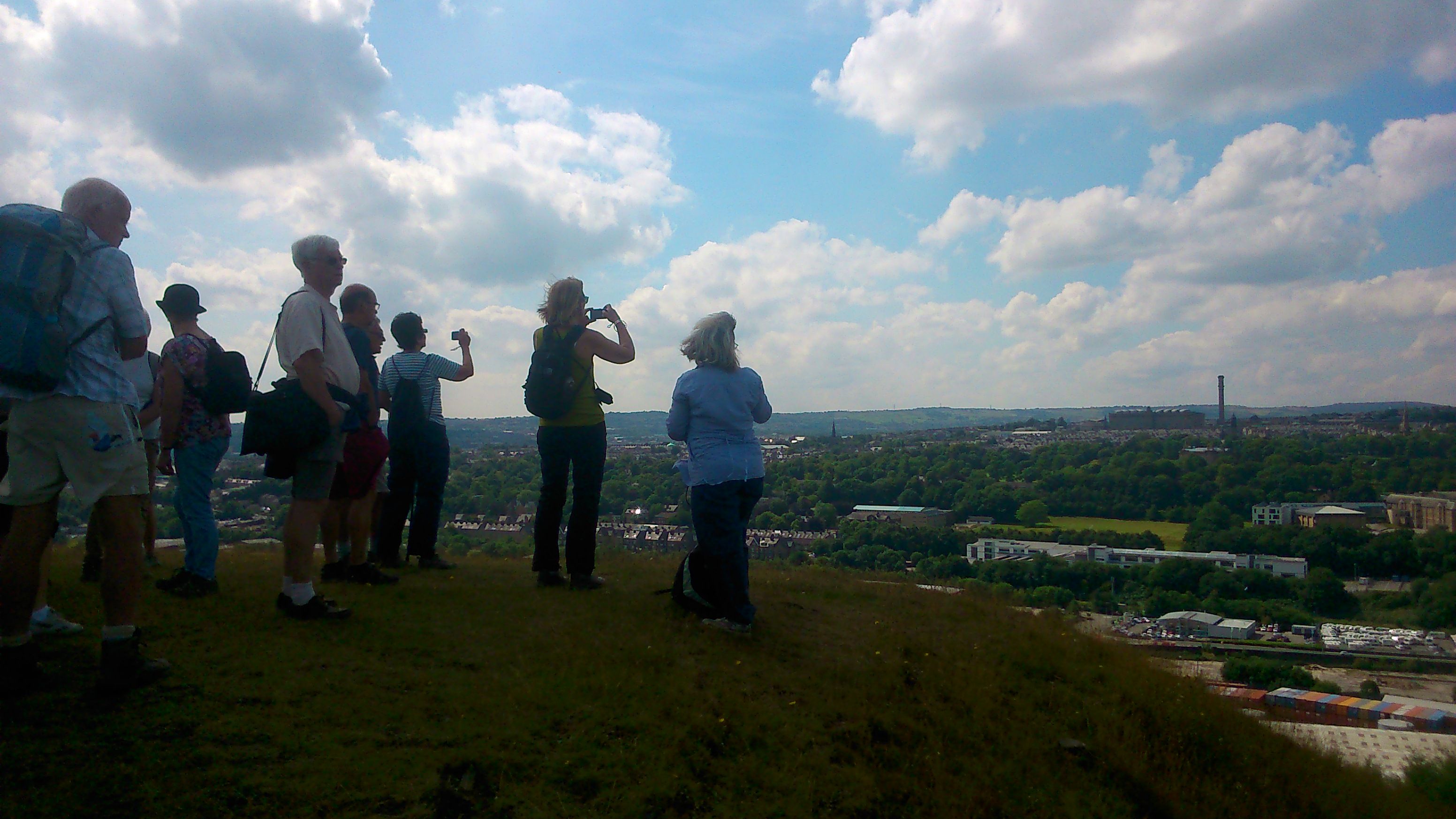
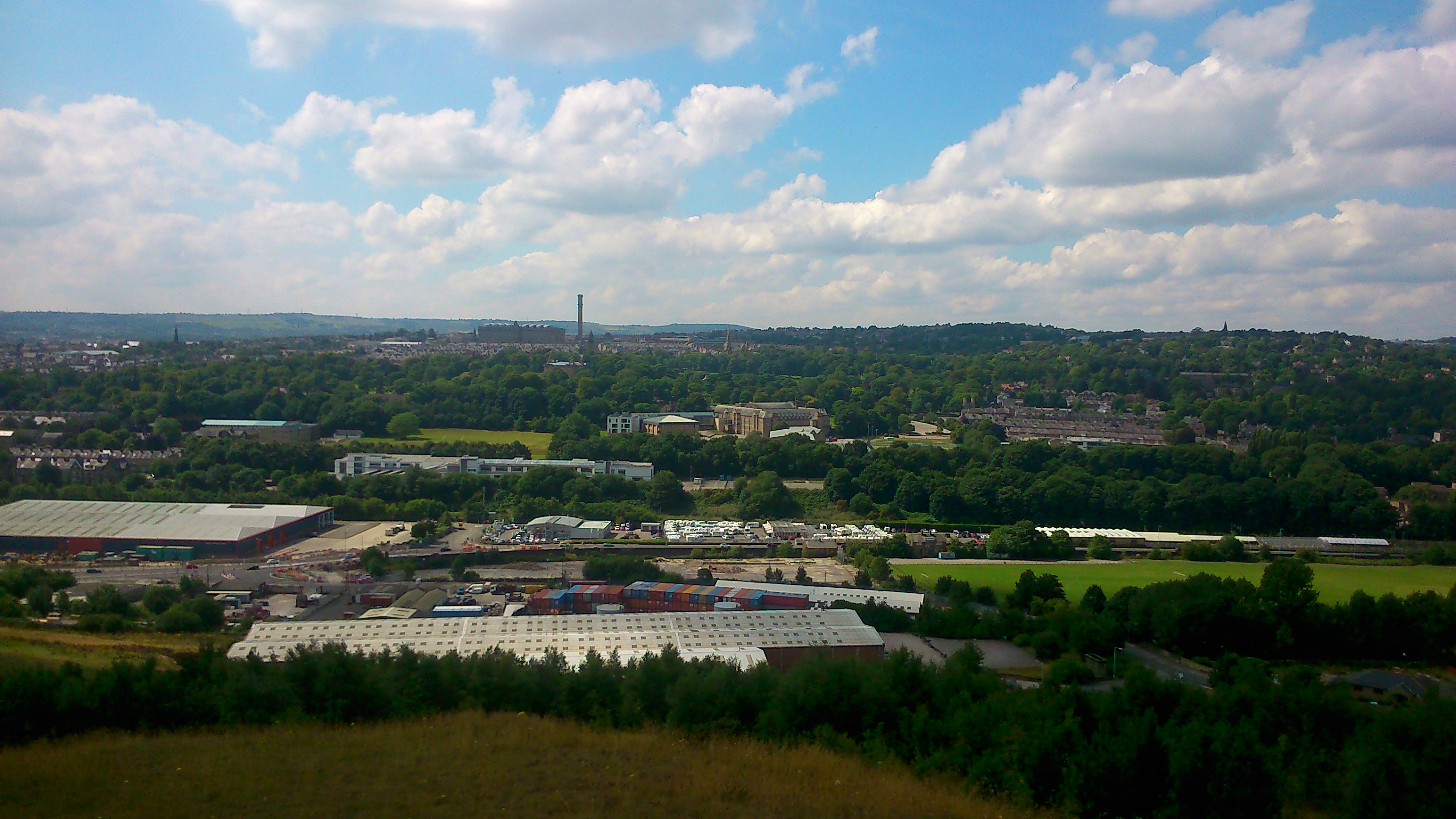
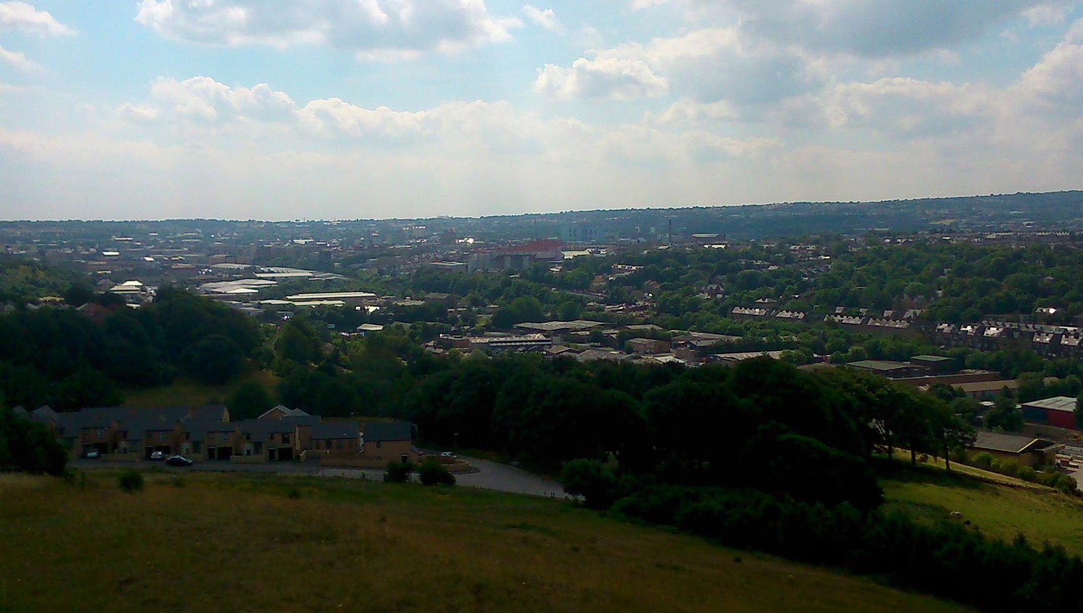
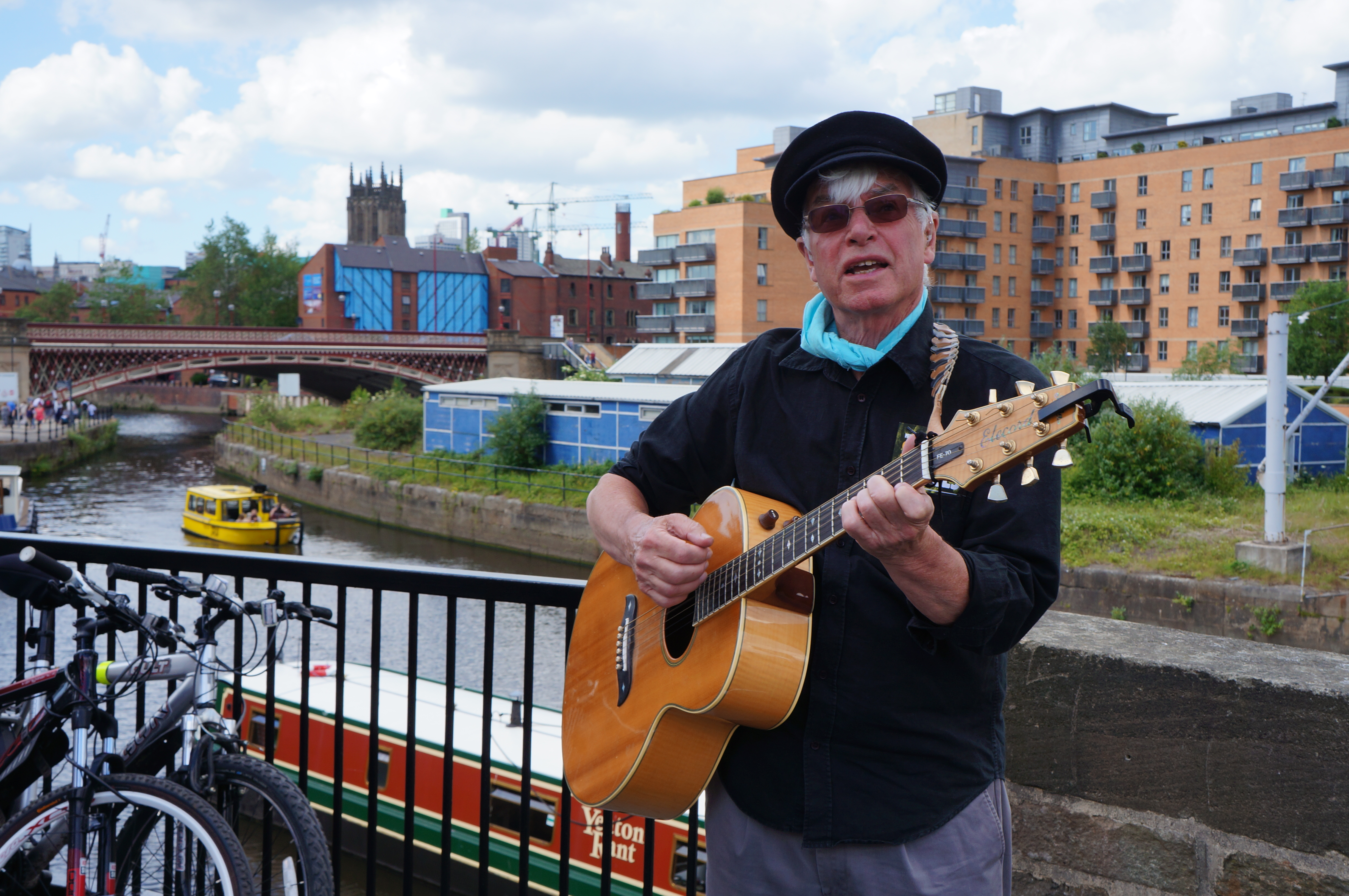
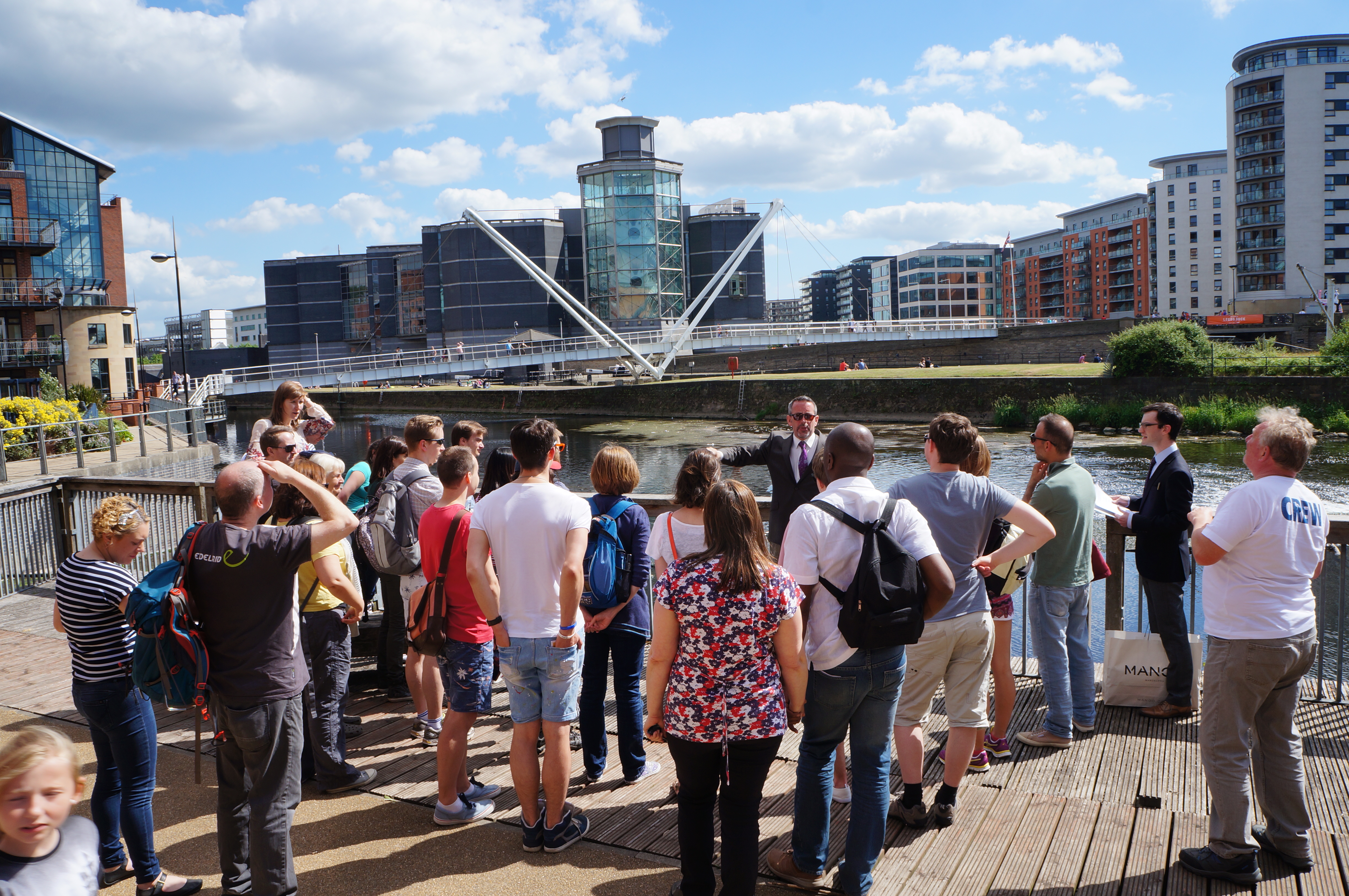
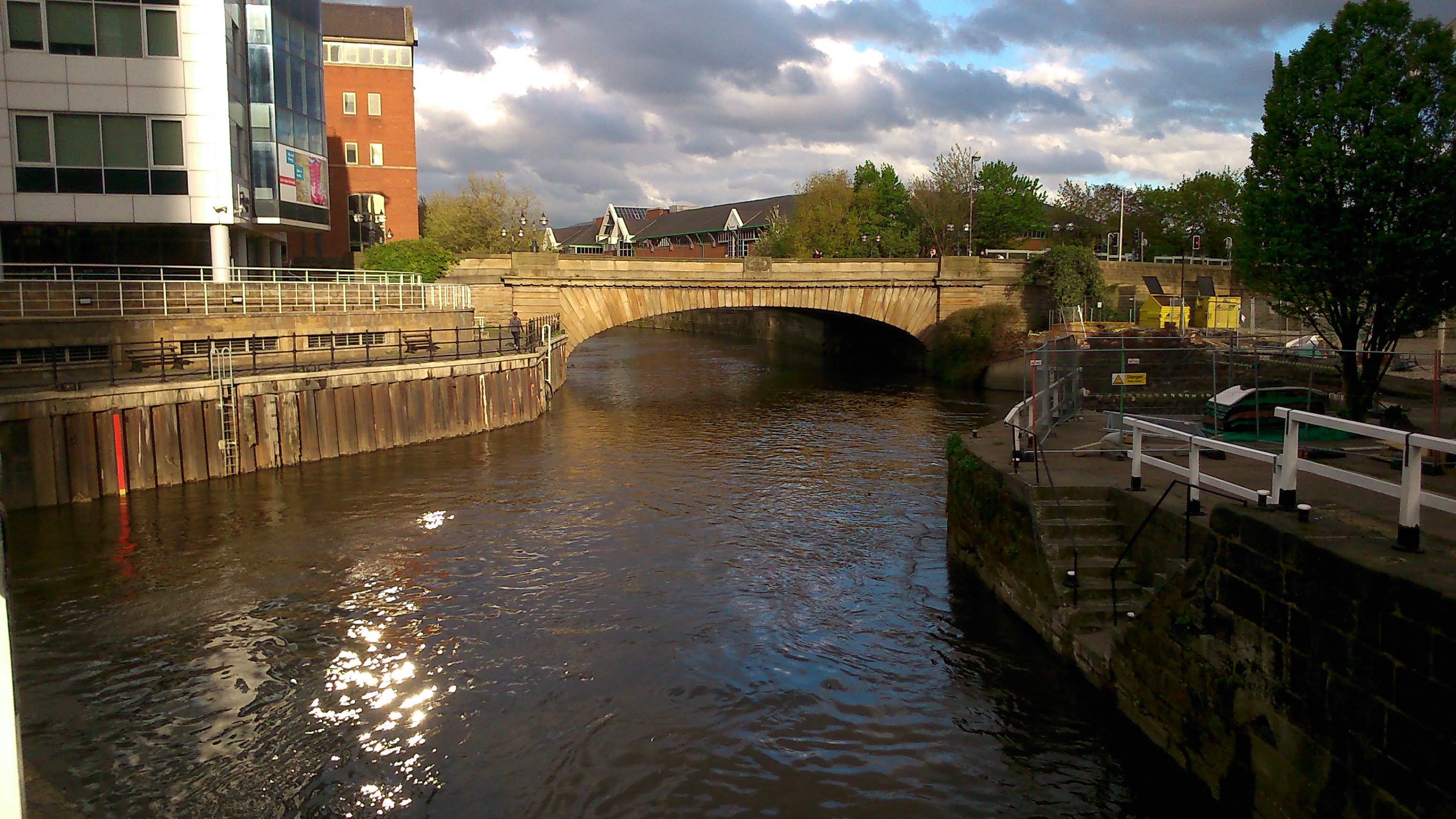
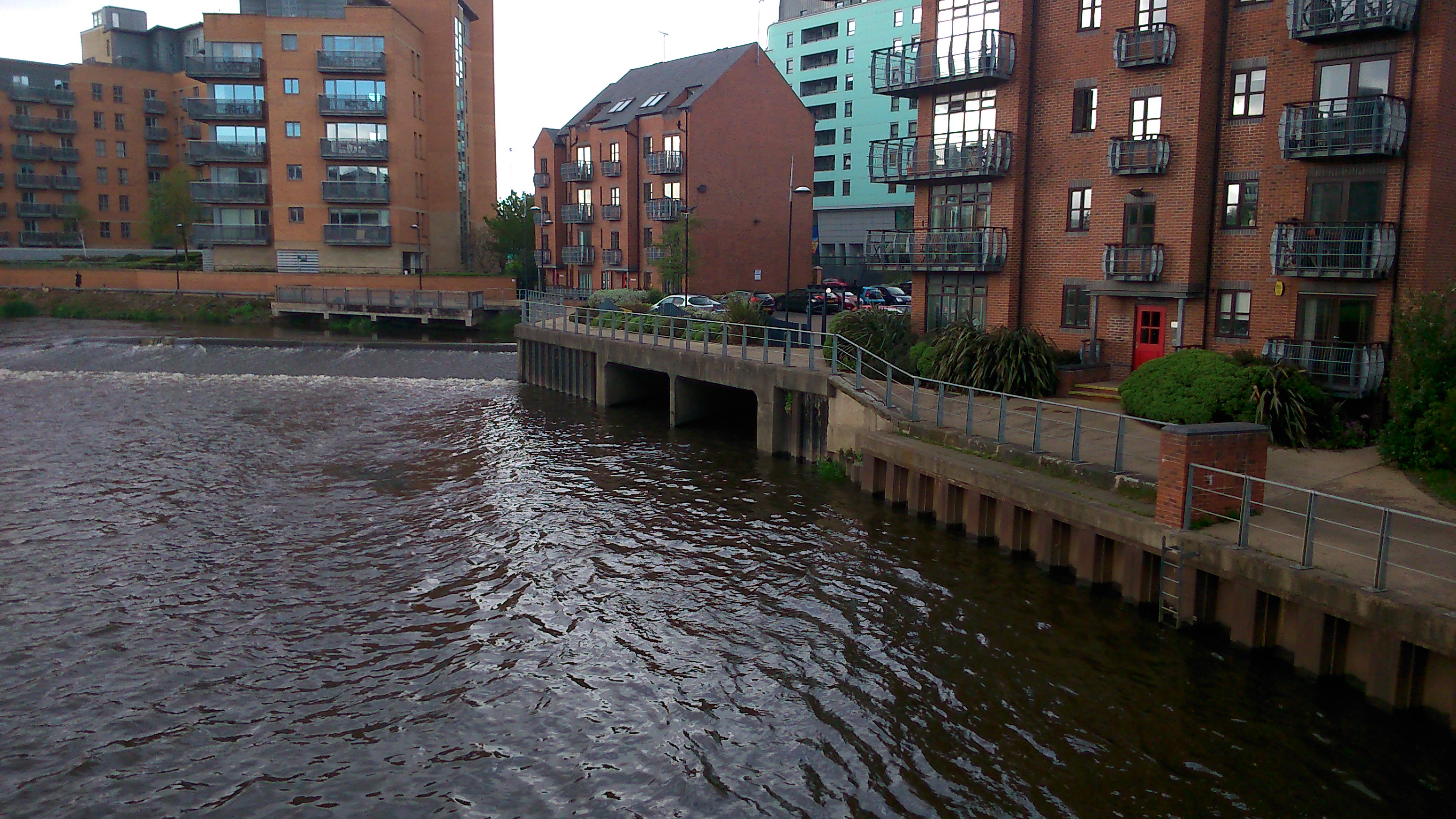
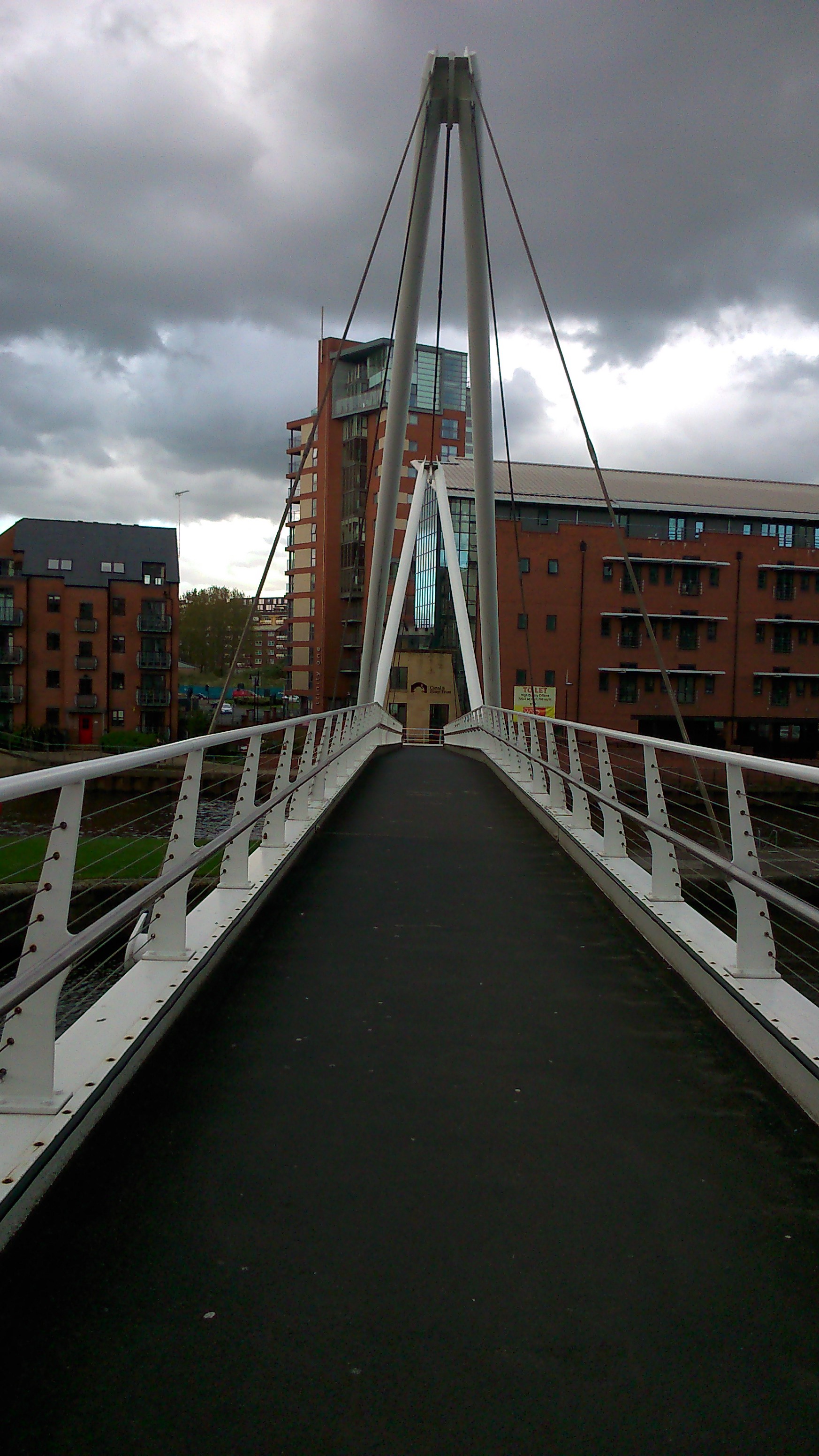
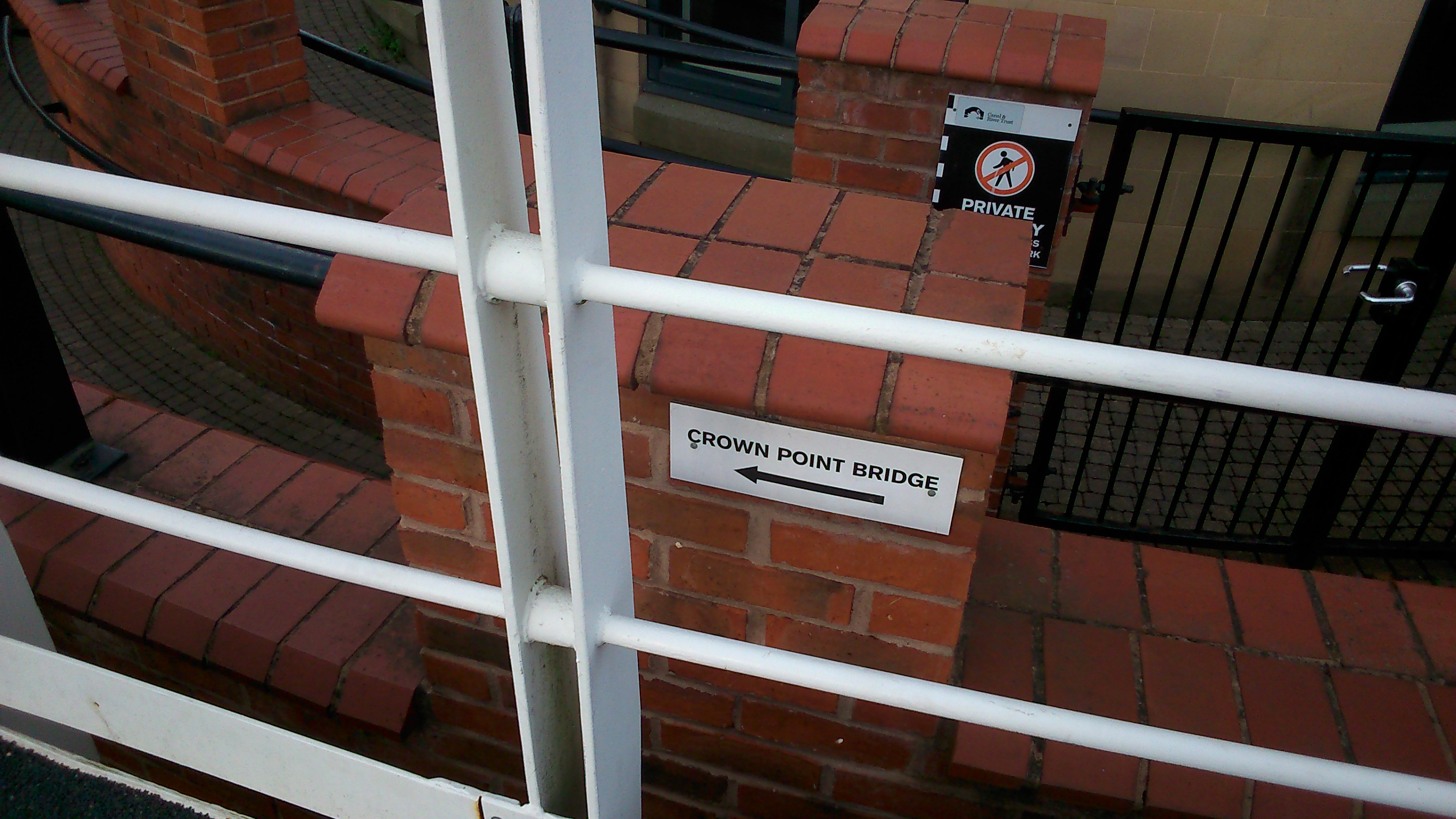
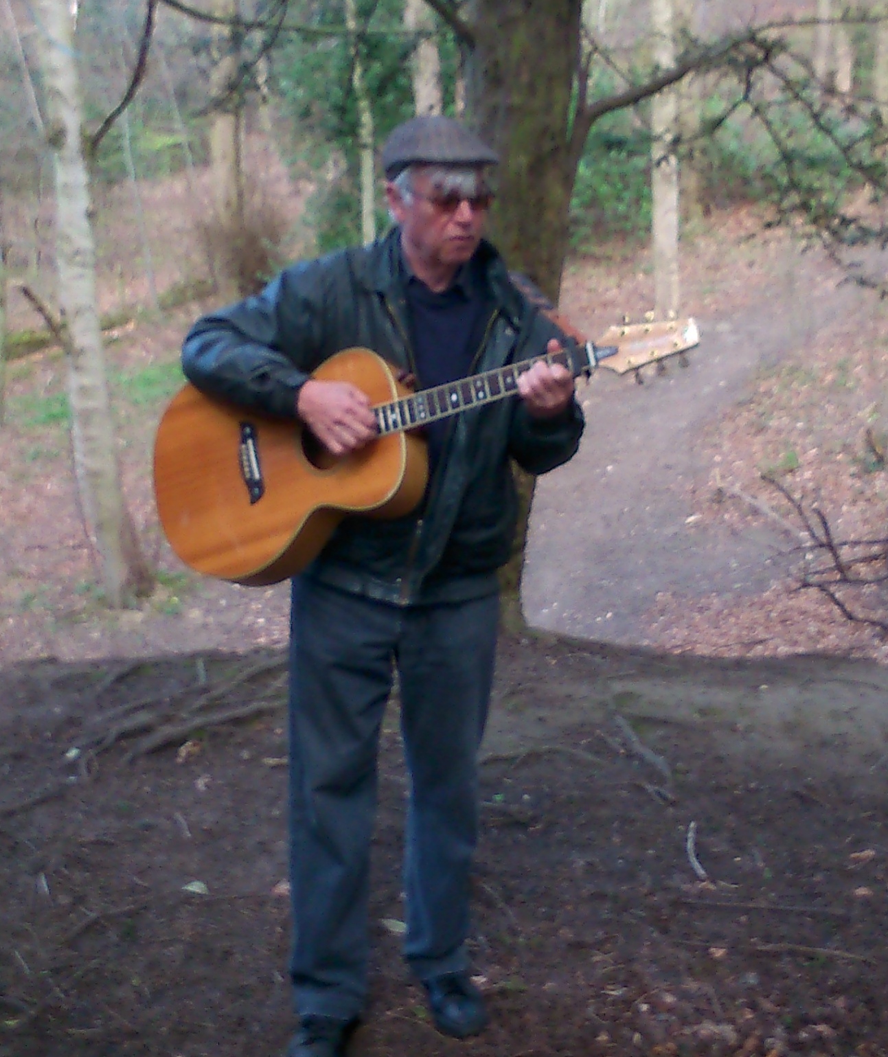
There’s more pictures and documentation of Seven Bridges (Shipley) if you look under the “Performances” tab on our menu bar… But for now, let’s turn our attention to its partner piece, Seven Bridges (Leeds)which we presented on the same dates at the Leeds Waterfront Festival. The idea was to “bridge” the two festival locations, upstream and downstream, if only conceptually… Obviously the Leeds version was on a bigger scale, with bigger bridges, and this one took the form of a guided tour rather than a self-led journey… Here’s musician Eddie Lawler (on a day out from his home in Saltaire) kicking the piece off at Clarence Dock (with Crown Point Bridge in the background) with an old canal song about the founding of the Aire and Calder Navigation, which turned Leeds into a “seaport town” in 1700…

DSC06079

But Eddie was just the “local colour” wheeled in to warm the crowd up by Don Freshwater (played by Steve Bottoms, below in the suit)… Don is a both little sinister and a little nuts… he claims to be the CEO of something called the “Leeds Re-Development Corporation”… As Don explains below (in front of Knights Way Bridge and Clarence Dock on the far side) the audience has been gathered as “consultants” to help decide how to redevelop the waterfront… The “ordinary people of Leeds” were never consulted in the past about these matters, so Don wants to consult them now… except that he doesn’t really, because he likes the sound of his own voice too much.

DSC06149

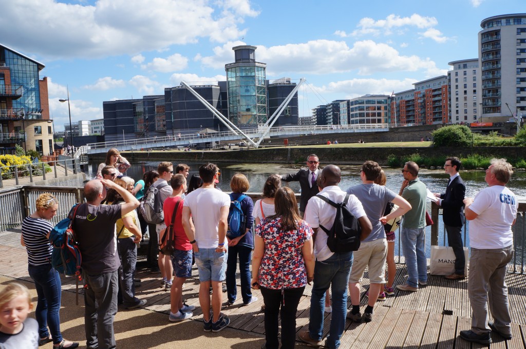
Again, there’s more photos and more detail on this slightly barmy performance (with a serious edge to it) if you look under the “Performances” tab above. Both versions of Seven Bridges were very well received, and pointed us in some interesting directions for future work.

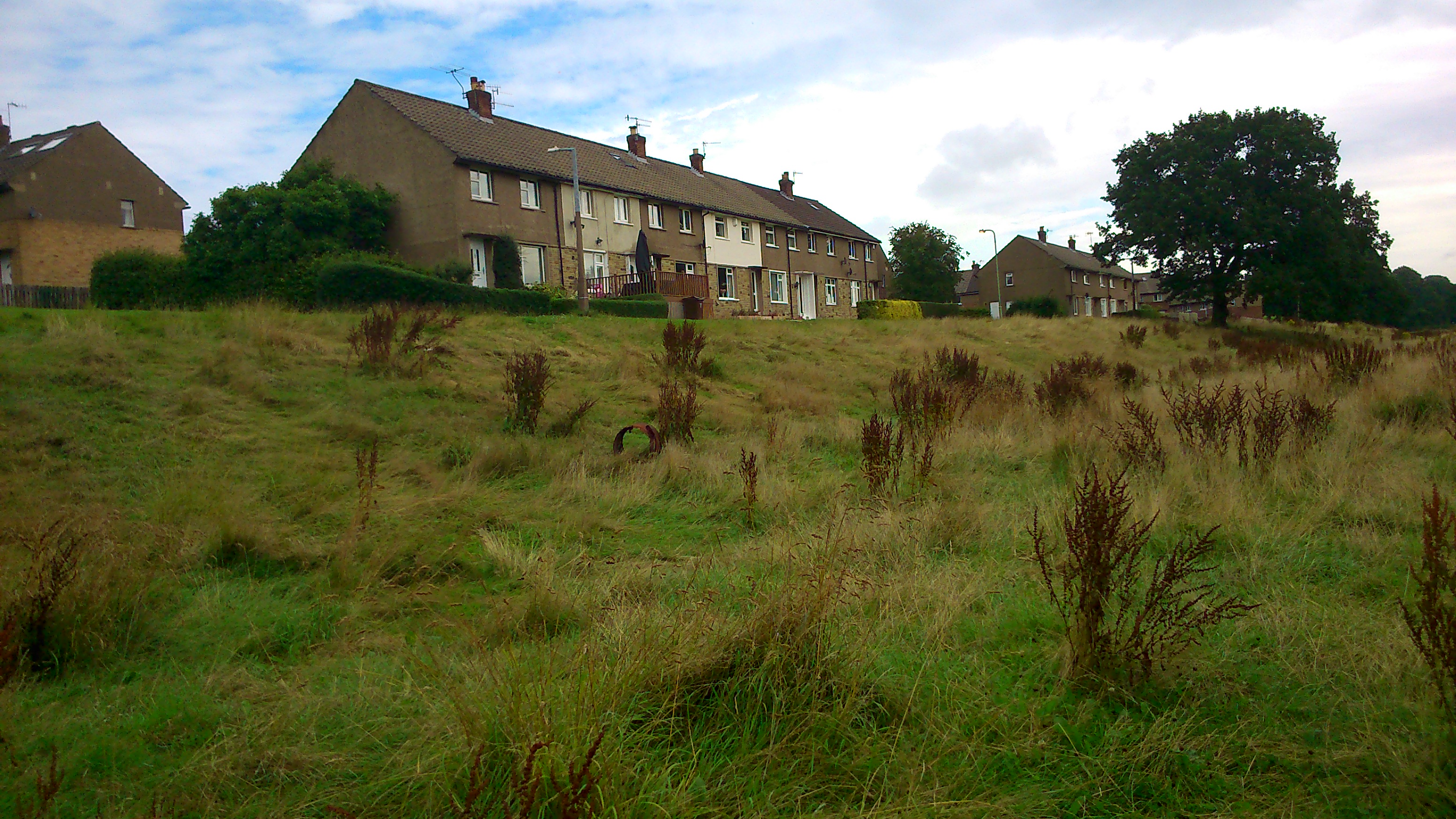
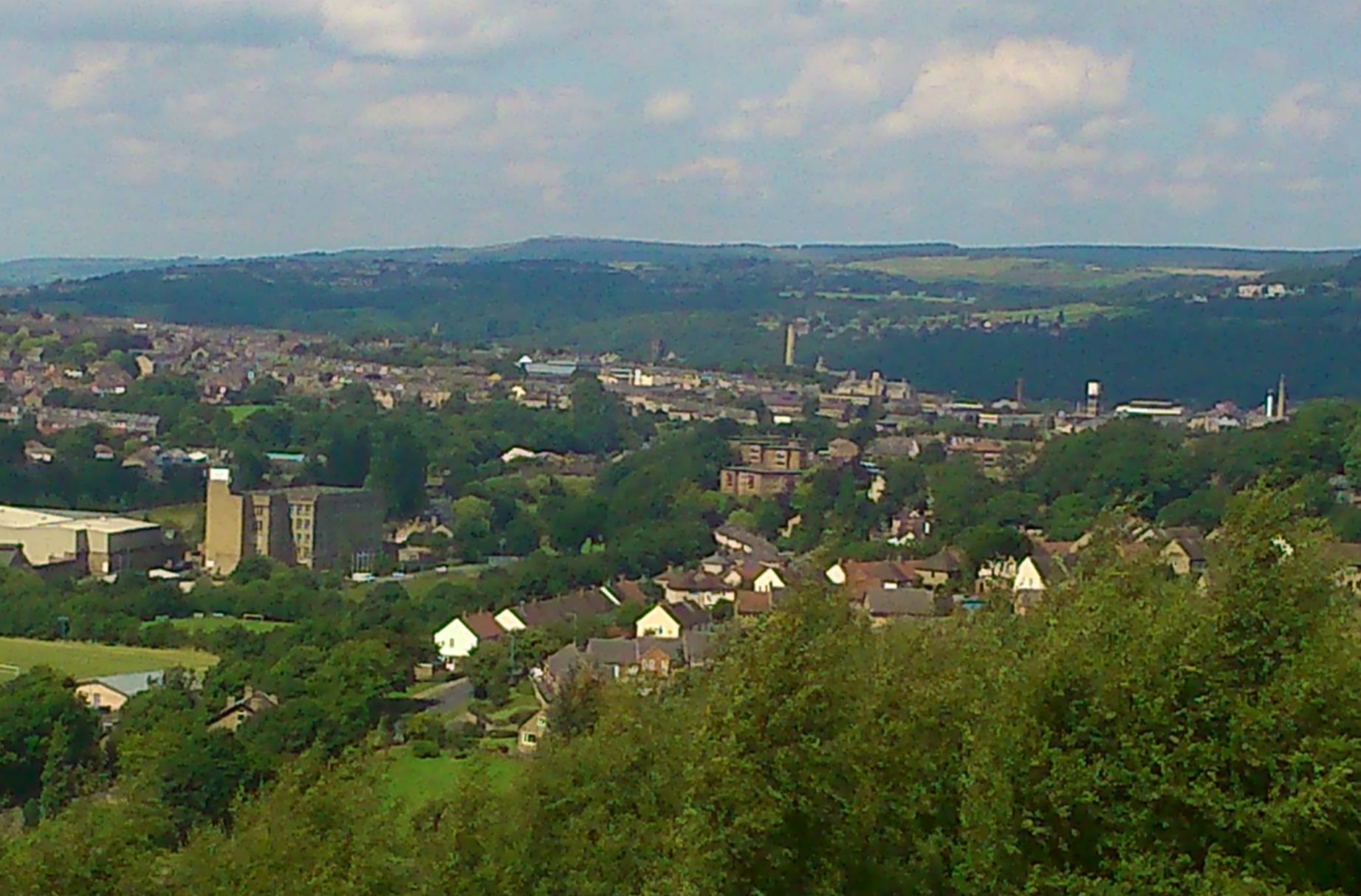
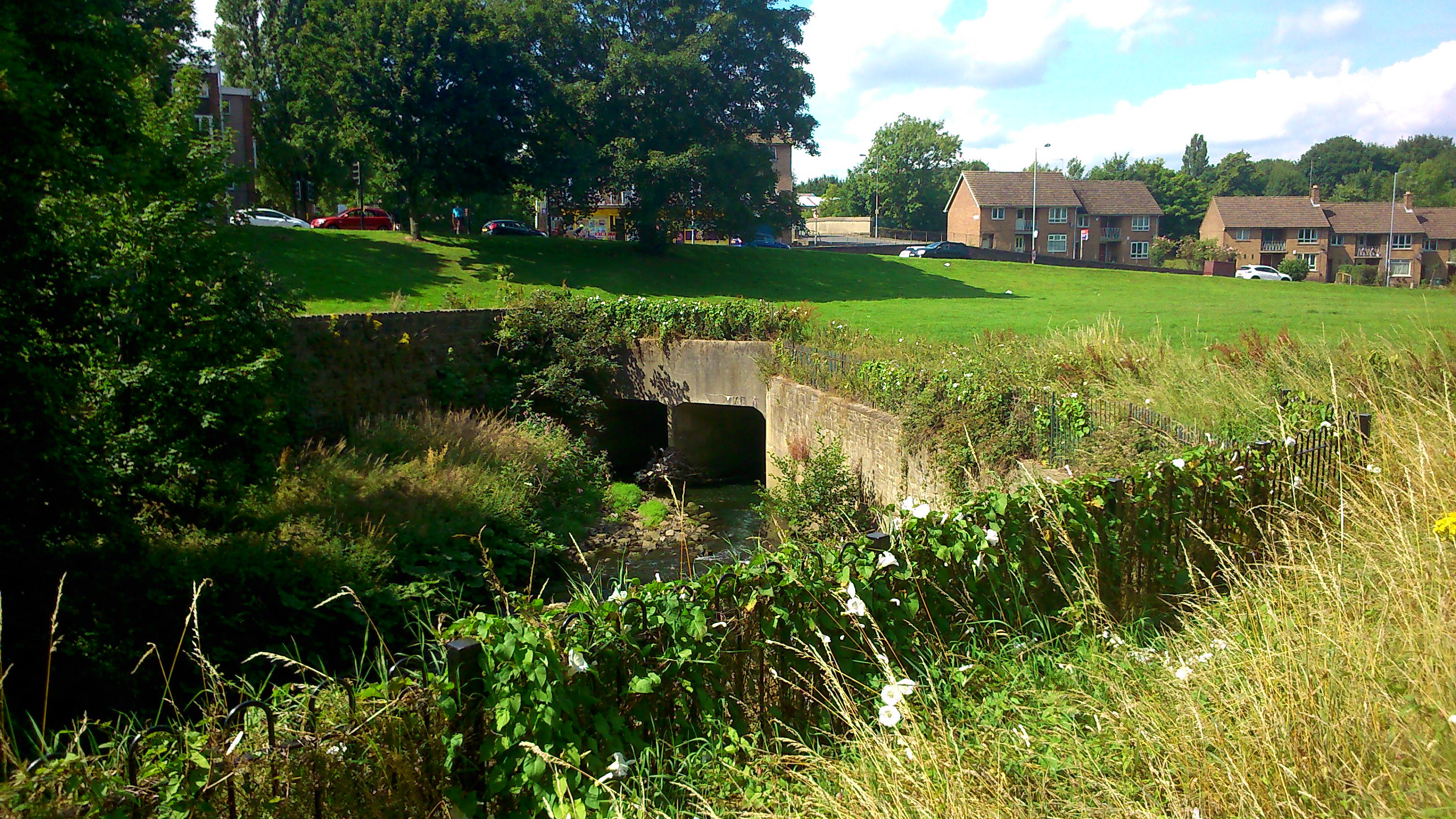
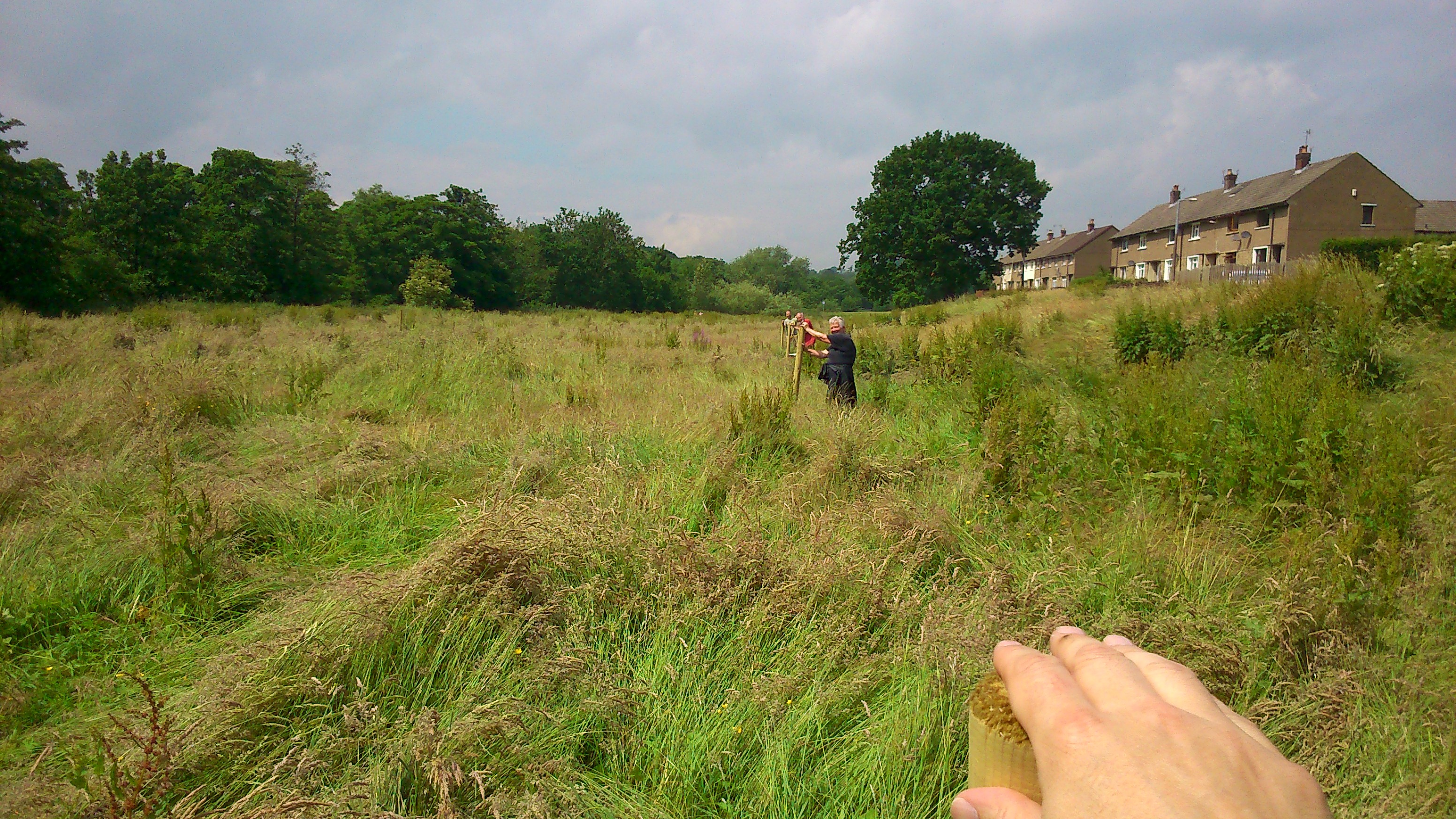
But in the interests of catching up with ourselves, let’s turn our attention now to this last weekend, spent in the flood plain meadow between the River Aire and the Higher Coach Road estate, west of Roberts Park (is it Saltaire, Shipley, Baildon..? you decide – there’s a case for all three). Preparations for the weekend began, in fact, a week earlier, when we sledgehammered a series of fence posts into the field in a rectangular pattern…

DSC_0030

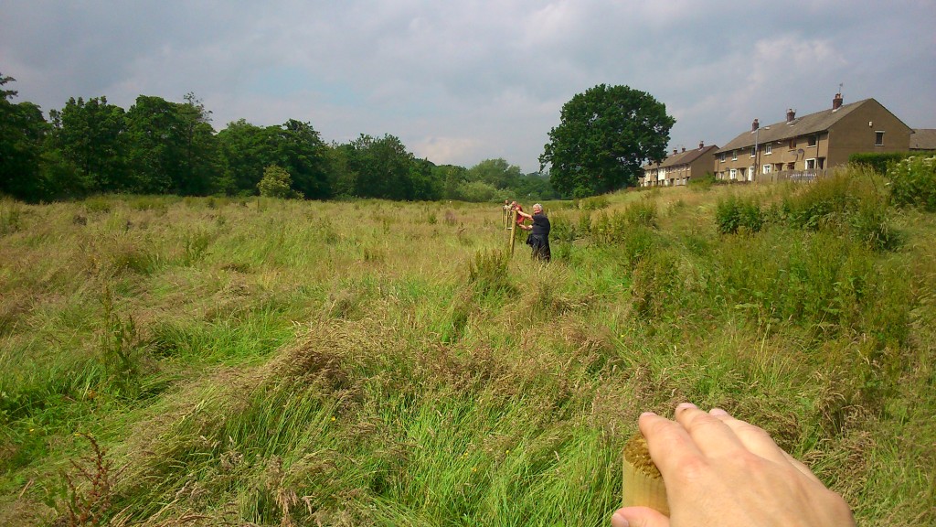
Three fenceposts in a row… that’s Steve’s hand in the foreground, Pat Gledhill with the second one, and Matt Blakeley with the third, obscured by Pat because our line was so straight! (well…)

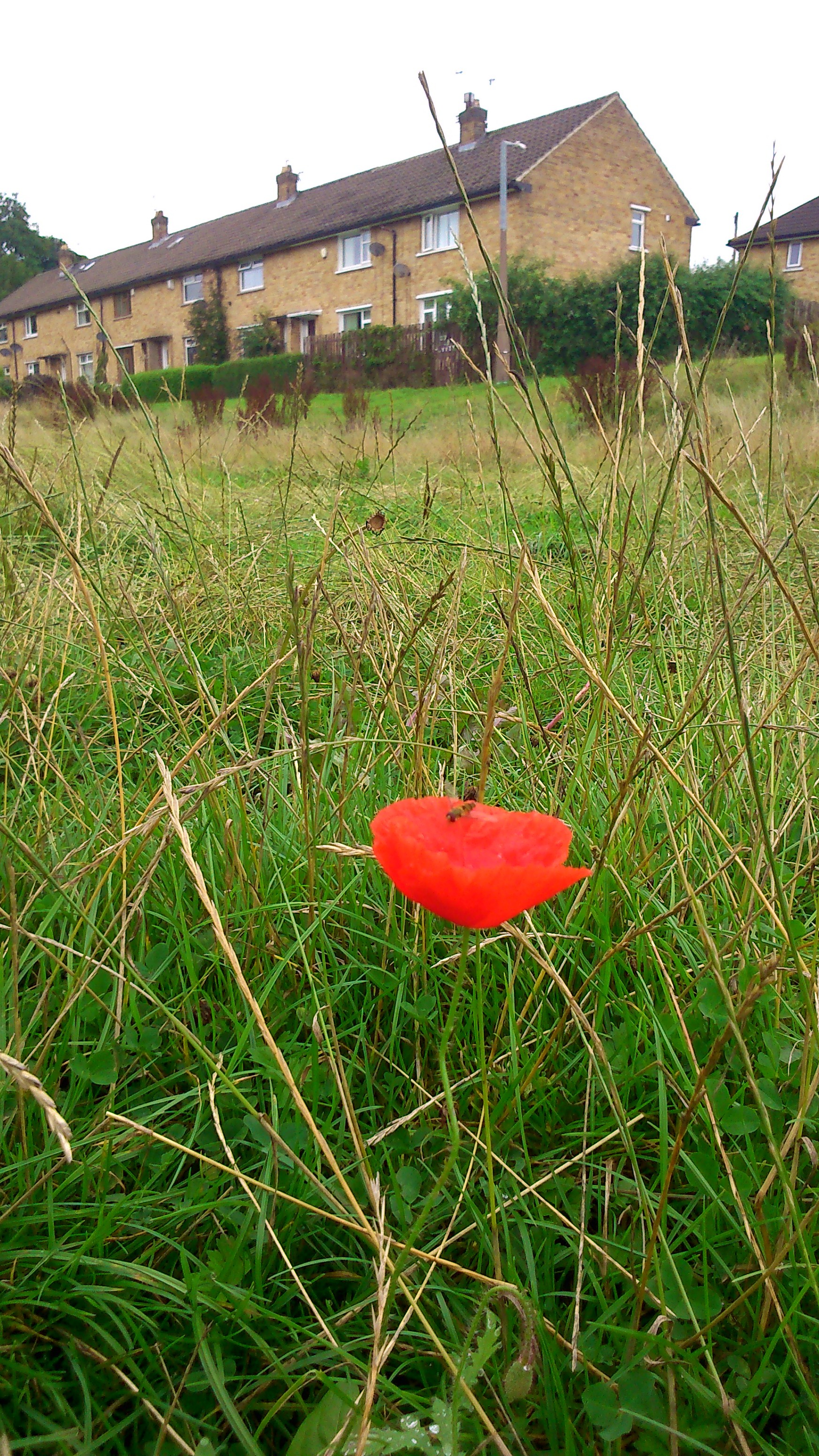
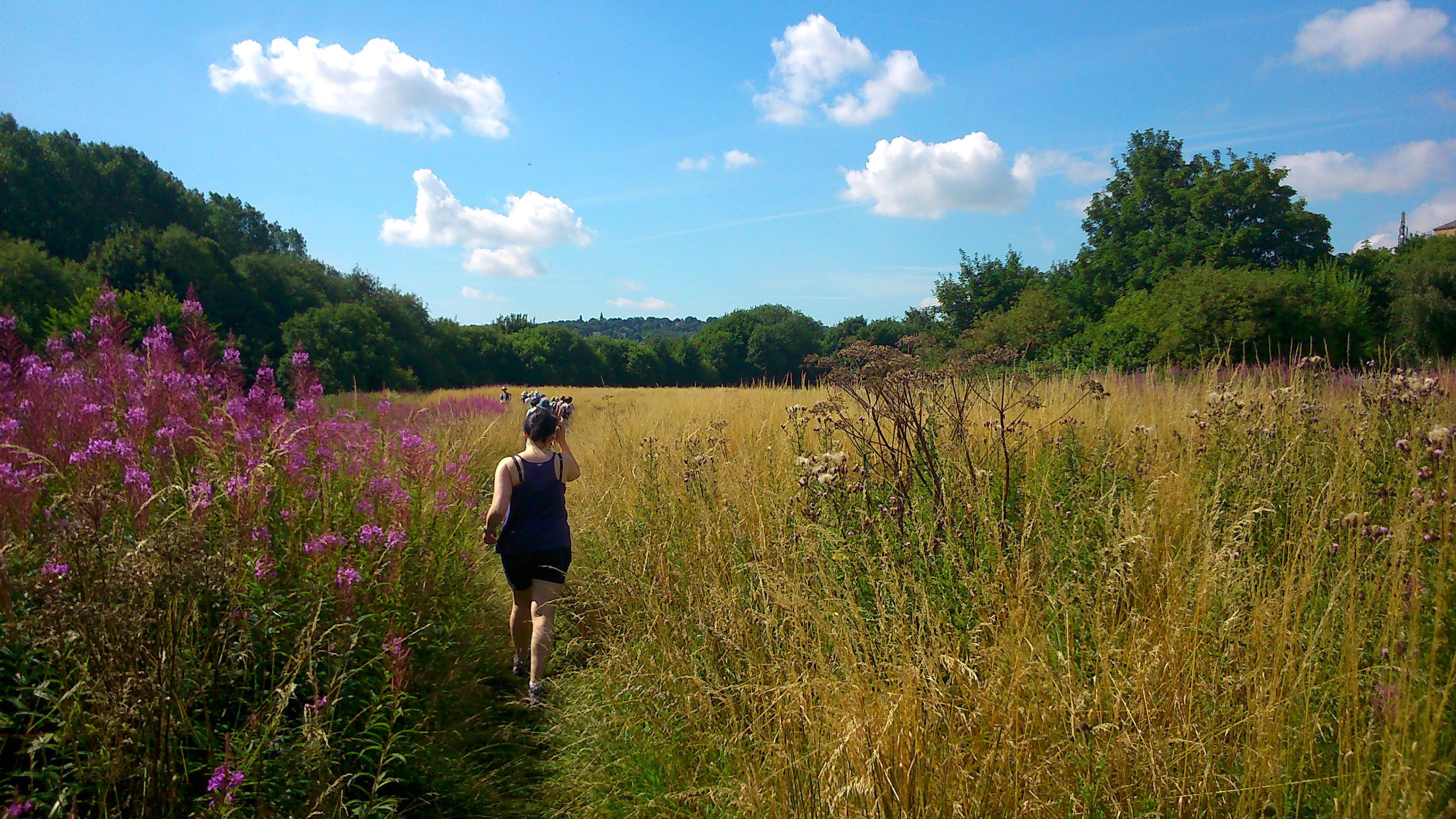
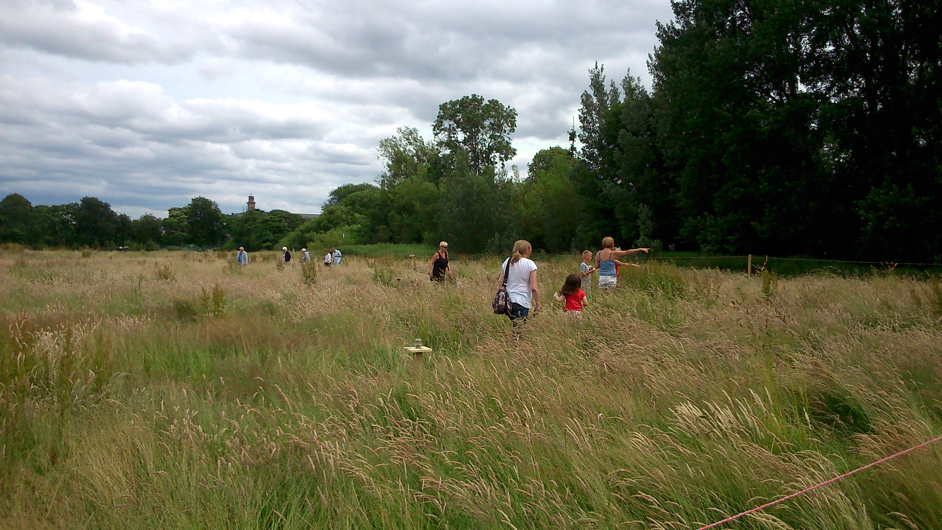
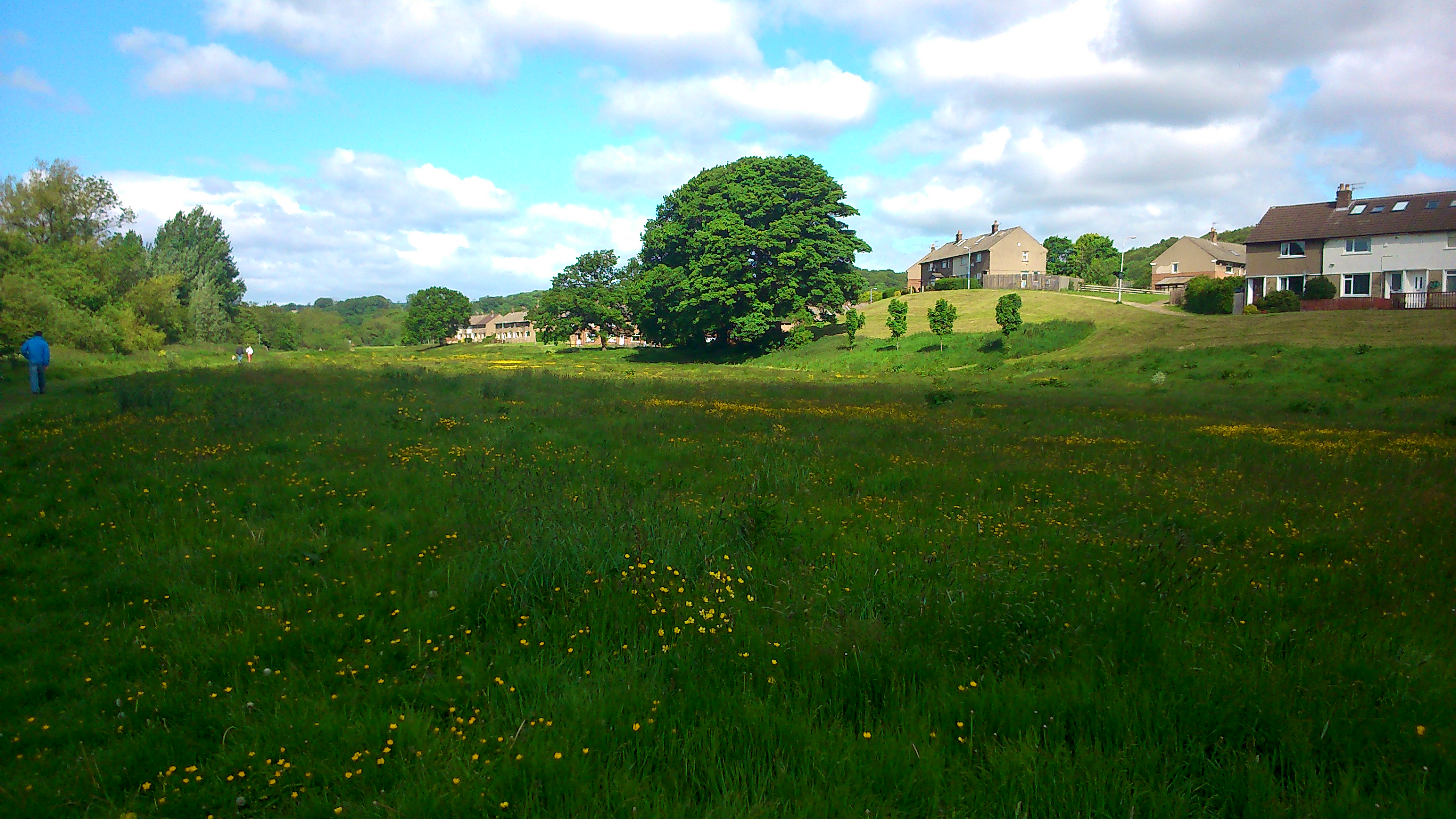
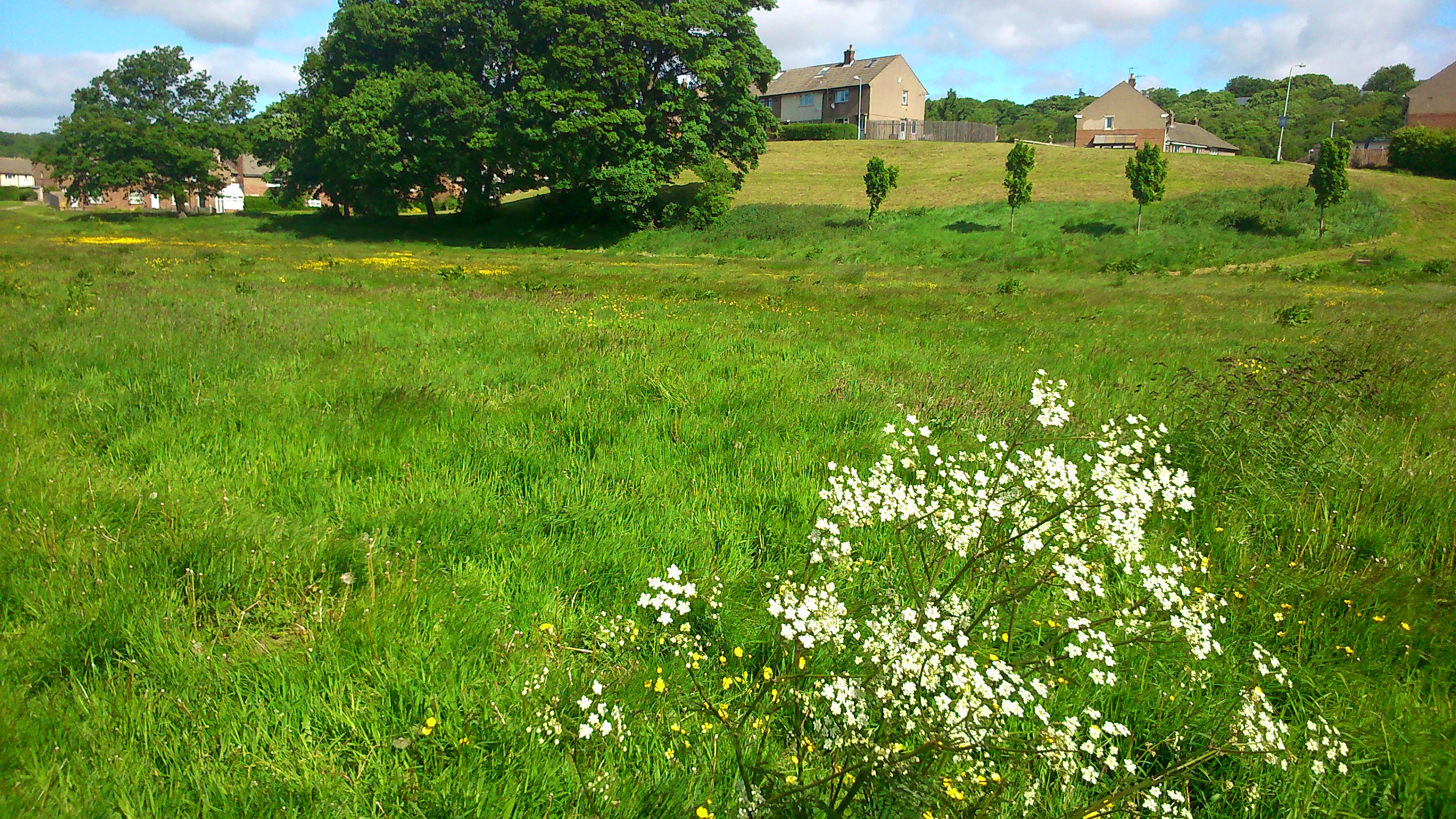
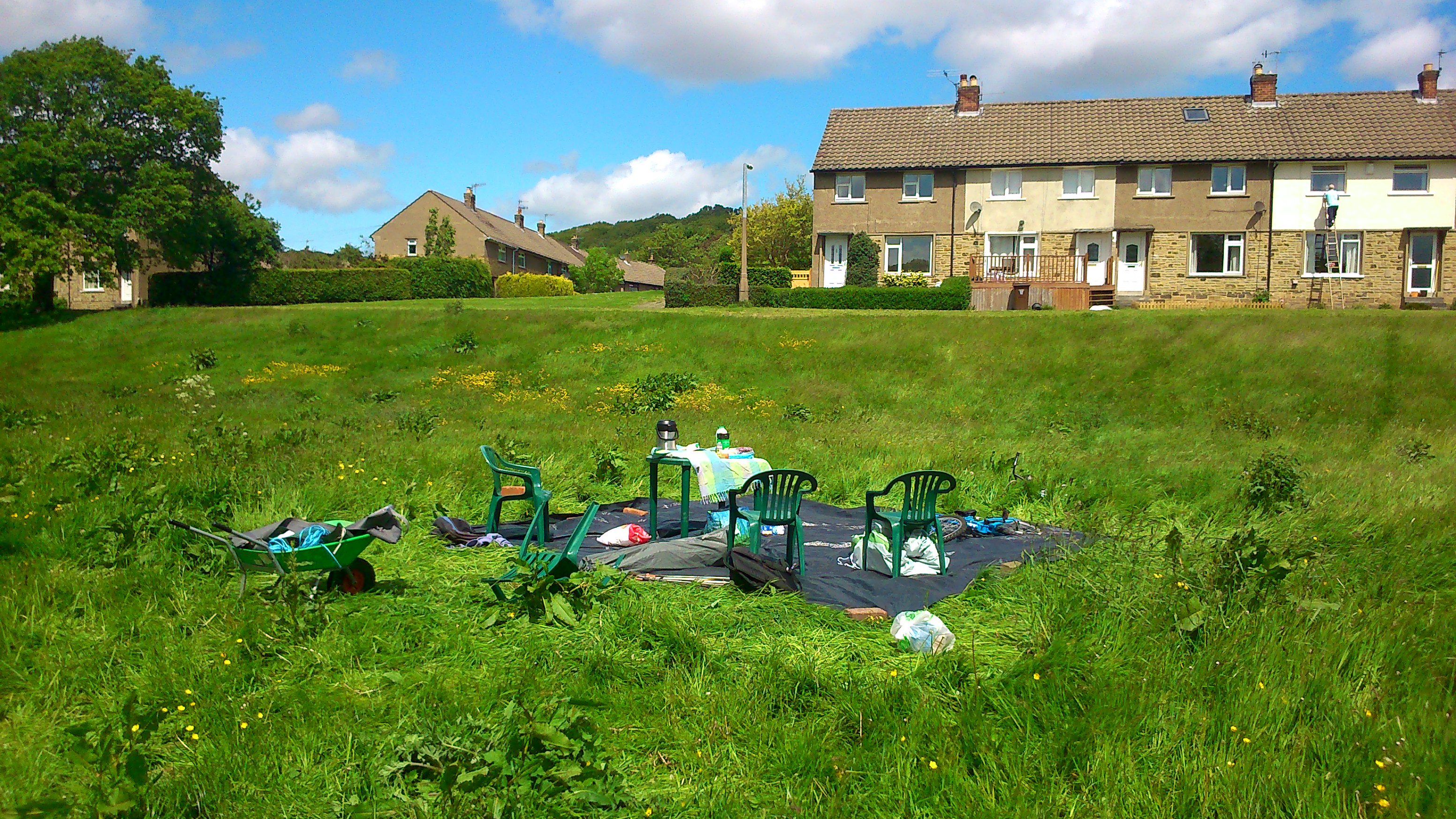
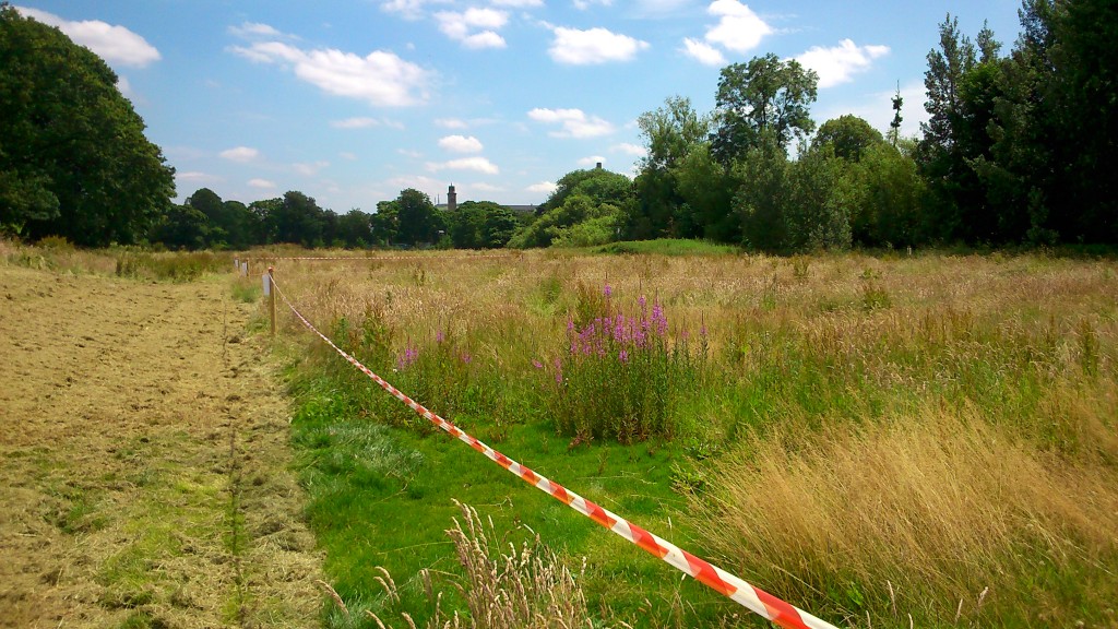
Notice how much longer the grass is than even last month (see previous post, “Meadow Madness”, where it’s much shorter and greener, with more buttercups visible). Basically Bradford Council have said that – with austerity cuts and the resulting loss of manpower and mowers – they will not cut the grass in this field as often as they used to. They did, however, oblige us by at least sparing the time to cut a swathe around our staked-out rectangle, so that by this last weekend, it looked like this:

DSC_0043
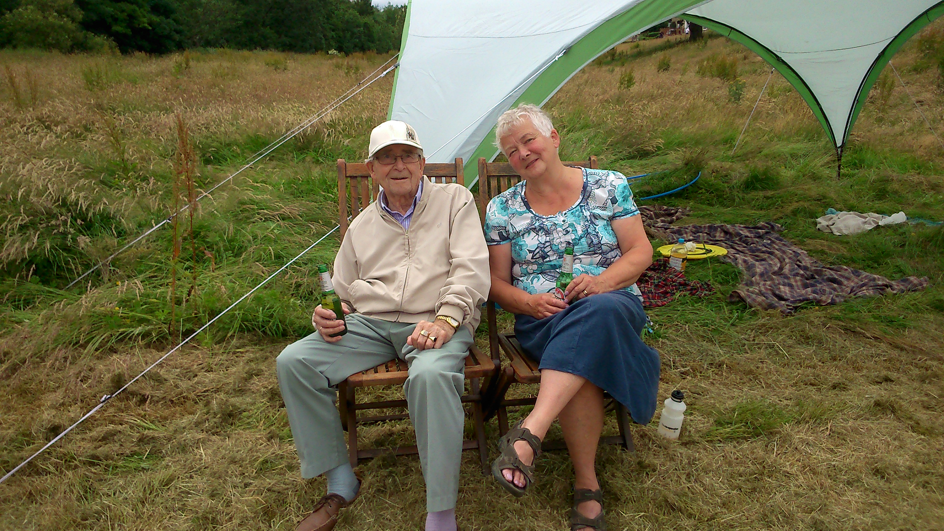
On Saturday afternoon (July 11th), in the cleared area on the outside of the staked-out rectangle, we held a community barbecue for residents on the estate – with conversation, games for the kids, etc…

Picture2


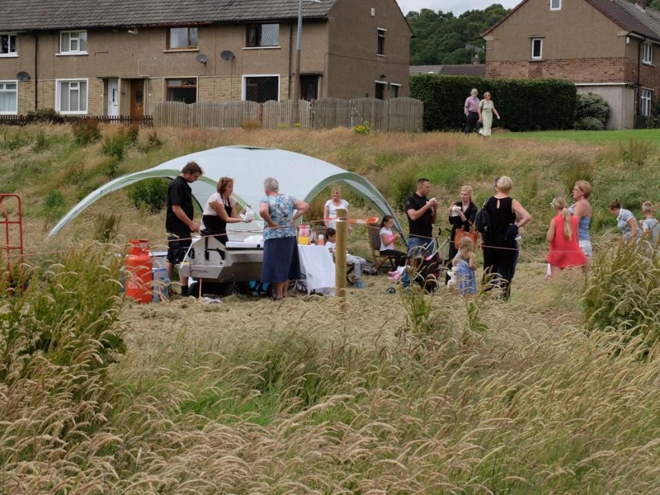
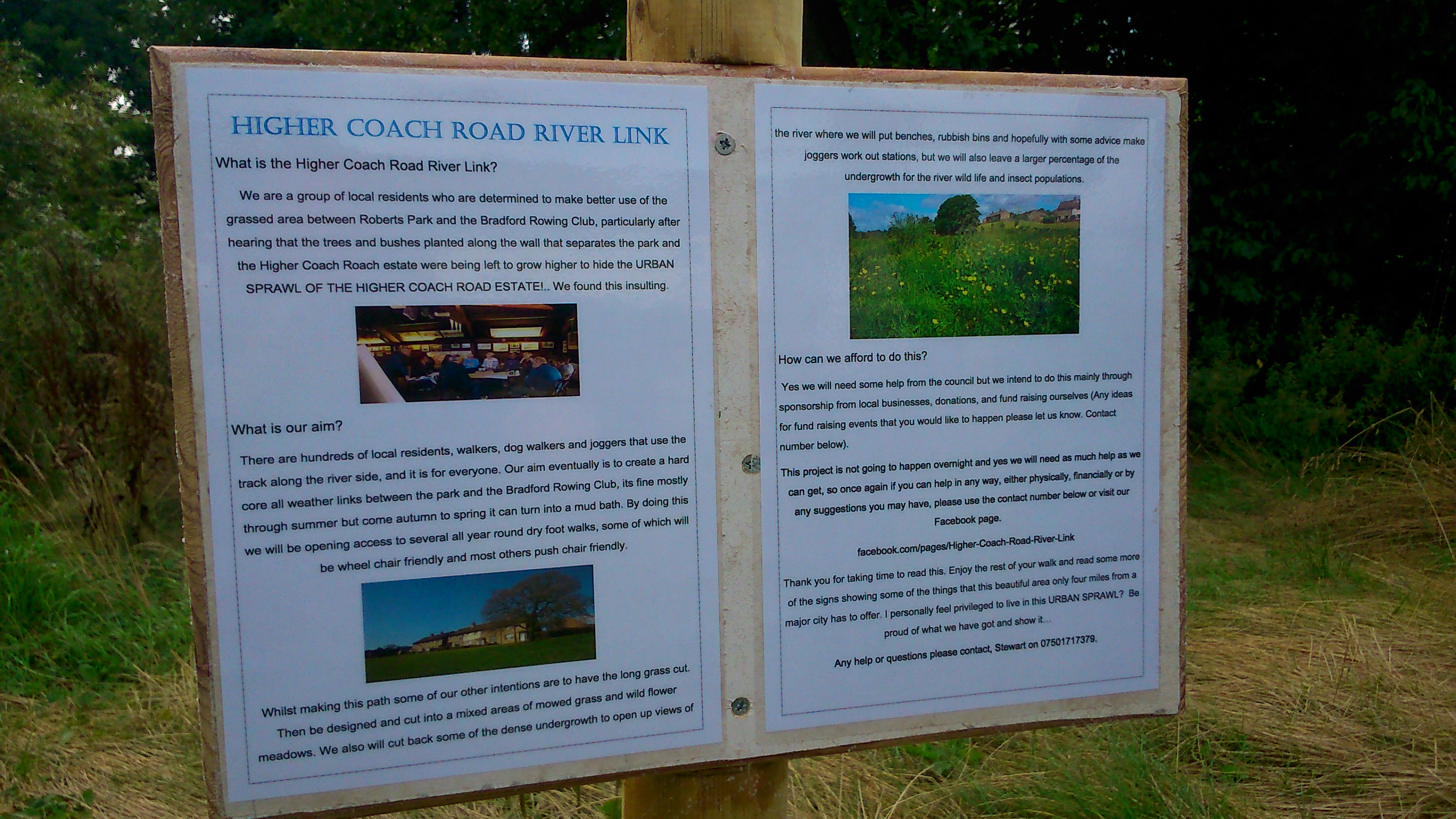
This was part of our ongoing engagement with residents here, as we (and our colleagues at Kirkgate Centre) work with them on developing some plans for this riverside field… People would like to see a proper footpath, for instance, and other improvements, but the main focus today was the grass… Some residents, understandably, think it’s a disgrace that the grass has been left to grow this long — they feel it looks scruffy, and embarrasses the neighbourhood, and want us to pass on their anger about this to the Council. Others, though (perhaps a majority of those we spoke to this weekend?) seem to think that, if this is to be a meadow in future, then perhaps something more could be made of it — by planting colourful wildflowers, for example, and cutting at least some areas so that it all looks a bit more intentional and a bit less scruffy…

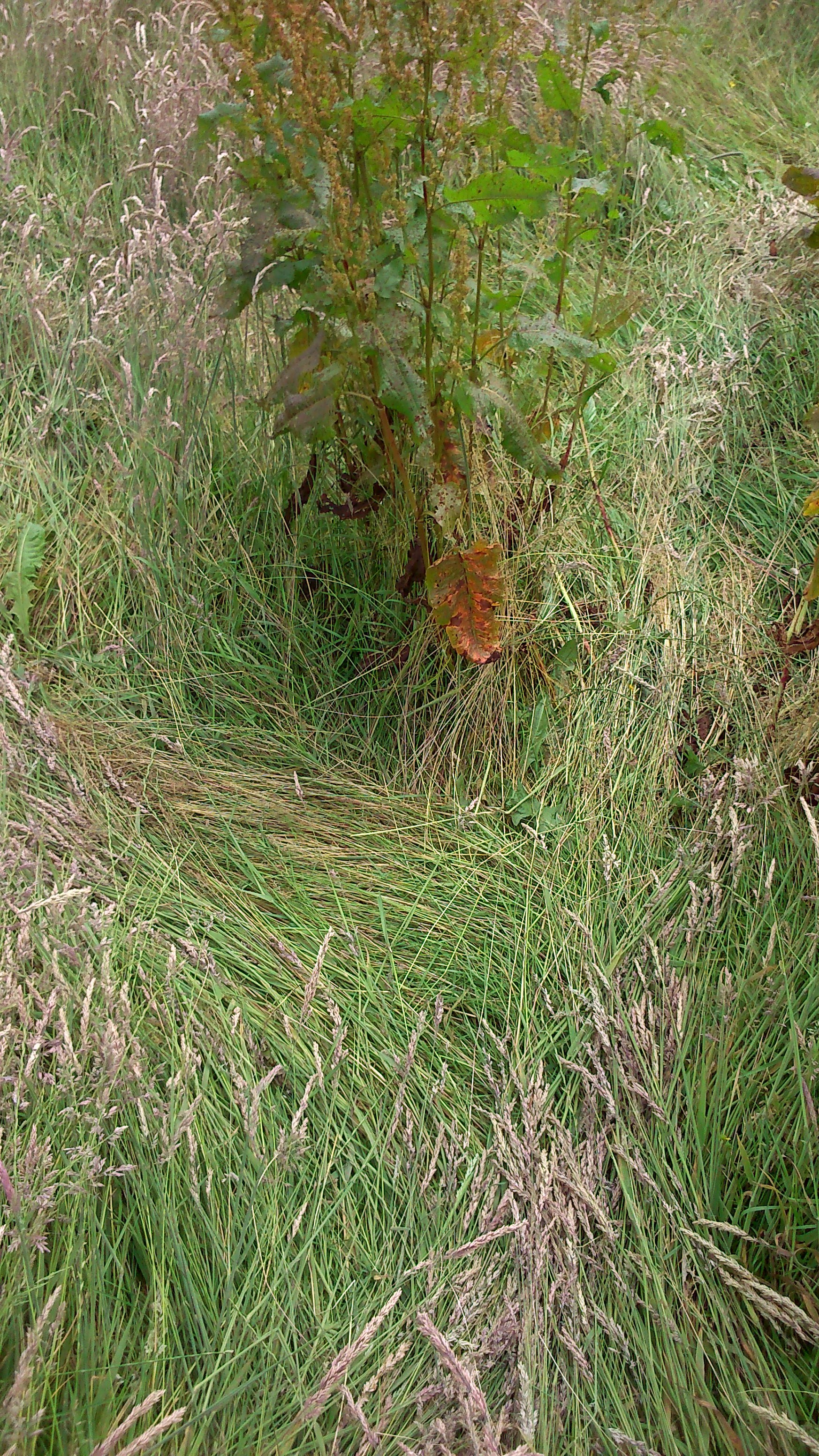
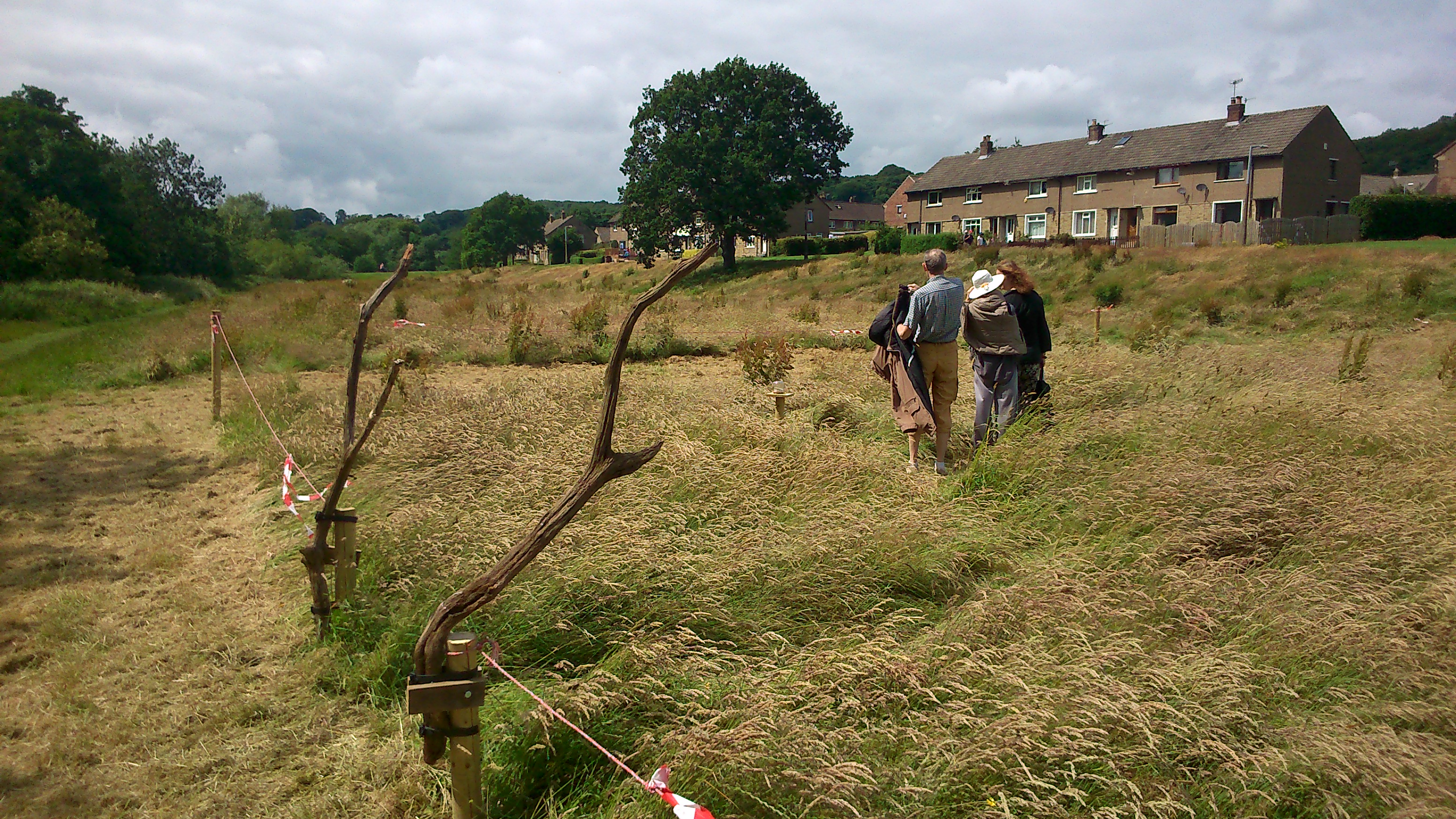
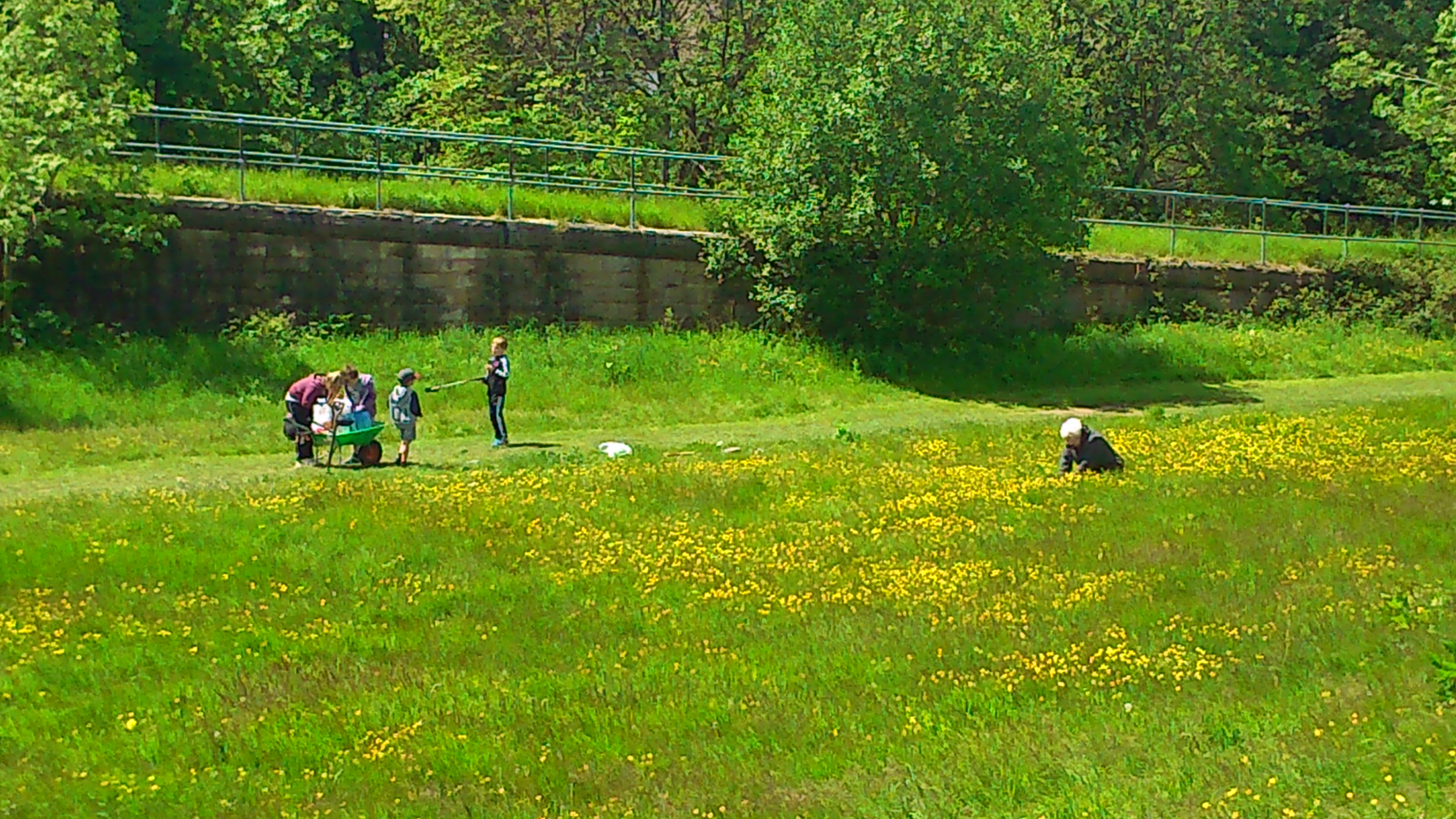
In an attempt to help focus this discussion, by drawing attention to what long grass is actually composed of up close, we created “A Meadow Meander” within the fenced off area. This is a mazy walk created by treading the grass down into a carefully planned set of looping pathways… So for example, in the picture below, you can make out a “Y” junction, where the “lie” of the grass could take you in one of two directions.

DSC_0040

As this picture also starts to suggest, left to their own devices, there are a LOT of different kinds of grasses and other plants growing in the field, and they merit some close up attention… “A Meadow Meander” is the creation of artist Baz Kershaw, and his Earthrise Repair Shop. Baz has created similar installations in various other UK locations, and for this one he had placed a series of jars on small plinths, to be discovered as you move around the maze…Picture3

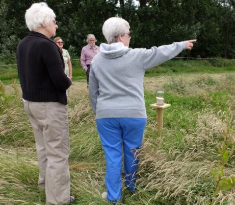
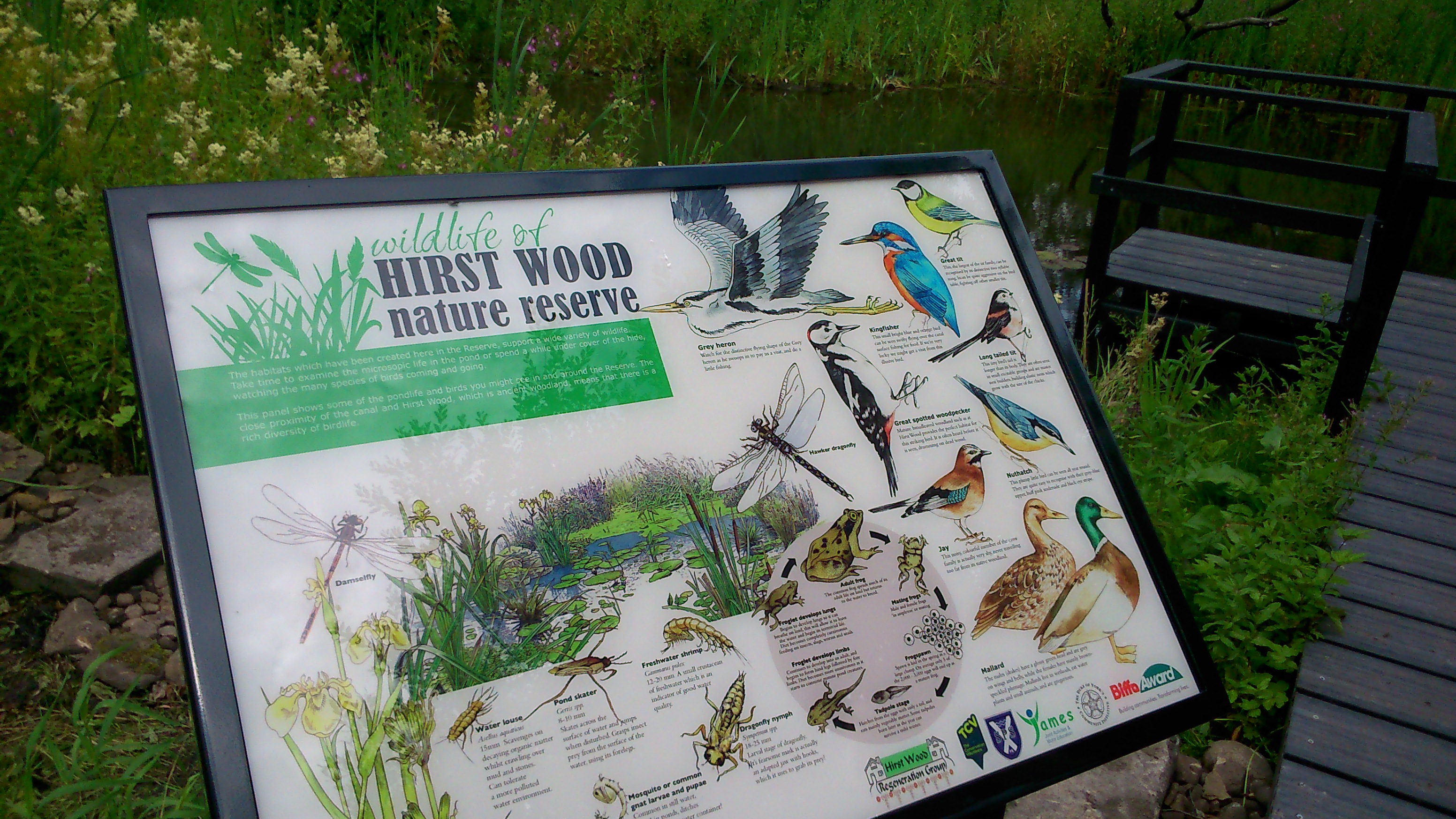
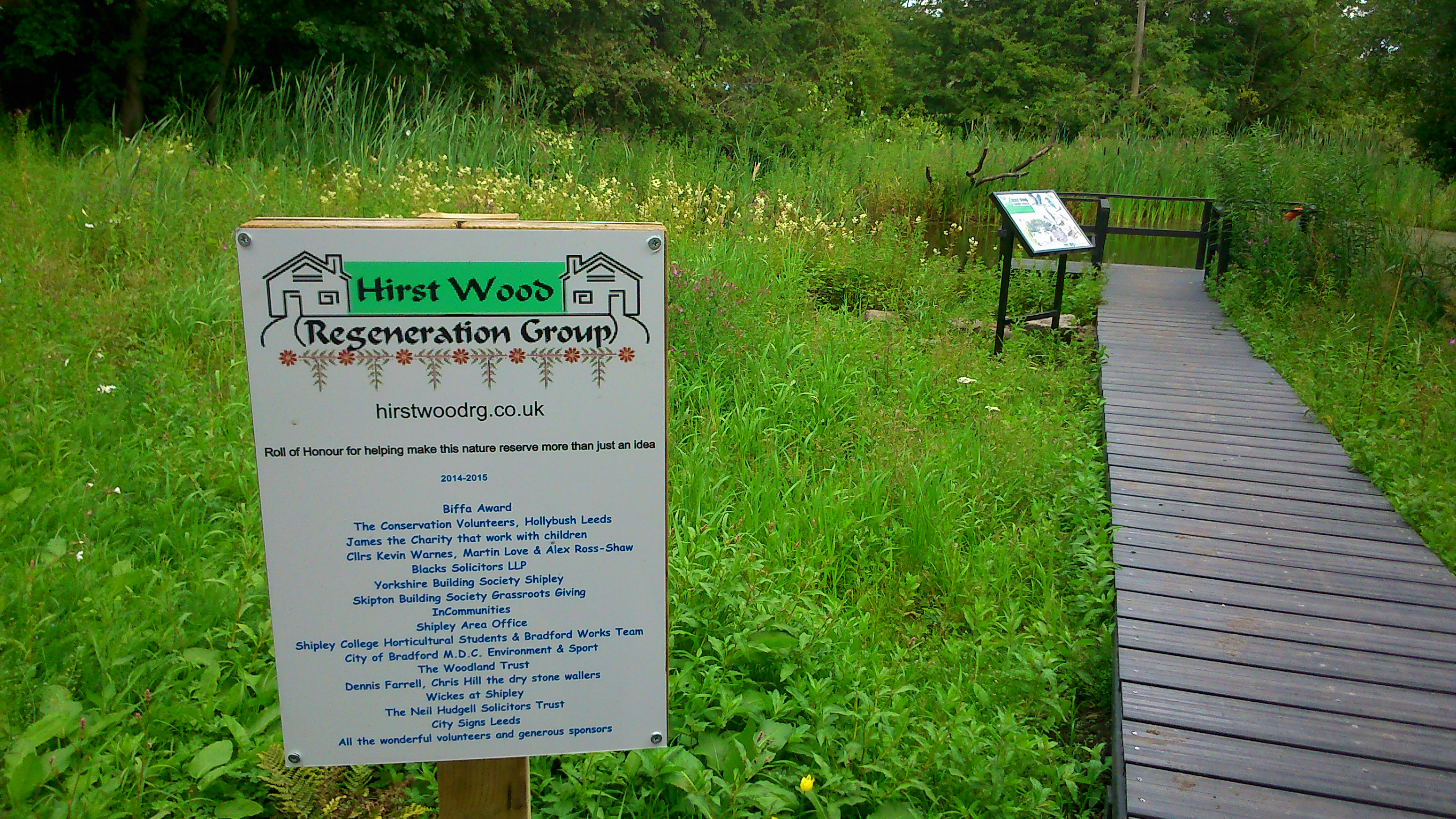
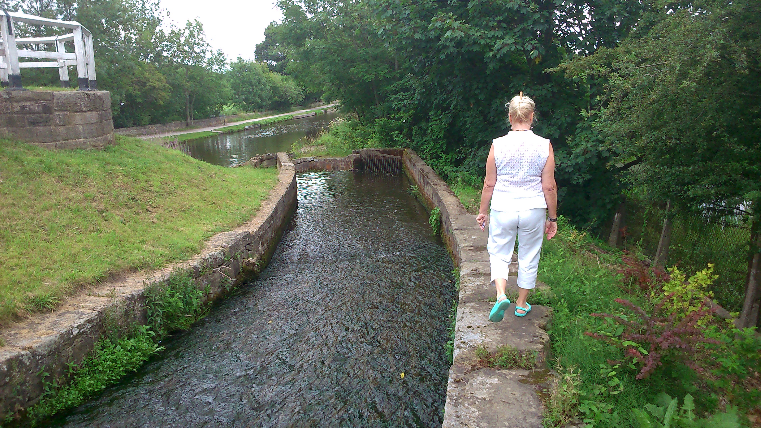
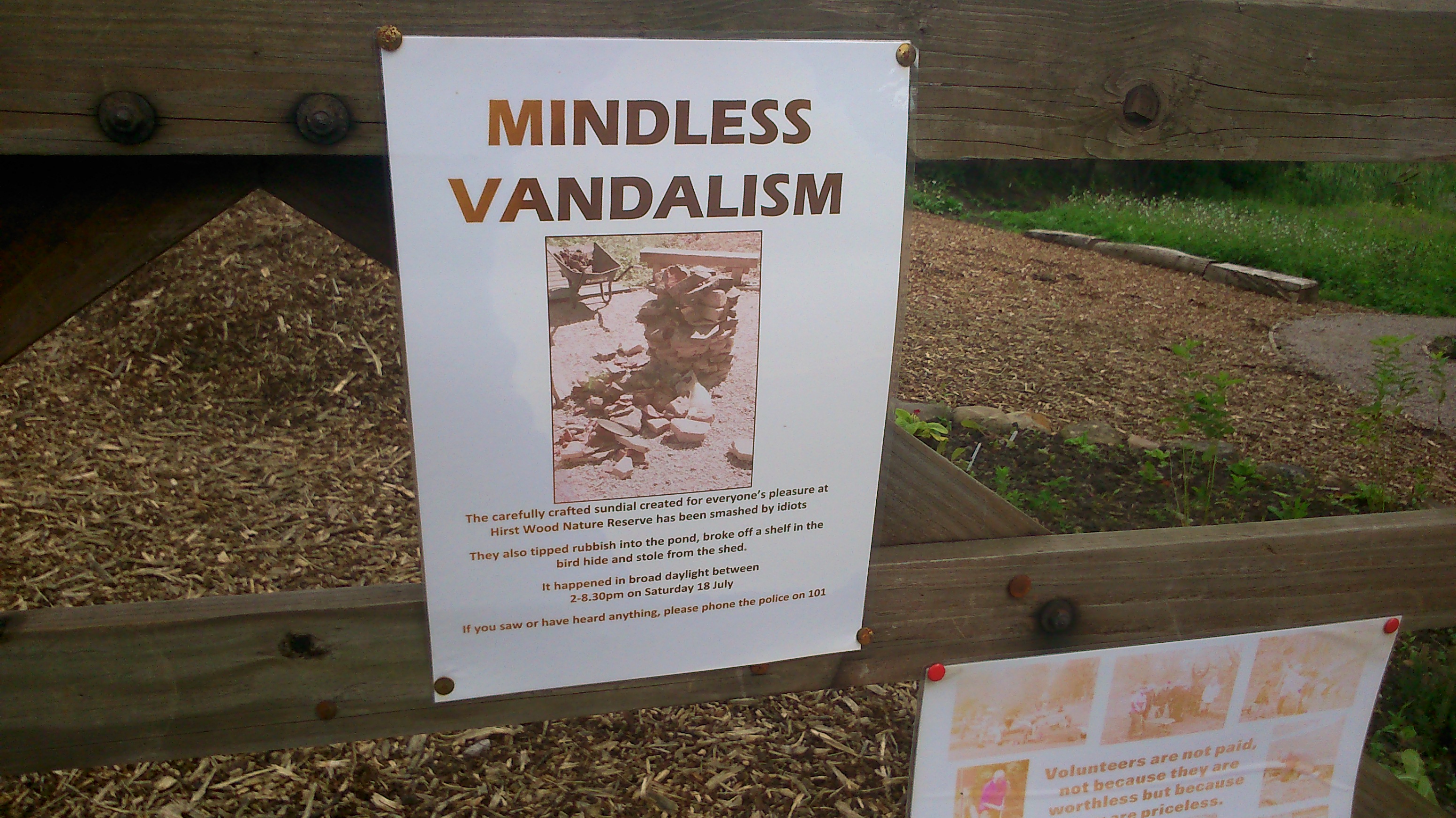
Each of the jars contains a secret to be puzzled out — just as the winding paths in the grass also follow a particular pattern that visitors are invited to guess at… Baz calls it an “open secret”, because if you’ve done the meander, he’ll happily tell you what the pattern represents… but sorry, if you’re just reading this blog, we’re not going to tell you! The only clue we’ll share is that it might have something to do with the way that long grass looks a little like waves when it is played with by the wind. The River Aire, alongside this meadow, is not the only reason why the meander was appropriate for “Multi-Story Water”…

DSC_0044
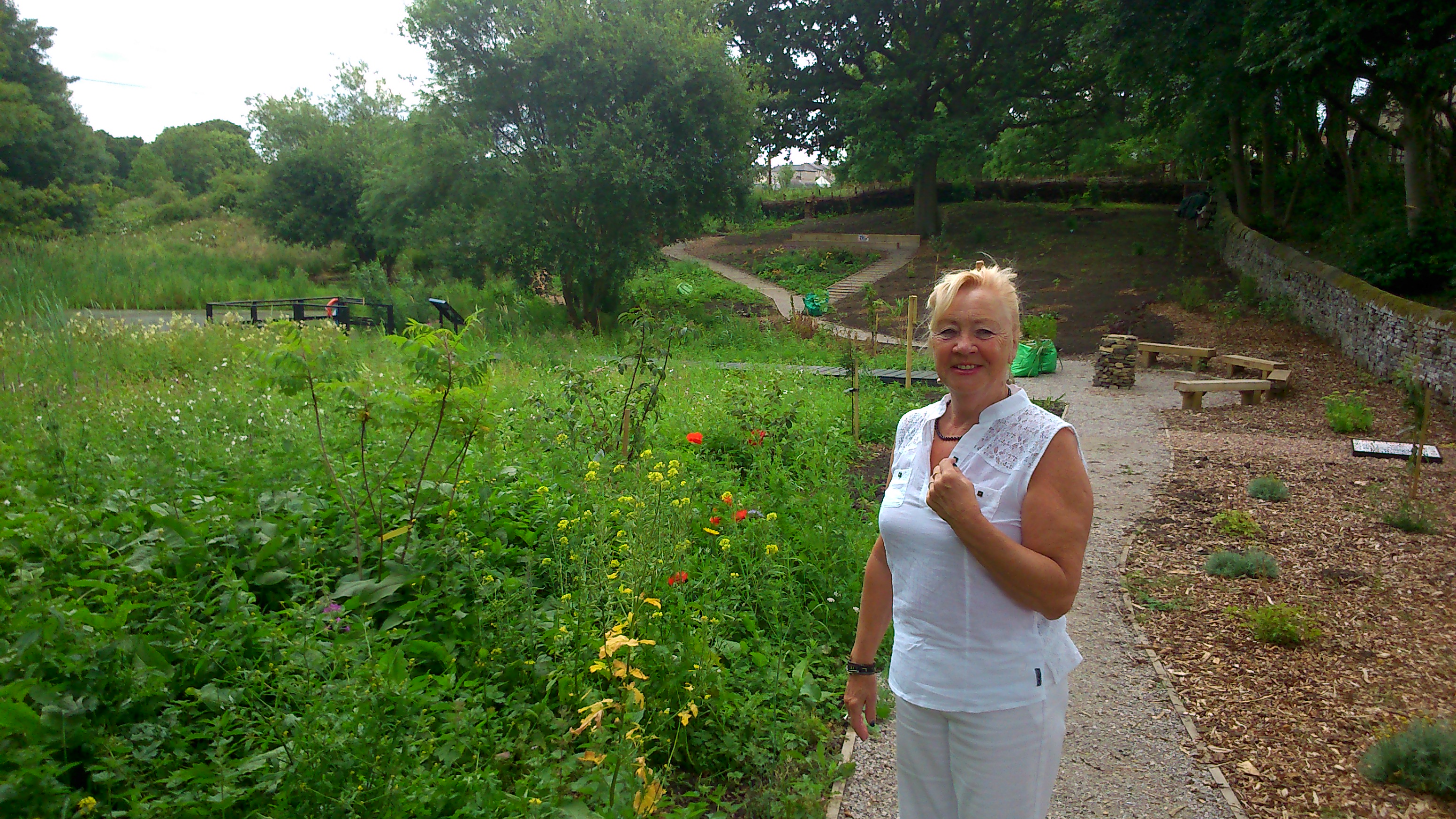
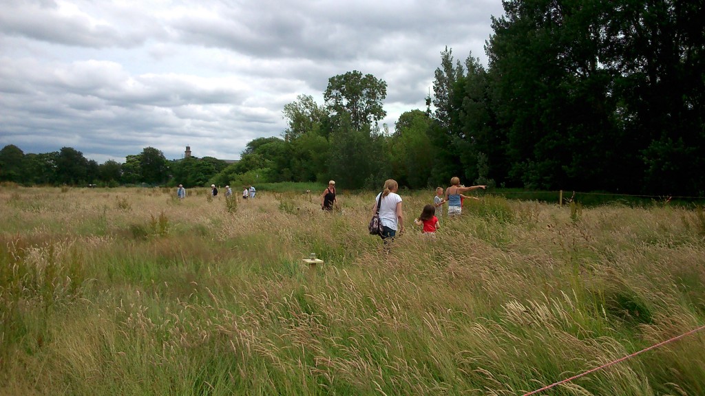
A Meadow Meander was presented both on the Saturday, along with the barbecue, and on the Sunday, when we put the entrance on the other side of the rectangle, right next to the riverside path. This meant that, where on Saturday it was mainly residents in the meander, on Sunday it was mainly passers-by — walking between Roberts Park and Hirst Wood. We wanted to get their ideas too, on the great meadow debate…

DSC_0052

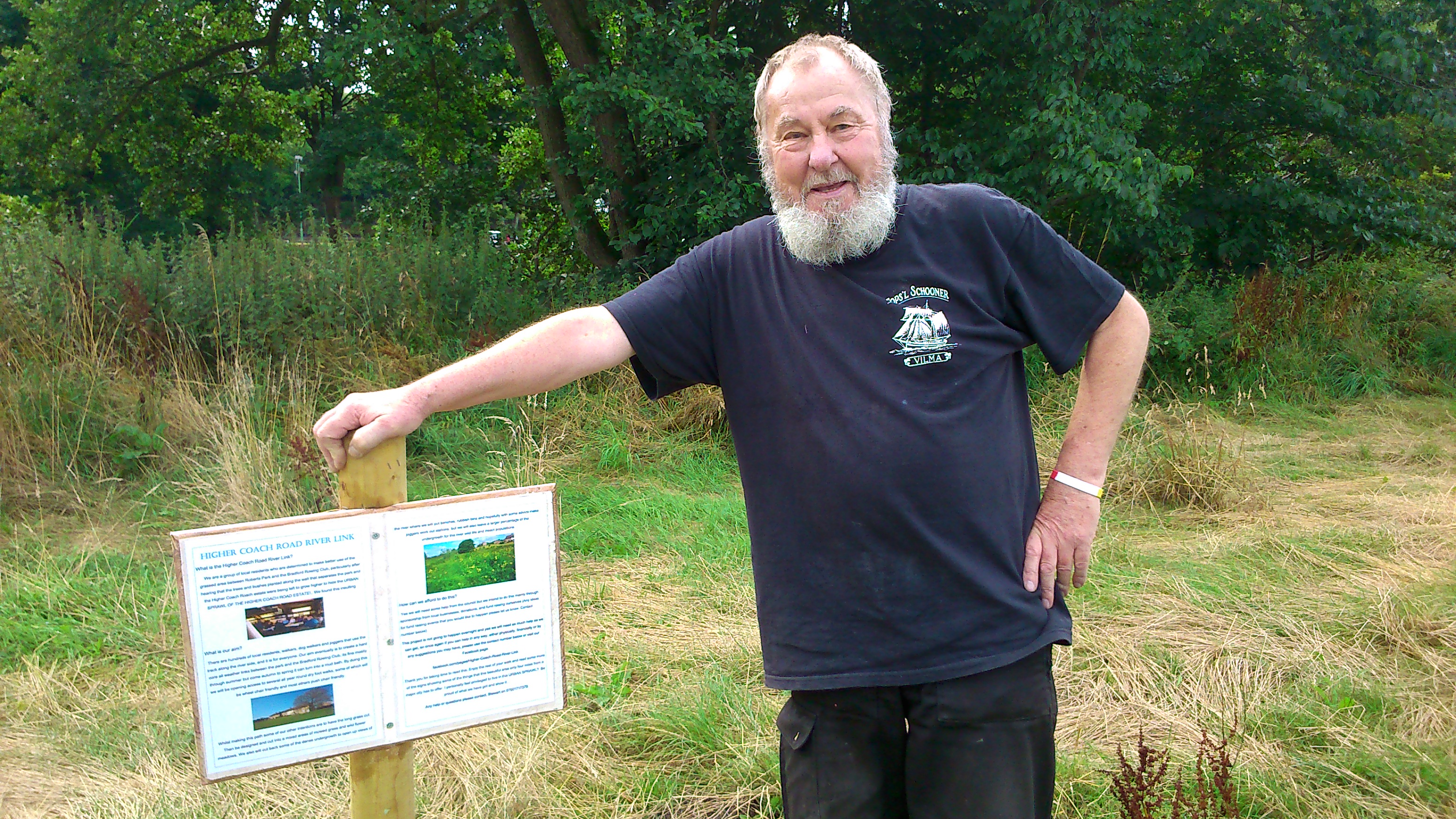
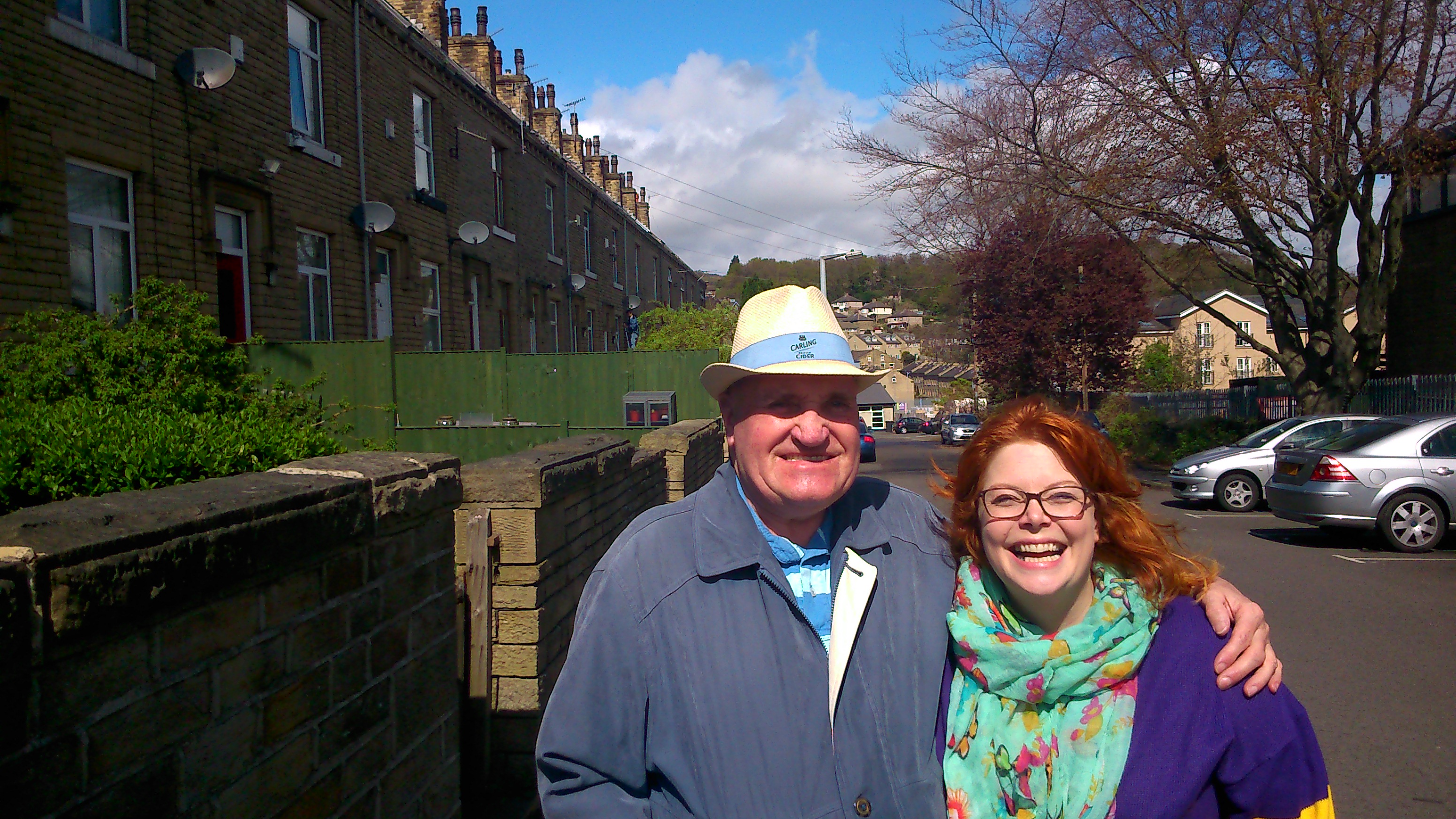
A big thankyou to everyone who made the events described happen… and especially — on the Higher Coach Road estate — a huge thanks to Sarah Muller and to Stewart and Pat Gledhill for so enthusiastically helping to create (and indeed dismantle) the meadow meander… The fence posts are at Stewart and Pat’s as I write, and we have some future plans in store for them…

Pat Gledhill, with her Troutbeck Avenue neighbour Eric -- who kindly donated alcohol to the cause!

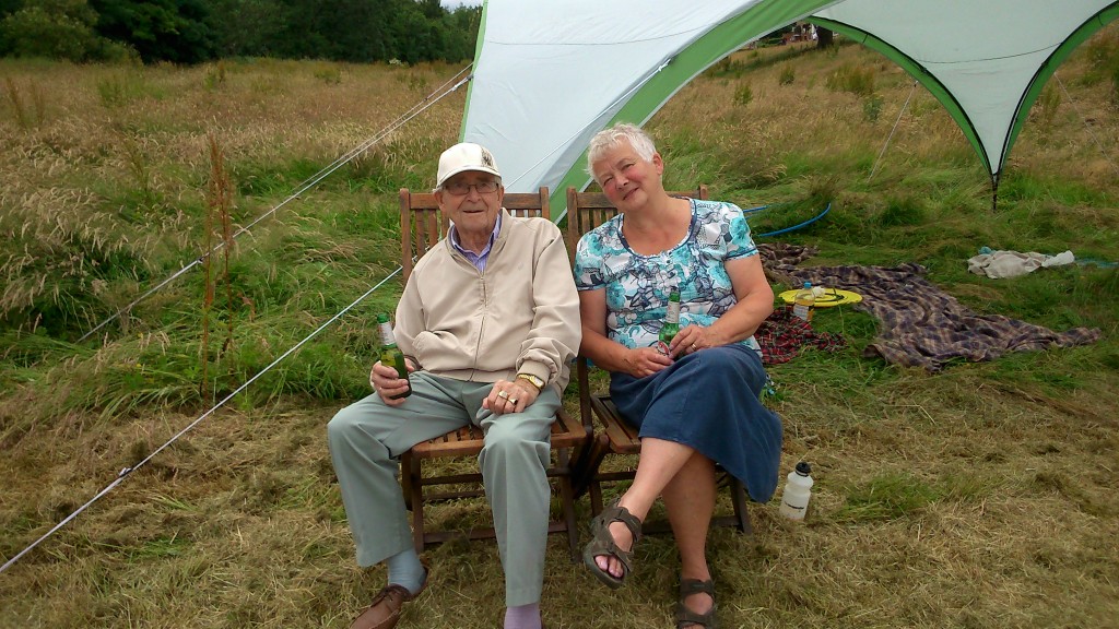
Pat Gledhill, with her Troutbeck Avenue neighbour Eric — who kindly donated alcohol to the cause!


Don’t miss Shipley Street Arts Festival!

The weekend of June 26-28th is the Shipley Street Arts Festival, co-ordinated by our good friends over at Q20 Theatre. There’s lots of activities and performances for all tastes and ages, many of them taking the river and canal as a watery theme…  We’ve got a hand in various events including the water flume demonstration near Shipley Library (from noon on Saturday 27th), and the duck race from Baildon Woodbottom Working Men’s Club (1pm, same day), and on Sunday 28th there’s a special screening of our short film Wading to Shipley at the Ibis Hotel. Multi-Story Water‘s main contribution to proceedings, though, will be this:

SevenBridges-leaflet-HiResThis new, interactive promenade performance will be directed by Simon Brewis, and performed by David Smith and Lynsey Jones. All three were part of our original, 2012 Multi-Story Water performances, and we’re delighted to have them back for this project. The Seven Bridges include some obvious ones and some less obvious ones, so do come along and discover the trail… (it’ll end up not very far from where it starts, you’ll be reassured to know!)

Meanwhile, on the very same weekend, just a few miles downstream, the Leeds Waterfront Festival is taking place. So to create a bit of a conceptual “bridge” between the two festivals — and between Shipley and Leeds — we are also presenting this:

SevenBridges-leaflets2Now that’s actually a photograph from Shipley (Amber Wharf flats viewed from under Junction Bridge, at Dockfield) but the designer liked the picture, and it sort of works for Leeds too… where there’s a whole lot of new build flats by the water!

Anyway, the Leeds piece will be performed by Steve Bottoms, who will be supported musically by the very wonderful Eddie Lawler (the Steve and Eddie partnership is now a recurring one, and also dates back to our 2012 MSW performances). In theory, it’s possible to see both Seven Bridges pieces in the same day, if you do Shipley at 11.30am and Leeds at 3.30pm. Or you can do them different days. You don’t have to do both, of course, but they will, we hope, complement each other in interesting ways… And it is all free, so you can’t go wrong!


Meadow madness!

The Higher Coach Road estate in spring/early summer…

DSC_0001This grassy flood plain next to the river (the riverside path is where that man in blue is walking to the left) has traditionally been mowed fairly regularly by Bradford Council. But in an age of austerity, they’re letting the grass grow… The buttercups have taken the opportunity to add a sprinkling of yellow to the “monoculture” green…

DSC_0003And there are larger wildflowers, too, growing up tall because they haven’t been annihilated at birth…

DSC_0005Recent meetings at the rowing club with residents from the estate have led to the idea of campaigning to turn this into a “real” wildflower meadow — seeded with poppy and cornflower, perhaps — to bring vivid colour to the area. It’s an approach that has already been applied up at Northcliffe Park. And the other weekend, by way of kicking this off, a group of us got together to do some planting…

DSC_0021Here’s the remains of the gazebo tent we put up for shade and as a refreshment area. The wind was too strong for it so we had to take it down again… an outcome indicative of how our whole plan started to go a bit south! The Council had provided us with some “plugs” to plant amid the long grass, to provide colour… but in the event it turned out that the plugs were too small, and the grass too long, to plant in the “meadow” proper. Nor, in fact, were they the promised poppy plugs… they turned out to be begonias!

Anyway, we made the best of the situation by electing to plant the plugs in the shorter grass at the edge of the riverside path (the path is the one bit of the field that is getting mown!). This in the hope of creating a little avenue of yellow to greet walkers coming by. And meanwhile Irene (below, accompanied by some local children who joined us to help out) found got some poppies from her own garden and determinedly planted them in the field outside her house on Bowland Avenue!

DSC_0022

So, not exactly the day we’d had in mind, but from small seeds grow great, er… well you get the idea! Fun was had by all, plenty of jokes shared, and I was treated to a beer by Irene’s neighbour Ruth when we packed up. The campaign continues! 🙂


Seven Bridges, Two Cities

The Shipley Street Arts Festival is coming up at the end of June (26th-28th), and this year is taking the river and canal as a linking theme. We’re delighted to announce that the Multi-Story Water project is working actively with Q20 Theatre to make this happen. In case you’re wondering whether there is any “street art” in Shipley, well lookee here…

DSC_0320A genuine (as far as I can tell) piece of Banksy graffiti, tucked away on the footpath that goes up to Gallows Bridge – across the canal – just up the hill from where Aldi and McDonalds sit by Bradford Beck. In case you don’t know his work, Banksy is a famously anonymous, Bristol-based artist whose graffiti has become internationally renowned. People sometimes rip down entire walls so as to be able to flog things he’s painted on them… This particular metal panel looks like its secure enough where it is, though. I’m not sure how long the painting has been there, but it’s tucked away in this wonderfully unassuming location… Here’s the image in close-up:

DSC_0318OK, that’s all I have to say about Banksy. But Gallows Bridge will be featuring as one of Seven Bridges in the Shipley area that will be linked by a looping promenade performance that we are making for the Street Arts Festival. I’m pleased to confirm that this will be performed by David Smith and Lynsey Jones (both of whom co-created and performed in our original Multi-Story Water tours back in 2012), and will be directed by Simon Brewis (who directed them). Always nice to keep things in the family…

Meanwhile, though, we are getting delusions of grandeur. Because simultaneously with the water-themed Street Arts Festival in Shipley, the Leeds Waterfront Festival will be running the same weekend. So to provide a kind of conceptual “bridge” between the two festivals, we will also be presenting another performance — with the same title, Seven Bridges — in Leeds. If you’re really keen, you might want to see both… (!)

DSC_0285This is me being anonymously artsy (if not banksy) while researching the Leeds end the other week. That’s Leeds Bridge you can see reflected in the plate glass — the crossing where the city began. Leeds’s whole history was built around the river, which is why it’s so strange that the city has sort of turned its back on the waterfront: you can live there for years and barely even be aware of its existence…

DSC_0304Here’s another of the Seven Bridges — Victoria Bridge, which was built (unsurprisingly) in the 19th Century to replace a longstanding ferry service. It’s one of the major road links to Leeds station … right beside Bridgewater Place — the unnecessarily tall building better known as “the Dalek”! But even though there’s a clue in the name — Bridge — water — place — you can drive across Victoria Bridge a thousand times and barely even notice that you’re crossing a river…

Now… notice the white, ‘canal style’ railings to the right of the shot above. That’s because this image was taken at the junction where the River Aire (aka the Aire-Calder Navigation) connects with the Leeds-Liverpool Canal. And here it is…

DSC_0303… the footbridge that crosses the end of Lock 1 on the Leeds-Liverpool… the very, very beginning of the 109 miles of canal, that goes through Shipley and all the way to the Mersey… Meanwhile, if you turn through 180 degrees and move upstream on the Aire a little (also in the direction of Shipley, of course…) you come to this…

DSC_0298This is the brand new entrance to Leeds Station, currently being built by Carillion. I like the sign on it: “this is civil engineering“! (as opposed to uncivil engineering…?) Notice that because space is so tight around the station, the building materials are having to be floated upstream on pontoons (in the foreground of the shot) in order to get to the site. Notice also the angle this shot is taken from… I was standing on – you guessed it – a bridge. Granary Wharf Bridge, to be precise — quite a new, modern one… That’s the western end of our Seven Bridges route… and here’s (almost) the eastern end…

DSC_0256This is the entrance to the weir and lock at Crown Point (Clarence Dock), with the Crown Point Bridge arcing overhead… another road bridge that you can merrily drive across without ever noticing the river… And in the shot below is the weir itself, viewed a little further downstream from Knights Bridge (footbridge)…

DSC_0261Notice the black holes in the middle of the shot here. Not technically a “bridge” perhaps, but this is where Meanwood Beck enters the Aire… a rather lovely beck that flows down through Meanwood Park and its attractive, surrounding valley, but then disappears into underground culverts before it gets close to the city centre (shades of Bradford…).

DSC_0259

This is Knights Bridge itself, viewed from the Clarence Dock side, and looking across to the building that operates as the headquarters for the Canal and River Trust in Leeds (hub of the CRT Northeastern partnership, if that means anything to you). Some very nice people work there… This bridge, as you can tell, is pretty modern, but I need to do some more research about it…

What strikes me here is the proliferation of white-painted metal, which even extends to these cage-like railings in front of the CRT building itself…

DSC_0262I like the little bit of signage here, pointing you to the next bridge (“hey, you’ve just crossed the river, fancy doing it again in the opposite direction?”). But there’s no shortage of signage in the vicinity of the river in Leeds… Check these out, for instance…

DSC_0239DSC_0242DSC_0251DSC_0272 DSC_0243Everywhere you go, it seems, you’re being warned that you’re on private property… that you are walking at the permission and indulgence of property owners… that you are on CCTV… There’s no sense in Leeds at all that the banks of a river might be public space, for anyone to walk along. The riverside paths are constantly broken up, interrupted by buildings or private spaces that you can’t enter. There is no “ancient right of way” here, in the way that there is in Shipley… And then the city wonders why people don’t engage more with the waterfront…

O Banksy, where art thou…?


Community consensus?

The Multi-Story Water project, in partnership with Kirkgate Centre, has recently been working actively in three different communities in the Shipley area… These are:

(1) the flats at Crosley Woods (actually Bingley – right next to the canal just past Dowley Gap locks);

(2) the Dockfields area (Dockfield Road, Dockfield Terrace, and the flats on Dock Lane);

(3) the Higher Coach Road estate (between Roberts Park and Hirst weir).

We plan to keep blogging about all this, while also of course seeking to respect the privacy of the residents and their discussions with us. Obviously we have to be a bit careful about what is said on a public forum like this one.

It’s fair to say, though, that our most recent meeting with Higher Coach Road residents — last Saturday morning (May 16th) at Bradford Rowing Club — was a very positive one, and that those attending now seem to have arrived at a good degree of consensus about what they’d like to achieve together. So it’s worth trying to briefly summarise what was agreed on, in order to share the plan more widely. Here goes:

1. Footpath project.  There seems to be universal agreement that the riverside footpath, running alongside the estate between Roberts Park and the rowing club, should become a proper footpath rather than just a track or “desire line” in the grass. This would have multiple benefits – including providing a safer, all-weather walking route; ensuring safer access (stepped and/or ramped) to the raised footbridge area near Bowland Avenue (currently quite treacherous to get up to from the grass); and finally, filling in a “missing link” in terms of local waterside paths — so as to create better connectivity for everyone around Shipley/Saltaire/Baildon. In this document, Stewart Gledhill, of Troutbeck Avenue, presents his own views on the potential of such a plan… he imagines a hardcore path like the one that runs past the rowing club, and that could potentially be built as a community project… Stewart’s suggestions have been greeted warmly by other residents attending our meetings. Everyone seems to agree that a project like this is one that might generate engagement and support not only from other residents on the estate, but from other people in the local area generally. Of course, the tricky part will be to get enough momentum going behind this that lots of people will want to invest their time and energy in actually making this happen…

2. Wildflower meadow. The flood plain area next to the estate has traditionally been just plain old grass, and gets very boggy in wet weather. Last year this grass was left to grow into a bit of a meadow because of council cuts to the lawnmowing staff, and this has inspired some residents to argue for a more permanent, planned wildflower meadow – to make the area more attractive. This is a bit more controversial than the path idea (e.g. concerns about dog fouling in long grass?), but there was general support at the meeting for the idea of creating a small, temporary “wildflower meadow” area this summer just to get a sense of what this might be like — and spark further conversation in the community. We have been promised poppy plugs by the council’s parks people, and as a group we’re hoping to plant these shortly to see what happens…

3. General care and maintenance. The main problems with the public areas on the estate at present are to do with a certain lack of care and respect in some quarters — littering, flytipping by the river, etc. But if the whole place looks a bit more cared for and planned out (see 1 and 2 above!) then maybe this will inspire a bit more respect from all concerned? (Just as Roberts Park has been much better treated by all, since it was refurbished under the Heritage Lottery Grant.)

4. Bins, signage, etc. If the footpath is made more ‘official’, this might also create the context for better provision of bins (for litter, dog muck etc.) along the way. And what about some signs to point the way or provide some information about the estate — make it part of the ‘heritage narrative’ in the area? (There is lots to justify this… e.g. see this previous blog post.) There has even been a suggestion for putting in simple exercise equipment at intervals along the footpath, just as you find in some parks. Obviously all this would require discussion with the council, and in “austerity Bradford” it might be tricky… but if we can get some real momentum behind the campaign, some of this might be achievable?

5. One way system? Finally, moving away from the river and grass up to the road, there is much consensus that Glenwood Avenue and its linked roads get too clogged up with traffic and parked cars pointing in different directions. The remarkable Stewart Gledhill has again suggested a simple but perhaps workable solution — by proposing that you could have two one-way loops. You would enter the estate at Gorse Avenue, and then turn either right or left along Glenwood Avenue, before exiting back onto Coach Road at one end of the estate or the other. This would ensure traffic flow and parked cars were always pointing in a single direction, and so hopefully reduce congestion. Again, there seems to be general support for this idea, and it wouldn’t need to cost a lot in terms of signage etc. We are hoping to raise it with Paula Truman, the new ward officer for Bradford Council, but in the meantime we need to keep talking to other residents to see if there would be any objections to the idea that we haven’t thought of.

There’s quite a list of ideas here, and the important thing to underline here is that they are just ideas at this stage. This means that:

(a) Nothing has been finally decided on … so there is lots of opportunity for other people to make their views heard …

(b) None of this can or will happen unless we can generate enough support and interest from other residents to really get the ball rolling. All that Kirkgate Centre and Multi-Story Water can do is try to facilitate the development of that community conversation…

One way we’re hoping to get more involvement is by organising some events this summer that will create the opportunity for some fun and some discussion… So keep an eye out!


Saltaire Hydro scheme approved… maybe…

Just a brief note to highlight this story in yesterday’s Telegraph and Argus (click to go there)

Bradford Council yesterday gave its initial planning approval to the hydro power scheme for the weir in Roberts Park (see earlier posts under ‘Saltaire Hydro’ category on this site). However, it appears that the scheme’s opponents will fight on, and are raising the question of whether or not all the heritage bodies involved — given that the hydro site is in a World Heritage Site — have been properly consulted.

Personally I’d be rather surprised if due process has not indeed been followed with this. The heritage issue is the obvious one to address in this instance, after all, and UNESCO gave the plan its approval quite a while back. The T&A story raises a number of issues around who has or has not been consulted — but then it also claims that the installation will be a “giant” turbine, which is a bit of a daft exaggeration (given that the design is actually quite small scale). So who knows what to believe…

It’ll all come out in the wash, no doubt.

A postscript to the above: courtesy of a Kirkgate Centre tweet, I’ve just come across THIS ruling by the Charity Commission – which was issued on March 26th (in response to THIS appeal by the Friends of Roberts Park). It would appear that due process has NOT – as far as the Charity Commission is concerned – been followed. Bradford Council may have got itself into a conflict of interest situation over proposing to parcel off part of the park for energy purposes…. Clearly this is going to run and run.


Talking and Walking (on Water)

We’ve had a busy couple of weekends, doing a lot of talking and a fair bit of walking, not necessarily at the same time. This photo was taken just this morning…

DSC_0231The location is Dockfield Terrace, and that’s my colleague Lyze (pronounced “Lizzie”, not “Lies” as one person mistakenly assumed — as Lyze says, “it’s my own fault for being pretentious”) standing with David, who kindly agreed to be photographed for this blog. David has lived in the Dockfields area since 1947 (that’s 68 years and counting), and is currently 500 pages into writing his life story — some of which we heard recounted as anecdotes! He’s one of the people who turned up to a community meeting that we organised this morning for local residents, at Q20 Theatre on Dockfield Road (thanks Q20! we are collaborating with them to deliver a river- and canal-themed version of their Shipley Street Arts Festival in June… more on that another time).

At the meeting we heard quite a few local concerns… everything from the need for speed controls on the main road (used as a rat run to avoid Foxes Corner) to very genuine concern about the wellbeing of this family of swans…

DSC_0230The swans have recently taken up residence on the canal bank above, having abandoned their previous nest — pictured below, on the track between Dockfield Road and the canal towpath…

DSC_0229… there was some debate among the residents who attended the meeting about what had happened here, but general agreement that at least one and possibly all of the swans’ eggs had been stolen by someone unscrupulous, and that the swans had been driven away from this spot in fear…  Whatever the correct story, it was striking how much the residents concerns were with the canal, and its resident wildlife, as well as with the roads, traffic, etc. Even though Dockfields is a very industrialised area with little obvious green space, the river and especially the canal give the area something special that people clearly value…  (For more on swans at this time of year, see Canal and River Trust’s page about caring for them.)

We’re working, in connection with Kirkgate Centre, to try to build community connections in the Dockfield area, with a view to ensuring that people’s concerns are listened to and acted upon. This includes understanding how their sense of connection with the local waterways might be a positive asset that can be built upon communally. We’re also working on the same process in the Higher Coach Road area, on the Baildon side of the River Aire. Last Saturday morning we had a parallel community meeting, this time kindly hosted by the Bradford Rowing Club…

DSC_0220

What is Maggie Roe saying to Paul Barrett? Caption suggestions please…

Here’s Kirkgate Centre’s Paul Barrett, pictured outside the club after the meeting (on a gorgeous, crystal clear day!), talking to landscape specialist Maggie Roe — who is very struck by the distinctive layout of the Higher Coach Road estate (see other blogs on that!). And here’s a shot from inside the club, showing the aftermath of a very positive and productive discussion with residents… I love the fact that Paul and Sara are both checking their just-taken photographs of the post-it notes!

DSC_0219Sara Penrhyn Jones is a filmmaker who was visiting us for the weekend from Aberystwyth, in Wales (like Maggie, she is part of the wider “Hydro-Citizenship” research project that Multi-Story Water is now a part of). Maybe she’ll have some film footage for us to share on this blog soon. Here she is armed with cameras again the following day — Sunday 19th April — on the canal towpath in Saltaire with Lyze…

DSC_0223… the other people in shot are some of the people who had gathered to go for a guided walk with me from this spot. As part of Saltaire’s “World Heritage Weekend” celebrations, I led a version of our Salt’s Waters walk — which will soon be available as a downloadable audio guide, for anyone to undertake whenever they like… although on this occasion we went with the low-tech, interactive option. The walk goes from the bottom of Victoria Road in Saltaire, and then heads west along the Aire, via Roberts Park and the Higher Coach Road estate, before turning uphill – alongside Loadpit Beck – on the way towards what little remains of Titus Salt Junior’s Milner Field mansion.

DSC_0225

A key feature of the audio mix will be Eddie Lawler’s beautiful song, The Ballad of Little Beck – written in honour of the unassuming stream that goes runs down through the grounds of Milner Field, and was once dammed as a boating lake. Eddie came along on the walk last Sunday and performed the song live, standing on the earthworked banking that takes Titus Jr’s coach road right across Little Beck (which trickles through at the base). It was a “shivers down the spine” moment, for me at least…

I don’t have other pictures of the walk, because for the most part I was too busy conducting it — talking and walking — to be taking photographs. But the merry band of travellers who came along on the journey were a great bunch to spend a couple of hours with. As I’d hoped, moreover, they had a good few suggestions (and one or two corrections!) to feed back into our work on the audio narrative…

So a big thanks to all those who contributed to a very enjoyable afternoon. Here are a few of you, enjoying Eddie’s music…

DSC_0226