Up in Salts Mill… JBA

Last week I had an intriguing meeting with Steve Maslen, of JBA Consulting — an engineering company based in offices on the top floor of Salts Mill. They’re right in the northwest corner, looking down directly over the Victoria Road canal bridge, with the slightly lower roof of the Visitor Centre building down to the left, and a grandstand view of Saltaire’s weir just to the right (I really should have taken a picture, but it felt a bit rude to ask!). This is the company that has consulted on the actual hydrological designs for the proposed hydro-electric turbine on the weir – and there it is right outside their window! Also in their “current” file, here in the Shipley area, is a consultation being carried out for Friends of Bradford’s Becks (with the blessing of Bradford Council) looking at the logistics of removing the box culvert over Bradford Beck (the covered bit on the green space next to Canal Road, just as you’re getting from Shipley to Frizinghall). Watch this space on that one.

Anyway, Steve Maslen (who used to run his own separate company, Maslen Environmental) is a very interesting and helpful man, and he gave me this Youtube link to a film about the work of JBA Trust — a not-for-profit organisation established to help educate and inform the public about environmental issues. When I asked if this was a form of corporate tax avoidance (as their charitable trusts often are), Steve politely but firmly said no. This is a company that prides itself on its ethical approach to business — so giving something back and sharing knowledge is a key part of what they do. “We’re not just an engineering company,” as Steve put it. Anyway, here’s the video (blog post continues below…).

xx

New Year: Lower Holme is open for business!

2015-01-12 17.09.39It could be Main Street America. KFC stands proudly in the night surrounded by halogen lamps. But this isn’t America, it’s Lower Baildon, and the cars are exiting (right) onto Otley Road. The long-overdue development at the site of Lower Holme mill now appears to be all done (except for a bit of work on the cosmetics) and KFC is open for business. Pan round to the right slightly from the view above and you get this…

2015-01-12 17.09.51The Lower Holme mill cottages and their half-street of surviving cobbles, separated from the new access road by a verge that will eventually have hedging to mask them off (according to the plans). Spin back to the left through 150 degrees and we have the monolithic box of the new Wickes with its back to the banks of the River Aire…

2015-01-12 17.09.23The stray road cones and other bits and pieces tell of a site not quite finished, but this is basically it… The long-suffering residents of Lower Holme are now looking at carparks and shiny new buildings instead of the rubble, weeds and shabby metal fencing that they had to live with for several years (see previous Lower Holme posts under ‘Categories’). I’ll be intrigued to talk to some of them about how they feel now the place is open for business… But for now, a happy new year to you all, especially Margaret, James, Lynda, Sean, Josh, Heather and Les. x


Upstream of Hirst Weir

Season’s greetings from the Multi-Story Water team! Here’s a little watery (rather than snowy) Christmas card image…

dec 2014 021This was taken last Friday, December 19th, on the bank of the Aire outside the Bradford Rowing Club (right). It had been raining in the Bradford area, but it must have been raining a whole lot more further upstream, because as you can see the river was high enough to have broken its banks here. Cyclists were having to navigate around the waterlogged path (see immmediate foreground). Meanwhile, just a few yards downstream, this was the view of Hirst Weir…

dec 2014 022The water’s so high that in the foreground the weir has almost disappeared. Those familiar with this weir will remember that it was seriously damaged during the high water of summer 2012, necessitating a patch-up repair job by the rowing club (which now owns the whole of the weir – under the holding company Hirst Weir Ltd.). A huge pile of rocks was lowered into the river on the nearside (nearside for this photo), making a more gradual descent for the water. In this shot above the rocks are, unusually, all but invisible because of the height of the river. Now, take look at this…

dec 2014 017This is the model box owned by the rowing club, showing their design for the planned, permanent reconstruction job on the weir. (For bearings: the mill is bottom right, the mouth of Loadpit Beck top right.) As you can see, the engineering solution being proposed is essentially to extend the use of loose rocks across the full width of the river, downstream of the weir, so as to make the water’s descent more gradual and thus less impactful on the river bed. (The middle section in the model, without loose stones, is there simply to illustrate the height of the drop at present – it won’t be built like that!). The laddered element at the top of the image is a fish pass design, which has helped secure Environment Agency approval for the plans. One can imagine, more broadly, that the EA approves of the design anyway, since the more gradual decline being created for the ‘new’ riverbed achieves the next best thing to a restoration of the river’s natural flow (presumably over time the river will wear the rocks themselves smoother, deposit silts on them, etc). Of course, the one thing the rowing club would not countenance is the removal of the weir, since their activities are entirely dependent on the 650m stretch of straight, flat water upstream that it permits on the upstream side. Anything less than that and they wouldn’t have a viable racing course (as it is, 650 is a modest sprint, compared to the international standard 2000m course at, say, Eton Dorney). It’s for this very reason – the centrality of the weir to the club’s existence – that they took over responsibility for the whole weir a number of years ago. Previously of course it belonged to the mill and its inheritors, but after previous damage to the weir in 2002, a repair grant from Sport England could only be secured if the weir was legally a public rather than private asset. Hence the club taking on responsibility — they they sensibly ensured arm’s-length liability by setting up the holding company.

If you’re wondering how I know so much about this all of a sudden, it’s because of meeting this man, Barry Wood (below). Barry is a self-effacing sort of person who didn’t really want his picture taken, but was happy to be seen in long shot surrounded by this view of the upstairs of the clubhouse. He has been a member here since 1957 — that’s 57 years! — so what he doesn’t know about this rowing club isn’t worth knowing…

dec 2014 019I’d been advised by my friend Eddie Lawler that Barry was the man to speak to about the club and its history, since we want to include something about it in the audio tour of the area that we’re developing (see previous post). Barry to be very generous with his time and thoughts, and it was a treat to talk to him. I didn’t like to ask a gentleman his age, but Barry says he had already been through a full education and National Service before joining the club, so he must now be pushing 80. You wouldn’t know it to look at him, though, and he maintains a very active role in the club — indeed he’s one of the three company directors of Hirst Weir Ltd!

No less extraordinary is the clubhouse itself — originally built in 1893 on the south side of the river, it was dismantled brick by brick and ferried across the river in 1922, to be built exactly as it had been (except that, now facing south, they moved the roof gable to the other end of the building so that it was still facing upstream to the racing!). This reconstruction was forced when the new owners of Hirst Mill demanded the club vacate their land, but Salts of Saltaire allowed them a spot on the opposite bank (which the club now owns). When Barry came here in 1957, the clubhouse was still very simple — with no gas, no electric, no running water — all of which has been installed during his time with them.

Now the next priority is to get that weir fixed up permanently, and for this, funds are going to be urgently needed. Hence this banner poster in the clubhouse itself…

dec 2014 018If you can chip anything in to the appeal, please do! I’m sure the rowing club would appreciate the gift, because the river isn’t going to stop pressuring at that weir any time soon…

dec 2014 020


Simmering quietly

Ok so here’s a really badly taken selfie to prove that we’re still here…

dec 14 762That’s me, Steve Bottoms, gurning at the camera – and blurring from left to right are Trevor Roberts, Lyze Dudley, and Paul Barrett (see ‘People’ page of this site for explanation of who we are and what we do). This is from a meeting at Shipley’s Kirkgate Centre last Saturday, November 29th… and we were meeting on a Saturday simply because everyone’s been so busy that finding a weekday was a bit of a nightmare. Kind of sums up the autumn really… (Speaking personally, I’ve been a bit preoccupied learning the ropes of being head of department (Drama, University of Manchester) and so Multi-Story Water has had to take a bit of a back seat.)

But… the project is ongoing and things have been happening quietly in the background, despite the lack of updates on this blog. We’re planning a range of events and activities for 2015, working in and with various groups/neighbourhoods in the Shipley area. Writing about them here might prove to be a hostage to fortune, but watch this space for new developments in the new year…

Weir(d) consultations…

“Worth every penny!” says Neill Morrison about his new 3-D model…

2014-10-17 13.34.47
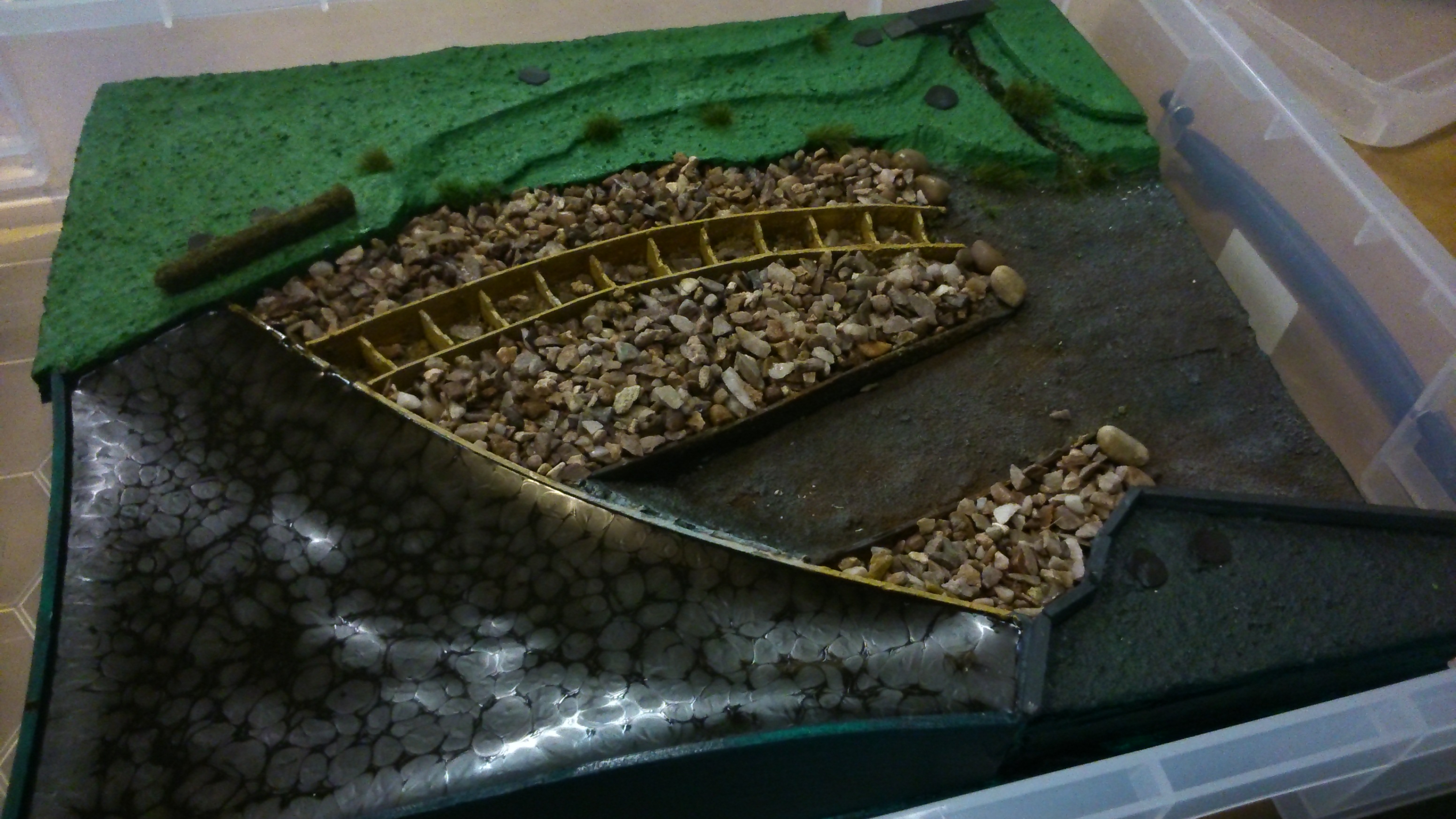
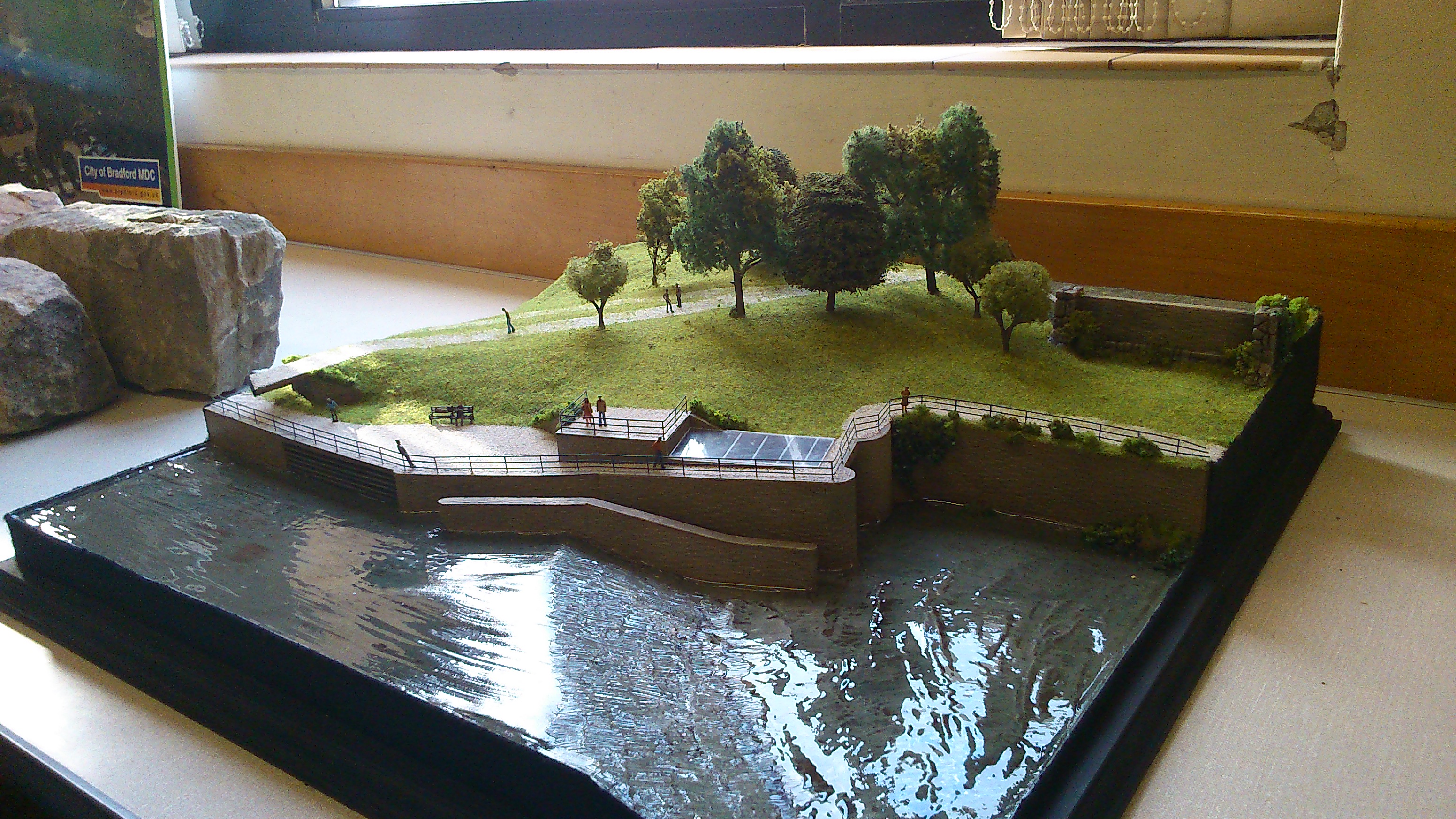
This is a model-maker’s rendering of what the Baildon side of Saltaire weir might look like after the completion of Bradford Council’s planned hydro-electric turbine installation. It was on display today (and will be again tomorrow) at Shipley Library, as part of a public consultation about the scheme. Neill Morrison, who has been leading work on the project since its inception, for the Council’s energy and climate change department, feels that the 3-D approach gives a much more accurate and friendly-looking impression of the scheme than the computer-generated graphics used at the last such consultation exercise — at Saltaire’s URC church back in July 2012. At that stage, plans for the scheme were still in their developmental stages, but a lot of the opposition generated that summer (previously discussed on this blog here and here) seems to have been sparked more by a dislike of the first-stage artwork than by the substance of the plans. Neill’s team have carefully redesigned the look of the planned installation, to make the buildings housing it lower and less obtrusive in the 2D graphics (at the consultation, you could compare the old and new impressions, to see how much had changed). But I tend to think he’s right, also, that the 3D model helps. It has little people figures in it, and pretend grass that you sort of want to touch, and it reminds you of your uncle’s Hornby train set. So much more ‘human’, somehow, than computer graphics…

2014-10-17 13.36.14
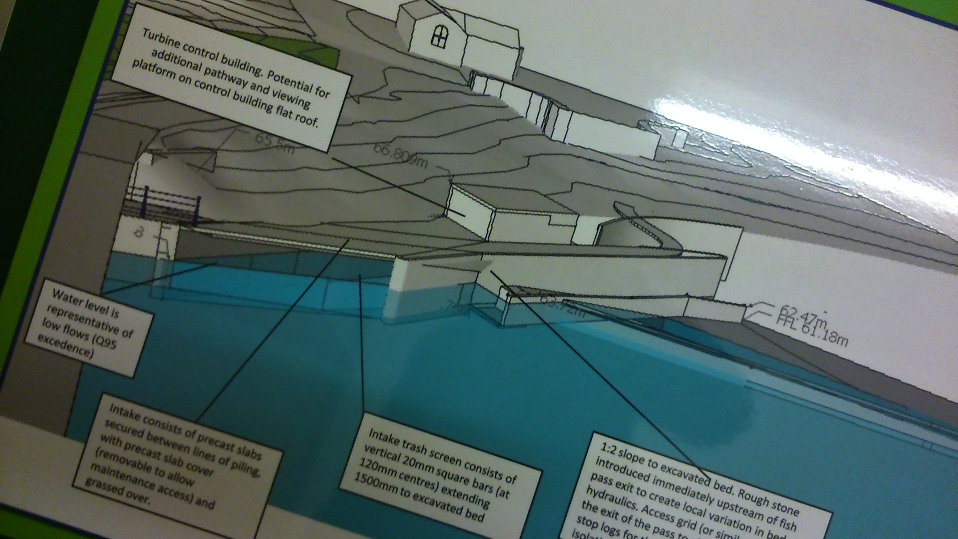
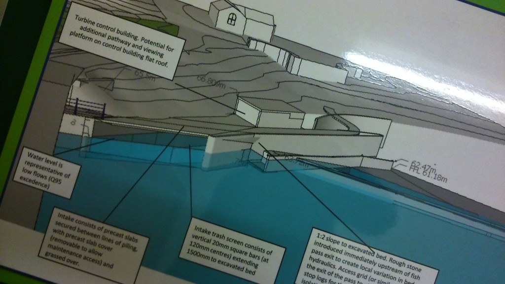
This is one of the more technical renderings of the new plans – in which talk of such things as “Q95 excedence” (see far left) might be prone to make even the most enthusiastic supporter of renewable energy glaze over a bit. But even this graphic gives you a useful sense of the depth of the river in relation to the contours of the land, and confirms the generally modest intrusion into the landscape of the installation itself. Meanwhile, for those who really want to get into technical detail, the consultation gave you the opportunity to read (or even take away) a chunky report from independent sound pollution consultants — which basically demonstrated that the noise from the hydro will be at such low levels that even close up to it you’ll be hard pressed to hear its workings over the other environmental sounds in the area (e.g. the river). The sound will be at a different frequency, operating at a decibel level well below other factors in the area. So you really will be able to take a nice stroll along the river bank, and peer down at the screw through the installation’s picture windows, and feel curious rather than oppressed…They’re starting to think now about the interpretation boards that might accompany the housing — as befits a feature designed for a World Heritage Site. And the actual ‘consultation’ part of this consultation involved asking the public about details such as the extent of railings to be used on the site, what substance should cover the roof of the machine house (turf, astroturf, gravel…), and so forth. They’re definitely into the fine details now…

2014-10-17 13.35.10
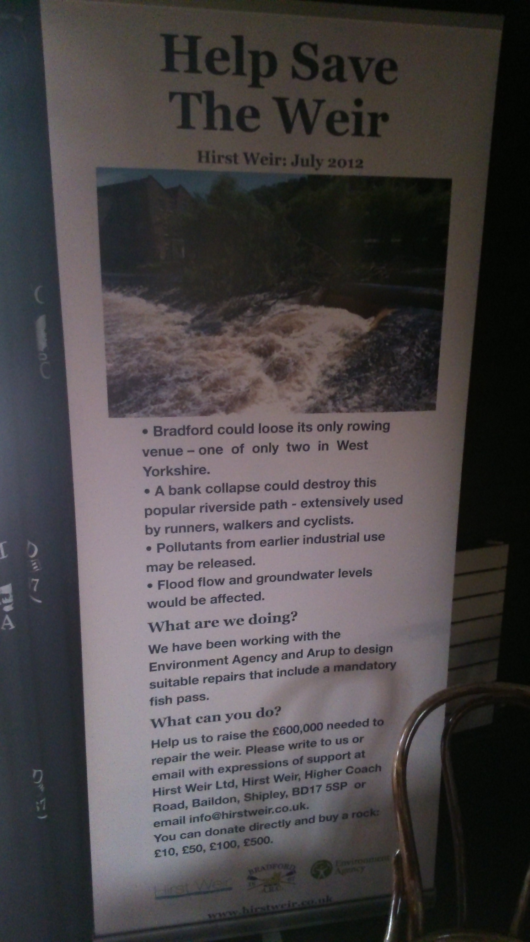
All in all, it’s actually quite hard at this point to know what one could possibly object to with the scheme. Apparently someone from the Telegraph and Argus turned up to cover the event today, and was a little disappointed not to find anybody – even during the lunch time ‘rush’ period – who wanted to voice any opposition to the scheme. I dare say there will be objections, of course, perhaps to the temporary disruption that will inevitably be caused by the build itself — but that will take up to 26 weeks, Neill told me, not the 26 months reported by some of the scheme’s opponents. And the build won’t in any way disrupt the Saltaire Festival: if planning permission is granted, they’ll either start building in the new year and have it finished by the summer, or (should a lot of objections need to be countered) they’ll start building next autumn after the Festival.

2014-10-17 13.52.59
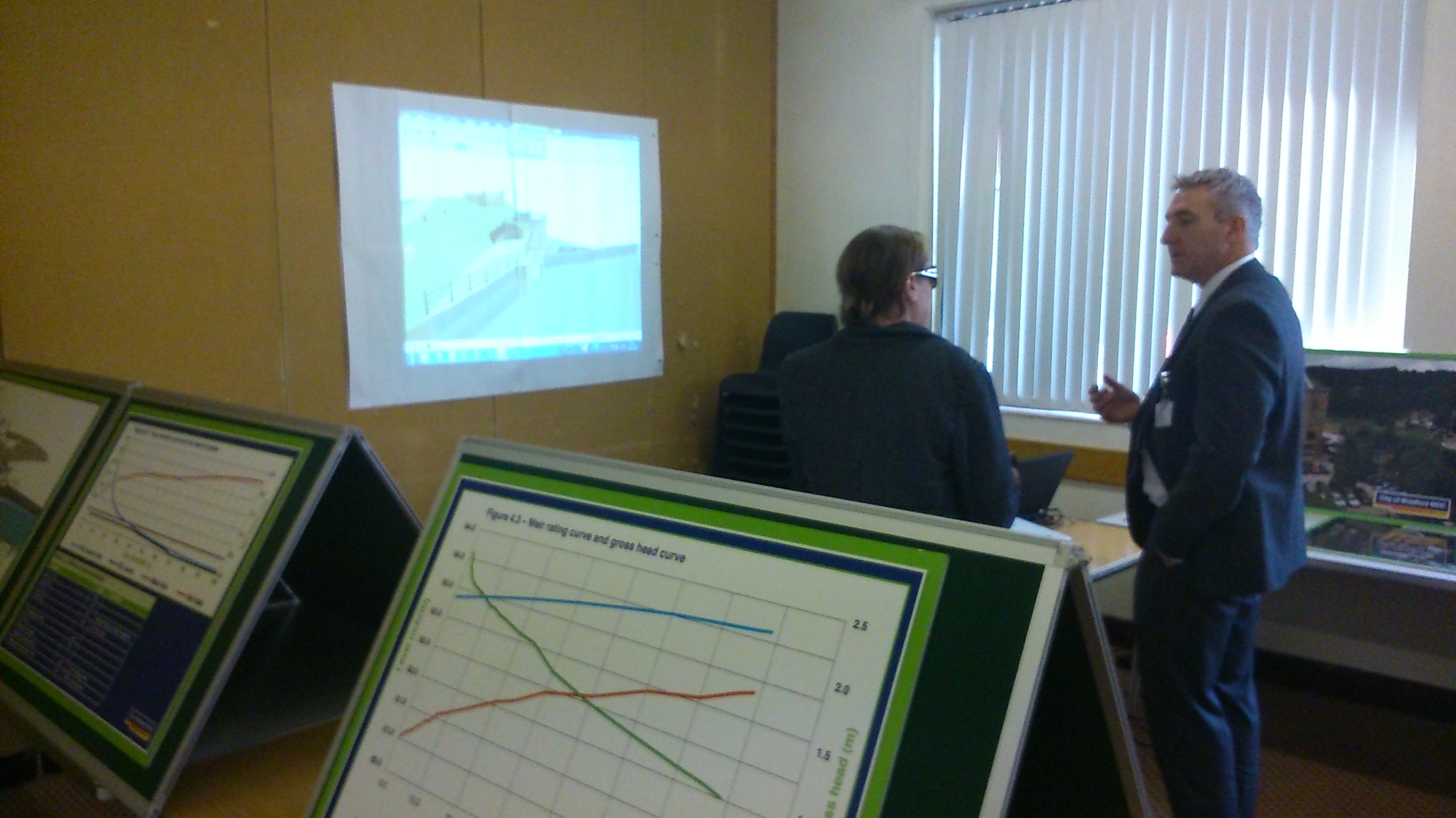
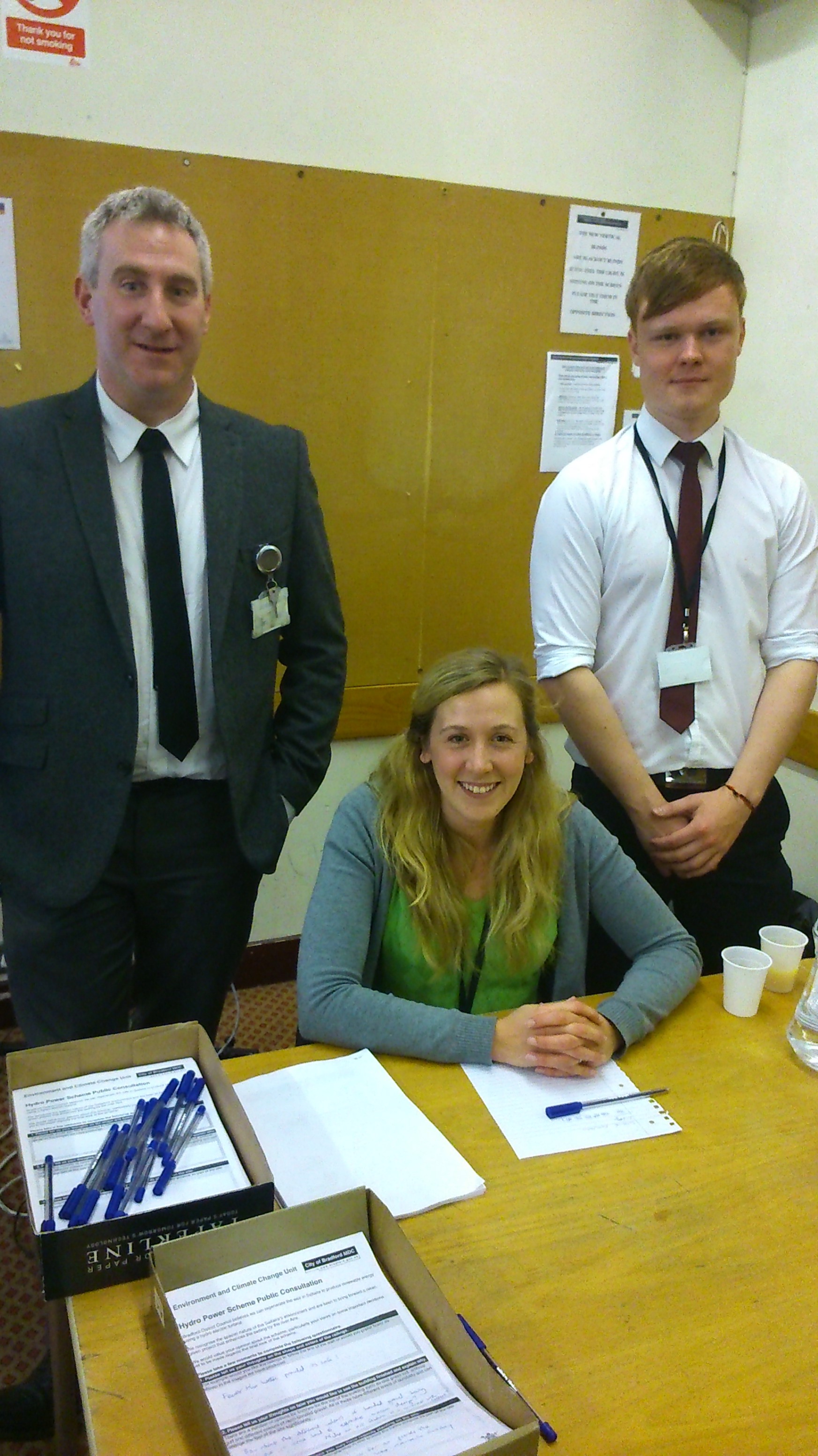
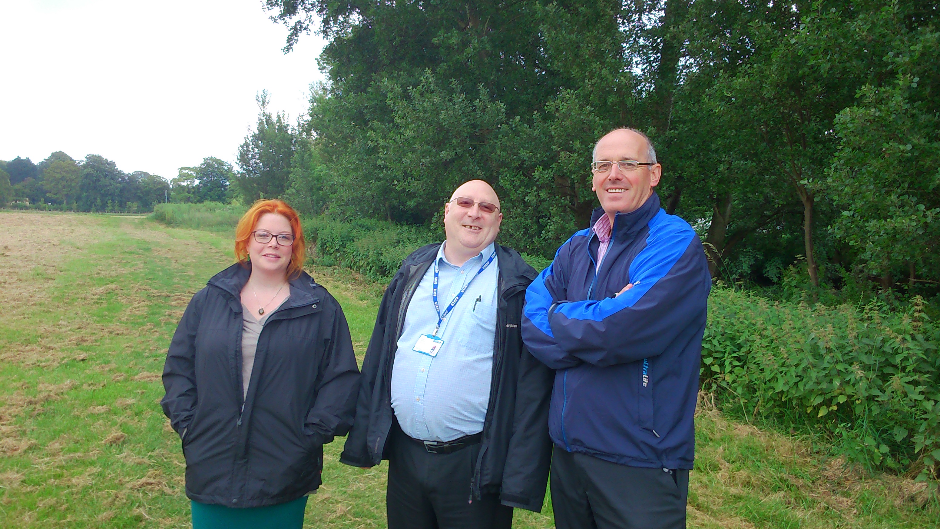
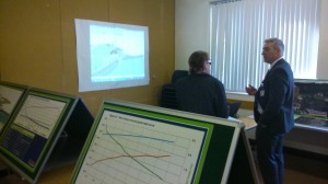
Here’s the valiant team from the Council battling disinformation at Shipley Library. Neill on the left, with his colleagues Kate and Tom, who all seem very committed to the project. The hydro, I’m told, will cost up to £1.5 million to construct, and should pay for itself within 10-12 years — although the currently volatile price of energy, Tom points out, will inevitably affect the length of time it takes to recoup costs. As for the rumour mill’s claims that the scheme has cost council tax payers around £1 million in consultancy fees (I’ve heard this claim put forward quite seriously), Neill blinked in bewilderment when I mentioned this figure. The true sum, he says, has been around £60 – £70,000.

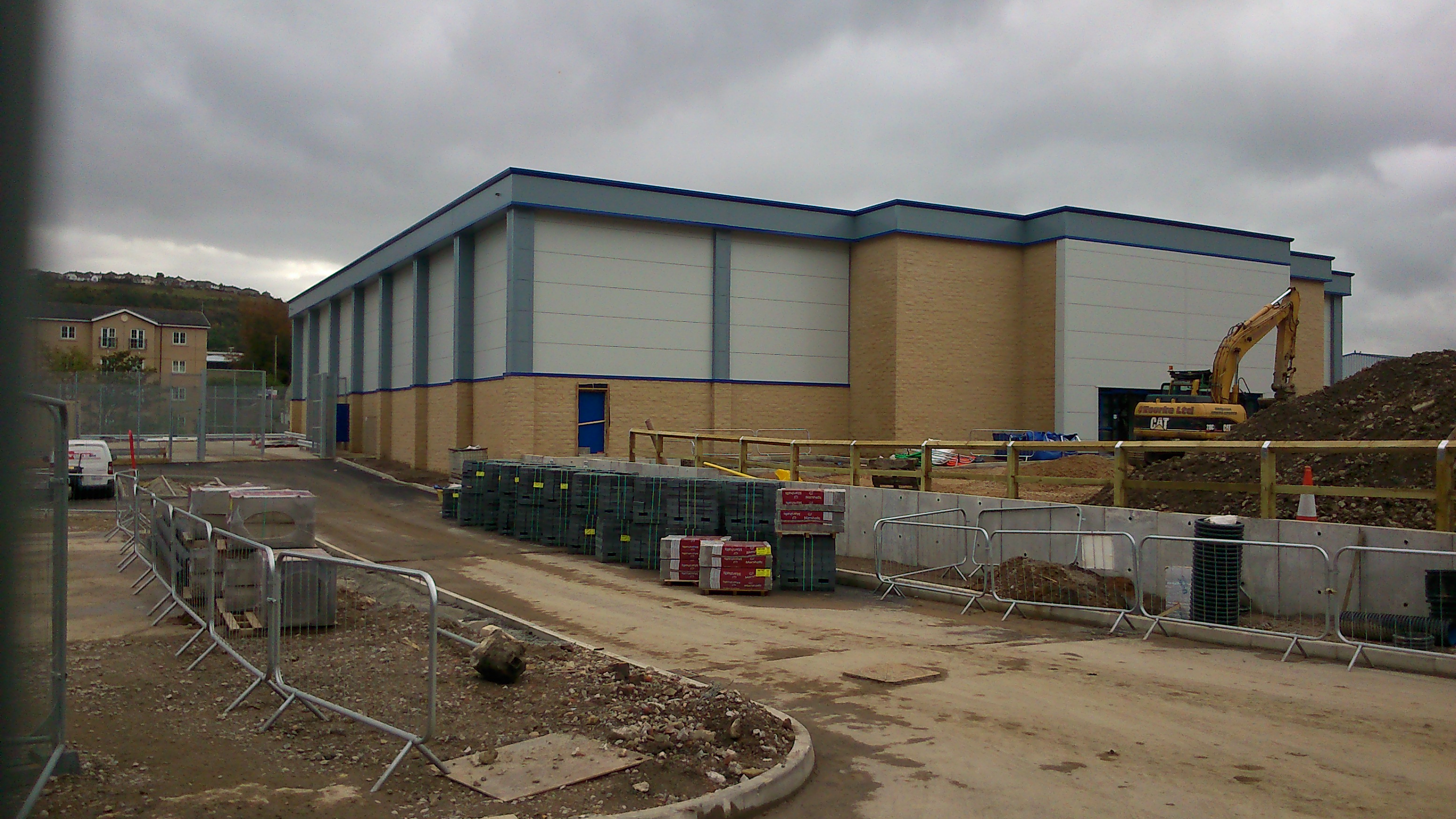
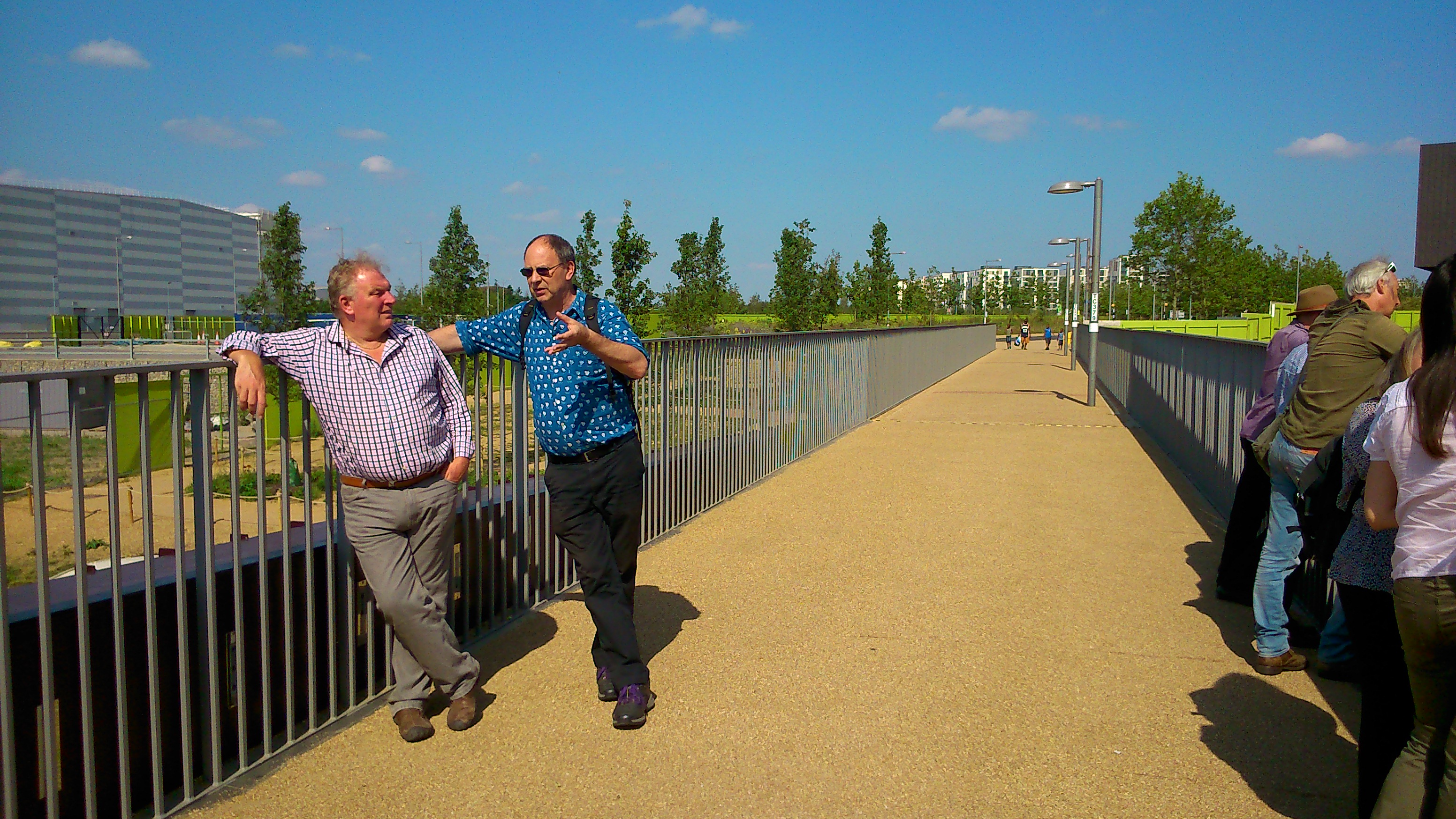
So anyway, inspired by this consultation exercise, I subsequently took myself down to Baildon Bridge to indulge in a little unofficial consulting of my own…

2014-10-17 14.21.54
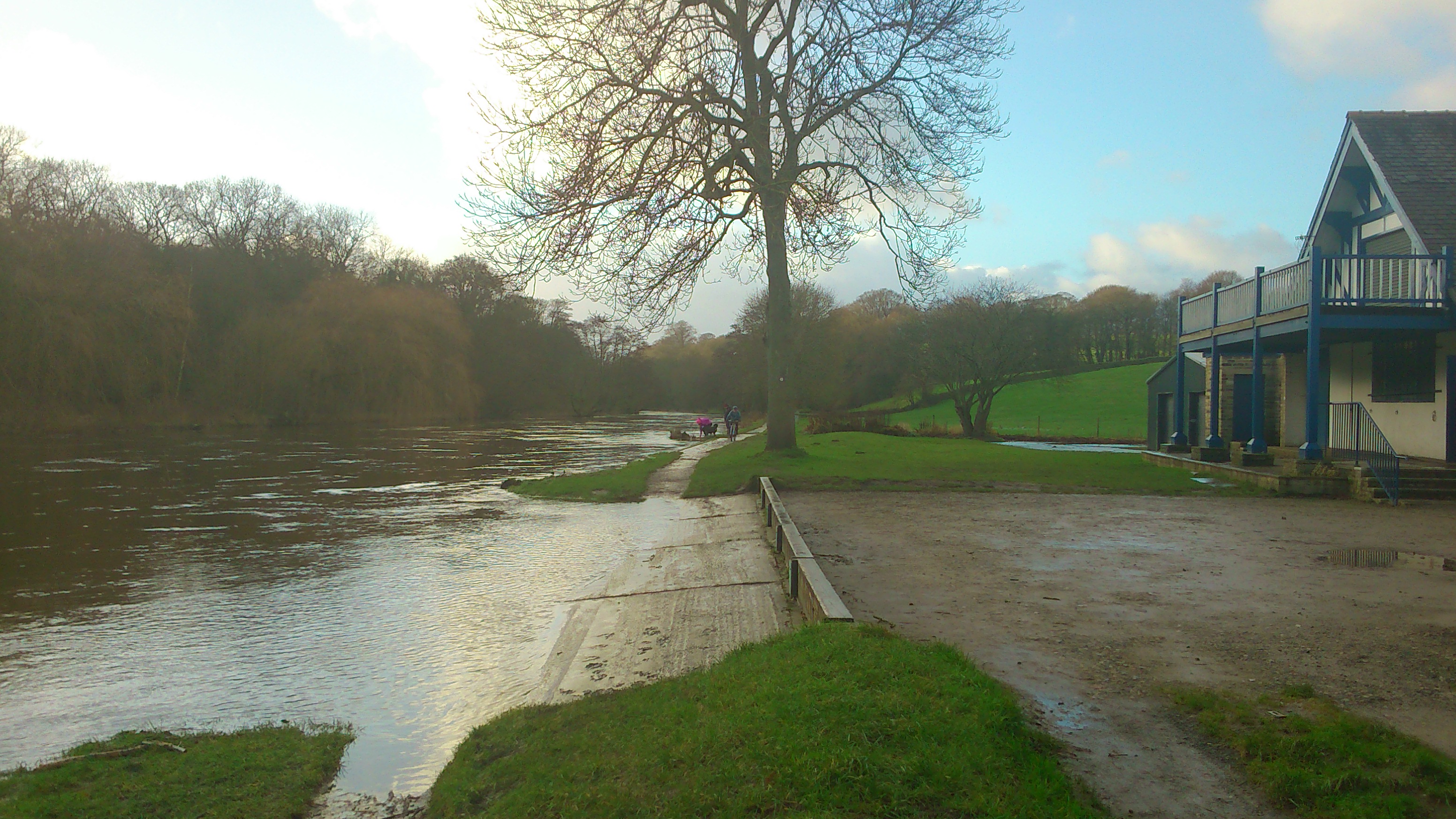
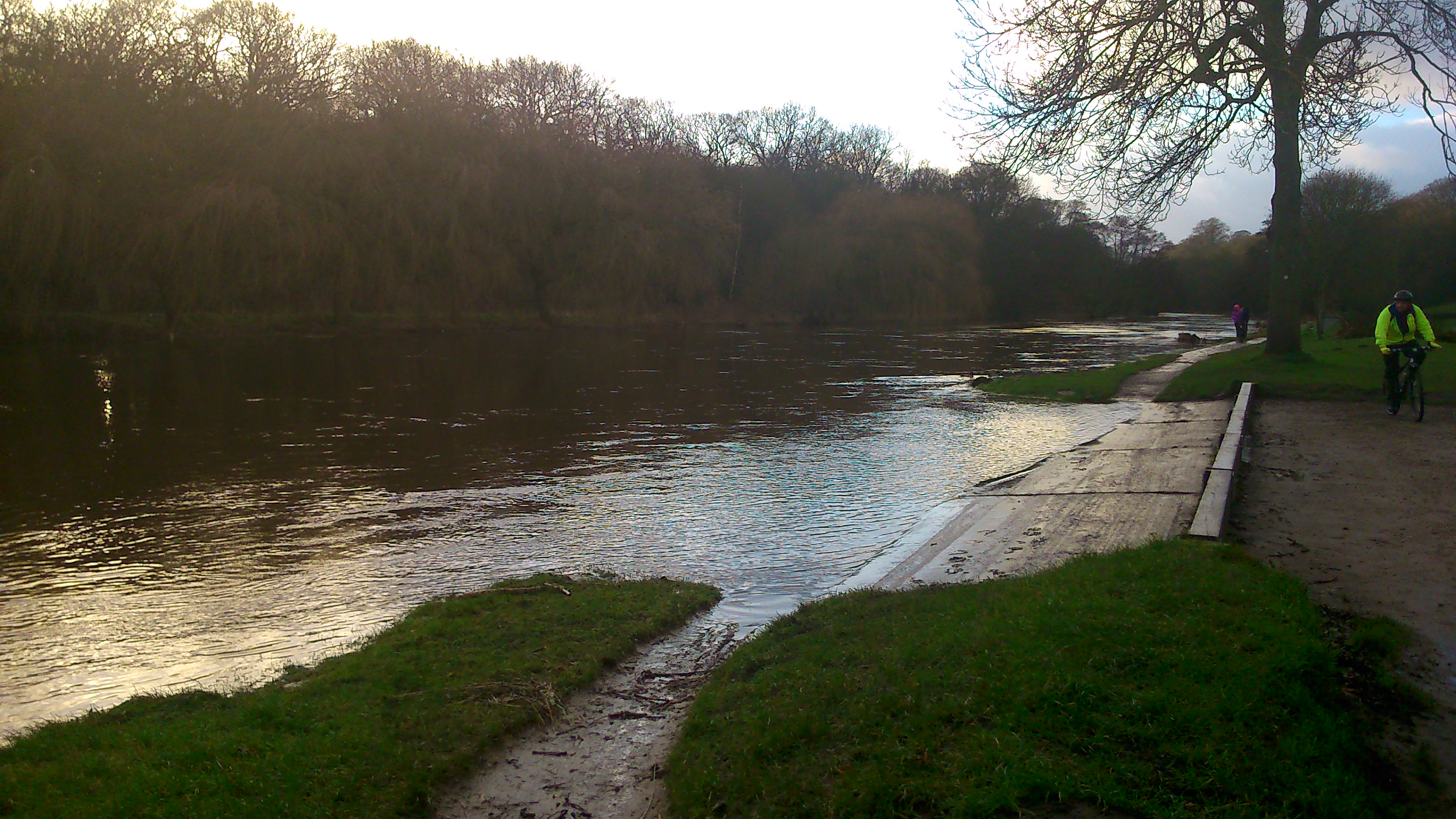
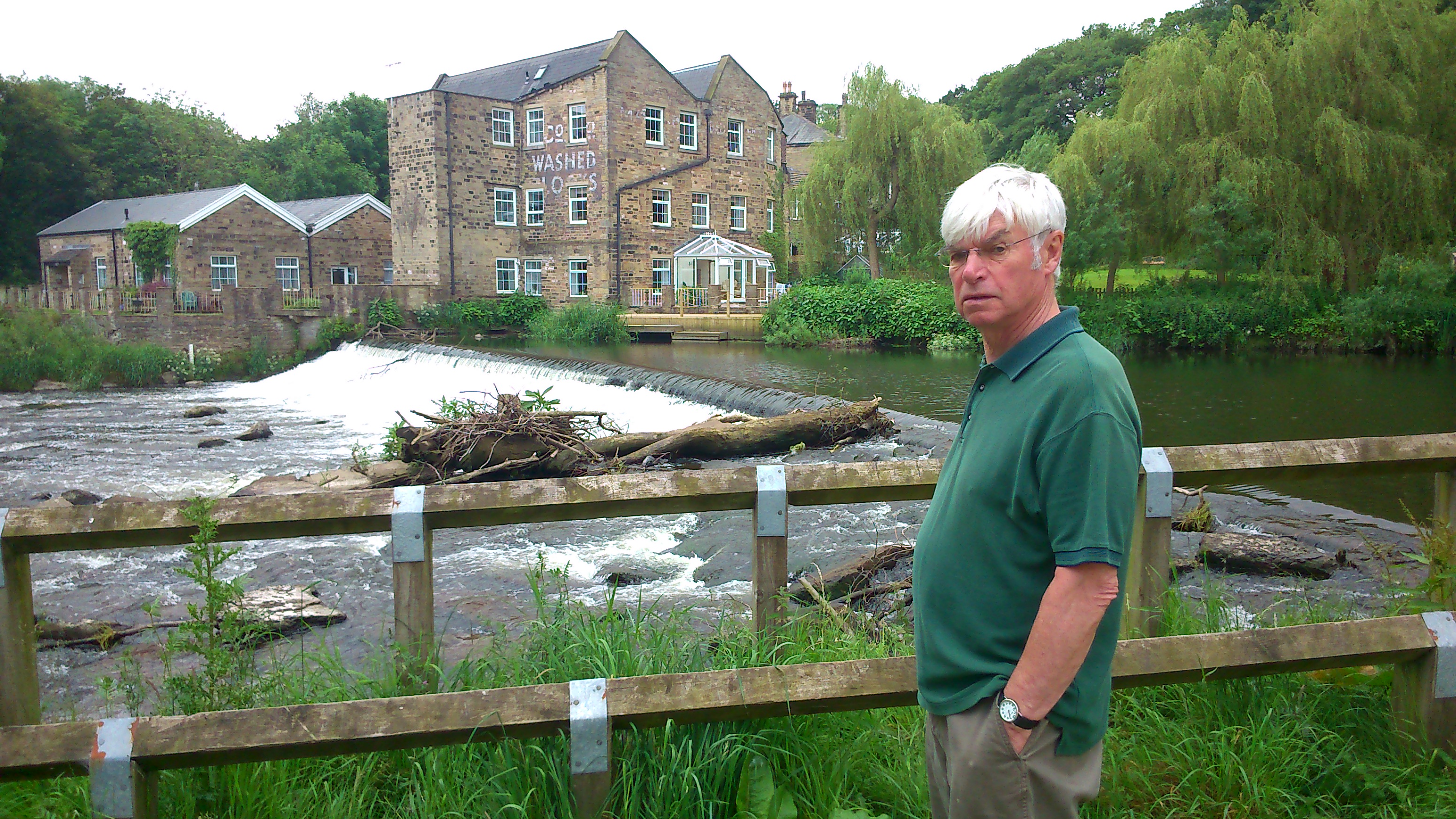
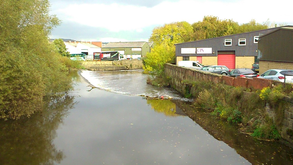
Here I am in a dubious ‘selfie’, standing on the bridge, with Shipley weir in the background… This is the less contested weir in the area, somewhat neglected and largely ignored by comparison with the one just upstream at Saltaire. But as has reported previously on this blog, some folk at the local working men’s club (just on the upstream side of the bridge) have argued for this weir’s removal. The suggestion is that, in keeping the water level artificially high as it comes under the bridge, the weir increases flood risk in the area (not least to the club), and it’s certainly the case that this bridge is the major flooding pinch point in Shipley — as it easily becomes dammed up with debris in high water… Anyhoo, point is, it’s been suggested to me that any talk of removing this weir would likely spark local opposition from those who see it as part of the area’s industrial heritage (there was a mill on the Baildon side of the river here probably since the 13th century…), or who like the aesthetic of the wide, curving structure. So today I decided to (unscientifically) test the waters a little by asking passers by what they thought of the weir and whether it would make any difference to them if it wasn’t there any more…

Now, my first discovery was that there are very few passers-by on this busy bit of road, at least on a Friday afternoon. The volume of road traffic far outweighs the footfall. And actually the footfall is mostly on the upstream side of the bridge… so I did wonder about crossing over to catch those people, but then I wouldn’t actually have a weir to point at so that would have been a bit daft. Among the people I was able to talk to, their main reaction to the question of ‘weir or no weir’ was profound indifference. In fact some of them looked a little surprised to realise there even was a weir there (or even that they were crossing a river, come to that). You sort of have to make an effort to look around and even notice it, even on the bridge — and the bridge is about the only vantage point in the area that offers an unimpeded view of the weir anyway (except perhaps for the car park on the right in the picture below). As I said, this is not Saltaire…

2014-10-17 14.22.25So would anyone miss this weir? One or two people expressed the view that, given the choice between it being there and not, they would rather it was, because at least it was something to look at. Which is fair enough. Other people, though, thought that it was rather unsightly to look at. There was no consensus on this. I did have one man explain in great detail to me why the weir had to be there to control the flow of the water round the curve in the river (all of which he was clearly making up, although he seemed quite convinced of his case). And another man seemd to think that the river level had been hollowed out on the downstream side, as opposed to artificially raised by damming on the upstream side. All of which will come as a surprise to engineers. But as I say, the point is that – basically – nobody seemed that bothered about this weir at all. This is a busy through road, not a beauty spot, and I was clearly a curiosity to most for even asking the question…

So, a curious afternoon all round really. But on a weirdly warm mid-October afternoon it was certainly pleasant to be out in the fresh air – even if those nagging fears about climate change won’t ever quite stop murmuring…

Lower Holme latest

Building work continues apace at Lower Holme, the former site of C.F. Taylor’s textile mill, pn the Baildon side of the River Aire, east of Baildon Bridge (see previous blog entries tagged ‘Lower Holme’). Here’s the river, the new flood wall, and the emerging Wickes… (plus a curious angler, bottom left) There’s something about the range of colours and textures here that really appeals to me…

2014-10-17 14.08.56Below is a shot taken near the front of the new Wickes building, from the bottom of Lower Holme’s row of remaining mill houses. I love the way this door stands in the midst of the site, like some abandoned piece of stage set…

2014-10-17 14.11.15From the angle below, you can clearly see the kerbing that has now been laid to mark out the edge of the new road that will bring traffic off the main road towards Wickes’s car parks…

2014-10-17 14.05.46There is also kerbing which, rather more intriguingly, marks out a sort of long island between the access road for Wickes and the residential road for the Lower Holme houses (see photo below, which looks north towards Otley Road). According to the plans, this island will eventually have high, masking hedging to protect the privacy of residents. But what of the strange mix of old cobbles and new tarmac…?

2014-10-17 14.05.33The shot below, taken looking towards the river from the access path that runs down from the houses to the footbridge, shows how wild riverside plants are once again establishing themselves on the banking area that’s been left between the path and the new car park…

2014-10-17 14.07.39And here, to balance the splashes of wild yellow above, is some autumnal red on the trees lining the other side of the path (in a shot now looking north again towards houses and road).

2014-10-17 14.09.22Again, there’s something about the clashing textures of metal, stone, wood and leaves that catches my eye. There’s a strange beauty about this place, at least for me, that is starting to re-emerge after years of neglect. (Maybe.)

Coming up at next month’s Saltaire Festival…

sALTS wATERS JPEGThis informal performance event will feature a combination of music and storytelling… Eddie Lawler, “the bard of Saltaire”, will perform a selection of his own original songs, focusing particularly on watery ones such as “Bradford Beck” and “Bradford Canal”, and showcasing a brand new song, “Little Beck”. In case you’re wondering, Little Beck is a very short tributary river that flows into the River Aire up at Hirst Wood, after flowing down through the overgrown grounds of Milner Field — the ruined mansion near Gilstead built by Titus Salt Jr. (who had the beck dammed to create boating lake for his guests). Meanwhile, I (Steve Bottoms) will be interspersing Eddie’s songs with a selection of stories and ‘spoken word’ material, all relating to places along the way between Saltaire mill village and Milner Field (via the Aire, the canal, Little Beck and Loadpit Beck). Salt’s Waters is a one-off, ‘work in progress’ presentation of material currently being developed for a downloadable audio guide of the same title, which will take listeners on a looped tour from Saltaire to Milner Field and back.

We hope you can join us!

Engineering the River Bank?

This summer we’ve seen two quite contrasting changes to the north bank of the Aire in the Shipley-Baildon area. East of Baildon Bridge there’s been new building work on the former mill site at Lower Holme — a location this blog has observed with interest for some time (see other posts categorised under ‘Lower Holme’). The long-derelict site is finally being turned into a commercial precinct with buildings and parking for Wickes and KFC, but the build was delayed for quite a while and this is part of the reason why:

phone pics 344The public footpath along the river, running along the edge of the site, is now flanked by this wall of caged rubble cubes — stacked to head height. Apparently the Environment Agency belatedly insisted on this being erected as a condition of the building permit. The ground on which the Wickes building is going up (you can see the frame in the top right of the shot above) has also had to be bulked up to the height of the wall on the other side. The theory, apparently, is that this will act as a flood defence for the site. But what you can’t quite tell from this photograph is that it’s already quite a drop from the footpath to the river. According to local residents, in the floods of 2000 (the most extreme weather event in these parts in most people’s living memory), the swollen river only just topped the level of the footpath. So it would take a really pretty apocalyptic flood to get anywhere near the top of these new rubble cubes.

phone pics 346You can see in this shot how the land naturally rose up further from the path anyway (here the footpath continues on the left of the shot, along the riverbank; the white and blue metal fencing between path and blocks is a remnant of the former site fencing put up by the previous developers, Mandale). So I can’t help but feeling this is flood defence overkill… especially when you bear in mind that the residents in Lower Holme weren’t affected by surface water in 2000 anyway, but by water coming up through their basements (and nearly reaching their electricity meters, rather scarily!). This whole area of land is right on the water table, so in flood conditions water literally seeps up through the floor, given half a chance. The ground is apparently so porous that Lynda, who lives in the end gable house nearest the river, remembers finding tiny fish swimming around in her basement during the flood – somehow they had filtered their way through the earth, even though the house is a good hundred yards from the river. A great story, and one that slightly begs the question (at least to a layman like myself) of what exactly the new defences are supposed to accomplish. They seem almost militaristic, as if the river is some assaulting army, laying siege to the land. I wonder if those tiddlers could get in between the blocks? 😉

2014-06-17 11.12.23A little upstream, at the western end of Shipley/Baildon catchment, we’ve seen a constrasting scenario… not ‘overkill’ but a kind of benign neglect. This picture is of the grassy flood plain area between the river (off to the left of this shot) and the Higher Coach Road housing estate. First posted on this blog at the end of June, the photo shows how the grass had been left to grow up into a meadow, with the only mowing occurring along the line of the traditional riverbank path, to the left of shot. (It’s not technically even a path – it’s usually just a ‘desire line’ tracked into the grass, so being marked out by mowing has almost made it seem more official.) Subsequent to my earlier post, I did look into why this long stretch had been left unmowed, because I wondered if there was some new planning rationale for it… And at the beginning of July I met on site with these lovely people:

phone pics 337Left to right here are Lyze (pronounced Lizzie) Dudley, our new research associate on the MSW project; Dave Horsman, from the Shipley Area Committee of Bradford Council; and Malcolm Wright, who is the Council’s head of parks and landscaping in the area. Based at the Park Lodge in Roberts Park, Malcolm is – it turns out – also responsible for the grass on the estate. And the reason it didn’t get mown this year was basically because of budget cuts within the Council (it’s the age of austerity…), which mean that Malcolm only has one man to send out to mow, instead of two. And in fact, only a few days before we met, one man went to mow (went to mow a meadow), with the result that we were looking at this:

phone pics 338Freshly cut hay… not meadow grass… And the reason for it being cut at this point was simply, Malcolm told us, because he had received a complaint from someone on the estate about the length of the grass — so he decided to prioritise doing something about it. There are a couple of ironies at work here… One is that I’m quite sure that some other people living on the estate will have quite liked the meadow effect. (See for example the comment that was posted on the end of my June 24th blog post.) The other is that Lyze and I had arranged to meet Dave and Malcolm specifically because we were interested in the meadow grass… The main reason for this is that our research in the area in the last couple of years uncovered quite a degree of interest among residents in something more creative and interesting being done with this lumpy, uneven, often boggy grassland. Back in September 2012 we held a sort of creative consultation event (the ‘Higher Coach Road beach party‘) which resulted in a painted map of the area being marked up as follows by residents:

MSW CE 09As you can see, we were presented with the idea of a “reed wetland bog”, with a “pond in [the] area that floods” (this refers to an especially boggy area of the flood plain just down the slope from Troutbeck Avenue). There was quite a bit of support for this idea (it originated with Theresa, I think, from Derwent Avenue), which would also amount to a form of ‘soft engineering’ of flood defences — since if designed right a layout of ponds, reeds, bushes and trees would enhance the flood storage capacity of the land here… whereas monoculture grass does little or nothing to prevent downhill run-off from just carrying straight on into the river and adding to the weight of water being carried downstream… Or at least, I think that’s the theory. Anyway, hopefully it’s now apparent what kind of contrast I’m trying to draw here with the questionable new ‘hard’ engineering downstream at Lower Holme.

The point here is that our earlier conversations with residents on the estate could only ever be that – conversations – since Multi-Story Water was originally only a one-year project (2012-13). But having now secured new funding for three years from 2014-17, we’re in a position to see if we can help facilitate some further discussion towards (just maybe!) actual changes. And the meadow grass had struck me as a great opportunity to kick something off, because most of the residents will have had opinions about it, pro or con (or both). A wildflower meadow is not a reed wetland, but it’s certainly a step towards more biodiversity… And I thought I had just the man to help us animate the meadow a bit, to spark debate. (See this blog page here for an account of Baz Kershaw and his ‘meadow meander’ – a temporary meadow area that he developed as a kind of theatrical exhibit at Leeds University in 2012). Malcolm Wright, the parks and landscaping chief pictured above, turned out to be very supportive of us doing something to engage residents in a discussion about how to treat this area in future —  and he offered to provide us with materials to illustrate the various different types of wildflower meadow and other alternative grassland arrangments that are used in other parts of Bradford… So this would really present people with choices to consider. But…

DSC_0041… in this photograph, taken just last week, you can see that the grass hasn’t really grown all that much in the five weeks since it was last mown. A few hay-like stalks appearing, but basically this grass is barely above ankle height. We had been planning to try to arrange an event involving Baz and others this coming September (next month). But it’s pretty clear that the grass won’t have grown into anything resembling a meadow by then…

All this brings a whole new meaning to the phrase “watching the grass grow”. But with hindsight it may be no bad thing that we’ve had to ditch our tentative plans for September. We’re now looking at planning ahead for an event next May or June, when the grass, if left, will be at its most springily meadow-like. This means that we can try to develop conversations with the residents in the run-up to this event, involving people properly in the planning, rather than simply using an event as a way to initiate conversations… It’s probably better this way round.


A Day Out in London…

Last week three members of the Shipley Multi-Story Water team — Trevor Roberts, Lyze Dudley, and myself (Steve Bottoms) took a trip to London. Here’s the view from where we ended up having dinner that evening…

phone pics 462The Olympic Stadium has cranes up around it again as they’re still in the process of dismantling the top level of seating from events two years ago (in preparation for handing it over to West Ham F.C., who presumably won’t need so many seats…). Anyway, as this image suggests, the Queen Elizabeth Olympic Park is surrounded by waterways – this bit being a navigable section of the River Lea…

phone pics 465The view above was taken from a floating restaurant platform that’s part of the Stour Space artists’ studios. Here’s some of the dinner party (left) including, in the foreground, Owain Jones – a geographer from Bath Spa University – who is the ‘principal investigator’ in the new 3-year, AHRC-funded project, “Towards Hydro-Citizenship”. We’re still not quite sure what hydro-citizenship is (or might be), but the point is that the MSW project in Shipley is now being continued as one of four UK-wide partner projects under the Hydro-Citizenship umbrella. In all four case study contexts, we’re exploring connections between communities, water, and the arts (and heritage), with a view to doing something useful…

phone pics 468The Lea Valley, which the Olympic Park lies towards the downstream end of (the Lea flows down from Hertfordshire and meets the Thames in east London) is one of the other case study areas… The other two are in Bristol and mid-Wales, so this blog might feature further ‘away day’ missives from time to time, when all the wider project’s team members collectively go to visit these other sites. But for now, what follows are a few personal reflections on the London site and how much it differs from Shipley. I was pleased to see, though, that some of the locals have a blunt line in graffiti wit that might go down well in Yorkshire. If you can make it out in the darkening image above, there’s the word “UGLY” painted on the waterside with a big arrow pointing at the Stadium…

phone pics 478This daytime shot shows a different but similar setting, with a restaurant on the right (west) bank looking towards the various stadia (the grey block to the left is the Copper Box Arena, which hosted such memorable events as handball, modern pentathlon and goalball during the 2012 games). What’s really striking is how the waterways function as borders for the whole site. So on one side of the water you have London’s east end, with lots of features you might expect to find in a post-industrial landscape (empty warehouses and factories, some now housing artists’ studios; run-down council housing, etc.), and on the other side of the water you have this spanking, shiny new artificial landscape of parkland and stadia. Here’s Trevor Roberts talking to Bristol-based arts consultant Iain Biggs, standing on the same bridge the shot above was taken from. Here we’re looking back at the Park…

phone pics 482This gives you an idea just how plastic-looking the new landscape is. One colleague described it as looking exactly like an architects’ computer plan for a green space, where they’ve just plonked identical avatars of bushes and trees onto a flat green background. And indeed that’s probably exactly what happened here: the park is a simulation of a computer model, rather than the other way around… It reminded me strongly of the cuddly astroturf home of the Teletubbies, only without the pleasingly rounded mound… (it’s flat flat flat, except where the ground slopes down to the waterways)

phone pics 476And perhaps the weirdest thing of all is how empty the whole place looks… I mean OK the shots above were taken early afternoon on a weekday, so lots of people were at work, but how often do you really see parks this empty? The place is like a kind of ghost town, a giant white elephant built at mind-bending expense to service a few weeks of sport two years ago, and now completely unsure of what its role is. Certainly there is little sense of it being embraced much by the communities lying just beyond its watery perimeters — in Tower Hamlets, Newham, Hackney… The whole place is like a giant corporate spaceship (complete with the inevitable mega-mall between Stratford tube station and the park itself), that has plonked itself down in the midst of some of London’s more deprived neighbourhoods. In fact Zaha Hadid’s swimming pool complex really does look like a spaceship (I kind of like the design of this one, actually!). Here are its insides, lit up at night like a forlorn ghost even as the Commonwealth Games were raging in Glasgow…

phone pics 473I really don’t envy the role of those people charged with making sense of the “legacy” of all this for east London. Nor do I particularly envy my colleagues working on the London case study for the Hydro-Citizenship project. How to engage local people with waterways that are mostly ill-maintained (full of duckweed that must be stifling whatever life there still is in the water), and that function as social barriers more than as community resources…? Admittedly, to some extent, that last comment is true of the waterways in Shipley too, but for all the sense of disconnectedness between different neighbourhoods in Shipley, the area as a whole at least makes a kind of sense. It’s a post-industrial landscape in which the local industrial heritage is genuinely valued (Saltaire being the most obvious evidence of this), and in which new developments have to respect that heritage and seek in some way to harmonise with it. And in which local people have persistently and famously fought against developments (such as new trunk roads) that were not in the town’s interests. Here in the east end of London, though, they’ve just razed whatever was there before and built this largely soulless mega-park, whether or not local people wanted it to begin with. How do you make sense of that? Maybe in time it will start to blend in with its surroundings a little more, but it looks like that might take a while…

Walking Salt’s Waters

High time I updated this blog. There’s been lots happening behind the scenes, as a new phase of the Multi-Story Water project slowly swings into gear. In the last month or so there’s been planning meetings with those excellent people at Shipley’s Kirkgate Centre, plus the appointment of a wonderful research associate in Lyze Dudley (of whom, more another time), and lots more besides — all irons in the fire for what’s going to become a 3-year project working directly with various local groups and individuals to develop discussions and creative projects around the future social and environmental potential of Shipley’s waterways (please do get in touch if you’d like to know more). In the shorter term, though, there are also plans afoot for a contribution to this year’s Saltaire Festival, in September…

2014-06-17 13.03.38Here’s the ‘bard of Saltaire’, Eddie Lawler, snapped last week up at Hirst Weir (which has yet another tree straddling it…). Eddie and I will be presenting a one-off gig on September 18th at Half Moon Cafe in Roberts Park — Eddie playing his guitar and singing, me doing a little spoken word… It’s a double act we first developed on the Blue Route of our performance tours in 2012-13 (see ‘Performances’ tab), and which we both enjoy. The Half Moon event will really just be a public launch, though, for a longer-lasting but less visible performance — which you’ll be able to experience in the form of a downloadable audio guide. This will take listeners on a walking tour from the bottom of Victoria Road, in the heart of Saltaire, and north-west to what remains of Milner Field, the grand mansion built in the 1870s by Titus Salt Jr., and now just a pile of stone overtaken by self-seeded woodland…

2014-06-17 10.44.22The audio guide, titled Salt’s Waters (Eddie’s suggestion), will connect mill and ruin via various local waterways. There’s the River Aire and Leeds-Liverpool Canal, most obviously, but also Loadpit Beck (which flows into the Aire near Bradford Rowing Club, and which marks the boundary line between Baildon and Bingley land). There’s also the even lesser-known Little Beck, which passes through the Milner Field estate and was once dammed to create a boating lake for Titus Jr. and his family and guests (who included royalty, no less!). Little Beck is the chosen subject for the new song Eddie has written to be mixed into the audio guide, and which will thus have its world premiere at Half Moon Cafe. It joins other watery songs in the Lawler canon, including those dedicated to the Bradford Canal (written for Blue Route), and of course Bradford Beck — an older song which is now the unofficial theme tune of the Friends of Bradford’s Becks, and also features (thanks Eddie!) on my short film Wading to Shipley. That film, incidentally, was expertly edited by Lee Dalley, of Leeds University’s Workshop Theatre, who is pictured above with Eddie last week… (they had just met for the first time!)

2014-06-17 11.20.17Lee has generously undertaken to sound-design our audio guide — mixing my words and Eddie’s music with layered sounds of his own… So he came out to walk the route with us and record sound samples along the way. Here he is with his recorder (and Eddie) underneath the Barden aqueduct — which crosses the Aire at one end of the Higher Coach Road estate. Lee wanted to catch the echoing sound of the river’s flow, as heard just here… He also will have captured the electronic click of my phone-camera taking this shot, but when I apologised he said he loves that kind of random sound interference. Who knows, maybe the ‘pling’ will find its way into the final audio mix!

It was a thoroughly enjoyable experience, walking with Eddie and Lee up to Milner Field — so enjoyable in fact that I forgot to take any more pictures en route, and just revelled in the company and the ambient sounds of flowing water, rushing water, gurgling water, wind in the trees, multiple forms of bird-song, footsteps going over wooden stiles, bike wheels on the towpath… you name it. You notice all this so much more acutely when someone keeps shutting you up to record them! (or at least, I do…) I just hope my narrative can do some kind of justice to the sounds that walkers will be hearing both around about them and in the mix…

There is one other picture I just want to share here though… It was taken just before the previous one, as we walked through the grassy flood plain area that separates the Higher Coach Road estate from the river. I was fascinated to notice that, this year, the council’s mowers have largely refrained from cutting the grass back — except along the riverside path that is traditionally beaten out only by walkers’ footsteps. You can see that mown bit to the left of the picture here… and in the centre and right, the long meadow grasses that have grown up unhindered…

2014-06-17 11.12.23I need to find out whose idea it was to leave the grass uncut… and also what the residents make of it! One of the findings of our previous research work on the estate (expressed in our Green Route performances, that came through it) is that many of the residents have felt that the mown grass field was both: (a) a bit daft – since the council’s mowers would come and chew up the grass even in wet weather – when parts of this flood plain area just become a big squelchy puddle!; and (b) a wasted opportunity – since some other, more imaginative arrangement, like a reeded wetland area, might attract more diverse wildlife and thus also be more interesting for residents and visitors… Interestingly, this new wildflower meadow option seems to be a sort of cautious step in that direction… although it might also be purely a result of council budget cuts making mowing less frequent! I must investigate… (… he dons a deerstalker and strides off into the long grass…)