Last Christmas: a view from the air

DCIM100MEDIADJI_0019.JPG

Tomorrow, Sunday 18th December 2016, we’re holding a Christmas party at Baildon Woodbottom Working Men’s Club for the Higher Coach Road Residents Group — and other invited members of the local community. We held a similar event around this time last year, shortly before the club was devastated by flooding on Boxing Day. That’s the club’s buildings, there, on the lower right of the photo above. The ‘proper’ river is to its right, and the lake that was Woodbottom cricket pitch is to the left. This was 27th December 2015, as the flood water was starting to recede.

DCIM100MEDIADJI_0006.JPG

Here’s a closer view of the club and adjacent caravan park… And below, another view as the aerial drone camera turns clockwise to show the rest of the club and the upstream area.

DCIM100MEDIADJI_0007.JPG

Below, moving further upstream but looking back — a higher and wider shot of the whole area. Here, the main course of the river is much clearer, just off to right of centre. The club is in the middle towards the back of the shot, and in the foreground, Baildon Rec and the local Sea Cadets hall.

DCIM100MEDIADJI_0014.JPG

Then, below… just a little further upstream still, and turning clockwise again to look west, we have the four houses of Aire Close — right next to the river — and the Victoria Mills complex on the opposite “bank”. In the distance, to the west, is Saltaire. Notice the visible watermark on the buildings in this shot, since the water is already well down on where it had been the previous day:

DCIM100MEDIADJI_0009.JPGI’m very grateful to Brian Tuxford, of Northway Vehicle Sales (on Baildon Bridge) for sharing these images with me and allowing me to put them up on the blog. I featured Brian a few weeks ago, in this blog post, but it’s taken me a while to get these images up (because the CD he gave me had got corrupted somehow, and I had to get technical support to recover the photo files). Anyway, it seems appropriate to share them at Christmas — one year on.

DCIM100MEDIADJI_0029.JPG

Above, we see the view from just downstream of Baildon Bridge, looking west. The cricket pitch etc are to the back of the shot now, and in the foreground we see the retail area east of the bridge, off Otley Road… United Carpets, and in the bottom right, the garden centre section of B&M. The river channel proper is to the left. The collection  of white vans in the middle of the shot is part of the Northway Vehicles fleet — the part that hadn’t been swept away by the flood — and you can see here just why Northway’s compound was in exactly the worst place as far as the flood was concerned… right in harm’s way as the water diverted across the cricket pitch tries to find its way back into the main channel. Below we see the same scene in reverse (i.e. the other side of United Carpets is now to the left; the river is to the right), and here you can get a very clear sense of the trajectory that would have been taken by the 37 vehicles swept downstream off the Northway lot…

DCIM100MEDIADJI_0035.JPG

The shot below gives some sense of how bright and sunny it was, on the day after the storm. Again we’re looking west, with the club to the left and the Rec in the centre of the shot. In the lower foreground is Otley Road, coming away from Baildon Bridge…

DCIM100MEDIADJI_0027.JPG

If you compare the shot above with the shot below — which seems to have been taken later in the day, when the water level had further receded — you can see how more of the road is now visible. And how the worst flooded part of it is actually around the junction with Green Lane… The bridge itself, to the left, and everso slightly raised to cross the river, is by this point comparatively dry. Which may be why the vehicle trying to ford through the flood water had thought it safe to ignore the road closure signs at the other side…

DCIM100MEDIADJI_0027.JPG

Particularly clear from this photo above is the way that the main river channel goes through a noticeable curve or bend as it comes under the bridge. Hardly surprising, then, that in high water — and with the channel under the bridge itself partially blocked by debris — the river diverts itself straight across this area, in a sort of “short cut.”

DCIM100MEDIADJI_0023.JPG

Finally, then, back to the club. And the vapour trails in the sky, reflecting in the standing water on the cricket pitch. And one, stranded blue car, which is not going anywhere fast.

Merry Christmas, one and all.


Flood Response @ Armley Mills

It was a pleasure and a privilege this last Thursday evening, December 8th, to have the opportunity to perform Too Much of Water, my one-man show about the Shipley flood last Christmas, at Leeds Industrial Museum — aka Armley Mills. The occasion was the opening of a special exhibition titled Flood Response. A single room in the basement of the museum is jam-packed with varied, colourful, striking exhibits documenting the impact of the Boxing Day flood in (mostly) Leeds. As the title implies, the exhibition looks at how communities in Leeds, especially in Kirkstall and Armley (the mill itself was directly hit by flooding), responded to the flood, often by showing a surprisingly festive spirit of resilience and co-operation, and thereby turning a crisis into a form of community-building. In the same spirit, the exhibition itself is labelled a “community exhibition”, and as such is composed largely of material donated by members of the public, rather than being professionally produced or commissioned.

IMG_2096

The curator of this rather remarkable display is Chris Sharp, pictured here on the right — his first big project for Leeds City Museums. He’s done a tremendous job (I really do recommend you visit). The exhibition was officially opened by Councillor Judith Blake, leader of Leeds City Council, pictured below during her speech, during which she spoke with real passion about the city’s response to the flood crisis..

IMG_2097
IMG_2103
To Councillor Blake’s right here is Councillor Lucinda Yeadon, deputy leader of the council and (more to the point in this context) the ward representative for Kirkstall. As such, she was directly involved in the community response to the flooding along Kirkstall Road, and she really does seem to be one of those (rather too rare) politicians who inspires the confidence and affection of her local community. The exhibition opening itself was attended by quite a diverse crowd of invitees, enough to pack out the exhibition space, but here too the spirit of inclusion was apparent. This wasn’t just the predictable collection of luvvies and bigwigs you might expect to see at an exhibition opening, but a cross-section of people from the local community who had got involved in the flood response effort, in one way or another. (And here’s a few of them…)

IMG_2099

IMG_2095

I’m very pleased to say that Multi-Story Water’s own contribution to telling the story of the Leeds flood response is on display as part of the exhibit (which will run for six months). Our promenade performance After the Flood — devised for Leeds Waterfront Festival in June — is on display in a new film version. We completed editing just in time for the exhibition opening. And OK, yes, some kind of technical glitch meant that the film file wasn’t playing on the digital screen designated for it on Thursday (i.e. the one to the left of this chap’s head, in the picture on the left), so it had to be temporarily installed on  an alternative screen at ground level. This hiccup should be resolved soon, though. And in the meantime you can also view the film online… Just look for After the Flood under the “Films” tab on the menu bar above… 

IMG_1737

This is actor Kat Martin — who you can just about see on the screen in the exhibition shot above — performing ‘live’ in After the Flood, as “Poppy”, a young woman whose family’s business on Kirkstall Road was badly affected by the flood. (The doll’s house represents the business, and the small figures are Poppy’s parents…) I’m really rather proud of this piece, made in collaboration with Simon Brewis’s Common Chorus Theatre, but on Thursday night, attendees at the opening were too busy milling and chatting to concentrate long on a video screen… Instead, after the speeches were over, they were invited upstairs to the museum’s cafe space for my live storytelling performance, Too Much of Water (both it and the ATF film were requested by Chris Sharp for the exhibition and opening – thanks for the opportunity, Chris).

Anyway, here I am, as pictured/tweeted by Geoff Roberts…

CzLAY1BWQAAtTAf

When I originally performed this piece in Roberts Park, for Saltaire Festival, it was mid-September and the Christmas tree and jumper seemed amusingly quirky. Since then, I have performed it around the country (Exeter, London, Cambridge, Manchester, Leeds), and I’m aware that by now — in December — I’m in danger of looking like I’m just trying too hard to be seasonal. Be that as it may, the performance was very well received by attendees at the opening, several of whom made a point of introducing themselves afterwards and thanking me personally (which was very nice – thankyou!).

What people find moving, I think, is the piece’s focus on some of the smaller, more human details of how people were affected by the flooding (the script draws from interviews with a number of people in the Shipley area, who are represented by the small wooden figures). I was especially flattered by the suggestion of one senior flood risk officer, who saw the piece on Thursday, that anybody who works with people affected by, or at risk of flooding (be it for the Environment Agency, local council, or whatever) ought to see this piece, because it will help them reflect on what it’s really like to be in those circumstances. High praise indeed.

On the other hand, I heard on Friday — from another friend who couldn’t attend the opening — that a couple of his colleagues at the Environment Agency, who had been at Armley Mills to represent on Thursday, had felt slightly uncomfortable watching the piece. They wondered if I was attacking the EA’s warning efforts in Shipley around the time of the flood. I’d just like to say, publicly, that I’m really sorry if they felt that way, because this was never my intention. Yes, certain details are documented in the show, as seen from the point of view of my interviewees, that might perhaps be seen as not reflecting all that well on the EA, but I was very careful in writing the piece not to make any comment either way — simply to represent the facts as best I could establish them, and let spectators draw their own conclusions. And I do make the point in the show that the Agency too, in its own way, was inundated on Boxing Day — struggling to keep up with the pace of events as the crisis unfolded in multiple towns, in multiple catchments, simultaneously. They, too, are only human.

With that in mind, I’ll close here by pasting in Scene 5 of our After the Flood film — “the Agency Man”. Hopefully this provides some sense of just how tricky the EA’s job is, in terms of Flood Response – often having to be all things to all people. In my (finite) experience, they usually do a great job, in often very difficult circumstances.

The Trouble with Baildon Bridge (views from downstream…)

So this blog is in two parts. The first is a close-up, the second takes a wider angle, but hopefully it connects up. Bear with me as I tell the story, because it has a few twists and turns…  And to begin with, there’s also a

Prologue

IMG_2005

This is Councillor Judith Blake, the current leader of Leeds City Council. This week she said something very interesting indeed, from a Shipley point of view. Councillor Blake was speaking at a special networking event about future flood planning and resilience in the Aire valley, hosted this week at Open Source Arts – an unassuming enterprise unit on Kirkstall Road in Leeds. Open Source was itself flooded at Christmas, but thanks to the tireless efforts of leaseholder Phil Marken, it also became a focal point for the community relief effort and, later, volunteer river clean-up activities. It was thus a rather symbolic (as well as practical) venue for the networking meeting – which was attended by (among others) the key flood risk and drainage officers for both Leeds and Bradford. The goal is greater future co-operation along the Aire Valley catchment… But more of that in a minute. First let me jump us back to Bradford and introduce somebody else…

Part One: Northway

IMG_1965

This is Brian Tuxford. He runs Northway Vehicle Sales Ltd., the van hire place on Otley Road, right next to Shipley’s Baildon Bridge. I met Brian the other week, following an introduction via our mutual friend Stewart Gledhill, and he toured me round the Northway compound and gave me the lowdown on just how badly impacted the company was by last December’s flooding. Northway lost no less than 37 vehicles to the flood water – cars and vans – one of them swept as far downstream as Denso Marston’s nature reserve, at Charlestown. Even those vehicles that Brian and his colleagues managed to save in time — by parking them around the corner up Dockfield Road — were stripped of exterior fittings that night by light-fingered visitors, who took advantage of the absence of the usual CCTV cover. Insult to injury.

IMG_1963

The bottom yard at Northway Vehicle Sales, just downhill from Otley Road

There was also the small matter of Northway’s workshop/garage (pictured above) having a massive hole driven straight through it by the force of the flood water — the end panels blown off. The whole thing has had to be taken down, repaired and re-erected.

Boxing Day flood was a bit of a “perfect storm” from Brian’s point of view. Normally, 80 to 90 percent of Northway’s fleet is out on hire at any given time, but over the Christmas period they’re called back to home base. So they were sitting right in harm’s way. On a normal working day, moreover, Brian would be at work at 7am, and would have been in exactly the right place to see the danger to his fleet and take swift action… Instead, he was staying over for Christmas in Huddersfield and only realised what was happening, by around 9am when the water hit, from the CCTV link on his phone. (In her talk, Councillor Blake spoke of how lucky Leeds was that the flood came at Christmas — with the city centre workforce not present, not travelling in or out… But Brian’s story is the opposite.)

The dark line across the lower part of the roofing here, well above head height, is the high watermark from the Boxing Day flood...

The dark line across the lower part of the roofing of Northway’s workshop, well above head height, is the high watermark from the Boxing Day flood…

In the aftermath of the flood, Brian had to lay off Northway’s mechanic, who had no work because there were almost no vehicles left to service. And of course Brian couldn’t pay him, either, because there was no income from hires. It took six months for a new fleet of vehicles to be delivered (after the insurance claims, and the long lead time for ordering new high-end vehicles). In the mean-time, the loss of operating revenue pushed the company to the limit — Brian and his partner nearly had to close up. And they know they’re taking a big risk reopening, because if another flood happens, there’s nothing to stop the whole scenario repeating itself…

Media coverage of flood victims typically tends to focus on people whose homes have been hit. This is understandable, given that we can all identify with the horror of having our personal sanctuaries being swamped by filthy water. We hear a lot less about the impact of flooding on small businesses like Brian’s, and the assumption can often be, well, business is business, right? They’ll claim on the insurance and get on with it. It’s not as bad as having your home invaded. And yet, as Brian grimly observes, his entire livelihood is tied up with this business. Fifteen years of hard slog, building it up from scratch on this site by the river. And much as he might want to move the business, since the flood, he can’t readily relocate to another site. The Baildon Bridge location is key, both because of the region-specific terms of his franchise agreement, and because many of his core customers need Northway exactly where it is (Saltaire Brewery, for example, just up Dockfield Road). And yet, Brian acknowledges, if they get hit by another flood, that’ll be it. Game over.

This year, post-flood, Northway’s insurance premiums have literally doubled. That too is putting the future of the business in serious jeopardy.

Now, you might be wondering what all this has to do with the Leeds flood planning meeting I mentioned in my “prologue”. Well, Brian’s business is specifically threatened by the way that flood water hits his riverside location. As he observes, on Boxing Day the river channel itself never threatened the van hire site. The water that was coming under Baildon Bridge flowed right on past. No, the water that hit Northway was water that had re-routed itself around the bridge…. In high water conditions, the low-lying bridge structure becomes something of a dam, and the river instead heads right out across Woodbottom cricket pitch as far as Green Lane, and then surges across the industrial/retail area east of the bridge, on its way back to the main channel. This happened not just last December but also in 2000 and in 1947. And Northway is right smack bang in the path of the water. The space between the buildings, Brian notes, became like a kind of surging plughole…

All of this raises the question… could floodwater, in future, somehow be persuaded to stay in its channel? If something could be done to re-engineer the bridge, maybe, so it’s less of an obstruction…? And if some walls could be constructed upstream to protect the Woodbottom area…? Might the river just surge right on by instead of going all over everywhere? Possibly. In which case, Brian’s livelihood would be safe. Or at least, safer.

But… there are some issues here. One is, obviously, the cost of such a defence scheme. Given the relatively small number of homes and businesses that are directly in harm’s way in this area, it’s unlikely that a “cost-benefit analysis” by government would find the spend worthwhile. (And who are any of us to argue with that, if we don’t want our taxes to go up to pay for equally worthy flood schemes on this sort of scale all over the country…?) But the other key point here, which I hadn’t fully appreciated until the Leeds meeting this week, is that – strictly from a Leeds point of view – it would be just fine if Bradford has quite poor flood defences. If water ends up sitting around on the Baildon flood plain for days, during a flood incident, well that’s just fine from a Leeds point of view. Leeds doesn’t really need high water flowing straight on through Bradford, staying in the Aire’s main channel, because then — well — it all ends up in Leeds…

Part 2: Scheming for Alleviation 

This was all brought home to me as I stood chatting, during the lunch break, to Andy Judson – who is the project director for BAM Nuttall Ltd on the current, £46m Leeds Flood Alleviation Scheme (FAS). The FAS has involved building a bunch of new flood walls in Leeds city centre over the last year or so, and BAM are now in the process of constructing high-tech collapsible weirs at Crown Point and Knostrop. Mr. Judson is a very approachable, very interesting man, who is – understandably – hoping that BAM Nuttall will get another big slice of contract work on “FAS2”, the mooted second stage of the Leeds scheme for which the government offered around £60m in the wake of the Boxing Day devastation. This scheme is intended to do something to better defend Aire valley areas of Leeds like Kirkstall, which was badly hit at Christmas, but for which nothing was provided in FAS1 (which is very much focused on the city centre).

IMG_2015

Mr. Judson and I found ourselves standing in front of this big poster about Bradford’s current flood risk planning. In the top right hand corner (see below) there’s an aerial shot of the flooding around Baildon Bridge at Christmas…. which is how we came to end up talking about it. Andy pointed out what I’ve just said about how flooding in this area, and many others upstream of Leeds, might be viewed “from a Leeds point of view”…

IMG_2015

Now, Mr. Judson’s job is to undertake the contracting work that is handed to him by major clients such as Leeds City Council and the Environment Agency. On a day to day basis, it’s not his responsibility to worry about Bradford. But this is why the networking event this week was so important. Because to give them their credit, LCC and the EA have decided to try to approach FAS2 differently to FAS1. The initial scheme has been dominated by the technical and engineering interests: a scheme was devised and proposed (by the engineering company Arup), funded (via the council, the EA, and central government), contracted out (to BAM and others) – but all in such a way that very few non-technical folk had anything much to say about it. A problem is identified (flood risk in Leeds city centre), a practical solution is proposed (build new walls, devise new weirs), and the construction juggernaut rolls into gear…

Yet the very fact of FAS2 being given a wider brief — to think “beyond” the city centre — has prompted some important reflections on exactly what the problem is that needs to be fixed by the new scheme. How far upstream – or indeed downstream – do we want to try to flood-defend? Putting the problem really crudely… Phil Marken’s Open Source Arts space on Kirkstall Road perhaps deserves better protection, but so too does Brian Tuxford’s van hire place — which is threatened by the exact same river. Viewed on a river catchment basis, the arbitrary distinctions between what is Leeds and what is Bradford are largely irrelevant – because the River Aire has no respect for political boundaries. In planning for FAS2, then, a “catchment-wide approach” is being adopted — and this includes an innovative attempt to involve as many relevant partners as possible, in order to better answer the flood defence questions (or even to establish what the questions are that need answering).

Andy Judson (BAM), Una McMahon (Environment Agency), Tony Poole (Bradford Council), and an unidentified fourth person, hard at work in a discussion group at Open Source Arts

Andy Judson (BAM), Una McMahon (Environment Agency), Tony Poole (Bradford Council), and an unidentified fourth person, hard at work in a discussion group at Open Source Arts

The workshop at Open Source Arts thus included representatives not only from the EA, the LCC, Arup, BAM, etc., but also senior planners from Bradford Council, and indeed counterparts from as far upstream as Craven (the district that includes Skipton and Malham). But the workshop also included community activists like Phil Marken and Vicki Gilbert (until lately of Yorkshire Voluntary Flood Support Group), as well as representatives from voluntary watchdogs like Aire Rivers Trust, social enterprises like Canal Connections, and even university researchers like me. Don’t ask me how the full list of invitees was arrived at – no doubt some significant people were inadvertently left out, as is the way with these things. But the point is that there was a genuine effort here to get people out of their regular boxes and comfort zones — and talking to other people with other perspectives and approaches to the flood problem. Andy Judson and I started speculating, for example, about how a natural flood storage scheme somewhere upstream of both Leeds and Bradford might provide the relief that both cities need… Exactly where or how that might happen is of course anybody’s guess (we were just talking…) but the point is that – just by having all these people in the same room – the debate had already moved well beyond the boundaries of Leeds itself. We can reasonably hope that there is going to be some serious partnership thinking going on in the coming months, which might – just might – benefit Brian Tuxford as well as Phil Marken. And, of course, many others like them.

IMG_2009

The loft level at Open Source Arts — including aerial harness and “Resilience” working group…

And this brings me back to Councillor Blake. Because at the heart of her opening pep talk to those assembled at Open Source (alongside her own personal, heartfelt reflections on the devastation of the city last Christmas) was the suggestion that community involvement has to be fundamental to the development of FAS2 and any associated initiatives. That was her word. Fundamental. This was a gauntlet, of sorts, thrown down for those present. Because flood risk managers, civil engineers and building contractors are not necessarily the kind of people best equipped or most inclined to engage with or listen to communities. But Councillor Blake was saying it unambiguously: other people need to be consulted. That’s the people of Leeds, yes, but also the people of Bradford, of Skipton, you name it… That’s the only way we’re going to arrive at the best possible solution for the greatest number.

And maybe, in the process, we’ll end up not just with more concrete walls, but better, safer, happier, greener places to live in…?

“You may say I’m a dreamer… But I’m not the only one.”

IMG_2014

“Week of Action” at Saltaire WI

This Thursday, I dusted off my one-man show Too Much of Water for the first time since Saltaire Festival last month, and presented it at St. Peter’s Church for the October meeting of the Saltaire Women’s Institute (WI)…. It was a very thoughtful, attentive crowd.

IMG_1834

I’d been invited by Ruth Simpson, who is the “Climate Ambassador” for this WI branch — a title which she herself finds rather falsely grand, but which indicates the organisation’s commitment to working environmentally, and to do what it can to mitigate climate change. Ruth gave a short but moving talk at the beginning of the meeting, to provide context for my performance — explaining that this is the Climate Coalition‘s “Week of Action” on climate change. Apparently, the coalition — in which WI is an active partner nationally — used to be called “Stop Climate Chaos” (in fact it still has that name in Scotland and Wales) but was rebranded to de-emphasise the “fear factor” implicit in the word chaos. Instead of playing on fear, the policy now is to emphasise the need for collective action on behalf of the things people love. Ruth spoke about how her own sense of engagement with these issues is motivated by a concern for things she cares about personally — the local, natural environment being prominent among them.

This is where Too Much of Water seemed to fit in well, because the performance — in telling the story of how the Boxing Day floods affected a range of people locally in the Shipley area — emphasises the kind of simple, personal, domestic details that tend to get overlooked in mainstream media coverage of flooding. It also concludes with some verbatim comments from my interviewees detailing their own conversations about how the climate seems to have changed over the years (less snow in winter, more rain, less distinct seasons, etc.). There was audible agreement from the audience on these points during the performance — and afterwards I was told by several people that, although they wouldn’t consider themselves “eco-warriors”, the piece had really made them think about how local, personal experiences connect with the big picture of the need for action on what is happening globally with our climate. This was pleasing to hear, because Too Much of Water was written with these concerns very much in mind, but — because it was originally a festival piece for the park — I also didn’t want to bang people over the head with a “message”. I guess the aim is to gently invite people to think further, for themselves, about these issues.

IMG_1830

Among the other people present on the evening were Elaine Gilligan, from Friends of the Earth, who briefly spoke to underline some of the points made by Ruth and myself, and engaged in conversation with members during the informal exchanges over refreshments that followed. I hadn’t met Elaine before, but we had a good chat ourselves, and she was very complimentary about the performance (always nice to hear!).

A number of WI members introduced themselves to me, including one young woman whose name I didn’t get, but who apparently reads this blog regularly! So hello, if you’re reading this — do make yourself known by leaving a comment below, if you like! And sorry I got distracted away from speaking to you properly.

I was distracted, I think, by Stewart and Pat Gledhill, of Higher Coach Road, who had been kindly and quietly helping to pack up my stuff, post-performance. Stewart made the wonderful little card models of local landmarks that form an important part of the performance, and since he and Pat had been unable to see the piece at the Festival (they were away in Scotland that weekend), I had invited them along to see it this evening.  I was very pleased to find that they liked the piece a lot! Stewart also took the pics included in this blog. Thanks Stewart and Pat, for everything!

IMG_1833


Too Much of Water will appear again on December 6th, at Armley Mills Museum in Leeds, and December 7th, at the John Thaw Studio Theatre, University of Manchester. I also have gigs for it in Exeter and Cambridge in November, so the Shipley/Saltaire story is travelling afar… If you’re interested in bringing it back closer to home, just drop me a line (stephen.bottoms@manchester.ac.uk).

After the Bradford flood: who scrutinises the scrutinisers?

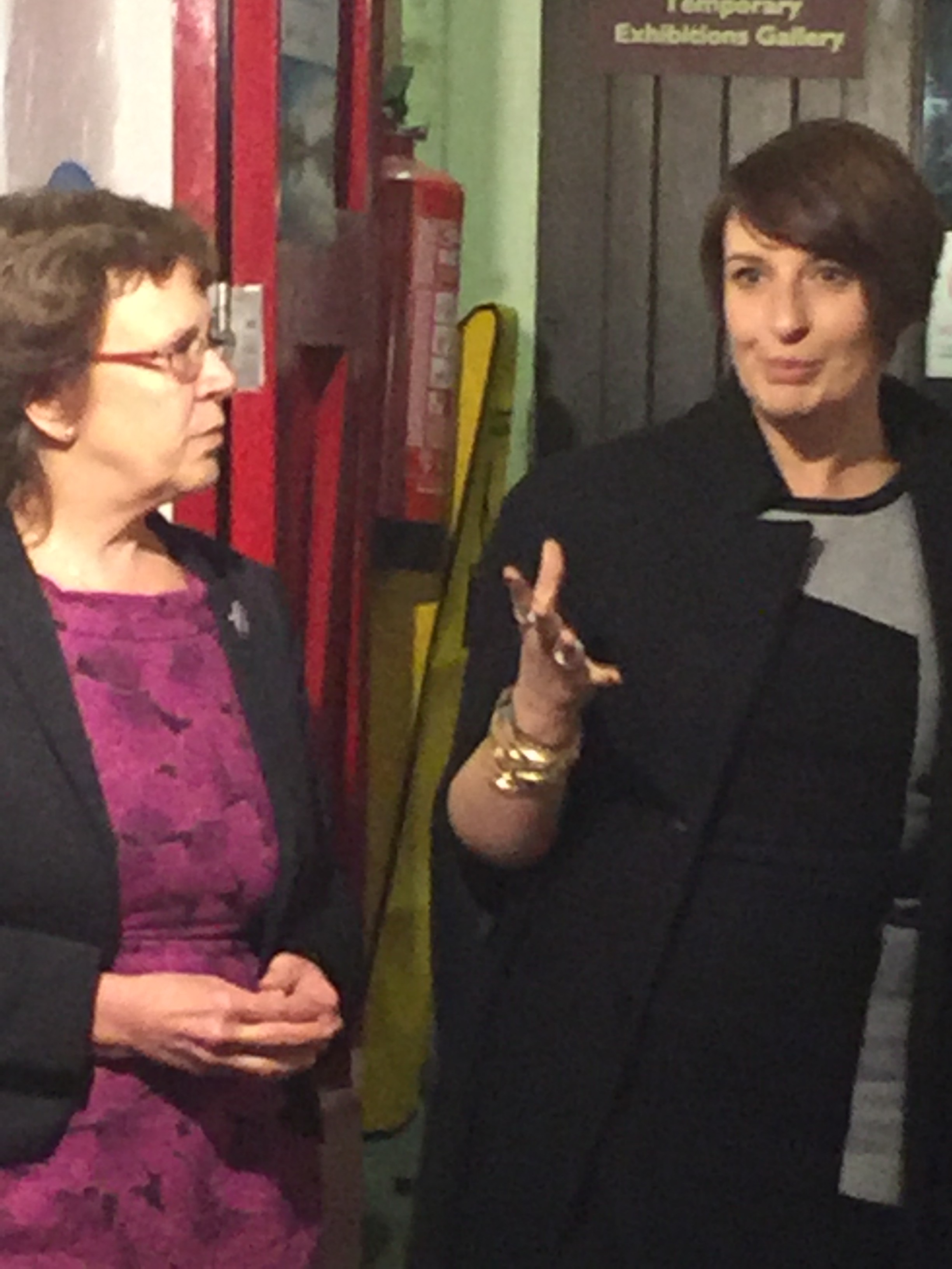
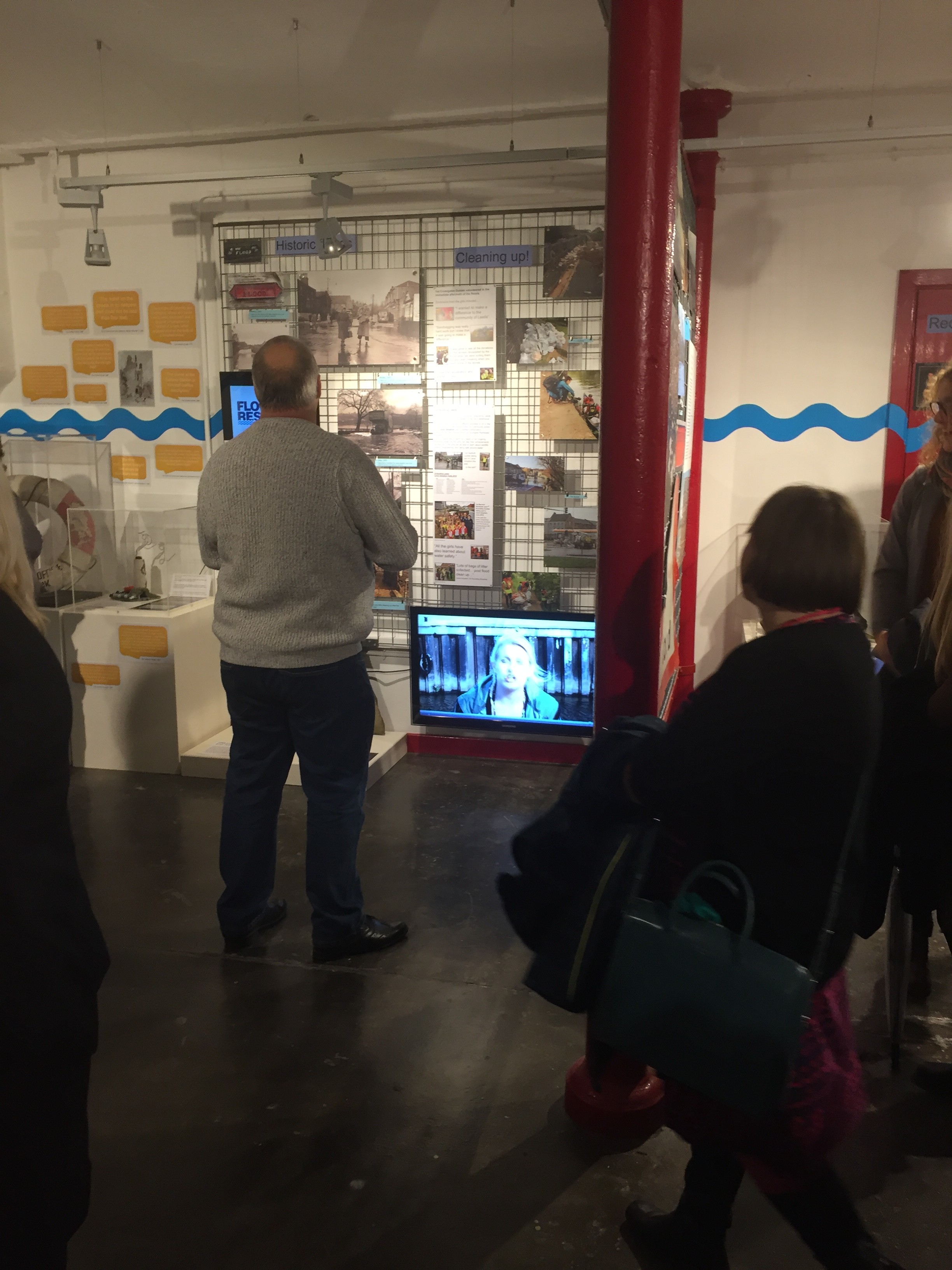
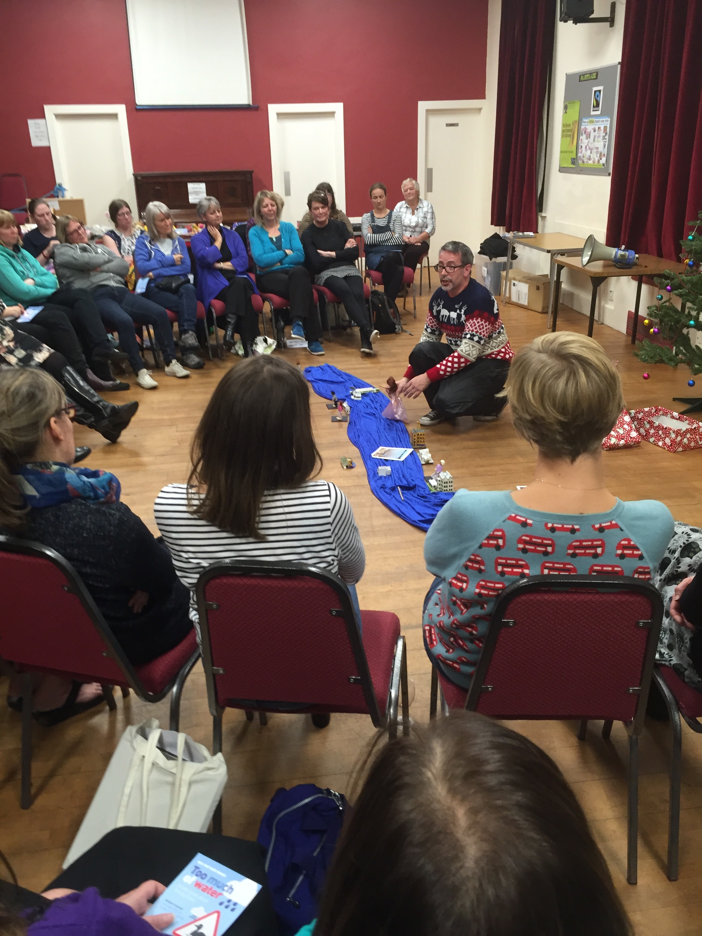
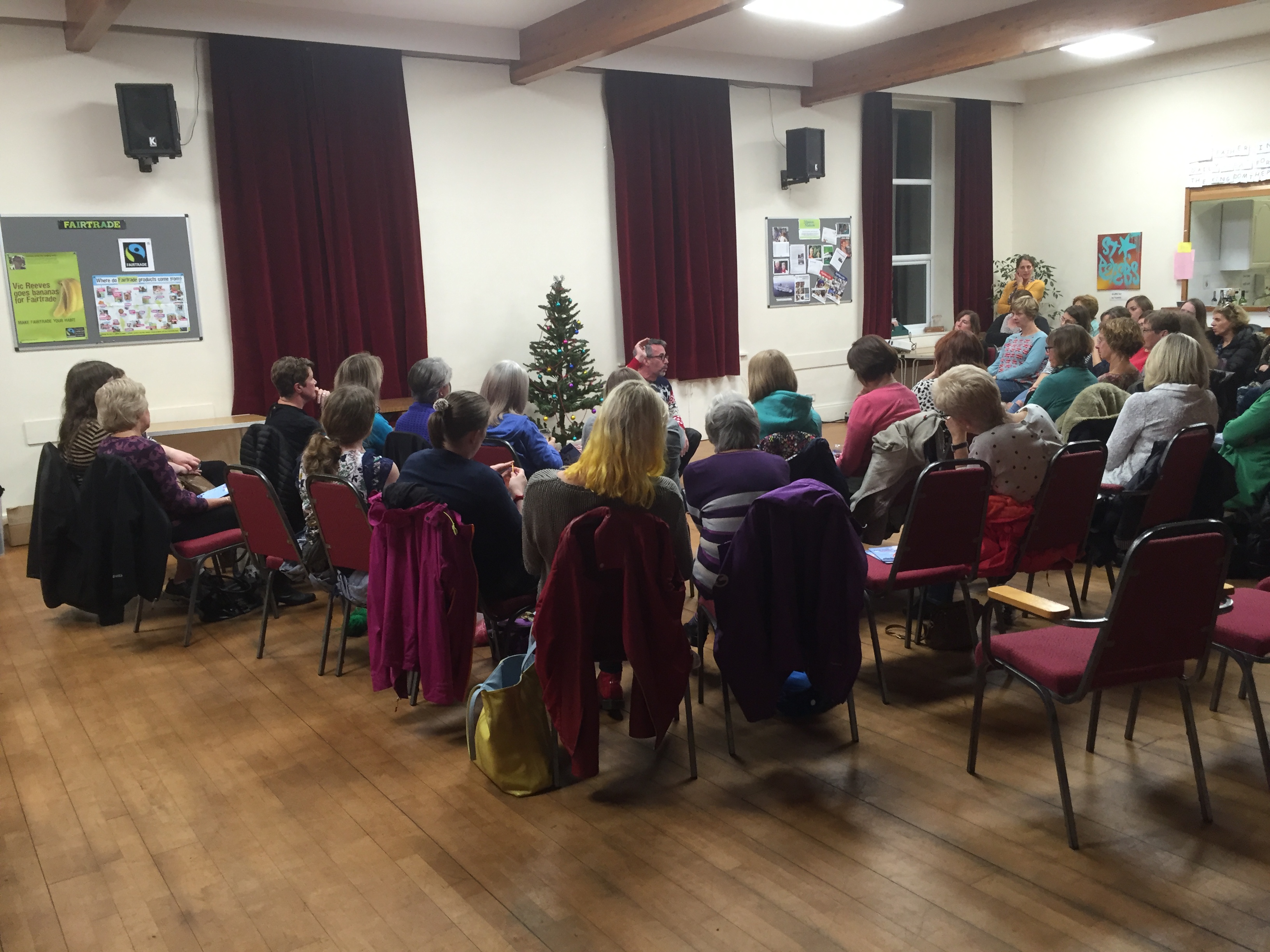
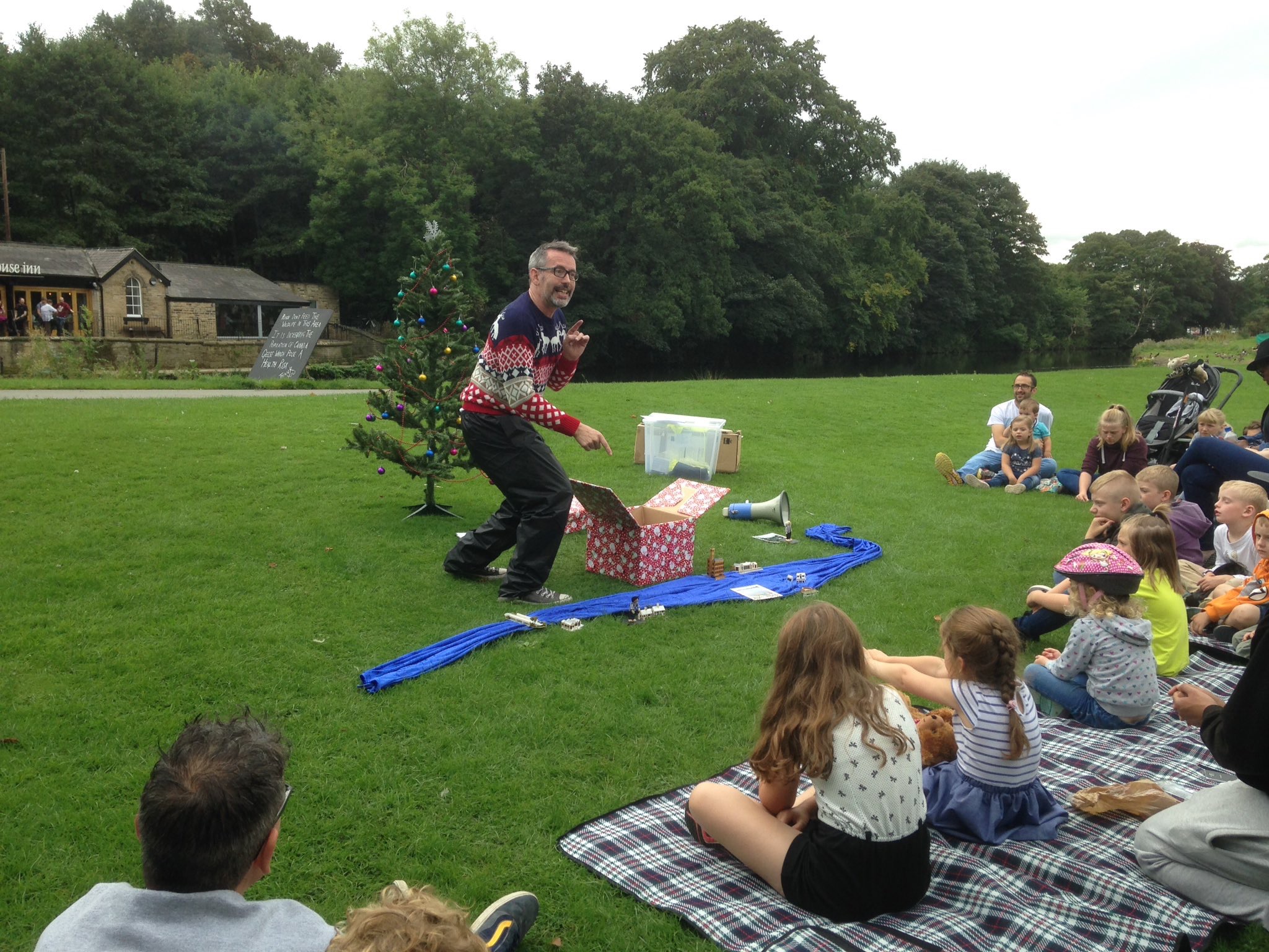
Just before I get to Bradford… a wee nod to the fact that, this last Wednesday, September 28th, I was busy in Leeds with a fine group of actors, remounting the promenade performance After the Flood. An attempt to reflect on the impact of the Boxing Day floods in the city, from a number of different angles — including the ‘expert’ view on how to mitigate future flood risk — this piece was originally created for the Leeds Waterfront Festival in June (Multi-Story Water in collaboration with Simon Brewis’s Common Chorus Theatre). This week’s one-day-only revival enabled us to show the piece to some important people, and to get it documented for a film version we’re planning. For more info and images, look under the ‘Performances’ tab above…

Kat Martin as "Poppy", a Kirkstall flood victim

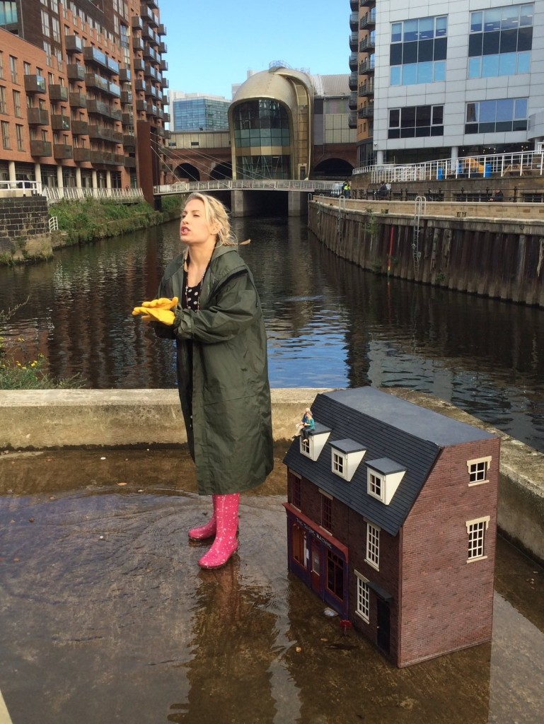
Kat Martin as “Poppy”, a Kirkstall flood victim

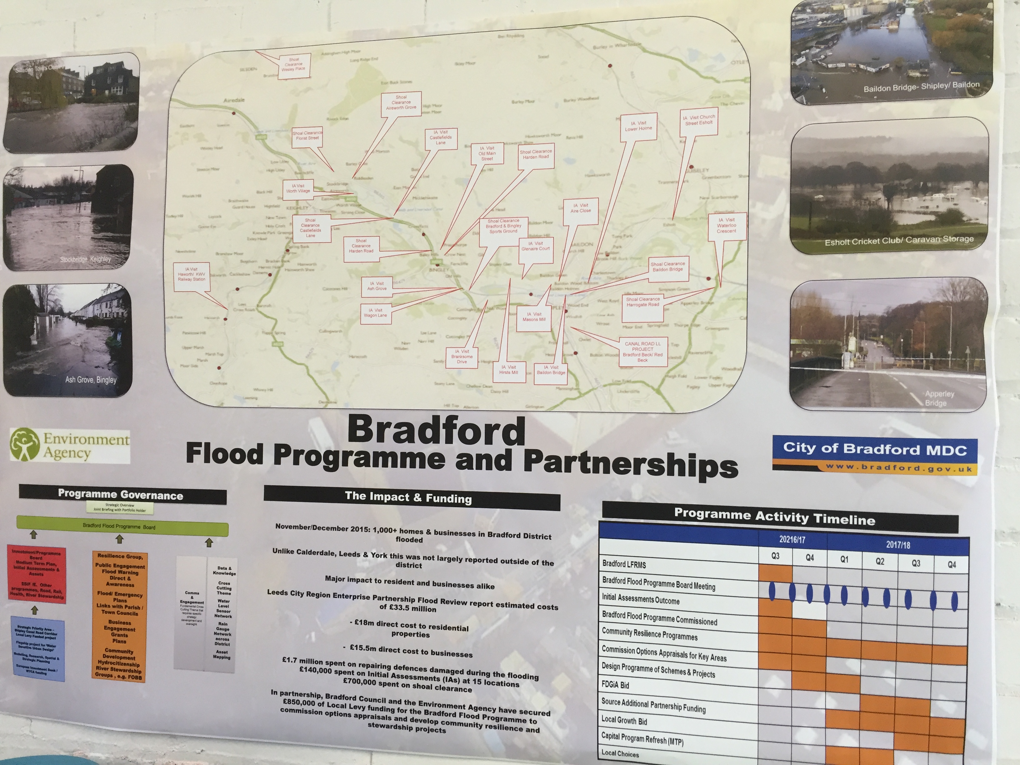
The following day, 29th September, Bradford Council published its “Flooding Scrutiny Review” — a “Report of the Corporate Overview and Scrutiny Committee” (henceforth, COSC) into how the council and its officers had responded to the Boxing Day floods in Shipley, Bingley, Keighley, and other affected areas of the Bradford district.

Or at least, I think it was the following day… The document is dated, on its cover page, “Wednesday 29th September 2016”, but since the 29th was actually a Thursday it’s difficult to know what exactly we’re talking about here. And the Bradford Telegraph and Argus was reporting on the Scrutiny Review a full week earlier, on September 22nd.

Unfortunately, this glaring, front-page error is far from being the only mistake in a poorly proof-read document that is littered with typos. The Committee’s apparent lack of scrutiny and due care with respect to the publication of its own report seems sadly symptomatic of their general approach to the overall task. That’s a pretty strong claim on my part, but let me break it down: 

1. “In-depth review”. 

The report tells us that, at a Council meeting on Tuesday 19th January (and yes, that actually was a Tuesday), the COSC should “undertake an in-depth Scrutiny Review into the effectiveness of Bradford Council and its partners in dealing with the floods…” Well, if this review is in-depth, I hate to think what “light touch” looks like. The entire report, once you remove front matter and appendices, is less than 10 pages long (in not-very-dense type, with lots of spaces). We quickly learn that the Committee’s “scrutiny” actually consisted of three “listening” exercises:

i. Looking at responses to an on-line survey, which was open to the public between April and July, and produced “75 responses”. This figure is also broken down into the areas that the responses were received from (15 from Bingley, 11 from Shipley, and so on), but the total of these figures only adds up to 62, so who knows where the other 13 went… (again, poor proofing…).

ii. Attending two information-gathering sessions, held on 21 and 26 July in Shipley Library and Saltaire’s Victoria Hall, respectively. (So, nothing in Bingley, Keighley, etc.) The latter was held at 2pm on a Thursday, automatically excluding anyone who has to work for a living.

iii. Attending one further information-gathering session, held on 25 August, this time with the Council’s relevant flood management officers and “external officers” (presumably people from the Environment Agency, etc). 

What the Scrutiny report does is simply present a blow-by-blow account of what people said to COSC members in each of these three contexts. Nowhere in the report is there any actual analysis — or, dare we say, scrutiny? — of what was being said to them, by whom. The process seems simply to have been “you tell us something, we’ll write it down, and then we can say we’ve scrutinised the situation.” One is obliged to ask what, if anything, COSC was doing on this report between January and July, since everything in the document appears to have simply been collated in July and August.

The document ends with half a page of “Concluding Remarks” and one page of “Recommendations” — although these are mostly just broad aspirations. Since there has been little to no real, informed analysis of the situation, these brief recommendations can give little indication as to how the suggestions involved should actually be achieved.

2. The Council doing itself a disservice… 

Quite the strangest thing about this report is that it seems simply to assume that the Council’s reaction to the floods was inadequate. One of the “key findings” is that “it was clear from the [online survey] responses that the only assistance that residents felt they had received was from Flood Support Groups…”  Now, it is certainly a very good thing that the amazing work done by voluntary groups in Bingley, Shipley and elsewhere is given due recognition in this report, but the implication of this wording is that flood victims universally felt they had received no support from the Council. And I can confidently say that this is simply not true. 

Many of the the people I have spoken to personally this year, as part of my research into the Shipley area flooding, have volunteered the opinion (without my even asking them) that the Council was actually very helpful to them — whether it was in terms of, for example…

– the provision of skips in which to dispose of flood-damaged goods

– the £500 council tax rebates that they received, often very quickly, directly into bank accounts, to help with short-term repairs and clean-up

– the later offer of £5,000 flood resilience grants to help with flood-proofing at-risk properties against future incidents

– the efforts made to clean out blocked gullies, etc., to ensure better surface drainage in flood-risk areas

I’ve had all this reported to me by affected residents. And in point of fact, all of these forms of support (and more) are acknowledged in the report’s section on information gathered from Council officers. But the Councillors on the committee appear to have made the assumption that the officers weren’t doing a good enough job, because they had been told people felt unsupported.

And yet… it doesn’t take a genius to see that if you hold an online survey of responses to the Council’s handling of the flood, the chances are that the people responding to such a survey will be — almost by definition — the people who have felt let down. And many of them no doubt had a right to feel let down. But that doesn’t mean that everybody felt let down. It’s simply that people without complaints don’t tend to fill in reports of this sort (or, indeed, to attend public meetings on a weekday…). Had the members of COSC actually made the effort to go out and speak to people where they live (as I have, and as have council officers and EA officers, in fact – because I’ve seen them doing it) they would have gathered a more balanced picture.

3. Communication, communication, communication…  

The most persistent strain throughout the report is the belief that communication with the general public, from the Council and EA point of view, needs to be improved. “Marketing and communications are a key area for improvement”; “Bradford Council and its partners needed to be more pro-active [in communicating] key information”; “For communication to be effective…”; etc. Indeed, one of the final recommendations is that “Council staff involved in emergency planning receive training on communicating key flooding messages…”

This really is the pot calling kettle black, given that the report itself exhibits a very poor model of communication — both in the efforts that COSC actually made to communicate with the public during the review (an on-line survey and two public meetings is surely the bare minimum required), and in the slapdash way it then communicates its alleged findings. Indeed, one of those findings is so badly written that it is literally incomprehensible:

Members were also concerned about the confusion surrounding the use of flood resilience grants, as well as half of the properties affected by the floods had actually received flood resilience grants and that that had of the properties that had been flooded had actually applied for flood resilience grants.” (p.11)

We are given no information as to what “the confusion” around these grants might have consisted of, but we are certainly left confused by the sentence.

Embarrassingly, the poor writing even extends to the Committee’s recommendation to an external partner, the Environment Agency:

Recommendation 6: This Committee recommends that the Environment Agency ensures that all residents and businesses that have been affected by the flood are on the flood alert system and that flood alert messages should be circulated much early.” [sic] (p.13)

Leaving aside that typo, this statement exposes just how little the Committee has actually comprehended about the tricky realities of flood risk communications. Reacting to complaints from members of the public who wished that they had received automated flood alert calls sooner, COSC simply passes this on as a recommendation. But I have spoken to residents who knowingly chose not to react to the phone calls they did receive — partly because of the “cry wolf” problem that occurs when you have received a call, in the past, that proved to be a false alarm. The fact is that, even with the best scientific tools available, rainfall remains an inherently unpredictable phenomenon (you never know exactly where or when a cloud will decide to burst…), and so flood risk predictions necessarily have an element of educated guesswork about them. If calls were to go out earlier, there would be less accurate data involved, and thus more guessing…  Calls would thus run the risk of being more inaccurate, and this would further increase the likelihood that people will ignore them when there is a real problem coming. This is fairly simple stuff to understand (I am not a scientist, by any stretch), but the Committee doesn’t even seem to have considered it.

Incidentally, that other point about residents being put on the flood alert system is again indicative of COSC’s ignorance of the facts it purports to be investigating. Several times the report refers to people needing to be registered onto the call system, but no mention is made of the fact that such automatic opt-in (i.e. you have to choose to opt out, not opt in, if you live in a flood zone) has been government policy since the Pitt Report of 2008. Where people did not receive these calls — on Branksome Drive, for example, in Shipley — it is because of an Environment Agency oversight in application of the system (for which they have already apologised). So this recommendation is, in short, a bit like telling your grandmother to suck eggs.

4. Who needs experts? 

For me, these last points about how poorly informed some of the report’s findings and recommendations are, seems indicative of a general lack of interest or trust in what the “experts” on the issue of flooding might have to say. The experts are, in this instance, the flood officers for Council and EA — i.e. the people who spend their professional lives dealing with the complexity of these issues of when and how to alert those at risk. Yet their comments are treated in this report as being of considerably less significance than the comments of the general public in the first two (all too sketchy) “listening” exercises.

I am not, of course, saying that the public’s concerns should not be treated seriously — they absolutely should. But the public is not the place to look for technical solutions. Right at the top of its “key findings” chapter, the Committee reports having been “made aware of various issues and concerns. Some of these focused specifically on flood prevention by looking into river dredging…” (p.6). It’s not surprising that dredging should be the first thing mentioned here, because it’s the go-to solution for anyone who has read a tabloid newspaper. In fact, the obviousness of this solution has become an article of faith for some, as is evidenced in the comments feed underneath the T&A article on the report: “Yes dredge the rivers to lower the water level, its so simple, why can’t the Councillors see that?” Yet anybody who has spent any time looking at the dredging question (and I am certainly no “expert” on this) knows that it is very far from being “so simple”: it’s expensive, rarely cost-effective, it can increase flood risk downstream of the dredged area; it is damaging to the ecosystem, etc. etc. But why listen to all that complicated stuff when the “solution” is so much simpler? As Michael Gove announced before the Brexit referendum, “people in this country have had enough of experts“.

Unfortunately, this line seems to sum up the approach of Bradford Council’s scrutiny report on the Boxing Day floods. Why get into any detail with our scrutinising? That would require us to actually learn something! We’ll just listen to what people say to us, in a small, arbitrarily selected set of listening contexts, and then write down a summary of what they said. Then we’ll write down some things we think might be a good idea, based on not having thought about any of this for very long. And we’ll call these recommendations. These recommendations might well suggest things to be done that have, in fact, been being done for years anyway (e.g. leafleting homes about flood risk). But who cares, as long as we can claim to have scrutinised something and given our own council officers a gentle kicking in the process, to keep them in their place. I mean, nobody’s going to read this report anyway, so we don’t even need to proof read it, right?

The depressing thing about all this is that it seems, basically, to represent politics as usual. And judging from the T&A article on the report, that’s also what we’ve had in the response to it. The Committee is Labour-dominated, so the leader of the council’s Conservative group says that the report doesn’t go far enough – “he said the council needed to prioritise flood prevention work far more.” And of course he would say that, because it’s his job to oppose Labour. Never mind that it was a Conservative government that cancelled flood prevention schemes up and down the country as part of its austerity drive… when there’s a political football to kick, just kick it.

When you have politics as usual, you have politicians sounding off at each other. What you don’t have, it would seem, is them actually thinking carefully about what a river is, what a flood is, or what the best-informed responses to an incident like this might be.

So much for scrutiny.
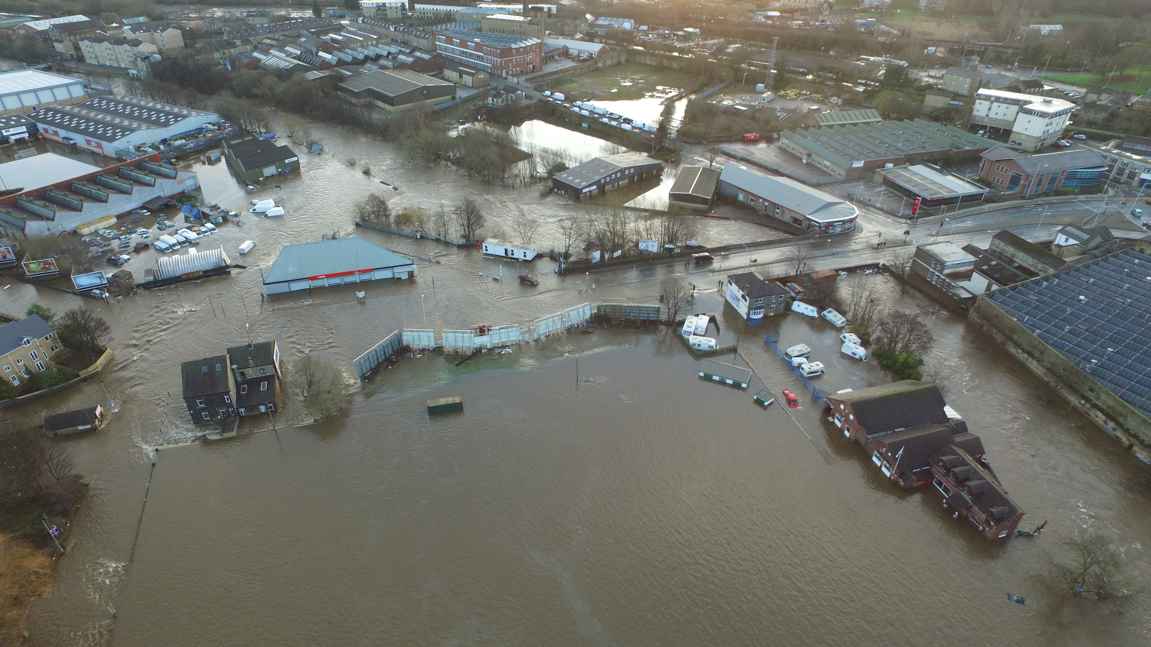
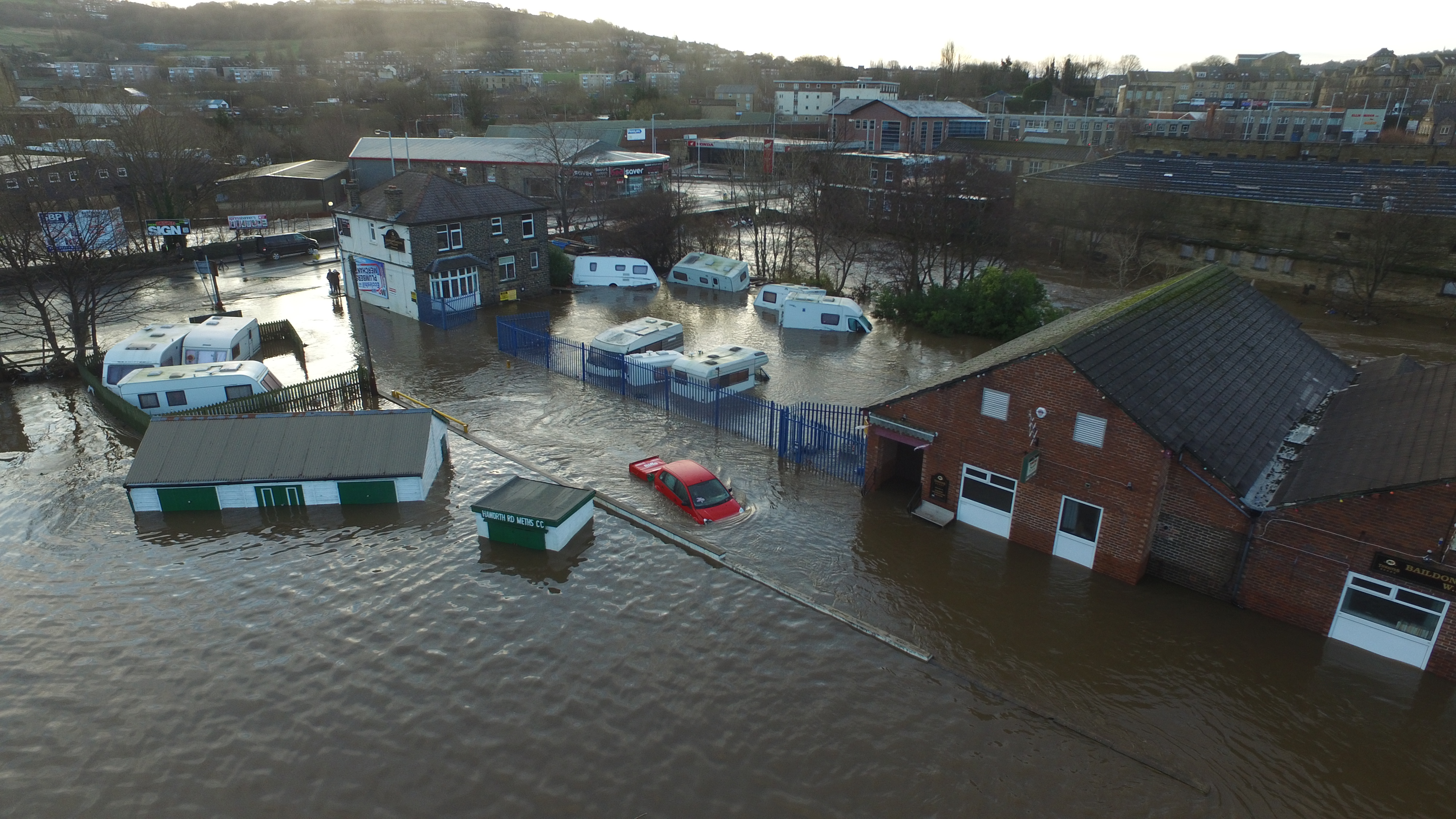
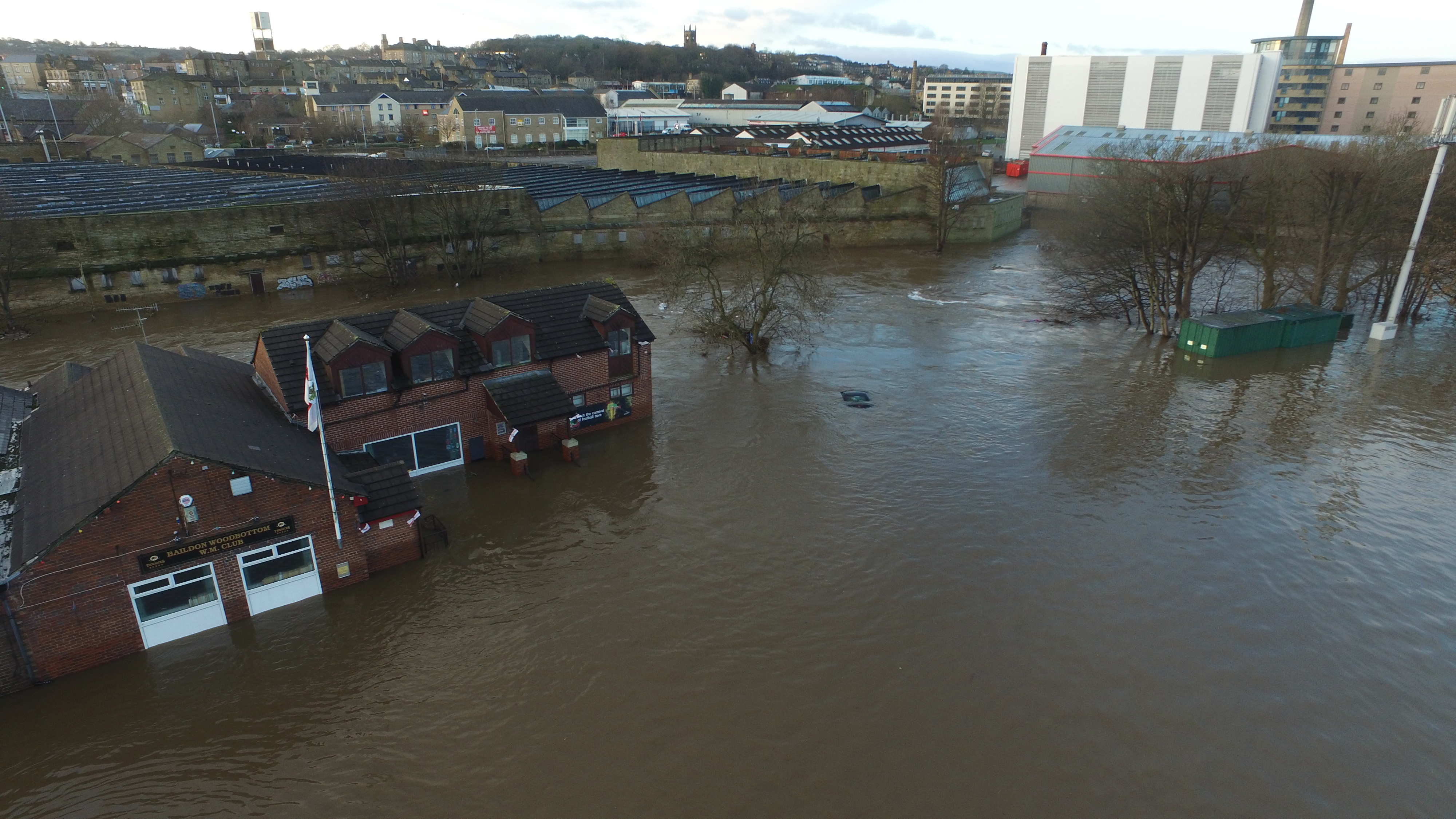
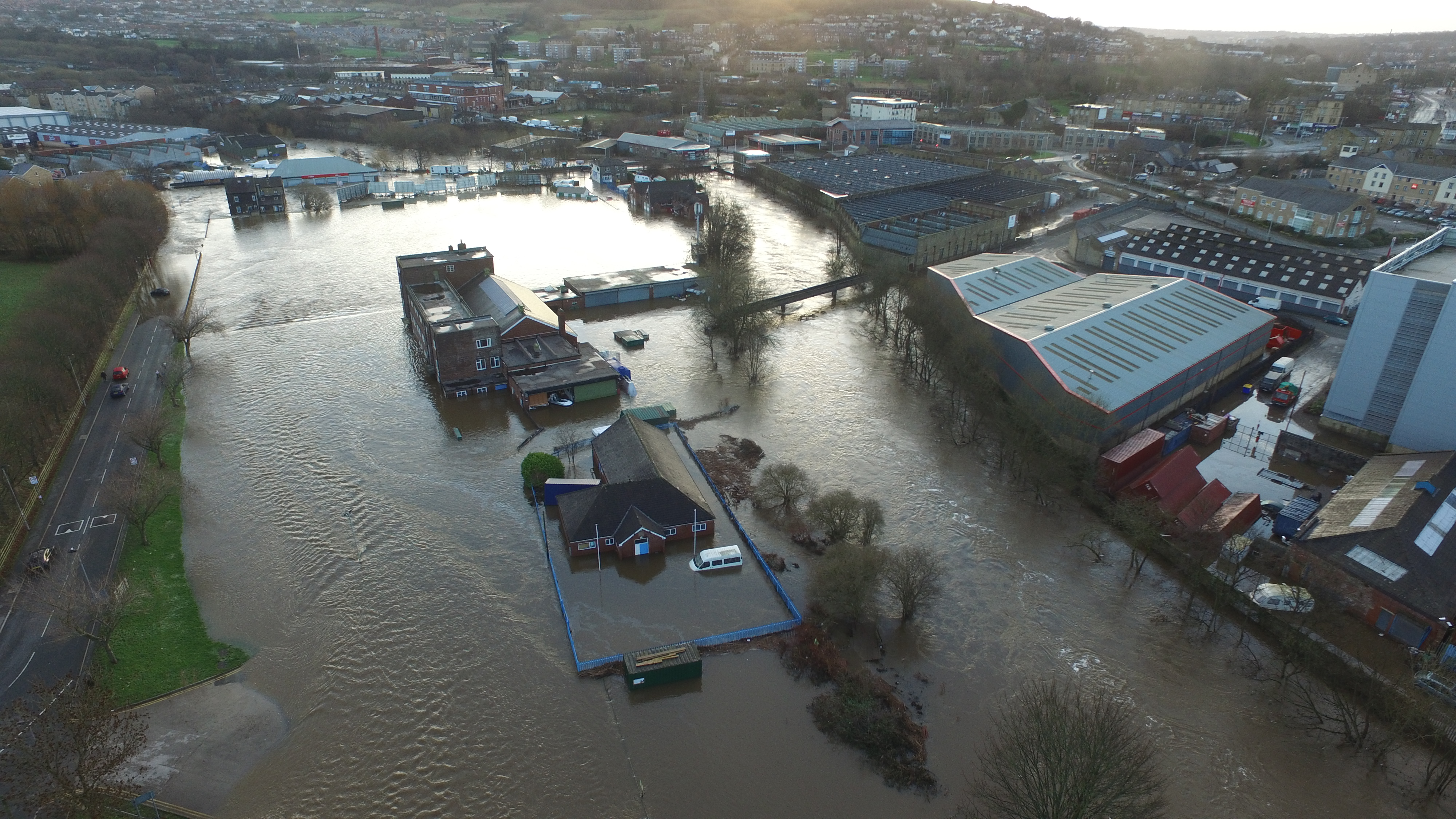
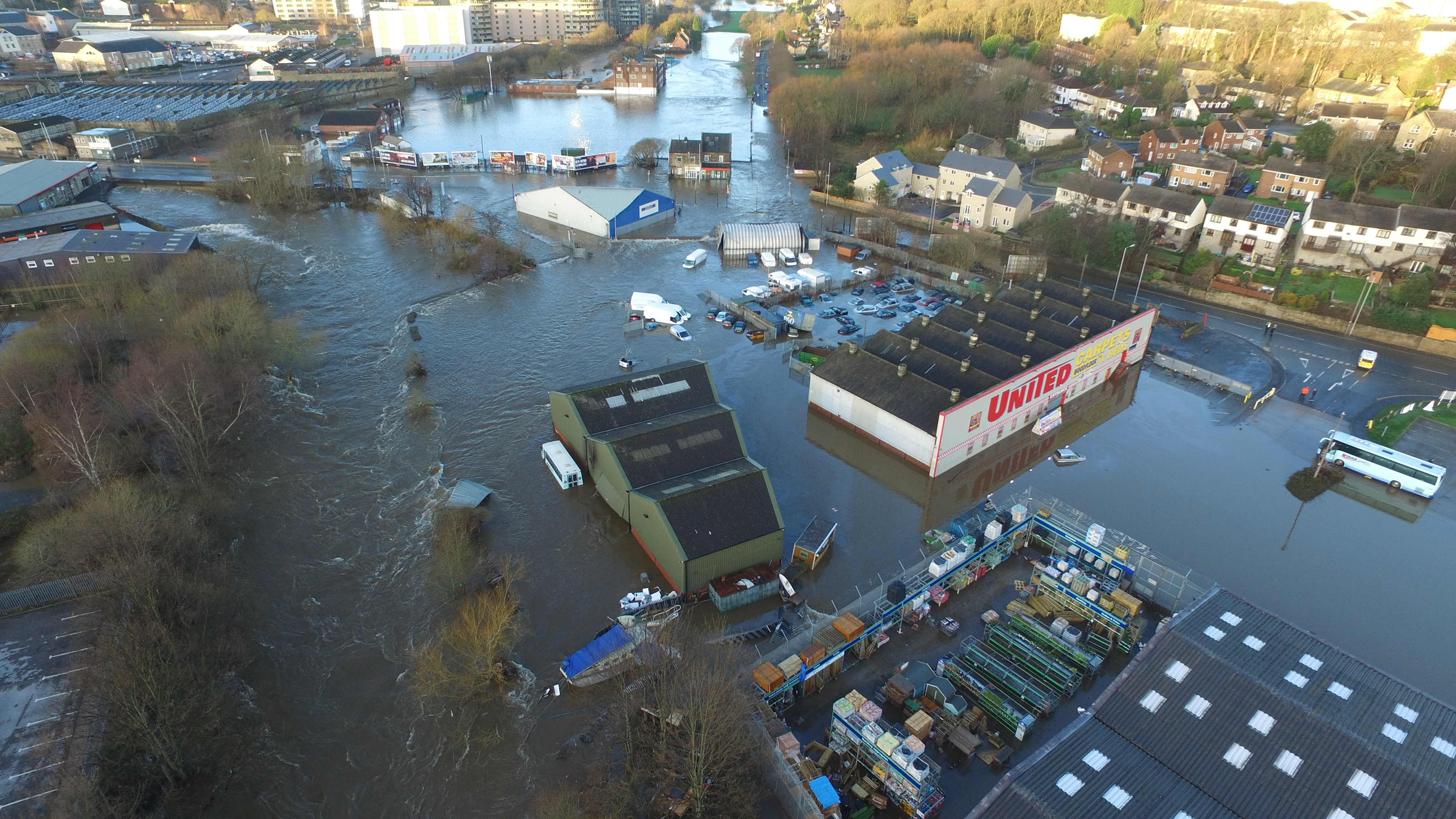
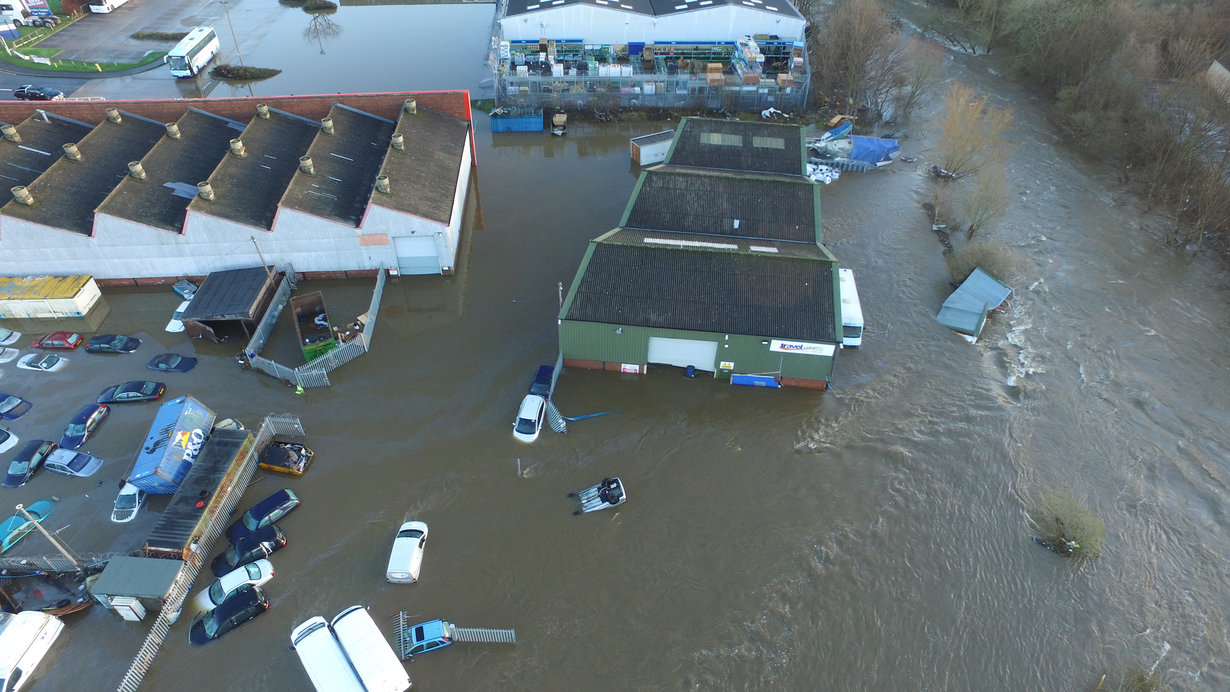
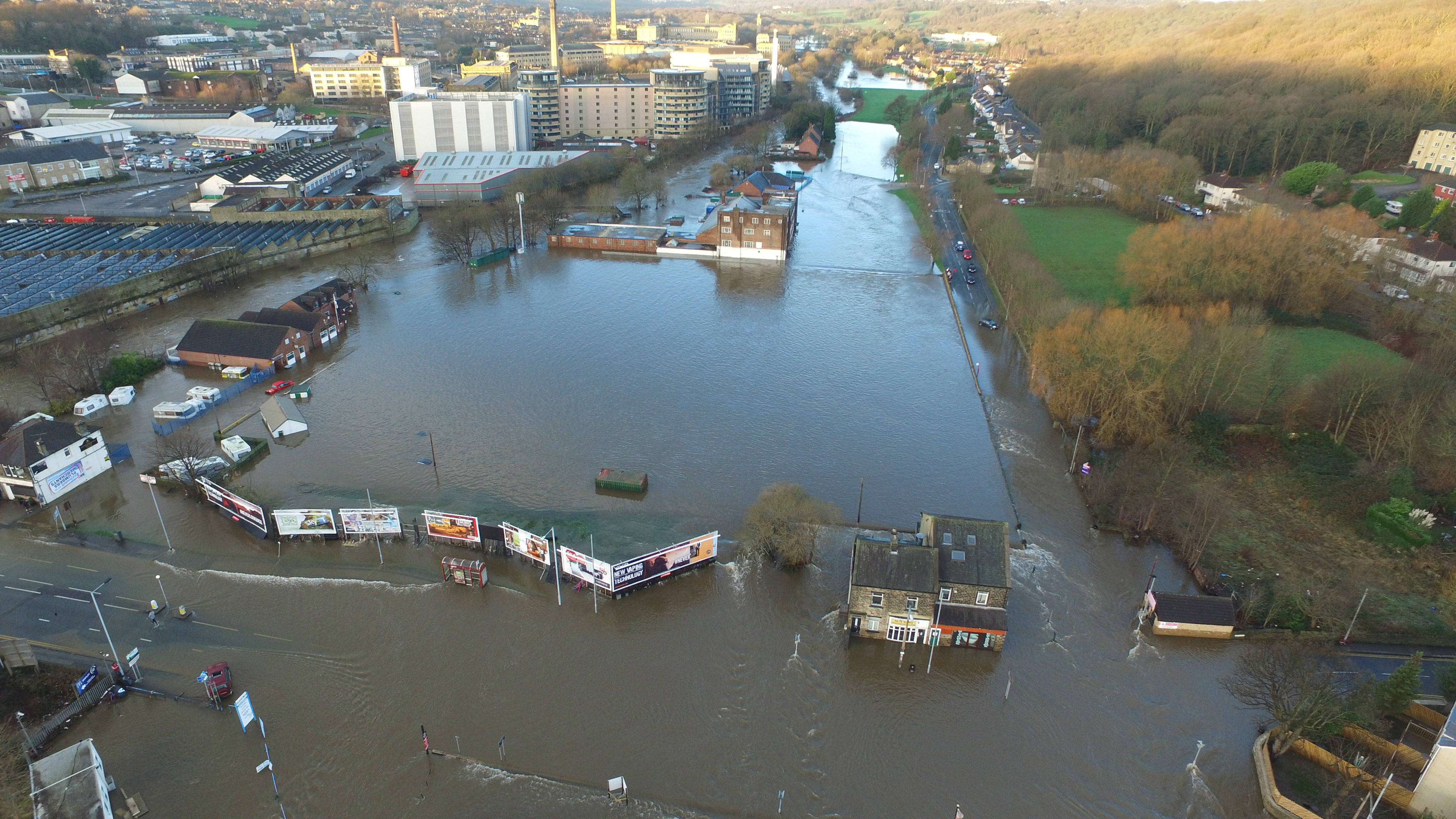
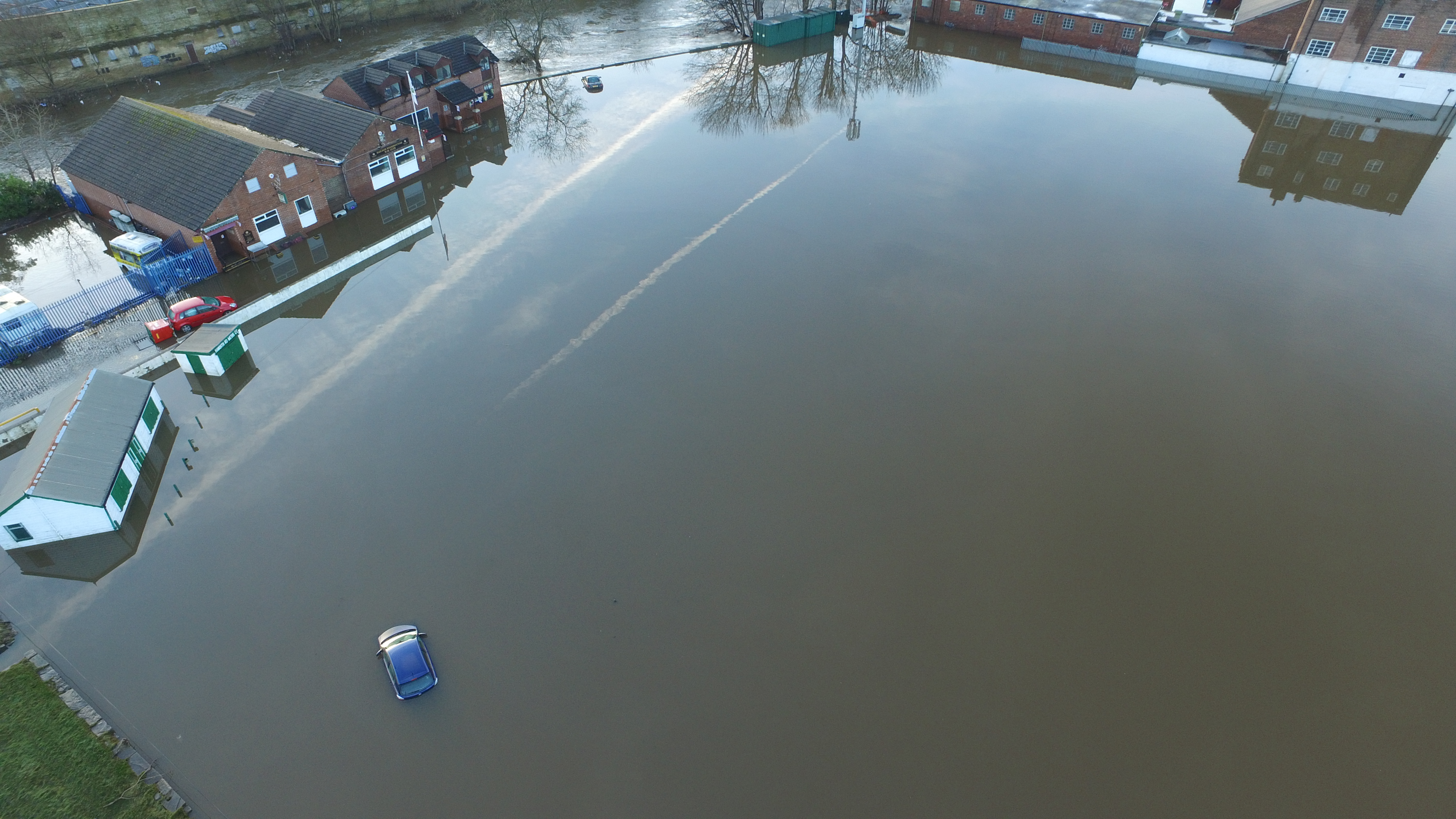
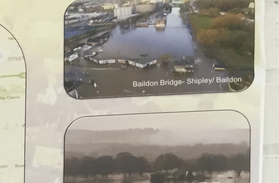
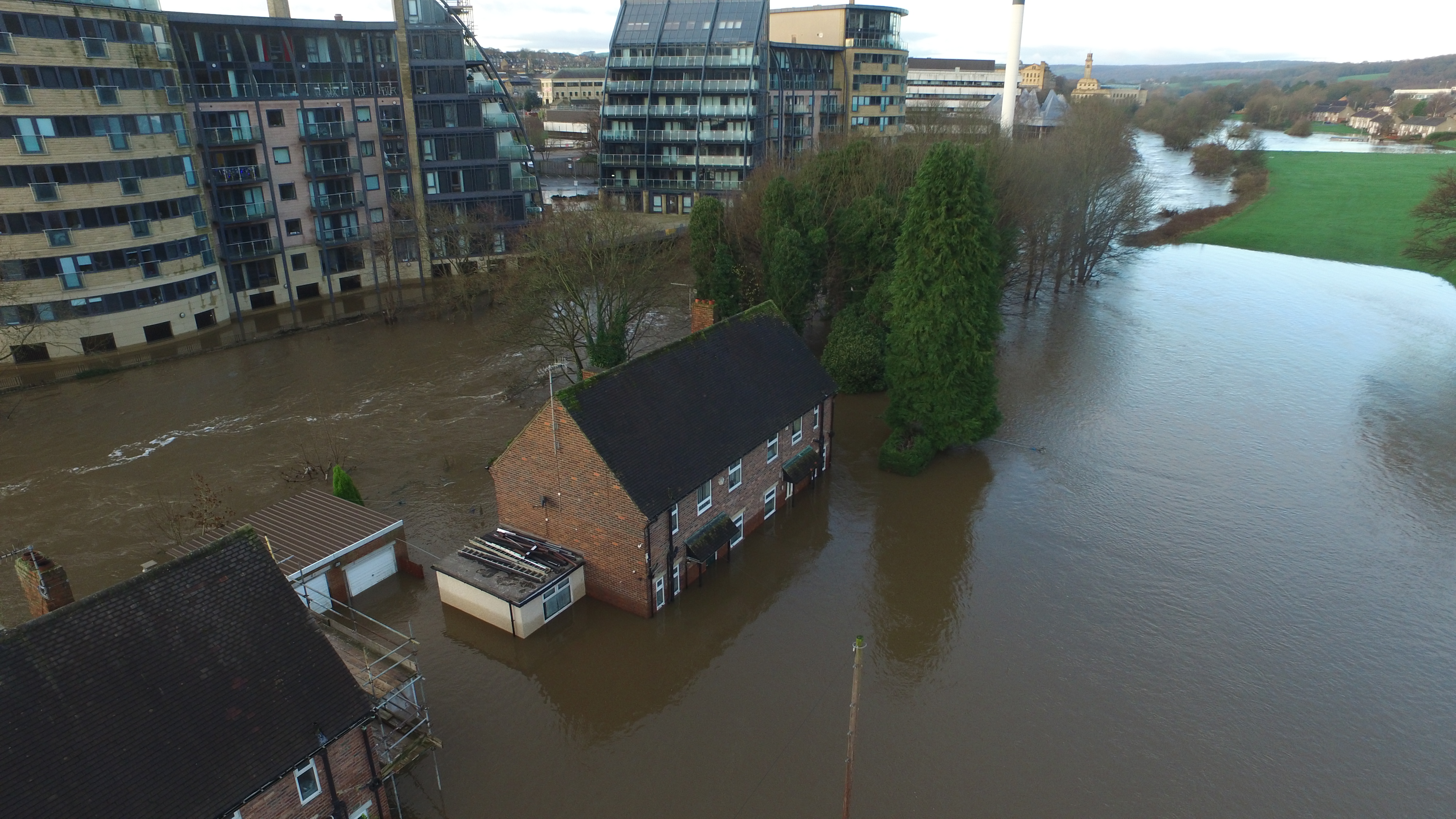
 

Flood memories at Saltaire Festival

Saltaire Festival 015

If you’re at Saltaire Festival this weekend, do check out The Power of Water — an exhibition specially created for the festival, and on show in an amazing attic level gallery at Salts Mill, which isn’t normally open to the public. The show’s title is intended to link together two significant historical landmarks — this year’s bicentenary celebrations for the completion of the Leeds-Liverpool Canal, and the major floods that hit the Aire Valley on Boxing Day. The exhibition’s main emphasis is on photographs of the floods — mostly selected from entries sent in by local residents, accompanied by some professional material alongside them. These are given wider context and resonance by the carefully chosen quotes on banners like the ones shown above.

Saltaire Festival 014

The striking thing about the way that the exhibition has been hung is that the photographs are unframed… They’re simply affixed to a wooden runner down the length of the roof space. Presumably this simple, lo-fi approach reflects the limited funds available for the exhibition (Saltaire Festival is run entirely by volunteers, and it receives only very limited funding from external sources). But for me there’s also something really apt about this method of staging. Given that the homes of many of these affected by the floods had to be stripped back to bare brick (see for instance this previous blog post), the distressed, unplastered walls of the mill provide a really poignant backdrop for the pictures. The photos almost give the impression of having been salvaged from somewhere and put on display as forensic evidence… which, in a sense, they are.

IMG_1659Down at Roberts Park, there’s another blue banner advertising what’s on… I’m rather chuffed about the prominent place here for Too Much of Water, a one-man, half-hour storytelling performance written and performed by yours truly. The piece, which I presented in the park last weekend, is based on interviews with some of those in the Shipley area affected by the Boxing Day floods. It provided some further reflections on the overwhelming “power of water”, while also seeking to entertain a festival audience…. Not an easy balance to strike!

IMG_1628This is me in Roberts Park last Saturday, mid-performance — as snapped by Barney Lerner. All the pics in this blog were taken by audience members and posted to social media, where I grabbed them from. As you can see from this image, the audience consisted of both adults and children (there were a lot more adults standing behind the seated kids), and I’m personally really pleased that the show seemed to hold the attention of both older and younger spectators.

IMG_1631

Irene Lofthouse: “A sensitive, thought-provoking piece that highlighted the tragedy of people’s experiences, but rippled with light humorous touches. The use of simple props (loved the Xmas jumper) and dolls made it accessible to all ages – and children at the performance I attended were as interested as the adults. Barbie and the Bard illustrating local people’s trauma was inspired.”

IMG_1630To capture a sense of what happened up and down Shipley ward — between Branksome Drive in the west and Lower Holme to the east — I used a bolt of blue cloth to stand in as the river (as seen here in close-up shots by Vanessa Hawkin), and miniature wooden figures to represent some of my interviewees. The resemblances weren’t great, because the figures were store-bought and I just had to arbitrarily assign identities! Much more recognisable were the landmark buildings represented by card models made by my good friend Stewart Gledhill (thanks Stewart!), the chairman of Higher Coach Road Residents’ Group (HCRRG).

IMG_1635


IMG_1637In this shot above, that’s Baildon Bridge and Woodbottom club to the left (east), then the four houses of Aire Close, then New Mill, the Boathouse Inn and Roberts Park’s Half Moon Cafe and cricket pavilion, then Hirst Mill at the far end (a bit too close to Saltaire because [a] none of this was to scale, and [b] I messed up my placements a bit in this particular run of the show…

IMG_1632

Graham P. Glover: “I wasn’t sure what to expect when I saw there was going to be a theatrical/comedic event at the Saltaire Festival around the Boxing Day floods which touched so many people’s lives in this area. However I found the event very thought-provoking and poignant. Steve’s use of models and the fabric for the flowing and ever expanding river that day worked brilliantly. A very entertaining show with some audience participation – the Christmas jumper and waterproof trousers were just the ideal costume too.”  (I was sweating like a pig in those, truth be told, especially the Sunday…)

IMG_1638This picture from one of the performances on Sunday (as snapped by Nicola Murray). I’d had to reposition myself because the sun was so bright. On the Saturday I had my mini-Aire directly parallel with the real thing (and the real Boathouse behind me), but on Sunday the sun was burning right above the Boathouse and would have blinded people, so I shifted round so my back was to the path to the footbridge. Anyway, I’m just glad that — title or no title — we were not affected by rain.

IMG_1644

IMG_1643Audience responses on both days were really positive, and I even had a few people asking where they could send donations to flood relief charities. (I recommend Yorkshire Voluntary Flood Support.) Some of my interviewees also turned out to see the show, and it was really great to see them — weird as it must have been for them to hear their personal stories recounted in this way. A huge thanks to all of them.

Thanks too to those people who have been interviewed by me this year, about the floods, but didn’t make it into the show at all. I had way too much material, and had to make some tough decisions about what to include and not. But who knows, maybe some of the other material will find its way into another show…

Thanks to everyone who came. It was great to see you all.


When is a flood not a flood? (Two tales of wet flats)

This Tuesday I was treated to stories of “water inundation” at opposite ends of the housing spectrum. I’ll explain why I’ve used that term in a moment, but first let me introduce you to Andrew Mason, an old friend of the Multi-Story Water project (we had an actor playing him back in 2012) who kindly spared me some time to discuss flood damage…

IMG_1551Andrew, who grew up in Shipley, is the property developer behind the Victoria Mills apartment complex on the south bank of the Aire, between Saltaire and Baildon Bridge. He built the place about a decade ago — converting existing mill buildings and also constructing from scratch three distinctive, curved apartment blocks: Northern Lights, to the left in the image above; and VM1 and VM2, in the background of the shot below, which stand on the bank of the river itself.

IMG_1540Victoria Mills was badly hit by the Boxing Day floods last year, and eight months on, the site is still in the process of rebuild and recovery. Actually, the first six months were occupied largely by endless debates with the insurance company, due to the extent and complexity of the damage, so the repair work only really began in the last couple of months. In these images you can see work continuing on the site’s bar, VM Lounge. As is apparent from the watermark on the windows in the shot below, the place was under 1.8 metres of water on Boxing Day.

IMG_1547VM Lounge has been completely redesigned following the flood, and like other businesses and homes in the area, there’s been something of a learning curve… The refit will be consciously more “flood resilient” than the bar’s previous incarnation, in terms of its fixtures and fittings: the pillars below, for example, will be left as exposed (albeit coated) masonry in the new design, partly as “post-industrial chic” and partly because this will avoid the need ever to repeat the process of stripping away flood-soaked plaster from the brickwork.

IMG_1548Despite this new eye to resilience, though, it’s important to note that VM Lounge and the grassy courtyard area it fronts onto were always designed and expected to flood in the development’s original plans. The rationale for putting the bar at this lower level was that, well, at least nobody lives there. If this gets wrecked, it’s less serious than someone’s home being impacted.

Indeed, the courtyard is specifically designed as a “compensatory flood storage” area — meaning that, in order to get planning permission for the development, Andrew and his colleagues had to provide a contained area on site for high water to flow into (in order that the defended buildings don’t just displace all the water downstream). In short, the courtyard is designed to become a temporary lake, while the actual living spaces are higher up, safely out of harm’s way. At least in theory…. Yet at 4pm on Boxing Day, while away at the coast in Whitby, Andrew received a call from a resident informing him that apartments were under water…

IMG_1541What went wrong? Well, this picture above tells something of the story. The wall to the right (which supports the walkway from which I took the first shot above of VM Lounge) is a flood wall. It’s designed to store displaced water away on the other side, where the bar is, while keeping this grassy tennis court area safe and dry. So it was thought safe to install apartments at ground level in the block you see here (Masons Mill) and in the one facing it (Old Mill). It was these apartments that were hit on Boxing Day.

Interestingly, though, the insurance company insists that these apartments (unlike the bar), were not “flooded”. Rather, they were affected by “a water inundation event”. The technical difference, Andrew tells me, is that flooding is what happens when the river flows into your property… whereas in this area the water came up through the ground. “Like something out of a science fiction movie”, Andrew remarks.

Basically, the land in this area was so completely waterlogged during the flood that pressure from the swollen river pushed water up through the ground itself. The irony is that Andrew’s tennis courtyard was particularly vulnerable, because — in line with the best current design thinking — it was created to provide “sustainable urban drainage”; i.e. to let water sink down into the ground rather than it simply draining off impermeable surfaces and being channeled away elsewhere (back into the river). So for instance, the tennis court itself is made of “tenniscrete”, a form of porous hard surface that allows water down through it. Yet the twist here, of course, is that what goes down can also come up. The ground’s porosity also allowed water to rise through it. It’s an issue that, Andrew notes, nobody thought to raise when the Victoria Mills complex was being designed — not the architects, not the engineers, not the Environment Agency. And now it’s too late to do remedial work to solve the problem. All that can be done is to make those ground floor flats, like the bar, more resilient to future “inundation”.

Now meet my other interviewees from Tuesday. Jenni M. and her son Dylan…

IMG_1555They’re pictured here on the bench at Dowley Gap locks, on the canal, which is just a five minute walk from their home in the Crosley Wood housing estate (at the east end of Bingley – close to Baildon and Shipley). If Victoria Mills styles itself as luxury apartment living, Crosley Wood is the polar opposite — a council estate, now run by Bradford’s social housing quango In Communities, which nobody who lives there has a good word for. The three concrete tower blocks that make up the estate were built back in the 1960s, and should probably have been demolished long ago…

ireland to crosley woods 207

Although the setting for the estate is beautifully green and wooded, and right next to the canal, the buildings themselves are in a terrible state. Jenni and family had a “water inundation event” of their own only a few weeks ago, when the badly plumbed piping under the kitchen sink sprang a leak and deluged the floor, leaving them paddling around in several centimetres of water. Jenni knows of almost identical incidents that have occurred in neighbours’ flats — and she has also had water pouring through her bathroom ceiling from a leak in the flat above. (Her own leak, of course, flowed down to the flat below… so there’s a kind of cascade effect – like an indoor waterfall!) But the real problem in terms of “living with water” in these buildings is the persistent damp from condensation in the external walls and in the walls around ventilation shafts. Dylan has lived his entire life at Crosley Wood, and has an asthmatic condition that his parents are convinced is related to the black mould spots on his bedroom wall. Yet every attempt that the family have made to get In Communities to pay serious attention to the condition of the flat — or to relocate them to alternative accommodation — has fallen on deaf ears.

Despite these struggles, though, Jenni and her family remain the most positive and community-minded people you could wish to come across. For instance, she and Dylan were active in the flood clear-up attempts organised by Bingley Flood Support in the aftermath of the Boxing Day deluge. They could see that other people needed help, and — as Jenni says — that is what community is for. Her approach is perhaps summed up by a phrase that’s been quoted to me by several other volunteer flood responders this year: “Do as you would be done by.” (These words are, of course, from Charles Kingsley’s Victorian children’s novel, The Water Babies — which is itself set in West Yorkshire, in Airedale and Wharfedale.)

I got to know Jenni and Dylan a little during recent visits to Crosley Wood’s regular Wednesday afternoon community meal (in the prefab hut that passes as a centre for residents). My colleague Lyze, and Paul Barrett of Kirkgate Centre, have been engaging with that group for some time now. I’ve been wanting, somehow, to reflect creatively on the circumstances that residents find themselves living in, and it occurred to me that Jenni’s story might make a good one focus for a short documentary film. She’s so passionate and articulate about their circumstances – and Dylan so sly and funny –  that the film will require no editorialising commentary from me. We spent two days this week shooting footage in and around Bingley, at Crosley Wood, and inside their flat — working from a rough outline plan that uses water as a connecting thread (from the Bingley Five Rise to the Crosley Wood ten-rise…). Maybe, just maybe, it will make somebody pay attention to their situation?

IMG_1561The final scene of the film will be a playfully imagined escape from the flats, as Jenni and Dylan disappear off into the sunset towards Saltaire, along the Leeds-Liverpool Canal. My colleague Trevor Roberts had one of his Canal Connections boats, the Out and About, coming through Dowley Gap locks on Tuesday evening, so we hitched a little ride… (That’s skipper Katrina at the tiller – she let Dylan have a go too.)

Thanks so much to Jenni and Dylan for a memorable and enjoyable couple of days filming. I really hope they’ll be proud of the results when we’ve finished editing the footage. Thanks to Andrew Mason, too, and of course to Canal Connections. Out on a boat, on a gorgeous summer’s evening like Tuesday’s, it was possible – at least temporarily – to forget the problems with wet flats…

IMG_1557


Mud of the Aire / Mud of the Somme… (Down at Denso’s)

This week I visited the Nature Reserve at Denso Marston’s, in Lower Baildon (Charlestown) to meet the warden there, Steve Warrillow. My visit was motivated by my research into how the Boxing Day floods have affected people and places in the Shipley/Baildon area. In my mental mapping, Denso’s is the most easterly point of interest on this stretch of the river —  with Branksome Drive and Dowley Gap at the westernmost end. Steve, though, is a fascinating interviewee and we talked about many things besides the flooding…

IMG_1417

Here he is down on the riverbank, pointing out to me the extent of what was lost to the river as a result of the flood. He estimates that, last year, there was eight to ten feet more banking between the river and the main footpath through the reserve — but as you can see, at this point there’s barely any gap at all. Given that much of the nature reserve is a fairly thin strip of land between the Aire and Denso’s working factory site, Steve can’t necessarily afford to lose whole chunks of it to the river… although of course he is the first to admit that it is the nature of rivers to alter their course over time.

IMG_1422

So severe has the banking collapse been, Steve notes, that he has decided to leave a small forest of Himalayan balsam in its (self-seeded) place, to provide a kind of safety barrier along the sharply sloping banking next to the path. (The balsam is of course visible in the photo above — as is, on the opposite side of the river, some of the flood debris still hanging in trees some seven months later.) Balsam grows tall enough that it masks and deters, but it is also of course (as discussed in my last blog but one) an invasive species that wreaks havoc with native plants and soil integrity along riverbanks. Some would no doubt be appalled that Steve has allowed so much of it to remain in place — rather than trying to pull it all up before it can release more seeds downstream — but he adopts a more philosophical attitude, seeing balsam as just one issue among many he has to deal with, rather than in terms of the tabloid-style hysteria that it sometimes attracts.

IMG_1421

Away from the river, evidence of the flood is also to be found underfoot. This, Steve points out, is river sand — left behind by the receding waters. It’s the kind of stuff that householders affected by the flood tried to get rid of straight away, not least because of the likely contaminants in it (e.g. raw sewage from up at the Dowley Gap sewage works). But of course, in a more natural setting like this one, anything organic can be left to rot down and provide nutrients for the earth. The big problems Steve had to deal with on the nature reserve, post-flood, was the huge quantity of inorganic debris that was swept downstream and left on site — everything from cars and freezers down to plastic bags and tampons. There were also quite a few dead animals, large and small … organic matter, yes, but not what you want left about to rot!

When you’re dealing with a sizeable patch of land like this, which was ten feet under water at the worst of the flooding, and has plenty of trees to act as barriers/obstacles to things being swept along, its unsurprising that so much was left behind. Fortunately, though, most of the debris was cleared away quite quickly by a major volunteer clean-up effort in January — when the Friends of Denso Marston’s customary volunteer force was joined by others from the area including the Friends of Roberts Park, Hirst Wood Regeneration Group, and Mat Holloway’s ADRI (Aire Debris Removal Initiative). Steve recalls the amazingly positive initial response to the Reserve’s calls for help — but also notes that this positive burst of energy tailed off quite quickly… He has been frustrated, in the months since, by the thoughtless remarks of visitors wondering why everything is not as perfect with the reserve as they would expect it to be… (We can all have very short memories.)

IMG_1423

Looking at the site today, it would indeed be easy to forget about the recent flooding, given that Steve and his volunteers have done such a great job cleaning it up and restoring it to former glories. This photo of the reserve’s wetland pond — the heart of its wildlife habitats — looks positively idyllic, and belies the hard slog that has gone into managing its restoration in the months since the flood. Moreover, Steve notes, the banking all the way around the pond is perilously soft, just as it is along the river.

He has been cheered, though, by the signs of wildlife making a resurgence on the site even after so much of it was rudely displaced at Christmas. In the reserve’s education hut (a new one now located some way up the hill, at a safer distance from the river than the old one, which was wrecked by the flood), Steve proudly showed me this display of dragonfly chrysalises that he has collected from around the site this year. There had been fears that the dragonfly population would be badly affected by the flooding and its aftermath, so this little exhibition is evidence of very good news…

IMG_1424

Even so, the reserve’s dragonfly population is also indicative of wider changes in the natural world that would be foolish to ignore. If the flooding, as many have argued, is symptomatic of a changing climate in this 21st century, so too is the fact that Steve regularly observes dragonfly species on this site that he would never have seen twenty years ago, when the reserve was establishing itself. The warming climate is pushing many species north in search of more temperate climes. (Although the chrysalises preserved in this display appear to be from species that are more “natural” residents of Yorkshire.)

IMG_1410

Also on display in the education hut is Steve’s personal collection of First World War memorabilia — set out to mark the hundredth anniversary of the Battle of the Somme at the beginning of this month. Aside from being a keen birder and insect expert, Steve is fascinated by story of the Somme — as well he might be, given that his great-grandfather was one of the lucky soldiers to survive the slaughter (had he not… no Steve). Among the treasures collected here are his great-grandfather’s first-aid box (the black tin to the right of this shot, now displaying bullet fragments etc), and a still-unopened tin of Tommy’s rations (the gold box to the left). It’s pretty weighty! Steve has heard tell of one such box being opened quite recently, and its contents still being perfectly intact (presumably because it was completely airtight). So strange what changes, and doesn’t, over time.

Steve’s interest in the war extends to having booked a package tour to the Somme, which he is heading off on in August. It’ll be his second visit. We spoke quite a bit about all this, as well as about the reserve and the flood, and I mentioned that — on July 1st, the centenary of the Battle — I had been fortunate enough to witness the eerie presence of World War I soldiers on the streets of Manchester… I promised to post some pictures on this blog, so Steve could see them…

IMG_1218

This was Exchange Square, towards the end of the day, as all the “soldiers” who had been positioned in different parts of the city, ever since the morning rush hour, gathered together for the event’s understated conclusion…The appearance of silent soldier figures in cities up and down the country that day was part of a commemmorative art event conceived by the artist Jeremy Deller (who in 2001 famously staged a reconstruction of the 1984 police vs. miners clash at the “Battle of Orgreave”). Titled simply “We Are Here” (after the song “We’re here, because we’re here…”; there wasn’t much more rationale for the trench warfare…), the piece consisted simply of perfectly attired actors standing — or sitting — as a silent presence within the everyday lives of commuters and shoppers. A little like the traditional “two minutes silence”, but played as an interruption in space rather than time.

IMG_1216

Each soldier had a collection of “business cards” indicating the identity of the man he was representing (and thus, literally, re-membering). They didn’t offer them around, but if you went up to one of them to ask what was going on — or simply to ask who he was — then he would give you a card and simply walk away. Like a ghost.

IMG_1211


It’s not just water that can sweep people away.

Thanks Steve, for a memorable visit.

Shipley’s weirs – a technical view

IMG_1436Yesterday I was back down at Shipley weir, immediately downstream of Baildon Bridge, to visit my old friend the heron (above), and to show around a colleague of mine at Manchester University, Andrea Bottacin Busolin. Andrea (male, pronounced the Italian way, because he’s Italian) is a civil engineer who very kindly took some time out to analyse some flow data for the River Aire (which was, in turn, kindly supplied by the Environment Agency). This investigation was in response to a question raised by Phillip Moncaster, of Baildon Woodbottom Working Men’s Club (just upstream of the bridge). Put simply, if this weir was taken out of the river, might this reduce flood risk to the club and other local homes and businesses? Phillip’s hypothesis (discussed in more detail in this previous blog post) was that taking the weir out might lower the flow level of the water going under Baildon Bridge — meaning that in high water conditions the bridge would not so quickly turn into a concrete dam across the river…

This always seemed a reasonable hypothesis, but we needed to look at what the technical evidence for it might or might not be. And in practice, it seems, the data does not support the hypothesis. The bridge is a problem, yes, but taking the weir out won’t really help. Here’s why…

First: If you click on this link, it should open up a summary graph of the technical data. Don’t ask me to explain what it all means, because I’m not an engineer, but basically this is a representation of the downhill flow of the River Aire – moving from left to right across the page. The section analysed here starts somewhere near Crossflatts, and stops somewhere downstream of Woodhouse Bridge. It shows “river bed elevation” (that is, the level of the river bed) in relation to the “water surface profile” (the level of the water in different flow conditions).

Now, you can clearly see where Andrea has marked Shipley weir (aka Baildon weir) on the summary graph. It shows up as a small spike in the downhill flow. And if you look just to the left of that marker, you see two other spikes… Together, these three little spikes, roughly in the middle of the graph, represent the three weirs in the Shipley area — Hirst weir, Saltaire weir, and then Shipley weir. Now, watch what happens to those three spikes in this animation of the flow data as the water gets higher and then lower again…


(OK, yes, I added a little free music to it via YouTube, to try and make it a bit more exciting.)

As you can see, as the water level gets higher, the weir spikes gradually cease to affect the surface level of the water. The water gets so high that the weirs basically disappear from view. And this happens fastest with Shipley weir — so fast, in fact, that the weir quite quickly ceases to make much difference to the flow level. Saltaire weir takes a bit longer to disappear below the waves — and interestingly it seems that Hirst weir continues to make a bit of a difference even in very high flows. This explains the roiling wave effect that eye-witnesses saw at Hirst weir during the height of the flooding.

Now, based on this same data, Andrea was also able to provide a hypothetical animation of what would happen to the flow if you were to take out Shipley weir. He simply removes that third spike from the graph, and then animates the same flow data. This is what you get (again with dubious musical accompaniment…): 
As you can see, the pattern is almost identical to that in the first animation… demonstrating that in practical terms, the presence of Shipley weir makes almost no difference at all to the behaviour of the river during high flows and flood conditions. It’s really only in low flows that the weir makes a marked difference to the river’s upstream and downstream levels.

Now, Andrea was the first to acknowledge that the accuracy of this judgement is dependent on the accuracy of the data that he was given. And the Environment Agency is in the process of updating its survey analysis of the Aire as we speak. But there’s no particular reason to doubt his broad conclusions. I invited him down to Shipley yesterday simply so that he could see the weir itself, in situ (rather than as an abstract set of data) and so that he could meet Phillip. We had a good chat, which concluded aptly with Phillip’s wry observation that: “I guess we need to think of something else then.”

IMG_1428

We noted rather grimly that there’s a lot of debris in the river again, especially around the bridge, just waiting to contribute to damming problems in high water conditions. And there was more of this to be seen as Andrea and I walked upstream to from Shipley weir towards Saltaire weir, using the riverside path. Look at this by the pipe aqueduct just upstream of Phillip’s club…

IMG_1437And then of course there’s the flood debris from last time, still very much apparent in the riverside trees….

IMG_1438Indeed, Andrea was intrigued to notice the amount of “lateral vegetation” along the river banks — by which he means the trees and shrubs that grow right out into the river, and catch hold of rubbish like this in high water. Vegetation like this, he noted, will provide some resistance to water flow which is difficult to represent in the simple graphs. It will be interesting to see if the EA’s new data set starts to take this kind of close-up detail into account, although – again – it probably won’t affect the broad conclusions about the weir.

Reaching Saltaire and its weir, its particularly apparent just how low the flow in the river is just now — enabling you to see the entire structural architecture of the weir…

IMG_1440

We didn’t walk up as far as Hirst weir (pictured below from a visit the day before), but perhaps the most significant finding of Andrea’s technical analysis is just how much of a role Hirst weir continues to play in relative flow levels, even in high water. This is relevant to the continuing debate about whether the Rowing Club’s repair of that weir has adequately addressed the downstream flood risk issues associated with it.

IMG_1377

Just for the record, here is Andrea’s slightly more technical summary of what his analysis shows:

“The graph summarises the results from the simulation of a 10 year flood under two different scenarios, with and without weir. I have also included a plot of the upstream flow hydrograph (discharge versus time) representing the boundary condition at the upstream section. You can see that the water surface elevation just upstream of the weir is different for the base flow at the beginning of the simulation, but the difference disappears as the flow discharge increases. The maximum water surface level for the simulated flood event is virtually the same for both scenarios. This means that the weir has no significant effect on the water level during high flows. However, the local flow contraction induced by the weir produces higher flow velocities just above the weir and higher turbulence intensity downstream of it, thereby increasing the risk of local erosion. This may not represent a significantly higher threat if the river bed and banks are sufficiently stable.”