An Alternative Take on World Heritage Weekend

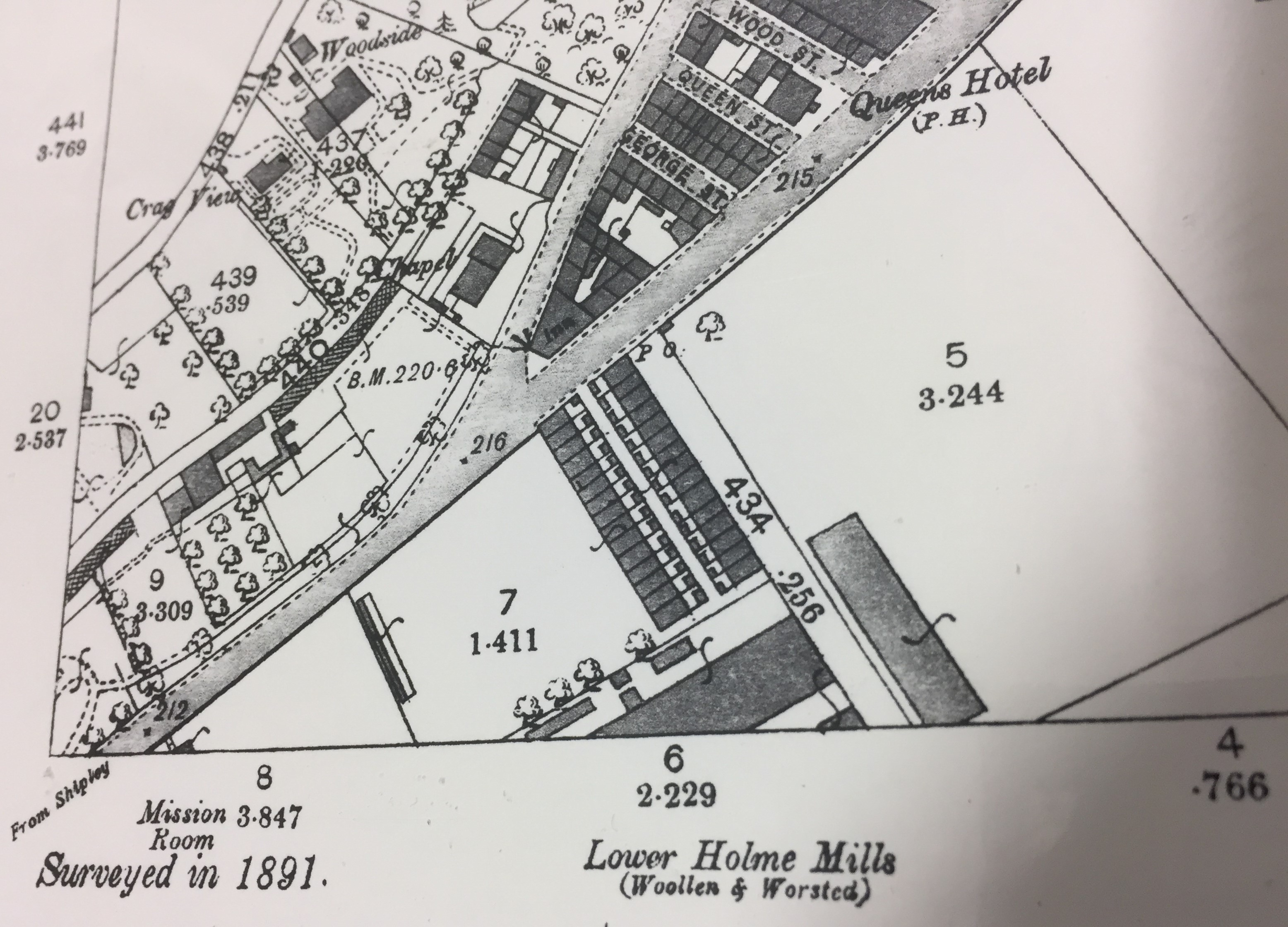
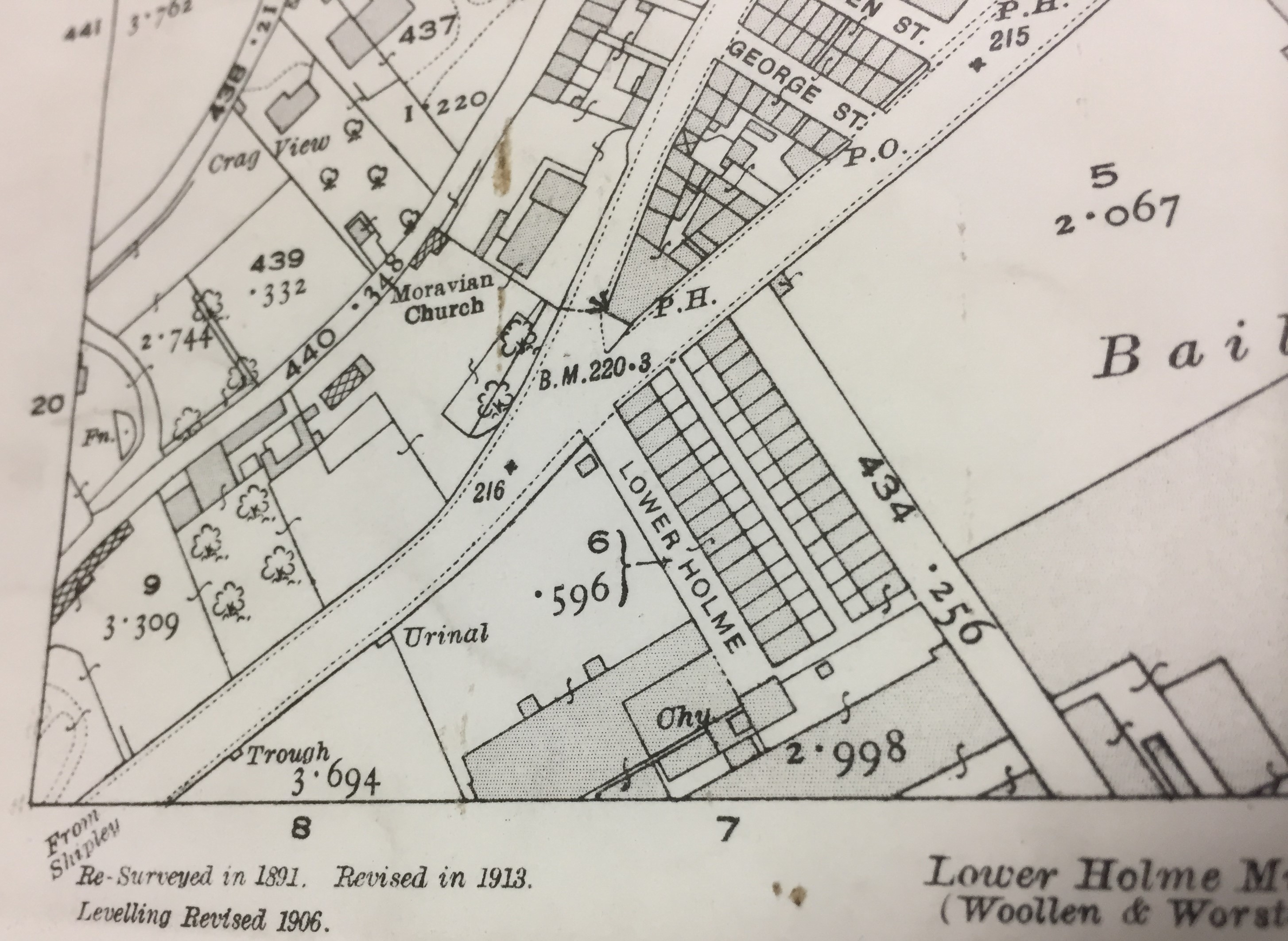
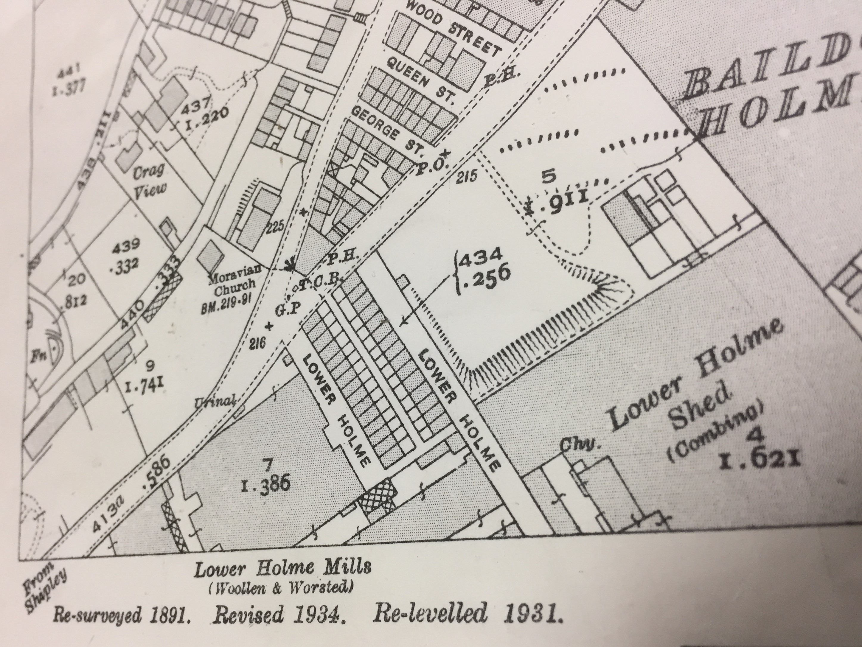
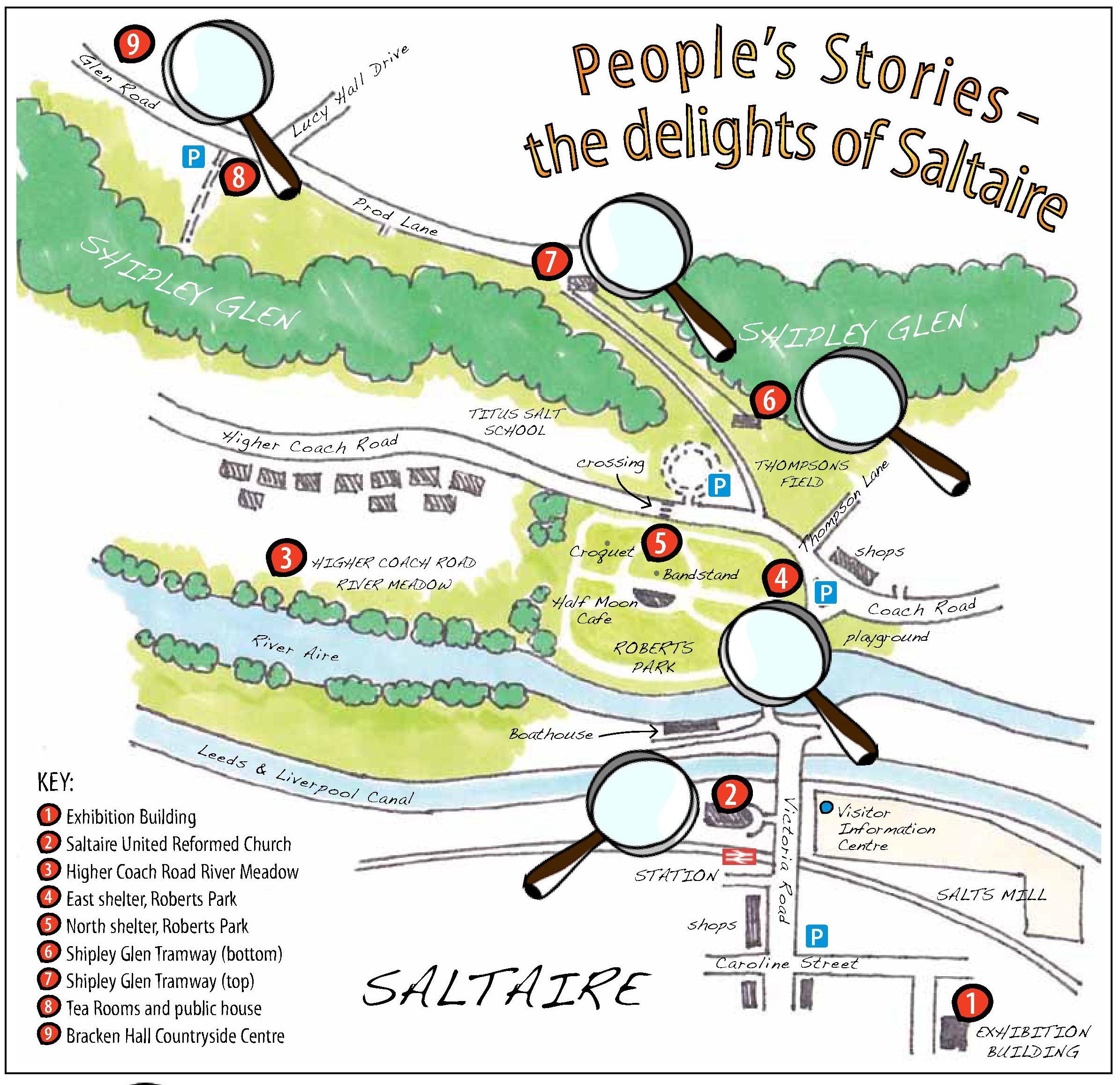
It’s been a crazy busy week, so I’m only just now catching up on here on the blog — to say a few words about last weekend’s events in the Saltaire area. It was the Annual World Heritage Weekend celebrations for Titus Salt’s Victorian mill village — part of a worldwide celebration of UNESCO-designated heritage sites. Saltaire has been participating for 5 years now, but this was the first year when the Higher Coach Road estate was officially ‘on the map’ for the Heritage celebrations (as you can see from this map, from the WHW leaflet)…

Higher Coach Road falls comfortably within the “buffer zone” which restricts planning within sight of Saltaire (subject to UNESCO approval), and of course the whole area that the estate is built on once belonged to Sir Titus Salt. But the residents chose to mark the occasion by celebrating their own “heritage” as a post-war council estate by hosting a 1950s picnic … for themselves, and anyone else who wanted to join in….

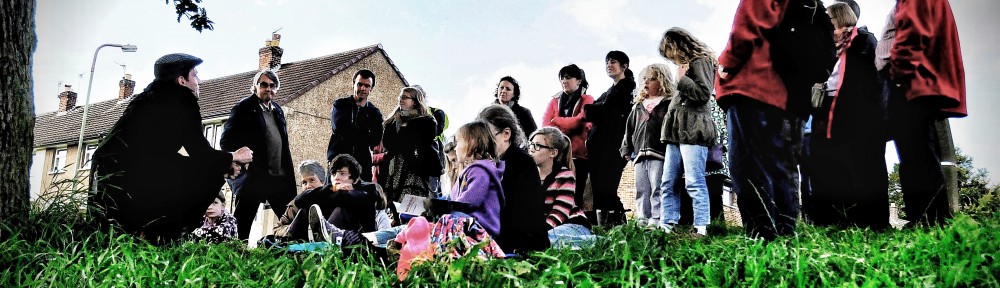
The 1950s picnic was initially the brainchild of resident Ruth Bartlett, pictured below in this rather curious picture that appeared in the online version of theTelegraph and Argus

Ruth is pictured here having (no) tea poured for her by myself, Steve Bottoms. The T&A photographer, having turned up at the very beginning of the 12-4 slot during which we’d said the picnic events would occur, found that not that many people were there yet (because, seriously dude, who turns up at a party in the first minute?), and so asked those of us who’d dressed up to pose with embarrassed grins for the camera…

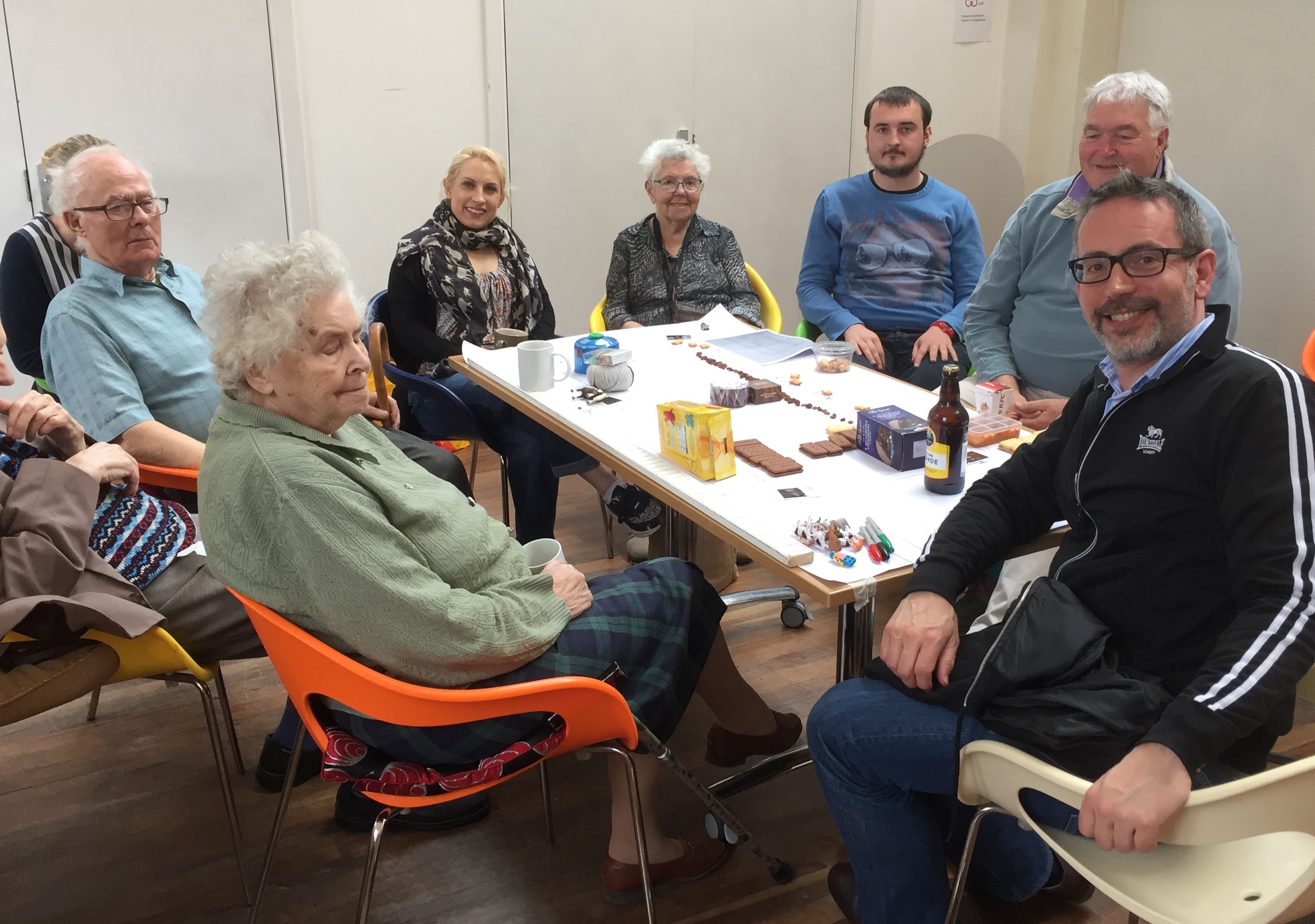
Ruth and I are seated here in the “outdoor living room” that was Multi-Story Water’s contribution to the festivities. Cleverly assembled by Anna Parker from visits to a string of charity shops, this installation of 50s furniture and nick-nacks was well populated over the course of the afternoon, as people came and sat down on the surprisingly comfortable furniture to enjoy the sunshine. (it was behind a cloud when the photographer came, naturally…)  That blue folder poking out from under the coffee table contained a selection of stories I had prepared about the area and its community and watery histories. I read these on request, in response to people picking titles from a menu we provided… such as “The Malicious Mr. Pickles”, “Higher Coach Road in the Ice Age” and “Ten Minutes of Madness (The Derwent Avenue Murderer)”. This was our “streaming service” for an age when most people didn’t have television yet… and it seemed to go down remarkably well! Some of the stories prompted considerable discussion. One resident, for example, shared her memories of working at Salts Mill in the 1970s — because she remembered as a co-worker the victim of the murder in my “ten minutes of madness” story (a black tale for a sunny day – it proved an unexpectedly popular choice!).

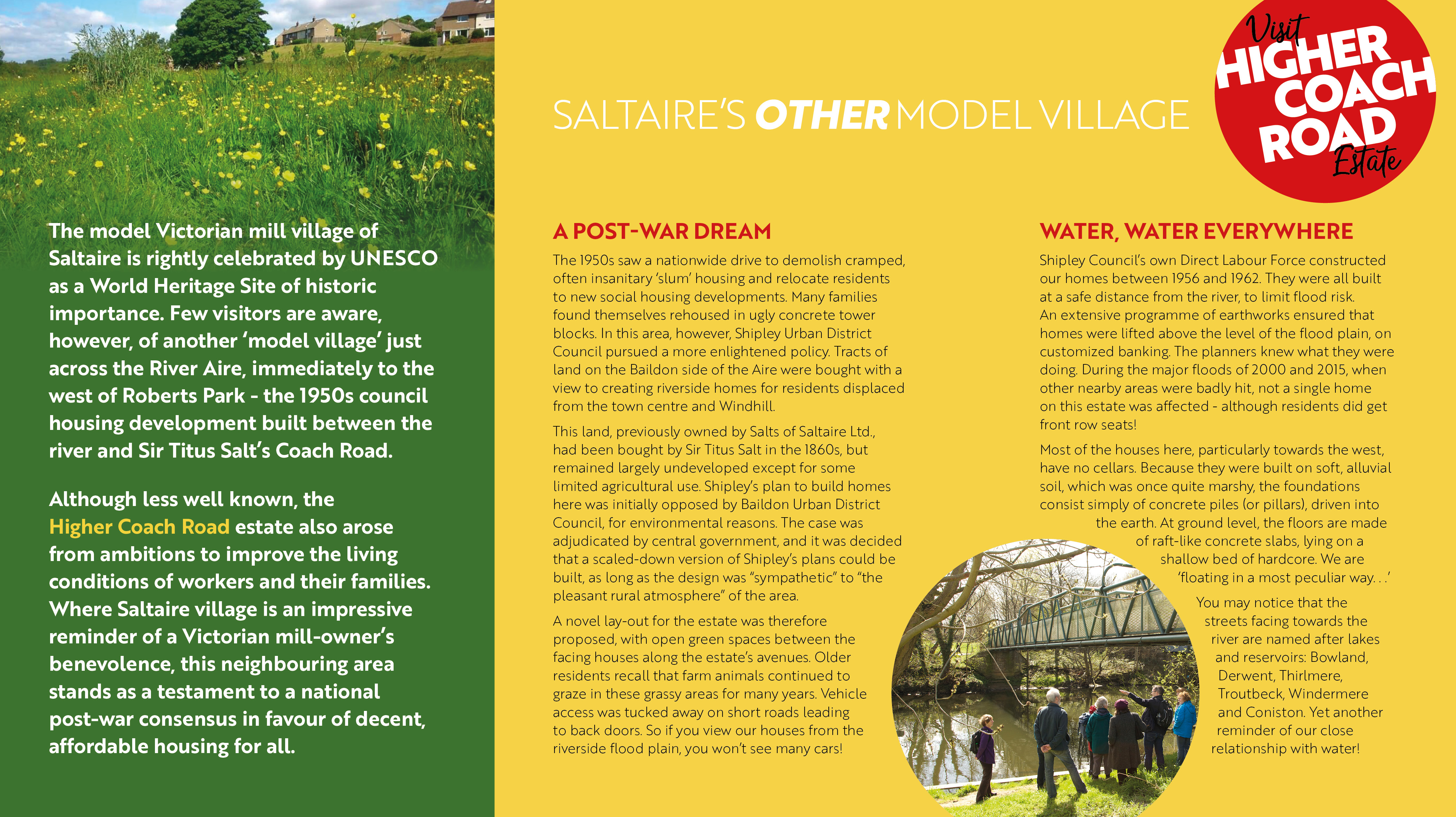
Ruth and I had also collaborated on writing this leaflet, launched on this occasion as a joint effort of MSW and HCR Residents Group (the image shows the inside of the ‘gatefold’). In this slightly-tongue-in-cheek “heritage” leaflet, which will also be available from Saltaire Visitor Information Centre, we wanted to make the case for this estate as “Saltaire’s Other Model Village” — a development planned to blend in with its green and pleasant environment, which residents still take great pride in.

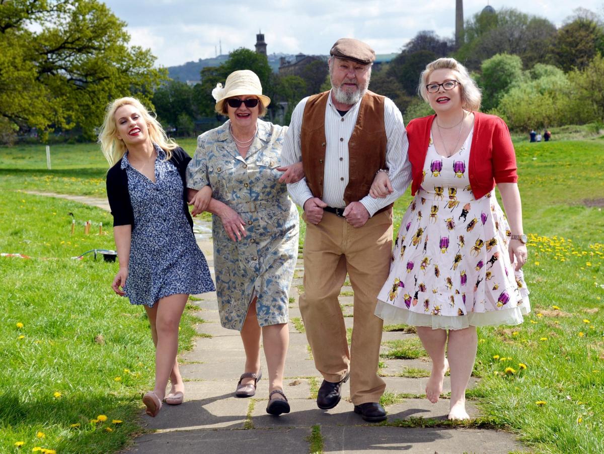
Here’s another of the shots from the T&A, with Saltaire’s towers visible in the background. Dressed in their versions of the 1950s are the current and recent chairs of the Higher Coach Road Residents’ Group — Pam Ruppe and Stewart Gledhill — who are flanked on either side by Kat Martin (left) and Lyze Dudley (right), both part of the Multi-Story Water team who dressed up for the day.

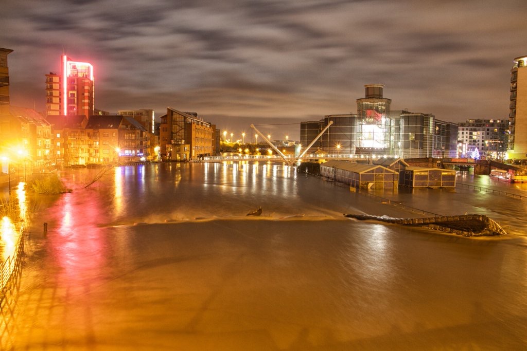
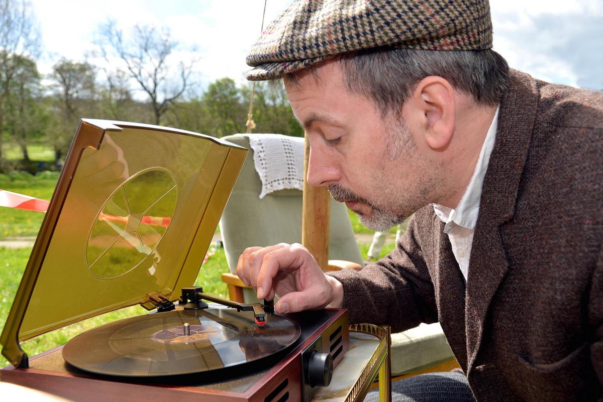
Now, it does rather look from these pictures as if nobody else was there… which is not in the least bit true. I’ll post other shots from the day as soon as I have access to them. [editor’s note: sure enough, other pics can be found here and here]. It was a perfect day for sitting out in the sun, for a chat with neighbours — whether enjoying food from the sandwich and cake stall masterminded by Irene Townend and other HCRRG members, or a little storytelling, or listening to music. We had “the bard of Saltaire”, Eddie Lawler, playing live on his acoustic guitar, and also a collection of old 78 rpm records from the 1950s that we played on the little machine pictured below (with which I was asked to pose for the most embarrassing photo op of the afternoon…). The most popular tunes turned out to be Cliff Richard‘s “Please Don’t Tease” and Brian Hyland’s “Itsy Bitsy Teeny Weeny Yellow Polka Dot Bikini” (which several picnickers seemed to know word for word by heart, and sang along…). Admittedly both those tunes were actually released in 1960, but what’s a year between friends? This is when a lot of people would have been moving onto the estate anyway: construction began in 1957, but continued until the early 60s.

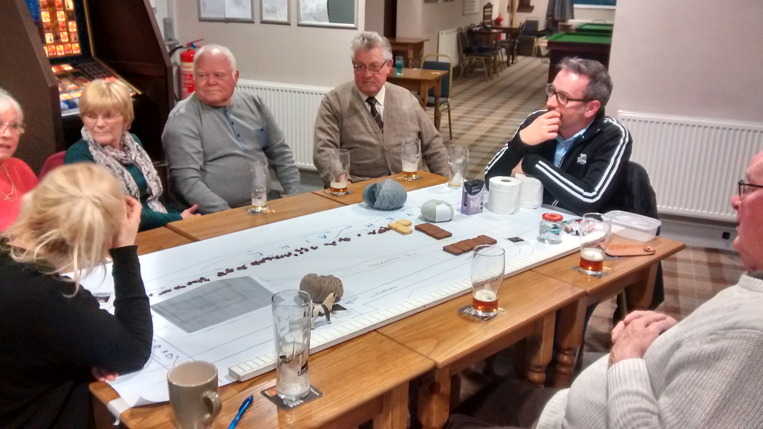
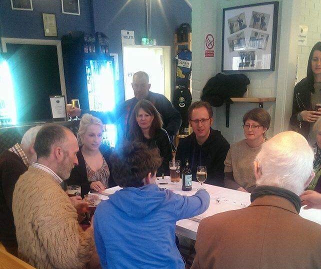
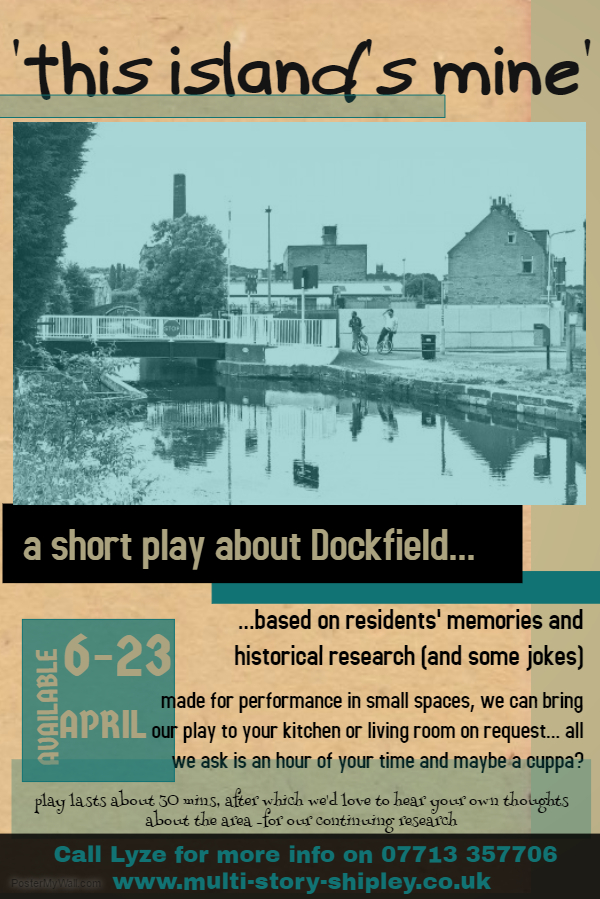
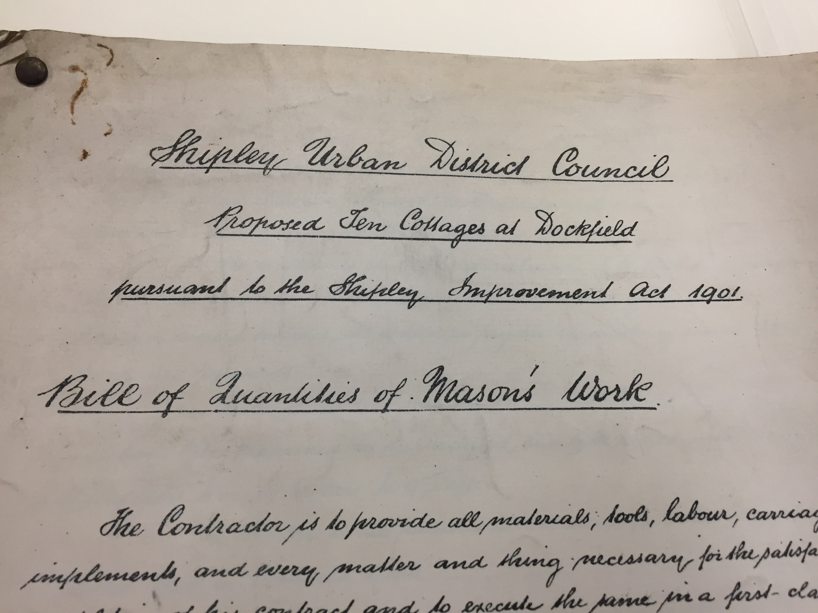
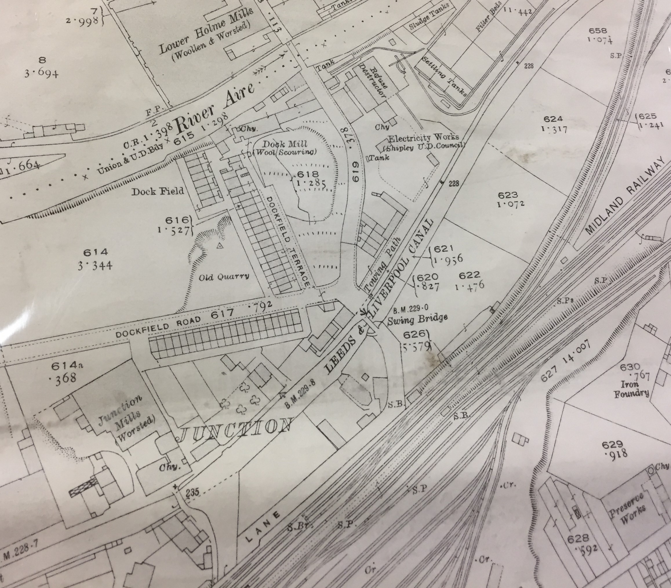
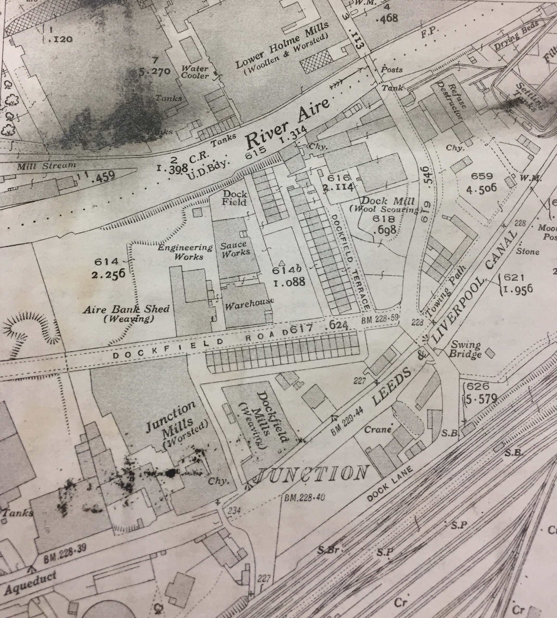
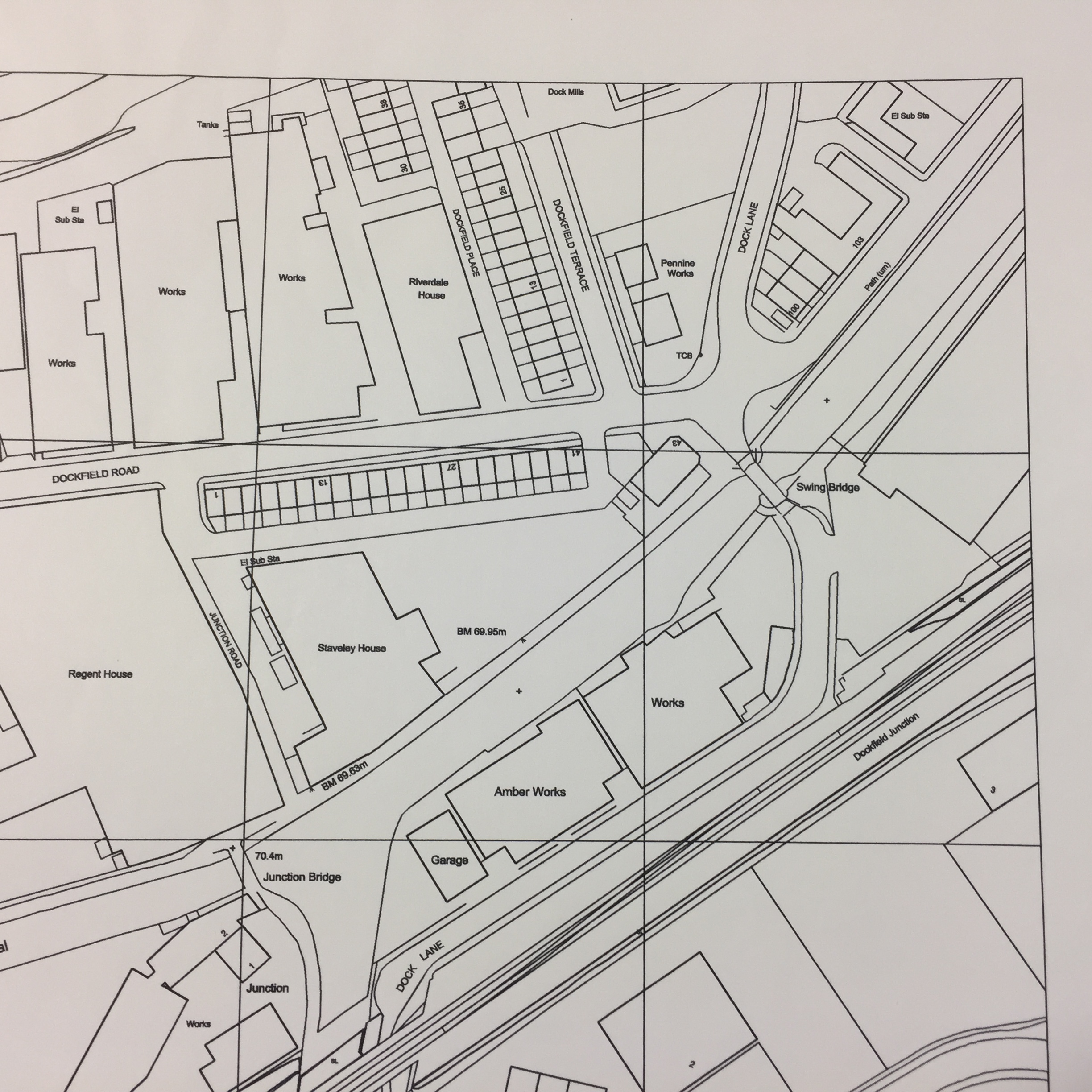
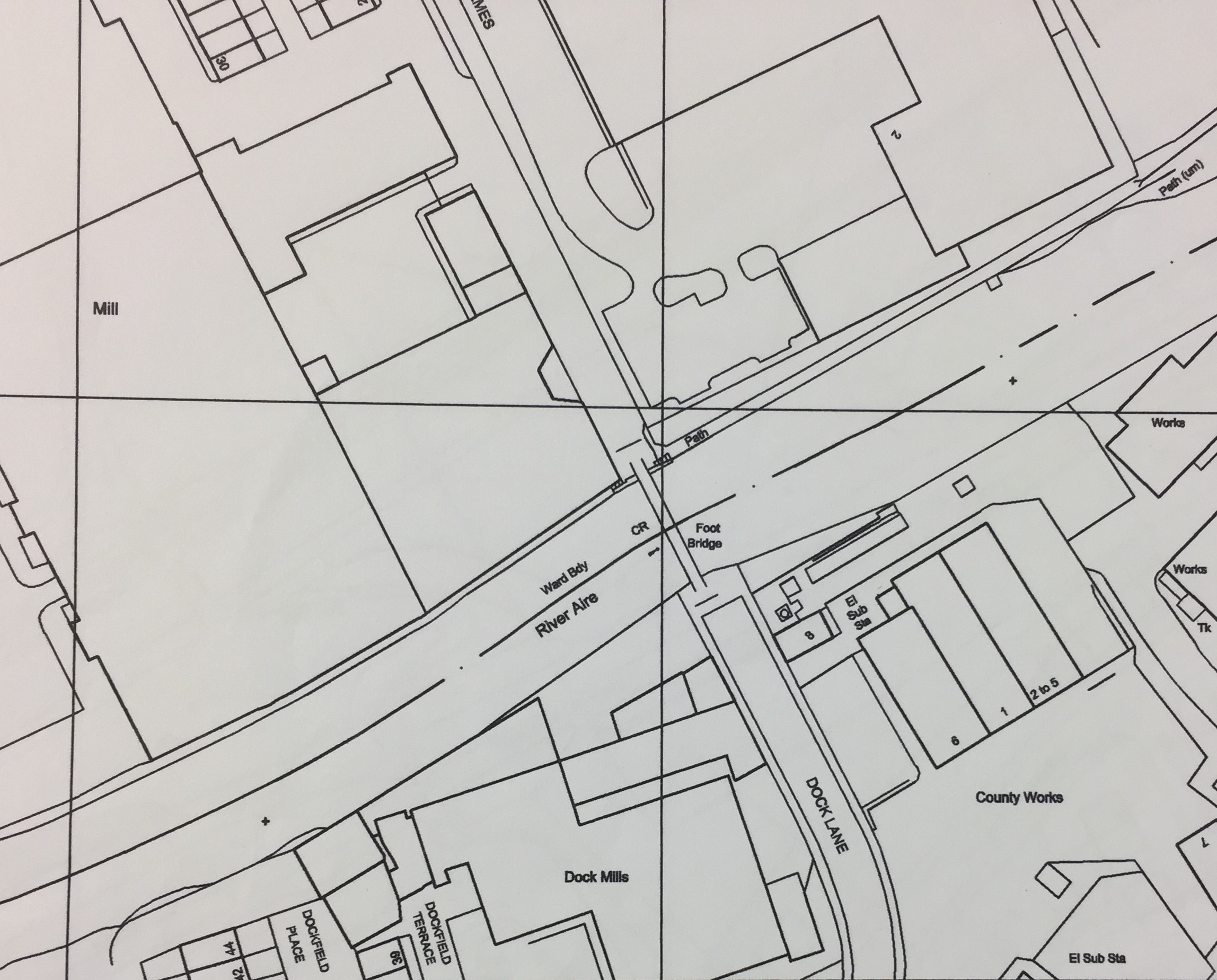
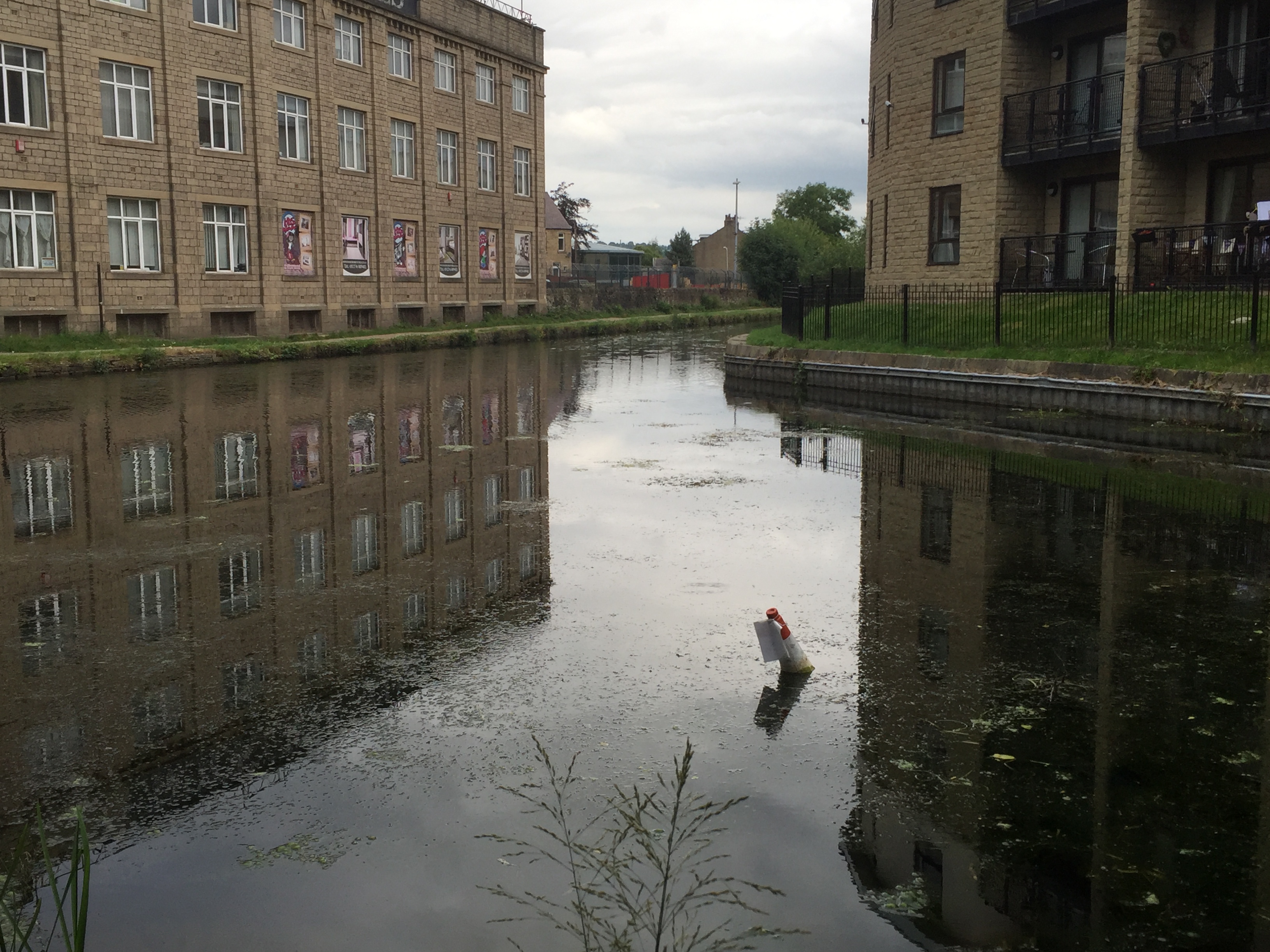
After the picnic wound down, and we’d packed up the outdoor living room, Kat and I made our way to Fanny’s Ale House, for the first of three Saltaire-area performances this weekend of This Island’s Mine — the short play celebrating the history of Dockfield, which I discussed in detail in my last blog post. Again, it was nice to be complicating the “official” heritage story of World Heritage Weekend, by drawing attention to another, less celebrated Shipley neighbourhood. (In Dockfield’s case, the major developments occurred not in the Victorian or post-WWII periods, but at the beginning of the 20th century, when Shipley Council built Dockfield Road, Dockfield Terrace, and local works for gas, electricity and sewage). And on Sunday afternoon, in the bar of Salts Sports Association (just across the river from the Coach Road estate), it was a particular pleasure to perform the play for an audience made up of members of the Higher Coach Road Residents Group…

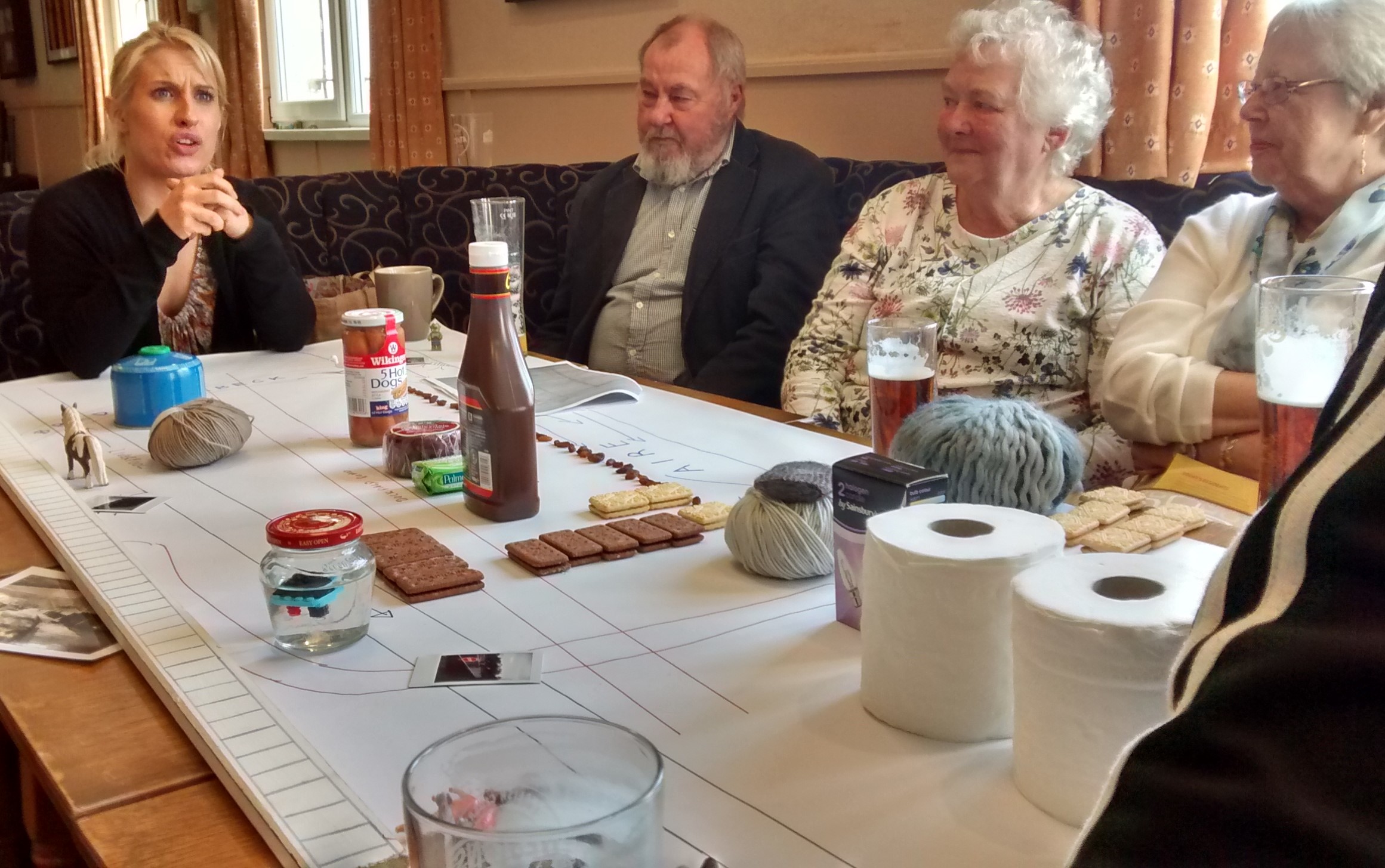
This Island’s Mine ends with a speech from Kat (based on interviews with Dockfield residents) about how, for all the improvements in living conditions we have nowadays, we’ve perhaps lost something of the sense of close community that was experienced by many local residents growing up (in the years when this was still very much an industrial town). This was a sentiment that I recall being expressed particularly clearly to me by some of the people sitting at this table — Stewart and Pat, Irene and Barry — when I first met and interviewed them back in 2012. So it was a particular delight, with Higher Coach Road Residents’ Group having become such a dynamic source of community identity over the last couple of years, to be sharing this story with them. It turns out that, just because something seems to have been lost, doesn’t mean it can’t be rediscovered with a little goodwill and ingenuity — because that sense of community may well still be there, lying dormant, and ready to sprout again…

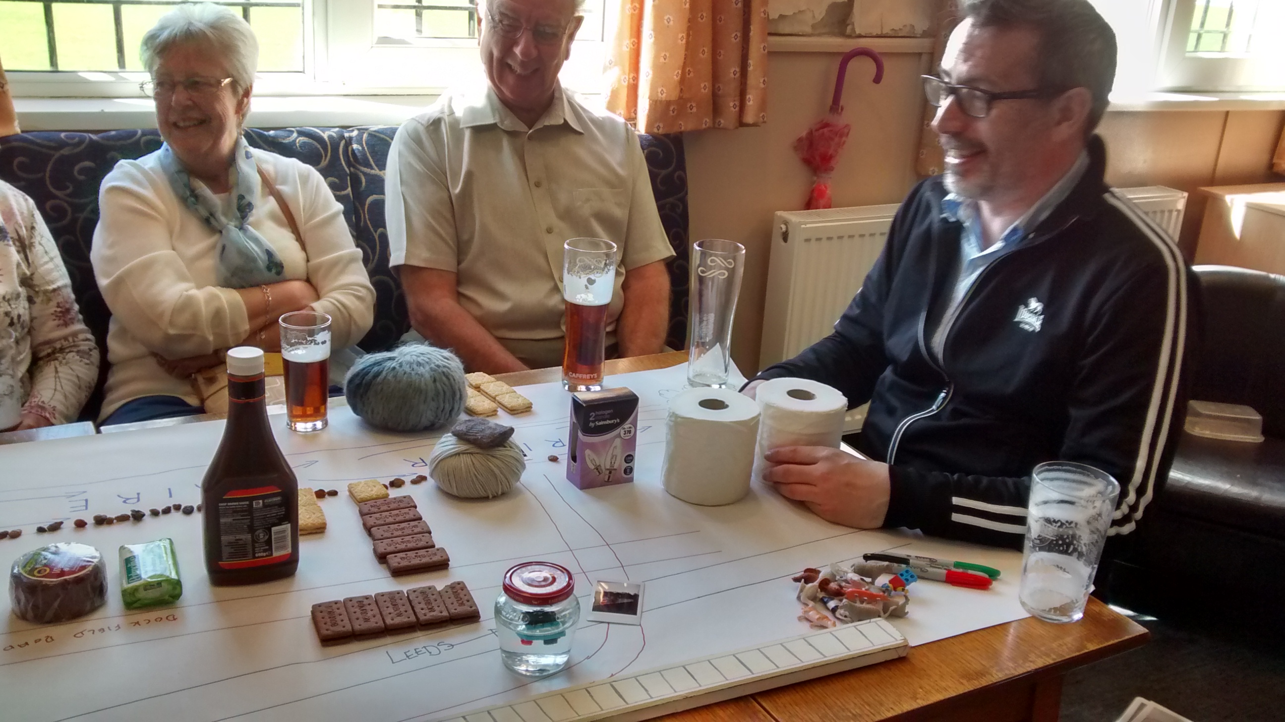
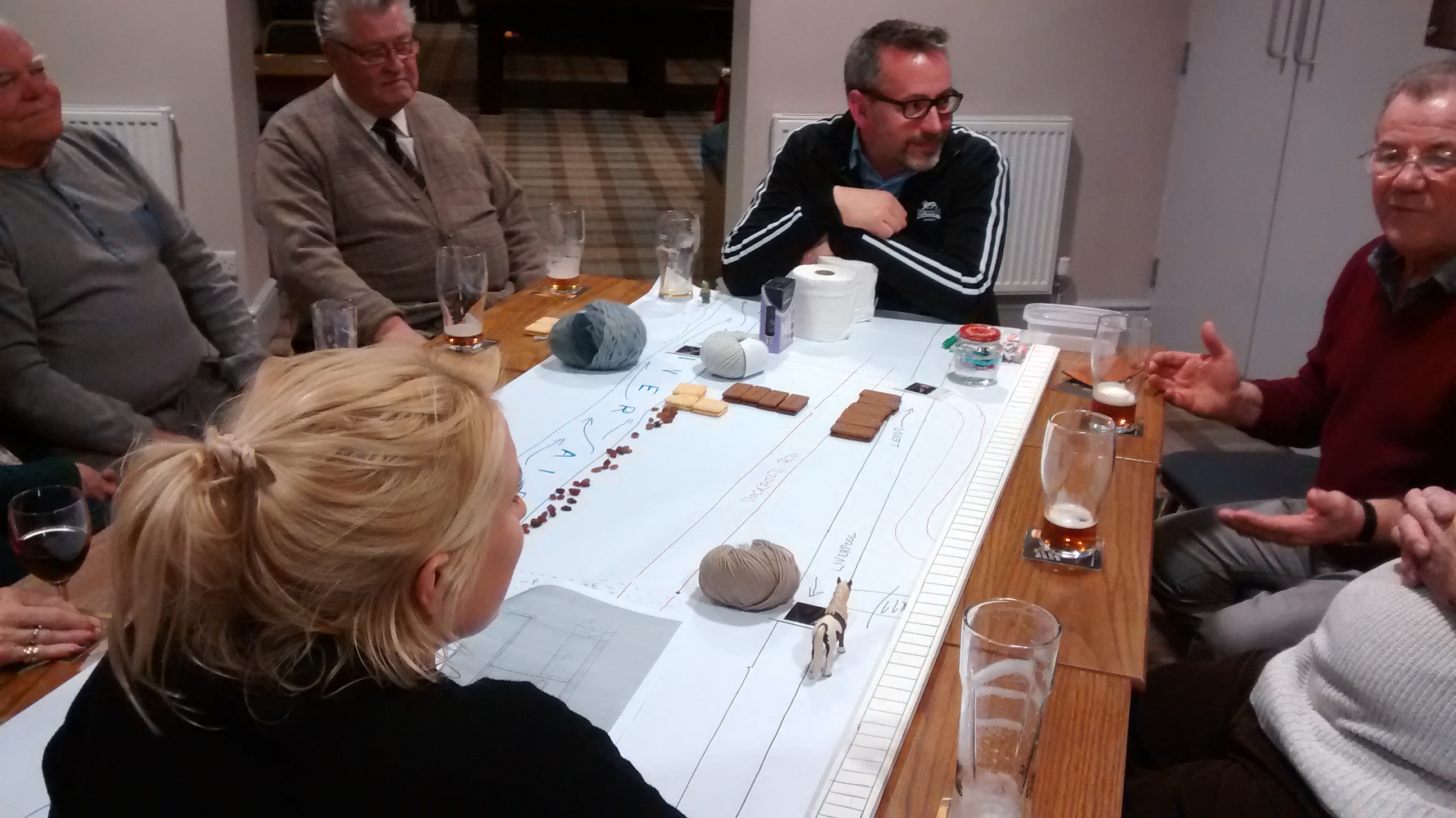
That’s Barry in the middle of the shot above. He grew up in Dockfield, and has lived on Higher Coach Road since the 60s. He contributed some great new additions to the collection of memories we’ve been gathering around this little play. And on the right in the image below is Steve, one of the most active current members of HCRRG, who went straight off from Salts to visit one of the older residents on the estate — as part of a “befriending” scheme that the group has started, to tackle the problem of isolation experienced by some. HCRRG is doing some amazing work now… I salute you all.

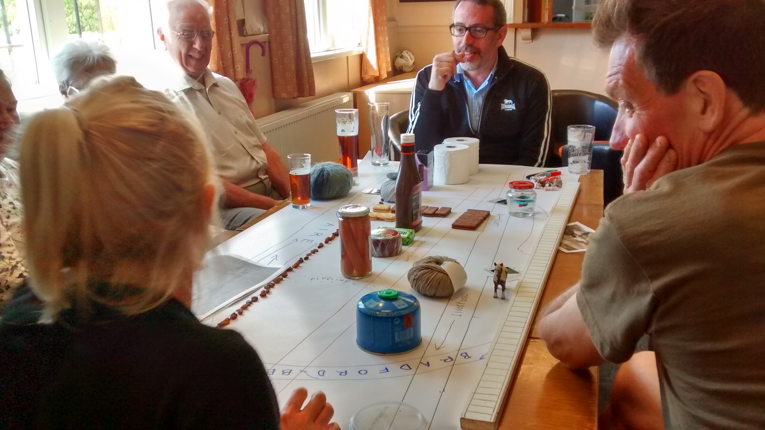
And so, back to Fanny’s Ale House, and the last of our scheduled performances of This Island’s Mine this weekend. For an audience that included Rob Martin and Molly Kenyon, the dynamic Saltaire duo who really got the World Heritage Weekend celebrations established as an annual thing these past five years (this year they’ve finally been able to step back a bit and let others take the lead). So it was great to share this with them too! That’s Rob’s knees in the bottom right of the shot below — after Kat had managed to attack them by accidentally knocking Rob’s pint off the table with one of her props… The perils of live theatre! Fortunately nobody was hurt, and the show continued once the glass was swept up by Fanny’s quick-reacting staff…

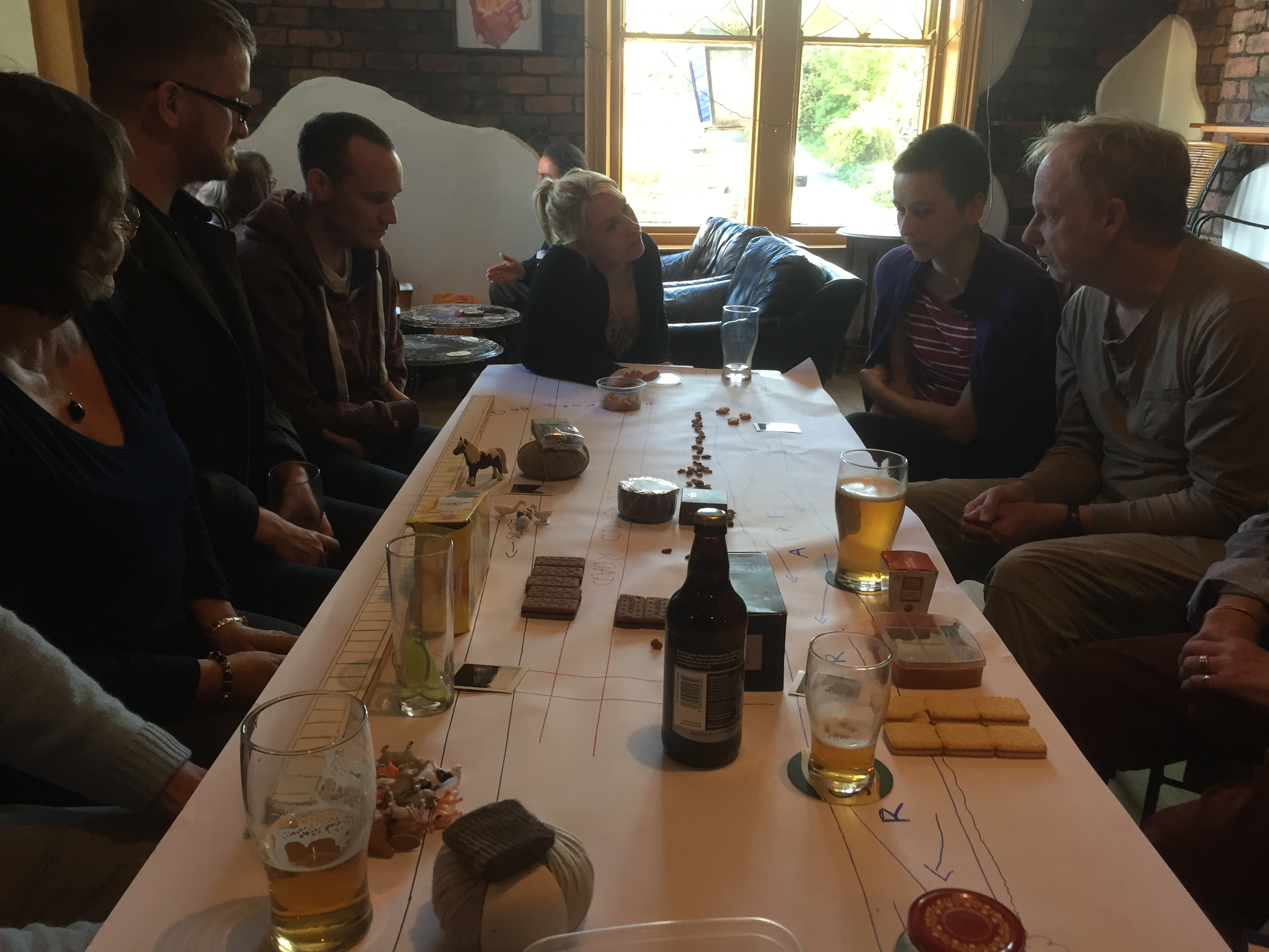
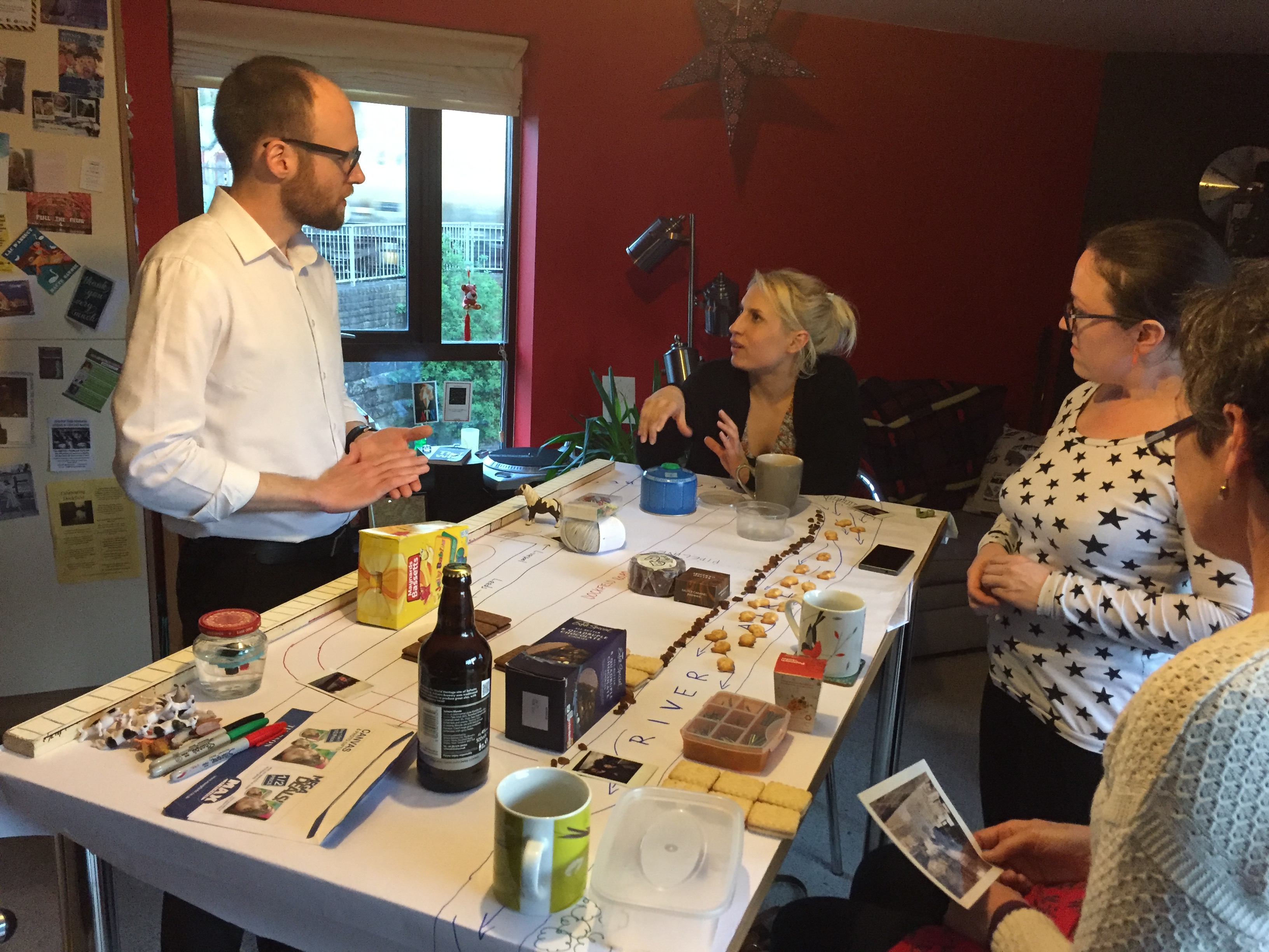
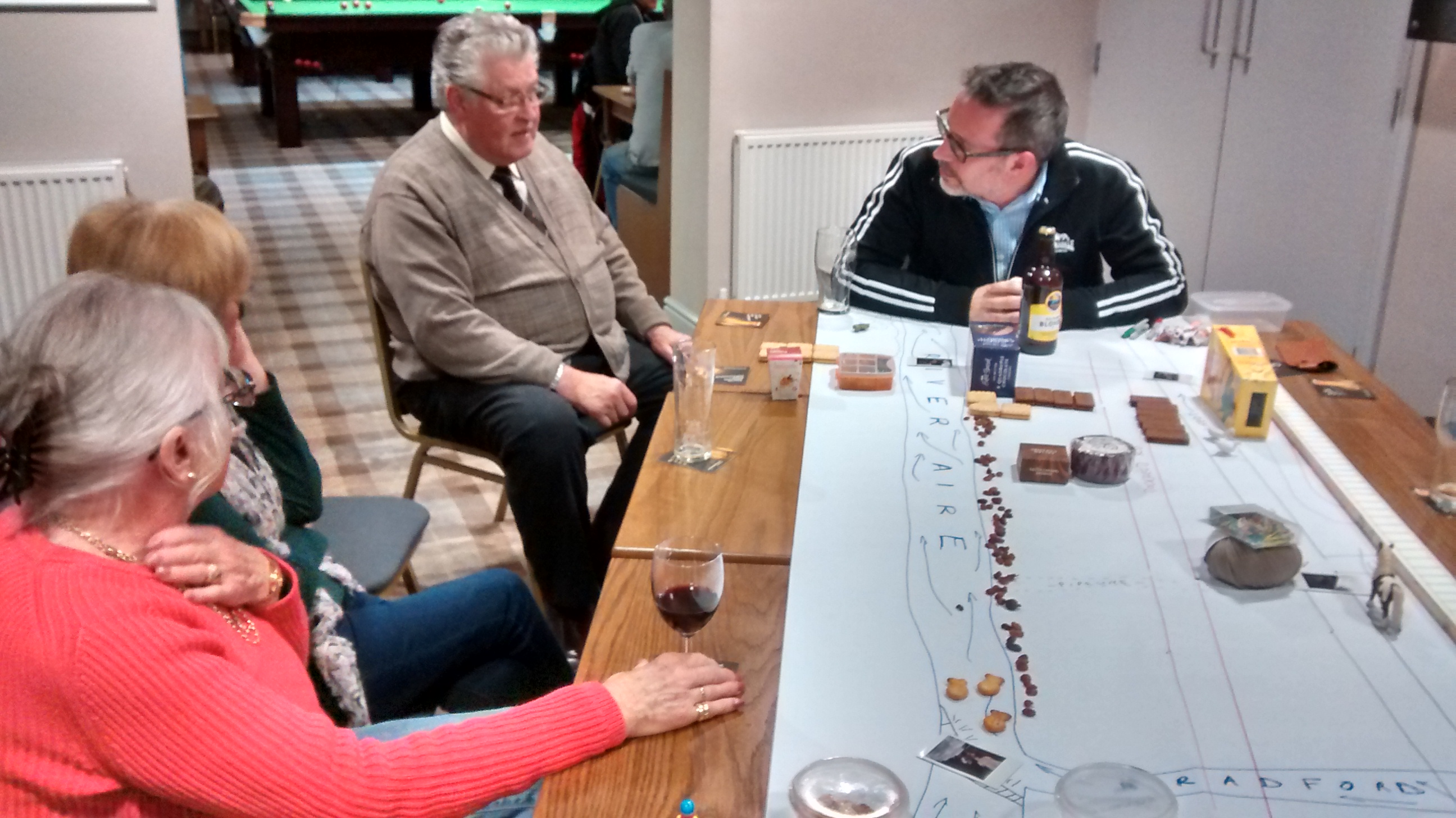
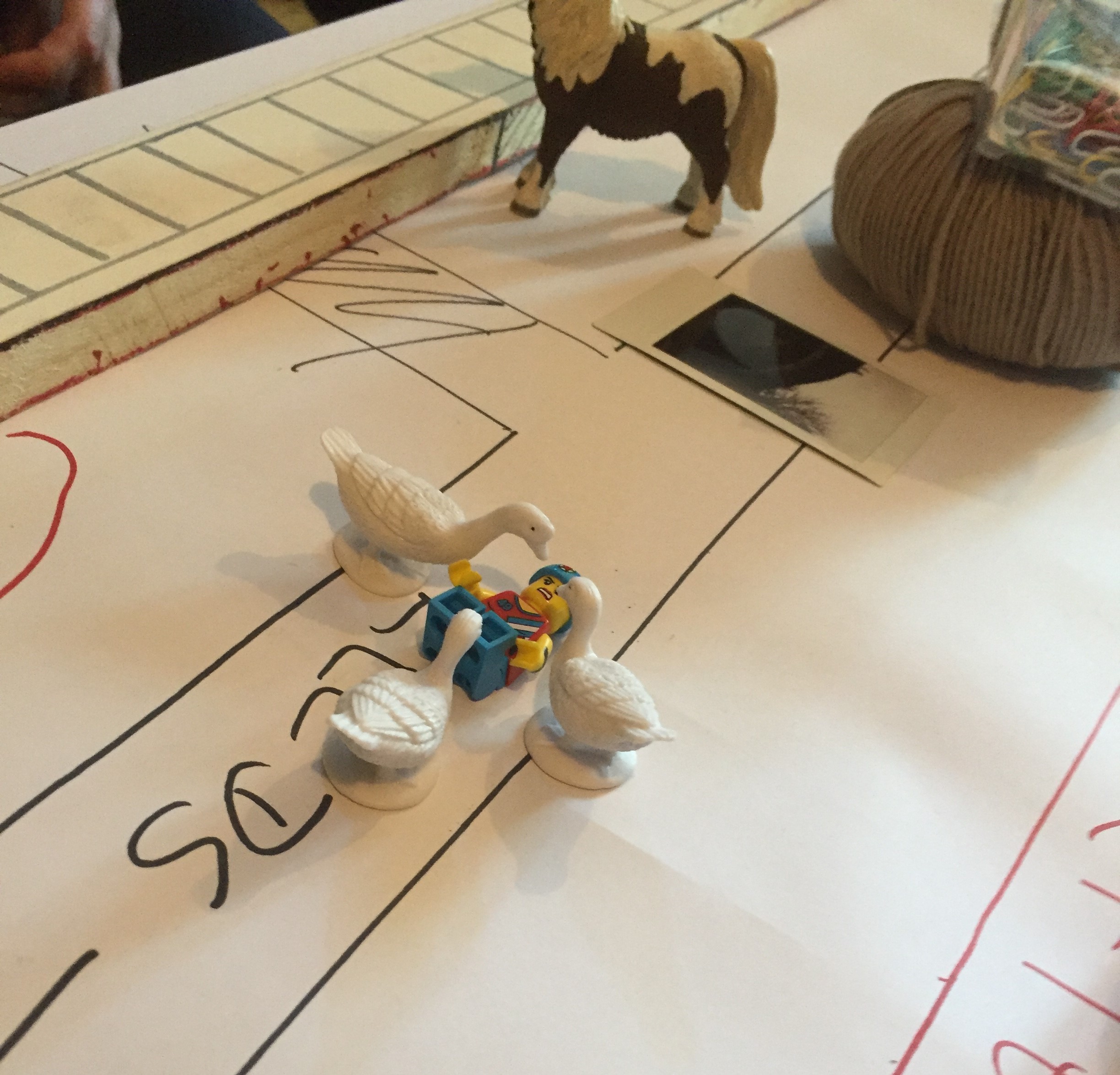
A particular highlight for me of this last performance was the way that the audience took it upon themselves to animate some of our table props… Below is one spectator’s interpretation of a story Kat tells, at the end of the piece, about canoeists being attacked by swans on the canal outside the Amber Wharf flats… So OK, it’s geese not swans, and a skateboarding lego man not a canoeist, but that is the spirit of improvisation!

Happy World Heritage Weekend everyone. A great celebration of past, present, and – perhaps – future…

This Island’s Mine – performing Dockfield

This was the scene just last night, in one of the flats at Amber Wharf. That’s the new-build properties next to the canal, in the Dockfield area of Shipley.

Sitting at the end of the table is Kat Martin, my co-performer in This Island’s Mine, the two-person play that we’ve devised and written about the history of Dockfield, and the close relationship that industry and residents have always had here with the River Aire, the Bradford Beck, and the Leeds-Liverpool Canal. This was the latest in a series of performances we’ve been giving in homes and pubs/clubs over the last week or so.

The other folk in the picture are last night’s audience (who prefer not to be identified by name, but were happy for me to share this pic), and strewn across their kitchen table is the “stage” of our drama — a map of Dockfield built up during the course of the play, using ordinary household objects from Kat’s shopping bags. Meanwhile, this was the view out of the window…

This particular flat overlooks what was once the junction of the Leeds-Liverpool and Bradford Canals. That’s Junction Bridge, built in 1774 at the same time as these sections of the canal network, to allow horses to get across from one tow-path to the other. This junction features prominently in our story, during the play, and it’s been one of the fun things, in performing it, to be able to point directly to where we are “on the map” as we speak. We’re talking about places and things that our audiences know well, but bringing a different perspective to them. So far, the reactions have been great!

One of the key locations on our map is Saltaire Brewery, whose main buildings were built as an electricity works for Shipley Council at the beginning of the 20th Century (later nationalised under Yorkshire Electricity Board). We were privileged last week to present a public performance of the play in the beer yard outside the Brewery Tap — on a gorgeous April evening in the setting sun (which kept everyone just warm enough!).

The picture above was snapped early in the performance (at a historical moment when the fields of Dockfield-to-be are farmers’ fields, yet to be built on… hence the animals) by Janet Wojtkow, one of our spectators… Janet is the partner of Tony Gartland, the Brewery’s founder and owner, so she took particular pride in snapping this picture…

… at the moment when we talk about how the former electricity works (represented by the light bulbs) is now the Brewery (represented by the bottle of Blonde). I actually had to pause mid-performance for a moment while Janet took the picture — much to everyone’s amusement. But that’s one of the nice things about the informal, round-the-table set-up for this play… there is a script we’re following, but people can also interrupt, ask questions, make observations, and we try to improvise satisfactory responses. It gives the show a lovely sense of liveness and one-off-ness every time we do it.

This conversational approach is also designed to elicit further contributions from the audience after we complete our story. The talking continues… At the Brewery, for instance, Janet shared the full story of why Saltaire Brewery is not in fact located in Saltaire but in Dockfield (it would have been in Salts Mill, it seems, but for the untimely death of its owner Jonathan Silver – and the subsequent hesitations of the interim manager). And this was just one of the additional tales we’ve been told… Take Geoff Roberts, for instance, pictured here in blue just behind my head on the right of the picture…

Geoff worked for decades in water quality control — for Yorkshire Water and its predecessors — and following our tales of Dockfield’s sewage works and plumbing, he told us how his very first work assignment, as a new employee in 1973, was to visit the pumping station next to the footbridge at the bottom of Dock Lane (again – very much part of our map!) in order to remedy a fault. It was quite the trip down memory lane. This performance at Shipley’s Kirkgate Centre was also attended by some with even longer memories, who told tales of Shipley and Bradford in childhoods before World War II.

Our most responsive and vocal audience so far was at Baildon Woodbottom Working Men’s Club last week, where our audience was almost entirely made up of people who grew up in Dockfield itself, in the 1940s, 50s and 60s. Since the characters that Kat and I play — Barbara and Danny — are amalgams based on interviews with a number of folk of this sort of age (and also a bit younger… we’re deliberately vague about exactly how old the characters are), the performance sparked especially vivid memories from those watching. In the picture below, on the right, Tony Brannon is offering an observation, mid-performance…

… and you can tell its mid performance because the objects on the table are different from those we end up with at the end (see below!). Truth to tell, Tony had been one of my interview sources, and he’s also a regular at the club, so for him the performance really was like an extension of our previous conversations. He and the others became as much a part of the show as we were — in fact our 30 minute running time stretched to more like an hour, with all the interjections, observations, and debates prompted by our script! Personally, I loved the way that the line between ‘play’ and ‘audience’ became almost indistinguishable…

… and for all that they corrected — or at least disputed — some of our “facts” (as Tony said, everyone remembers things differently anyway), this audience was also especially appreciative of what we’d made. Mary (in the foreground on the left in the picture above) was especially keen, after the play, to know why we’d chosen to focus on Dockfield. She seemed delighted by the thought that the place she grew up in — the landscape of her own childhood, if you like —  was being celebrated and remembered in  a play (however low-key and informal it might be as a play). I had the sense that her own sense of pride in the specialness of that place was somehow being confirmed by this outside intervention. And she had a few additional stories to tell of her own — like the way that the railings along Dockfield Terrace had been cut down during the war, to feed the urgent need for metal for the war effort…

What I’m really proud about with this play, so far, is that it seems to “work” in different ways for different audiences. For these people at Woodbottom Club, it provided an opportunity to look back and remember together — they carried on talking for hours (literally) after the performance, but were still thanking us for this “special evening” when they left. Conversely, our hosts last night at Amber Wharf are relatively new arrivals in Dockfield, and so the play helped to ground them in the history of the place and answer some of the questions they had about it. In the end, I suppose, that’s the great thing about storytelling… a story has a shape of its own, but it can mean different things to every spectator, depending on the interests and experiences they bring to it.

++++

Postscript. This was tonight’s performance — Wednesday April 19th — at Saltaire Brewery Tap. This week we came inside (no setting sun to warm us this time), and were joined by the biggest and most diverse audience we’ve had yet… Diverse in terms of both age and background. Gathered in two rows around our table, they included long-term Dockfield residents, more recent arrivals, and visitors from right out of town!

Indeed, among those present were a family from the Midlands… theatre and cinema enthusiasts who had come up to see the “magic lantern” collection at the Bradford Media Museum (an old-fashioned form of colour slide projection), only to discover that the collection has been shunted off down to London. They seemed delighted by our show, though (as if reassured that the North had managed to keep some culture of its own!). Despite knowing nothing about the Shipley area, they said that the history of industrialisation — that we tell through the microcosm of Dockfield’s story — was one they very much recognised from their own Black Country background.

“You’ve invented a new paradigm”, one of them told me afterwards. I confessed to not knowing what he meant. “A new model for doing plays,” he explained. “You could take this format and tell the story of anywhere.” And I suppose you could…  Personally, I wouldn’t claim to any enormous originality in the format of this piece: the component parts come from a range of theatre forms. But it’s true I haven’t seen them combined in quite this way before, or for quite this purpose (telling the up-close story of a place, through the use of characters, rather than the story of characters, that’s set in a place). As I say, though, what’s most special to me about this piece is the way that it seems to invite such spontaneous, conversational responses — even as we’re performing it.

Acknowledgements: Special thanks are due to Kat Martin, my wonderful co-performer in this piece, and to Simon Brewis – our director, who also guided us skilfully through the play’s development phase, from my initial draft script. Simon also took the pics of the Woodbottom performance. Thanks also Janet Wojtkow (whose pics I pinched off our Facebook feed, where she’d uploaded them), Paul Barrett (for the Kirkgate Centre pic), and Ruth Bartlett (for tonight’s Brewery pics).

Thanks for bearing with us…

If you’ve tried to look at our site in the last few days, you may have been warned off by virus detectors. We got hacked by someone in Bangalore who put malware on the site. (Aargh!)

We think this is fixed now, but please bear with us while we get things back up and running properly. There are a few blog posts we’ve meant to share in recent days, which we couldn’t because of these unwanted visitors…

If you’re interested in our short play about Dockfield, This Island’s Mine, we can confirm planned performances at:

Kirkgate Centre  – today, April 12th, 1pm

Saltaire Brewery Tap (Dockfield Road) – today, April 12th, 7pm

Saltaire Brewery Tap – Wednesday April 19th, 7pm

Fanny’s Ale House (Saltaire Rd) – Saturday April 22nd, 7pm    (to coincide with Saltaire’s World Heritage Weekend)

Further dates to be confirmed.

Please note: this is an intimate performance designed for small audiences. You are welcome to just turn up, but if you would like to ensure a spot for one of these performances, please call or text Steve at 07504 417323. Alternatively, we can arrange another time/date/place to suit you! We’re taking this as it comes and trying to respond to audience interest as it arises.


Telling the Story of Dockfield…

This Saturday, 1st April, at Saltaire Brewery – between 4pm and 8pm – we are proud to be co-hosting a special event for residents of the Dockfield area. It’s a chance to meet, chat, eat, sample the beer, and find out more about what’s going on in the area. There’ll be some acoustic music from Eddie Lawler, and a quick plug for This Island’s Mine — the short play we’ve made from our research into the area’s distinctive history and identity… Here’s the flyer!

Dockfield play flyer (1)As the flyer says, this is a piece that’s been especially made to take into people’s homes (although we’re also planning a few shows in the ‘Brewery Tap’ at Saltaire Brewery – details tbc). We wanted to make something that doesn’t have the formality of a ‘proper play’, and that feels relaxed and fun for everyone (kids as well as adults). We figured you’re most likely to feel relaxed at home — hence the idea of bringing it to you. It’s available on a range of dates in April, and it’s completely free of charge! Just call Lyze on 07713 357706 if you’d like to book us in for a visit.

The play features two actors (Steve Bottoms and Kat Martin) whose characters are fictionalised versions of some of the local residents we’ve met and interviewed. The title, This Island’s Mine, is inspired by one person who told us that – as a kid – he always thought of Dockfield as an island (because it’s bordered by the canal, the River Aire, and Bradford Beck). Perhaps you’ve never seen it that way – but in a way that’s the point… We’re hoping the play will spark reactions and further conversation… Maybe you’ll want to share a few memories or stories of your own in response? (or not – up to you!)

This is all part of an ongoing research project into some of the waterside communities in the Shipley area. We’re using various events, performances and conversations to share our findings with members of the community, to create a kind of ‘feedback loop’. Hopefully we all learn something that way, and have some fun doing it.

We’re really interested in your thoughts about Dockfield, and how life here could be further improved. Do join in the conversation!


Dockfield – going through Ch-Ch-Ch-Changes…

On Saturday 1st April, from 4pm-8pm, the Multi-Story Water project will be co-hosting a special event for residents of the Dockfield area at Saltaire Brewery – in conjunction with the Brewery and with Shipley’s Kirkgate Centre. It’s an opportunity for people in the neighbourhood to get together for a drink and a bite to eat — to celebrate Dockfield’s distinctive heritage and community — and to share some thoughts about what’s happening in the area now… Do come and join us!

IMG_2377Dockfield is in a state of transition today — just as it always has been. Residents and businesses come and go… buildings go up and come down. Right now, there’s a new residential building going up right at the junction of Dock Lane and Dockfield Road…

IMG_2378In this picture above, taken a couple of weeks ago, you can see the distinctive outline of the Amber Wharf flats — just across the canal from this construction site –about to be obscured by the rising walls of the new building. Of course, the previous building on this site was single-storeyed, but not this one…

IMG_2090

Not so long ago, the flats were still clearly visible across the site… And just last summer, the area was completely clear… just awaiting new development….

IMG_1395

The sense of ongoing change that, in many ways, defines Dockfield is perhaps summed up in the picture below… Here, on the other side of the Dock Lane junction, looking east, you can see a lump of old wood on top of a post… leftover from who knows what? … which currently serves as a makeshift sign for Saltaire Angling Association — warning away unlicensed fishermen…

IMG_2376

The sign makes a claim to private rights, but it’s clear from our interviews with local residents that the canal always used to be seen as a community asset. People fished in it, swam in it, you name it… One interviewee memorably referred to it as “the Leeds-Liverpool Lido”…

IMG_1379

The canal itself has been in a state of transition recently. Just last year, the Dock Lane swing bridge got a complete makeover… This followed on from the re-paving of the towpath the previous year – although the new surface only extends as far as the swing bridge (as you can see in the last but one picture, cyclists are then advised to switch over to the road from the rough track beside the canal).

IMG_1381

IMG_1382

Here’s the lovely new, railinged platform area for the swing bridge operating panel. This has gone all high-tech and automated now, replacing the crank handle system that had been there for decades… It used to require 18 full turns, I’ve been told, to open or close the swing bridge… And if you didn’t do enough turns when closing it, then the bridge wouldn’t be lowered properly back into place, and there’d be a horrible banging noise any time a car drove across it… This would keep some nearby residents awake at night, so hopefully the new system is an improvement!

A continuing issue for residents, though, is the far more unsightly state of things directly across the swing bridge, where a big row of containers — effectively just skips full of weight to prevent them being moved — hugs the edge of Dock Lane…

IMG_1383

I’ve been told that the containers were put here some time ago to prevent travellers from moving onto the land just east of Dock Lane here, next to the canal… That land is still earmarked for new residential development, and the owners don’t want squatters.

IMG_1390

But I gather there are various complications for the site owners here — including a lack of existing service infrastructure (eg water and sewage pipes), as well as issues around financing etc. Whatever the reason, the site has remained empty since the last pre-fab industrial building was removed from it… leaving just an exposed concrete floor through which nature somehow finds its way…

IMG_1386

I must admit that the persistence of nature in this long-industrialised area is one of the things that appeals to me about Dockfield. There’s this rather lovely row of self-seeded birch trees, for example, which has grown up at the edge of what remains of the Bradford Canal (at its junction, here in Dockfield, with the Leeds-Liverpool…).

IMG_1406And then of course there are the local swans, much loved by the residents here, who have adopted the area and seem to be in no hurry to leave. For the last couple of years, they have nested right here, along the snicket alongside Junction Mill, that links from the towpath through to Dockfield Road…

IMG_1400

This picture is from last year… when the swans returned to nest in the same spot despite having been plagued by some unscrupulous egg-thieves the year before (or so I heard). I wonder if they’ll nest here again this year…? In the shadow of Junction Mill and the local razor-wire…

IMG_1397

Dockfield is a special place. An “island”, one resident told me, sandwiched between the river, the canal, Bradford Beck to the west, and – to the east – a road dead-ending in fields. It’s maybe not a place people come to visit, but it’s got a special history that we’ve been exploring through both interviews with residents and archival research. In April, we’ll be presenting the findings of this research in the form of a specially-written play, This Island’s Mine. We’re hoping to perform it (free of charge) in residents’ living rooms and kitchens, as a conversation starter… Just call us if you’d like to book us in! (Steve is on 07504 417323)

IMG_1388


A Bridge Over Troubled Waters?

panoramaLike many people, I’ve spent a lot of time this week trying to make sense of the chaotic whirlwind that has been President Donald Trump’s first week in office. Events in Washington don’t normally have much to do with the waterways and communities of Shipley (this blog’s usual subject matter), but there was something about the Women’s March held last Saturday in Shipley town centre — in protest at Trump’s inauguration — that resonated deeply for me. Let me try to explain why.

clock tower

The march in Shipley was, of course, one of many held all around the world. But unlike most of the other places where this happened, Shipley is not a major city. It’s not London or Manchester or Glasgow or even Leeds. It’s a small, former mill town, and the decision of some of its citizens to march was curious enough to attract journalistic comment as far away as India. The specific, local incentive for the action was a kind of subsidiary protest against the local Conservative MP, Philip Davies, who has stated that he would have voted for Donald Trump “in a heartbeat”. But it’s not just his liking for Trump that has antagonised Shipley’s self-proclaimed “Feminist Zealots” (their name is an ironic dig at Davies’s derogatory terminology); it’s their sense that he seems similarly reluctant to treat women as equals. Davies may not have been recorded boasting about grabbing small felines, but his membership of Parliament’s Equalities and Diversity Committee is — as even he would likely admit — about as natural a fit as asking Nigel Farage to join the European Commission.

women and placardsI will nail my colours to the mast and say that I whole-heartedly support the Feminist Zealots of Shipley — from whose previously ‘secret’ Facebook feed I have nicked these pictures of the march (with apologies to the photographers). But I also think it’s important to say that Philip Davies is not a man simply to be rubbished and ridiculed (despite the best efforts of, say, comedian Russell Howard). Whatever one thinks of his politics, it’s hard to deny that he is also a hard-working constituency MP who is quite remarkably responsive to the needs of constituents, regardless of who they vote for, or indeed what sex they are. I’ve lost track of the number of stories I’ve heard from local people of how he has helped them out with pressing problems to do with housing, local services, etc. Davies has earned the gratitude and respect of many, which is no doubt a big part of the reason he gets re-elected. So it was great to see that even the protest against him was voiced in a creative, generous spirit, rather than in the kind of divisive, aggressive language that Donald Trump himself has become known for:

16114177_10154540134381888_5887707022175432936_n

This slogan — “Bridges Not Walls” — recurred on a number of placards on the march, and exemplified the spirit of wanting to build and heal, rather than divide and antagonise. It’s also a gift to your local water-blogger, because of course Shipley has no shortage of bridges. Off the top of my head, I count seven road and footbridges across the canal between Dockfield and Hirst Wood (not including the lock gates, which you can also walk across), and a further four across the River Aire. (Of course the canal even takes a bridge of its own over Bradford Beck at one point, just to underline my point…) In short, in the Shipley area, we’re pretty good at finding our way over sometimes troubled waters. So maybe there are even bridges to be built between Philip Davies and his opponents? Before that begins to sound tritely optimistic, let’s take a closer look at one particular bridge…

IMG_2374This is Victoria Street in the foreground, ramping up to the left of the picture as it starts to bridge the Leeds-Liverpool Canal in central Shipley. (The distinctive chimney of Salts Mill is in the distance, to the west.) One the right of the image, standing to one side of the canal, is the headquarters of In Communities, Bradford’s social housing authority. (I’ll come back to them in a minute.) On the left of the picture — and directly across the canal — is the distinctive red-brick structure of the former Leeds-Liverpool Canal Company warehouse. This pairing of buildings, old and new, facing each other across the water, sums up quite a lot about the state of modern Shipley. Let’s look first at the warehouse…

IMG_2375

If you were looking to find local examples of what President Trump was speaking about in his ominous inauguration speech — those “rusted out factories scattered like tombstones across the landscape of our nation” — well, this would be as good a place as any to start. Sure, it’s a warehouse, not a factory, but this rather beautiful edifice (which my friend Eddie Lawler has playfully earmarked as the HQ for his imaginary “University of Saltaire”) has been left to go to rack and ruin in recent decades. It’s one of many sadly neglected canalside structures, which has never been retrieved and repurposed for any “post-industrial” service industry. But the question is, what would a Trump (what would a Davies?) propose to do to remedy the situation?

The answer promoted by most mainstream politicians, of either hue, in the UK and US over the last 30 years has been to trust the market. Private enterprise, we are told, will deliver improvements to all our lives… Well, perhaps it will in some places, but the canal company building is still there, crumbling, and last month it was raided by police officers charged with shutting down an unregulated private enterprise…

Cannabis factory at Ashley Lane, Shipley.jpg.gallery

As reported by the Telegraph and Argus , this was not the first time that the building has been squatted for the purpose of growing industrial quantities of cannabis…

Shipley Ashley Lane cannabis farm.jpg.galleryThe spirit of free enterprise has always been about serving yourself first, even if that involves stretching the law. It’s useful for some things, but it’s not going to save the crumbling infrastructure of Yorkshire’s former mill towns, let alone the American “rustbelt” states that swung victory for Trump. And the new President, who knows a thing or two about free enterprise, knows there’s no business incentive for rebuilding in depressed areas. (Where’s the profit in that?) So instead, he is promising the biggest federal infrastructure programme since FDR’s New Deal in the 1930s. Donald the Builder wants to make more than his signature golden towers. His plans will, he promises, put thousands of ordinary Americans back in work, and it’s these promises that got him the votes he needed in Michigan, Wisconsin and Pennsylvania to win the election.

The question is, who is going to pay for all this? Because much as we’ve all got tired of mainstream politicians who seem only to represent vested interests (hence the Trump rallying cry to “drain the swamp!”), we’ve also got used to not having to pay too much in taxes. Hence Trump’s determination to make Mexicans, not Americans, pay for his most controversial infrastructure project — the mooted wall on America’s southern border (which, of course, the “Bridges Not Walls” slogan refers to). Well, good luck with that, Donald. So far the Mexicans don’t seem too impressed by your negotiation tactics.

But enough about America. Let’s get back to Shipley. Where the appeal of Philip Davies to local voters is perhaps not dissimilar to the appeal of Donald Trump. His slogan is “Your Interests, Not Self Interest”. And as I mentioned, Mr. Davies does seem to do a fair job of helping people out with their immediate difficulties, by banging heads together where he can. And yet… in this era of small-ish government and low-ish taxes, there’s little prospect of the local infrastructure being rebuilt any time soon.

For me, this realisation has become particularly apparent this last month thanks to some striking bits of local history. Paul Barrett at Kirkgate Centre recently circulated this link to Operation Progress — a 1957 documentary film, on the British Film Institute’s web player, which shows the demolition of some of Shipley’s insanitary old back-to-back houses, and the building of the spanking new council housing estates along Coach Road. You get an amazing sense, watching this film, of just how exciting and progressive it seemed at the time to build these solid new homes in green spaces on the Baildon side of the river — transplanting people from the dark, crowded streets so many had been living in before. This was “operation progress”, and it was masterminded not by private enterprise or indeed by central government, but by Shipley Urban District Council. They had a masterplan, and they carried it out, and in many ways we’re still living with the landscape they created in the 1950s. Partly because there’s been no comparable attempt at regeneration since…

IMG_1395

I’ve also been actively researching the history of Shipley’s Dockfield area this month (see also my last blog), and one of the striking things I’ve discovered is that here, too, it was Shipley Urban District Council that made all the difference. Not in the 1950s, but half a century earlier, when SUDC had a masterplan called the “Shipley Improvement Act of 1901”.

IMG_2158

Up til then, Dockfield had basically been the wild west (or rather east) — an area dominated by a few largely unregulated textile mills, with the only road access going under the railway via Dock Lane. The lane was in a shocking state of disrepair because the mill owners didn’t want the responsibility or cost of maintaining it. But then SUDC built Dockfield Road as a modern road link from the main Otley Road. And alongside Dockfield Road, SUDC built the row of terraced housing that still stand there. And at right angles to Dockfield Road, they also built the homes along Dockfield Terrace. Council houses all. And they made them solidly, from stone, with then-state-of-the-art plumbing and heating systems.

And at the same time they built a water treatment works in Dockfield, as the outfall to a brand new sewage main running west to east, the length of Shipley. Because decent sanitation is a basic health requirement. But left to its own devices, free enterprise was never going to provide it.

IMG_1387

All of which brings me back to In Communities. Remember them? Opposite the weed warehouse? It oversees what’s left of Shipley’s council housing stock. Of course, ever since Mrs. Thatcher introduced the right to buy in the 1980s, most council housing in the area — whether along Coach Road (c.1957) or in Dockfield (c.1908) has been sold into private ownership. There’s not much stock left, because there’s been no new drive for social house-building. Because — we’re always told — we can’t afford it. And to judge from the Comments on the InCommunities facebook page (where the average ‘star grading’ out of 5 is 2.2), the condition of much of the remaining stock is poor, and too little care is being taken about the welfare of those people having to live in them. In fact, I even made a film about this recently. But that’s another story.

My point is, if you look around Shipley, it’s easy to see why people here might — given the opportunity — vote for Donald Trump. Whether “in a heartbeat”, or just in the forlorn hope that it might change something. But my point is also that what we really need is properly resourced, properly led local government, with a new vision for the town’s future.

Is it too much to hope that we might build a bridge, on this basis, between Philip Davies and his detractors?

IMG_1404

This is Dockfield’s Junction Bridge. Built in 1774 to allow horses to cross from the towpath of the Leeds-Liverpool Canal to the connecting towpath of the Bradford Canal. This is the junction – and the bridge – at the heart of Bradford’s early industrial expansion. Behind the bridge, Junction House — also built in 1774 — continues to fall into chronic disrepair…


Dockfield and Lower Holme: A story in maps

This time last year, I was trying to keep this blog updated with the crisis that was the Boxing Day flood of 2015. Thankfully, things have been a lot quieter this Christmas, so I’ve been able to devote a bit of ‘down time’ to some more historical water stories. Specifically, I’ve been puzzling over old maps, trying to figure out the history of how homes and industry developed in the Dockfield area of Shipley (and the Lower Holme area of Baildon, just across the river footbridge). It’s more fun than a jigsaw puzzle…

1837 Shipley Kirkstall turnpike plan

Dockfied is an area defined by water on all sides — the River Aire to the north, the Leeds-Liverpool Canal parallel to the south, and Bradford Beck to the west (flowing north to meet the Aire). But as you can see from this 1837 map, above, it was not even dreamed of at that point in time. Shipley was then a small town whose centre was slightly further west than it is now, clustered around the road leading off the original Canal Bridge (now Victoria Street Bridge), before the Otley Road bridge and Foxes Corner junction even existed. East of the Beck (or “Brook”, as this map has it), was simply farmers’ fields. By 1852, though — the date of this next map — there are sure signs of industrialisation…

Dockfield 1852 detail of larger Shipley mapNot far to the west, Salts Mill was nearing completion and about to open — in 1853. But here, in addition to Baildon Mill (the old water mill on the Aire, also visible in our earlier map), we can now see Junction Mill — in the spot where it still stands, directly to the east of Bradford Beck, and facing Junction Bridge — the original canal bridge that allowed horses to cross from the towpath of the Leeds-Liverpool to the towpath of the Bradford Canal (hence “junction”). Also in what’s to become known as Dockfield, there on the southern bank of the Aire, is another, as-yet unnamed “Worsted Mill“.

Neither of these two new mills would have had water wheels (or their attendant weirs). This was now the age of steam engines. But still, you need water to make steam. Junction Mill appears to have been getting its supply from the river via the “Junction Aqueduct” (Salts Mill had a similar pipeline set-up), but the smaller worsted mill had clearly opted to site itself right next to the river. This meant that it didn’t face onto the canal, as Junction Mill did, so to get access to this vital transport and haulage route, a road of sorts has been constructed between the mill and a small “Dock” on the southern edge of the canal. And a swing bridge (or “Turn Bridge”) has been installed to provide access across the canal itself. Notice that, at this stage, Dock Lane does not appear to extend any further: it is literally just a lane linking the riverside mill to the canal dock.

Taken together, the appearance of these two mills gives a clear indication of what the appeal of this area was to industrialists: you needed both the river for a ready water supply and the canal for transportation, and in the Shipley area you had both, running in parallel. Of course, rail is another transport option, and already in this 1852 picture above you can already see the clear line of what was then the Midland Railway, running roughly parallel to the canal, just to the south. But stations were fewer and further between on a railway, so the canal still had a clear appeal for its readier freight access (just as road haulage is, today, much more convenient than rail for most businesses).

Now let’s spool forward another 40 years, to the first modern Ordnance Survey map, printed in 1893:

Dockfield OS 1893 (first edition)Notice, first, the appearance of the words Dock Field on this map. The area has found its name — a name that presumably refers simply to the fact that there is a dock right there in the middle of a field… But the words actually appear next to the first row of houses in the area, which have no doubt been built to house the worsted mill’s growing workforce. These houses, now known as Dockfield Place, are still in use today. 

Notice, though, how the riverside worsted mill has now been dwarfed by the erection of the Lower Holme mill, directly across the river. This Baildon site, bought up by Titus Salt in 1850 (apparently before he decided where to site Saltaire), was sold on to C.F. Taylor in 1862, and it was Taylor who then built the large mill building next to the river (again, water supply…). He must also have been responsible for building the bridge across the river, in order to connect to Dock Lane and, thus, the canal dock. Although the present, 1960s bridge structure is just a footbridge, it must originally have been wide enough for wagons — which also explains why the road running down to it has always been full road-width (at least until the arrival of the controversial “landscaping” — aka a long row of dumped earth — that was left along the edge of the Wickes overspill car park when the site was redeveloped in 2014… still a sore point with residents!).

I can’t easily show you the Lower Holme cottages north of the mill, because in a quirk of OS mapping, there’s a key grid line that runs through here that always carves the mill and cottages onto two separate pages of the maps. So we’ll come back to the Baildon side of things at the end of this post… Sticking for now with Dock Lane, notice how — in the 1893 map above — the lane now continues alongside the railway and then underneath it by the canal junction. It then runs alongside the Bradford Canal (long since filled in, of course) to connect with the Leeds Road, just as it still does today. Finally in the 1893 map above, note also the massive expansion of railway sidings to the south of the mainline.

The next map is from 1908, just fifteen years later…

Dockfield OS 1908 revisionAt first glance you might think this looks much the same as in 1893. But notice the developments to the east of Dock Lane, between river and canal. A small row of houses has now appeared along the towpath to the east of the swing bridge — houses which still stand today on Dockfield Road (though the road did not yet exist when they were built). These houses and the other new buildings to the north have apparently been built to service the new Sewage Works that Shipley Urban District Council has recently been building. The long, rectangular in the top right of the image above will soon be more clearly delineated as sewage settling tanks. So… the outlines of the Dockfields “island” (as some residents call it) are now clearly defined: river, beck, and canal to the north, west and south, and wastewater treatment to the east…

The sewage works’ arrival was the result of developments in local government and sanitation around the end of the 19th Century. The SUDC was created from the old Shipley Local Board, and one of its main reasons for being was to bring proper drainage and sewerage to Shipley — by eliminating the old middens and cesspits, and providing new homes with proper plumbing. A new sewage main running west to east along the Aire valley through the whole of Shipley parish now emptied into these wastewater treatment works at what was then the easternmost edge of the town. Indeed, technically (as 19th C. maps make clear), the area east of Bradford Beck was in the parish of Idle, not Shipley, so in effect Shipley was dumping its waste on the threshold of its neighbour.

But Shipley Urban District Council was not done yet… Look at this next OS map, from 1922 (? ish).Dockfield OS 1922 probably

The new sewage works are more clearly labelled now. The worsted mill on the riverbank has now finally acquired the name of Dock Mill. But most strikingly, we now have the spanking new Dockfield Road, leading all the way up from Otley Road, at Baildon Bridge. The road has been built by the SUDC to provide better access to the sewage works and thus take the pressure off Dock Lane (which was no longer fit for purpose, with the mounting volume of traffic, and with that low bridge under the railway). Along Dockfield Road and the adjoining Dockfield Terrace (which links to the older homes nearer the mill) we now have two rows of early council housing — homes literally built by Shipley Council, with the very latest spec in plumbing and drainage… This was an early statement about the unsuitability of the old back-to-back homes in the Windhill area — visible in the bottom of the 1893 map above, and eventually demolished by SUDC in the years after World War II.

If we fast forward again to 1934, the full scale of Dockfield’s industrial development has now become apparent…

Dockfield OS 1934 (1)West of Dockfield Terrace, the Hammond Sauce works has now set up shop, and there’s also a weaving shed and small engineering works alongside the sauce. Dockfield Mills has now been built on the canal bank next to Junction Mills (also still standing today). Dock Mill itself has further expanded, and there are more buildings around the canal dock (presumably warehousing, to cope with the increased capacity now needed). This is Dockfield at its industrial height.

Now then… All of these map images are close-up photographs I’ve taken from the large maps on display to the public in Bradford Central Library’s Local Studies section. (There’s no indication there of any copyright issues with the maps, so hopefully I’m not breaking any laws here.) But for some reason the library’s big maps don’t go past 1934. After that we move to a different scale of OS mapping, but we also make a huge leap to 2003…

Dockfield OS 2003What’s perhaps most noticeable here, apart from the altered graphics, is just how little has changed since the 1930s. In the map above, Dock Mills is still there, and the various “Works” to the west of Dockfield Terrace. But Junction Mills has been renamed “Regent House” and Dockfield Mills is “Staveley House”. These name changes are indicative of a change in use from industrial space to office space, in this “post-industrial period” after Mrs. Thatcher murdered the country’s manufacturing base in the 1980s…

Notice, too, that at some point since the 1930s, the old canal dock has been filled in (the canal’s “super slow way” no longer being a viable freight transport option in this high speed era). More “works” have been built over the docks area, although — in 2003 — these are just about to be demolished. One of these buildings, Amber Works, will very shortly give its name to Amber Wharf, the new-build apartment complex built along the southern bank of the canal. (The first flats at Amber Wharf were sold in 2007 — right before the bottom fell out of the property market…) Dock Mills, too, will shortly disappear, to be replaced by the new-build riverside flats whose street address is still Dock Mill.

Notice that, at some point between 1934 and 2003, the OS maps also seem to have moved their grid slightly, so that the page cut-off now happens south of the river, rather than north of it… Below is the connecting page, from 2003, with Dockfield now linking clearly across to Lower Holme, via the modern footbridge structure…

Dockfield OS 2003 + Lower Holme

The Lower Holme mill has yet to be demolished (that would take another 5 or 6 years). And notice, on this map, that there are still “County Works” east of Dock Lane on the Shipley side of the river. Shipley’s sewage works were long gone by 2003, the wastewater treatment having been moved down to Esholt back in the 1950s (the land to the east that had once been an array of settling tanks and filter beds was redeveloped for more manufacturing, such as the Metal Box engineering plant that’s still there today). That said, there’s still a sewage pumping station next to the river, pushing the stuff on towards Esholt, and there are still electricity substations on this site, as on the map above. What’s changed now, of course, is that the County Works site has been sold off to the local success story that is Saltaire Brewery. Personally I’m a big fan of the Saltaire Blonde and their other beers, but next time you have a pint of theirs, it’s worth reflecting on the fact that it was brewed in a building that was once (according to the maps above) the “Refuse Destructor” for Shipley’s wastewater.

On that note, let’s cross the river again and jump back to the earlier maps for Lower Holme, across that OS boundary line…  Here’s the 1893 OS map for the area immediately north of the river, around the junction of Otley Road and Baildon Road:

Lower Holme cottages 1891The “inn” at the junction (aka the Junction pub) stands on the corner just as it does today. And south of Otley Road you can already see the distinctive twin lines of the Lower Holme mill cottages, also still standing. However, the area immediately west of these homes (where KFC is today!) appears to be green space at this point (note the little tree drawings!). The houses are separate from the mill itself, even though they’ve been built to house C.F. Taylor’s workforce. The mill is set back from the road because, as was noted earlier, it’s the water supply from the river that Taylor needs most. That and the canal access, across the river bridge.

Lower Holme cottages 1913

Jump forward to the 1913 revision (above), and the Lower Holme mill works are starting to encroach on the land west of the houses. There’s also been more development on the site to the east (also originally part of Taylor’s operation). And along the main road, notice the apperance of “Urinal” and “Trough” — all part of the public sanitation drive being pursued by Baildon Urban District Council at this time, in parallel with Shipley’s.

Lower Holme cottages 1934By the time of the 1934 revision, above, the houses are pretty much surrounded… Industry at its height! The mill buildings, of course, have all now been demolished — within the living memory of some of those still living on Lower Holme.

So all in all, this area is a story of industrial rise and fall… industries dependent on water supplies, water transport, and (arguably most important to the area’s modern development) water treatment. But if the manufacturing has largely gone, or transmuted into service-sector industries like brewing and (down Dockfield Road at Funopolis) recreation, it’s important to remember that the homes built to house the area’s workers are all still standing. None of these have been demolished, because they’re good homes… the solidly domestic legacy of a bygone industrial era.


Celebrating Dockfields…

IMG_1405


The Dockfields area is at the cross-roads of Shipley’s history …

It’s here that docks, factories and homes sprang up around the junction of the Leeds-Liverpool and Bradford canals

here that an ancient right of way across the River Aire (now Dock Lane footbridge) has long provided access between Shipley and Baildon…

and here that people have lived, worked and played, with industry all around, for generations…

The Multi-Story Water arts project, working with Shipley’s Kirkgate Centre, is planning a festive celebration of Dockfields – of its communities, its history, and its future – for 2017.

This includes Amber Wharf, across the canal, and Lower Holme, across the river, as well as Dockfield Road, Dockfield Terrace, etc…

But what kind of event should this be?

We’d love to collect your ideas, and your memories of the area…

… and we’d love your involvement in making something happen!

To get the conversation going, we’re making a short play about the area, for performance in your very own living room! (it’s just two actors…)

If you’d like the play to visit you (in Jan or Feb), just let us know!

Please conact Lyze for more info on 07713 357706

Or: lyze@kirkgatecentre.org.uk

Flood (mis)management? (some thoughts for George Osborne)

Tomorrow afternoon, from 2.30pm at Kirkgate Centre in Shipley, the Multi-Story Water project is hosting After the Flood – a community conversation event to discuss what happened in the Shipley area on and after Boxing Day… Please do come along and share your thoughts. We want to hear from as many people as possible!

image

Chancellor George Osborne in Leeds on Friday

Our event marks World Water Day (actually Tuesday 22nd), but it also comes just days after Chancellor George Osborne‘s budget statement — in which he announced £700 million, nationwide, for new flood defence and resilience schemes. This is to be paid for, according to this government website, by 0.5% being added to insurance tax… a cost which insurers will apparently pass on to households, and yet — it says — the average household will only be £1 worse off per year… Since there are clearly not 700 million households in the UK, I’m not quite sure how this adds up. But anyway, the point is that this money will include around £150 million for Yorkshire — to be spent mainly in York, Leeds, and the Calder Valley.

This is good news, but there’s also a sense of “too little too late”, when one considers that it was Osborne who slashed planned spending on flood defences when the Conservatives came to power in 2010, as part of his austerity drive. Moreover, according to this Yorkshire Post article — the estimated cost of necessary flood defence work in Yorkshire is currently estimated at around £180m, so there’s still a shortfall.

And of course there is no money for Bradford… Those in this area who were flooded at Christmas can feel justifiably aggrieved at this omission. But when there is not enough money to go around… or rather, when not enough money is being offered (because this government has an ideological commitment to budget surplus by 2020 — something that no serious economist thinks is even necessary!), then the available cash is always going to be targeted at areas perceived to be in the most need — and that basically means “where the most people are”. In fact DEFRA (government’s Department for Environment, Food and Rural Affairs) has a system of cost-benefit analysis that is applied to any proposed flood defence scheme, and which calculates population numbers benefited in relation to amount of money spent. That approach will always skew things heavily towards major urban centres, and so it’s no surprise that Osborne (who, tellingly, visited Leeds the day after the budget announcement!) is promising to support “Phase 2” and even “Phase 3” of the planned Leeds Flood Alleviation Scheme. Phase 1 has been being built since last year — affecting mainly the city centre. You can see a big crane right now down at the Royal Armouries, working on a new weir construction as part of this…

IMG_0633

… but the irony is that “Phase 2” (i.e. further upstream in the Kirkstall area, for instance, which was hit badly at Christmas) was always supposed to be covered by the earlier scheme anyway — the one that was scrapped in 2010.

The funding for work in Calderdale does not quite stack up in relation to the cost-benefit analyses — I’ve been told — because the population figures in places like Hebden Bridge and Mytholmroyd are not nearly as high/dense as in a city like Leeds. But given that Calderdale has been repeatedly hit by severe flooding in both 2012 and 2015 — causing total misery for local people and some very dramatic pictures on the national news — it’s perhaps not that surprising that a PR-conscious government would decide that something visible needs to be done.

3532713284

Hebden Bridge in full flood at Christmas

Unfortunately, it would seem, Shipley figures pretty far down on the priority scale, since (a) the numbers of people living directly in the flood-risk areas is relatively low, and (b) the national media coverage has been relatively minimal (apart from that caravan spectacularly hitting the footbridge at Dockfields/Lower Holme… that got a lot of airplay!).

This means that in Shipley, Bingley, Keighley, Apperley Bridge, it is really the “lead local flood authority” — ie. Bradford Council — that needs to step up and be seen to take action. And the Cameron/Osborne government has of course massively slashed Bradford’s working budget over the last few years… greatly limiting what can be spent by the city. But now there is a row brewing about the Council’s lack of a coherent flood defence strategy. According to this T&A article, the opposition Tory group is gunning for the council’s Labour leader, and she is trying to deflect blame for the lack of planning to the council’s officers rather than its councillors. But officers take their lead from politicians, so that’s a pretty poor excuse. And certainly, from what I’ve been hearing in various different contexts lately, Bradford Council has simply not been stepping up to play its part in the flood recovery effort. (Although it must be said that a lot of individual officers and councillors are doing their very best to do a good job and facilitate local people’s efforts, despite the lack of a joined-up strategy.)

Amidst all this doom and gloom, though, I was heartened this week to be sent the link to this short film — which is centrally concerned with the work that Chris Utley — who grew up in the Dockfields area of Shipley — has been doing in his current job down in Stroud, in Gloucestershire. (You can watch either the 3-minute “taster version, here…)

(Or there’s the full, 20-minute version here:)

As the film shows, there are novel experiments happening in locations like Stroud, to diminish flood risk by slowing and spreading the flow of water in what they call “upper catchment areas” (upstream), using comparatively natural methods. This works out much more economically than building big engineering structures downstream in the towns and cities affected (though that may be necessary too). What George Osborne needs to do, perhaps, is look less for the eye-catching, cash-splashing headline, than for innovative solutions like this one — which if applied more widely could make a big difference.

Conversations this week with people at the Environment Agency and the Aire Rivers Trust have brought my attention to the fact that much work is being quietly done to try to encourage landowners in the upper catchment of the Aire valley to embrace these more “natural” flood defence schemes. Notice, though, in Chris Utley’s video, how the big landowner they’re dealing with in Stroud is the National Trust — a charitable organisation that owns massive amounts of land and tries to be pro-active with new land management initiatives. When land is owned by a much more diverse patchwork of farmers and landowners — as in the upper Aire — there is a lot more work to be done bringing lots of different people onside. Let’s hope this proves successful, as it could make a big difference for people further downstream — in Bradford and Leeds alike.

The difficulty is, of course, that landowners don’t necessarily want water being retained in their own land, rather than draining off downhill. Historically, drainage ditches have been dug in upper catchment areas precisely to make land more farmable by removing water from it. And this brings to mind, also, one further story that caught my eye this week — one involving none other than American mogul and presidential candidate Donald Trump. 

nbc-fires-donald-trump-after-he-calls-mexicans-rapists-and-drug-runners

Trump is currently being sued by a town in Westchester County, New York state, for illegally and intentionally (they claim) altering the drainage system on his golf course so that water would drain off it quicker. This was designed to fill up the ponds on the course, to make them more aesthetically pleasing for golders, but has had the side-effect (so the town claims) of increasing their own degree of town centre flood risk. They were hit by flooding in 2011, but are suing now… which means that either (a) it took them a while to figure it out, (b) it takes a long time to get anything done legally in the United States, or (c) someone is out to raise negative publicity about Donald Trump. Or (d) all of the above. Who knows. We can rest assured, though, that Donald Trump’s house will never flood.

Update: according to this BBC news report (25 March), the sums needed by local government to pay for the flood repair and defence work now needed are considerably higher than anything being offered by government.


More on the Aire in flood (inc. selected video links)

IMG_0243This was the scene last night, looking across the Aire from Roberts Park towards Saltaire… And then this morning, this strangely beautiful image of Cricket Pitch Lake in the sunshine was tweeted by Saltaire Festival. Note that the path in the foreground, in front of the Boathouse Inn, is no longer under water was it was yesterday…

IMG_0254It’s been reasonably dry today (Dec 27th), so the water has receded a bit, but it looks bad for Tuesday with more rain forecast to fall on already sodden ground. Fingers crossed.

Geoff Tynan posted this short video edit of the flooding in Shipley and Saltaire yesterday on Youtube. It really captures something of what was going on in the area. Begins with footage of Baildon Bridge’s arches completed obscured by water.

Another striking bit of video is this widely-screened BBC clip (I can’t paste it in as it doesn’t have an embed code… but you just have to click on the link). This shows the Aire just east of Baildon Bridge, flowing past the back of Wickes and up to the footbridge that runs between Dockfields and Lower Holme. A massive something is carried rapidly downstream until it crashes into the bridge with an almighty noise: the BBC say it’s a caravan but it looks to me more like a mobile burger stall or something of that sort? Anyway, this incident recalls residents’ memories of the exact same thing happening with a skip back in 2000… the fact that the river in flood flows north across the Green Lane cricket pitch and then back into the main channel via commercial/industrial properties means that some pretty big pieces of debris find their way into the river at this point. (Very dangerous!!) It can’t have come from any further upstream, because Baildon Bridge forms a barrier for large debris… as this next clip clearly demonstrates! Thanks to Rob Walsh for drawing my attention to this incident…

The area around Baildon Bridge was a bit calmer today, but here is an eerily silent Otley Road, at the junction with Green Lane, still covered by water in the sunshine…

IMG_0257And here was the scene just to the right of here, going west up Green Lane to junction with Coach Road…

IMG_0255As you can see, the area outside Baildon Rec is still a lake, and the four riverside houses of Aire Close are cut off completely. We send best wishes and hope for speedy return to normal for the residents there.

Downstream in Leeds, the Aire was at the highest level anyone can remember, but interestingly the new flood walls that have been being constructed this year as part of the Leeds FAS (Flood Alleviation Scheme) seem to have been doing their job. In this next video from Moss Travel TV, look particularly at the low wall in the foreground between 2.23 and 2.31 in the time coding… that’s been built recently around the edge of the Direct Line building (across the river from Granary Wharf, south of Leeds Station) and it seems to have been just high enough…?


The more severe flooding problems in Leeds were further downstream, it seems, in the area between Leeds Bridge and Clarence Dock, where the new defences have not yet been completed… (they’re scheduled for completion early next year). This video by Laurie Cooper-Murray captures that area after dark last night. It’s powerful not just for the visual footage but also for the eerie quietness of the soundtrack. There’s no added music or commentary, you just hear wind and water… 

This still aerial image captures the extent of the flooding last night on East Street — a major link road just adjacent to the river on the north side (acr

IMG_0238Perhaps most startling for many Leeds residents, though, was the way that Kirkstall Road turned into a river last night. This is captured in full by Lauren Potts in her twitter feed… Look especially for the eerie “morning after” video she’s posted under the heading “Unbelievable scenes down here on Kirkstall Rd – it’s like something from an apocalypse film.” Many people were perhaps unaware that Kirkstall Road runs directly parallel with the Aire at valley bottom, since you can’t usually see the river for all the buildings. Not so last night… (Random fact: Lauren Potts is a BBC journalist based in Leeds, but also coincidentally a graduate of Manchester University’s Drama department, where I teach)

Finally for now, a couple of very artistically composed shots of the extent of flooding around Clarence Dock – and Leeds Lock adjacent to it. That’s the Knights Way Bridge in both shots. (Grabbed these off twitter… hope the photographer doesn’t mind!)

IMG_0242

IMG_0241