Weir Science (Part 2): Quod Erat Demonstrandum

Quod Erat Demonstrandum. QED. These three letters are usually used when something has supposedly been proved – but the phrase literally means “that which has been (or is to be) demonstrated”. Well, at Leeds Waterfront Festival, last weekend but one, we set out to demonstrate (without ‘proving’) how the Leeds Flood Alleviation Scheme’s brand new weir at Crown Point operates. Through the medium of street performance. And therein lies a tale…

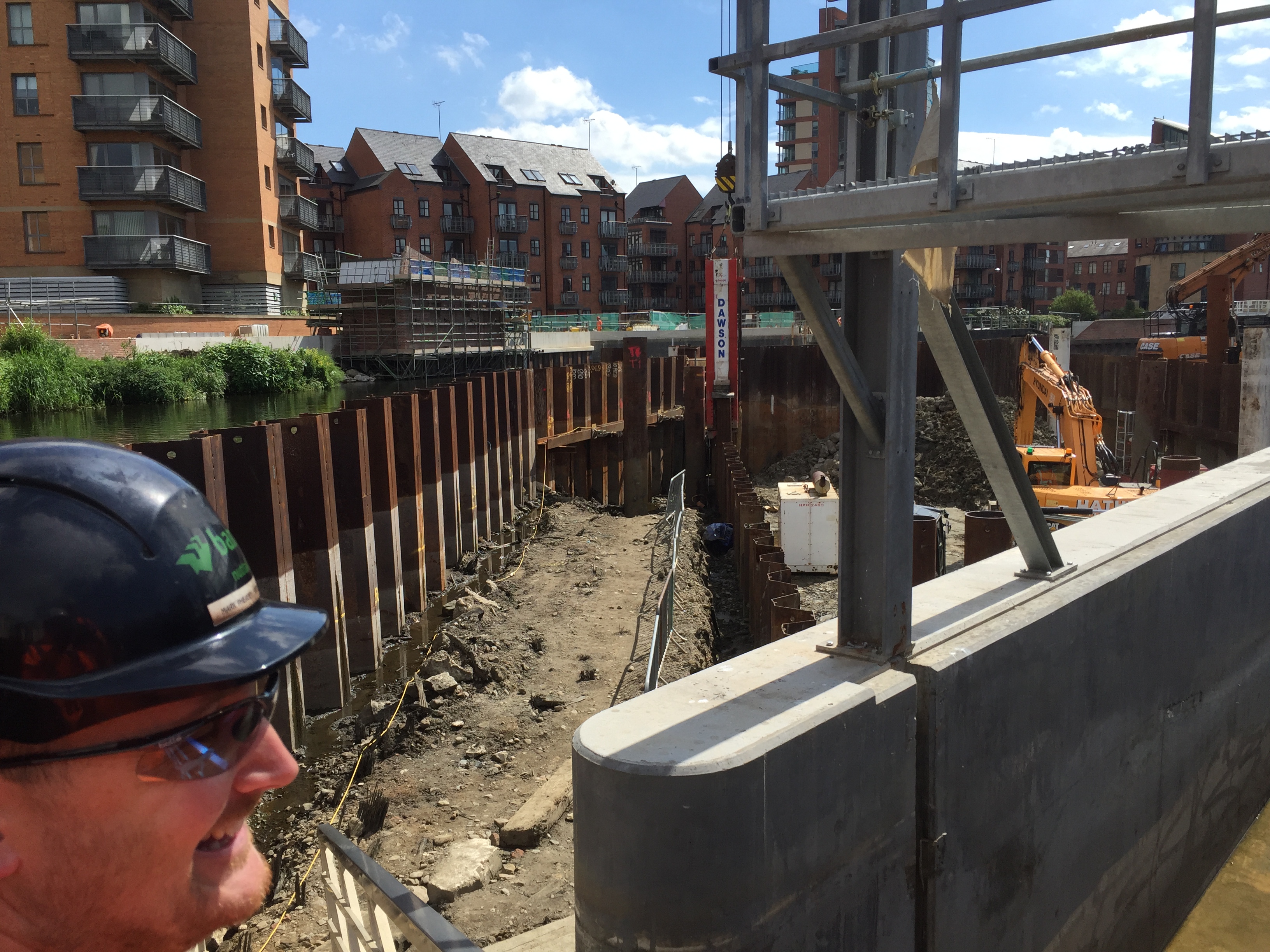
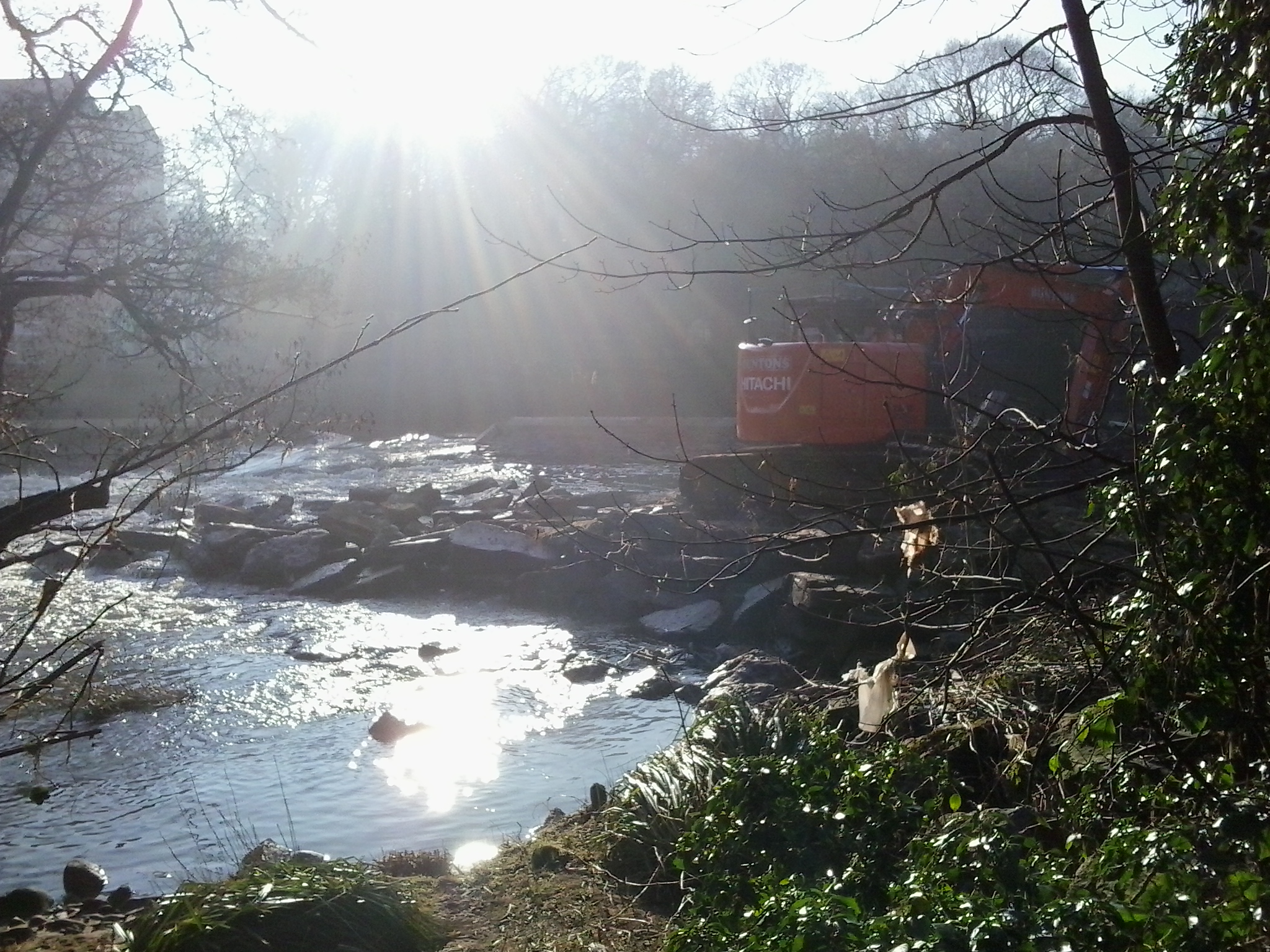
In the first part of this two-part blog, I looked at the FAS scheme itself, and took you, dear reader, on a backstage tour of the heavy engineering work still continuing at Crown Point — in the middle of the River Aire — to install the new weir. But why was I, a drama professor, given this access to the site? It all goes back to an unexpected conversation with BAM Nuttall’s FAS project director Andy Judson, over lunch at a networking event last November. On that occasion, I found myself describing to Andy our contribution to Leeds Waterfront Festival 2016, the promenade performance After the Flood  — during which plans for the new weir were demonstrated using a clipboard and a balloon… (as seen below, in a scene featuring Nick DeJong and Joe Large). It was shame, I said to Andy, that the moveable weir mechanism itself couldn’t be demonstrated to the public, because (a) it’s underwater and (b) it will only be operated in potential flood conditions. When I said that, though, you could sort of see a light bulb illuminating over Andy’s head. “Maybe we could demonstrate it,” he said, “by building a mock-up model at ground level during the festival…”

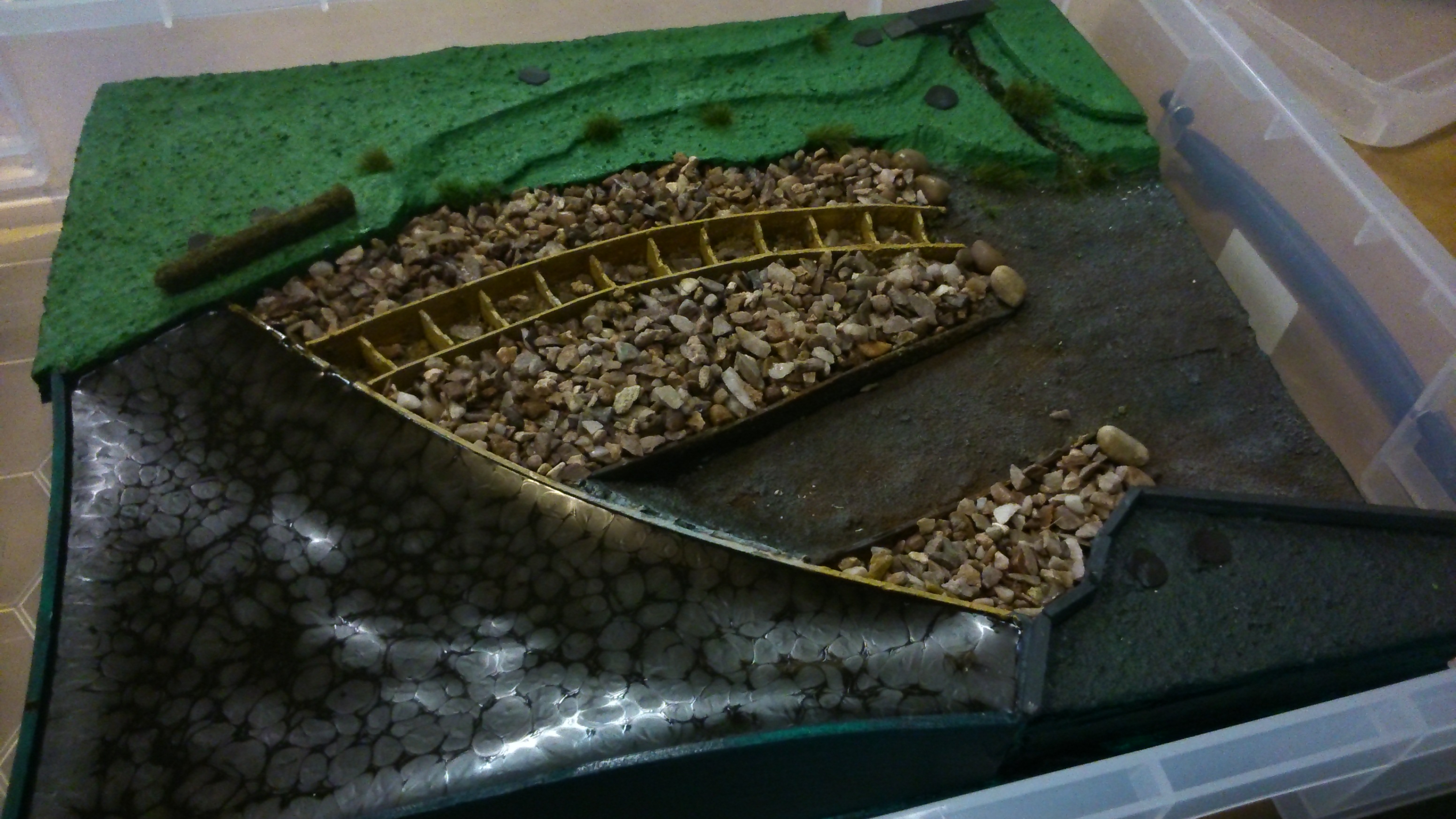
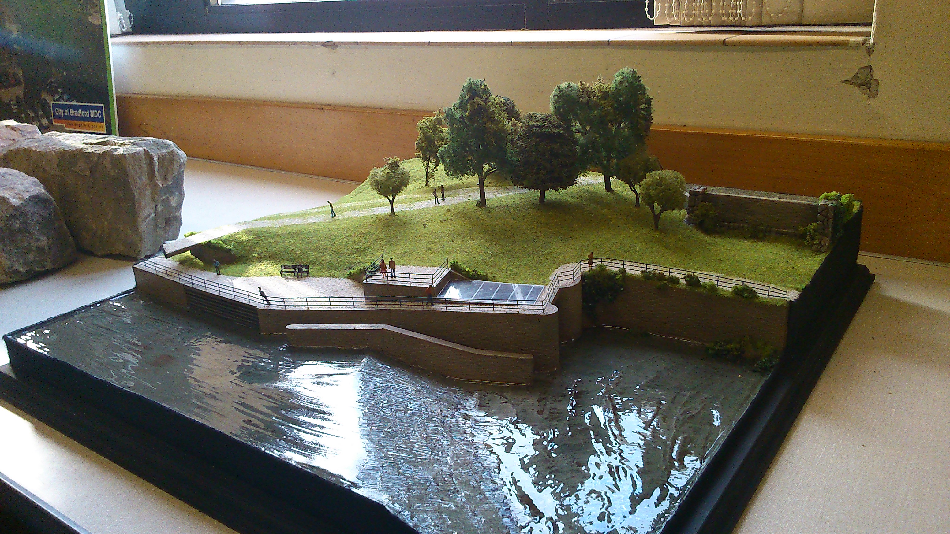
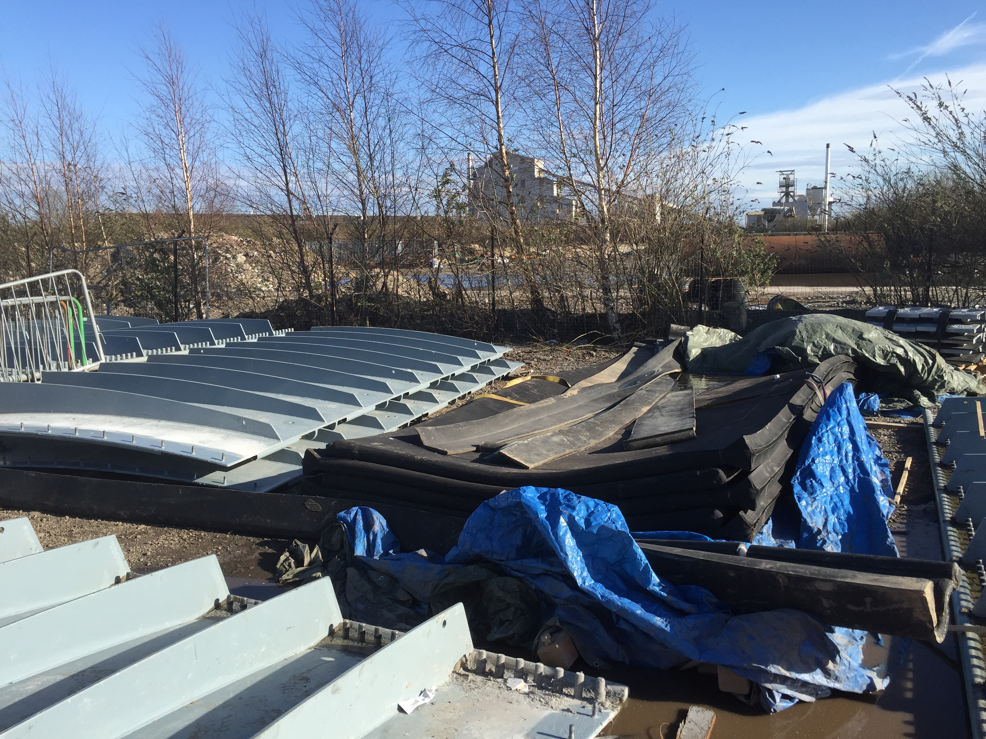
And here is the mock-up model, as exhibited the day before the Festival by BAM foreman Mark Pheasey (left) and two colleagues including stakeholder relations manager Jonathan Bulmer (right). The model was originally going to be much larger — on the same scale as the real thing, and using one of the actual air bladders that will go into the weir installation (as seen below – the black rubber bladders stacked next to the metal weir plates at the FAS compound to the east of the city centre…).

In the event, though, there were logistical problems with the full-scale plan, so Mark Pheasey dreamed up the scaled-down model using painted hardboard for the weir plate (which really does look like the real thing – as you can see) and some much smaller air bags, which didn’t have to support the weight of the River Aire! Actually I think this worked much better than the full-scale model might have, because the air-bags in the mock-up could inflate and deflate in seconds, raising and lowering the hardboard weir, whereas the big bladder would have taken at least half an hour to inflate fully. Much better for demonstration purposes!

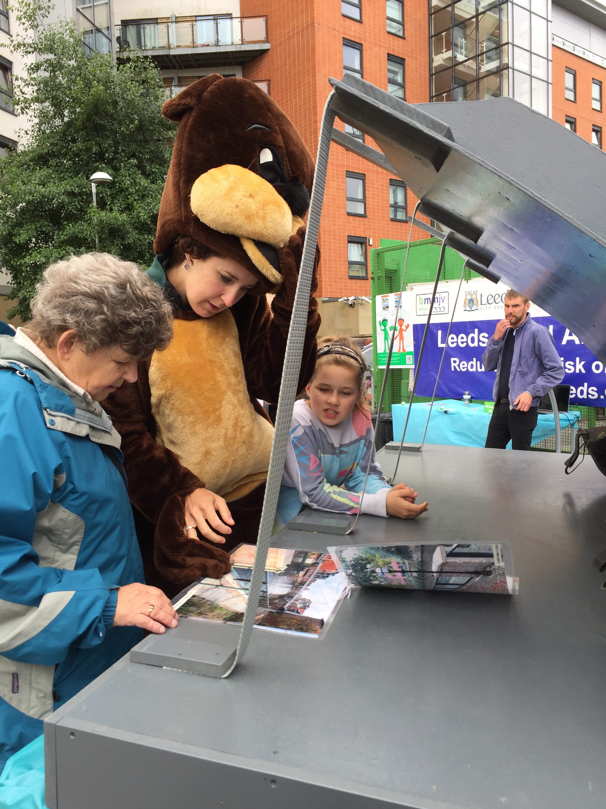
So this is the model in situ at the weekend, on the left (weir plate up), being explained to two members of the public by one of the volunteering FAS staff (the people with white patches on their T-shirt sleeves). On the far right is Andy Judson himself, chatting to the Environment Agency’s Mark Garford and others. The FAS team were on hand all weekend, in different combinations, to chat to the public about the scheme from a more official, technical point of view — using the model as a point of focus.

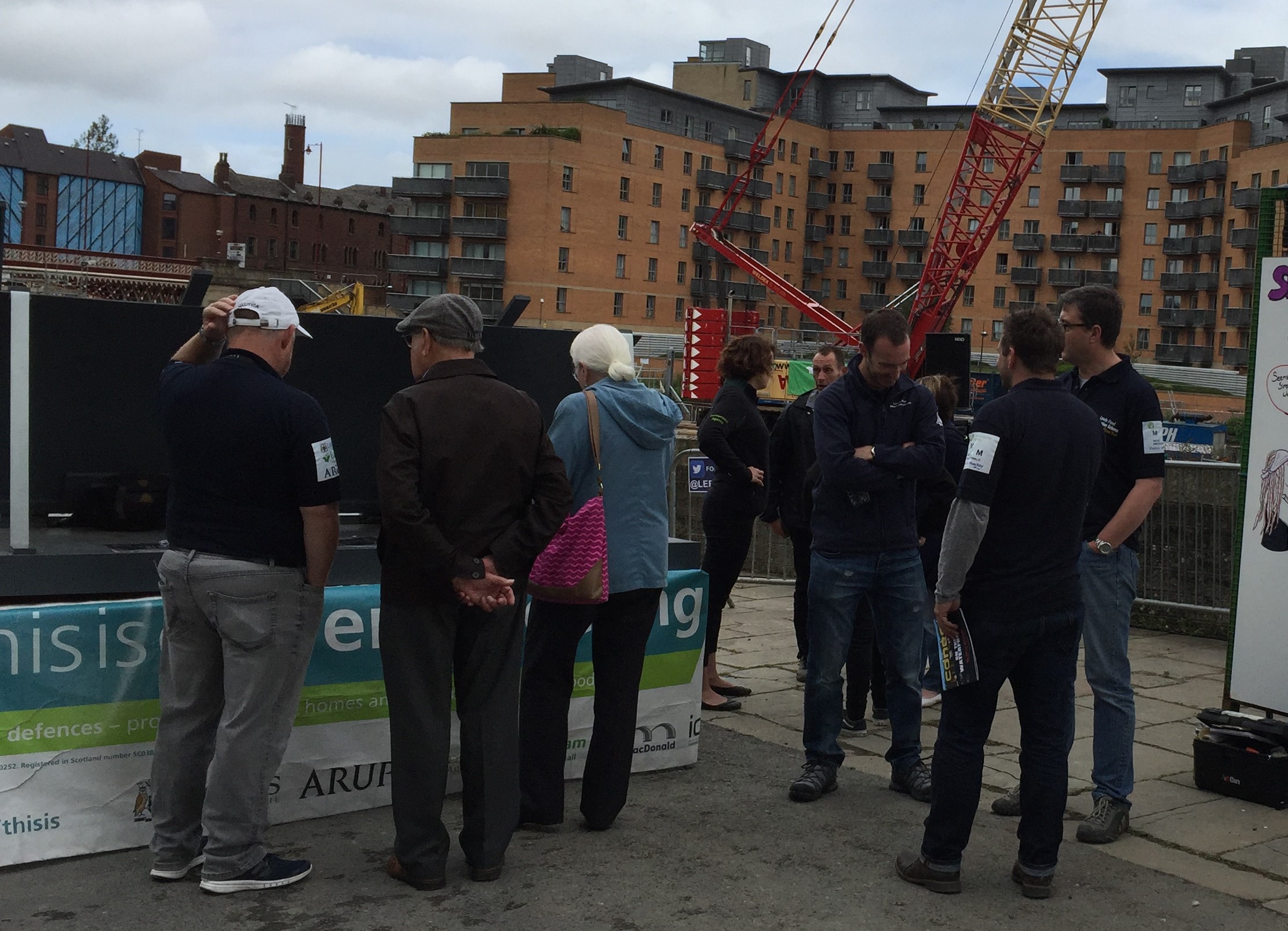
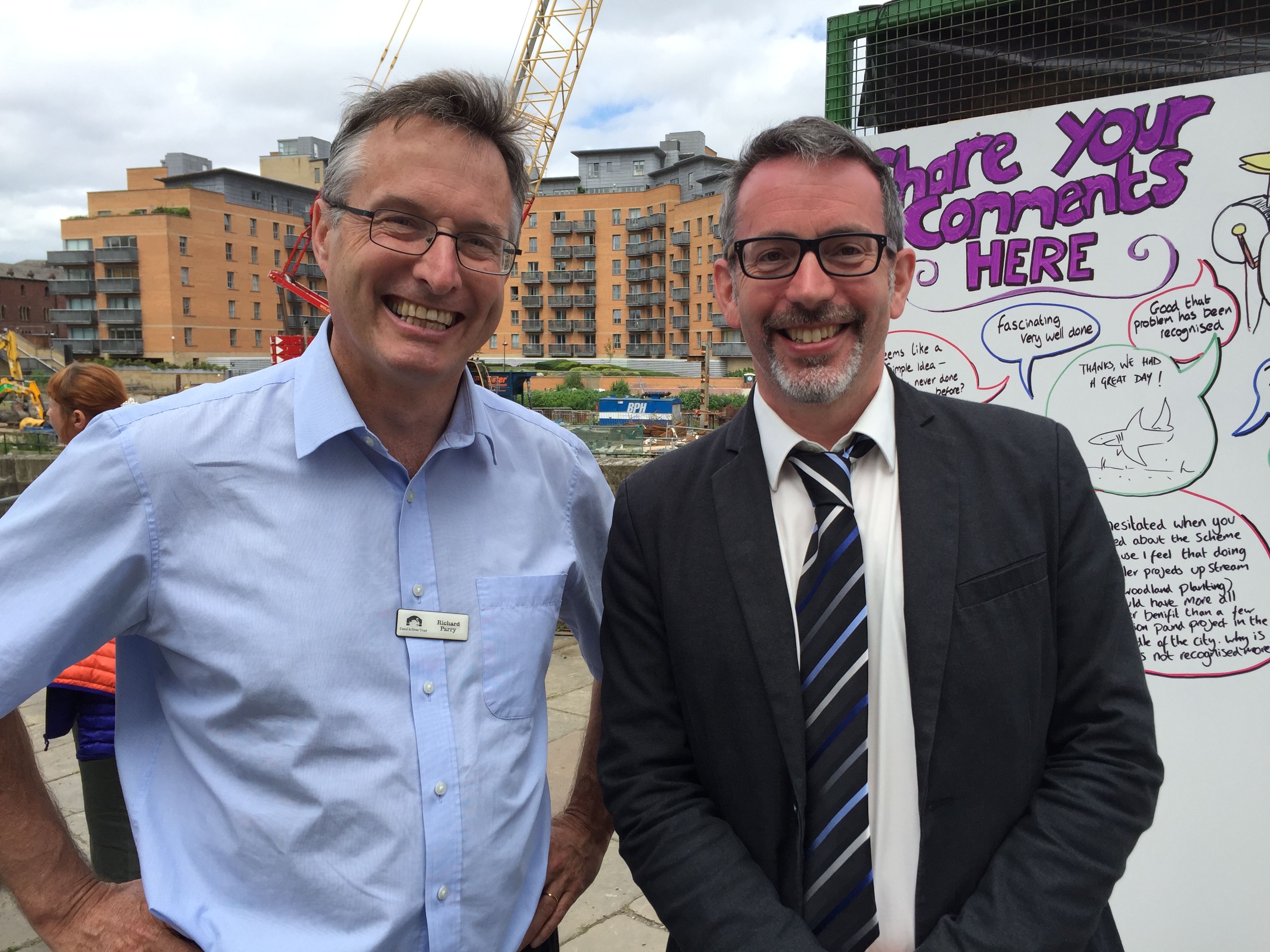
It became clear that word of the model demonstration had spread to some pretty influential places. Above is Hilary BennLabour MP for Leeds Central, who seemed genuinely fascinated by the scheme when he turned up early on the Saturday morning. And on the Sunday, Richard Parry, the Chief Executive of the Canal and River Trust (formerly British Waterways) also stopped by to see what we were doing (at which point I shamelessly asked for a picture with him…).

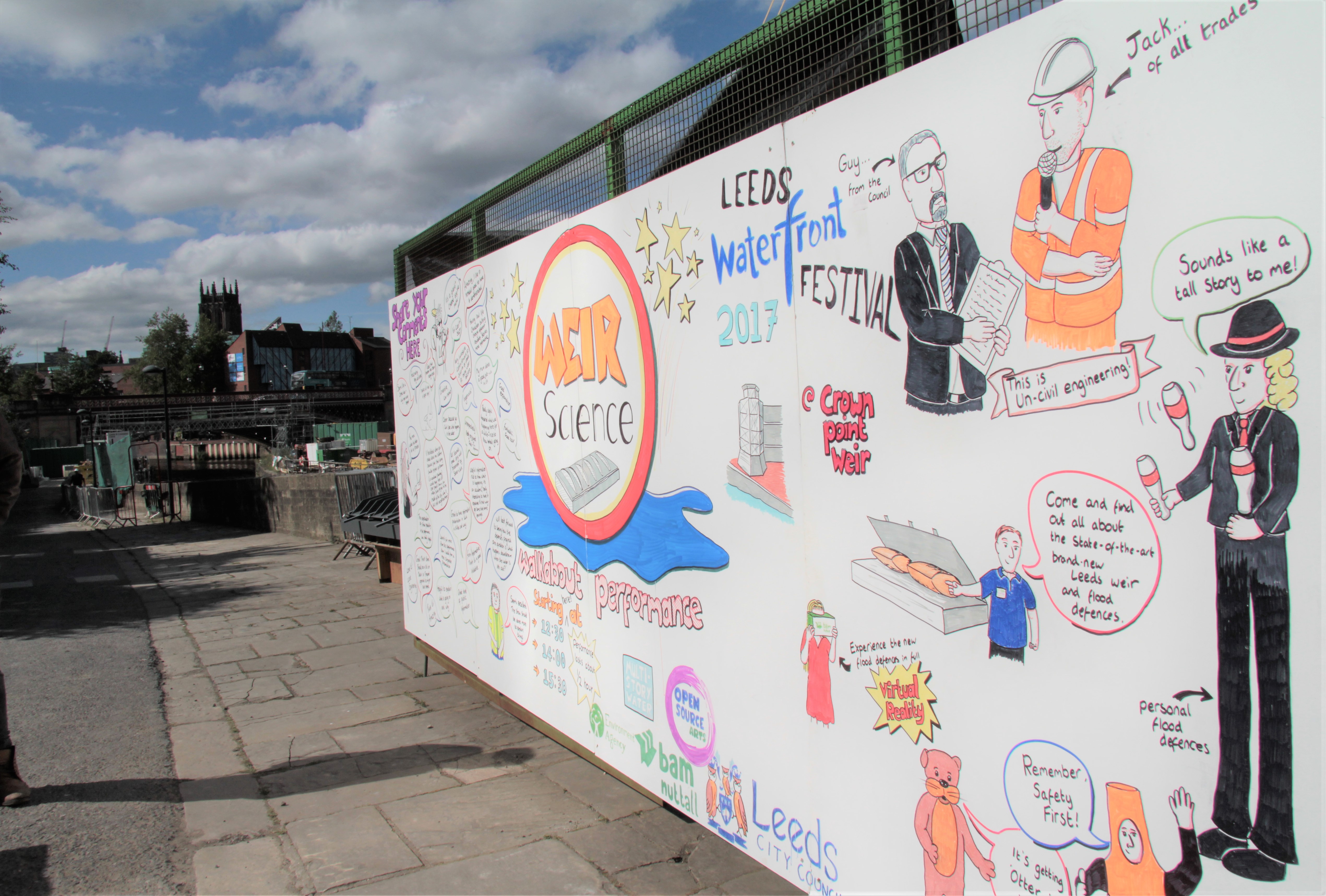
Despite this interest at policy level, though, the mock-up model and uniformed FAS team still looked — as they themselves put it to me — somewhat “dry” and “worky” for a festival weekend. Somehow the general public had to be engaged a little more eye-catchingly, and this is where Weir Science came in ….

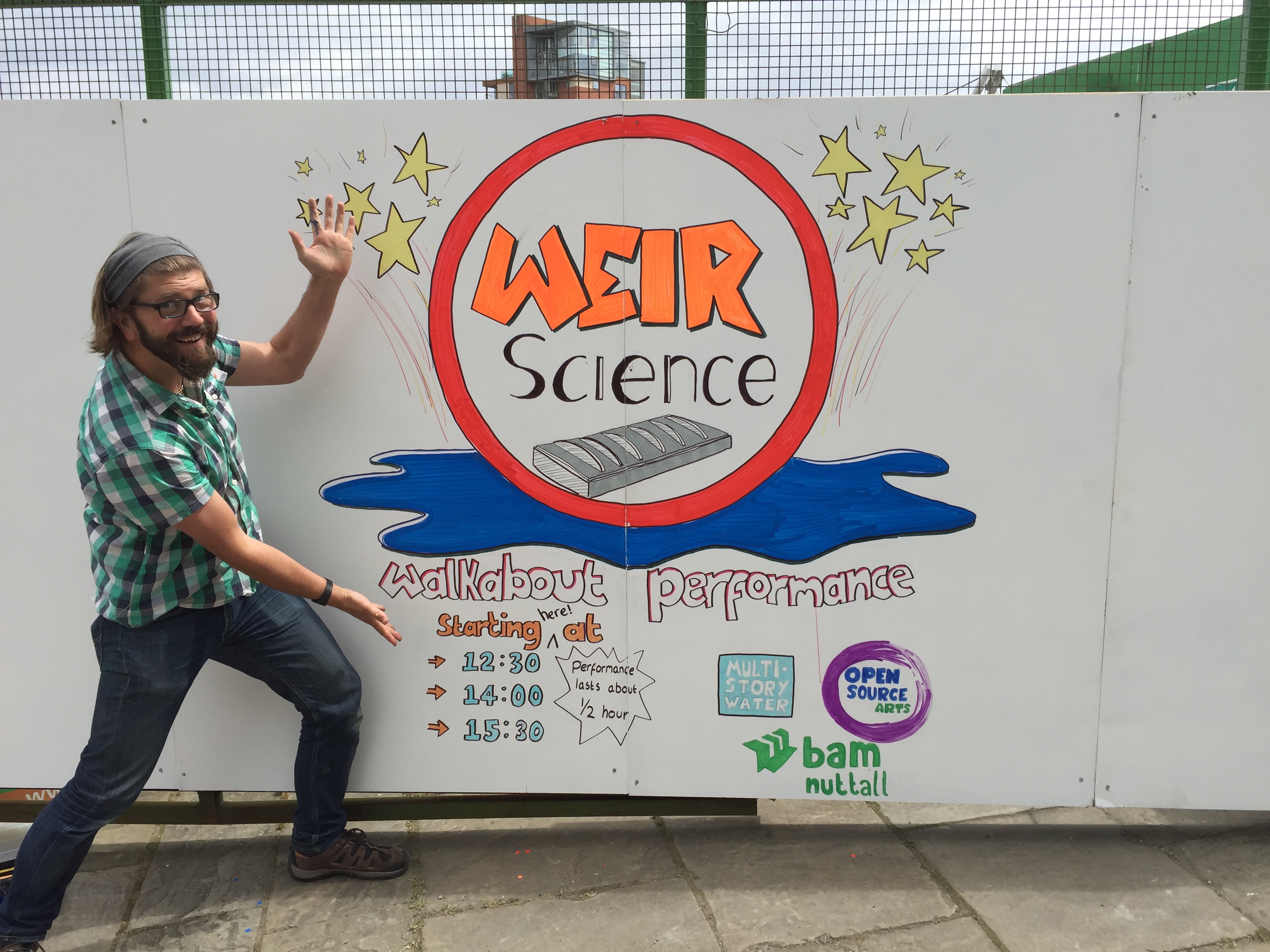
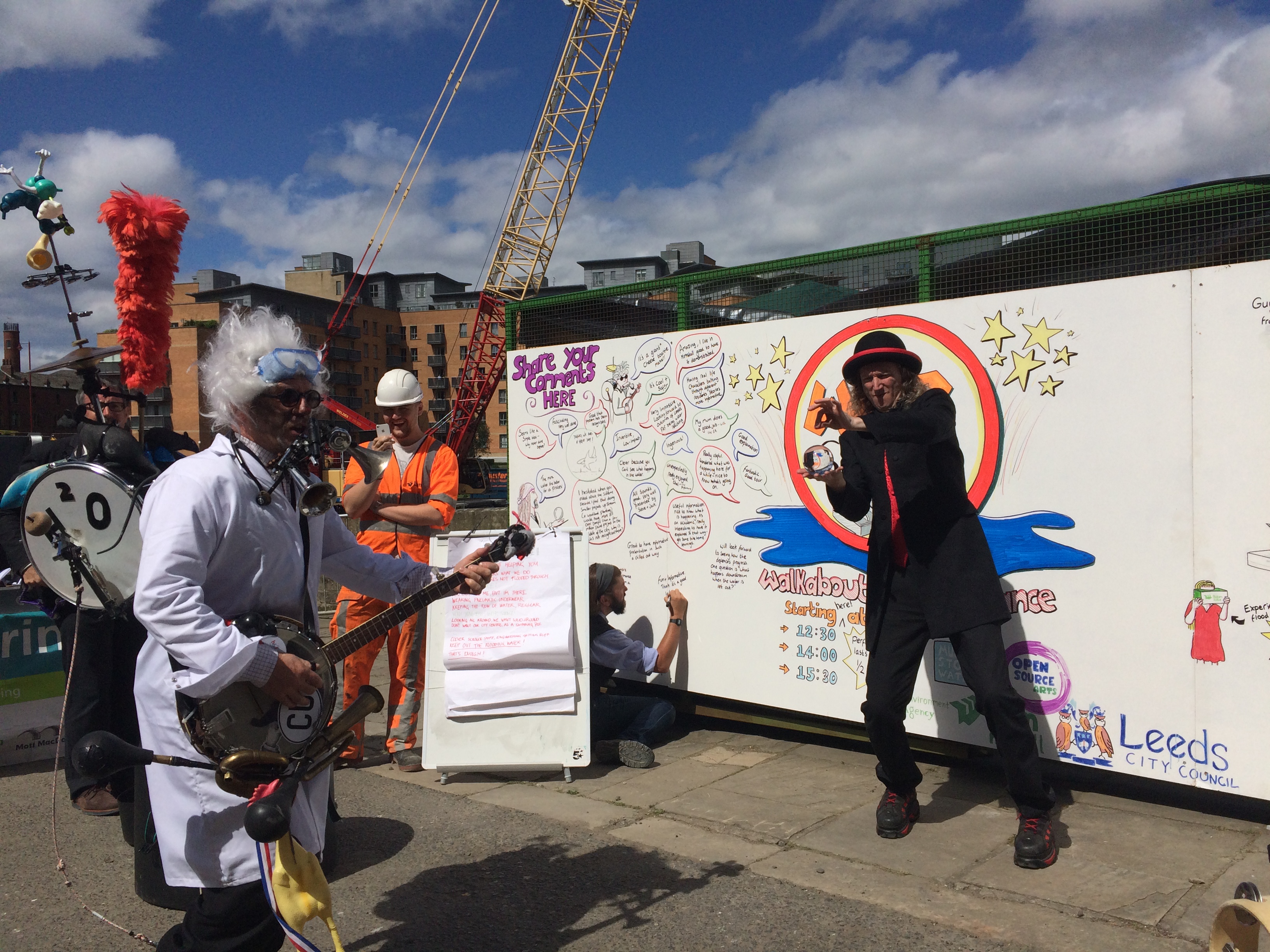
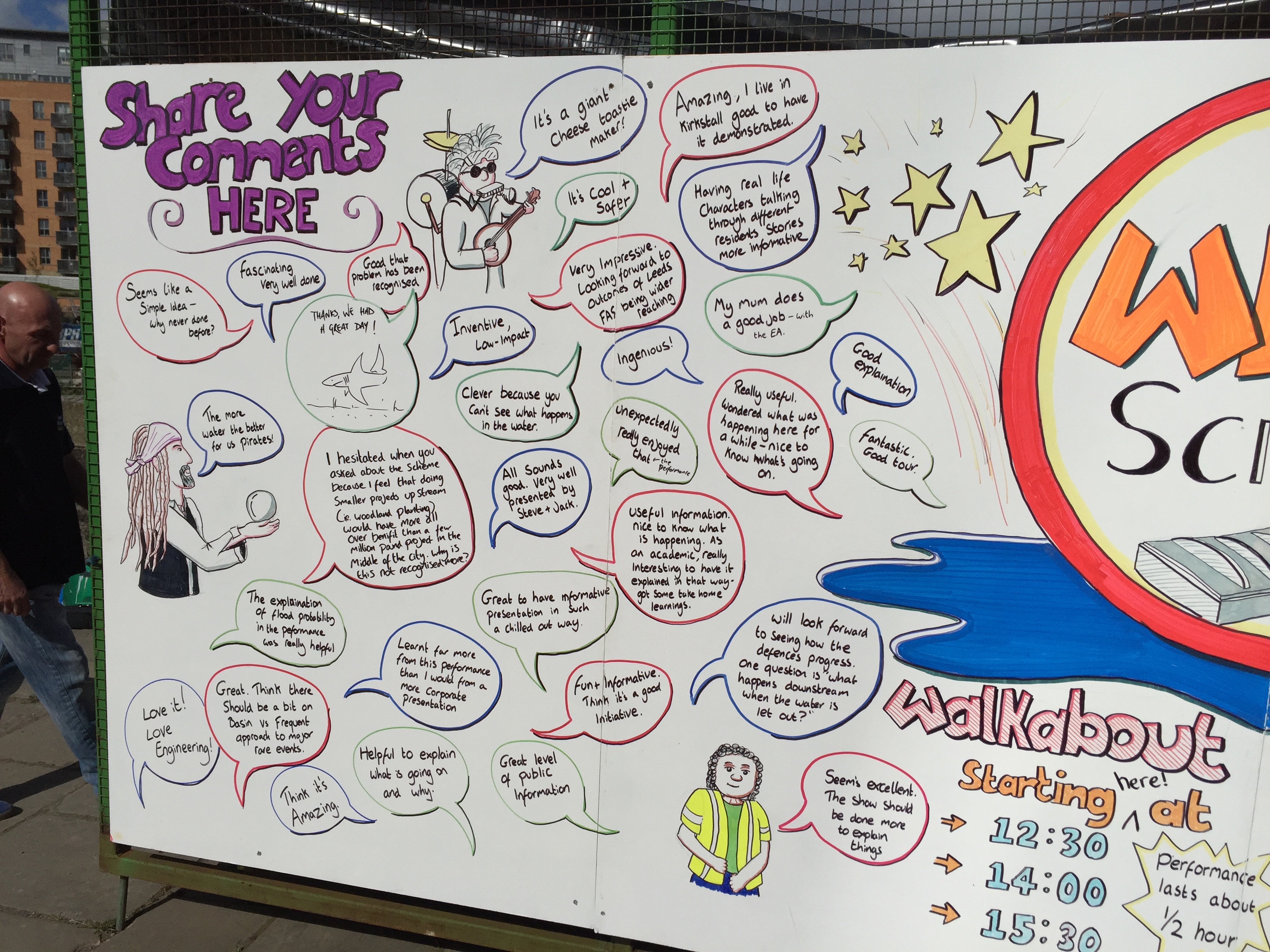
… that’s the name we gave to the creative elements we built around the FAS model. “We” being Multi-Story Water and Open Source Arts, in Kirkstall, which is run by Phil Marken (one of the leading lights in Leeds’s voluntary flood response after the inundation of Boxing Day 2015). Phil himself wasn’t available at the weekend, but he had arranged for “graphic harvester” Jon Dorsett – above – to be on hand to gradually build up a visual record of the activities as they occurred, on four white boards that BAM staff had fastened to the open gate of their compound. The first thing Jon did was draw this appealing, cartoonish logo for us – to catch the eye of passers-by… (I love that he even hand-drew all the logos… a lovely counterbalance to the ‘official’ signage).

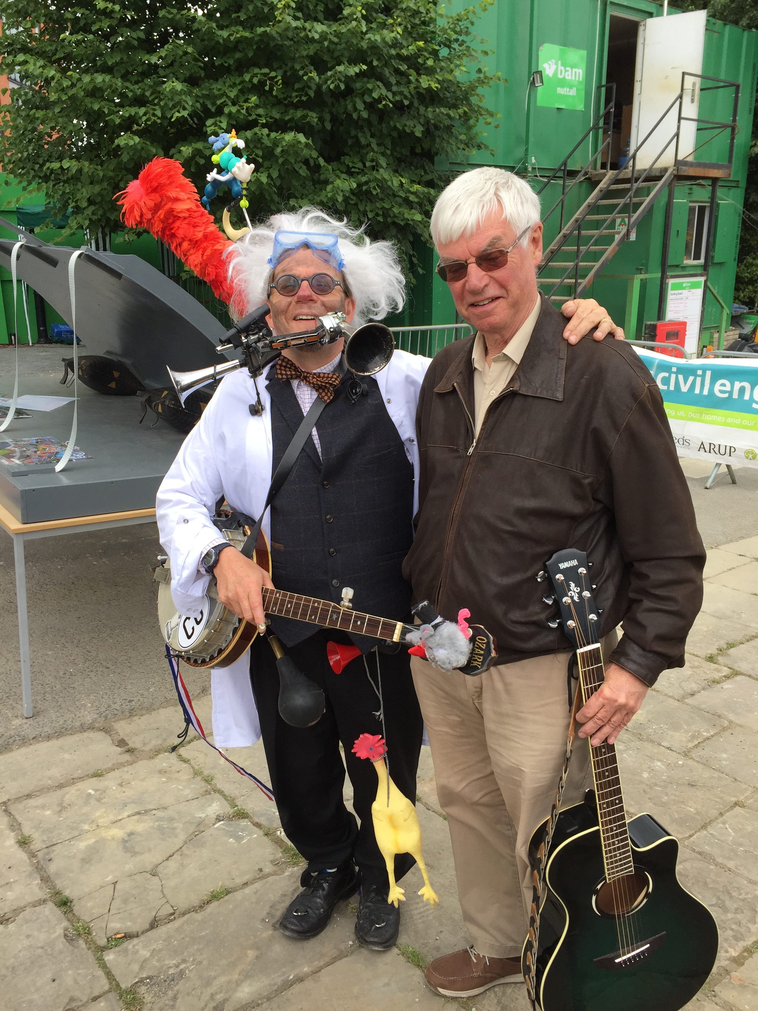
Phil had also consulted his address book of street performers and come up with one-man-band Jake Rodrigues, aka “Shabby Jake”, aka Professor Leaky-Faucet. This last was a new identity and ‘look’ that Jake created for us this weekend, inspired by the Weir Science title and by every mad scientist you’ve seen in books and movies… In fact Jake’s entire set was tweaked for context, as he engaged crowds in (seemingly) spontaneous renditions of “songs with weir in the title”… from Queen’s “Weir the Champions” to Vera Lynn’s “Weir Meet Again”, via the Pointer Sisters’ “Weir Are Family”, and many others. The results were hilarious, as were Jake’s various bits of improvised schtick about the weir model (“it’s a giant cheese toastie maker”) and explanations about the risks involved in flooding Leeds with custard…

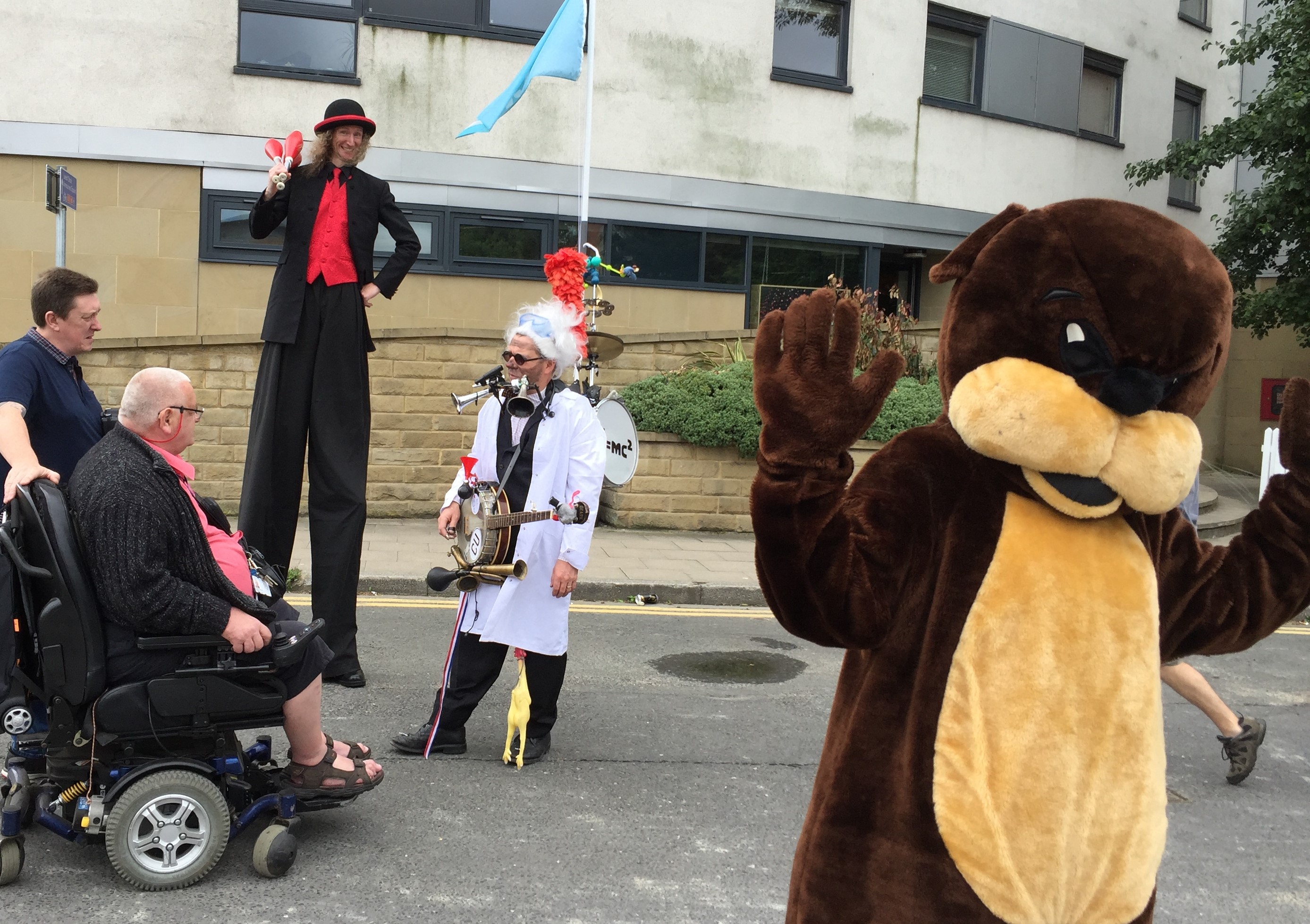
In the picture above, taken on the Sunday, Jake is chatting with passers-by while accompanied by another of Phil’s recommendations — stilt-walker Nik, aka Das Isobar. The job of these two, whom I briefed carefully in advance, was to deliver a version of their usual act — wandering out and about in the immediate Leeds Dock area to attract attention — while also trying to encourage people towards the weir demonstration area. They did a tremendous job of this, by blending visual appeal with conversational wit. One of my favourite moments of the weekend was watching Nik, from the top of his stilts, chatting animatedly with a man from the Netherlands, who (craning up to look at him) was explaining in detail the history of his country’s reactions to the 1997 floods that engulfed about a third of their landscape… (Nik was only with us for the Sunday: on Saturday the same role was filled by an excellent contact juggler, Steve the Pirate, although I don’t have any good pics of him unfortunately.) Oh and also in the picture above, there’s the otter…

The otter costume belongs to the Environment Agency, apparently, and is often used at public engagement events. Here it is worn by Rosa Foster, one of the EA’s senior flood risk management officers, who found herself oscillating between waving goofily with the head on, and then lifting it up to explain details to passers-by… Rosa made the interesting point to me, though, that when she first put the costume on at the start of the day, people were waving at her, or posing for pictures with their kids, but weren’t readily being pulled in to talk about flood alleviation. After Jake and Nik started up, though, she found that the engagement process became much easier. Andy Judson made much the same point, telling me that the performers succeeded in creating a much “softer landing” for the FAS team’s more technical explanations … Once drawn in by the sense of fun, spectacle and banter, people were much more willing to express their curiosity about the weir itself… and some great conversations then followed. Throughout the weekend it became clear that the FAS team were having a great time chatting with people, since the level of interest was so much greater than they’re used to.

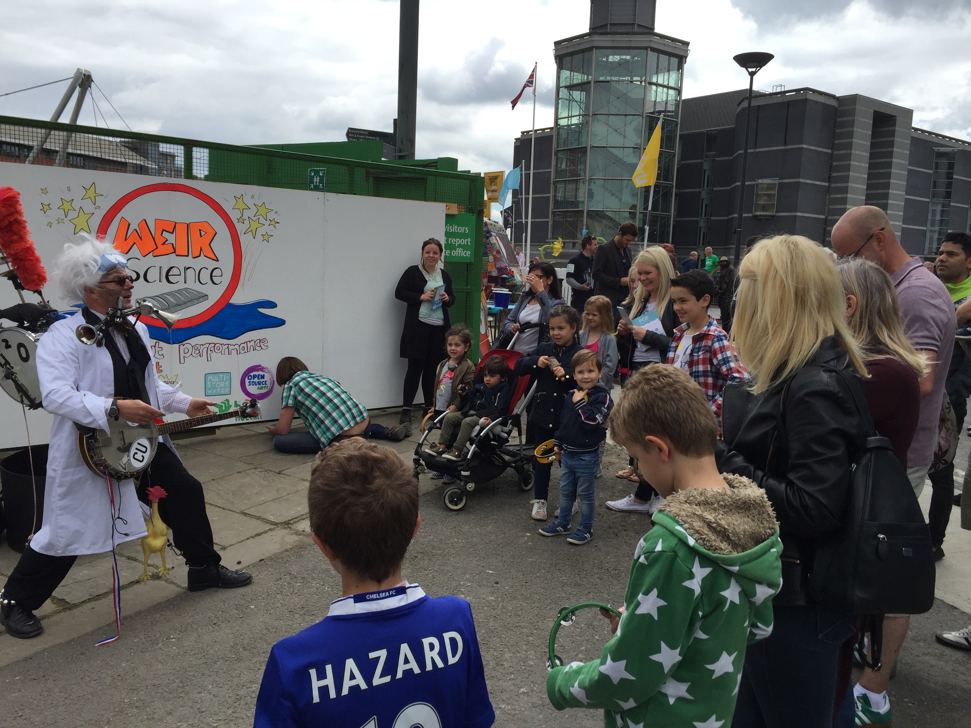
Here’s Professor Leaky-Faucet again (above), in the midst of the “pre-show” set that he delivered six times over the course of the weekend, before each of our Weir Science walking tours (starting at 12.30, 2.00 and 3.30 each day). On the occasion below, he was also accompanied by Nik — down off his stilts and doing his object manipulation routine. At one point this involved commandeering a child’s remote control joystick box, and appearing to use it to “drive” a wheelchair-user around in circles… this man played along gamely to hilarious effect (he was of course really operating his own chair!) .. thereby totally upstaging Jake!

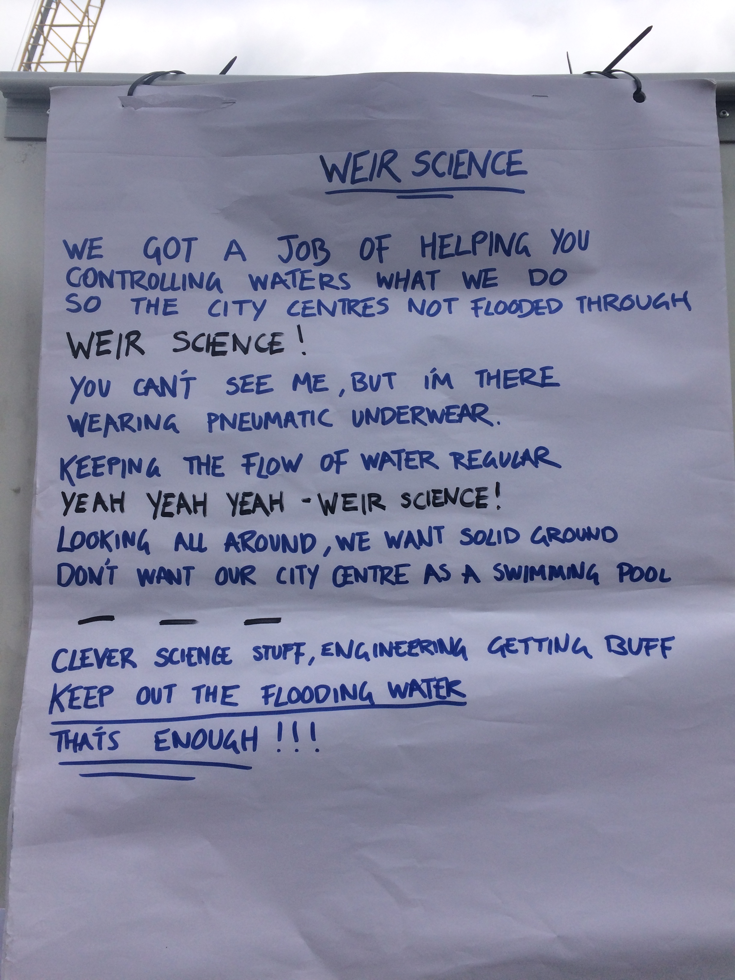
Jake’s crowd-gathering set would end, each time, with him delivering his stompy, one-man-band version of the theme tune to the 1980s teen movie Weird Science — now renamed “Weir Science”…

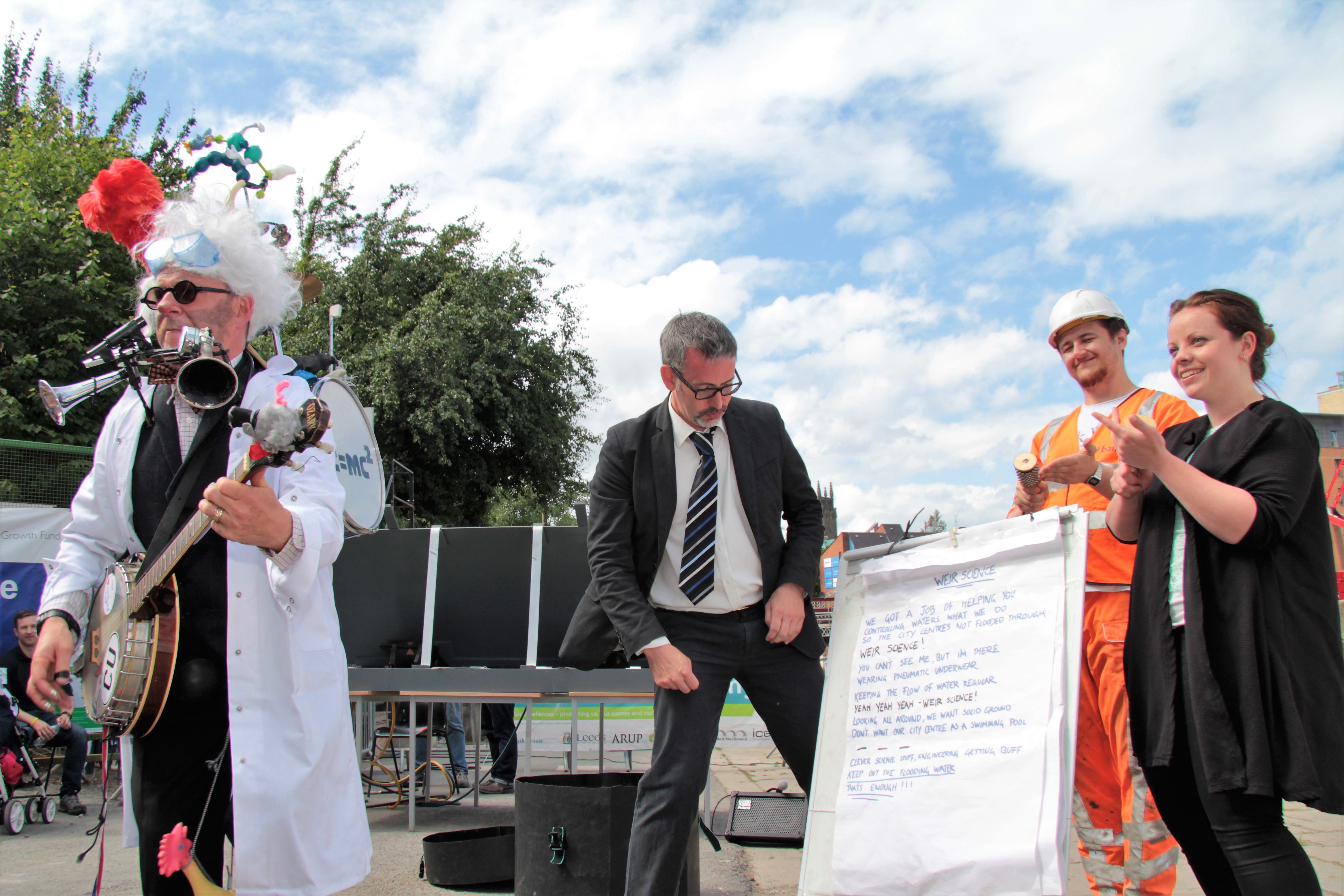
… here are his lyrics, which stage manager Jenny and I (above) would point out with our fingers as he went… rather like the bouncing ball on karaoke lyrics…

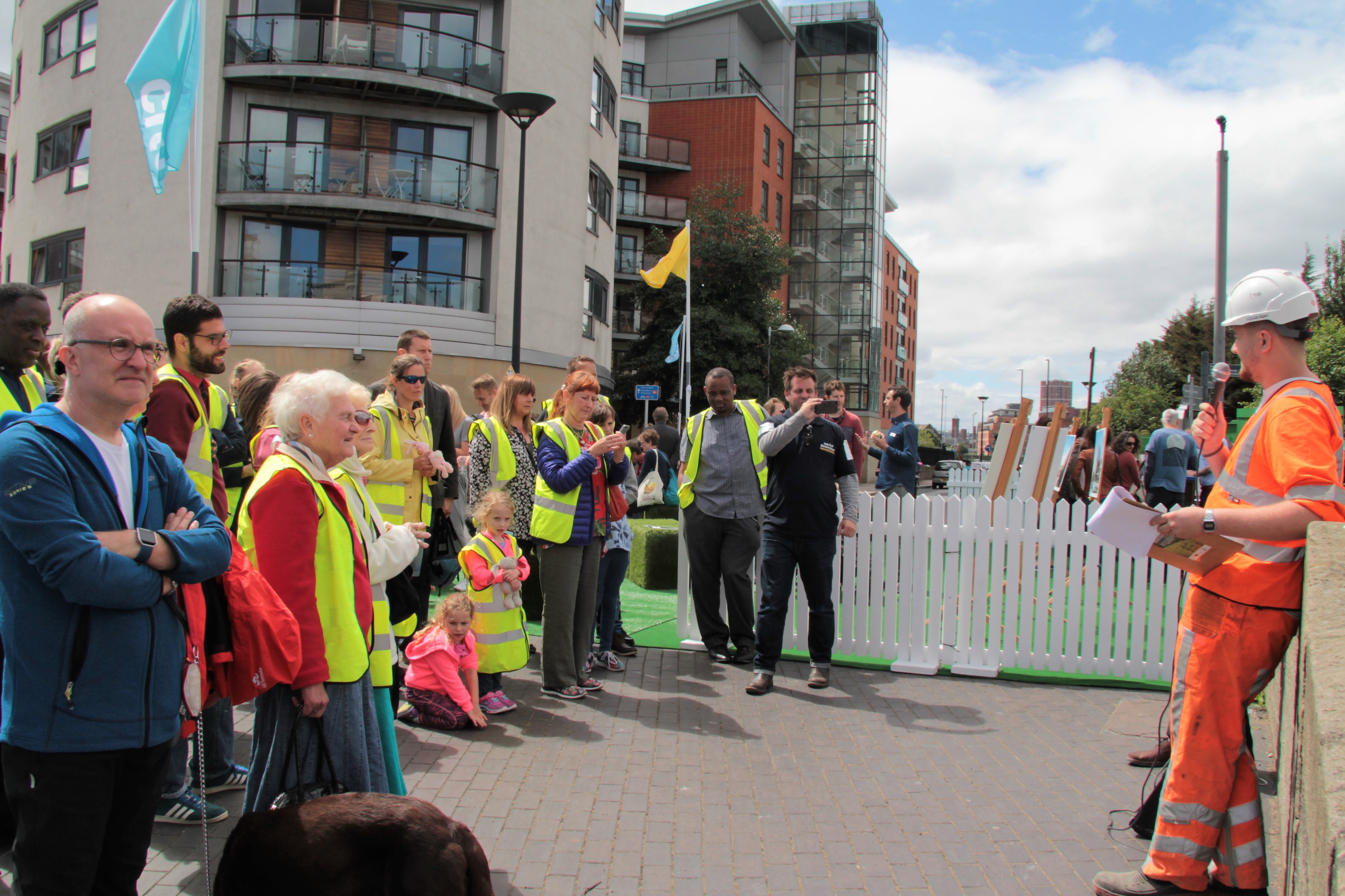
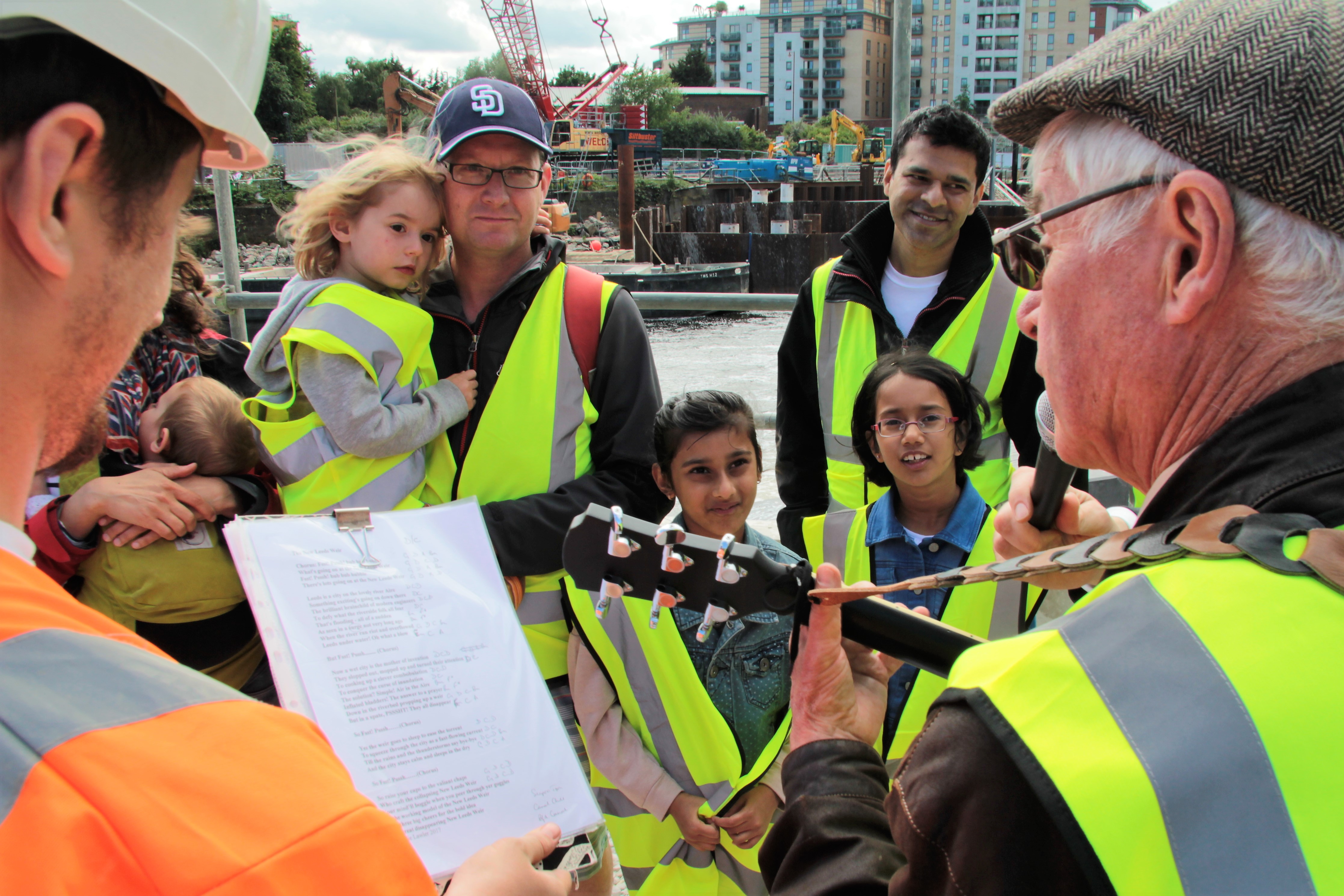
As soon as Jake finished his song, I would then take over in my role as “Guy…from the Council” (complete with carefully selected hush puppies). Accompanied by “my glamorous assistant Jack” (“of all trades”) in head-to-toe BAM orange, we would then demonstrate the weir model before inviting people to come with us on a tour around the real thing… Jack (played by the aptly named Jack Waterman) would then read a mock safety briefing, during which people joining us were invited to put on hi-viz vests…

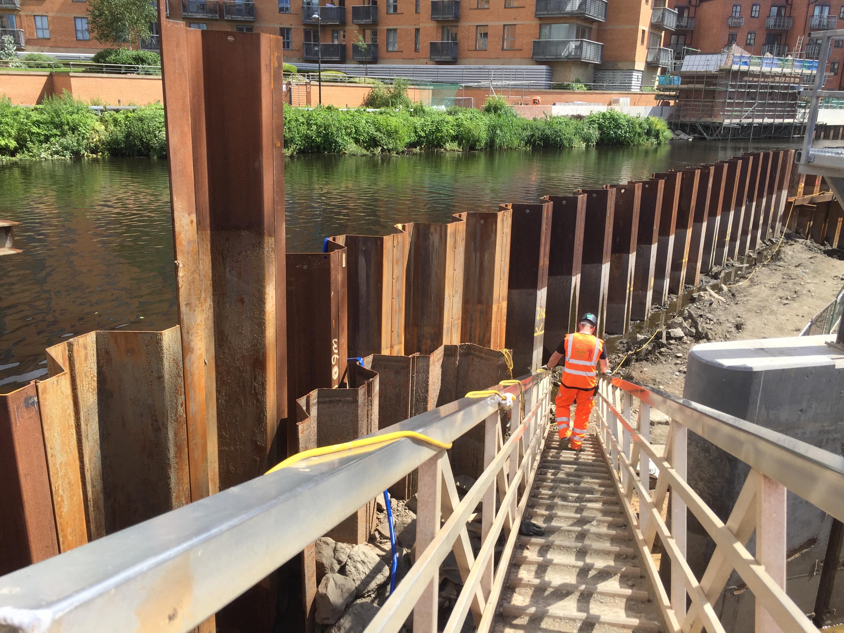
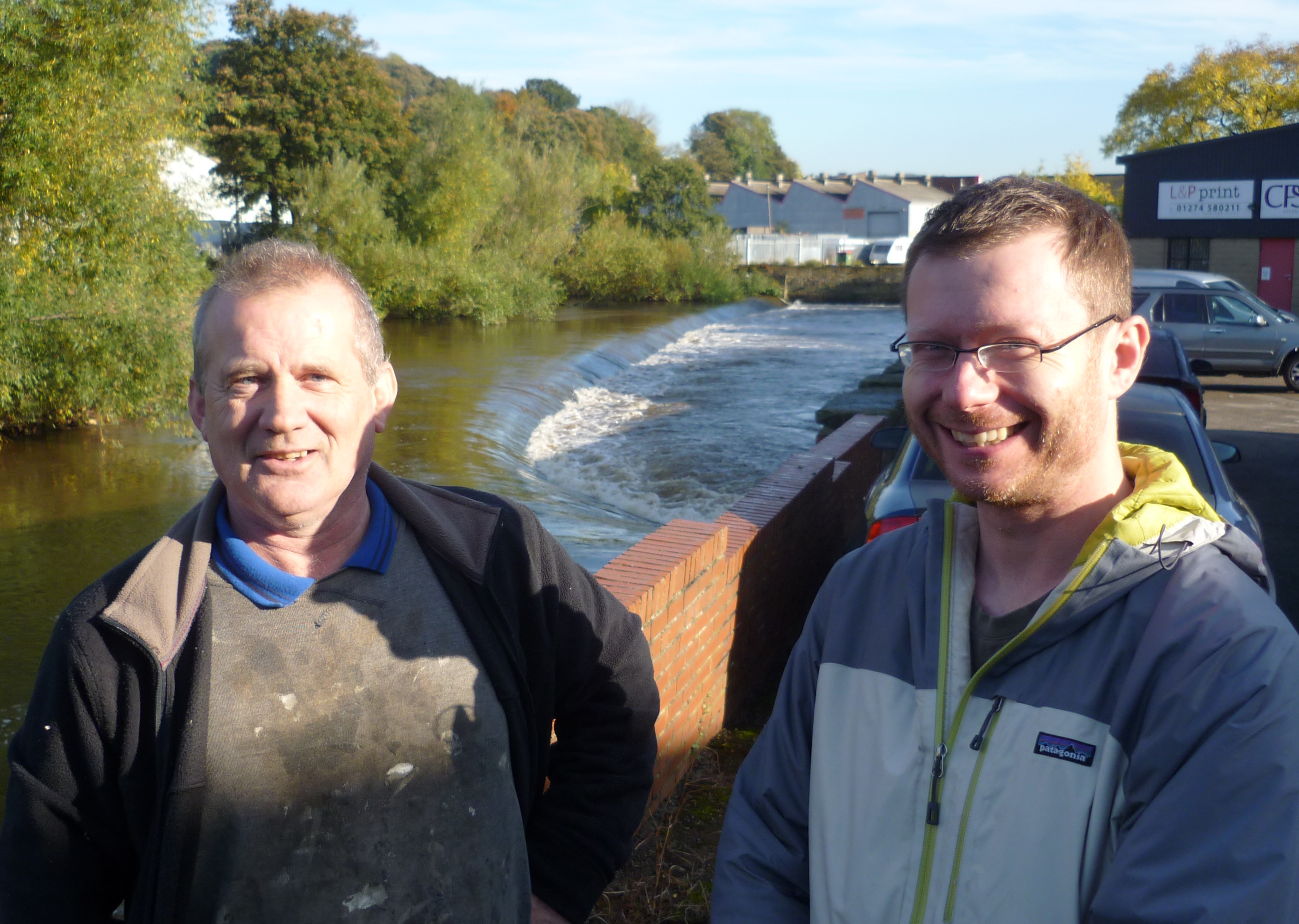
… and a surprising number of people proved willing to do just that (even though we made clear that the vests were optional – still it was a useful way for us to identify our audience on the move). Our first stopping point on the tour was a spot just by the river, where Jack would explain how the crane on Fearns Island had been erected – while also having a sly go at “men in suits and ties”, such as myself, who under-estimate the skills and expertise of construction workers such as himself…

My script for this was based on a gently satirical reading of the research interviews I’d done as preparation: the idea was to bring a human side to the story, to offset and balance out our more technical explanations.

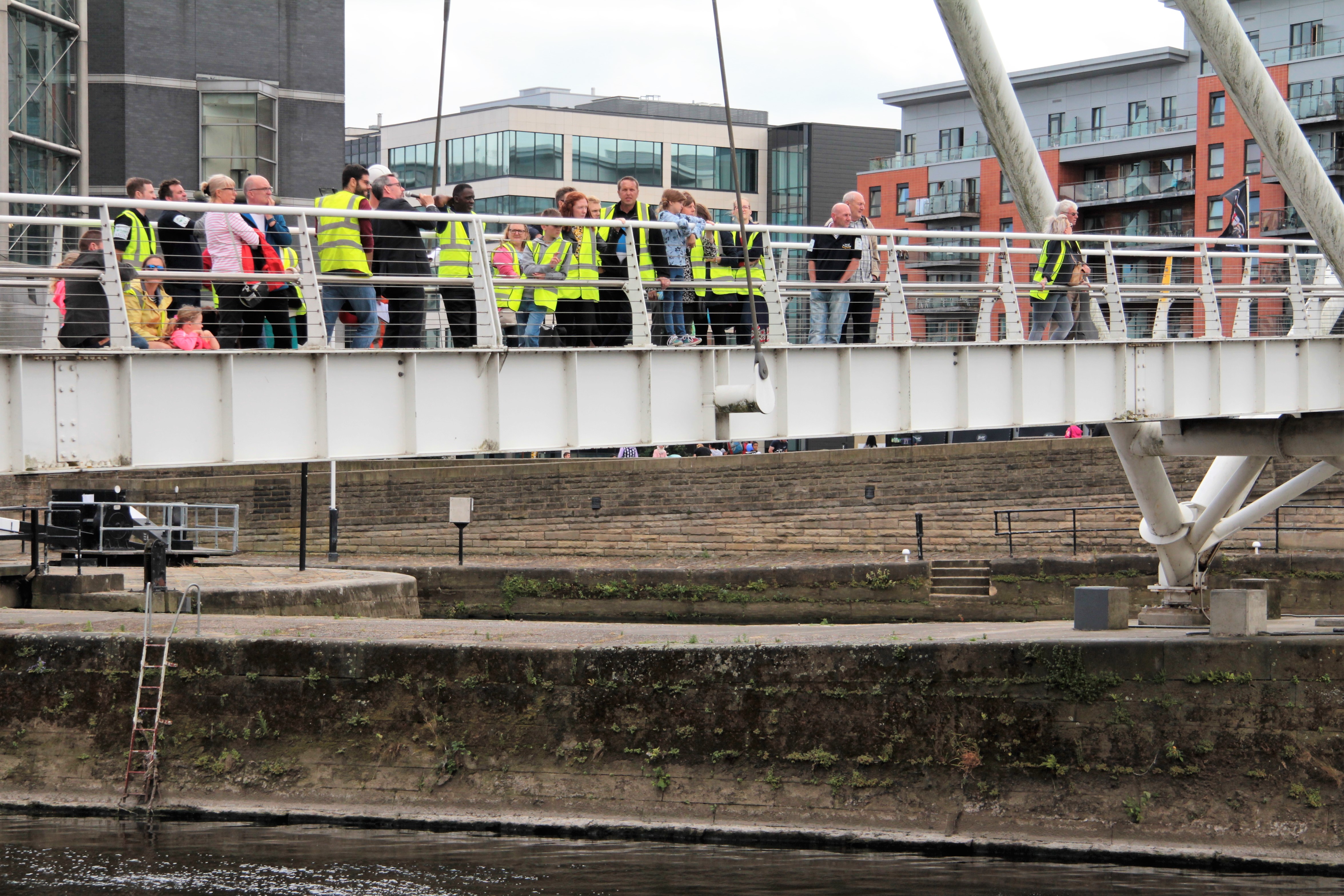
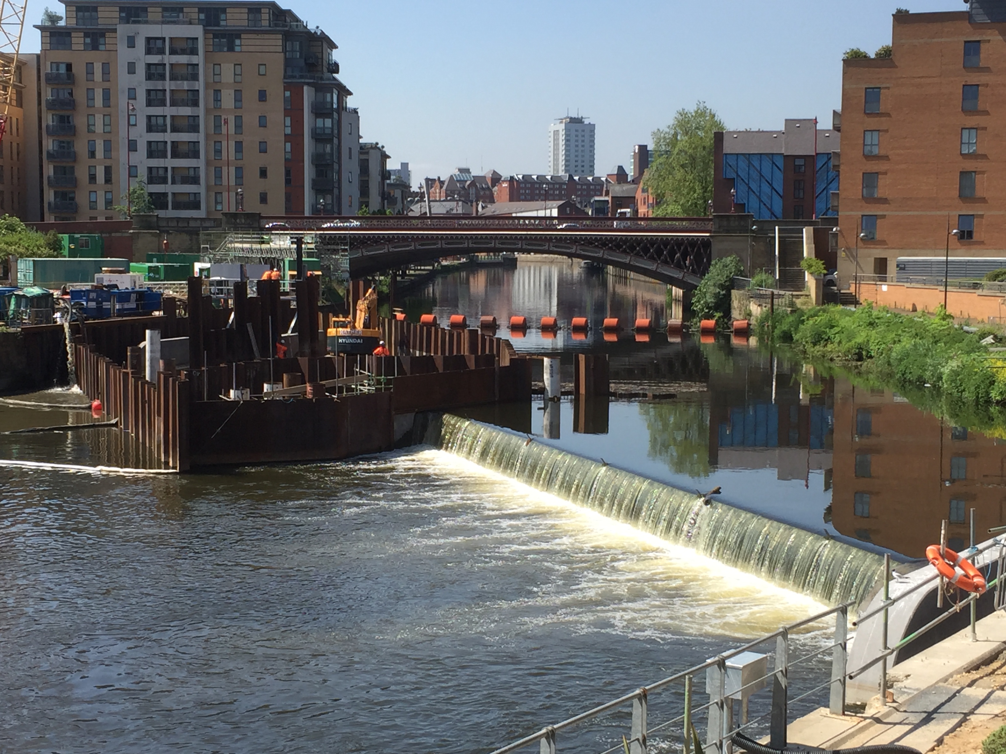
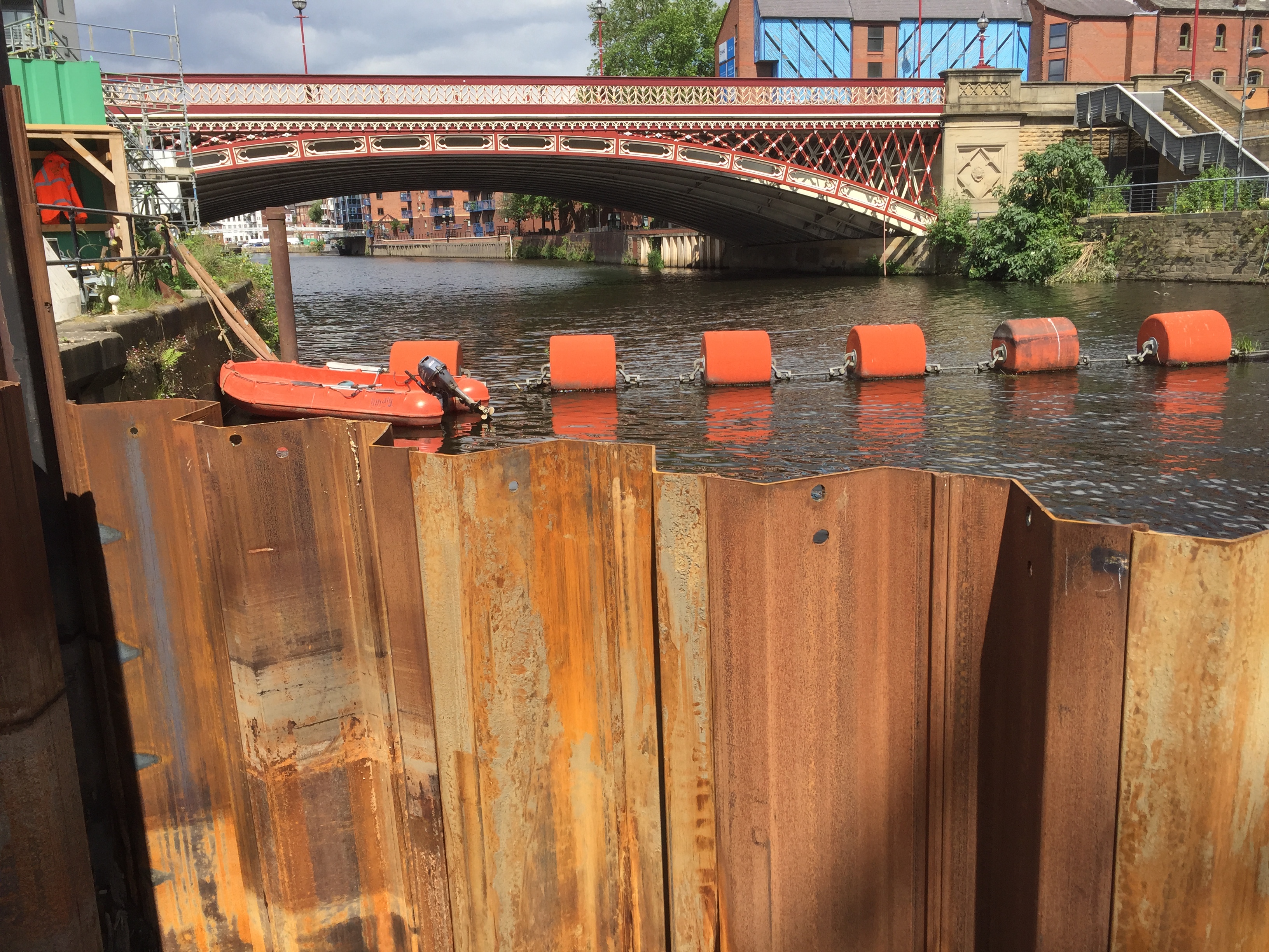
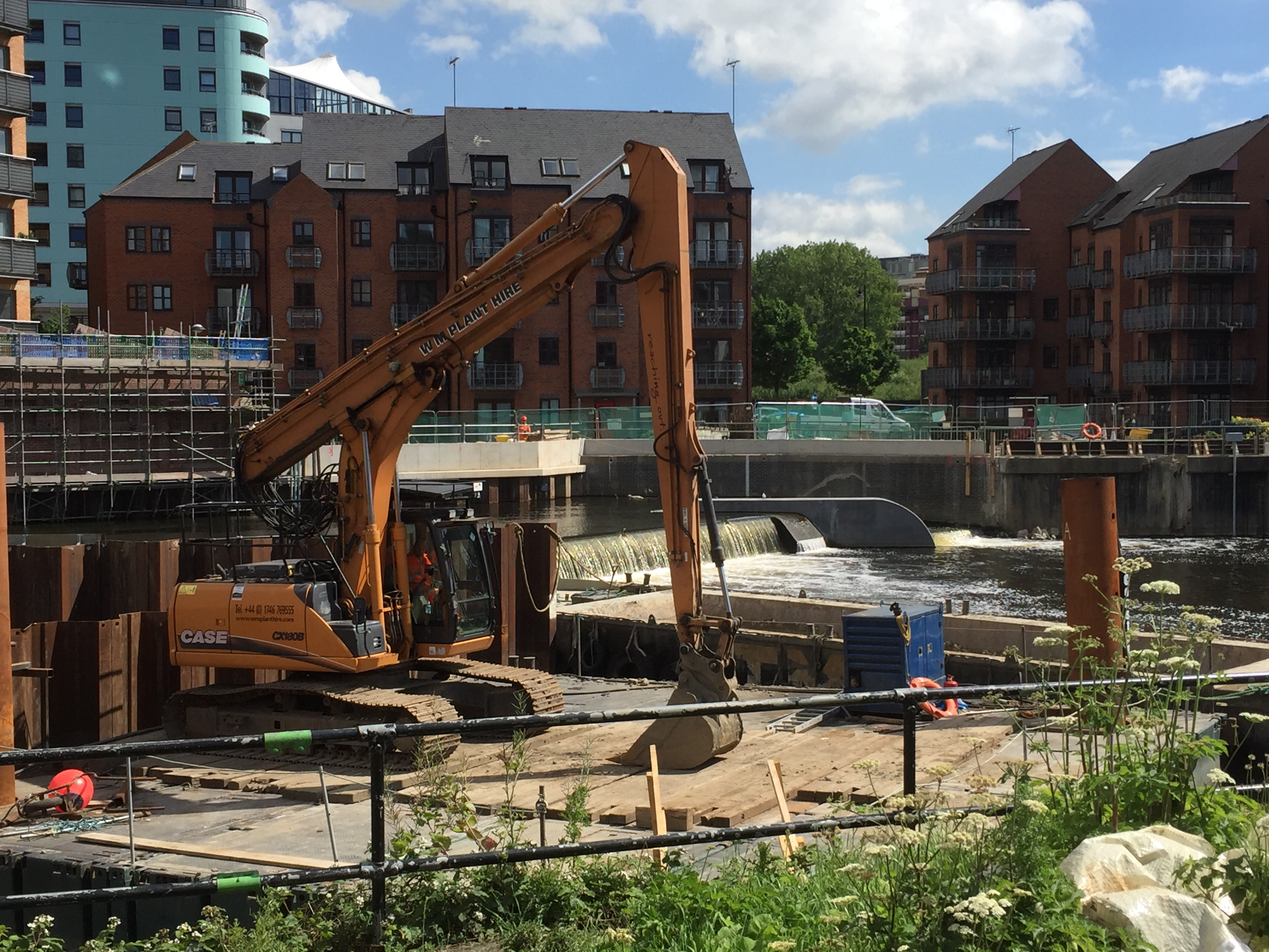
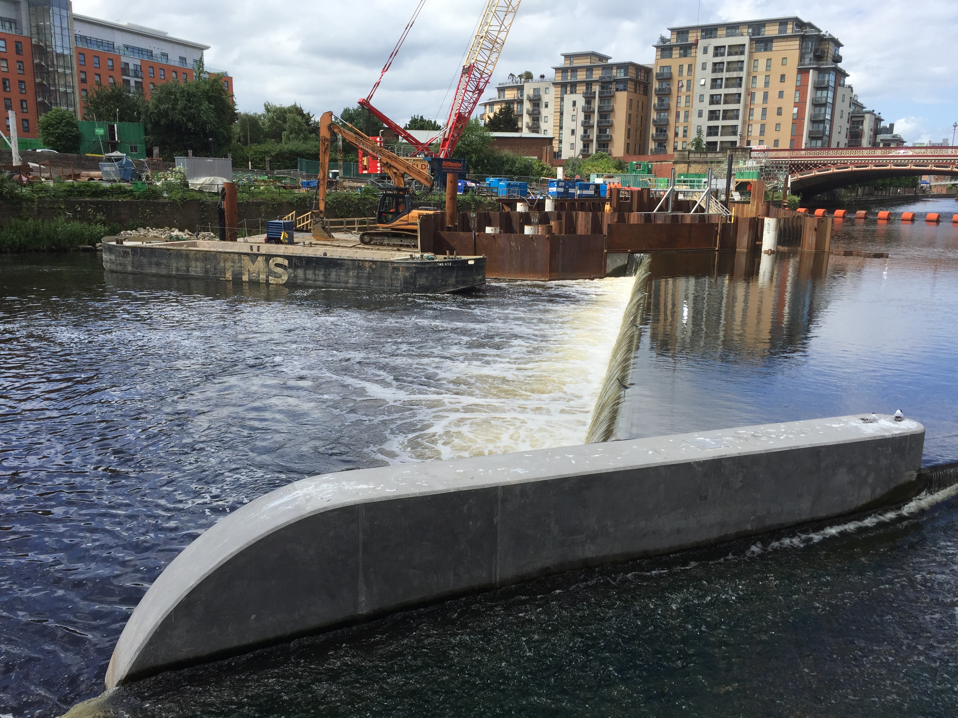
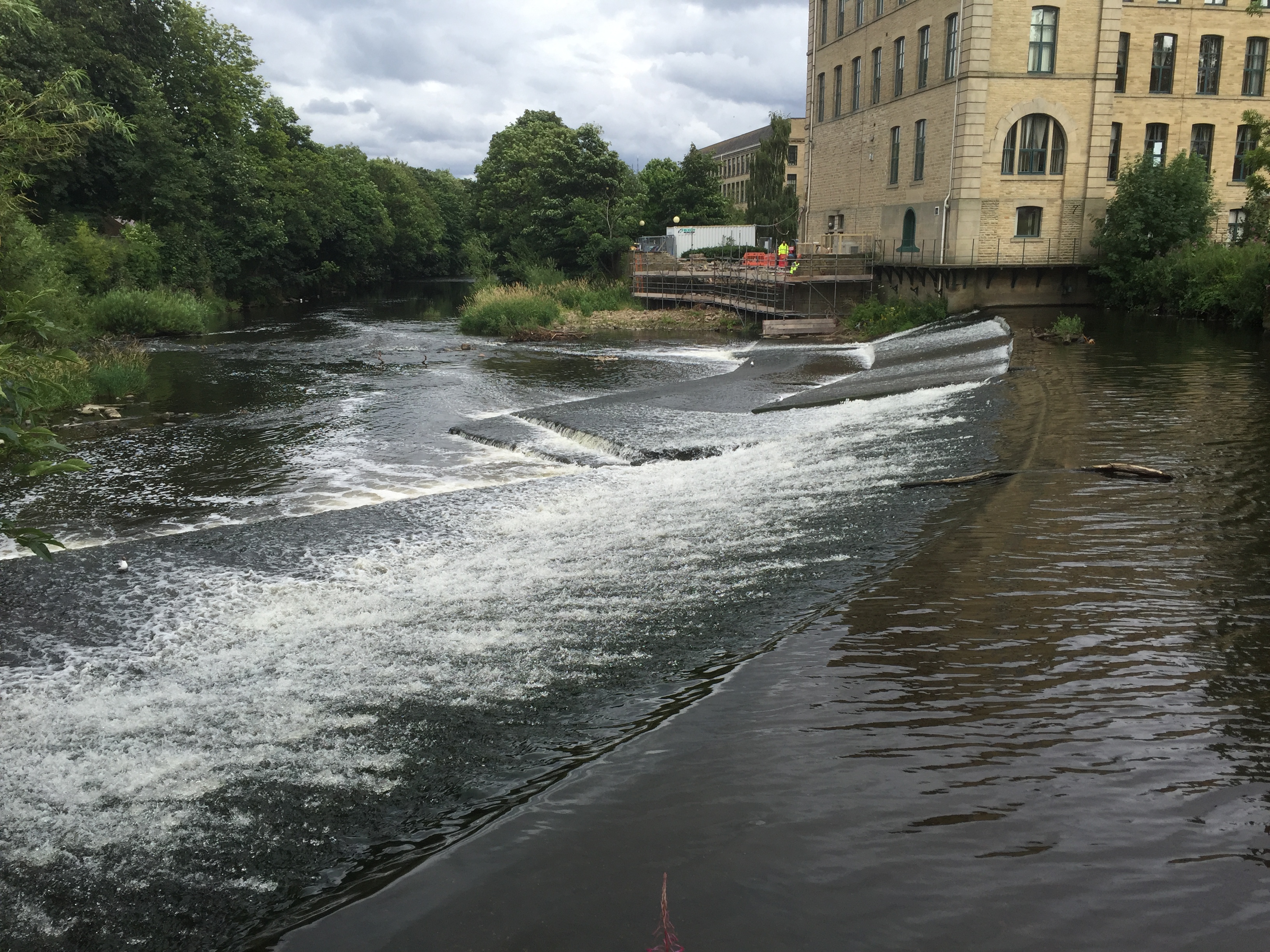
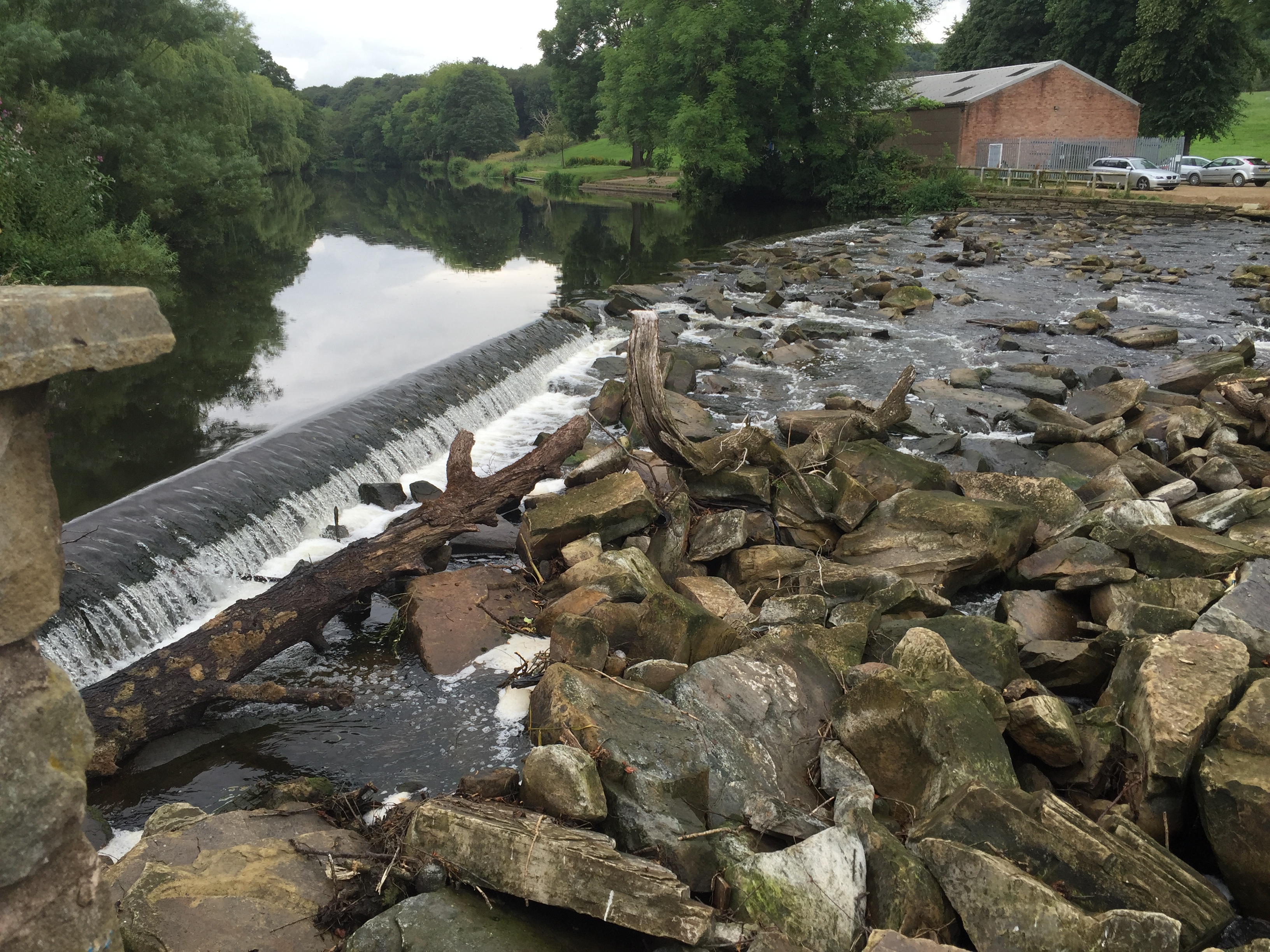
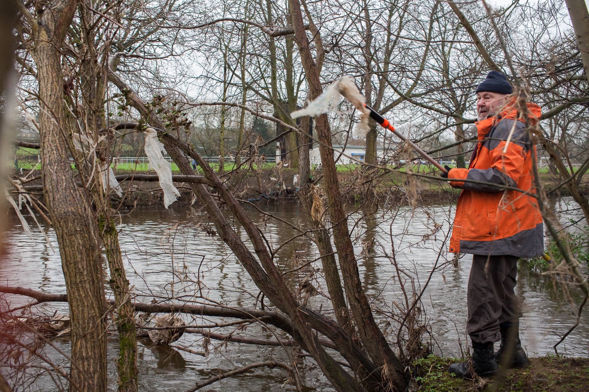
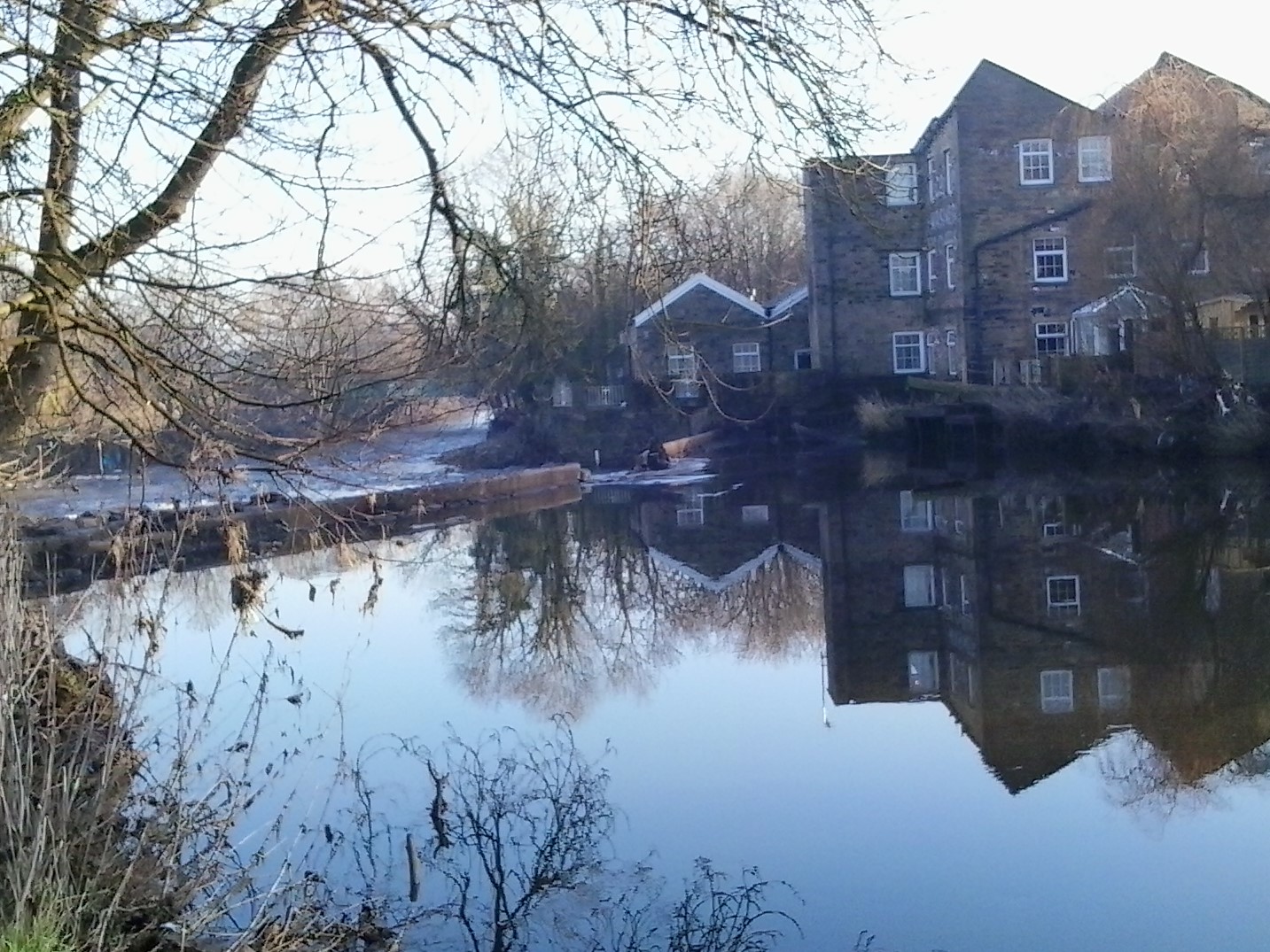
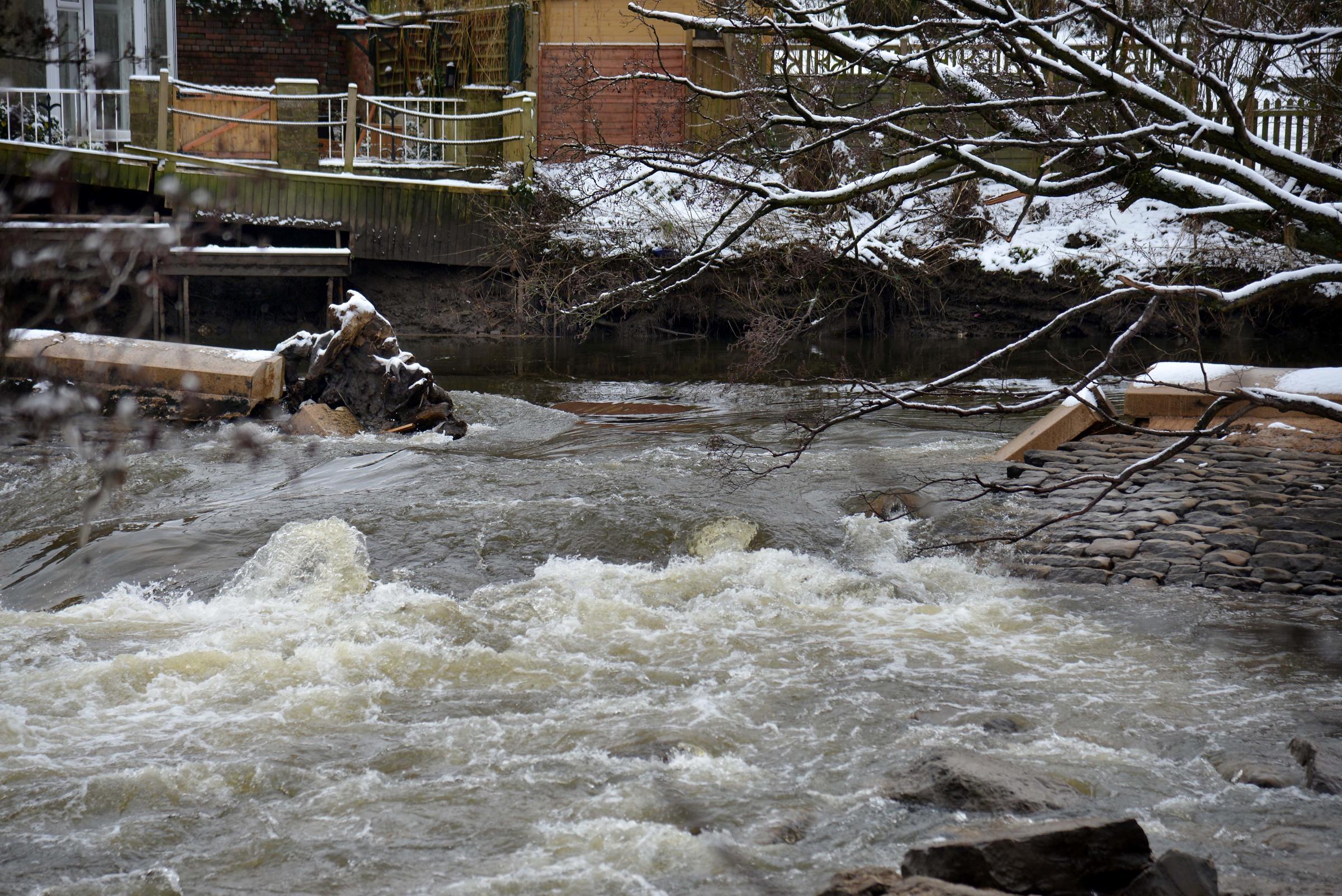
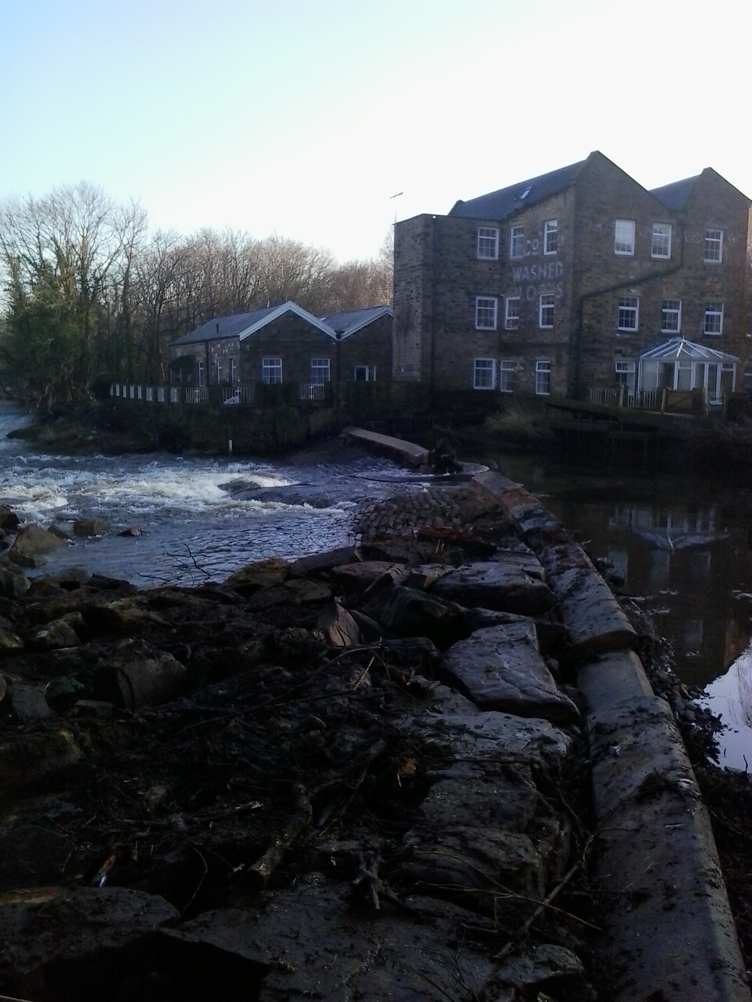
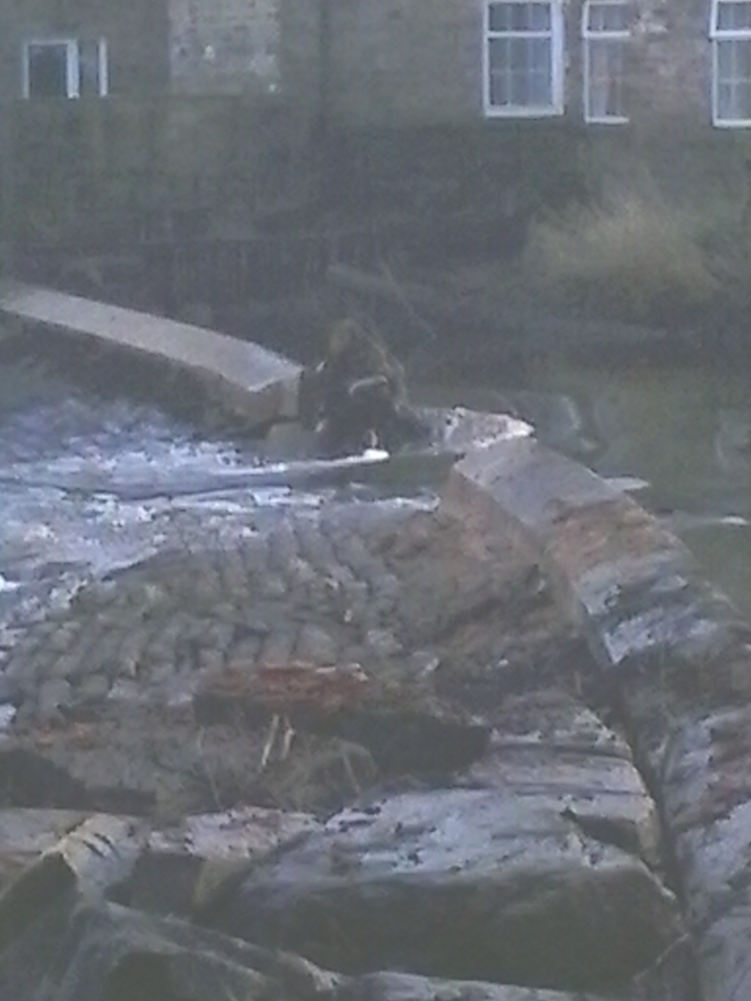
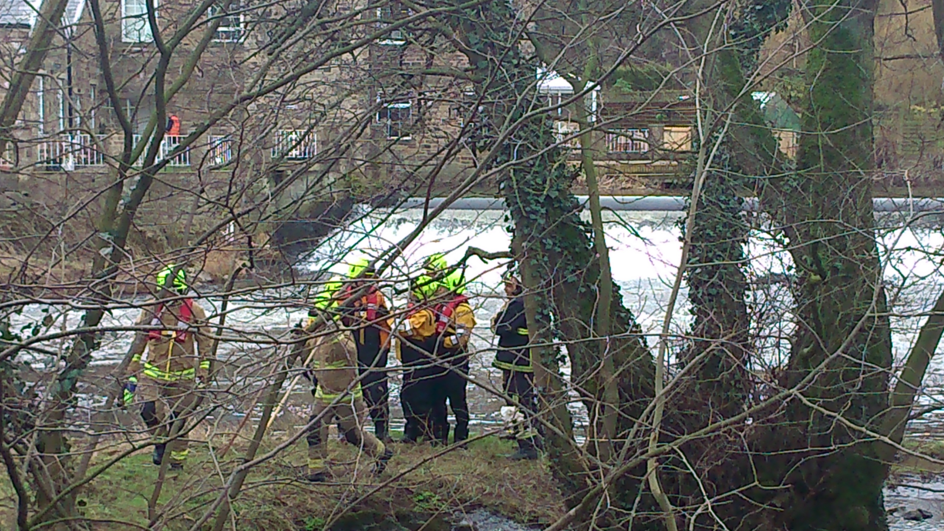
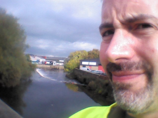
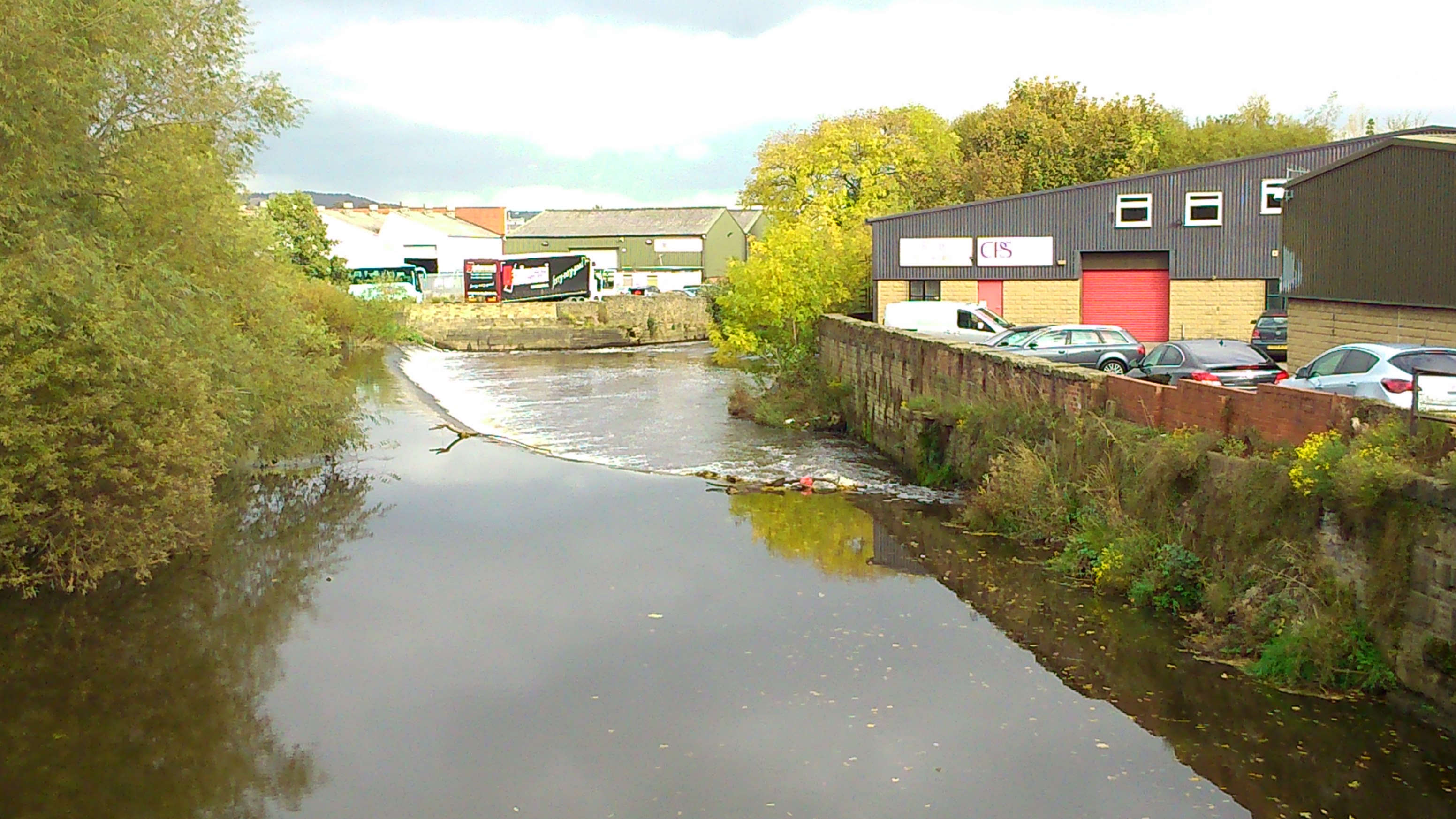
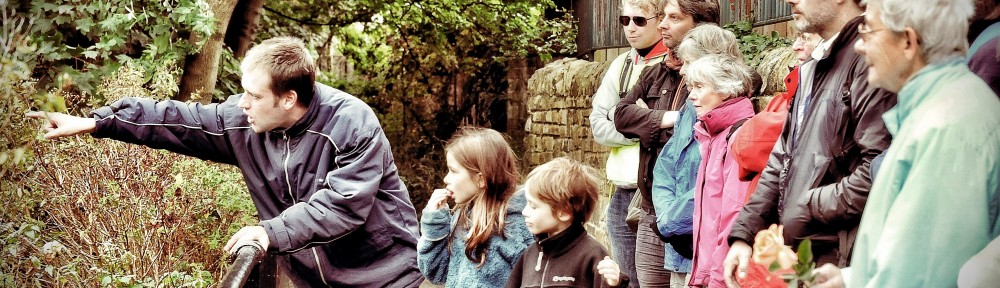
And then it was off across Knights Way Bridge… stopping part-way across to get a good look at the weir itself — currently half-completed… Here we discussed what exactly a coffer dam is, and spoke in some detail about the scheme’s benefits for wildlife…

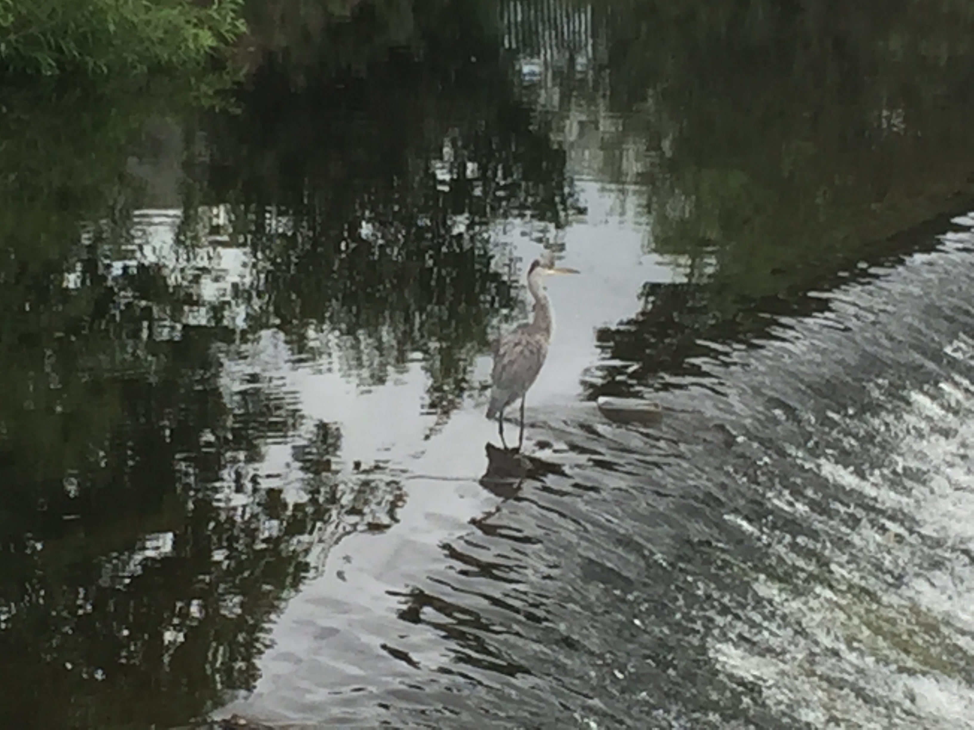
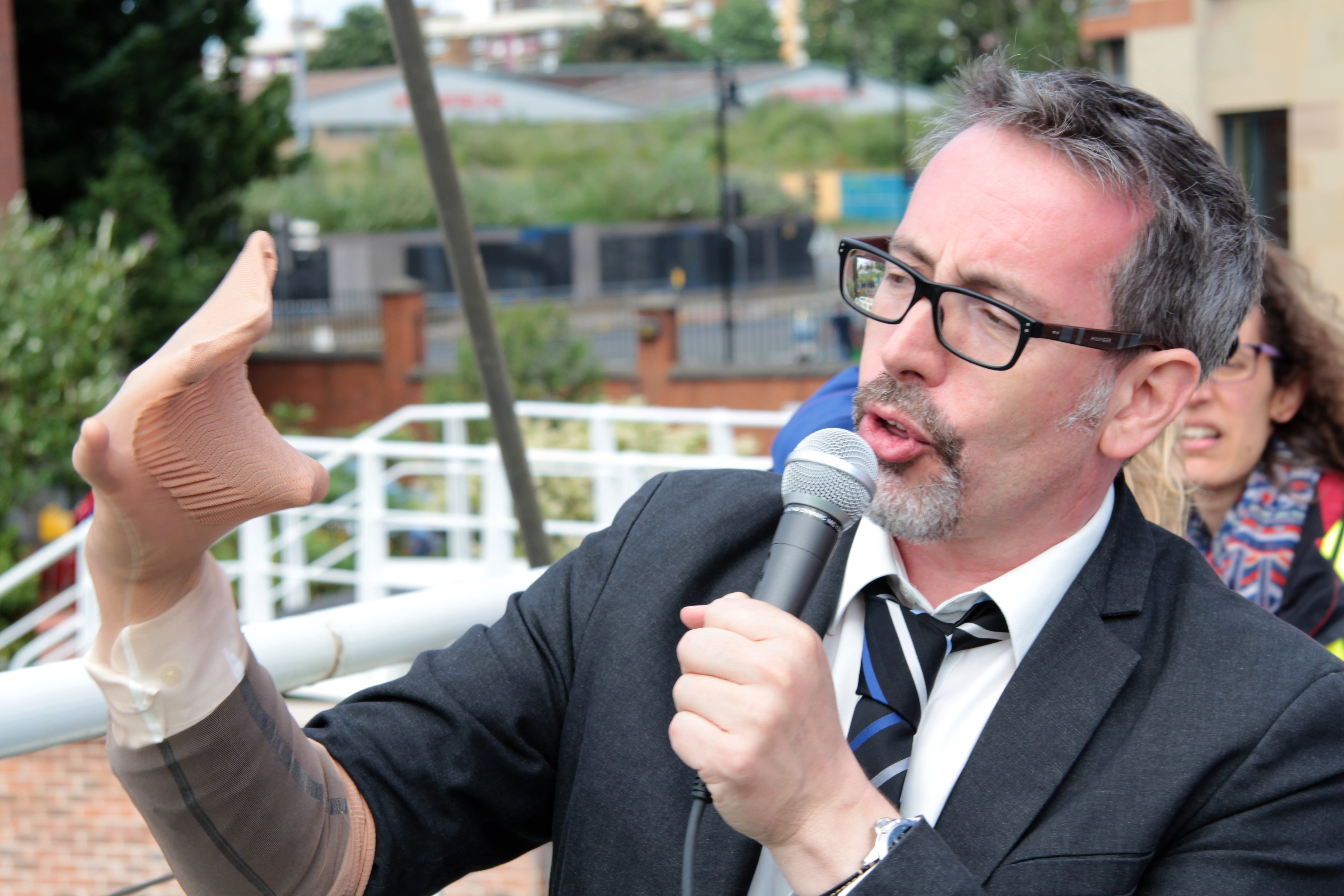
At one point, “Guy” even attempted to explain the possible reappearance of lamprey in the Aire by demonstrating with a visual aid …

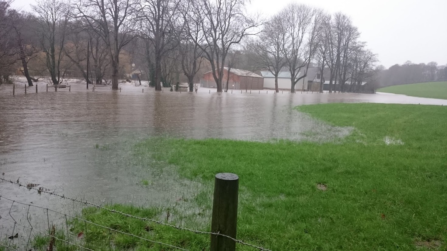
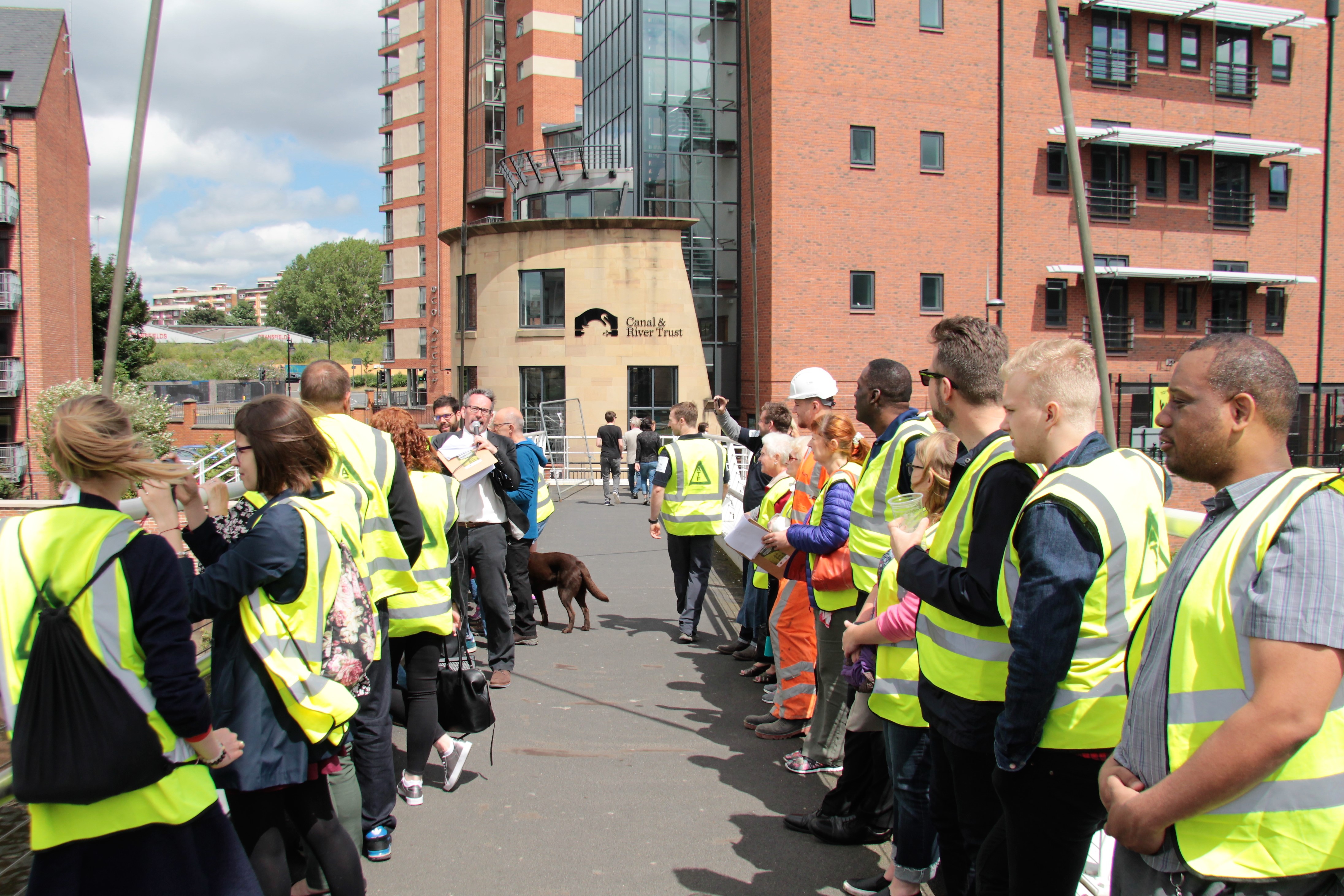
After completing our crossing of the bridge, we stopped outside the Turlow Court apartment building — badly hit during the Boxing Day flood of 2015 — to reflect on some of the residents’ feelings about the flood alleviation scheme (which are generally very positive, despite the temporary inconveniences involved with the construction process).

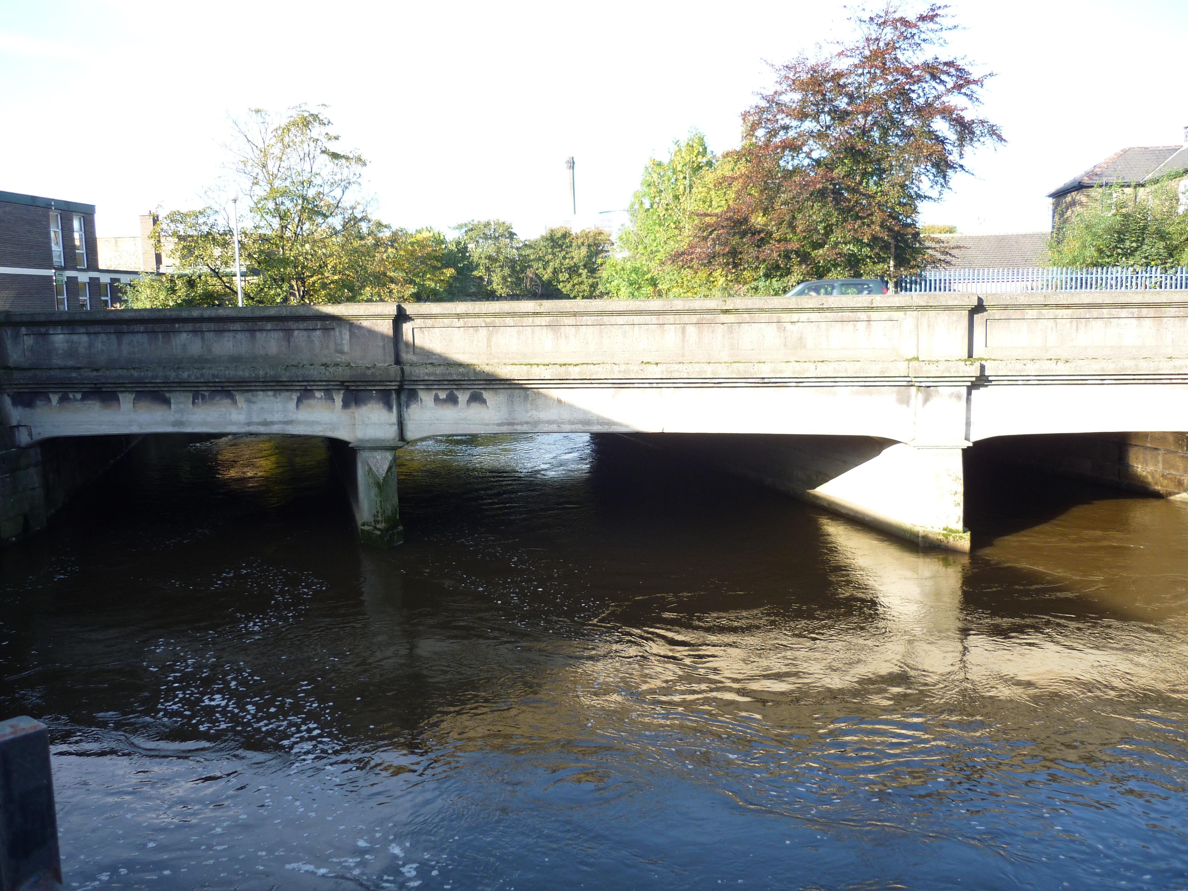
Then, for our last stop, we brought the audience to a spot directly overlooking the new weir. This was within a fenced-off construction area, which had been specially tidied and made safe for us, for the weekend, by BAM staff.

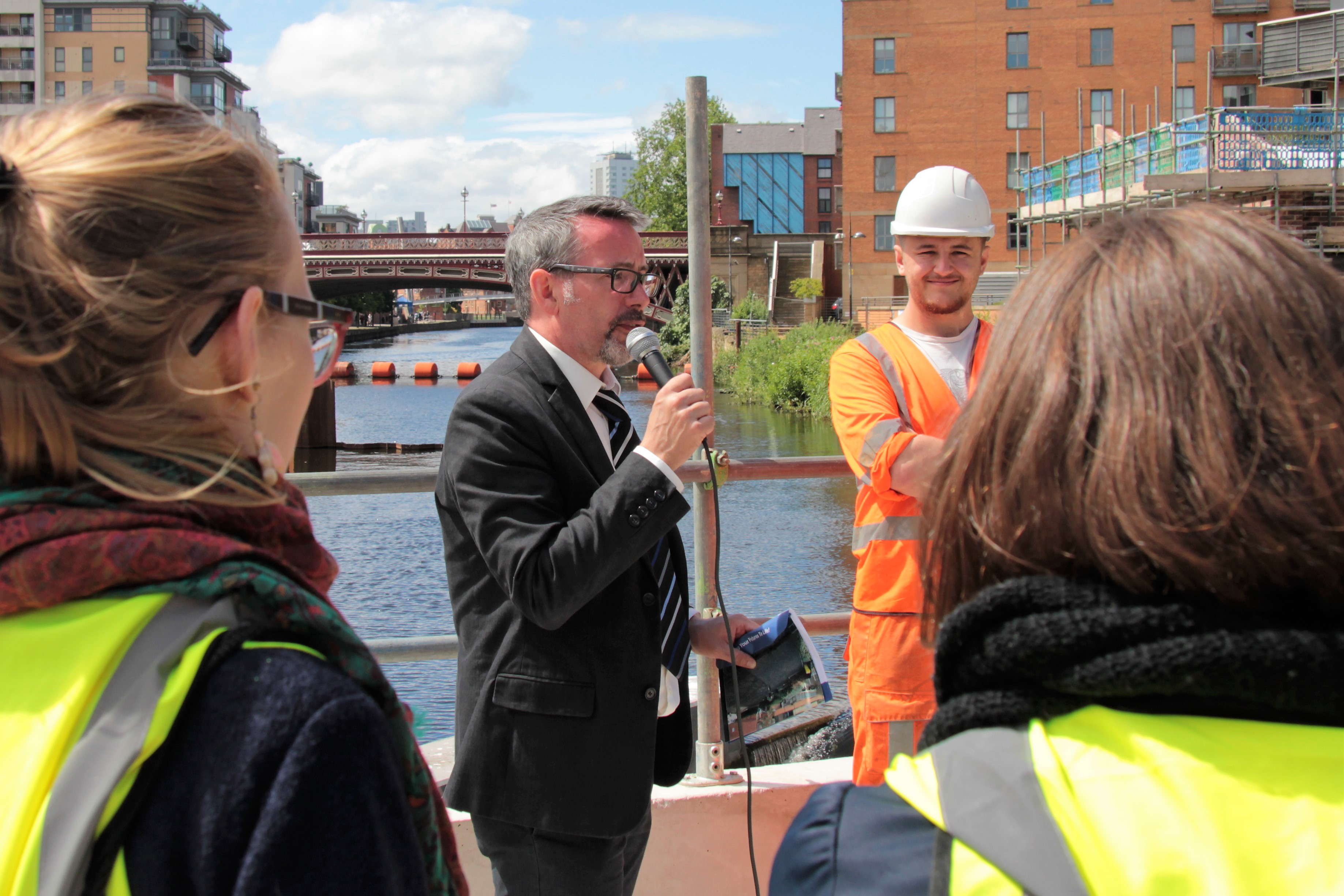
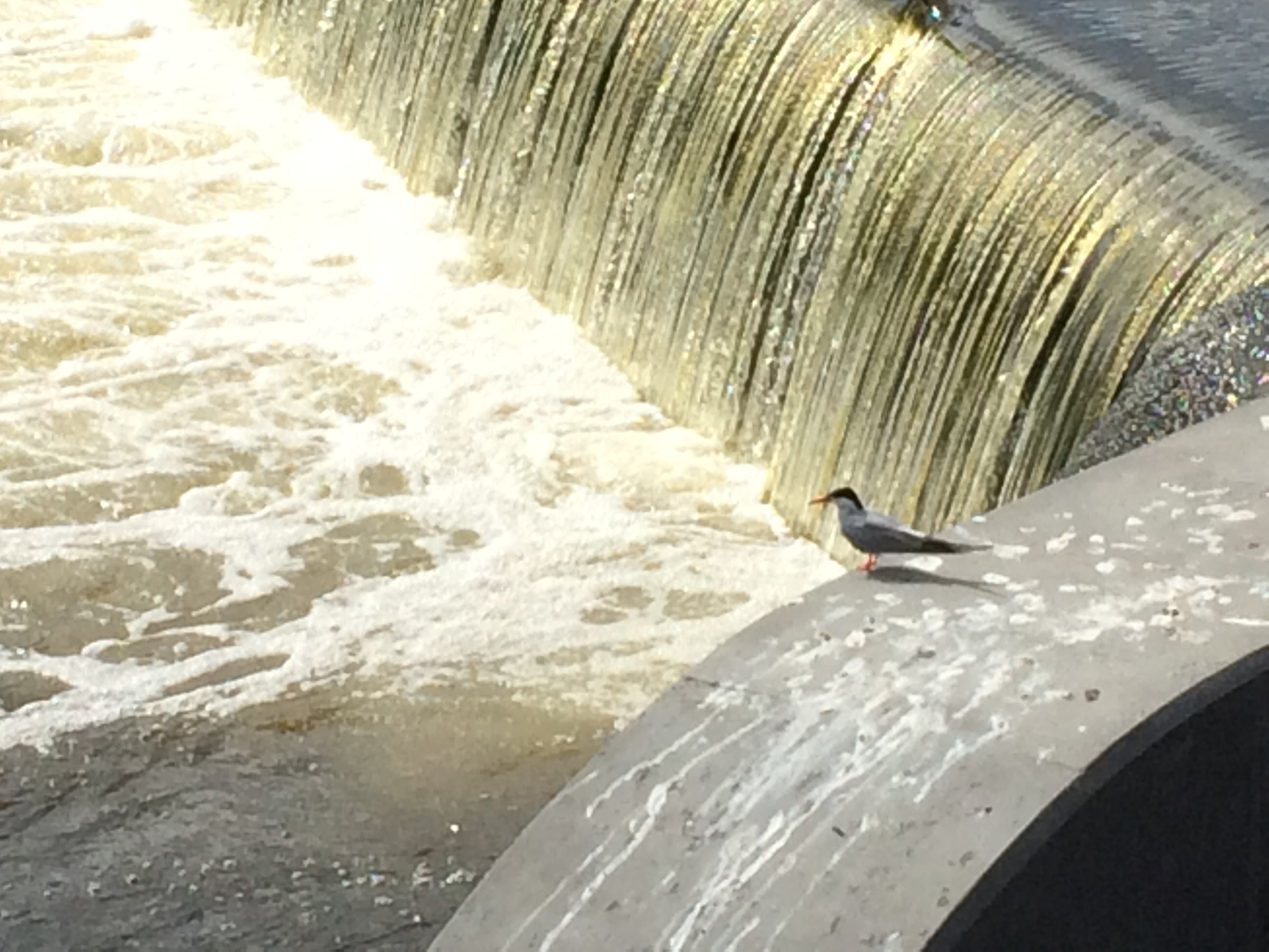
Here, Jack and I shared various anecdotes, including the story of the moorhen who had made her nest against the upstream side of the part of the sheet piling used to construct the coffer dam for the first (now complete) section of the weir works… Since the nest could not be removed, either legally or morally, when they came to take the coffer dam down, the FAS team had to find a way of working around it — at some considerable cost and expenditure of time. And yet there are now moorhen chicks swimming happily around — who appeared right on cue for one of the Sunday performances, much to the delight of the audience! (I don’t have a picture of them, but here is a tern that stage manager Jenny spotted on the weir…)

Finally, to wrap up, my good friend Eddie Lawler would appear to sing his brand new song, written for the occasion, “The New Leeds Weir”. This had a great, catchy chorus involving making the imagined sounds of the weir moving (“Psst! Fsssh! Bub-bub-bubble! What’s going on at at the New Leeds Weir?”) which many audience members merrily joined in with. It was a lovely, relaxed way to conclude the presentation.

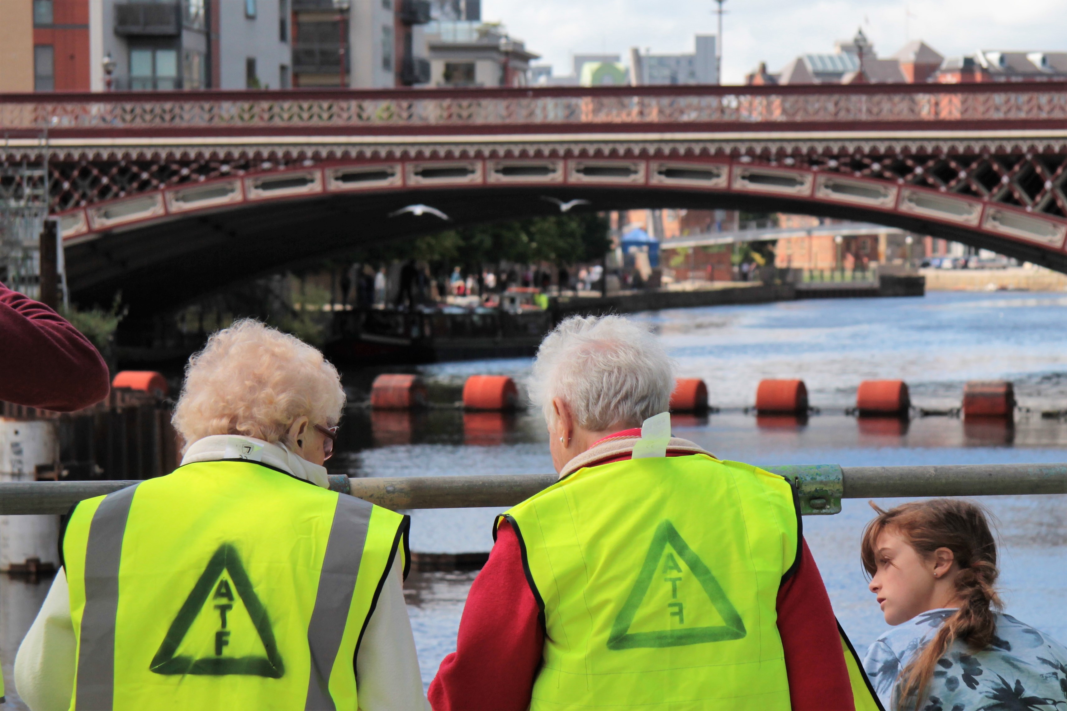
And then, before departing, many audience members wanted to stand around some more, look at the weir and the river, and ask further questions…

Back at the starting point, Jon gradually built up a visual representation of some of the feedback we received over the course of the weekend… Some of it related to people’s thoughts about the weir installation itself, and some of it was feedback on the way we’d presented and explained it to people. My favourite is: “Unexpectedly, I really enjoyed that!”

A huge thankyou to everyone who collaborated on putting this weekend together — to Andy, Jonathan, Mark and everyone at BAM… to Rosa, Mark Garford and others at the EA… to my “sidekick” Jack Waterman, to Phil Marken and Open Source arts, stage manager Jenny, street performers Nik and Steve, and of course two very different musicians who wrote original material for the occasion… Jake and Eddie… Thanks all!

By the end of the weekend, Jon had pretty much filled up that big expanse of whiteboard, and it was the last thing to get dismantled on the Sunday. I gather it might get preserved as a mural in a meeting room somewhere. So I made sure Jon signed it, bottom right corner. QED.

Weir Science (Part 1): Hold Back the River

This is me, taking a selfie, rocking head-to-toe orange. Something of a contrast to my usual look, but this is a blog post about contrasts. I’ll explain the new look shortly, but first…

The last couple of weeks have seen striking contrasts in weather patterns (climate change? wot climate change?). At the peak of a mini-heatwave that had us all sweating, June 21st was the hottest June day in the UK in 40 years. But only a week later, after several days of persistent rain, Bradford was once again facing flood warnings across the district — with water at perilously high levels in the Shipley area along both Bradford Beck and the main River Aire. Appropriate, then, that we also saw the publication this week of a long-awaited council report on Bradford’s preparedness for future flooding — which concludes that the serious budgetary cutbacks Bradford has experienced in recent years has left it vulnerable and exposed to “accelerating climate change risks”.

This report, from a committee chaired by Shipley’s own Green party councillor (and all-round lovely human) Kevin Warnes, is far better-informed than another report published last autumn by a different committee (which I critiqued in this previous blog post), and took advice from local figures who really do know what they’re talking about (such as the chairmen, respectively, of the Aire Rivers Trust and the Friends’ of Bradford’s Becks, Geoff Roberts and Barney Lerner). And while the report is frank about some of the council’s own failings, its key conclusion about insufficient funding points the finger (implicitly) right back at central government — since Bradford is among those councils who have been most disproportionately hit by austerity-era cutbacks (and faces another £32 million in cuts over the next couple of years). My last post on this blog was – in part – about the desperate under-funding of social housing in the area, but the shortage of adequate flood defences is symptomatic of related economic disparities…

Speaking of which… if we’re looking for contrasts, let’s head 12 miles downstream to Leeds, where a very expensive bit of flood engineering is still under construction…

This is the weir at Crown Point — aka Leeds Dam. The rather aesthetically appealing waterfall effect on the right of the picture (i.e. the north side of the river) is created by the brand-new, state-of-the-art weir installation that has replaced the old industrial weir (versions of which have held up water here for about 700 years). The idea with this new weir is that it gets lower – or even disappears completely – in high water conditions, thanks to the pressurised air bladders underneath it, which can simply be deflated to lower the level of the water on the upstream side. It’s the first time this technology has been used in the UK as a flood alleviation measure – and it’s being installed not just here at Crown Point but downstream (on an even larger scale) at Knostrop weir. These weirs, combined with the new flood walls running through the city centre, up as far as the railway station, comprise Phase 1 of the Leeds Flood Alleviation Scheme (FAS).

This £47million scheme (underwritten by the City Council, with central government support) will soon be followed by the even more expensive Phase 2 – covering points east through Kirkstall to Horsforth – using money provided by then-Chancellor George Osborne in the aftermath of the Boxing Day floods of 2015. Bradford, by contrast, was offered nothing — and the big difference of course is that money follows money. Or, to mis-paraphrase the biblical parable of the talents: “To those that have shall be given more.”

It’s apparently quite unusual, in the world of flood defences, for so many millions to be spent on such a specific, geographically-limited scheme as this. It’s reckoned that the new Crown Point weir, when lowered, will reduce upstream river levels on the Aire about as far as Victoria Bridge — so not even quite as far as the station. That’s a fairly short stretch of river, but it’s an extremely high value stretch of river. Better flood protection here will mean greater peace of mind for the major businesses and residential complexes on either side of the river — and will make it more likely that further inward investment will flow in to the city (especially in terms of the mooted regeneration of the South Bank area). So that’s why this investment has been made… and the results are, let’s be honest, pretty awe-inspiring… That coffer dam is quite literally holding back the River Aire, so that contractors have access to the riverbed.

This is FAS foreman Mark Pheasey, descending the gangway into the coffer dam, where the second section of the new collapsible weir is currently under construction (it’s now due for completion around September). Mark, also pictured below, is one of my new favourite people — helpful, generous, knowledgeable — after being assigned by his employers, the engineering contractors BAM Nuttall, to show me around the site…

I was granted this privileged access (and required to wear orange) as part of my preparation and research for Weir Science — our latest Multi-Story Water performance project, which I’ll document in the promised “Part Two” of this blog post. For now, though, just check out the big boys’ toys…

This is the main crane on site, weighing in at a modest 250 tonnes. The counter-weight alone (the big red bit on the back) is 86 tonnes. Mark laughed when I expressed amazement at this behemoth, because BAM deals with much bigger cranes on other sites. But still, it is way too big to have been driven here… It had to be assembled, here on Fearns Island (in the middle of the river), through the use of a smaller, mobile crane (a mere 110 tonnes) that was driven across to the island via a temporary stone bridge – erected across the narrowest part of the navigation. The big crane is basically being used as a very large coat-hanger from which to suspend equipment like this… (press play and insert fingers in ears…)

This hammer is pile-driving sheet metal… It’s the stuff the coffer dam is made of, but the row going in here is part of the permanent foundations for the new weir. This is “heavy metal” in action, and it’s being installed by a team of highly skilled contractors. BAM workers get assigned to work around the country in teams, where they’re most needed (Mark’s home is in Hartlepool – so mostly he only gets back to see his family at weekends). The guy you see in the video above, lining up the hammer so it falls just right, has been doing work like this for decades. (I didn’t catch his name, sorry…)

But if you’re not easily impressed by scale and power, you might prefer this bit of video instead…

Here we see the River Aire having a minor disagreement with the coffer dam holding it back, and leaking through the cracks to make a new, miniature river along its own river-bottom… A pump system is in operation to deal with this, 24/7.


Further along Fearns Island, we can glimpse the new weir doing its thing, while – across on the far side of the river – the new flood walls are still under construction (that white concrete will eventually have red-brick facing on it to blend in with the surrounding buildings). And to the left, also across on the far side, that scaffolding-covered block is the operations booth for the new system. Though the building itself isn’t finished yet, the key machinery has already been installed inside, as Mark showed me…

That touch-screen computer has adjacent settings on it for the two weir plates that will form part of the new weir. Since one of those plates is already operational, all the relevant readings are visible. But since the second plate is not yet installed (inside the coffer dam), that simply shows as being offline.

Whatever. I must admit that I was more drawn to the old school, lower-tech look of the pipes and dials below. And, yes, sadly, my inner child found some measure of amusement in the notice on the left…

Many thanks to Mark and BAM for a fascinating tour of the weir works. It gave me much of the material I needed for Weir Science, which we presented as part of the Leeds Waterfront Festival last weekend (June 24th/25th)… [see Part 2 of this blog].

Though based primarily in Shipley, the Multi-Story Water project has made annual forays downstream along the Aire to present performances at the LWF (see After the Flood and Seven Bridges under the Performance tab on the menu bar above). Working in Leeds has always felt like a different, but related context to Shipley, but this year the contrasts have seemed especially pronounced. Last year, an investigation led by this project established that there would be little to be gained, in terms of flood mitigation, by removing Shipley’s old industrial weirs. (Even if the money was available, which it isn’t.) In Leeds, though, they’re transforming a centuries-old landmark into contemporary art…

Shipley’s weirs – a technical view

IMG_1436Yesterday I was back down at Shipley weir, immediately downstream of Baildon Bridge, to visit my old friend the heron (above), and to show around a colleague of mine at Manchester University, Andrea Bottacin Busolin. Andrea (male, pronounced the Italian way, because he’s Italian) is a civil engineer who very kindly took some time out to analyse some flow data for the River Aire (which was, in turn, kindly supplied by the Environment Agency). This investigation was in response to a question raised by Phillip Moncaster, of Baildon Woodbottom Working Men’s Club (just upstream of the bridge). Put simply, if this weir was taken out of the river, might this reduce flood risk to the club and other local homes and businesses? Phillip’s hypothesis (discussed in more detail in this previous blog post) was that taking the weir out might lower the flow level of the water going under Baildon Bridge — meaning that in high water conditions the bridge would not so quickly turn into a concrete dam across the river…

This always seemed a reasonable hypothesis, but we needed to look at what the technical evidence for it might or might not be. And in practice, it seems, the data does not support the hypothesis. The bridge is a problem, yes, but taking the weir out won’t really help. Here’s why…

First: If you click on this link, it should open up a summary graph of the technical data. Don’t ask me to explain what it all means, because I’m not an engineer, but basically this is a representation of the downhill flow of the River Aire – moving from left to right across the page. The section analysed here starts somewhere near Crossflatts, and stops somewhere downstream of Woodhouse Bridge. It shows “river bed elevation” (that is, the level of the river bed) in relation to the “water surface profile” (the level of the water in different flow conditions).

Now, you can clearly see where Andrea has marked Shipley weir (aka Baildon weir) on the summary graph. It shows up as a small spike in the downhill flow. And if you look just to the left of that marker, you see two other spikes… Together, these three little spikes, roughly in the middle of the graph, represent the three weirs in the Shipley area — Hirst weir, Saltaire weir, and then Shipley weir. Now, watch what happens to those three spikes in this animation of the flow data as the water gets higher and then lower again…


(OK, yes, I added a little free music to it via YouTube, to try and make it a bit more exciting.)

As you can see, as the water level gets higher, the weir spikes gradually cease to affect the surface level of the water. The water gets so high that the weirs basically disappear from view. And this happens fastest with Shipley weir — so fast, in fact, that the weir quite quickly ceases to make much difference to the flow level. Saltaire weir takes a bit longer to disappear below the waves — and interestingly it seems that Hirst weir continues to make a bit of a difference even in very high flows. This explains the roiling wave effect that eye-witnesses saw at Hirst weir during the height of the flooding.

Now, based on this same data, Andrea was also able to provide a hypothetical animation of what would happen to the flow if you were to take out Shipley weir. He simply removes that third spike from the graph, and then animates the same flow data. This is what you get (again with dubious musical accompaniment…): 
As you can see, the pattern is almost identical to that in the first animation… demonstrating that in practical terms, the presence of Shipley weir makes almost no difference at all to the behaviour of the river during high flows and flood conditions. It’s really only in low flows that the weir makes a marked difference to the river’s upstream and downstream levels.

Now, Andrea was the first to acknowledge that the accuracy of this judgement is dependent on the accuracy of the data that he was given. And the Environment Agency is in the process of updating its survey analysis of the Aire as we speak. But there’s no particular reason to doubt his broad conclusions. I invited him down to Shipley yesterday simply so that he could see the weir itself, in situ (rather than as an abstract set of data) and so that he could meet Phillip. We had a good chat, which concluded aptly with Phillip’s wry observation that: “I guess we need to think of something else then.”

IMG_1428

We noted rather grimly that there’s a lot of debris in the river again, especially around the bridge, just waiting to contribute to damming problems in high water conditions. And there was more of this to be seen as Andrea and I walked upstream to from Shipley weir towards Saltaire weir, using the riverside path. Look at this by the pipe aqueduct just upstream of Phillip’s club…

IMG_1437And then of course there’s the flood debris from last time, still very much apparent in the riverside trees….

IMG_1438Indeed, Andrea was intrigued to notice the amount of “lateral vegetation” along the river banks — by which he means the trees and shrubs that grow right out into the river, and catch hold of rubbish like this in high water. Vegetation like this, he noted, will provide some resistance to water flow which is difficult to represent in the simple graphs. It will be interesting to see if the EA’s new data set starts to take this kind of close-up detail into account, although – again – it probably won’t affect the broad conclusions about the weir.

Reaching Saltaire and its weir, its particularly apparent just how low the flow in the river is just now — enabling you to see the entire structural architecture of the weir…

IMG_1440

We didn’t walk up as far as Hirst weir (pictured below from a visit the day before), but perhaps the most significant finding of Andrea’s technical analysis is just how much of a role Hirst weir continues to play in relative flow levels, even in high water. This is relevant to the continuing debate about whether the Rowing Club’s repair of that weir has adequately addressed the downstream flood risk issues associated with it.

IMG_1377

Just for the record, here is Andrea’s slightly more technical summary of what his analysis shows:

“The graph summarises the results from the simulation of a 10 year flood under two different scenarios, with and without weir. I have also included a plot of the upstream flow hydrograph (discharge versus time) representing the boundary condition at the upstream section. You can see that the water surface elevation just upstream of the weir is different for the base flow at the beginning of the simulation, but the difference disappears as the flow discharge increases. The maximum water surface level for the simulated flood event is virtually the same for both scenarios. This means that the weir has no significant effect on the water level during high flows. However, the local flow contraction induced by the weir produces higher flow velocities just above the weir and higher turbulence intensity downstream of it, thereby increasing the risk of local erosion. This may not represent a significantly higher threat if the river bed and banks are sufficiently stable.”

Looking for common ground

Last week I was at Baildon Woodbottom Working Men’s Club for an intriguing meeting between two very different men. Here they are below – on the left, the club’s secretary Phillip Moncaster, and on the right, Jonathan Moxon, a senior flood risk manager at the Environment Agency. They seemed to get on pretty well.

IMG_1222

I’ve got to know both these men quite well over the last couple of years, but they had never met each other before this meeting. So you can imagine how weird it was when I saw them juxtaposed on television in January, in BBC’s Yorkshire’s Inside Out documentary about the Boxing Day flooding, with Jonathan saying that he was “disappointed” to hear how frustrated Phillip was with the Environment Agency…

Actually, describing Phillip as being “frustrated” by the EA would be the understatement of the year. His anger with them began back in November and December, before the floods even hit, for reasons documented on this previous blog post. Then come December 26th, both the Woodbottom club and Phillip’s own house were six feet underwater (he lives just upstream on Aire Close, right next to the river). He received a phone call from the EA flood service at around midnight on Christmas Day, advising him that the river was swollen but that it was thought to have peaked. It was on this basis that he decided further action was unnecessary that night — and yet the next morning he had to wade out of his house because the river had come up hugely overnight and was still rising…

From Phillip’s point of view, insult was then added to injury when some people from the EA finally showed up during the days after the flood, and wanted to ask him questions about what had happened, rather than offering any assistance with cleaning up the sewage-covered mess that the house and club had been reduced to. That conversation turned into the EA people having strips torn off them by Phillip, with some pretty colourful language being used (another understatement). Since then, he has made his views pretty vocally heard on TV — not just in the clip pasted in above, but on a couple of other programmes too, including Look North. 

So what was the point of Jonathan coming down to meet Phillip? I must admit that I did worry, in advance, that it might turn into another uneasy confrontation – because god knows he has plenty to feel aggrieved about. (The club is only just properly back on its feet — although they reopened with a makeshift bar by the end of January, it took until last month to complete the replastering and refurbishing.) But my sense was that Phillip and Jonathan would get on OK if they sat down and talked it through — because communication is the only way to improve things, right?

Jonathan acknowledged that Phillip had had plenty of cause to be stressed and angry after Christmas. He pointed out, though, that the reality for the EA was that they simply didn’t have the staff or resources to cope with the demands placed on them right across the North of England following the Boxing Day deluge (and it doesn’t help that they suffered major staff cuts during the post-2010 government austerity drive). So the two people that had visited Phillip weren’t even from the Yorkshire area – they were simply colleagues who’d come up from down South to try to help the over-stretched Leeds office. They didn’t have the resources or kit to do anything more than gather information and try to see what help people needed.

As for the poor information that Phillip had been given on the telephone on Christmas night, Jonathan was clear that he shouldn’t have been told what he was told about the river having peaked. Yet the reality is that people under pressure in rapidly changing circumstances will sometimes make errors of judgement when trying to interpret the information they’re receiving. And again, limited resources are part of the problem here — insofar that the Agency can’t always get all the information that would be useful to make the best judgements, because they can’t be everywhere at once.

It was at some point in the middle of this conversation that Jonathan mentioned that a particular problem the EA faces in Bradford is that they have no volunteer Flood Wardens (whereas they have plenty, for example, in the Calder valley). Flood Wardens are just members of the community who volunteer to keep an eye out on what the river is doing, and report concerns directly to EA officers so that they have the most detailed information possible. I decided to jump right in and ask directly whether Jonathan was saying, “would Phillip be willing to act as a Flood warden?” And given Phillip’s widely broadcast grievances with the EA, my expectation was that he would laugh this idea off – as if he was simply being asked to work for free, or something.

But much to my surprise, before Jonathan even had a chance to answer my question, Phillip had answered it for me. Yes, he said, he would be happy to do that — because he does it anyway. By which he meant that, for years, he has been on the phone to the EA, to Bradford Council, and whoever else he could get hold of, trying to report his concerns with the river — and for years he’s been getting the runaround from call centre operators, passed from pillar to post. So when Jonathan explained that Flood wardens get to use a different phone number, which gets them direct access to flood risk officers and a proper, two-way conversation about what’s going on — well, that’s exactly what Phillip has wanted — to be able to talk to someone who is actually listening and can say more than just “let me take down your number.” (I mean, when Jonathan put it like that, my thought was, why would you not want to have that access, and that kind of response, if you care about the river? As Phillip so obviously does. … The irony is, I guess, that the EA doesn’t have enough resources to properly advertise the Flood warden scheme…?)

IMG_1227

After we’d spoken for about an hour in the club, Phillip took us outside and across the river — across Baildon Bridge — to get a better look at the key problem. The club is directly upstream of the bridge. And in flood conditions, the bridge turns into a dam — backing the water up and sending it all the way out across the cricket pitch towards Green Lane. This is partly because of that thick, low, concrete-sided wall, and partly because even the space underneath the bridge can get dammed up very quickly with dead trees and other debris being swept downstream. Phillip pointed out one submerged tree, under the bridge, that has literally been there for months.

On the other side of Baildon Bridge, this is the view downstream towards Shipley weir…

IMG_1231


Phillip has long felt that, if the weir could be taken out, this might reduce the height of the water going under the bridge, and mean that it doesn’t get dammed up so quickly — thereby potentially reducing flood risk. His concerns on this point were first documented quite a while ago on this blog. Since it seemed a reasonable argument, I have — for quite a while now — been trying to find out if there is any scientific validity for Phillip’s theory, and in fact it was Jonathan who kindly arranged last year for the EA’s flow data for this stretch of the Aire to be released to the University of Manchester (where I work) for analysis. Just a month or two ago, a civil engineer colleague finally found the time to look at this data for me. The conclusion he came to was that, while the weir does appear to make a difference to the levels of the river in low flow conditions, in high flow the weir makes very little difference to the water level because it basically disappears under the deluge. So this initial assessment appeared disappointing, from Phillip’s point of view.

But… (and here’s the intriguing part) … Jonathan himself is not all that persuaded by this engineering analysis. And the reason is not because he thinks my colleague at Manchester got anything wrong, but simply that the data the EA was able to provide to him in the first place may not have been as detailed or up-to-date as it could be. And crucially, the modelling won’t have accounted sufficiently for effects on the bridge… To Jonathan, the real issue here is what happens to the bridge in high water, more than what happens to the weir. What if, he asks, there turns out to be a case for the bridge itself to be raised or replaced? I should stress that this was purely speculative on Jonathan’s part, but the point he was making is that we might need to look seriously at all the possible options — even the ones that at first glance seem wildly ambitious and expensive — if we’re going to think seriously about future-proofing.

And here’s the twist. The Boxing Day flooding, while devastating for many including Phillip, has also created a new sense of urgency in government circles, and thus a willingness to look at new options. Jonathan’s approach is to try to use that “fair wind” to push for better data and better answers … and so just a few weeks ago, for example, he was able to order an up-to-date survey of river conditions in the Shipley area. And he was able to do this using a small slice of the government funding allocated to the Leeds Flood Alleviation Scheme — on the grounds that, since Bradford is upstream of Leeds, anything that can be usefully done to better control high water upstream could have valuable knock-on benefits downstream.

From Jonathan’s point of view, the active concern shown by citizens like Phillip is exactly the kind of involvement that should be being better utilised and responded to by the EA and other responsible agencies. In the immortal words of the just-fired Chancellor George Osborne, “we’re all in this together” — and so it’s the job of agencies to listen to and work with communities, to find solutions that work for all of us, rather than just imposing “expert” solutions without consultation.

A case in point? Take another look at that picture above… Actually I’ll paste it in again…

IMG_1231

See that new breezeblock wall that’s been built onto the old stone wall on the right here? It’s not a thing of beauty, and Phillip was skeptical about whether the site owner had permission to build it — he knew there had been some exchanges of letters about it. Jonathan’s attitude, though, was intriguing. The EA has some concerns about this new bit of wall, he told us, and would not normally sign off on something like this without further investigation (which may yet happen… does raising the wall level here negatively impact on flood risk downstream, for instance?). Yet in the aftermath of the Boxing Day floods, there is also an awareness that people want to take fresh precautions against future risk, and that the EA shouldn’t simply be in the business of frustrating people from trying to protect their businesses or homes. So there needs to be a degree of leeway with the regulations, and perhaps a degree of improvisational “make it up as we go” when dealing with individual cases of concerned citizens wanting to take action. Because that is going to be the only way to build trust and understanding, as opposed to tying people up in infuriating amounts of red tape.

I must admit, I left that meeting feeling quietly inspired. Here were two men, Phillip and Jonathan, who had every reason to be wary of each other, every reason to keep  their defences up. Yet after a “full and frank discussion” (as the politicians say), there really did seem to be a sense of goodwill on both sides and a concern to keep in touch and keep each other informed. With so much sound and fury and mistrust going on in wider political life at the moment, it was refreshing to be part of a discussion that seemed constructive and tentatively optimistic.

A huge thankyou to both Phillip and Jonathan for taking the time out of their busy days to meet up.

Hirst Weir and Debris Removal Initiative: updates

A short-ish post this, to keep the blog up to date on some recent developments… Further to my post about Hirst Weir a couple of weeks back, work is now well underway on repairing the breach, as this photo nabbed from a recent Telegraph and Argus story shows…

Hirst Weir repairs wAnd as you can see, the heavy machinery is in, er, full flow. In my previous post on this, I erroneously suggested that — because the breach in the weir is out in the middle — it was too far out for excavators to get to, and that the repairs would have to be handled manually. But the repair scheme is (of course) much cleverer than that. As Geoff Roberts, of the Aire Rivers Trust, explained to me a couple of days ago, the approach being adopted involves gradually working the machinery out into the river by laying big rocks ahead of it, onto which it can then move. They are constructing a massive “rock ramp” (with massive rocks) downstream of the weir, a full-river-width extension of the temporary repairs carried out on the Baildon side in 2012. This means that the river will flow more gradually downhill after coming over the weir lip, rather than crashing down on the river bottom. By building the rock ramp first, the contractors can then get themselves in a position to fill the actual breach in the weir itself as the final stage of the repair (using a more nuanced version of the same “stick in some rocks” strategy).

Geoff and the Aire Rivers Trust have been working over recent weeks with Bradford Rowing Club, which owns the weir, on two key things:

(1) to raise the money as quickly as possible to carry out the repairs. Between them, they raised the shortfall of £30,000 in two weeks flat, partly through crowd-sourcing. Amazing!

(2) ensuring that the new rock ramp weir will be laid so as to allow fish to travel upstream by slipping between the rocks. This is instead of a more heavily engineered fish pass solution, but is also much cheaper and, arguably, more “natural”. Geoff told me that the Rowing Club’s much more expensive plans for a permanent design solution to the weir, for which they were raising money last year (target: £600,000) have basically been shelved and superceded by these emergency repairs, but he seems confident that the new solution might even work out better in the long run.

Geoff also mentioned that Buntons, the contractors carrying out the work on the weir (who also did the 2012 repairs), are doing so on a costs-only, not-for-profit basis. This is just one more example of the amazing spirit of generosity and community co-operation that has characterised so much of the public response to the recent flooding. Speaking of which…

12640453_1269057376443563_3066255554316192284_o

This was the sight last Sunday, January 31st, on the Higher Coach Road stretch of the Aire riverbank (downstream of Hirst Weir). Thanks to the tireless cajoling and publicising of Mat Holloway and his Aire Debris Removal Initiative (ADRI), around 75 people from all around the district turned out on a damp morning and — starting from the cricket pitch at Roberts Park — worked their way west for two hours with litter pickers and rubbish bags supplied by the Council…

12605429_1269057369776897_5035669100109396234_o

These pictures are taken from ADRI’s Facebook page, which is very active and full of images and news updates (I can’t keep up with them!). And there are new connections forming too, between different groups… Pictured below is Stewart Gledhill, chairman of the recently-established Higher Coach Road Residents Group, plucking a particularly large piece of plastic debris from the riverside trees…

12628399_1269057383110229_4738135556817538399_o

In a matter of just over a couple of hours, the Debris Removal task force collected over 100 bags of debris! Here’s a bunch of it left for collection at the Roberts Park end…

12615442_1269057646443536_6128792064856253518_o

And here’s a bunch more left for collection at the far end of the Salts Sports site, by the footbridge across the Aire…

12604849_1269057593110208_5406968391414570274_o

All of the bags were then swiftly collected by the Council trucks, and a job had been well done! Well done to everyone involved (I’m just sorry I couldn’t be there myself), and good luck to Mat and ADRI in organising further clear-ups. Unfortunately, the session scheduled for today, Sunday 7th June, down in the Buck Wood area near Denso Marstons Nature Reserve has been cancelled as a precaution, due to the persistent rain this weekend making the ground soft and treacherous underfoot. But hopefully the momentum can nonetheless be maintained into future weeks…

Bradford Rowing Club repairs Hirst Weir

As was flagged up by this story in yesterday’s Bradford Telegraph and Argusthere was emergency repair work taking place today on Hirst Weir.

rowing club crisis

This is Dr. Celia Hickman, current President of Bradford Amateur Rowing Club (BARC), as photographed for the T&A. The Rowing club owns and maintains the weir (through a limited liability holding company), because without the weir acting as a mini-dam for the stretch of the River Aire upstream up of it — the stretch coming down from Dowley Gap — there would be no viable rowing course. And right now, there is a pretty big hole in the dam…

Jan 20 12

As is clear from this picture, taken today under sunny blue skies, the hole in the weir – over towards the mill on the south side — means that the rest of the structure simply looks like a wall. The entire river is now flowing through the breach, as this picture (also from the T&A) shows…

rowing club 2

The weir and rowing club featured on this blog in this entry from a year ago – here I noted that the club was trying to raise money for major works on the weir that would stabilise it for the long term. Unfortunately, however, this plan has been overtaken, by the need to make emergency repairs following the Boxing Day floods… There’s an emergency bill of £85,000, according to the T&A, and the club is still £20,000 short of this target but needs to get on the with the work before more permanent damage is done. (One wonders whether the £65k they do have is actually from the fundraising efforts for the longer-term solution…?)

When the weir was last damaged, during the high water of summer 2012, an emergency repair of the resulting breach was effected by plugging it with large stones dumped in by an excavator… Today there was no water at all flowing over those stones, because of the breach further along… Instead, there was an excavator actually sitting on those stones!

Jan 20 11As you can see, though, the location of the breach makes it impossible for the heavy machinery to get anywhere near it, without risking further damage to the weir (and possibly risking the equipment and driver!).

Jan 20 9

Instead, then, it looks like the damage will need to be repaired by laboriously moving stones into position by hand… Slow and very hazardous work, given what the force of the current/undertow must be, going through the breach.

Jan 20 10 (2)

The T&A article reports on plans for installing a fish pass as part of the repair process. This is certainly part of the Rowing Club’s longer-term repair plans — as you can see in the scale model featured in my previous blog on this topic…. dec 2014 017

The ladder effect here is the fish pass, and the assembly of stones downstream of the weir is the basic idea for long term stability — creating a more gradual incline for the water, rather than a sudden drop that scours the river bottom (the central bit without stones, in black in the model, is simply to indicate the current drop – it wouldn’t be retained like this).

It seems unlikely, given the laborious patch-up work taking place today, that anything as sophisticated as a fish pass will be going in any time soon — whatever the T&A story says. But of course I’m no engineer and I could be completely wrong. Corrections gratefully welcomed…  Anyway, let’s hope the repairs are effected smoothly and the weir is functioning again soon.

Jan 20 6

I’m grateful, again, to Eddie Lawler, for furnishing me with the (non-T&A) photos above – including this pleasingly arty one here… Thanks Eddie!

And thanks also to Martin Spiers, for providing the images below of the Rowing Club on the Boxing Day itself, the day of the flood… Here it is, completely cut off by water…

DSC_0031This shot is taken from the access road that leads to the club. Turning left through about 90 degrees, Martin also got this shot of the road blurring into the adjacent Loadpit Beck, as they both run downhill to the swollen Aire…

DSC_0029

Finally, there’s this shot, taken from Martin’s home on Bowland Avenue, looking across towards the Rowing Club via the path that would normally cross Loadpit Beck where the little railing stands…

IMG_4337

The weir, which should lie to the left of shot here beyond the trees, was totally submerged…

Making Space for Water?

DSC_0097Spotted through the trees yesterday just downstream of Hirst Weir…  Members of West Yorkshire Fire and Rescue Service (with their big red engine parked up in the car park of Bradford Rowing Club). I’m hazarding a guess that this was a training exercise for coping with flood conditions. A couple of weeks I heard a presentation from Humberside Fire and Rescue about how poorly prepared firemen are for working in flood conditions — even though flooding is likely to become an increasing problem in coming years, with climate change. Hull, of course, has an ongoing, near-annual problem with flooding (the presenter described it as “the plughole of England”), but since flood conditions are so difficult to simulate in normal circumstances, training is an issue. Presumably this is why these WYFR folk were stomping around near the roiling waters of Hirst Weir, but in Hull they have an altogether more elaborate plan – to build The Ark. No, not Noah’s ark, but a big water simulator… a kind of theatre for flooding… which sounds quite exciting!

We don’t have any project plans on that scale, alas, but here’s a few updates on what we are up to. First off… I was passing Hirst weir on a walk with sound artist Jon Tipler, who is working with me to complete the downloadable Salt’s Waters audio-guide that will lead listeners from Salts Mill up to the ruins of Titus Salt Jr’s Milner Field house – via various waterways big and small. (This has been in development for a while, but we’re aiming to have it finished for Saltaire’s World Heritage Weekend in April.) Among other things, this guided walk passes along the grassy flood plain that runs next to the Higher Coach Road estate – and (as in our live performances of 2012-13) makes a case for seeing this 1950s estate as integral to the local heritage narrative. And in the last couple of weeks, we’ve also started to get back in touch with residents on the estate about another, related project. My colleague Lyze Dudley has been knocking on doors, chatting to people about our plans for a sort of festival event on the flood plain in June. The idea will be to try to get a real conversation going about what people would like to see done with this grassy area which gets so boggy, and which the Council now can’t afford to mow regularly either (what with the swingeing cuts they’ve had to implement). Various residents have put various dream schemes to us in previous discussions, so we’re going to see if we can facilitate any kind of agreement being reached, with a view to taking it forward. Of course, if the consensus is just to leave it alone, then we’ll do exactly that, and – as Lyze has found – there are certainly people who think that, since that area is always going to flood, it’s best just left as vacant as possible. But it’s also possible to design imaginative green spaces that are intended to flood — “making space for water”, they call it.

DSC_0088Here’s a picture I took last week on a walk along the flood plain in question. To the right is Dave Horsman, Shipley ward officer for Bradford Council, and to the left is John [didn’t get his surname] who works out of Northcliffe Park and is responsible for all the mowing and maintenance of Council grassland in the area. (The park keeper at Roberts Park is retiring, and – again thanks to the cuts – won’t be directly replaced, hence John now taking on this remit.) In the middle is Baz Kershaw, an old friend and colleague of mine who was visiting to look at the site, with a view to creating a “meadow meander” in the long grass as one of our events in June. It’s a sort of interactive art installation that invites you to take a maze-like walk specially prepared in areas of long grass. Baz has done this in a number of places now (he started off doing it in his own home in Devon), and it always gets great responses. We’re hoping it will help spark discussion about whether people want long or short grass, a wildflower meadow, etc.

DSC_0096And here’s another picture from a meeting last week, this time taken in the Rose Wharf headquarters of the engineering firm ARUP, in Leeds city centre. This graffiti art hoarding celebrates some of the major projects ARUP has been involved with recently – including (as you can see) the Leeds Arena, and the Rosebowl at Leeds Beckett University. (In Bradford, ARUP were also the key engineering consultants behind the City Park’s Mirror Pool.) They’re also involved with plans for the HS2 rail link (a bit controversial, that one), and are lead consultants on the Leeds Flood Alleviation Scheme (or FAS), which is now under construction, as of this month — and is due for completion in about two years. It was this that I was at ARUP to learn more about…

As you might expect, the Flood Alleviation Scheme is — at root — also based on the premise of “making space for water”. Specifically, the big old industrial weirs in Leeds central are going to be removed, and replaced by new, moveable weirs. In normal conditions, they’ll operate just like the old ones did (so that the navigation of the river using locks etc. can continue as it has done). But in flood conditions, these new weirs will basically collapse (they’ll be held up by the equivalent of deflatable air bags…), thereby dropping the water level and alleviating flood risk to the city centre. This will help obviate the need and the expense of building higher concrete walls, as in the earlier scheme vetoed by government a few years back (although there will also be some new riverside construction designed to complement the work of the new weirs).

Apparently, collapsible weirs have been used elsewhere in the world for the sake of hydro power installations, but to date they have not been used as part of a flood alleviation scheme — so this is a first. I find it intriguing, though, that this scheme basically confirms that there can be a relationship between weir removal and lowering flood risk. This is the exact same logic that our friends at Baildon Woodbottom Working Men’s Club have used to argue for taking out the weir just downstream of Baildon Bridge — so as to mitigate their own risk of flooding at the club, and to help prevent the Bridge itself from becoming impassable as it last did in 2000. To date, though, the responsible agencies haven’t seemed very interested in this weir removal suggestion… That’s another little project we’re working on, if we can get the scientific data needed to show whether or not this is a viable proposition.

So, to sum up – we have various irons in the fire at the moment, each attempting to respond to ideas put to us by people living near the river. It remains to be seen which of these strands will produce any useful results, but I guess that is the nature of an exploratory research project like this one…

Up in Salts Mill… JBA

Last week I had an intriguing meeting with Steve Maslen, of JBA Consulting — an engineering company based in offices on the top floor of Salts Mill. They’re right in the northwest corner, looking down directly over the Victoria Road canal bridge, with the slightly lower roof of the Visitor Centre building down to the left, and a grandstand view of Saltaire’s weir just to the right (I really should have taken a picture, but it felt a bit rude to ask!). This is the company that has consulted on the actual hydrological designs for the proposed hydro-electric turbine on the weir – and there it is right outside their window! Also in their “current” file, here in the Shipley area, is a consultation being carried out for Friends of Bradford’s Becks (with the blessing of Bradford Council) looking at the logistics of removing the box culvert over Bradford Beck (the covered bit on the green space next to Canal Road, just as you’re getting from Shipley to Frizinghall). Watch this space on that one.

Anyway, Steve Maslen (who used to run his own separate company, Maslen Environmental) is a very interesting and helpful man, and he gave me this Youtube link to a film about the work of JBA Trust — a not-for-profit organisation established to help educate and inform the public about environmental issues. When I asked if this was a form of corporate tax avoidance (as their charitable trusts often are), Steve politely but firmly said no. This is a company that prides itself on its ethical approach to business — so giving something back and sharing knowledge is a key part of what they do. “We’re not just an engineering company,” as Steve put it. Anyway, here’s the video (blog post continues below…).

xx

Weir(d) consultations…

“Worth every penny!” says Neill Morrison about his new 3-D model…

2014-10-17 13.34.47This is a model-maker’s rendering of what the Baildon side of Saltaire weir might look like after the completion of Bradford Council’s planned hydro-electric turbine installation. It was on display today (and will be again tomorrow) at Shipley Library, as part of a public consultation about the scheme. Neill Morrison, who has been leading work on the project since its inception, for the Council’s energy and climate change department, feels that the 3-D approach gives a much more accurate and friendly-looking impression of the scheme than the computer-generated graphics used at the last such consultation exercise — at Saltaire’s URC church back in July 2012. At that stage, plans for the scheme were still in their developmental stages, but a lot of the opposition generated that summer (previously discussed on this blog here and here) seems to have been sparked more by a dislike of the first-stage artwork than by the substance of the plans. Neill’s team have carefully redesigned the look of the planned installation, to make the buildings housing it lower and less obtrusive in the 2D graphics (at the consultation, you could compare the old and new impressions, to see how much had changed). But I tend to think he’s right, also, that the 3D model helps. It has little people figures in it, and pretend grass that you sort of want to touch, and it reminds you of your uncle’s Hornby train set. So much more ‘human’, somehow, than computer graphics…

2014-10-17 13.36.14This is one of the more technical renderings of the new plans – in which talk of such things as “Q95 excedence” (see far left) might be prone to make even the most enthusiastic supporter of renewable energy glaze over a bit. But even this graphic gives you a useful sense of the depth of the river in relation to the contours of the land, and confirms the generally modest intrusion into the landscape of the installation itself. Meanwhile, for those who really want to get into technical detail, the consultation gave you the opportunity to read (or even take away) a chunky report from independent sound pollution consultants — which basically demonstrated that the noise from the hydro will be at such low levels that even close up to it you’ll be hard pressed to hear its workings over the other environmental sounds in the area (e.g. the river). The sound will be at a different frequency, operating at a decibel level well below other factors in the area. So you really will be able to take a nice stroll along the river bank, and peer down at the screw through the installation’s picture windows, and feel curious rather than oppressed…They’re starting to think now about the interpretation boards that might accompany the housing — as befits a feature designed for a World Heritage Site. And the actual ‘consultation’ part of this consultation involved asking the public about details such as the extent of railings to be used on the site, what substance should cover the roof of the machine house (turf, astroturf, gravel…), and so forth. They’re definitely into the fine details now…

2014-10-17 13.35.10All in all, it’s actually quite hard at this point to know what one could possibly object to with the scheme. Apparently someone from the Telegraph and Argus turned up to cover the event today, and was a little disappointed not to find anybody – even during the lunch time ‘rush’ period – who wanted to voice any opposition to the scheme. I dare say there will be objections, of course, perhaps to the temporary disruption that will inevitably be caused by the build itself — but that will take up to 26 weeks, Neill told me, not the 26 months reported by some of the scheme’s opponents. And the build won’t in any way disrupt the Saltaire Festival: if planning permission is granted, they’ll either start building in the new year and have it finished by the summer, or (should a lot of objections need to be countered) they’ll start building next autumn after the Festival.

2014-10-17 13.52.59Here’s the valiant team from the Council battling disinformation at Shipley Library. Neill on the left, with his colleagues Kate and Tom, who all seem very committed to the project. The hydro, I’m told, will cost up to £1.5 million to construct, and should pay for itself within 10-12 years — although the currently volatile price of energy, Tom points out, will inevitably affect the length of time it takes to recoup costs. As for the rumour mill’s claims that the scheme has cost council tax payers around £1 million in consultancy fees (I’ve heard this claim put forward quite seriously), Neill blinked in bewilderment when I mentioned this figure. The true sum, he says, has been around £60 – £70,000.

So anyway, inspired by this consultation exercise, I subsequently took myself down to Baildon Bridge to indulge in a little unofficial consulting of my own…

2014-10-17 14.21.54Here I am in a dubious ‘selfie’, standing on the bridge, with Shipley weir in the background… This is the less contested weir in the area, somewhat neglected and largely ignored by comparison with the one just upstream at Saltaire. But as has reported previously on this blog, some folk at the local working men’s club (just on the upstream side of the bridge) have argued for this weir’s removal. The suggestion is that, in keeping the water level artificially high as it comes under the bridge, the weir increases flood risk in the area (not least to the club), and it’s certainly the case that this bridge is the major flooding pinch point in Shipley — as it easily becomes dammed up with debris in high water… Anyhoo, point is, it’s been suggested to me that any talk of removing this weir would likely spark local opposition from those who see it as part of the area’s industrial heritage (there was a mill on the Baildon side of the river here probably since the 13th century…), or who like the aesthetic of the wide, curving structure. So today I decided to (unscientifically) test the waters a little by asking passers by what they thought of the weir and whether it would make any difference to them if it wasn’t there any more…

Now, my first discovery was that there are very few passers-by on this busy bit of road, at least on a Friday afternoon. The volume of road traffic far outweighs the footfall. And actually the footfall is mostly on the upstream side of the bridge… so I did wonder about crossing over to catch those people, but then I wouldn’t actually have a weir to point at so that would have been a bit daft. Among the people I was able to talk to, their main reaction to the question of ‘weir or no weir’ was profound indifference. In fact some of them looked a little surprised to realise there even was a weir there (or even that they were crossing a river, come to that). You sort of have to make an effort to look around and even notice it, even on the bridge — and the bridge is about the only vantage point in the area that offers an unimpeded view of the weir anyway (except perhaps for the car park on the right in the picture below). As I said, this is not Saltaire…

2014-10-17 14.22.25So would anyone miss this weir? One or two people expressed the view that, given the choice between it being there and not, they would rather it was, because at least it was something to look at. Which is fair enough. Other people, though, thought that it was rather unsightly to look at. There was no consensus on this. I did have one man explain in great detail to me why the weir had to be there to control the flow of the water round the curve in the river (all of which he was clearly making up, although he seemed quite convinced of his case). And another man seemd to think that the river level had been hollowed out on the downstream side, as opposed to artificially raised by damming on the upstream side. All of which will come as a surprise to engineers. But as I say, the point is that – basically – nobody seemed that bothered about this weir at all. This is a busy through road, not a beauty spot, and I was clearly a curiosity to most for even asking the question…

So, a curious afternoon all round really. But on a weirdly warm mid-October afternoon it was certainly pleasant to be out in the fresh air – even if those nagging fears about climate change won’t ever quite stop murmuring…

Weir Today, Gone Tomorrow?

weir 24 10 13 003Today, perhaps, we may just have started something. I met with Philip Moncaster (left) and Paul Gaskell (right) at the weir just downstream of Baildon Bridge (between their heads), and we discussed the possibilities for getting the weir removed once and for all. This has long been a goal of Philip’s, who lives right on the river upstream of the bridge, and is also secretary of the Baildon Woodbottom Working Men’s Club, which stands almost next to the bridge. (Anyone who came along on the “Red Route” section of our Multi-Story Water performance tour of the area will remember that we based one of our main characters on Philip.) He believes that getting rid of the weir would significantly reduce flood risk at both the club and his home — and in all probability he’s right. Baildon Bridge is the major flooding pinch point in the Shipley/Baildon area (this was the case in both 2000 and 1947), because debris in the river can all too easily get caught around and across its thick concrete stanchions. This can create a dam effect, which the solid-walled sides of the road bridge itself only add to…

weir 24 10 13 002When the bridge turns into a dam, the water simply re-routes itself off around the club and across the adjacent cricket pitch (people were swimming on it in 2000, Philip mentioned!). But it doesn’t take a rocket scientist to figure out that if the water level going under the bridge was lower to start with, the level of flood risk would also be reduced. And taking the weir out would surely help to lower the water level, because a weir is itself a small dam that artificially raises the water level on the upstream side.

All this begs the question why the responsible authorities (mainly the Environment Agency and Bradford Council) have never done anything about this before. But for whatever reason, it simply isn’t on their “to do” list. Indeed, Philip has been told by the Council that if he wants to campaign for the weir’s removal, that is fine with them, but he would need to raise the money not only for the work, but for the consultation process that would allow the work to be done. Unsurprisingly, Philip is unimpressed with this response!

This is where Paul Gaskell comes in. Paul is based in Sheffield, and works for a charity called the Wild Trout Trust. I met him at a “think tank” workshop held this July by the Environment Agency, looking at “river stewardship”, and I learned then that one of the things Paul is particularly keen to campaign on is the removal of old weirs. For him, the major issue is not so much flood risk as the ecological health of the river itself. Weirs interrupt the natural “geomorphology” of a river’s flow, causing sediment deposits to build up on the upstream side, but conversely adding to river bed erosion on the downstream side – because water flowing over the top of the weir (minus its low-flowing sediments) tends to ‘dig into’ the bed as it comes down. All of this has consequences for the general health of the river, and of course weirs particularly affect the ability of fish to move up and downstream (hence the Wild Trout Trust interest).

Because Paul knows so much about all this — and particularly about the kinds of obstacles that get thrown up to prevent weirs being taken out — I invited him up to Shipley to meet with Philip. Maybe Paul could point Philip in the direction of the right people to help him overcome the administrative inertia. What was clear from our very positive meeting was that we can all see benefits in our putting some energy into pursuing this. Obviously, for Philip, it’s a longstanding concern, but Paul also thinks that this particular weir could make for a valuable “case study” site that might help prompt further action elsewhere. One of the blockers to action on weirs that he has often encountered is the “heritage” dimension, whereby people think that weirs represent an important part of their local industrial heritage (although apparently there are ways to remove them that still leave in a sort of ghost trace of the “heritage” structure, if desired…). With the Saltaire World Heritage Site only a few hundred yards upstream, the removal of this weir could be particularly interesting from the “cultural” point of view — and that is of course where my personal interests lie, as a theatre-maker and researcher: could we make the process of removing the weir into a “creative process” of sorts, one aimed at developing dialogue and understanding around the relationship of human heritage and the natural environment? (Perhaps, when Philip eventually gets to climb in and smash it up, we can stage a bit of a party around the action! … And yes, he’s keen to be involved in the work itself – as a builder he knows quite a bit about both construction and destruction…)

All of that said, Philip himself is not sure that local people care too much about this particular weir, or any heritage value it might be seen to have. He’s collected hundreds of signatures on a petition for its removal, and has encountered only a couple of objectors. In all likelihood, the big obstacle is going to be the red tape — the consultations around what the downsides to the weir’s removal might be. Ironically enough, Paul believes that the main issue is likely to be the bridge. The removal of the weir would probably mean water flowing downstream a little faster at this point, and there’s a chance (small!) that this might impact negatively on the bridge’s foundations. The Environment Agency, Philip notes, will also want to establish whether or not anyone downstream will be negatively affected by the weir’s removal, although it is hard to see how that could be the case.

Basically the outcome of our meeting was that taking out this weir is probably a win-win from every angle, and that it’s the red tape that will be the main problem to getting it done. Paul also noted, however, that some regulations may be working in our interests. One of the provisions of the European Water Framework Directive (WFD) is that governments and local authorities need to work towards freer movement for fish up and down rivers (for good ecological reasons besides happy fish), and indeed fines can be levied if not enough is being done to pursue this goal. This was news to Philip, who was delighted to hear that there is a stick as well as a carrot for the relevant authoritiees… In some places, Paul mentioned, fish passes have been built onto weirs to address the WFD requirements. And yet the process of designing, consulting on and building a new fish pass is vastly more expensive — and less ecologically beneficial — than simply removing a weir. Paul mentioned that a fish pass can cost around a quarter of a million pounds — as against the twenty or thirty thousand it costs to remove a weir. According to Philip, the actual construction of this weir at Shipley cost less than £400, back in the day… How times change.

So numbers were exchanged, diaries consulted, and the beginnings of an action plan agreed. We’re all very busy over the next couple of months, but hopefully our meeting will be the beginning of something… Please do get in touch if you’d like to help!

Yvonne Roberts's photographic rendering of the weir from the Shipley side.

Yvonne Roberts’s photographic rendering of the weir from the Shipley side.