Getting Together… at Higher Coach Road

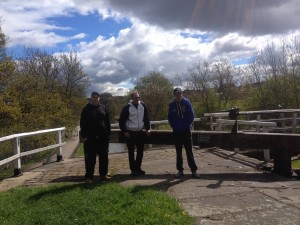
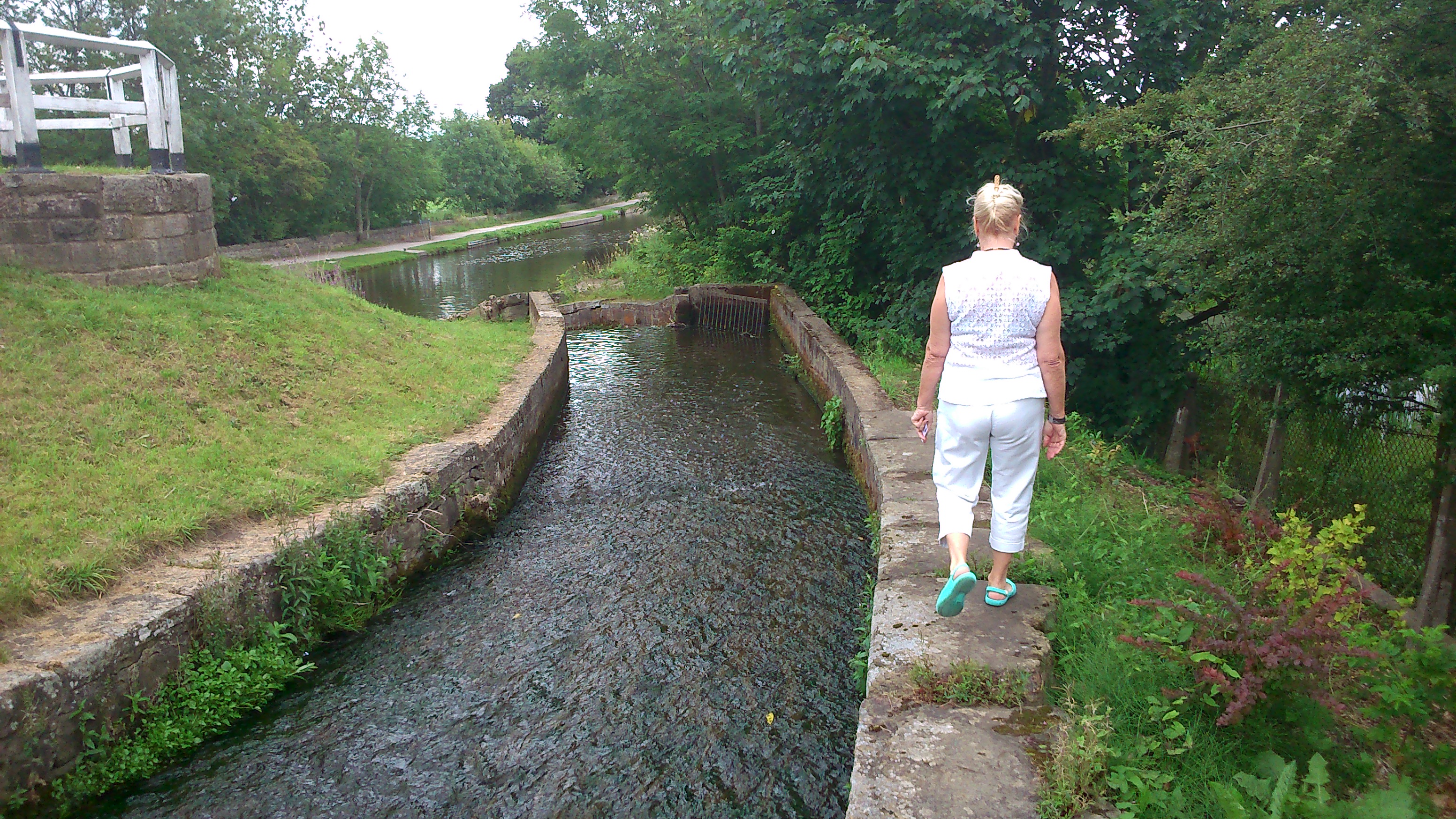
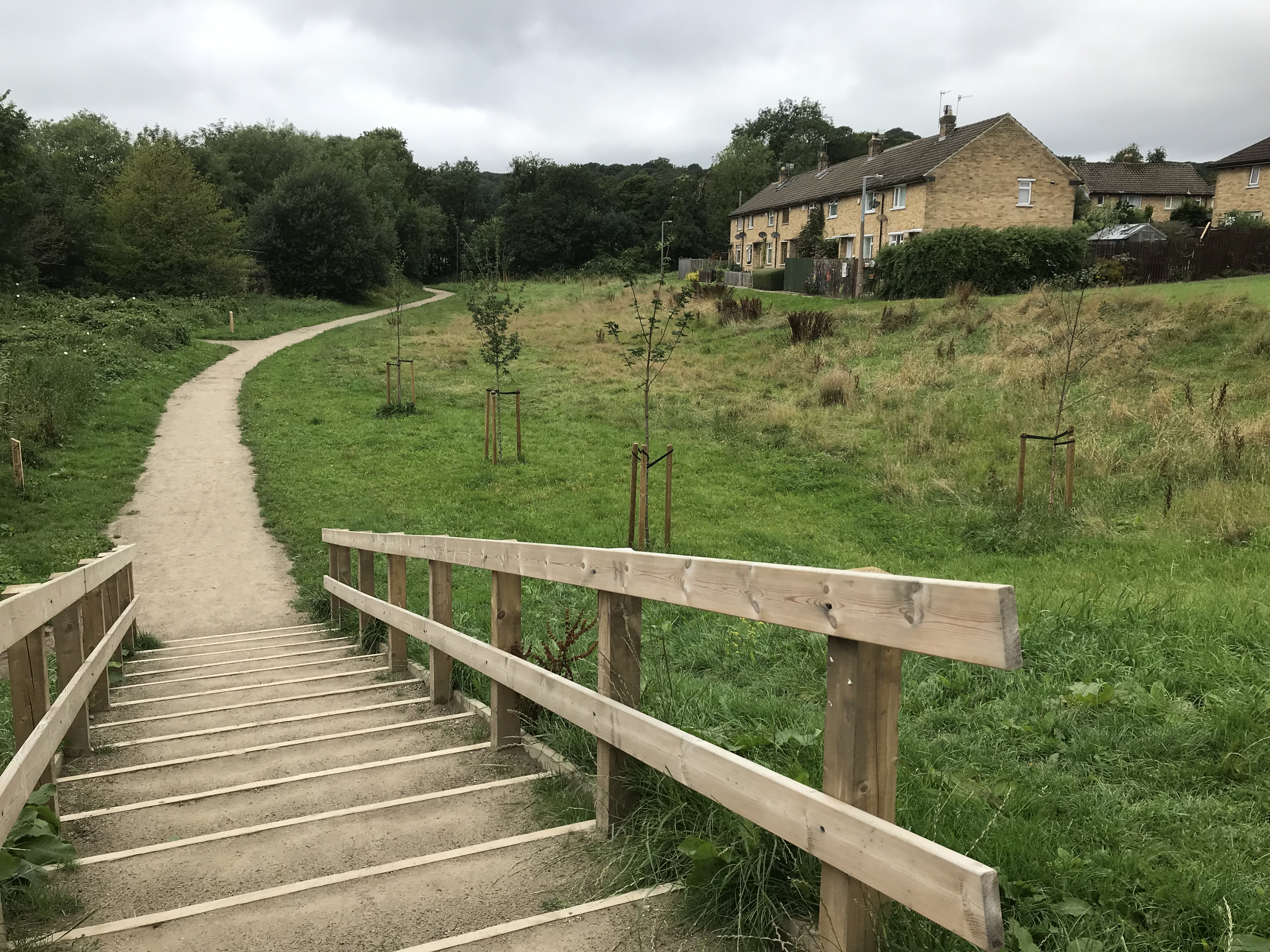
A couple of weeks ago, I visited the Shipley/Saltaire area for the first time in months — and took a walk along the footpath on the left of the picture above, which runs parallel with the River Aire (it’s on the other side of those trees). This is the flood-plain field that separates the river from the Higher Coach Road estate, and my plan that day was to attend the “Great Get Together” organised by the HCR Residents Group. In the end, that got postponed thanks to iffy weather… (see the glowering sky in the picture!) So here’s a shout-out for the rescheduled event, now taking place this coming Saturday…

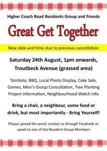
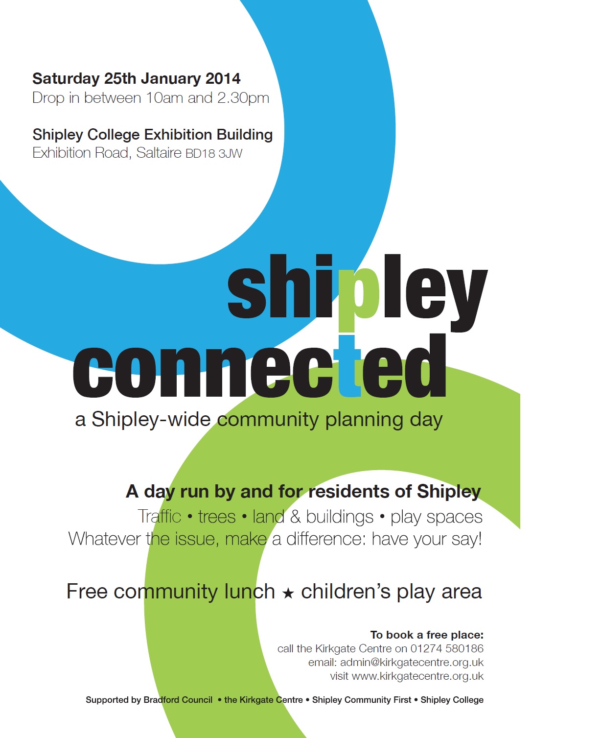
This is one of over 6,000 “get togethers” happening around the country this year, as part of a new tradition established in memory of the murdered MP Jo Cox. The idea is that bringing people together in community and friendship might help overcome some of the divisions that are causing anger and sometimes violence in our society at present…

Actually, that seems to have been a principle of the Higher Coach Road Residents Group ever since it got started in 2015. The residents have many, varied political viewpoints, but they’ve carefully avoided letting those become an obstacle to working together in the interests of everyone in the area. They’ve always found ways to prioritise “getting together” socially, so as to build a sense of community … and then they’ve used that common strength to campaign for improvements to life on the estate. Just look at the wording on the flyer — it’s about being sociable, but then also using that sociability for good effect. And that footpath in the first picture is Exhibit A!

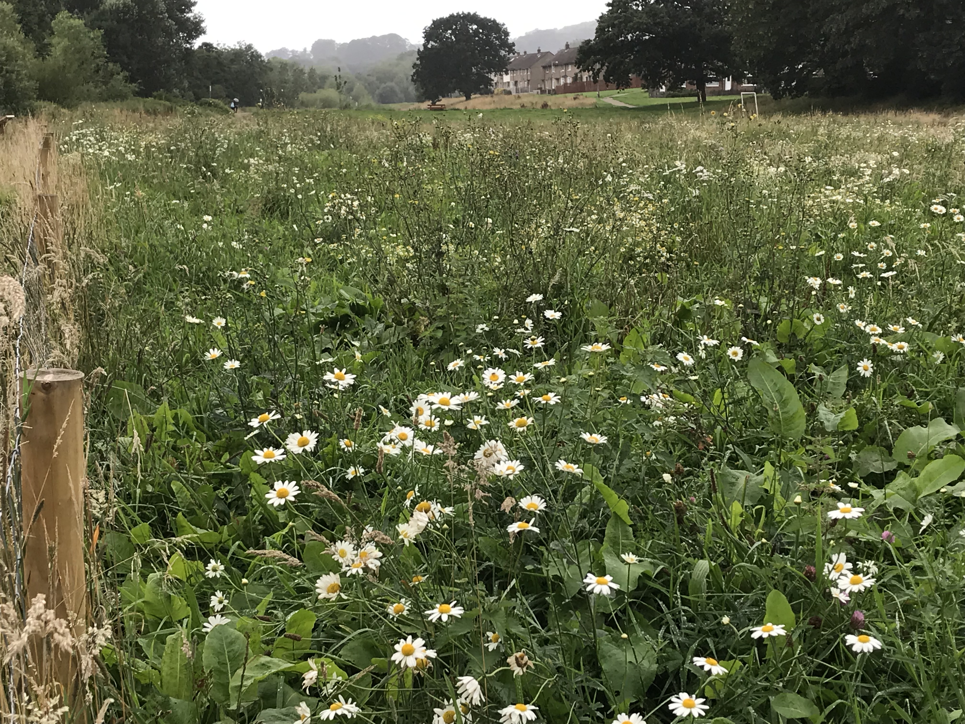
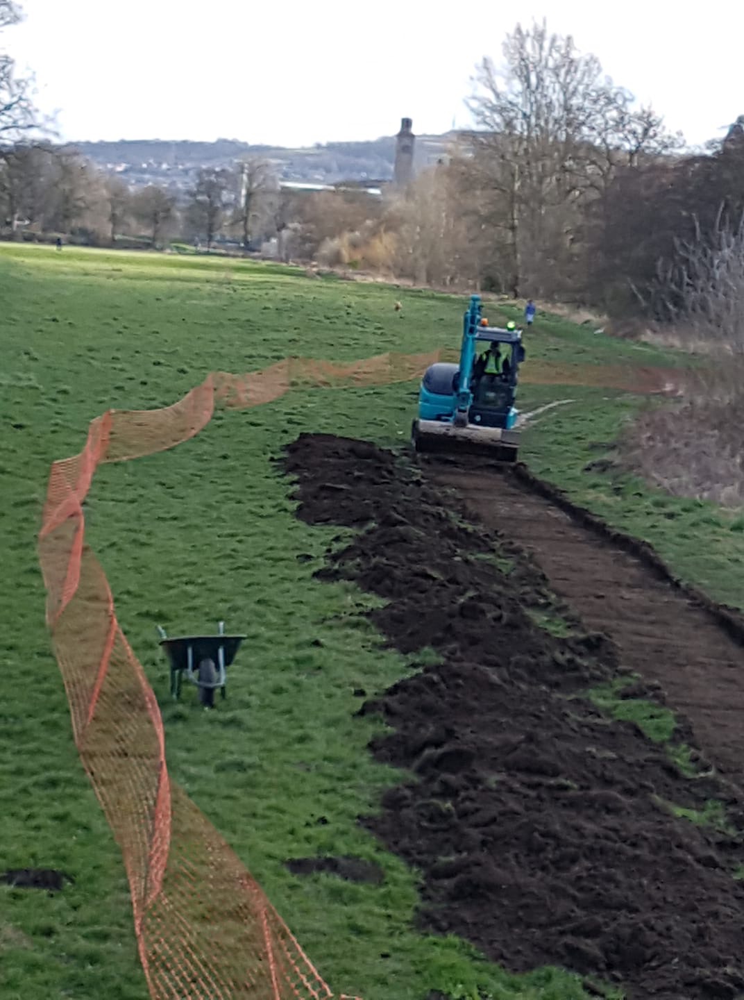
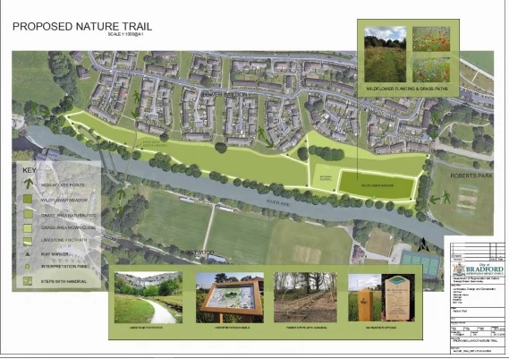
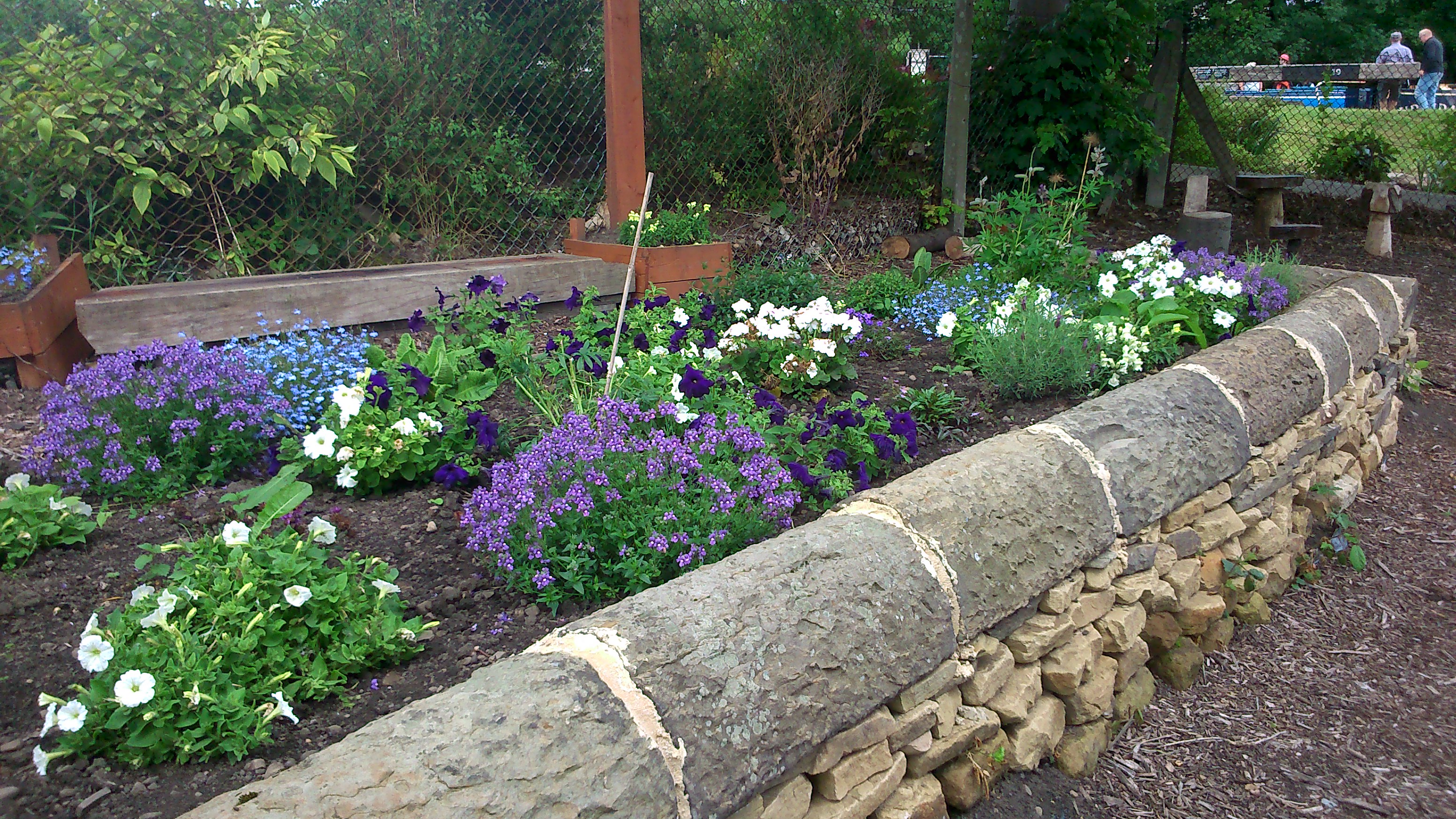
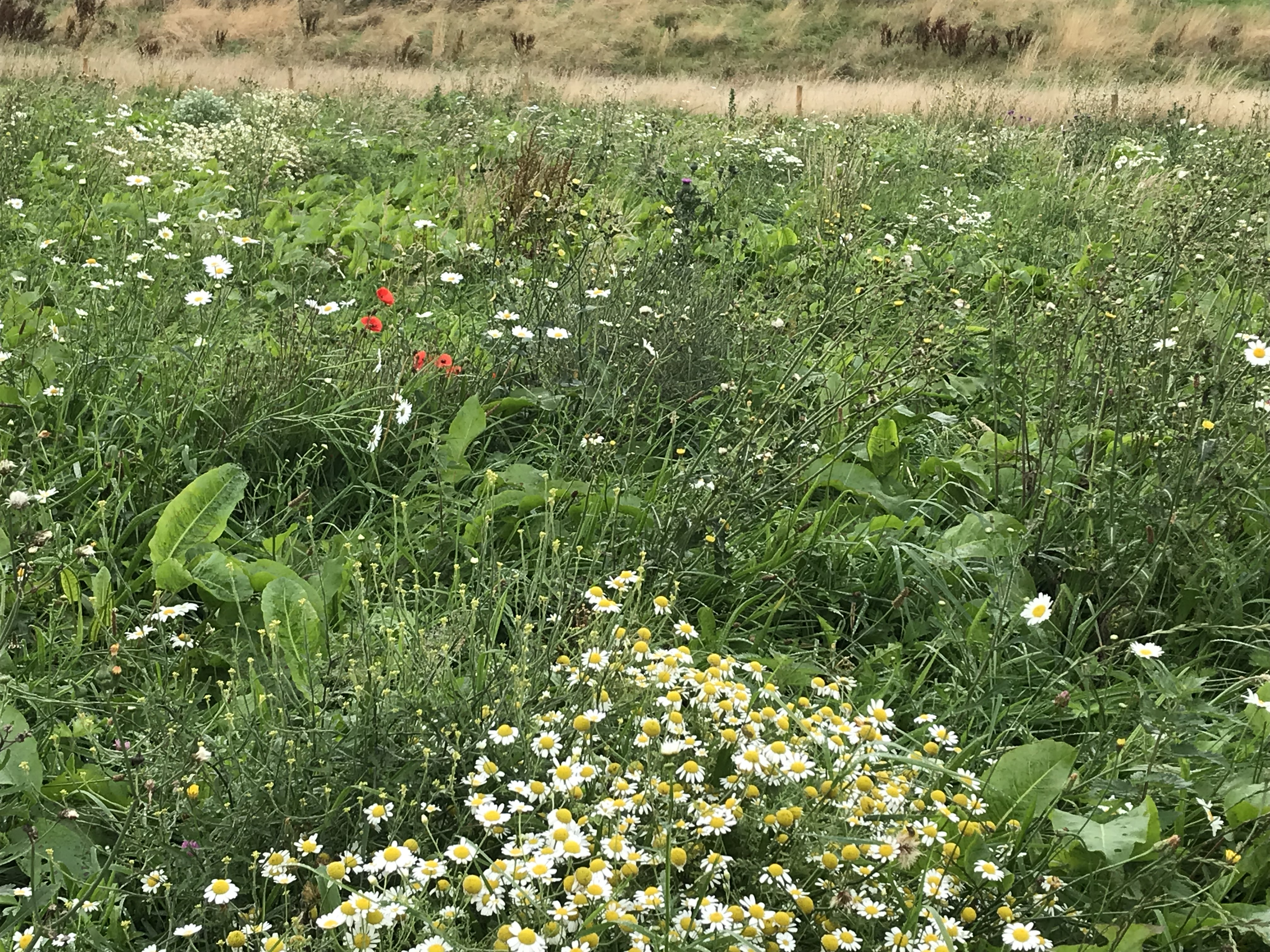
The path may not look like much, at first glance, but until just a few months ago, this riverside walking route was just a track in the grass. It’s now a proper, hardcore path that’s safe and secure in all weathers, thanks to a long campaign by HCR Residents to make it a reality. (I summarised the back-story in this blog post earlier this year, when the path was starting to be installed.) And it’s not just the path… at the end of the estate near Roberts Park there’s also a meadow of wildflowers (pictured above and below), which is another residents’ dream becoming reality. The fenceposts are there to protect this area while it grows in properly, over time, but there’s various colours and species already apparent…

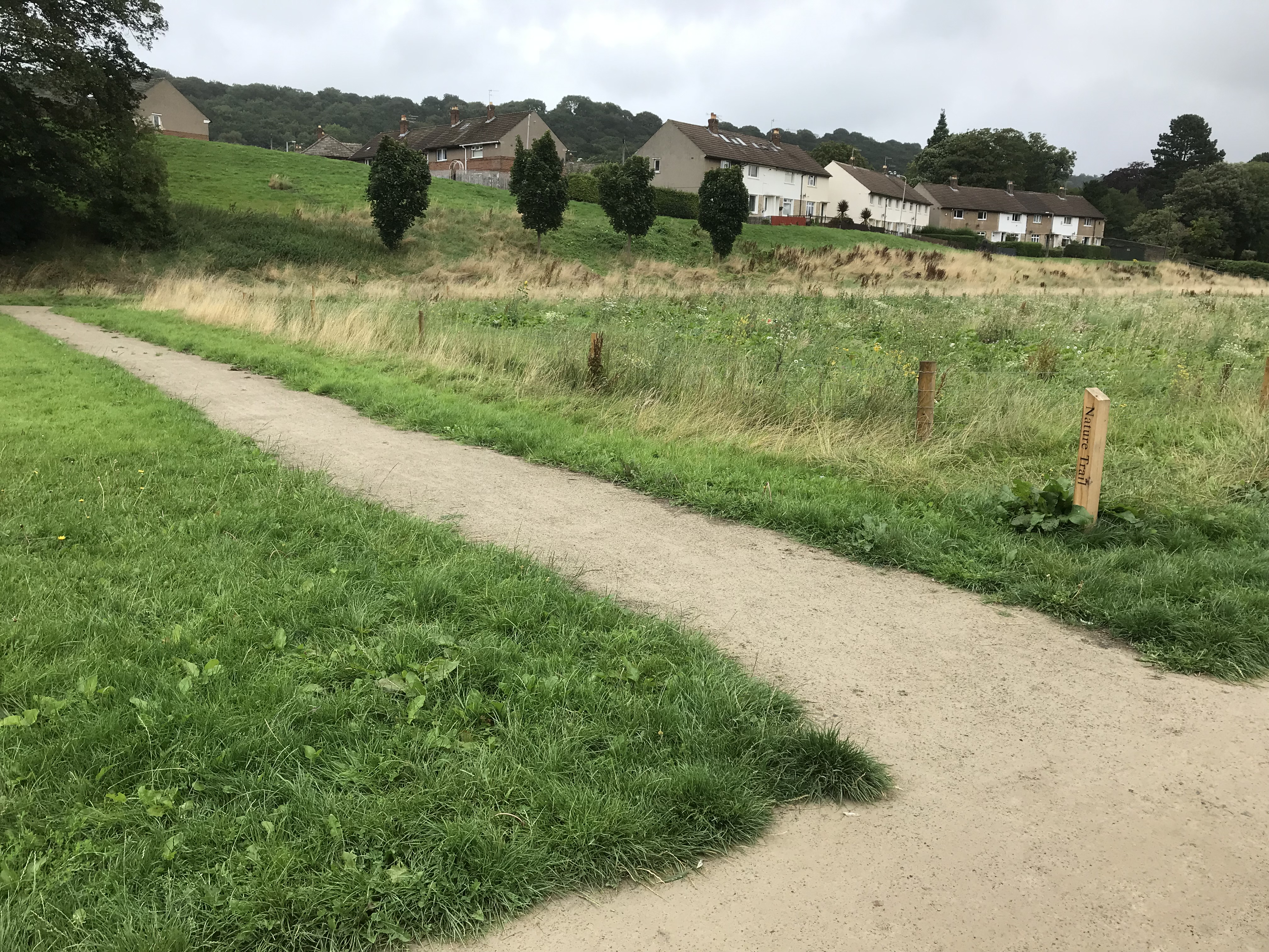
The riverside path even has a side-track that loops all the way around the wildflower area, so that people can walk around and view it from all sides. I hadn’t expected that!

As part of the same set of developments, a series of benches have also been installed along the paths for walkers to rest on and enjoy the view…

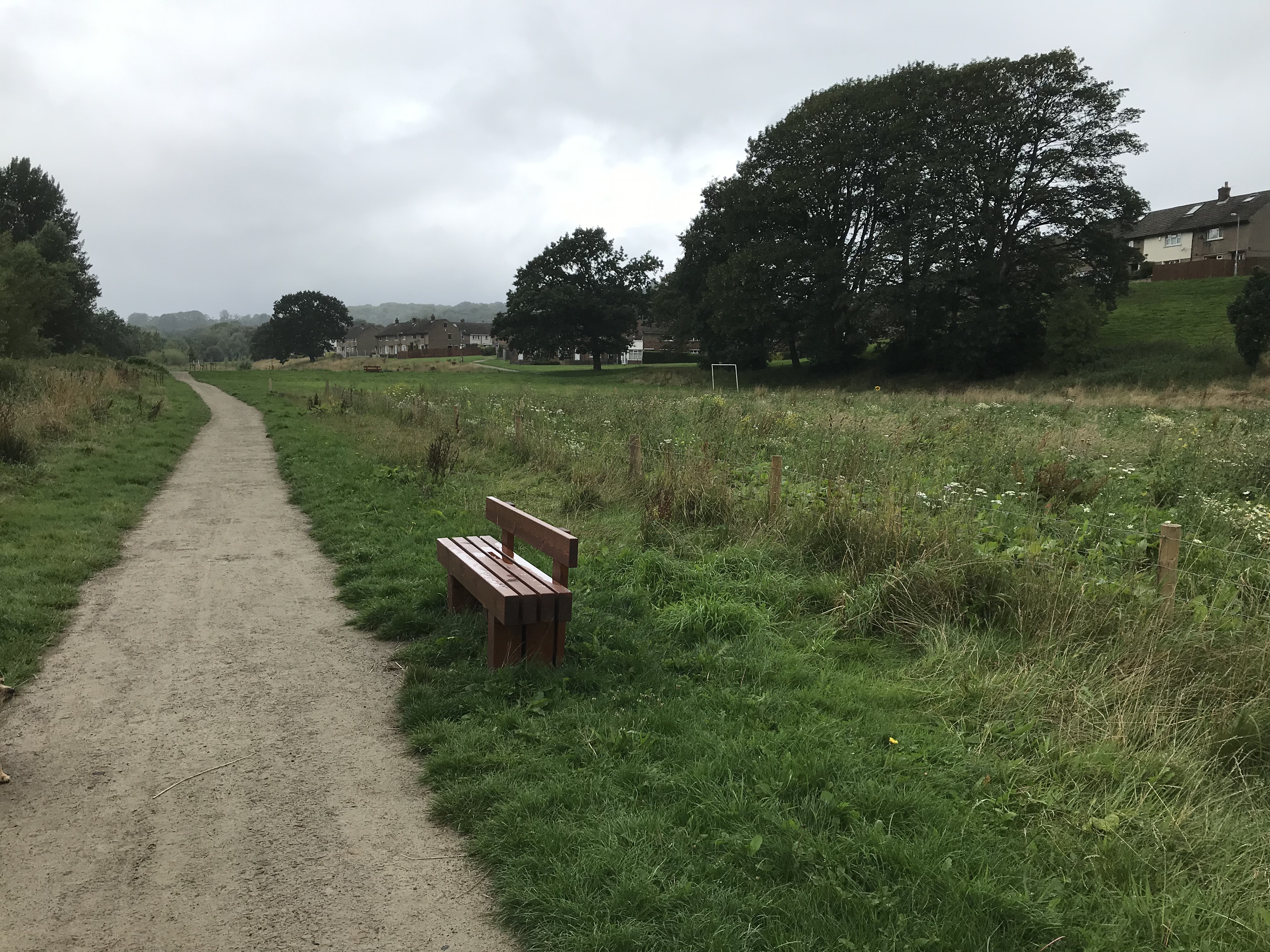
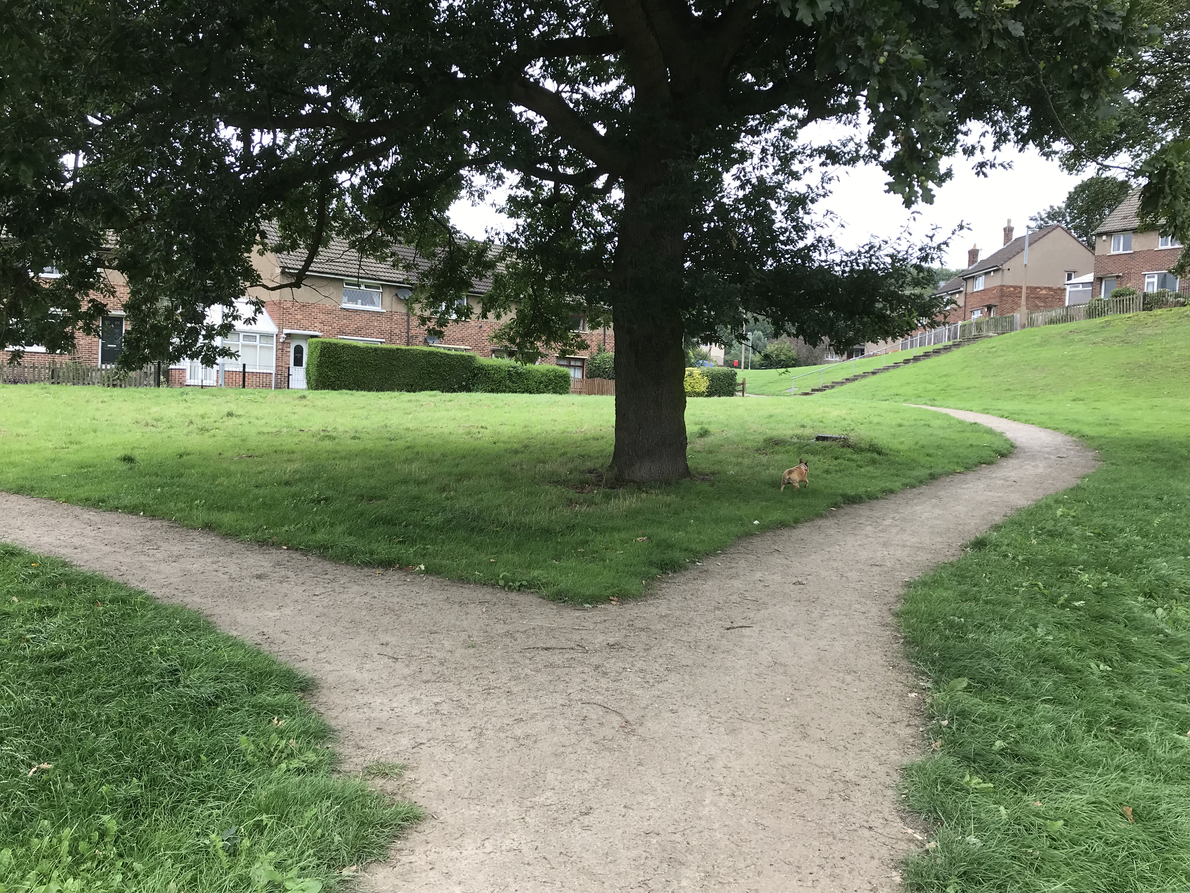
The bench above is beside the main riverside path, and then there’s another one on the side-path that runs north to connect up with the streets of the estate itself… Below is where the path coming away from the river splits in two directions towards Troutbeck Avenue and Windermere Avenue . . . by the tree where HCRRG’s children’s art group often meets.

All of this is a real benefit for residents, particularly those who are older or less physically mobile, who could not safely get down to the field before. These paths now allow full access for everyone. Still, I’d be lying if I claimed that everyone is now completely happy with the field… For several years now, it’s been a sore point with many residents that Bradford Council’s park service has refused to mow the main part of the field regularly, during the summer months (citing austerity cuts). This still seems to be an issue, despite the other improvements, and here’s the result…

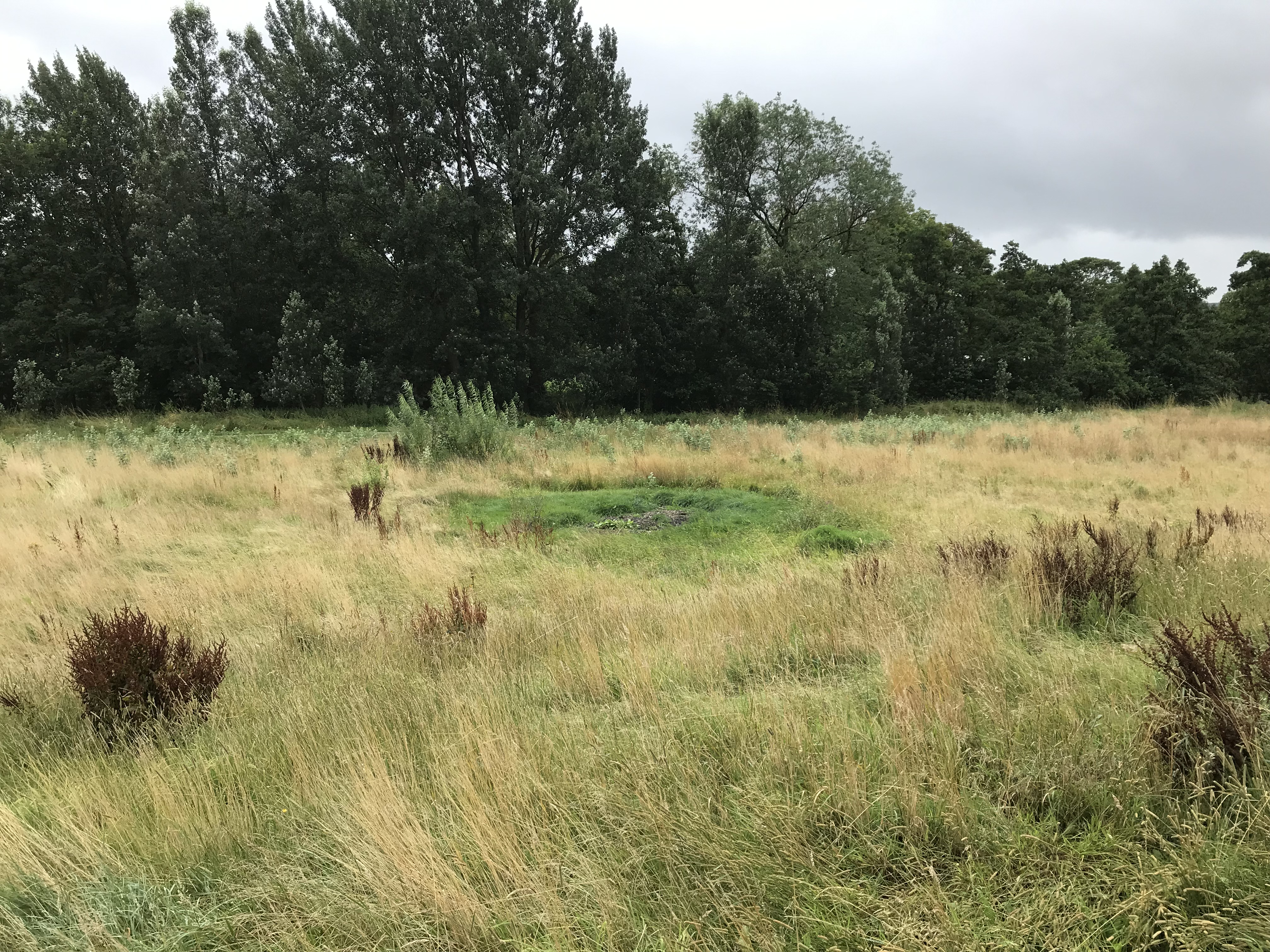
Obviously, unlike the planned wildflower section, this is just a bit of a scrubby mess… although birds and insects love it, for sure. The long grass really limits what people can do on the field, although it hasn’t stopped them completely! That shorter-grassed area in the middle of the picture above shows the spot where residents’ bonfires sometimes happen. The spirit of unofficial improvisation with the field has always been an aspect of life on the estate, and hopefully the new improvements won’t change that!

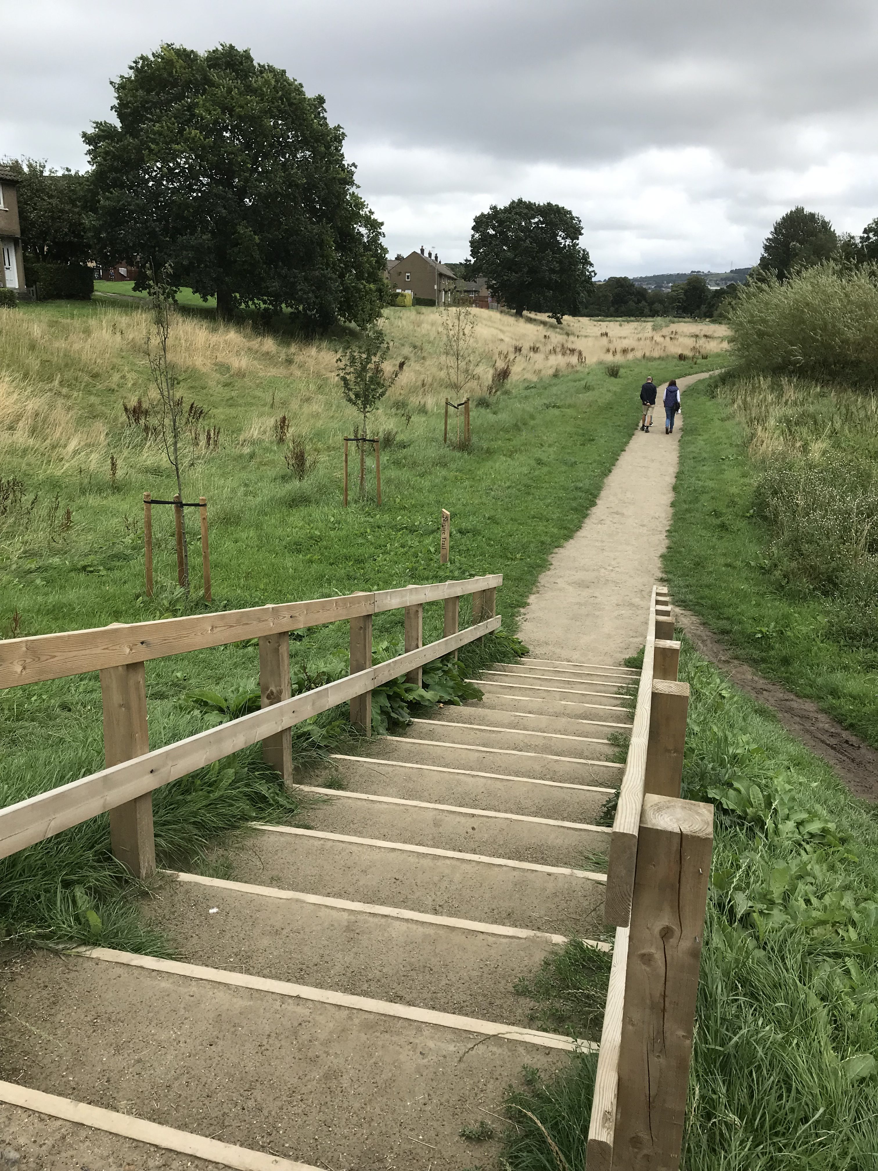
In the picture above, you’re looking east towards Saltaire, with the river the left… The long grass in the field doesn’t look quite so bad from this angle. And these new steps, which were also installed as part of the path scheme, allow safe access up the banking that leads to the footbridge over the river. In the past, climbing up this grassy slope could be pretty treacherous in wet weather – but not now!

Now turn yourself through 180 degrees, and you’re looking west towards Bingley. Here’s the steps back down from the footbridge banking…

… notice the newly planted trees in this picture (and the one above it), again all part of the landscaping improvements. And also, notice the side path going off the left in this picture, a little way down. This leads walkers to a short tunnel underneath the Barden aqueduct (which we once turned into an impromptu cinema!), and then along a short bit of (new) path right next to the river…

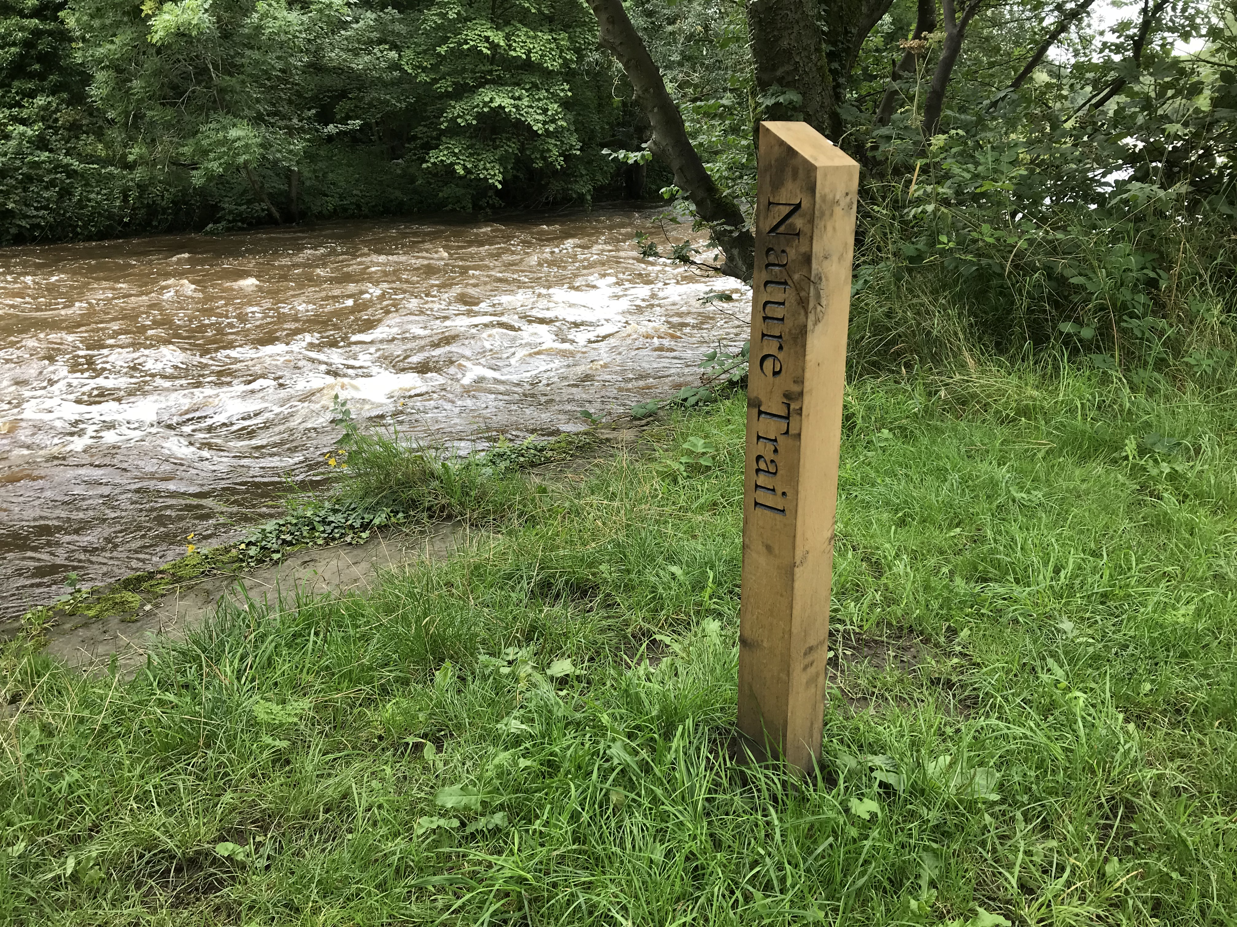
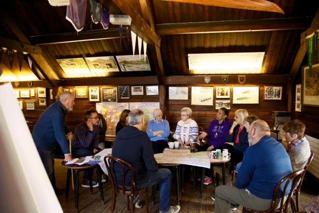
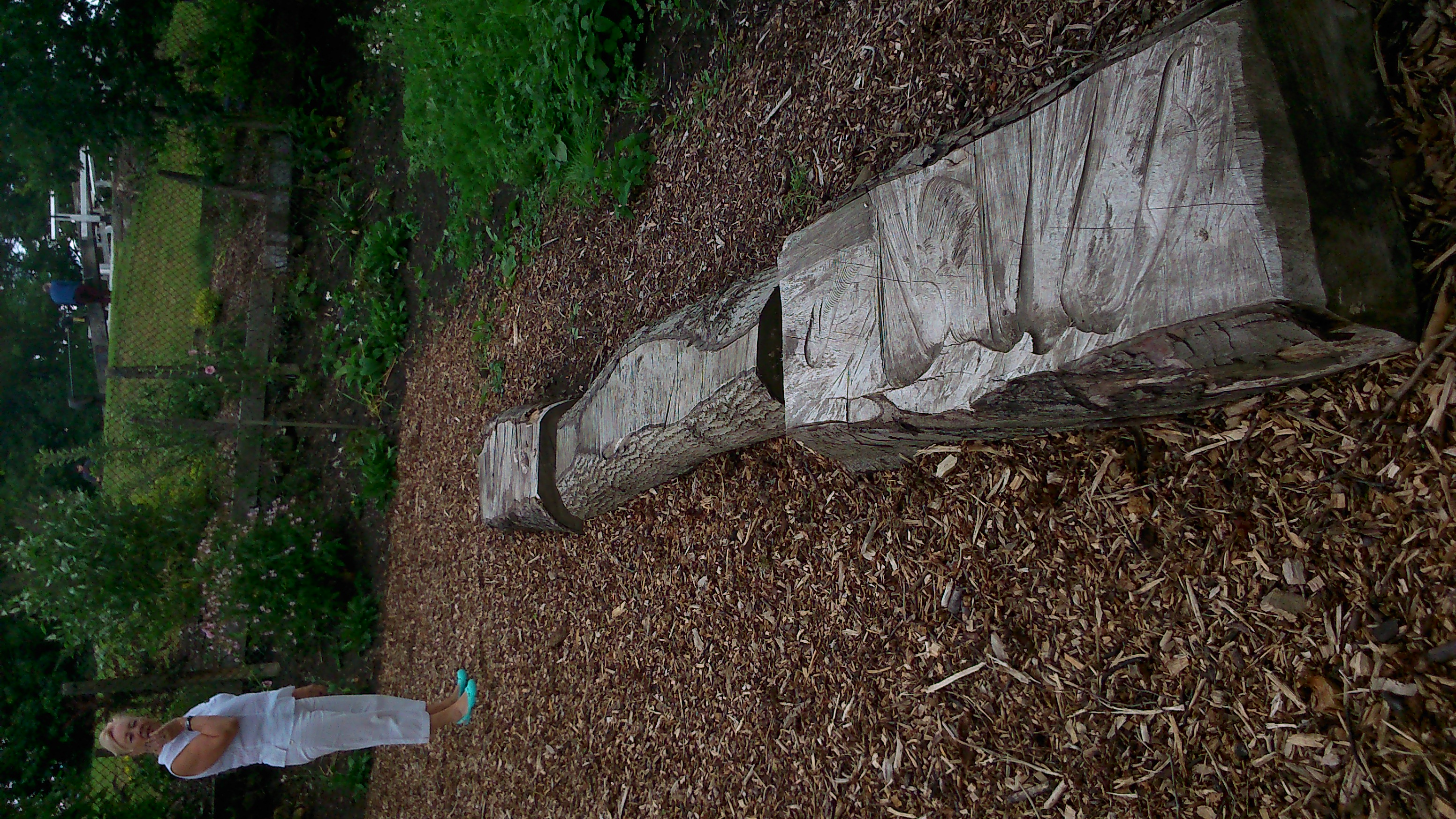
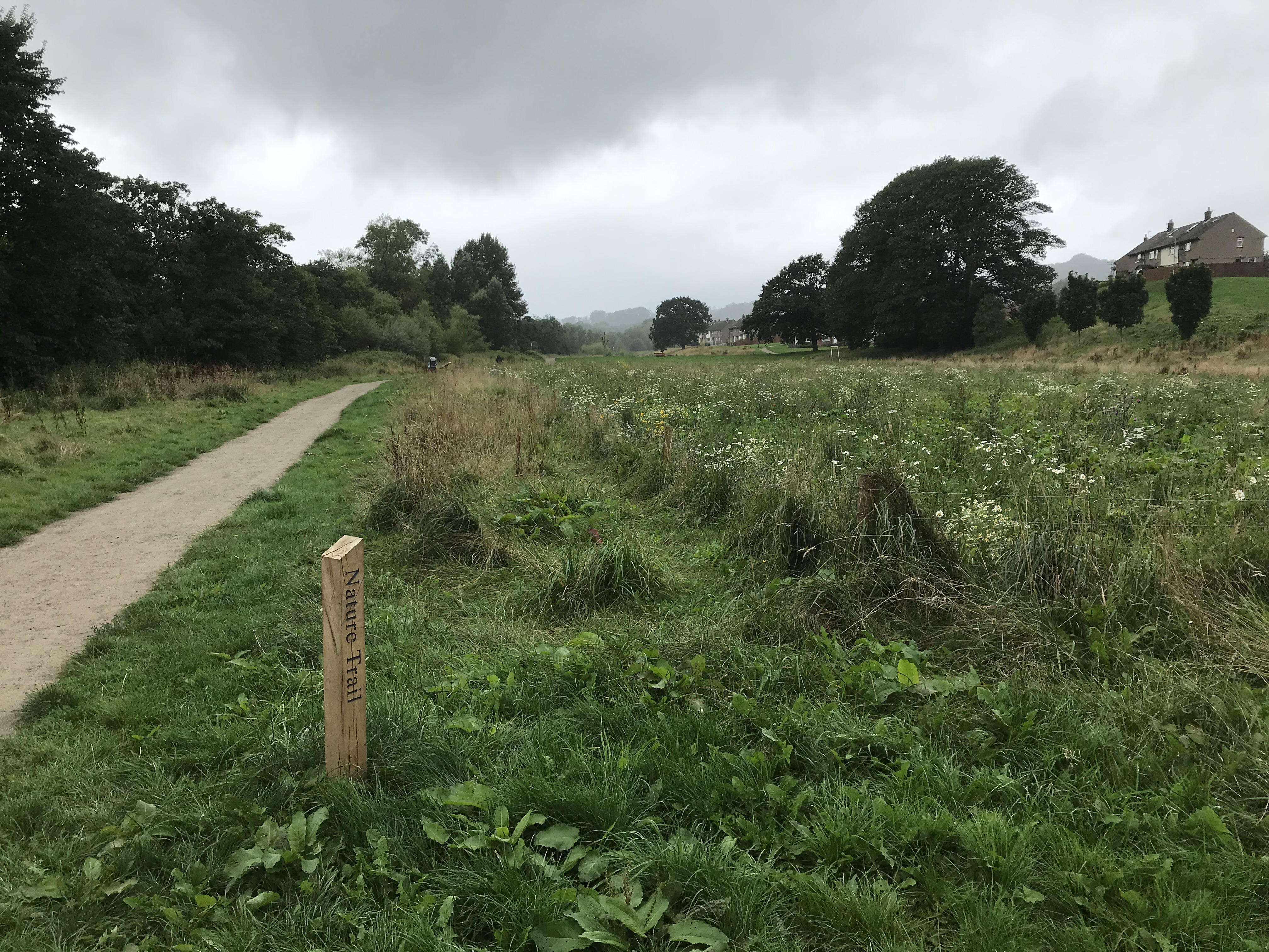
Here, there’s one of several wooden posts that have been staked out along the new path, marked “Nature Trail.” These show where the permanent version will be, of a temporary nature trail that was marked out as one of the first statements of intent by the new residents’ group in 2015. As yet, these new posts don’t yet have interpretation boards mounted on them, but these will presumably follow. I’m sure the group is working on composing these! (Maybe they’ll be discussed at the Great Get Together.)

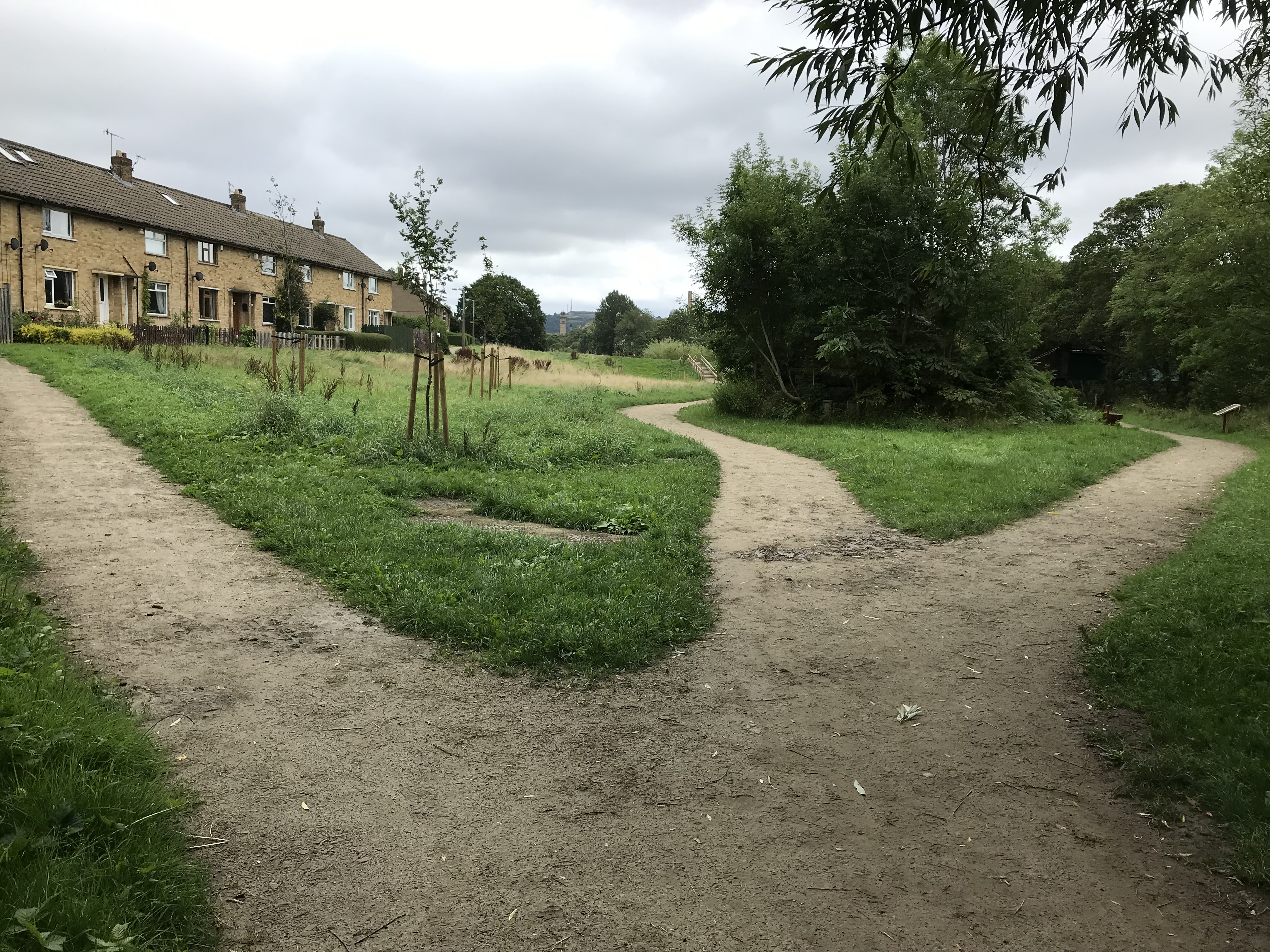
Here’s the view from the far end of the estate, looking back towards the east. Here, three paths come together — again, none of them existed properly until earlier this year! To the left, there’s a path up towards the homes on Bowland Avenue and the nearby flats… down the middle, the main path towards the footbridge… to the right, the shorter path taking you closer to the river and under the acqueduct. There’s more new tree-planting in this picture —  which, by the way, is also something of a flood mitigation measure (provided that enough new planting also happens in other places).

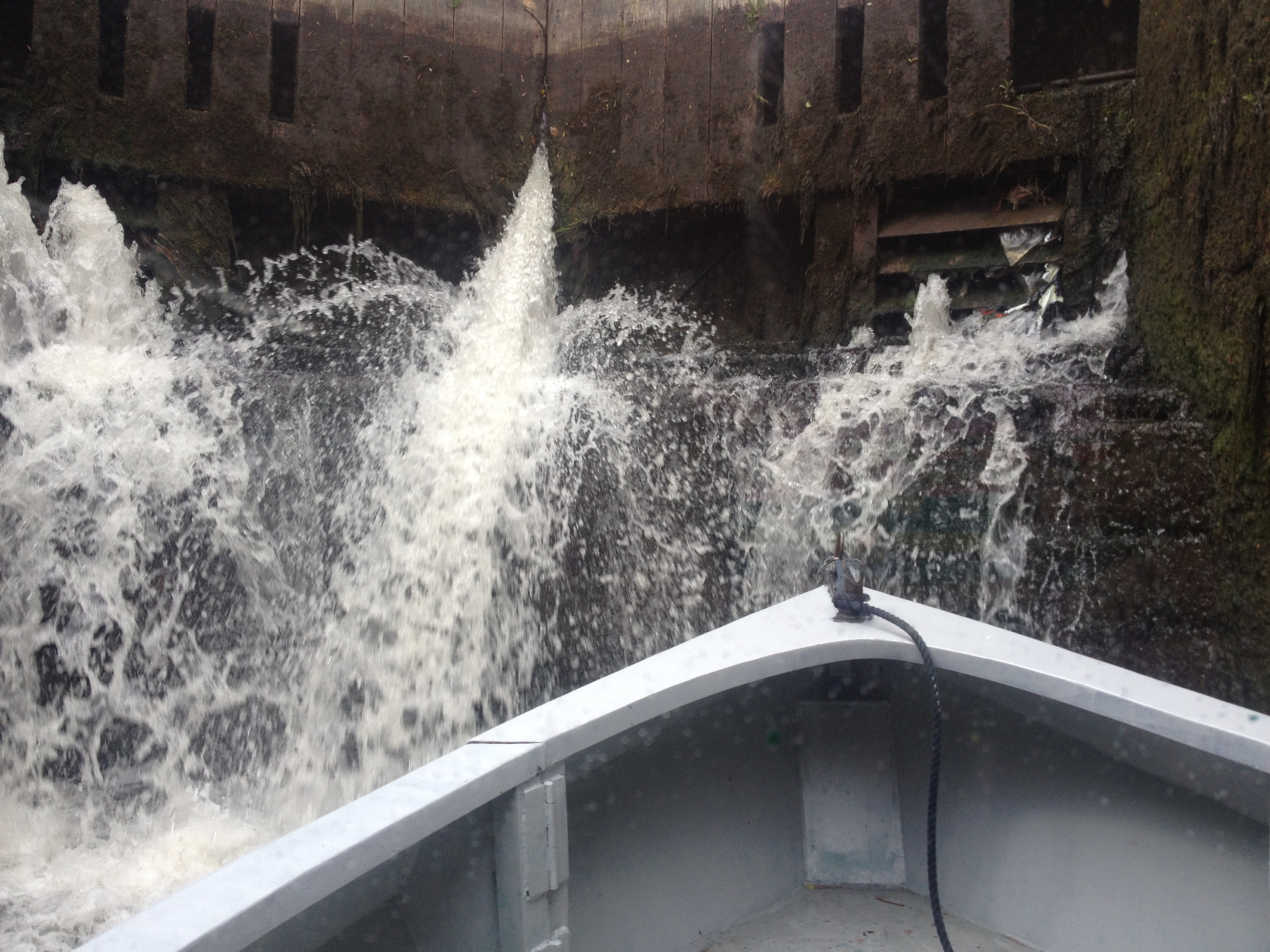
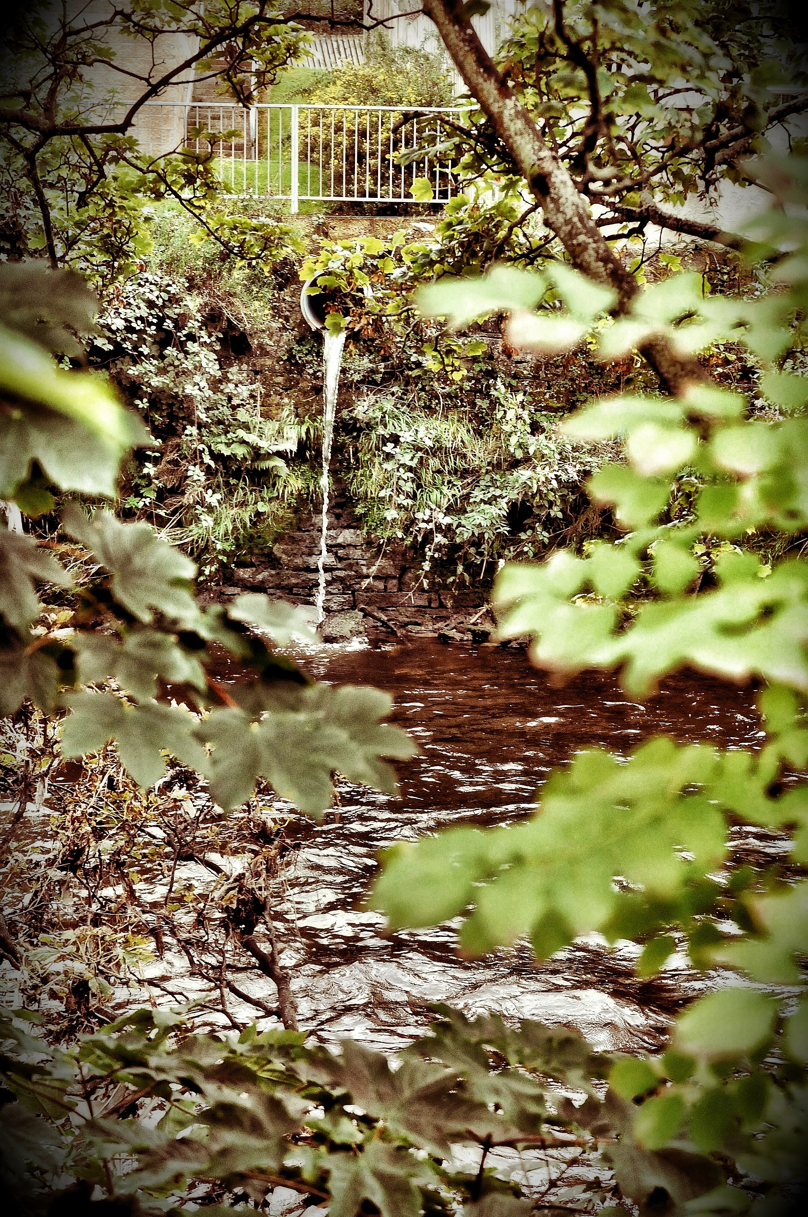
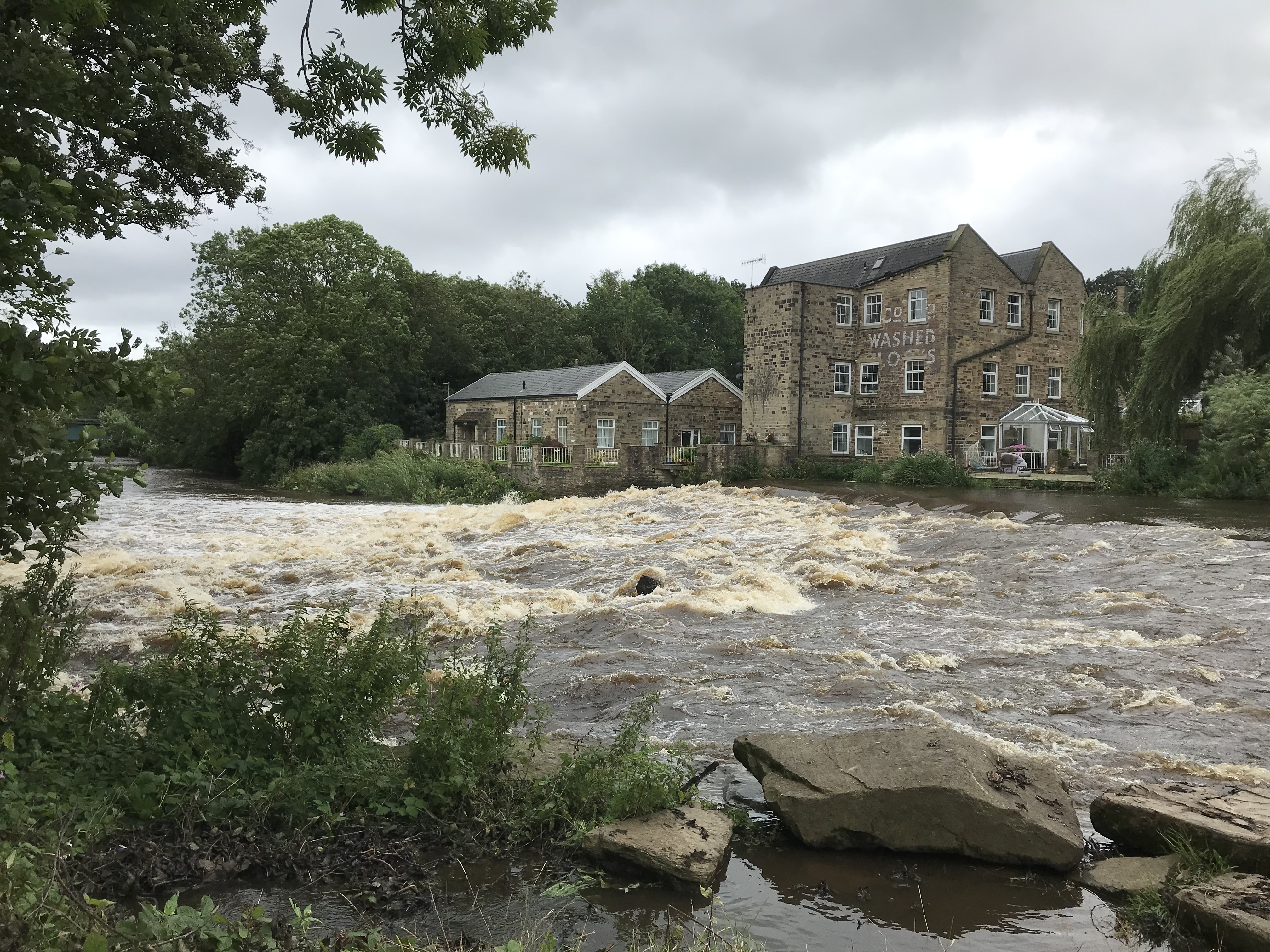
And finally, here is the River Aire itself, viewed from just a few yards further upstream, near the Rowing Club. The weir was looking pretty stormy that day, after a lot of rain.

So… many congratulations, again, to the Higher Coach Road Residents Group and Friends, on achieving these important and attractive improvements to the riverside landscape! Enjoy your Get Together this Saturday, and keep up the great work!

Dreams coming true at Higher Coach Road!

It was very, very exciting to see this happening this week, along the riverbank, on the ‘bottom field’ of the Higher Coach Road estate… (Thanks to Vicky, of HCR Residents’ Group, from whom I’ve stolen this picture… I like the way it takes in Salts’ Mill in the background … the river is unseen to the right, of course.)

Now, the sight of a digger ploughing up grass may not seem very exciting to some, but this work marks the beginnings of a proper, permanent footpath that’s being laid along the riverbank. For as long as anyone can remember, people have been walking along this way anyway – often  with their dogs – because to get from Roberts Park (to the west) to the Bradford Rowing Club and Hirst Wood (to the east) you have to walk along here. But it’s only ever been grass, or an unofficial muddy track, which gets very boggy and muddy in wet weather. It can get very difficult, in particular, for older or less able-bodied people to use. There’s also the incline up from the field level to the raised footbridge area, which is really treacherous when it’s at all wet.

Now, with a proper path going in, those problems should be taken care of. And don’t worry, it’s not going to be nasty tarmac — but a permeable pebble path, like they have along past the rowing club. So it’ll blend in nicely with the natural surroundings, and won’t add any further to flood risk…

The reason I’m especially excited about this finally happening, is that this riverbank path is really the dream that got Higher Coach Road Residents’ Group started in the first place. The history is documented on this blog site, in fact… starting with

1. this post from April 2015 – almost four years ago now – which discusses Troutbeck Avenue resident Stewart‘s dream of a proper path along the riverbank. That post helped advertise and invite other residents to …

2. … the very first meeting of what was later to become the Higher Coach Residents’ Group… That meeting, hosted at the Rowing Club, is described briefly in this post from later that month (after you scroll down past some stuff about the Dockfield). I did not include residents’ names or pictures in that post because it didn’t feel right to be too public with discussions at that early stage. But a picture of those present — pasted in below — later became the cover photo for this Facebook group – for “Higher Coach Road River Link” – which was set up to attract the attention of other residents…

The “River Link” campaign was so-called because Stewart’s footpath was one of the two key, galvanising ideas that excited residents at that first meeting … The second key idea was from another resident, Pat, for a wildflower meadow, to make something more attractive of the long, unkempt grass on the bottom field. And very excitingly, this too is going to happen now! 

3. Here’s yet another post – from June 2015 which discusses how the first public action of the new residents’ group was to combine the two ideas (path and wildflowers) by planting some wildflower plugs along the riverbank path. This was just a modest gesture — a statement of future intent, if you like. But, according to the plans now published by Baildon Town Council, there is soon going to be a wildflower meadow on the part of the field closest to Roberts Park…

Notice how the meadow area will be just next to the football pitch area, which — for those with shorter memories — was established in the spring of 2016, also thanks to campaigning by HCR residents (see this blog post). But we’re getting ahead of the story…

4. If you check out this post from August 2015 you’ll see how the idea for a “Nature Trail” along the riverbank path — now the “headline” element of the scheme supported by Baildon Town Council — also originated with Stewart. He literally made a nature trail of his own with fence posts and home-made notices, and planted them along the riverbank path — partly as a means to attract passers-by to the new “River Link” group. (The posts that didn’t get pulled out by teenagers-with-nothing-better-to-do eventually got swept away in the Boxing Day flood, but that was OK, they’d served a purpose…)

5. By the autumn of 2015, the River Link group had morphed into Higher Coach Road Residents Group. The new name recognised, quite rightly, that the group should have the widest possible remit, to look out for all the interests of HCR residents, and not be limited to a single campaign objective. A first, formally-constituted meeting of the group was held in November at St. Hugh’s Church, lower down Coach Road, to which local councillors and others were invited. Although I never got round to blogging about that meeting (it was a very busy autumn), I did take this photograph that day…

Here’s Stewart, Pat and Pam, the three residents who had had the bravery to put themselves forward as Chair, Treasurer and Secretary (not necessarily in that order…?). Those roles have of course been taken up by others since. You know who you are… I can’t name everyone who helped to get the ball rolling with HCRRG, but it would be remiss not to give special credit to Ruth for setting up the still-very-active Facebook group for Higher Coach Road Residents Group and Friends.

So, what’s the point of all this…? Well, I guess the moral of this story is as follows…

Sometimes, when you want to involve other people in something, you might need a bold vision to catch their imagination. Maybe it’s a personal dream that seems a bit impossible, like a footpath along the length of your whole estate… And for sure, both the footpath dream and the wildflower meadow dream seemed for a time like they might never happen, because they were “too ambitious”. But these were the ideas that brought people together to begin with. And HCR Residents Group has achieved so much else in the 3+ years since it was formally established, that it almost wouldn’t matter if the footpath and meadow never happened… But they are happening!!

And so we can proudly declare that sometimes dreams can come true (as the song goes). And yes, it’s also the case that sometimes, if things seem almost too good to be true, then it turns out that they are too good to be true… And then people have to fight for what they’ve already been promised… But if that was to happen in this case (and I’m not at all saying it will) then I know that HCRRG now has the momentum and energy and also the political “nouse” to stand its ground and fight. (In the words of the boat-race slogan: “Go HCR Dragons!“)

OK, enough from me.

Pasted in below is the official press release statement about exactly what is supposed to happen on the estate… (many thanks to Councillor Vick Jenkins for sharing this)

Bradford Council and local community groups have been working together to develop the Higher Coach Road Nature Trail and Wildflower Meadow.

The Higher Coach Road Residents Group and Bradford Council’s Landscape Design and Conservation Team have secured the support of Pocket Parks Plus, Local Transport Plan and Baildon Town Council funding to improve walking facilities and neighbourhood connectivity by forming links between homes, local shops, open spaces, public transport and schools. 

The project will transform an area rough mown grass land that is already a well-used and loved stretch of land which takes in wonderful views along the River Aire.

A wildflower meadow will be created to increase biodiversity, along with interpretation to provide education on both wildflowers and the rich wildlife of the area.

Linking footpaths constructed from natural materials will improve access for the local community, along with timber steps and handrails on the riverside embankments adjacent to an existing foot bridge near Hirst Mill. The footpaths will run all the way through to Roberts Park.

Timber seating will be located near the footpaths to encourage people to stop and enjoy the space.

New way markers will be installed along with interpretation displays looking out towards the river, which will include information on wildlife and fauna. 

Additional native tree species will be planted.

The scheme will not only benefit the community, but the many visitors to the area, who come to enjoy the UNESCO World Heritage Site at Saltaire

The aim of the Higher Coach Road Residents Group is to look after and enhance the environment, encourage residents to be more active, promote social activities for recreation, promote a community spirit and sense of responsibility, and work with young people. The project will offer opportunities for volunteer groups and residents to be involved in wildflower seed sowing and plug planting that will be organised as planting season approaches in Spring time.

Notes:

Pocket Parks Plus is an initiative of the Ministry of Housing, Communities and Local Government, supporting parks and public spaces where people can relax, exercise, socialise and play.

Local Transport Plan funding comes from the West Yorkshire Combined Authority.


And so, the end is near…

This Saturday evening, we have a retrospective event for the Multi-Story Water project at Kirkgate Centre in Shipley. The funded period for the project officially ends this month, and although I’m sure it will have various kinds of after-life (not least this blog, which I expect to continue updating from time to time), we are presenting an exhibition to mark this end point.

For the launch evening on Saturday, we’ll also be remounting two well-received live performances — Too Much of Water and Salt’s Waters — and screening selected short films. We do hope you can join us. Please do RSVP Ruth if you’d like to come, so we can estimate numbers. (Like everything we do, it’s free of charge.)

Just Say “No” to the proposed Milner Farm development

[note: this piece was originally posted on 5th May, but for technical reasons has had to be removed and reposted. The text remains as was.]

Ten days from now — on May 15th, from 10am — the Regulatory and Appeals Committee of Bradford Council will hold a public hearing to discuss proposals for an “Innovation Centre” to be built on the footprint of the existing farm buildings of Milner Farm, Bingley. We are all invited to turn up and register our views on the planning application, whether pro- or con.

Here is a short, musical message for the Committee’s consideration, recorded the other weekend at the Higher Coach Road Residents’ Group’s “1950s picnic”, for Saltaire’s World Heritage Weekend:

The words to the song, in case you can’t make them out from the video, run as follows:

“Welcome to our Airedale home / We’re glad to see you all here,

We’ll go and put the kettle on / If you’ll just sit yersen in a chair

There’s allus a welcome around, IF / You leave the place as you found it

Cos we’ll not stand no muckin’ around with / Our ‘andsome Airedale ‘ome.”

And then there’s a verse, newly composed, which you can make out for yourself…

“Welcome to Our Airedale Home” was written by singer-songwriter Eddie Lawler, “the bard of Saltaire” (seen here on the far left of the frame) way back in the 1970s, as a contribution to the road protest movement against plans to drive a dual carriageway straight down the Aire valley. That plan, which would have been disastrous for the local environment, was fought off by concerted community activism (and some famous fisticuffs at Shipley Town Hall). Eddie dusted the song off this year in the hopes that this latest plan to mess with the greenbelt could also be sent packing…

The Higher Coach Road Residents Group is one of a number of local groups (including the single-interest Milnerfield Action Group) that have consistently opposed the redevelopment plans. Milner Farm lies directly to the west of the HCR estate, past Bradford Rowing Club. The farm’s fields come down a gently sloping hillside, and stop close to the banks of both the River Aire and the Leeds-Liverpool Canal (which cross over each other at the Seven Arches aqueduct).

This farmland, and the woodland to the north which contains the ruined remnants of Titus Salt Junior’s country mansion, Milner Field House, was once all owned by the Salt family. Today, it belongs to the Hartley Property Trust, which has entered into a consortium with partners including Bradford University, to propose a development that it claims will be a “beacon of excellence” for Bradford.

The public, however, is overwhelmingly underwhelmed by these claims. An online consultation which closed a couple of weeks ago attracted a grand total of 1355 statements of opposition to the plans, and only 6 in favour (a truly pitiful total by any standards – do the developers have no friends at all??). And just today, a statement released by Bradford’s Planning Officer indicates that the official recommendation to the councillors on the Committee will also be one of opposition — on the basis of harm to the greenbelt. The statement is as follows:

The committee is asked to consider a planning application, ref. 15/05538/MAF to develop an Innovation Centre (sui generis use) on the site of Milner Field Farm, Gilstead, involving the demolition of certain existing farm buildings, refurbishment and change of use of other existing farm buildings and construction of new innovation centre buildings, the formation of a new car park and the undertaking of ancillary landscaping, drainage and access works and landscaping works to the wider farmland to provide for enhanced public access, including to the remains of Milner Field House, and ecological enhancement. The application is an EIA application, within the meaning of the Environmental Impact Assessment Regulations and is accompanied by an Environmental Statement.

The proposed development is inappropriate development within the Green Belt. Although the development would be likely to result in significant economic benefits, and additionally some public and biodiversity benefits associated with proposed woodland planting and increasing public access to the site, including to the remains of Milner Field House, it is considered that these benefits do not clearly outweigh the harm the development would cause to the Green Belt.

The development would also cause other harm, in terms of substantial harm to the Saltaire World Heritage Site and erosion of its Outstanding Universal Value, harm to the historic landscape associated with Milner Field House, harm to the particular character of the local wooded incline landscape, potential harm to the integrity of the adjacent Trench Meadows SSSI and harm through a reduction in road safety at the canal bridge on Primrose Lane. When these other forms of harm are considered in combination with the harm the development would cause to the Green Belt it is considered that the benefits of the development/ other considerations put forward by the applicant clearly do not outweigh this cumulative harm.

Let’s hope the councillors feel inclined to listen to their officers and to the public.

Do no harm.


River stewardship at Higher Coach Road

One of the things I was going to blog about before our site got hacked recently (all sorted now) was the events of Saturday 8th April, along the riverside near the Higher Coach Road estate (west of Roberts Park). Our friends from the Higher Coach Residents Group joined with an initiative led by the Aire Rivers Trust to help clean up and look after their stretch of the Aire.

Here’s Stewart Gledhill, who recently stepped down as Chair of the Residents Group, kitted out in hi-viz provided by the specialists from the River Stewardship Company. The RSC (no relation of the Royal Shakespeare Company…) are a Sheffield-based social enterprise specialising in river maintenance, brought in by the ART to help with work on the Aire. (You can find out more about the RSC in our film from 2013, City of Rivers, under the ‘films’ tab on this site.) These people really know what they’re doing, but they rely on local volunteers to get it done. Hence the importance of goodwill and community spirit…

Here’s one of the RSC staff identifying where volunteers need to get stuck in. Between 30 and 40 volunteers turned out during the course of the morning to help — a really good turnout from the RSC’s point of view. So well done HCRRG for getting word out, and also other local groups like the Friends of Bradfords’ Becks…

Here’s some kit being prepared by another RSC person, at the bottom of Bowland Avenue. The house in the background, complete with childrens’ art work on the fence, belongs to HCRRG stalwart Ruth Bartlett, who also took these pictures. (Thanks Ruth!)

And so people got stuck in along the riverbank, with gloves, litter-pickers and rubbish bags… And of course, because some of the debris being targeted was hanging in riverside trees (still there since the flood of Boxing Day 2015!), the RSC also needed to crack out the dinghies so that people could access the trees safely from the water. Looks like this was quite an adventure for at least one young member of the community!

Ruth kindly shared with me some bits of video of the work with boats — shot from the footbridge over the river. Not much is happening in this first one, to be honest, but I really like the general atmosphere — the sunshine, the birdsong, the sense of endeavour… and Ruth’s voice in the background, trying to decide what’s going on. 🙂

This second clip shows volunteers pulling a big rug or section of carpet out of the river… presumably either more flood debris, or something that some unhelpful person has simply fly-tipped. With all the water in it, it was incredibly heavy to move, although Stewart quipped that there was probably a body in there too. Some black humour on a sunny day…

Anyway, well done to everyone who turned out and pitched in. You picked a great day for it! Really brilliant to see HCRRG and friends taking care of their riverbank and having some fun doing it. “Stewardship” is an off-putting word, but what it really means is just looking after things that matter to us. Taking care. There’s not enough caring in the world these days, so every little counts.

After the Flood

AFTER THE FLOOD kirkgate jpeg


The next event for Multi-Story Water is in March, in response to the recent events at Christmas and beyond. We welcome everyone who has been effected, has an interest or would like to attend a general conversation about the floods.

What happened? What could have been better? and most importantly to celebrate some of the excellent community spirit and initiatives that came out of such a devastating event. What would you like to see for the future of your town? Come and join us at the Kirkgate Centre with representatives from The Council, Canal & River Trust, The Aire and Debris Removal Initiative to name a few! As always all are welcome, there will be activities for children too. We look forward to seeing you all on March 20th.


Community conversations

A new voice joins on the infamous blog! It is my first piece so please bare with me, as I am not as literary as my counterpart the ‘Mad Professor’. In the months that have passed i’ve walked the streets of Shipley & Bingley, knocking on doors, holding community meetings, events and finding out what really matters to people. There are now three established community groups; Higher Coach Road River Link, Crosley Woods Action Group & Dockfield Community Group….

11258305_1472148383106844_1606725260056091016_n

All areas wanted to get to know their neighbours more, some suggestions to achieve this were a sports day, BBQ’s, street parties & trips to the seaside, among others. In a previous blog Steve talks about our meadow meander on 11th July ’15, more recently Canal Connections have joined us from Leeds to get people back on the canals’. First to brave the open waters were the Crosley Woods Action group….

Canal Water       CW Canal Trip

Some were even convinced to put in some hard labour for the trip!

LockCW Guys Lock

Fun was had by all and a plan to develop a path from Crosley Woods flats to the canal was hatched! Now to more watery adventures, just last Saturday (24th Oct) The Dockfield Community Group embarked on a soggy trip up to visit Hirst regeneration site for some local inspiration!

IMG_0340 - Copy IMG_0347

IMG_0357

“I’ve lived by the canal for 10 years and have never been on a canal boat.” All were happy to have the time to meet new faces and plan another trip in the summer, hopefully with some sun this time.

IMG_0355IMG_0351

Interesting conversations were had by all, one aspect that kept cropping up was the impact on wellbeing that comes from being on and around the water. One resident (a teacher) enquired about using the boat for extra curricular activities and the local GP reflected on the mental health benefits of such an activity. Enough seriousness and back to the story….while gently floating along the canal we were atacked by disgruntled swan and their signets.

IMG_0350

And now back over to Crosley Woods, on Monday (26th Oct) Canal Connections & some lovely volunteers from the Department of Work and Pensions spent a day up at Crosley Wood flats. They filled 15 bags of rubbish and cleared a seating area in the trees for local residents, we were also helped by two lovely young boys!

IMG_0073IMG_0068

Our trusty local builder and volunteer put in a lot of hard work to build a fire pit for locals, this should be great for the spring and summer!

IMG_0076

Have a great Halloween all! Next steps for all groups are Christmas parties. Ho, ho, ho!

Not-quite-natural wetland: a sneak preview at Hirst Wood nature reserve

The other day I was treated to a guided tour of Hirst Wood Regeneration Group‘s new nature reserve area (next to Hirst Lock at the bottom of Hirst Lane) by the group’s secretary Pauline Bradley Sharp. The reserve has its official opening on Saturday 12th September from 1pm — on the first weekend of Saltaire Festival. (The opening will, we hope, be visited by our promenade performance for the festival, Pleasant Valley Saltaire – which kicks off at 2pm from Saltaire Visitor Information Centre. See festival info.)

DSC_0006Here’s Pauline with most of the reserve area behind her – the more natural, wetland area to the left of the path, and the more orderly areas and fresh planting to the right. The whole thing is beautifully laid out, and while there are some finishing touches to complete before the opening, it’s already a wonderful space to wander around and spend time in.

DSC_0012This welcome board stands at the entrance to the site, providing a map … you can see how the Leeds-Liverpool Canal provides the northerly boundary, to what is essentially a hollow in the landscape, no use for building on, because of the way it collects water.

DSC_0009But as is clearly indicated by this second interpretation board — in the heart of the site, on the approach to the pond area — this area is brilliant for wildlife, in terms of birds, insects, an so forth. A perfect location for a nature reserve: all that was needed was a bit of planning and a bit of love.

DSC_0008

Here’s the pond from a bit more of a distance, and a sign indicating all the sponsors and supporters who have contributed to the project (a lot of love, as I mentioned!). The whole thing got going because of a £25,000 grant that Pauline researched and applied for — the Biffa Award scheme (designed to create sites compensating for Biffa’s landfill activities elsewhere!). It’s the latest and most ambitious in a series of area improvement schemes that HWRG has pursued in the last few years. They’re an amazing example of what a community interest group can achieve when they put their minds and wills to something.

DSC_0005Here’s the pond area again from a bit more of a distance. Most of what you see in this shot is land that will be quite boggy in most seasons and weather conditions — although that’s not especially the case just now after a fairly dry summer. One of the things I like best about the nature reserve is how nature is being left to take its course in areas like this — but it never looks scruffy or uncared for.

Pauline tried to show me the French drain that feeds the wetland area. I hadn’t heard the expression before, but apparently its a stone-lined drainage channel that guides surface water in a particular direction downhill. We couldn’t find it amidst the undergrowth, but Pauline then led me out of the nature reserve site and along its northern perimeter…

DSC_0014

Here she is walking down the edge of the lock’s bywash, with the nature reserve to the right. A little further along, she showed me the crack in the wall where water runs out of the bywash and down towards the not-quite-natural wetland area! Now, it wasn’t quite clear to me why someone would construct a French drain instead of just repairing the wall, but maybe it’s all about taking advantage of opportunities that present themselves…

That;s exactly what a lot of local groups and organisations have done, in getting involved with the nature reserve scheme. Pauline told  me about a sort of snowball effect that has occurred (more so with this scheme than any previous HWRG initiative): the more people have got interested and involved, the more this has drawn in others…

DSC_0004This little garden area, at the west end of the site, is a good example. It’s planted in the colours of Saltaire Primary School, because the school has adopted it and will take responsibility for it. In the background of the shot, you can see the little outdoor classroom area they’ll also be using. And just below is a mosaic the children have made as a covering for an old manhole cover that was found on the site, and that has to remain in situ. So they decided to beautify it a bit…

DSC_0007

Pauline joked that she’s not good with art like this, though the tree, pond and flowers look fairly clear to me (good job kids!). In this short Youtube video the children explain how the made it — and there are also some images of the site before it began to be redeveloped. There’s quite a radical difference.

DSC_0010Everyone is welcome at the nature reserve — even bugs! This is one of two bug hotels on the site. The other one (pictured in this previous blog post with its maker, when it was still in his front garden) is more of a traditional ‘house’ shape, but this one’s more ‘modernist’ — reminds me of a Frank Lloyd Wright building I saw in America once…

DSC_0011And here is Pauline (on her side for some reason – can’t get this picture to stand up straight!) with a log bench that has been made out of one of the tree trunks that, very controversially, were cut down from Victoria Road in Saltaire. It’s good to see that a new use has been found for it, despite the upset caused to some.

DSC_0003

And no, this sign isn’t a comment on the Saltaire trees being cut down (!). Posted on the gate of the nature reserve, it records the fact that — a few weeks ago — some “idiots” could apparently find nothing better to do with themselves than smash up parts of a site lovingly prepared by volunteers… I’ve left this to the end of the blog post because I didn’t want to sour the main story, which is one of real endeavour and achievement. And thankfully, nothing was broken that can’t be repaired or replaced. But there’s a salutary reminder here that a place like this can only survive if there really a will from everyone in the community to protect and preserve it. Come September 12th it will be open to everyone, at all hours. Still, I’m confident that, once people see the value of what is on offer here – as a place to visit, hang out, watch the world go by — it will indeed be respected and cared for. Let’s hope so, anyway…

My thanks again to Pauline, for this sneak preview and for her excellent company.


World Water Day: 22nd March

Sunday 22nd March is World Water Day (a date marked annually since 1993 by the United Nations). To mark the occasion, why not join us for a special evening event at Shipley’s Kirkgate Centre – from 7pm? We’ll be showing two films, and hosting a bit of an informal discussion about them. How does the water in our local area relate to the global scene?

imagesThe main feature is Watermark (2014), the award-winning documentary film full of stunningly beautiful images. It brings together diverse stories from around the globe about our relationship with water: how we are drawn to it, what we learn from it, how we use it. We witness how humans are drawn to water, from the U.S. Open of Surfing in Huntington Beach to the Kumbh Mela in Allahabad, where thirty million people gather for a sacred bath in the Ganges at the same time. We see massive floating abalone farms off China’s Fujian coast and the construction site of the biggest arch dam in the world. We visit the barren desert delta where the mighty Colorado River no longer reaches the ocean, and the water-intensive leather tanneries of Dhaka. Watermark immerses the viewer in a world defined by a magnificent force of nature that we all too often take for granted.

MSW RED AR 07As a short “curtain-raiser”, we will also be screening a much more local film, Wading to Shipley (2013), which has been available to view on this site for a while, but which you might not have seen on a big screen…. It traces a journey along the hidden reaches of Bradford Beck as it flows towards Shipley, revealing a surprising landscape…

We do hope you can join for a drink, a chat, and a movie… We’d love you to join us!


Shipley Connected

We’re excited to announce that the Multi-Story Water project will be among the partners represented at Shipley Connected – a major community planning event coming up on Saturday 25th January… We’ll be contributing to the conversation and encouraging the sharing of stories, memories and hopes…  Do come along and have your say!

shipleyconnctd1And here’s the reverse side of the flyer…

shipleycnntd2This marks the start of a new partnership between Multi-Story Water and the Kirkgate Community Centre, which we’ll be developing over the next couple of years. The idea will be to work actively with Kirkgate to engage local neighbourhood groups in conversations about both their own immediate concerns, and the ways in which these concerns might (or might not!) tie in with a renewed focus on the uses, conditions and potentials of the local rivers and canal… waterways that have shaped Shipley’s history, and that continue to determine (in part) the shape of its communities.