Merry Christmas, everyone!

A very merry Christmas to you and yours from Multi-Story Water! We’ve been pretty quiet in 2018, but here’s a seasonal greeting of sorts…

This is one of my favourite Christmas cards this year — a fat cat looking none too happy, because he hasn’t a snowball’s chance…  (the red scarf – tie? – reminds me of Donald Trump but I’ve always been prone to over-interpreting things!). Anyway, the card is from Lynda, from Lower Baildon, who featured as a “character” in both my one-man show Too Much of Water and our original Multi-Story Water shows back in 2012! She is also very much an actual person, whose home was flooded three years ago on Boxing Day, 2015, so the P.S. on her card was reassuring: “still above water : / ”

The river is high again this Christmas-time, after a lot of recent rain, but (touch wood) it’s nothing like as bad as 2015, and hopefully everyone will enjoy a safe festive season!

This was me last month (7th November 2018), decked out in my Christmas jumper, telling the story of Shipley’s flood yet again in Too Much of Water. When I first presented it for Saltaire Festival, 2016, I had no particular intention of ever performing it again, but people keep asking for it, so it still gets wheeled out occasionally (the script is permanently etched in my memory now). On this occasion I was performing at Manchester University’s Green Impact awards ceremony — an annual shindig they have to celebrate staff attempts at developing sustainable working practices… I was there to provide some variation in between two tranches of award-giving…

Too Much of Water (TMOW) is a piece that was made for intimate audiences, sitting or standing close to me in Roberts Park. On this occasion, though, the audience was a lot bigger than usual (as is apparent above!), so we had to “boost” the visuals using a live camera relay of the small objects at my feet…

Here I am, in fact, holding up the figure that represents “Lynda” — although frankly it looks nothing like her (I had to work with the dolls I was given…). You can just about see “her” enlarged on the screen behind me. Meanwhile my voice was amplified for the Whitworth Hall (where they normally hold graduation ceremonies, etc.) by a radio mic.

So here you have it… Salts’ New Mill, the Boathouse Inn, and Roberts’ Park’s Half Moon Cafe and cricket pavilion/scoreboard — all “under water” on Boxing Day 2015. (Models by the very wonderful Stewart Gledhill, of Higher Coach Road Residents’ Group…)

In case you’re wondering how this piece about Shipley went over with a bunch of Manchester University employees who mostly don’t know the place, it turns out the answer is: very well! The Green Impact staff sent an email questionnaire about the awards event out to everyone who attended it (142 people, apparently), and got 72 completed responses… which is a pretty good return, as these things go. Of these, a very pleasing 73.6% (i.e. 53 people) rated TMOW as a 5* performance — with another 12.5% (9 people) rating it 4*. Since nobody in the audience had actually asked to sit through this, this is excellent feedback. 🙂 In fact in the same questionnaire, 44 of the 72 said that TMOW was their favourite thing about the whole event (which was generally considered well organised, well catered, etc.). I’m sharing this info in the interests of full documentation, and of course in the spirit of self-congratulation… Joking aside, though, what’s important here is that these very personal flood stories — as they were experienced by Lynda and others — can still capture people’s attention and empathy, three years after the fact.

And so this is Christmas. Another year over, and a quiet one for Multi-Story Water, as we’ve mainly been working on other things. But watch this space, as we’ll be back in action in the New Year.


Dockfield and Lower Holme: A story in maps

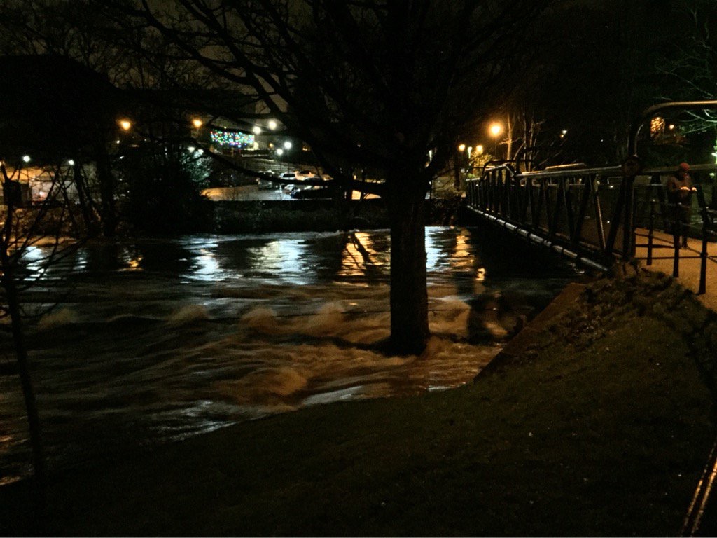
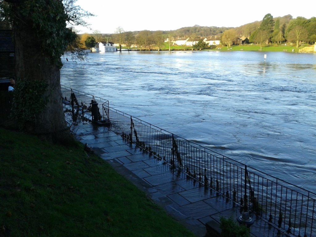
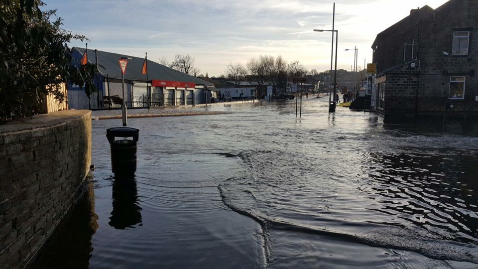
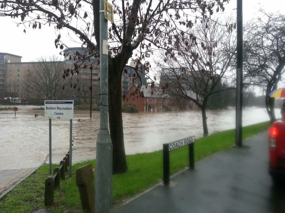
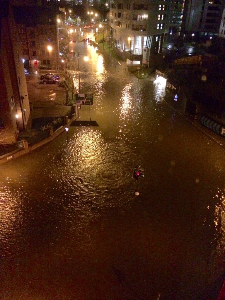
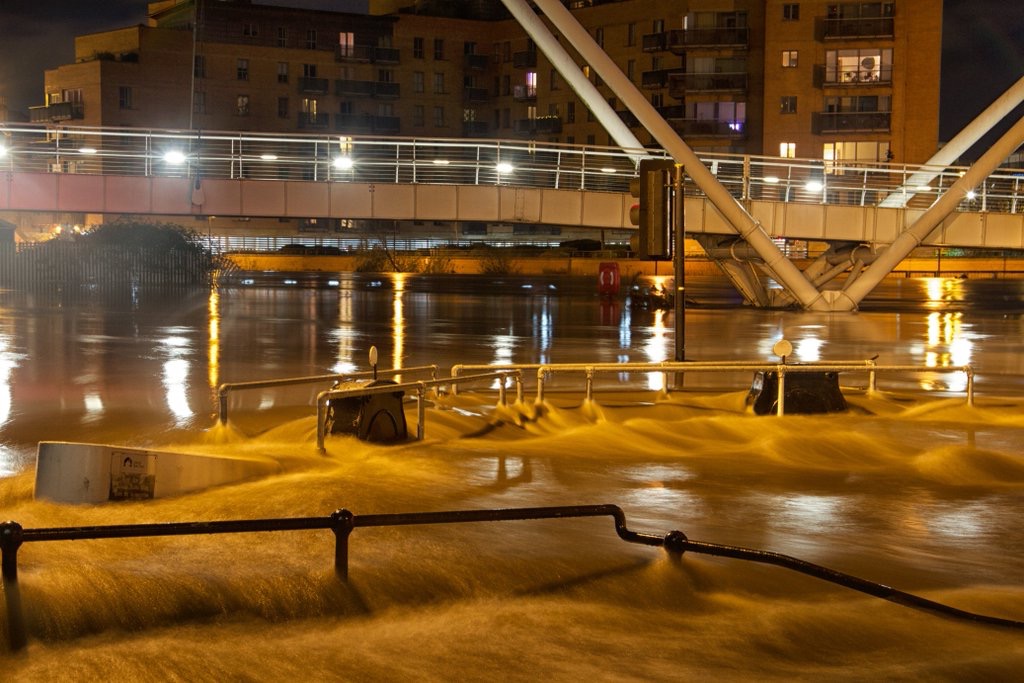
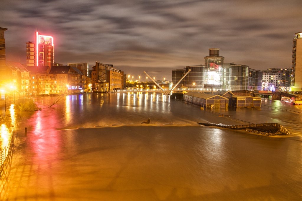
This time last year, I was trying to keep this blog updated with the crisis that was the Boxing Day flood of 2015. Thankfully, things have been a lot quieter this Christmas, so I’ve been able to devote a bit of ‘down time’ to some more historical water stories. Specifically, I’ve been puzzling over old maps, trying to figure out the history of how homes and industry developed in the Dockfield area of Shipley (and the Lower Holme area of Baildon, just across the river footbridge). It’s more fun than a jigsaw puzzle…

1837 Shipley Kirkstall turnpike plan

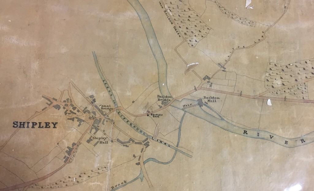
Dockfied is an area defined by water on all sides — the River Aire to the north, the Leeds-Liverpool Canal parallel to the south, and Bradford Beck to the west (flowing north to meet the Aire). But as you can see from this 1837 map, above, it was not even dreamed of at that point in time. Shipley was then a small town whose centre was slightly further west than it is now, clustered around the road leading off the original Canal Bridge (now Victoria Street Bridge), before the Otley Road bridge and Foxes Corner junction even existed. East of the Beck (or “Brook”, as this map has it), was simply farmers’ fields. By 1852, though — the date of this next map — there are sure signs of industrialisation…

Dockfield 1852 detail of larger Shipley map
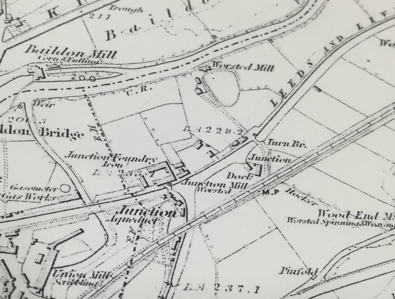
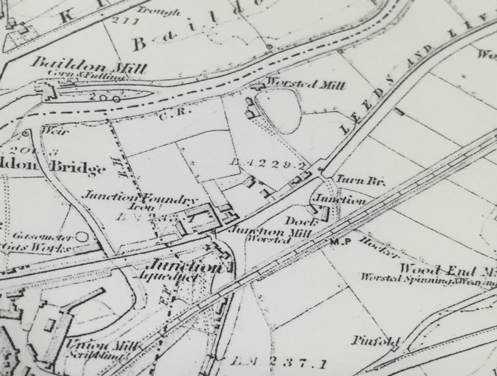
Not far to the west, Salts Mill was nearing completion and about to open — in 1853. But here, in addition to Baildon Mill (the old water mill on the Aire, also visible in our earlier map), we can now see Junction Mill — in the spot where it still stands, directly to the east of Bradford Beck, and facing Junction Bridge — the original canal bridge that allowed horses to cross from the towpath of the Leeds-Liverpool to the towpath of the Bradford Canal (hence “junction”). Also in what’s to become known as Dockfield, there on the southern bank of the Aire, is another, as-yet unnamed “Worsted Mill“.

Neither of these two new mills would have had water wheels (or their attendant weirs). This was now the age of steam engines. But still, you need water to make steam. Junction Mill appears to have been getting its supply from the river via the “Junction Aqueduct” (Salts Mill had a similar pipeline set-up), but the smaller worsted mill had clearly opted to site itself right next to the river. This meant that it didn’t face onto the canal, as Junction Mill did, so to get access to this vital transport and haulage route, a road of sorts has been constructed between the mill and a small “Dock” on the southern edge of the canal. And a swing bridge (or “Turn Bridge”) has been installed to provide access across the canal itself. Notice that, at this stage, Dock Lane does not appear to extend any further: it is literally just a lane linking the riverside mill to the canal dock.

Taken together, the appearance of these two mills gives a clear indication of what the appeal of this area was to industrialists: you needed both the river for a ready water supply and the canal for transportation, and in the Shipley area you had both, running in parallel. Of course, rail is another transport option, and already in this 1852 picture above you can already see the clear line of what was then the Midland Railway, running roughly parallel to the canal, just to the south. But stations were fewer and further between on a railway, so the canal still had a clear appeal for its readier freight access (just as road haulage is, today, much more convenient than rail for most businesses).

Now let’s spool forward another 40 years, to the first modern Ordnance Survey map, printed in 1893:

Dockfield OS 1893 (first edition)Notice, first, the appearance of the words Dock Field on this map. The area has found its name — a name that presumably refers simply to the fact that there is a dock right there in the middle of a field… But the words actually appear next to the first row of houses in the area, which have no doubt been built to house the worsted mill’s growing workforce. These houses, now known as Dockfield Place, are still in use today. 

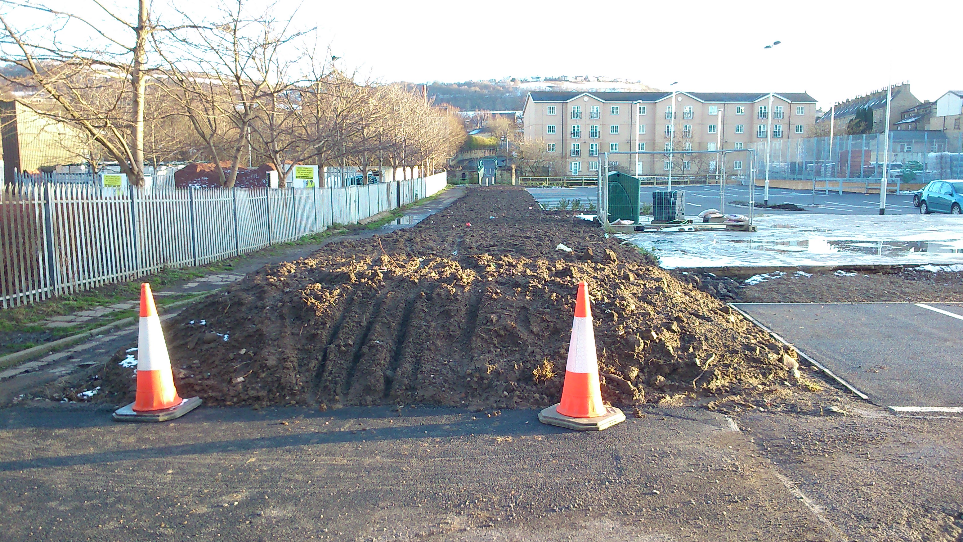
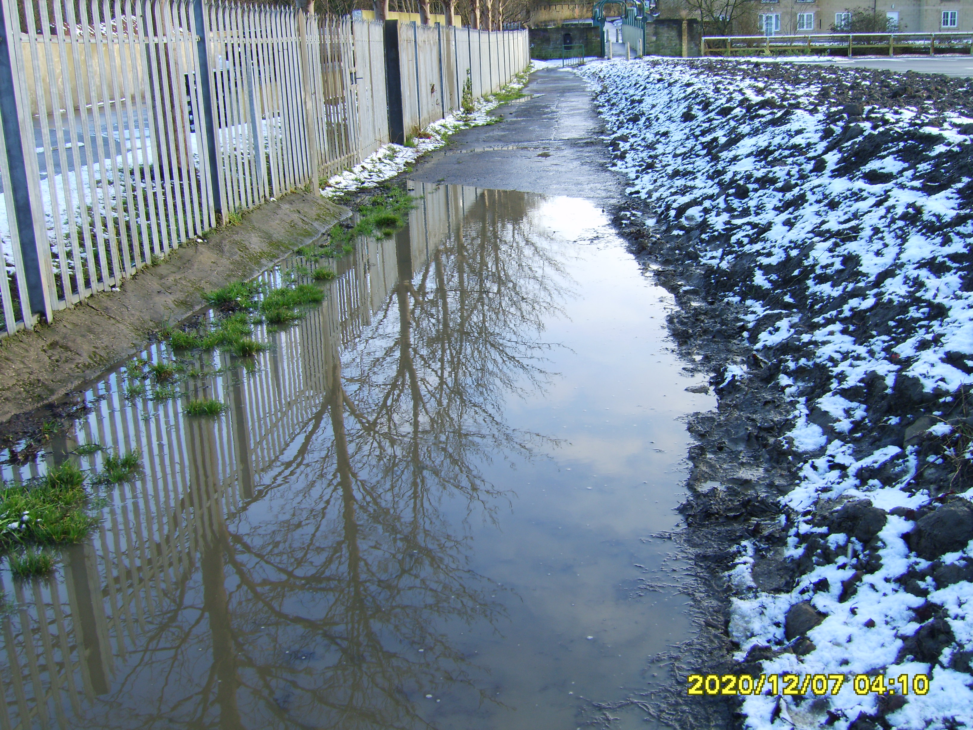
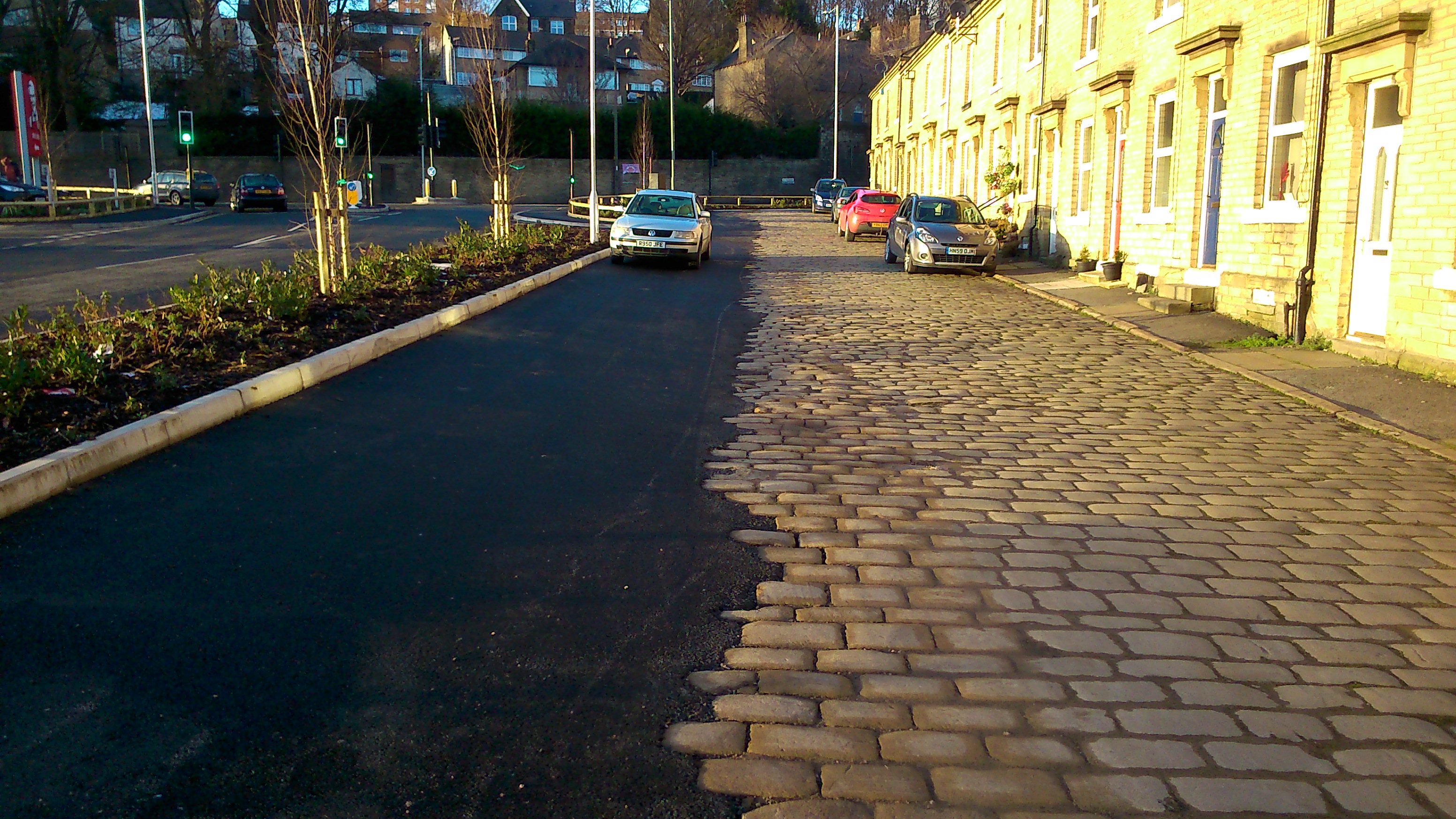
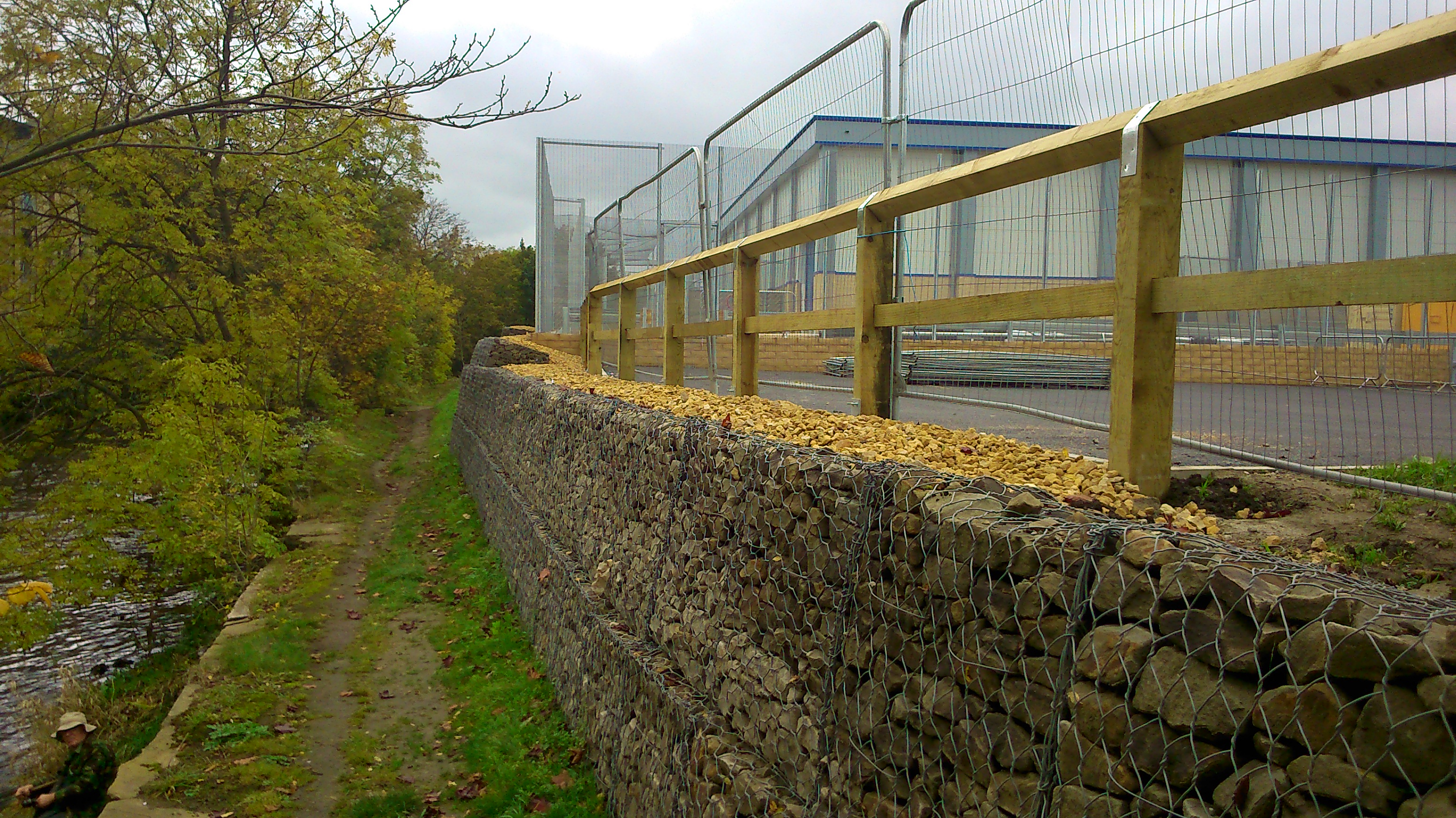
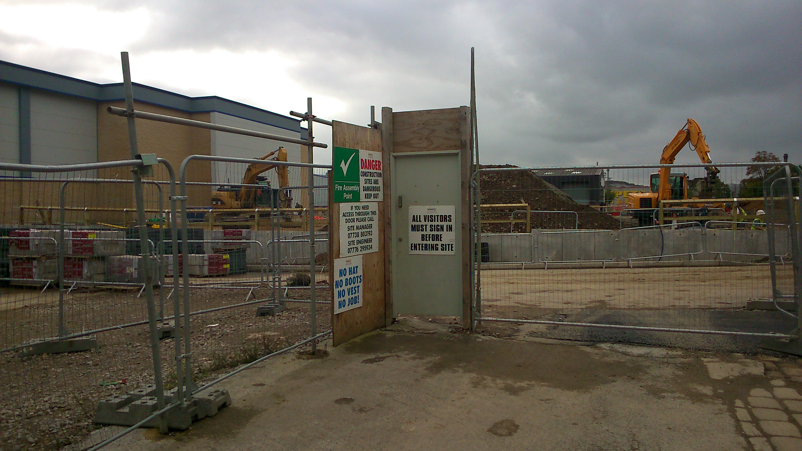
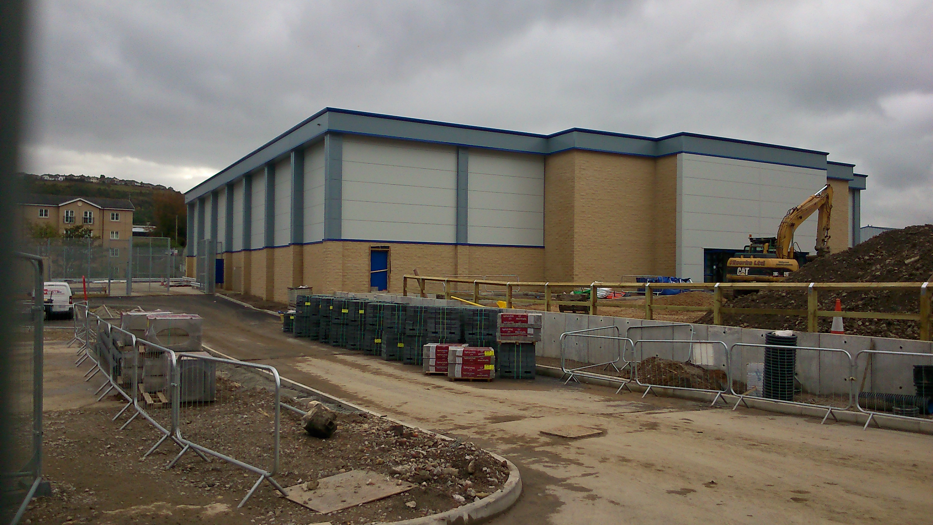
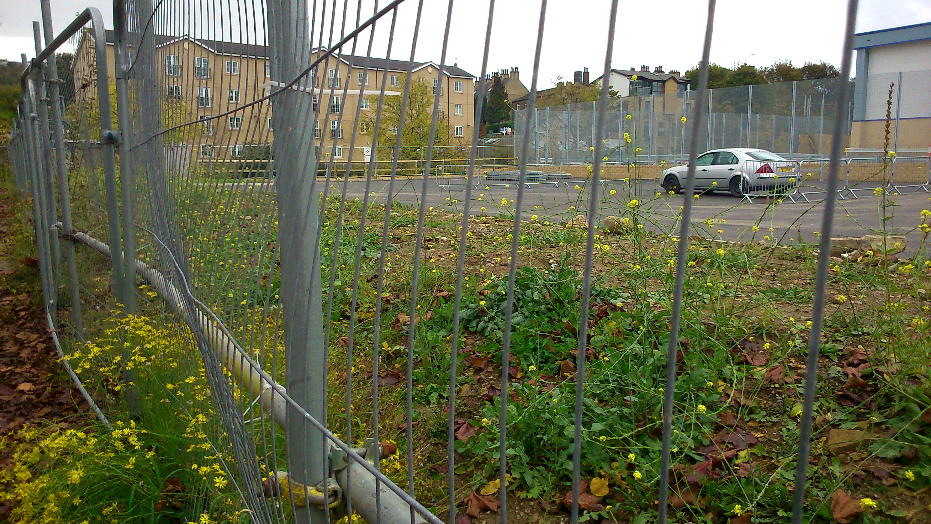
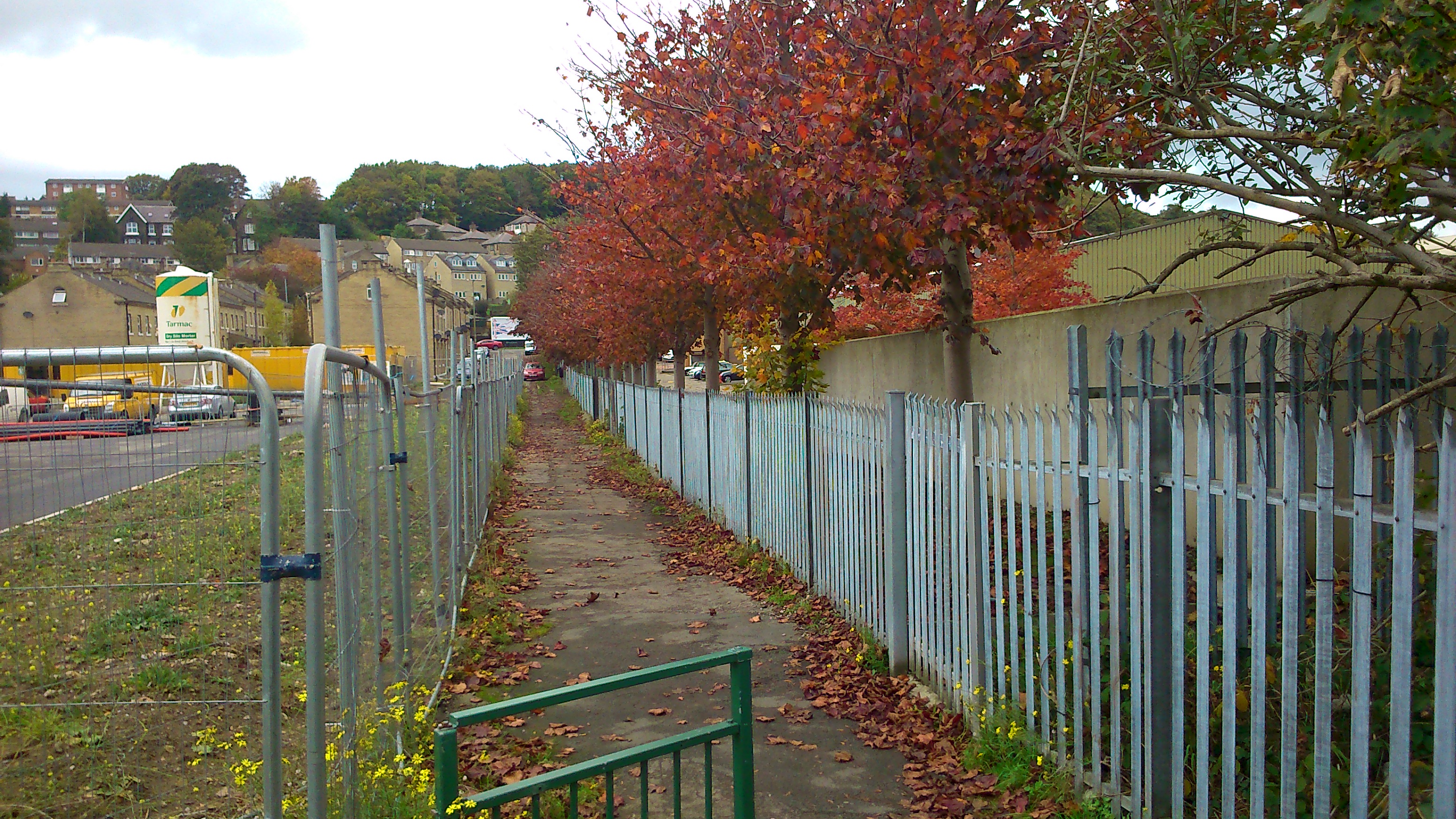
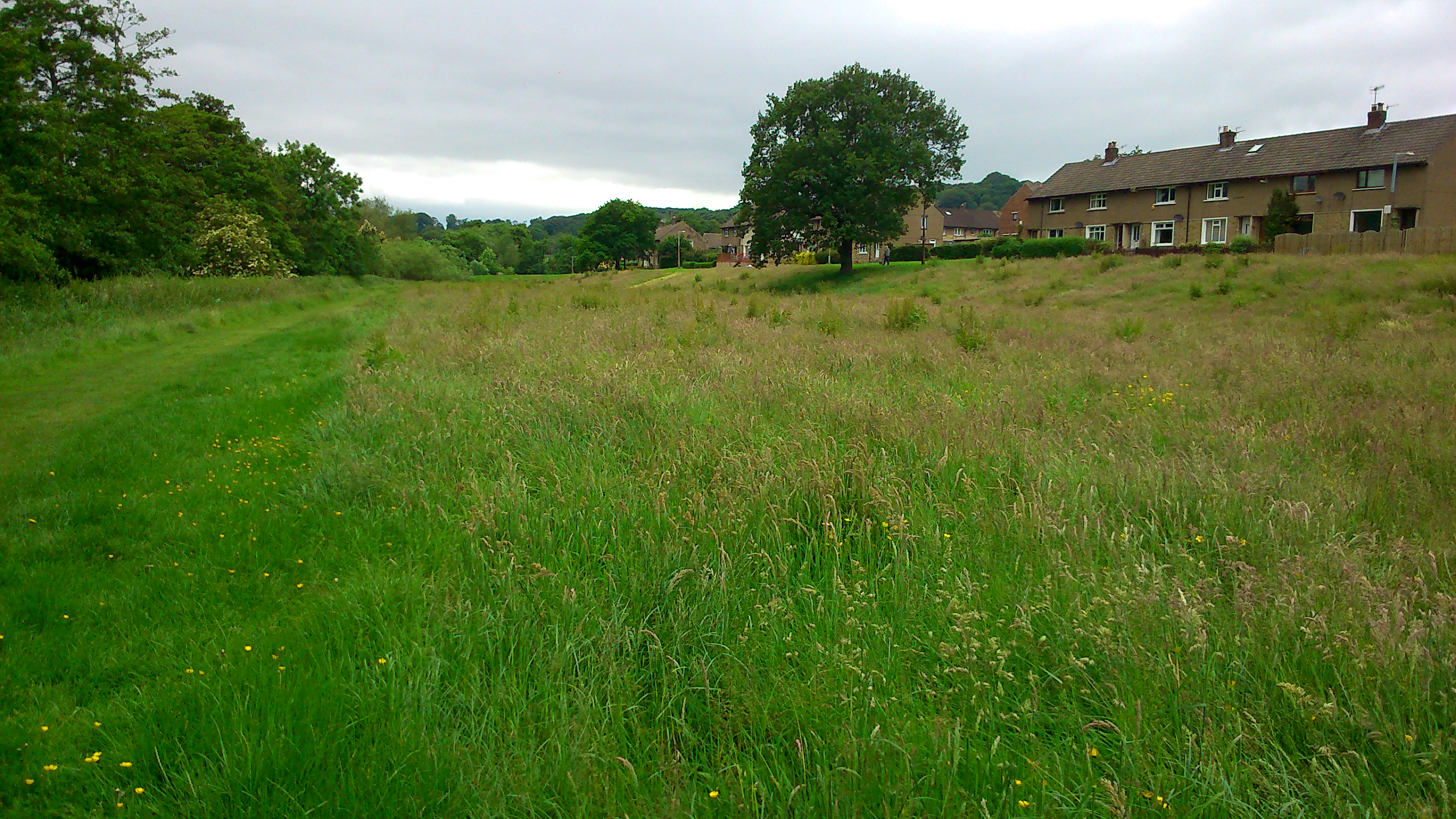
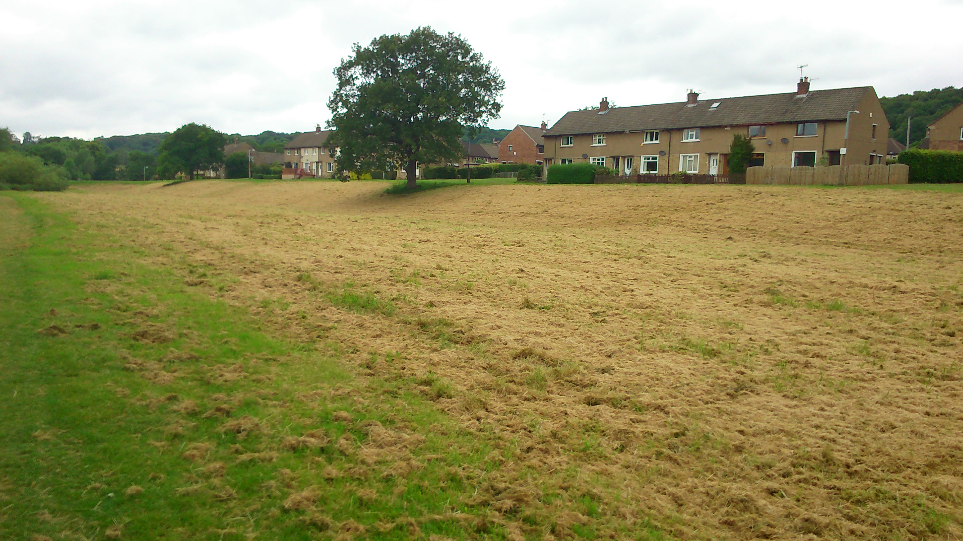
Notice, though, how the riverside worsted mill has now been dwarfed by the erection of the Lower Holme mill, directly across the river. This Baildon site, bought up by Titus Salt in 1850 (apparently before he decided where to site Saltaire), was sold on to C.F. Taylor in 1862, and it was Taylor who then built the large mill building next to the river (again, water supply…). He must also have been responsible for building the bridge across the river, in order to connect to Dock Lane and, thus, the canal dock. Although the present, 1960s bridge structure is just a footbridge, it must originally have been wide enough for wagons — which also explains why the road running down to it has always been full road-width (at least until the arrival of the controversial “landscaping” — aka a long row of dumped earth — that was left along the edge of the Wickes overspill car park when the site was redeveloped in 2014… still a sore point with residents!).

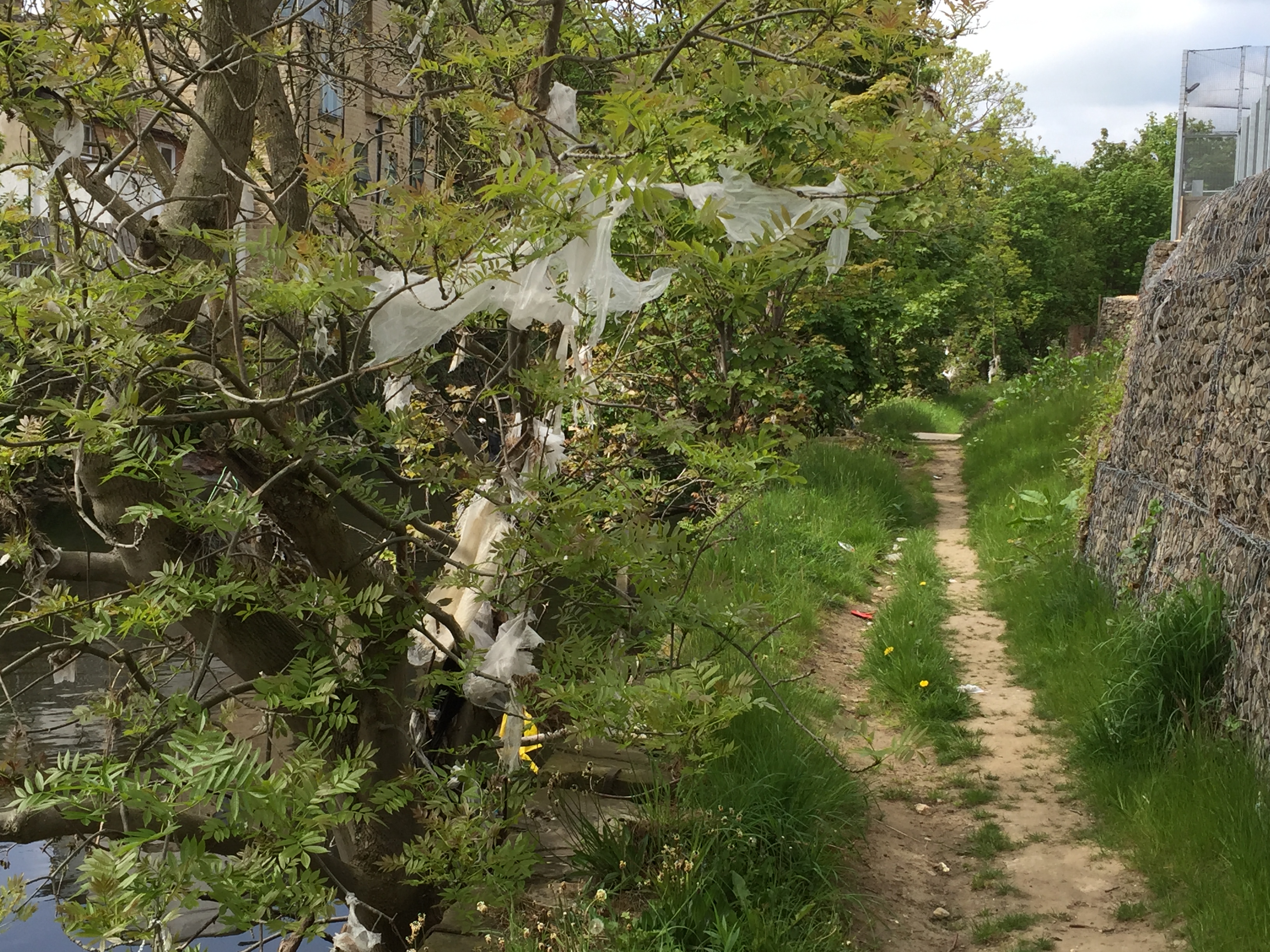
I can’t easily show you the Lower Holme cottages north of the mill, because in a quirk of OS mapping, there’s a key grid line that runs through here that always carves the mill and cottages onto two separate pages of the maps. So we’ll come back to the Baildon side of things at the end of this post… Sticking for now with Dock Lane, notice how — in the 1893 map above — the lane now continues alongside the railway and then underneath it by the canal junction. It then runs alongside the Bradford Canal (long since filled in, of course) to connect with the Leeds Road, just as it still does today. Finally in the 1893 map above, note also the massive expansion of railway sidings to the south of the mainline.

The next map is from 1908, just fifteen years later…

Dockfield OS 1908 revision
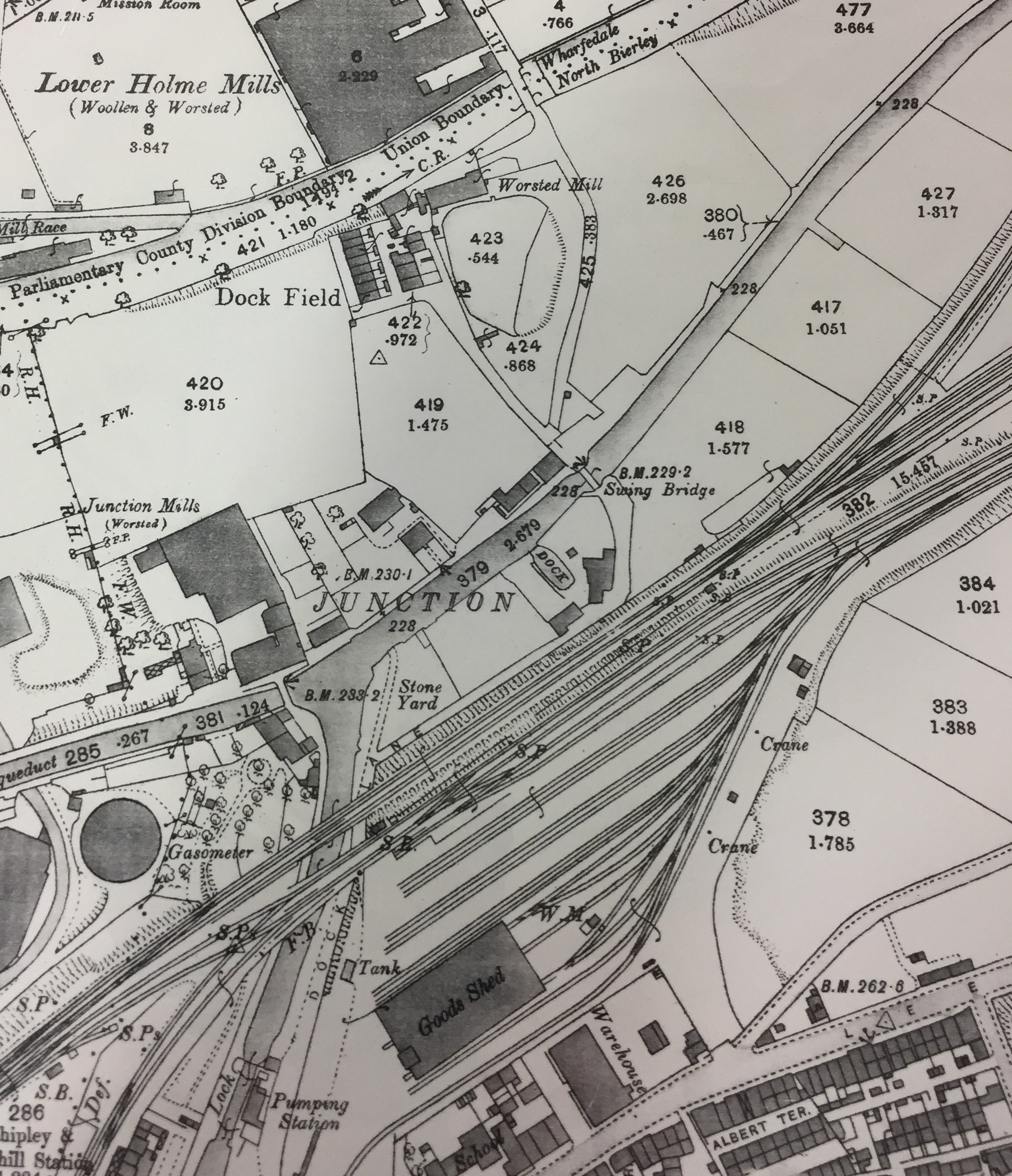
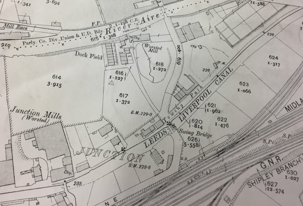
At first glance you might think this looks much the same as in 1893. But notice the developments to the east of Dock Lane, between river and canal. A small row of houses has now appeared along the towpath to the east of the swing bridge — houses which still stand today on Dockfield Road (though the road did not yet exist when they were built). These houses and the other new buildings to the north have apparently been built to service the new Sewage Works that Shipley Urban District Council has recently been building. The long, rectangular in the top right of the image above will soon be more clearly delineated as sewage settling tanks. So… the outlines of the Dockfields “island” (as some residents call it) are now clearly defined: river, beck, and canal to the north, west and south, and wastewater treatment to the east…

The sewage works’ arrival was the result of developments in local government and sanitation around the end of the 19th Century. The SUDC was created from the old Shipley Local Board, and one of its main reasons for being was to bring proper drainage and sewerage to Shipley — by eliminating the old middens and cesspits, and providing new homes with proper plumbing. A new sewage main running west to east along the Aire valley through the whole of Shipley parish now emptied into these wastewater treatment works at what was then the easternmost edge of the town. Indeed, technically (as 19th C. maps make clear), the area east of Bradford Beck was in the parish of Idle, not Shipley, so in effect Shipley was dumping its waste on the threshold of its neighbour.

But Shipley Urban District Council was not done yet… Look at this next OS map, from 1922 (? ish).Dockfield OS 1922 probably

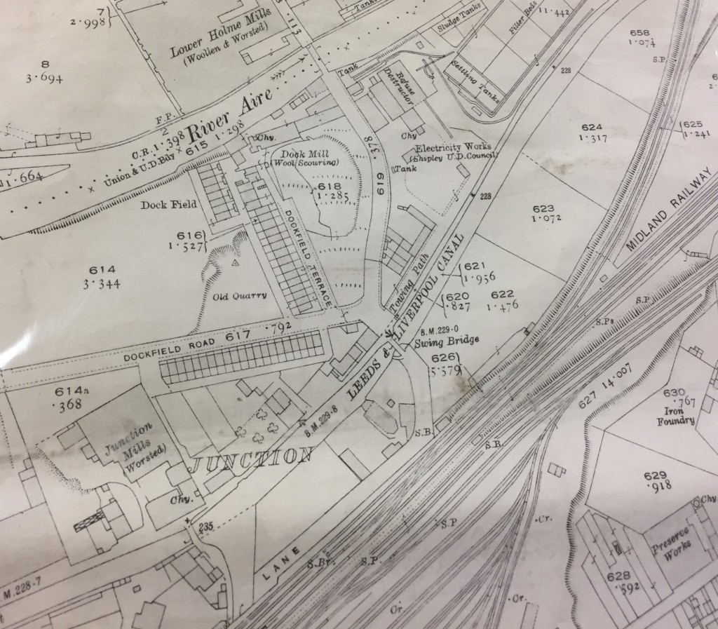
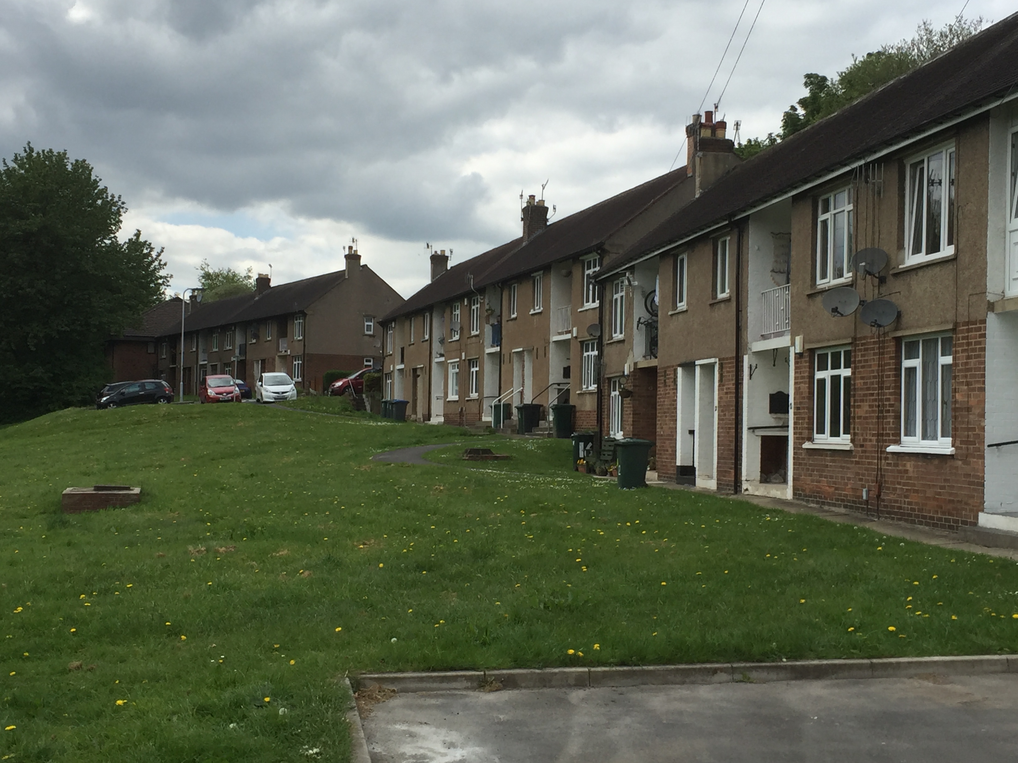
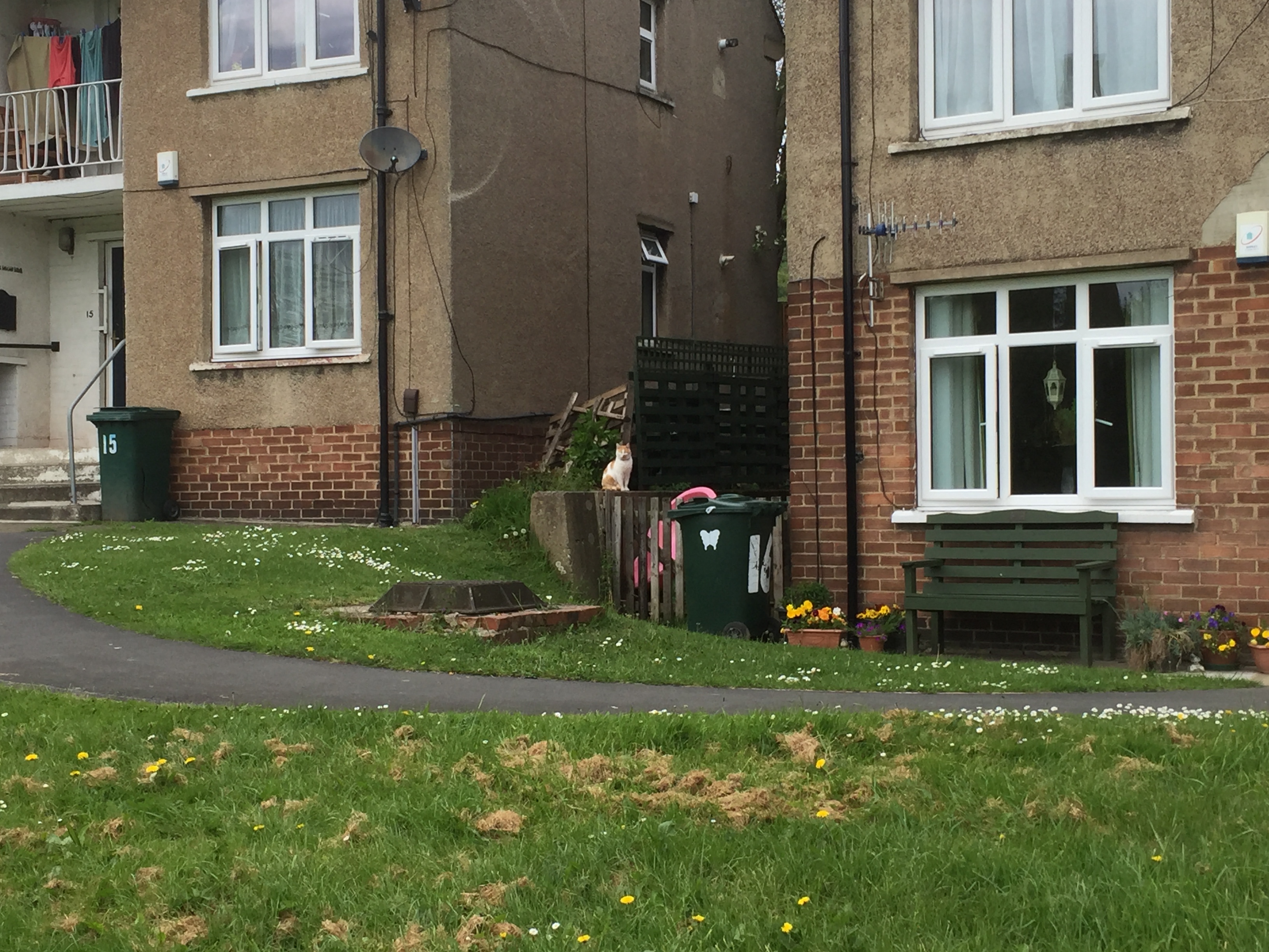
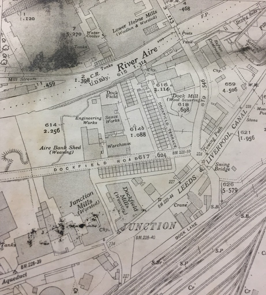
The new sewage works are more clearly labelled now. The worsted mill on the riverbank has now finally acquired the name of Dock Mill. But most strikingly, we now have the spanking new Dockfield Road, leading all the way up from Otley Road, at Baildon Bridge. The road has been built by the SUDC to provide better access to the sewage works and thus take the pressure off Dock Lane (which was no longer fit for purpose, with the mounting volume of traffic, and with that low bridge under the railway). Along Dockfield Road and the adjoining Dockfield Terrace (which links to the older homes nearer the mill) we now have two rows of early council housing — homes literally built by Shipley Council, with the very latest spec in plumbing and drainage… This was an early statement about the unsuitability of the old back-to-back homes in the Windhill area — visible in the bottom of the 1893 map above, and eventually demolished by SUDC in the years after World War II.

If we fast forward again to 1934, the full scale of Dockfield’s industrial development has now become apparent…

Dockfield OS 1934 (1)
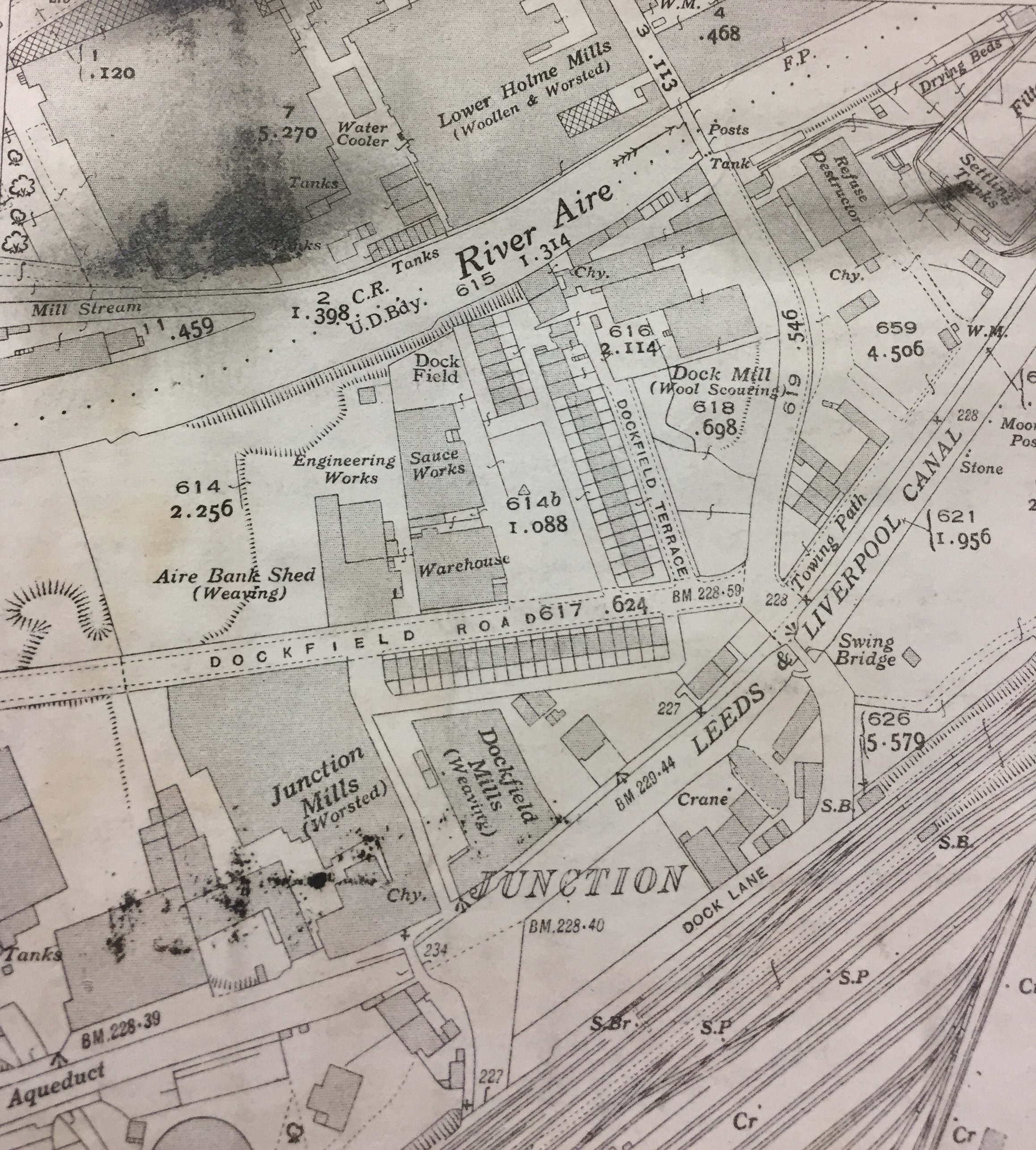
West of Dockfield Terrace, the Hammond Sauce works has now set up shop, and there’s also a weaving shed and small engineering works alongside the sauce. Dockfield Mills has now been built on the canal bank next to Junction Mills (also still standing today). Dock Mill itself has further expanded, and there are more buildings around the canal dock (presumably warehousing, to cope with the increased capacity now needed). This is Dockfield at its industrial height.

Now then… All of these map images are close-up photographs I’ve taken from the large maps on display to the public in Bradford Central Library’s Local Studies section. (There’s no indication there of any copyright issues with the maps, so hopefully I’m not breaking any laws here.) But for some reason the library’s big maps don’t go past 1934. After that we move to a different scale of OS mapping, but we also make a huge leap to 2003…

Dockfield OS 2003
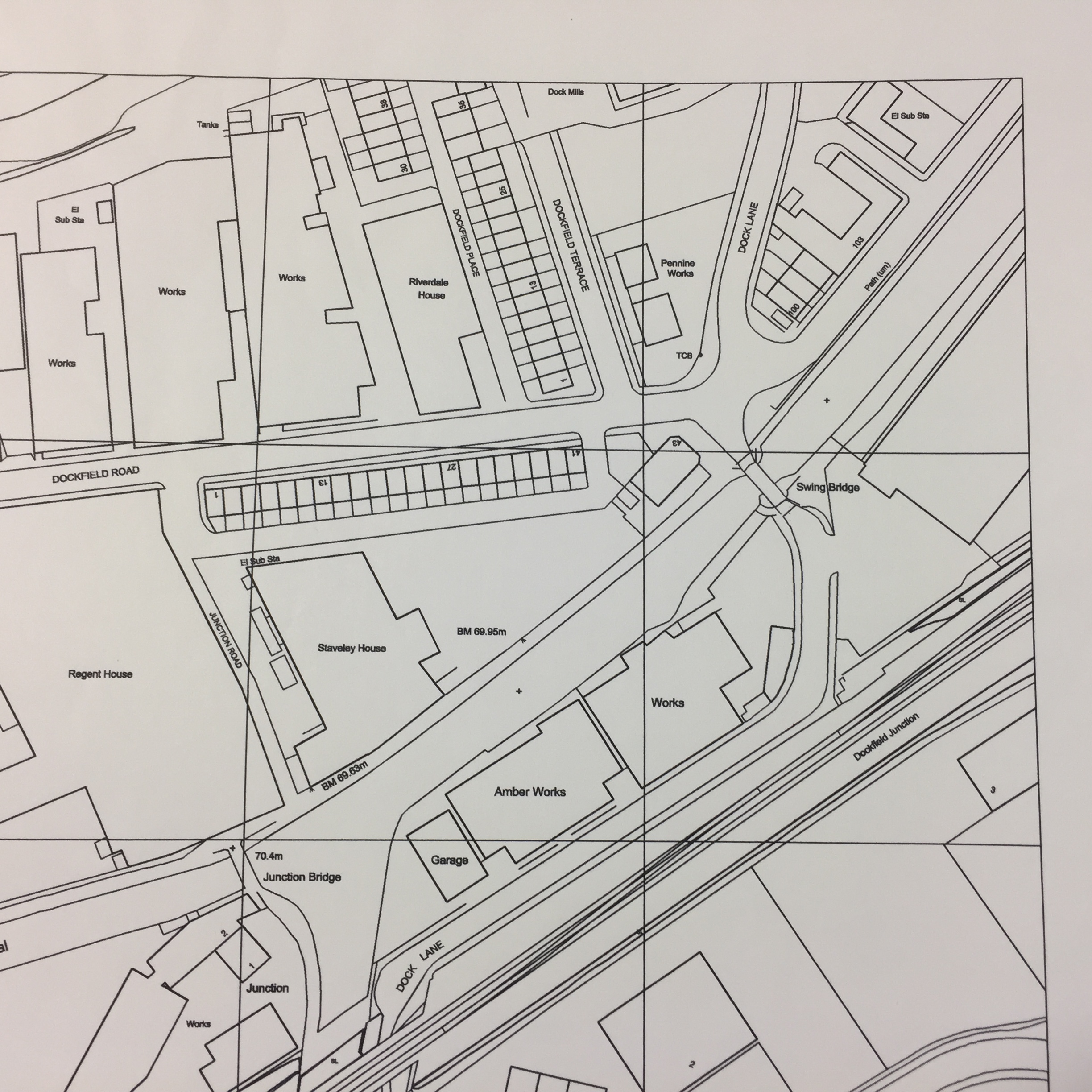
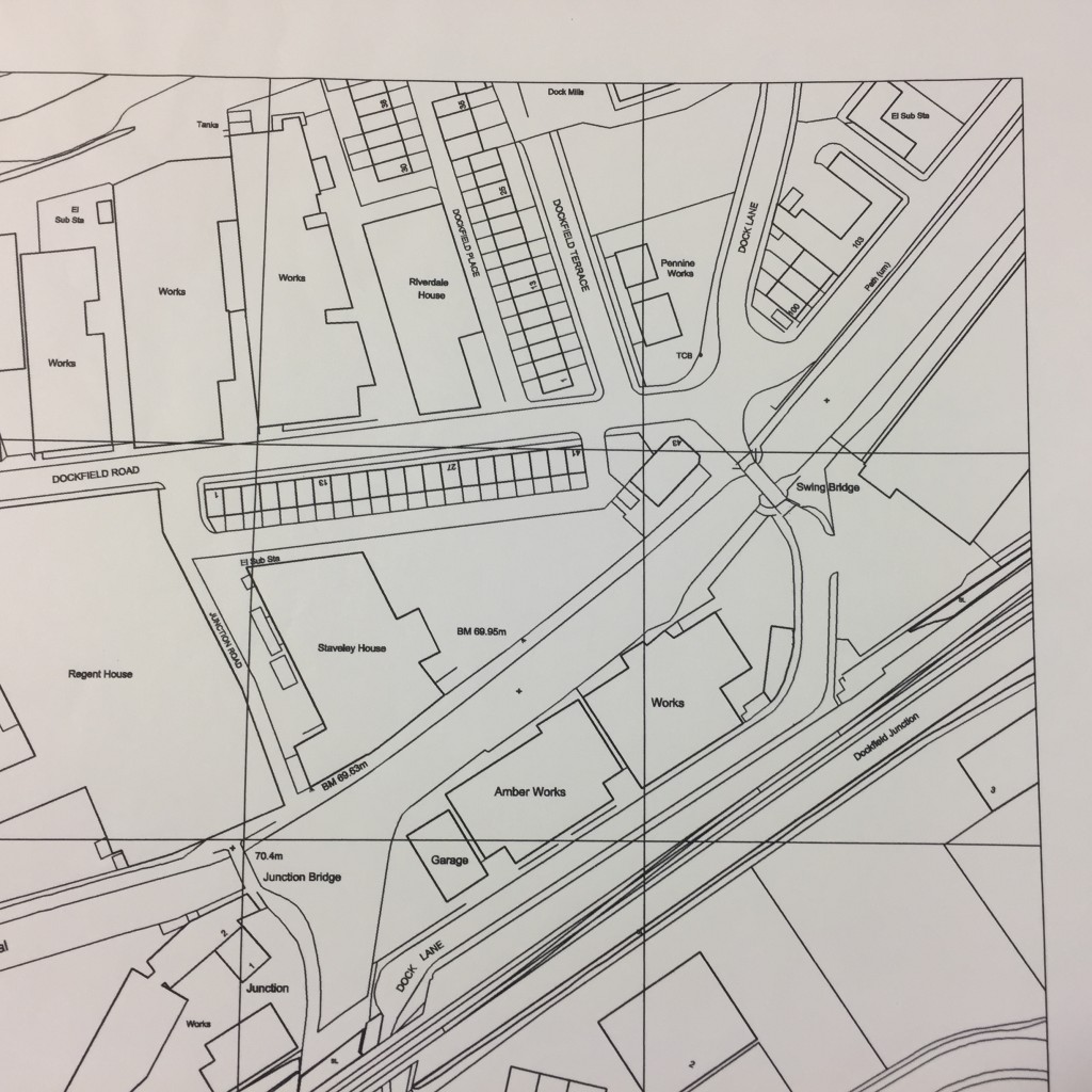
What’s perhaps most noticeable here, apart from the altered graphics, is just how little has changed since the 1930s. In the map above, Dock Mills is still there, and the various “Works” to the west of Dockfield Terrace. But Junction Mills has been renamed “Regent House” and Dockfield Mills is “Staveley House”. These name changes are indicative of a change in use from industrial space to office space, in this “post-industrial period” after Mrs. Thatcher murdered the country’s manufacturing base in the 1980s…

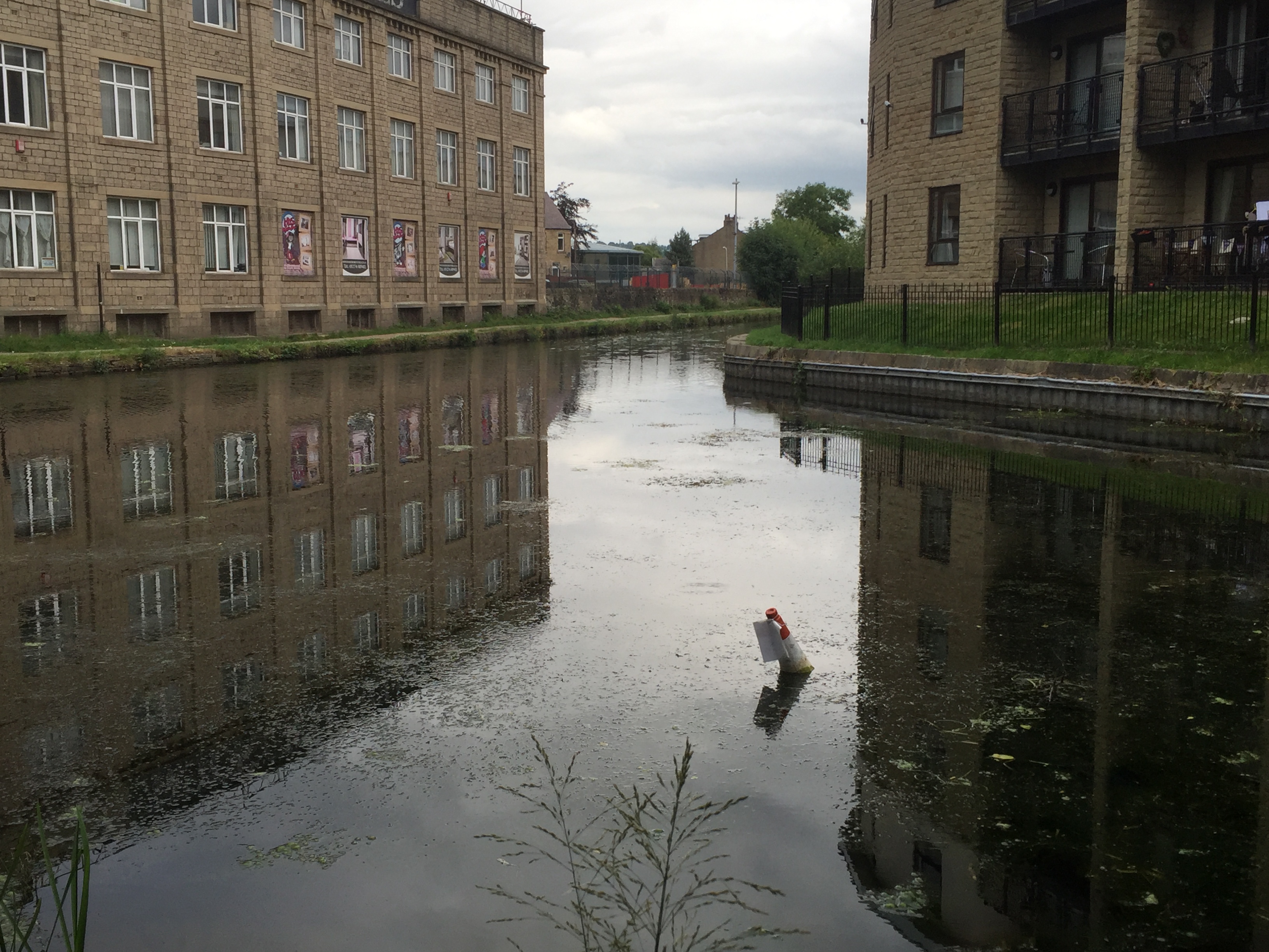
Notice, too, that at some point since the 1930s, the old canal dock has been filled in (the canal’s “super slow way” no longer being a viable freight transport option in this high speed era). More “works” have been built over the docks area, although — in 2003 — these are just about to be demolished. One of these buildings, Amber Works, will very shortly give its name to Amber Wharf, the new-build apartment complex built along the southern bank of the canal. (The first flats at Amber Wharf were sold in 2007 — right before the bottom fell out of the property market…) Dock Mills, too, will shortly disappear, to be replaced by the new-build riverside flats whose street address is still Dock Mill.

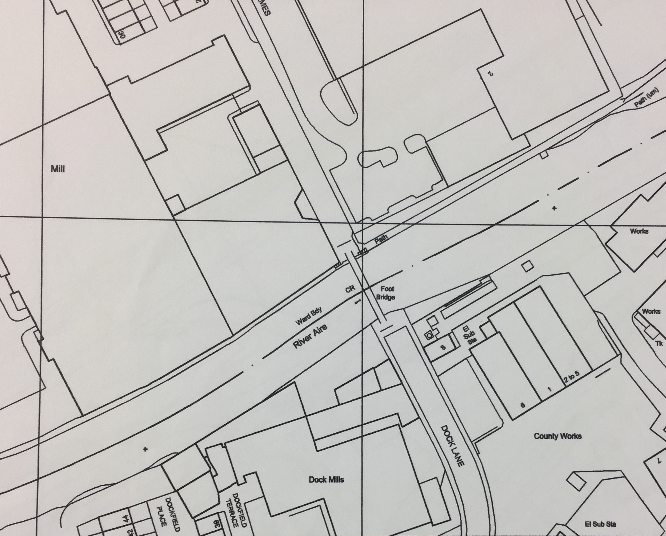
Notice that, at some point between 1934 and 2003, the OS maps also seem to have moved their grid slightly, so that the page cut-off now happens south of the river, rather than north of it… Below is the connecting page, from 2003, with Dockfield now linking clearly across to Lower Holme, via the modern footbridge structure…

Dockfield OS 2003 + Lower Holme

The Lower Holme mill has yet to be demolished (that would take another 5 or 6 years). And notice, on this map, that there are still “County Works” east of Dock Lane on the Shipley side of the river. Shipley’s sewage works were long gone by 2003, the wastewater treatment having been moved down to Esholt back in the 1950s (the land to the east that had once been an array of settling tanks and filter beds was redeveloped for more manufacturing, such as the Metal Box engineering plant that’s still there today). That said, there’s still a sewage pumping station next to the river, pushing the stuff on towards Esholt, and there are still electricity substations on this site, as on the map above. What’s changed now, of course, is that the County Works site has been sold off to the local success story that is Saltaire Brewery. Personally I’m a big fan of the Saltaire Blonde and their other beers, but next time you have a pint of theirs, it’s worth reflecting on the fact that it was brewed in a building that was once (according to the maps above) the “Refuse Destructor” for Shipley’s wastewater.

On that note, let’s cross the river again and jump back to the earlier maps for Lower Holme, across that OS boundary line…  Here’s the 1893 OS map for the area immediately north of the river, around the junction of Otley Road and Baildon Road:

Lower Holme cottages 1891
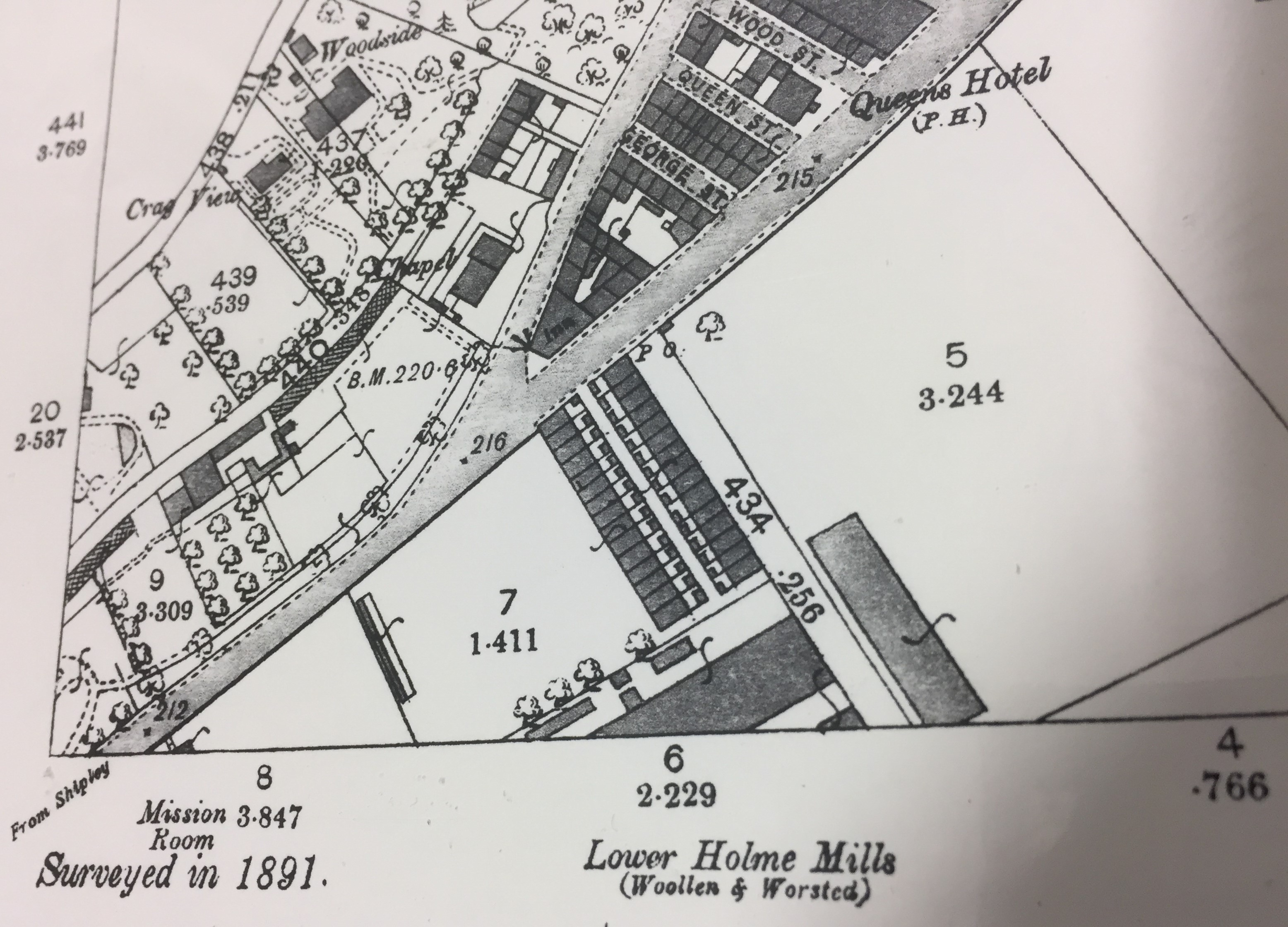
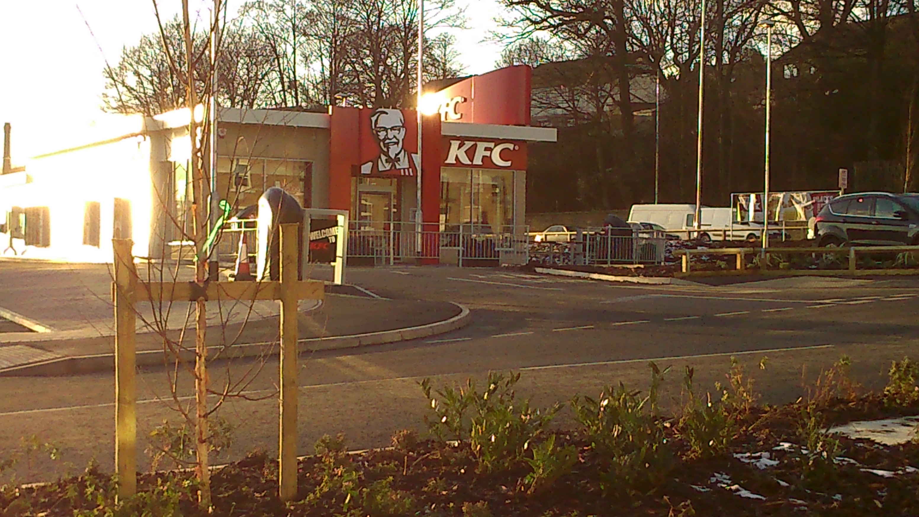
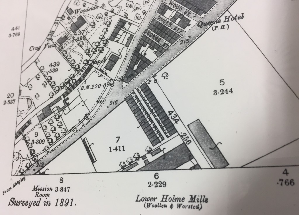
The “inn” at the junction (aka the Junction pub) stands on the corner just as it does today. And south of Otley Road you can already see the distinctive twin lines of the Lower Holme mill cottages, also still standing. However, the area immediately west of these homes (where KFC is today!) appears to be green space at this point (note the little tree drawings!). The houses are separate from the mill itself, even though they’ve been built to house C.F. Taylor’s workforce. The mill is set back from the road because, as was noted earlier, it’s the water supply from the river that Taylor needs most. That and the canal access, across the river bridge.

Lower Holme cottages 1913

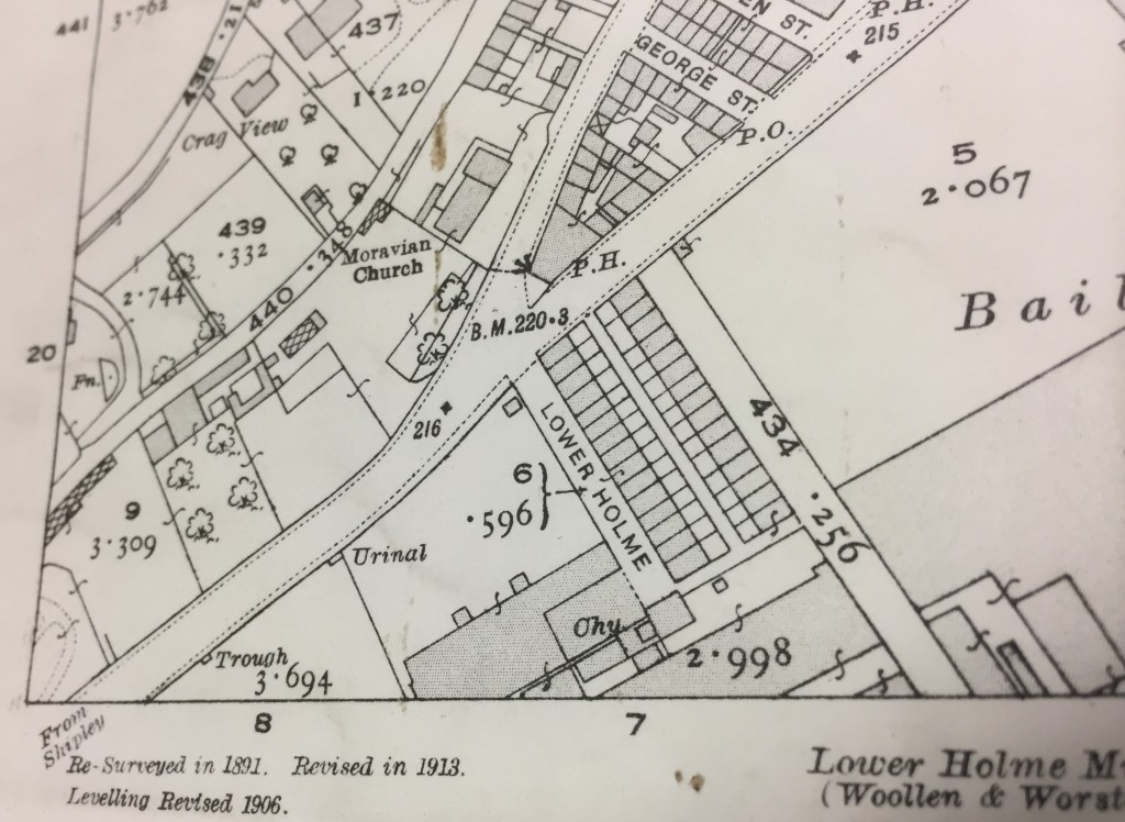
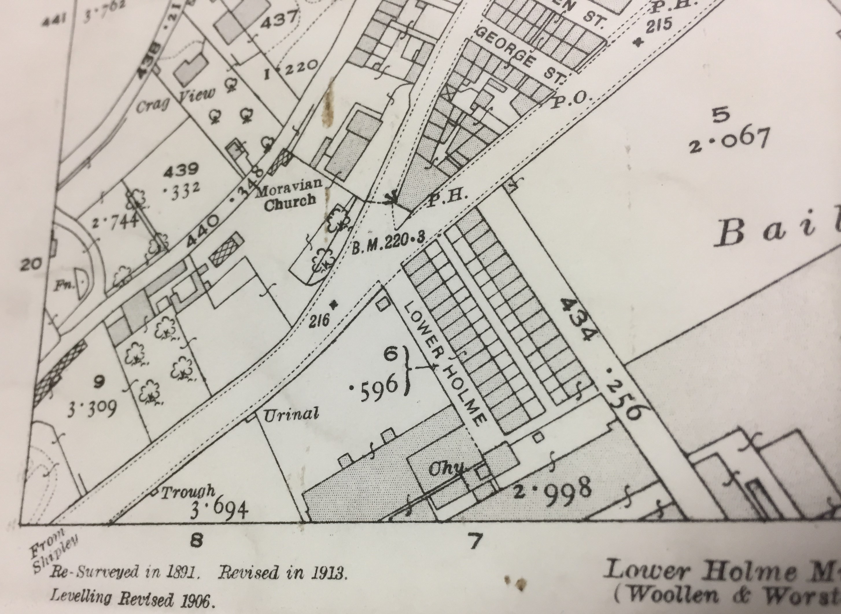
Jump forward to the 1913 revision (above), and the Lower Holme mill works are starting to encroach on the land west of the houses. There’s also been more development on the site to the east (also originally part of Taylor’s operation). And along the main road, notice the apperance of “Urinal” and “Trough” — all part of the public sanitation drive being pursued by Baildon Urban District Council at this time, in parallel with Shipley’s.

Lower Holme cottages 1934
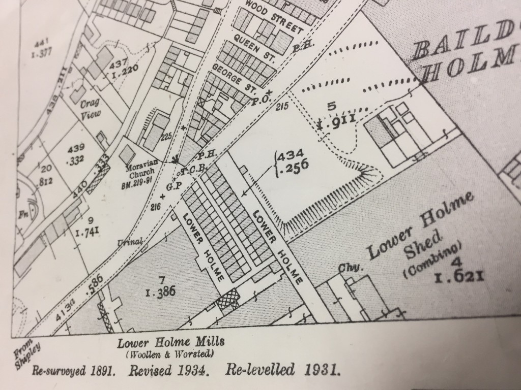
By the time of the 1934 revision, above, the houses are pretty much surrounded… Industry at its height! The mill buildings, of course, have all now been demolished — within the living memory of some of those still living on Lower Holme.

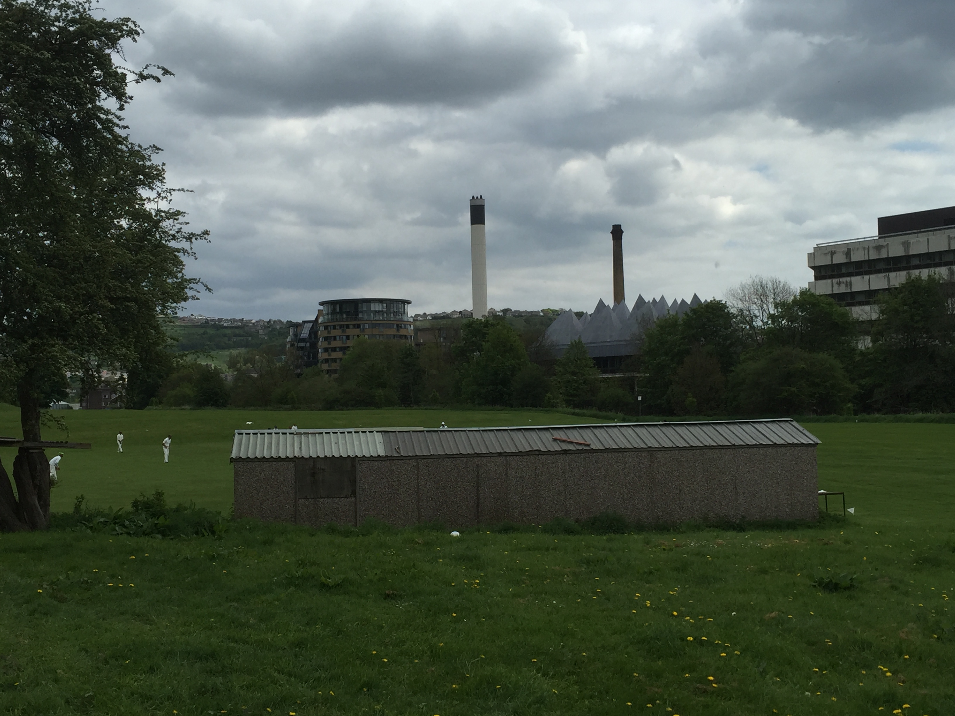
So all in all, this area is a story of industrial rise and fall… industries dependent on water supplies, water transport, and (arguably most important to the area’s modern development) water treatment. But if the manufacturing has largely gone, or transmuted into service-sector industries like brewing and (down Dockfield Road at Funopolis) recreation, it’s important to remember that the homes built to house the area’s workers are all still standing. None of these have been demolished, because they’re good homes… the solidly domestic legacy of a bygone industrial era.
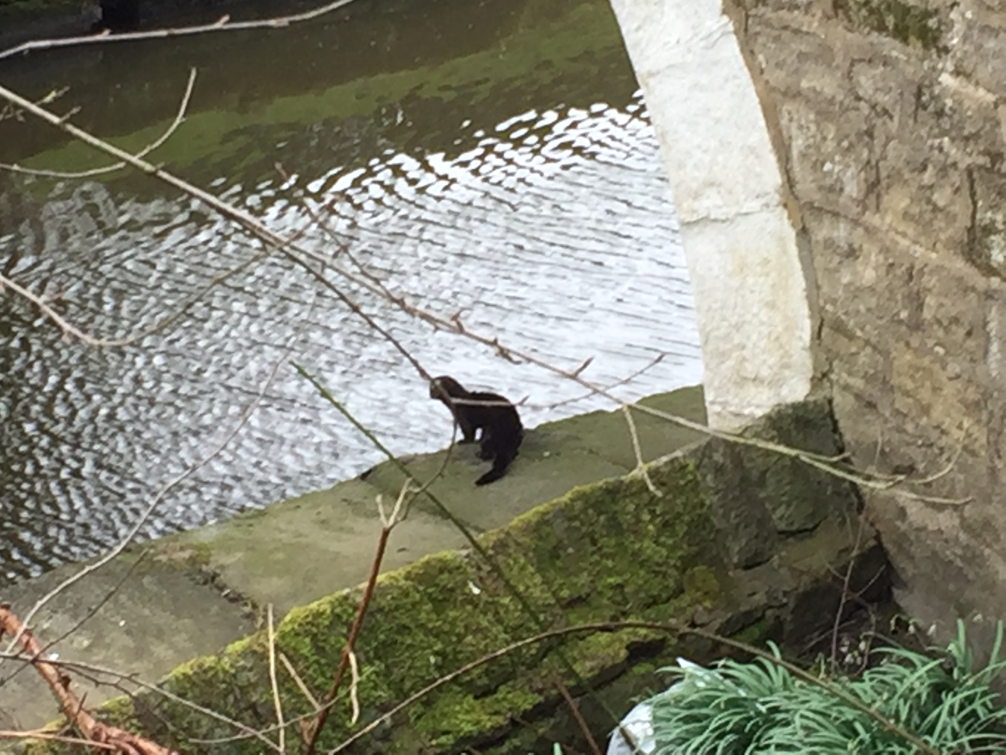


Celebrating Dockfields…

IMG_1405


The Dockfields area is at the cross-roads of Shipley’s history …

It’s here that docks, factories and homes sprang up around the junction of the Leeds-Liverpool and Bradford canals

here that an ancient right of way across the River Aire (now Dock Lane footbridge) has long provided access between Shipley and Baildon…

and here that people have lived, worked and played, with industry all around, for generations…

The Multi-Story Water arts project, working with Shipley’s Kirkgate Centre, is planning a festive celebration of Dockfields – of its communities, its history, and its future – for 2017.

This includes Amber Wharf, across the canal, and Lower Holme, across the river, as well as Dockfield Road, Dockfield Terrace, etc…

But what kind of event should this be?

We’d love to collect your ideas, and your memories of the area…

… and we’d love your involvement in making something happen!

To get the conversation going, we’re making a short play about the area, for performance in your very own living room! (it’s just two actors…)

If you’d like the play to visit you (in Jan or Feb), just let us know!

Please conact Lyze for more info on 07713 357706

Or: lyze@kirkgatecentre.org.uk

Water margins

I’ve been continuing, in recent weeks, to nose around Shipley and Baildon to get more of a sense of how the Boxing Day floods affected people in different areas. Come September, at Saltaire Festival, we’ll be presenting a new storytelling piece called Wading Home for Christmas that will seek to capture some of these accounts in an engaging and pointed way. Last weekend I paid a visit to Aire Way, one of the streets off Coach Road which opens out onto the flood plain area east of Roberts Park. What the residents here told me really underlines just how narrow the margins can be in terms of who gets hit by flooding and who doesn’t.

IMG_0894

These are the houses on Aire Way — the gap in the middle is where the road comes in for car access — with the odd- and even-numbered houses extending from either side of this entry point. Here we’re looking west, in the direction of the park. If you imagine taking the photograph above, and then turning through about 180 degrees, this is what you would see looking the other way….

IMG_0893

The line of trees in the distance marks the edge of the River Aire, with the large buildings all being on the other (Shipley) side of the river. Here you see one of the several cricket pitches that populate the local flood plain areas… But what’s amazing to contemplate is that this corrugated tin cricket hut was — according to the residents — completely under water on Boxing Day. I said, what, completely? You couldn’t even see the ridge of the roof? They said that’s right. Back in 2000, when the last major flood hit, you could still see the roof — but not this time.

IMG_0899

Taking a closer look at Aire Way, we can see a waterworks manhole in the grass just in front of the houses. This, I was told, is the point that the floodwater got to back in 2000. Just shy of the final slope. On Boxing Day 2015, though, the water came right up and into people’s homes — filling the ground floor and flowing out of the back. It also came up through the foundations of the houses — quicker, in fact, than it arrived at surface level. Residents had to wade out of their homes, and some have only recently been able to return. But look at this…

IMG_0896

To the right in this picture is the most westerly house on Aire Way, and to the left is the most easterly house on Tennis Way (the next street opening off Coach Road as you head towards the park). As you can see, there’s just a slight rise in the banking between Aire and Tennis, but this extra bit of height made all the difference. The homes on Tennis Way remained unaffected by the flooding — safe as houses.

Incidentally, the other people who were safe as houses were those living upstairs on Aire Way — who had a grandstand view of the flood from their balconies. These houses are actually split-levels, with the upstairs apartments being accessed by stairs leading straight up from front doors on ground level. So the worst the upstairs residents got was some damage to their stair carpets, but by all accounts, Bradford Council paid out its £500 per household in flood relief to anyone on this stretch who asked for it, regardless of whether they were upstairs or downstairs. One might question whether this money was really going where it was most needed.

If the level of the water made a big difference, depending on where exactly you live along here, it’s also worth noting that seemingly small differences in residential status also really made a big difference. Aire Way and Tennis Way are still mostly (if not all) social housing stock — run by InCommunities. Among the residents I spoke to were Kenneth, who is a regular tenant with In Communities, and was really happy with the help that he received from them in the wake of the flooding. He was back in his repaired house by mid-March, and has no complaints. His only problem is that — like a surprising number of people living near the river, it seems — he had no contents insurance for his belongings, and so has had to fork out for an entirely new set of furniture.

However, just along the street from Kenneth is Chris. He did have contents insurance, but he also has his home on a 99-year lease from InCommunities (he’s sort of halfway to being a home-owner). Being a leaseholder meant that Chris found himself right at the back of the queue in terms of getting the flood damage repaired. InCommunities were still responsible for sorting it, since ultimately they are the property owners, but they were apparently in no hurry to do so. Perhaps they were working on the basis that Chris can’t move anywhere else because of the length of his lease. So Chris literally just moved home two weeks ago — mid-May — after nearly five months being put up in Abbey Lodge guest house, up on Kirkgate in Shipley. He was still unpacking boxes when I met him…

Speaking of which, here is Margaret Wright — an old friend of this blog. She normally lives on Lower Holme, off Otley Road — near the new Wickes. But I took this photo in April, when she was still living in a room at Shipley’s Ibis Hotel (just by the canal).

IMG_0874Margaret finally moved home on April 28th — after being stuck in the Ibis for four months, without even any self-catering facilties. Her housing association, Accent, gave her and her grandson James a daily allowance of £25 between them to feed themselves … which, needless to say, doesn’t go far when you’re eating out all the time. Even so, this and the hotel bills do add up, and as Margaret points out, you would think it was in Accent’s interests to have got her back into her home quicker than this! And unlike InCommunities, it was not even as if Accent had the excuse of having a lot of clients to deal with after the flooding. They admitted to Margaret that they had just one other property in the area — in Bingley — affected by the floods. But this very lack of impact on them as an organisation seems to have led to a general lack of concern.

The particular irony is that the water didn’t even reach Margaret’s house at ground level. It’s set back far enough from the river that the only impact was from water coming up through the basement. Margaret’s neighbour Lynda had exactly the same situation, but remained safely in her home throughout (despite losing power for six days around New Year). However, where Lynda’s ground floor had apparently been reinforced on some previous occasion, Margaret’s had not. Yet another small difference that made a very big difference… Margaret’s kitchen and living room floors were undermined by the flood water, and caved in. It then took four months for Accent to get it fixed — although the actual working time, Margaret says, was a matter of only three weeks. The rest of the time was simply taken up with interminable bureaucratic delays, for the visits of loss adjusters, surveyors, and God knows what. And no doubt for the paperwork to sit around on a pile for a while, until it got attended to. Margaret had been almost six weeks in the Ibis before anyone even began to do anything to the property…

Fortunately, Margaret is able to joke about her experiences as a kind of black comedy — but the strain on her has been clear to see. She’s in her later sixties, and suffers from arthritis – and you would think that, as a resident of 33 years, Accent had a duty of care towards her. Instead though, their attention to the house has been all about the “margins”… Costs have been cut at every opportunity, especially on the finish, so that Margaret has had to vociferously complain about idiocies such as an ugly gas heating pipe being run along her living room wall above the skirting board. (If you know how beautifully she has always kept her home, you know just how much of an insult this is.) The final straw, though, was when she discovered that her living room window blind — one of those nice, wooden-slatted ones that cost well over £100 — had mysteriously lost its draw-string and so been rendered useless. A workman eventually admitted to having cut it off so he could use it as a plumb-line. This completely unnecessary bit of criminal damage resulted in Accent having to pay out for a brand new blind. As Margaret remarks, “If you pay peanuts, you get monkeys.” It’s all about the margins…

If you leave Margaret’s house, at the bottom of Lower Holme, and walk the short path down to the river, this is what you’ll come to…

IMG_0912The brand new flood wall on the right, installed just last year before the Wickes opened, was overtopped on Boxing Day. The debris still caught in the trees (and this photo shows just one sample of a problem all along this stretch) indicates just how high the water came, but also just how long it’s now been left unattended to… This is the stretch of river that became nationally visible at Christmas, when the TV news played cameraphone footage of a caravan being smashed into the footbridge at the bottom of Lower Holme. But most of the rest of the time, this is a pretty neglected stretch of river. Out of sight of the general public, out of mind of the authorities… It’ll take a volunteer effort, in all probability, before this lot is cleared.

Floods, it turns out, can make you cynical.


After the Flood: Domestic Damage

A house stripped bare.

No flooring, no plaster. A house stripped bare – with a dehumidifier as the only furniture.

For me, our “After the Flood” event at Kirkgate Centre last Sunday was something of an eye-opener. As will be clear from my other blog posts on this site, my conversations with people in the Shipley area since the Boxing Day floods have often been about the clear-up effort or about local features in need of repair following flood damage, such as Hirst weir. Up until last Sunday, the contact I’ve had with people directly impacted in their homes by the flooding had been limited to people who were nonetheless still living in their homes. People like Lynda, at Lower Holme, whose basement had been flooded by groundwater — with the result that she lost electricity and gas supplies for a week. Or people like Phillip (featured in this previous blog), who moved back into his home in Aire Close before the end of January, despite having had five or six feet of water in his living room.

It occurs to me now that because Phillip is a builder by trade, he planned to oversee repairs to his downstairs while living upstairs — but of course not everyone has such a relevant skill set, or can deal as stoically with the emotional impact of living in such conditions. The meeting on Sunday was attended by a number of people who have been living in temporary accommodation since Christmas, and who still don’t know when they will be able to move back home. People like Margaret (an old friend of the Multi-Story Water project), who lives adjacent to Lynda on Lower Holme, but whose living room and kitchen floors collapsed in the flooding. Her housing association put her in the Ibis hotel, at Shipley Wharf, where she has been since December — in a standard no-frills room, without a kitchen, having to eat all her meals out. She has just been told that work on repairing her home will finally begin in April, but she has been offered no explanation for the 3 month delay. Perhaps the property was simply too damp until now to do any meaningful work.

That’s certainly the case for Graham and Ann — who live right on the river in Lower Baildon — and had over five feet of water in their living room on Boxing Day. They are hoping to be told in the next few days that the walls of their house are now dry enough that work can begin on rebuilding and replastering. They were kind enough to invite me, yesterday, to see the state of their house before work begins. The entire downstairs has literally had to be stripped back to the brickwork, with the removal of stud walls turning the house into a series of spaces between brick columns. The dehumidifiers are still going full tilt.

IMG_0679

Seeing the state of this house made me realise just how long and difficult a road to recovery it can be for those affected by flooding. We all hear about the immediate impact of floods when they hit — it’s all over the news and the pictures are everywhere — but the story never stays in the public eye for long. The news cycle moves on, and so it’s easy to assume that the story is over. But it really isn’t, if it’s happening to you.

IMG_0672

This is Graham, indicating the height the water came up to in his living room. And yes, he is managing to smile about it. I’ve been so impressed by his and Ann’s positivity in the face of such a complete devastation of their home. He also pointed out how the French windows are full of water and will also need replacing…

IMG_0677

… and how they are taking extra precautions to keep the front door secured, given that empty houses can be a target for unwanted intruders…

IMG_0680

Outside, work on putting things to rights has not even begun. Graham pointed out how the decking outside his back door, and the hot-tub that used to sit next to it, were both picked up and then unceremoniously dumped again by the flood water…

IMG_0681


And this is all that’s left of the decking area that overlooked the river itself… (Graham pointed out the decking section itself, caught up against a tree 100 yards downstream)

IMG_0682

It’s clearly going to take quite a long time before Graham and Ann are going to have anything that resembles a home again, and they are understandably concerned about the threat of something like this happening again in future. All they can really do — whether they want to live here or look to sell — is to look to make the house as resilient and flood proof as possible. And that isn’t going to be cheap.

If the continuing difficulties of affected households are not being reported on, another location that I visited yesterday has been particularly far out of the public eye. Branksome Drive is a quiet, residential road that had not even been on my radar as somewhere that been affected by the floods, until some of those affected came to the meeting on Sunday. Indeed, not even Paul Barrett — Kirkgate Centre’s community development manager — was aware of the problems there. Branksome Drive is at the extreme west end of Shipley ward, out past Nab Wood cemetery, and as such is quite isolated from, and invisible to, other local people. But if you look on this bit of Google maps, you can see how the end of Branksome Drive sits worryingly close to the Aire at the bottom of the long S-shape bend that takes the river up towards Dowley Gap (when it then turns eastward and adopts a relatively straight line of flow through the rest of the Saltaire and Shipley area).

IMG_0651

Bottom of Branksome Drive, looking back from dead end

Curious to get a bit more of a sense of the location, I went down to Branksome Drive yesterday. From a junction with the main Bingley Road, it winds steeply downhill before curling around to arrive at a dead end. As you can see from the photograph above, one side of the street (to the right) is built up at a higher level than the other. It’s this left side, the more northerly side, that was hit worst by the flooding — according to Luke, a builder I spoke to, who was repairing this wall that separates the last house on the Drive from the neighbouring field. The floodwater, he said, came up as high as the top of the hedging.

IMG_0649

Luke confirmed that the damage to this wall was done by the river on Boxing Day. The water, he explained had just come sweeping over the brow of the hill in the adjacent field. You can imagine this from the picture below, where the row of hedging marks the normal line of the riverbank….

IMG_0648

As Luke noted, these 1930s houses (also hit in the floods of 2000, apparently) were built on what is basically exposed flood plain. They probably shouldn’t have been built at all, although saying that is of little comfort to the homeowners, obviously. The residents of fourteen or fifteen houses along the northerly side of the street are literally still mopping up from the Boxing Day deluge. Among the telltale signs were this Dyson van, with cable running into one of the houses (presumably for dehumidifying purposes)…

IMG_0652

… There were also a number of camper vans sitting on driveways as temporary accommodation…

IMG_0650

… as well as skips full of discarded furnishings outside other homes…

IMG_0655

…and even abandoned white goods left outside another property…

IMG_0654At the point where the street bends onto this last, vulnerable stretch of houses, there’s a public footpath that leads off down to the river itself, so I opted to take this route back towards Shipley.

IMG_0656

The water level yesterday was reassuringly low, but I imagine that during the flooding, it must have reached right up to the gravestones at this bottom corner of Nab Wood cemetery…

IMG_0657

Working my way downstream from here (going up north, on the map) I soon came to the Dowley Gap sewage works — viewed here from the Seven Arches aqueduct that brings the canal across the river at this point.

IMG_0660

Looking at the level of the river here, and the level of the settling tanks, you realise that on Boxing Day the water must have just swept over this lot, taking a lot of the sewage downstream with it. Just one of the reasons why the water ending up in homes downstream was so foully contaminated. (This set of assumptions, on my part, was confirmed last night by a conversation with Jim Walker, who used to work as “sludge manager” for Yorkshire Water, and knows the Dowley Gap site well.)

Incidentally, crossing over to the northern side of the canal, so as to get to the towpath that would take me towards Saltaire, I spotted this mink darting under the bridge. Entirely another kind of unwanted invasive…

IMG_0664


More on the Aire in flood (inc. selected video links)

IMG_0243This was the scene last night, looking across the Aire from Roberts Park towards Saltaire… And then this morning, this strangely beautiful image of Cricket Pitch Lake in the sunshine was tweeted by Saltaire Festival. Note that the path in the foreground, in front of the Boathouse Inn, is no longer under water was it was yesterday…

IMG_0254It’s been reasonably dry today (Dec 27th), so the water has receded a bit, but it looks bad for Tuesday with more rain forecast to fall on already sodden ground. Fingers crossed.

Geoff Tynan posted this short video edit of the flooding in Shipley and Saltaire yesterday on Youtube. It really captures something of what was going on in the area. Begins with footage of Baildon Bridge’s arches completed obscured by water.

Another striking bit of video is this widely-screened BBC clip (I can’t paste it in as it doesn’t have an embed code… but you just have to click on the link). This shows the Aire just east of Baildon Bridge, flowing past the back of Wickes and up to the footbridge that runs between Dockfields and Lower Holme. A massive something is carried rapidly downstream until it crashes into the bridge with an almighty noise: the BBC say it’s a caravan but it looks to me more like a mobile burger stall or something of that sort? Anyway, this incident recalls residents’ memories of the exact same thing happening with a skip back in 2000… the fact that the river in flood flows north across the Green Lane cricket pitch and then back into the main channel via commercial/industrial properties means that some pretty big pieces of debris find their way into the river at this point. (Very dangerous!!) It can’t have come from any further upstream, because Baildon Bridge forms a barrier for large debris… as this next clip clearly demonstrates! Thanks to Rob Walsh for drawing my attention to this incident…

The area around Baildon Bridge was a bit calmer today, but here is an eerily silent Otley Road, at the junction with Green Lane, still covered by water in the sunshine…

IMG_0257And here was the scene just to the right of here, going west up Green Lane to junction with Coach Road…

IMG_0255As you can see, the area outside Baildon Rec is still a lake, and the four riverside houses of Aire Close are cut off completely. We send best wishes and hope for speedy return to normal for the residents there.

Downstream in Leeds, the Aire was at the highest level anyone can remember, but interestingly the new flood walls that have been being constructed this year as part of the Leeds FAS (Flood Alleviation Scheme) seem to have been doing their job. In this next video from Moss Travel TV, look particularly at the low wall in the foreground between 2.23 and 2.31 in the time coding… that’s been built recently around the edge of the Direct Line building (across the river from Granary Wharf, south of Leeds Station) and it seems to have been just high enough…?


The more severe flooding problems in Leeds were further downstream, it seems, in the area between Leeds Bridge and Clarence Dock, where the new defences have not yet been completed… (they’re scheduled for completion early next year). This video by Laurie Cooper-Murray captures that area after dark last night. It’s powerful not just for the visual footage but also for the eerie quietness of the soundtrack. There’s no added music or commentary, you just hear wind and water… 

This still aerial image captures the extent of the flooding last night on East Street — a major link road just adjacent to the river on the north side (acr

IMG_0238Perhaps most startling for many Leeds residents, though, was the way that Kirkstall Road turned into a river last night. This is captured in full by Lauren Potts in her twitter feed… Look especially for the eerie “morning after” video she’s posted under the heading “Unbelievable scenes down here on Kirkstall Rd – it’s like something from an apocalypse film.” Many people were perhaps unaware that Kirkstall Road runs directly parallel with the Aire at valley bottom, since you can’t usually see the river for all the buildings. Not so last night… (Random fact: Lauren Potts is a BBC journalist based in Leeds, but also coincidentally a graduate of Manchester University’s Drama department, where I teach)

Finally for now, a couple of very artistically composed shots of the extent of flooding around Clarence Dock – and Leeds Lock adjacent to it. That’s the Knights Way Bridge in both shots. (Grabbed these off twitter… hope the photographer doesn’t mind!)

IMG_0242

IMG_0241

Lower Holme: unfinished business?

I had a very productive day in Shipley-Saltaire-Baildon today, with a series of meetings with interesting people. First off, at the bakery in Saltaire, I met Neill Morrison, energy manager at Bradford Council, who is responsible for the Saltaire hydro scheme, for an update on progress with that (it’s gone to planning, and there were no objections arising as a result of last autumn’s consultation at Shipley library). Next I was off to Troutbeck Avenue, on the Higher Coach Road estate, to catch up with Stewart and Pat Gledhill (Stewart is a part-time pirate, battle re-enactor, wood bodger, you name it…). Then it was back into Saltaire, this time downstairs from the bakery at the Victoria tea room, to meet Carol Buchan from the Canal and River Trust (and, briefly, Helen Thornton, the World Heritage Site officer). Lots of ideas being discussed although nothing solid enough to report here yet. Finally, though, I went to visit Margaret Wright and Heather and Les Moxon, residents of the former mill cottages at Lower Holme…

DSC_0002Here’s Heather, Margaret, and Les (left to right), standing outside Margaret’s house, next to the street that has been newly tarmacked by the property developers, CDP, who recently redeveloped the former mill site. The residents are grateful for the tarmacking, which was essentially a gesture of goodwill on the part of CDP’s James Marshall — since the actual ownership of and responsibility for this bit of road remains a source of contention (Bradford Council refuse to adopt it, but since the terraced cottages are now partly private owned, partly run by a housing association, it is legally unclear whether the road is the responsibility of the residents or the mill-site owners (now CDP). That said, though, the residents are more than a little concerned that the tarmacking appears to have been carried out rather hastily — with the result, for example, that one of the drains in the road has simply been tarmacked over. Drainage has always been an issue here — on a site classified as flood plain — and that issue looks particularly unresolved when one looks south from Margaret’s house towards the river…

DSC_0003To the left here you can see part of the (still unadopted) road that leads down to the footbridge (at the end of the row of trees — the modern-build flats you can see are on the other side of the river). This road has to be left clear because it provides a public right of way across the river, but as you can see, a large part of it is currently covered by a massive earth pile that has been left by the developers — with no clear indication as to when it will be removed. The narrow navigable path to the right (only about half the width of the full road) is prone to surface flooding — you can see a big puddle there and it wasn’t a wet day today — and this is being exacerbated by the earth pile since it is effectively channeling run-off into the narrow pathway. Heather sent me this picture taken a few days earlier [the date signature is misleading] which shows how bad it can easily get… This is basicaly impassable unless you have wellies on…

So who is responsible for sorting this out? Well, clearly a large part of the problem would disappear if that soil stack was removed. The longer term solution is less obvious though. Heather and Margaret recall promises having been made to properly tarmac the whole road down to the river, and they are upset that CDP’s James Marshall denies this. However, reviewing my own account on this blog of earlier meetings between Mr Marshall and the residents, I found this diagram from autumn 2012, which indicates that the limit of the area he had offered to tarmac (marked in pink) was indeed around the houses, and not down to the river… (which is off to the right of this image) index That said, this same diagram indicates that the road would be left clear to its full width, not left covered with a mound of earth. Moreover, this diagram clearly indicates two planning commitments that have not been carried through on by CDP. The first is the area in red, which is designated as representing the old cobbled street surface that would be retained for heritage purposes. The key on the diagram (if you can read it) states that the cobbles will be repaired/replaced where necessary. But this is what has actually happened:

DSC_0007The extant cobbles have been left in place, but the remaining width of the road has simply been blacked over in a manner that looks — quite frankly — bizarre. One can well imagine why residents are not happy about this. What had been discussed and agreed was that the cobbling here would be restored by removing the remaining cobbles from the road running across the bottom end of the houses (since this was to be “pink” = tarmac). But as you can see from this photo taken next to Margaret’s house, those cobbles too have been left exactly where they were, and the new tarmacking has simply skirted around them in a very unsightly way…

DSC_0006This kind of finish is clearly not what was agreed. But then nor is the image below… If you’re looking out from the front doors of the even-numbered houses on Lower Holme, what you’re looking at is KFC…

DSC_0009The small shrubs planted in the dividing area, and the few spindly trees, do not in any way constitute the masking hedge that was promised by CDP. That “hedge” is clearly marked on the diagram above, all nice and thick and bushy (!), and I specifically recall promises from James Marshall at the meetings recorded on this blog that this masking (to consist of trellising with climbing plants, as I recall it) was to be at least six feet high — to prevent residents having to look at KFC, and indeed to prevent KFC patrons from staring across into the residents’ homes. This has not happened. A particularly distressing consequence of this lack of effective masking is that residents are left exposed to the full glare of KFC’s massive night-time halogen lamps…

2015-01-12 17.09.39Again, my record of the 2012 meetings clearly indicates that residents raised concerns very early on about light pollution as well as stray litter from KFC. James Marshall gave what I documented as “sensible” assurances that these issues would not be a problem, because of measures planned in. But despite these assurances, both light pollution and litter are already an issue for the residents… Indeed, note Heather and Les, something about the way the wind blows around the site means that KFC litter has begun accumulating outside their own front door, even though they live on the odd-numbered side, facing away from KFC…

The good news is that many of the concerns residents have can still be effectively addressed. The earth pile can be removed. Proper fence masking can still be installed. Signage can still be put up at either end of the residential street to indicate “Residents Only” (at present people are driving around it as a rat-run, just as had been feared). Decent locks can be installed on the KFC bins to stop lids coming off and stuff blowing around (the litter Heather has retrieved has included the blue hairnets worn by staff… clearly not dropped by littering pedestrians!).

But of course, the tarmacking and cobbles issues are altogether harder to remedy at this point. And that road down to the River Aire, the most neglected part of the site, which CDP apparently never planned to do anything about – on the grounds that it is someone else’s responsibility – remains neglected and too easily flooded. Come in Bradford Council, your time is up…

New Year: Lower Holme is open for business!

2015-01-12 17.09.39It could be Main Street America. KFC stands proudly in the night surrounded by halogen lamps. But this isn’t America, it’s Lower Baildon, and the cars are exiting (right) onto Otley Road. The long-overdue development at the site of Lower Holme mill now appears to be all done (except for a bit of work on the cosmetics) and KFC is open for business. Pan round to the right slightly from the view above and you get this…

2015-01-12 17.09.51The Lower Holme mill cottages and their half-street of surviving cobbles, separated from the new access road by a verge that will eventually have hedging to mask them off (according to the plans). Spin back to the left through 150 degrees and we have the monolithic box of the new Wickes with its back to the banks of the River Aire…

2015-01-12 17.09.23The stray road cones and other bits and pieces tell of a site not quite finished, but this is basically it… The long-suffering residents of Lower Holme are now looking at carparks and shiny new buildings instead of the rubble, weeds and shabby metal fencing that they had to live with for several years (see previous Lower Holme posts under ‘Categories’). I’ll be intrigued to talk to some of them about how they feel now the place is open for business… But for now, a happy new year to you all, especially Margaret, James, Lynda, Sean, Josh, Heather and Les. x


Lower Holme latest

Building work continues apace at Lower Holme, the former site of C.F. Taylor’s textile mill, pn the Baildon side of the River Aire, east of Baildon Bridge (see previous blog entries tagged ‘Lower Holme’). Here’s the river, the new flood wall, and the emerging Wickes… (plus a curious angler, bottom left) There’s something about the range of colours and textures here that really appeals to me…

2014-10-17 14.08.56Below is a shot taken near the front of the new Wickes building, from the bottom of Lower Holme’s row of remaining mill houses. I love the way this door stands in the midst of the site, like some abandoned piece of stage set…

2014-10-17 14.11.15From the angle below, you can clearly see the kerbing that has now been laid to mark out the edge of the new road that will bring traffic off the main road towards Wickes’s car parks…

2014-10-17 14.05.46There is also kerbing which, rather more intriguingly, marks out a sort of long island between the access road for Wickes and the residential road for the Lower Holme houses (see photo below, which looks north towards Otley Road). According to the plans, this island will eventually have high, masking hedging to protect the privacy of residents. But what of the strange mix of old cobbles and new tarmac…?

2014-10-17 14.05.33The shot below, taken looking towards the river from the access path that runs down from the houses to the footbridge, shows how wild riverside plants are once again establishing themselves on the banking area that’s been left between the path and the new car park…

2014-10-17 14.07.39And here, to balance the splashes of wild yellow above, is some autumnal red on the trees lining the other side of the path (in a shot now looking north again towards houses and road).

2014-10-17 14.09.22Again, there’s something about the clashing textures of metal, stone, wood and leaves that catches my eye. There’s a strange beauty about this place, at least for me, that is starting to re-emerge after years of neglect. (Maybe.)

Engineering the River Bank?

This summer we’ve seen two quite contrasting changes to the north bank of the Aire in the Shipley-Baildon area. East of Baildon Bridge there’s been new building work on the former mill site at Lower Holme — a location this blog has observed with interest for some time (see other posts categorised under ‘Lower Holme’). The long-derelict site is finally being turned into a commercial precinct with buildings and parking for Wickes and KFC, but the build was delayed for quite a while and this is part of the reason why:

phone pics 344The public footpath along the river, running along the edge of the site, is now flanked by this wall of caged rubble cubes — stacked to head height. Apparently the Environment Agency belatedly insisted on this being erected as a condition of the building permit. The ground on which the Wickes building is going up (you can see the frame in the top right of the shot above) has also had to be bulked up to the height of the wall on the other side. The theory, apparently, is that this will act as a flood defence for the site. But what you can’t quite tell from this photograph is that it’s already quite a drop from the footpath to the river. According to local residents, in the floods of 2000 (the most extreme weather event in these parts in most people’s living memory), the swollen river only just topped the level of the footpath. So it would take a really pretty apocalyptic flood to get anywhere near the top of these new rubble cubes.

phone pics 346You can see in this shot how the land naturally rose up further from the path anyway (here the footpath continues on the left of the shot, along the riverbank; the white and blue metal fencing between path and blocks is a remnant of the former site fencing put up by the previous developers, Mandale). So I can’t help but feeling this is flood defence overkill… especially when you bear in mind that the residents in Lower Holme weren’t affected by surface water in 2000 anyway, but by water coming up through their basements (and nearly reaching their electricity meters, rather scarily!). This whole area of land is right on the water table, so in flood conditions water literally seeps up through the floor, given half a chance. The ground is apparently so porous that Lynda, who lives in the end gable house nearest the river, remembers finding tiny fish swimming around in her basement during the flood – somehow they had filtered their way through the earth, even though the house is a good hundred yards from the river. A great story, and one that slightly begs the question (at least to a layman like myself) of what exactly the new defences are supposed to accomplish. They seem almost militaristic, as if the river is some assaulting army, laying siege to the land. I wonder if those tiddlers could get in between the blocks? 😉

2014-06-17 11.12.23A little upstream, at the western end of Shipley/Baildon catchment, we’ve seen a constrasting scenario… not ‘overkill’ but a kind of benign neglect. This picture is of the grassy flood plain area between the river (off to the left of this shot) and the Higher Coach Road housing estate. First posted on this blog at the end of June, the photo shows how the grass had been left to grow up into a meadow, with the only mowing occurring along the line of the traditional riverbank path, to the left of shot. (It’s not technically even a path – it’s usually just a ‘desire line’ tracked into the grass, so being marked out by mowing has almost made it seem more official.) Subsequent to my earlier post, I did look into why this long stretch had been left unmowed, because I wondered if there was some new planning rationale for it… And at the beginning of July I met on site with these lovely people:

phone pics 337Left to right here are Lyze (pronounced Lizzie) Dudley, our new research associate on the MSW project; Dave Horsman, from the Shipley Area Committee of Bradford Council; and Malcolm Wright, who is the Council’s head of parks and landscaping in the area. Based at the Park Lodge in Roberts Park, Malcolm is – it turns out – also responsible for the grass on the estate. And the reason it didn’t get mown this year was basically because of budget cuts within the Council (it’s the age of austerity…), which mean that Malcolm only has one man to send out to mow, instead of two. And in fact, only a few days before we met, one man went to mow (went to mow a meadow), with the result that we were looking at this:

phone pics 338Freshly cut hay… not meadow grass… And the reason for it being cut at this point was simply, Malcolm told us, because he had received a complaint from someone on the estate about the length of the grass — so he decided to prioritise doing something about it. There are a couple of ironies at work here… One is that I’m quite sure that some other people living on the estate will have quite liked the meadow effect. (See for example the comment that was posted on the end of my June 24th blog post.) The other is that Lyze and I had arranged to meet Dave and Malcolm specifically because we were interested in the meadow grass… The main reason for this is that our research in the area in the last couple of years uncovered quite a degree of interest among residents in something more creative and interesting being done with this lumpy, uneven, often boggy grassland. Back in September 2012 we held a sort of creative consultation event (the ‘Higher Coach Road beach party‘) which resulted in a painted map of the area being marked up as follows by residents:

MSW CE 09As you can see, we were presented with the idea of a “reed wetland bog”, with a “pond in [the] area that floods” (this refers to an especially boggy area of the flood plain just down the slope from Troutbeck Avenue). There was quite a bit of support for this idea (it originated with Theresa, I think, from Derwent Avenue), which would also amount to a form of ‘soft engineering’ of flood defences — since if designed right a layout of ponds, reeds, bushes and trees would enhance the flood storage capacity of the land here… whereas monoculture grass does little or nothing to prevent downhill run-off from just carrying straight on into the river and adding to the weight of water being carried downstream… Or at least, I think that’s the theory. Anyway, hopefully it’s now apparent what kind of contrast I’m trying to draw here with the questionable new ‘hard’ engineering downstream at Lower Holme.

The point here is that our earlier conversations with residents on the estate could only ever be that – conversations – since Multi-Story Water was originally only a one-year project (2012-13). But having now secured new funding for three years from 2014-17, we’re in a position to see if we can help facilitate some further discussion towards (just maybe!) actual changes. And the meadow grass had struck me as a great opportunity to kick something off, because most of the residents will have had opinions about it, pro or con (or both). A wildflower meadow is not a reed wetland, but it’s certainly a step towards more biodiversity… And I thought I had just the man to help us animate the meadow a bit, to spark debate. (See this blog page here for an account of Baz Kershaw and his ‘meadow meander’ – a temporary meadow area that he developed as a kind of theatrical exhibit at Leeds University in 2012). Malcolm Wright, the parks and landscaping chief pictured above, turned out to be very supportive of us doing something to engage residents in a discussion about how to treat this area in future —  and he offered to provide us with materials to illustrate the various different types of wildflower meadow and other alternative grassland arrangments that are used in other parts of Bradford… So this would really present people with choices to consider. But…

DSC_0041… in this photograph, taken just last week, you can see that the grass hasn’t really grown all that much in the five weeks since it was last mown. A few hay-like stalks appearing, but basically this grass is barely above ankle height. We had been planning to try to arrange an event involving Baz and others this coming September (next month). But it’s pretty clear that the grass won’t have grown into anything resembling a meadow by then…

All this brings a whole new meaning to the phrase “watching the grass grow”. But with hindsight it may be no bad thing that we’ve had to ditch our tentative plans for September. We’re now looking at planning ahead for an event next May or June, when the grass, if left, will be at its most springily meadow-like. This means that we can try to develop conversations with the residents in the run-up to this event, involving people properly in the planning, rather than simply using an event as a way to initiate conversations… It’s probably better this way round.