A Bridge Over Troubled Waters?

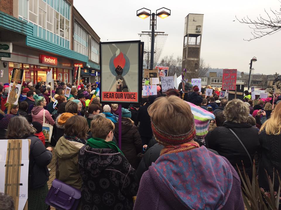
panoramaLike many people, I’ve spent a lot of time this week trying to make sense of the chaotic whirlwind that has been President Donald Trump’s first week in office. Events in Washington don’t normally have much to do with the waterways and communities of Shipley (this blog’s usual subject matter), but there was something about the Women’s March held last Saturday in Shipley town centre — in protest at Trump’s inauguration — that resonated deeply for me. Let me try to explain why.

clock tower

The march in Shipley was, of course, one of many held all around the world. But unlike most of the other places where this happened, Shipley is not a major city. It’s not London or Manchester or Glasgow or even Leeds. It’s a small, former mill town, and the decision of some of its citizens to march was curious enough to attract journalistic comment as far away as India. The specific, local incentive for the action was a kind of subsidiary protest against the local Conservative MP, Philip Davies, who has stated that he would have voted for Donald Trump “in a heartbeat”. But it’s not just his liking for Trump that has antagonised Shipley’s self-proclaimed “Feminist Zealots” (their name is an ironic dig at Davies’s derogatory terminology); it’s their sense that he seems similarly reluctant to treat women as equals. Davies may not have been recorded boasting about grabbing small felines, but his membership of Parliament’s Equalities and Diversity Committee is — as even he would likely admit — about as natural a fit as asking Nigel Farage to join the European Commission.
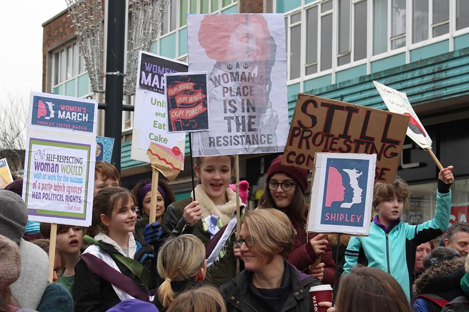
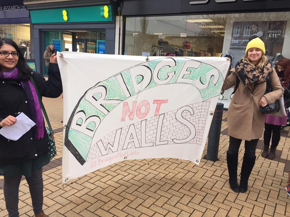
women and placardsI will nail my colours to the mast and say that I whole-heartedly support the Feminist Zealots of Shipley — from whose previously ‘secret’ Facebook feed I have nicked these pictures of the march (with apologies to the photographers). But I also think it’s important to say that Philip Davies is not a man simply to be rubbished and ridiculed (despite the best efforts of, say, comedian Russell Howard). Whatever one thinks of his politics, it’s hard to deny that he is also a hard-working constituency MP who is quite remarkably responsive to the needs of constituents, regardless of who they vote for, or indeed what sex they are. I’ve lost track of the number of stories I’ve heard from local people of how he has helped them out with pressing problems to do with housing, local services, etc. Davies has earned the gratitude and respect of many, which is no doubt a big part of the reason he gets re-elected. So it was great to see that even the protest against him was voiced in a creative, generous spirit, rather than in the kind of divisive, aggressive language that Donald Trump himself has become known for:

16114177_10154540134381888_5887707022175432936_n

This slogan — “Bridges Not Walls” — recurred on a number of placards on the march, and exemplified the spirit of wanting to build and heal, rather than divide and antagonise. It’s also a gift to your local water-blogger, because of course Shipley has no shortage of bridges. Off the top of my head, I count seven road and footbridges across the canal between Dockfield and Hirst Wood (not including the lock gates, which you can also walk across), and a further four across the River Aire. (Of course the canal even takes a bridge of its own over Bradford Beck at one point, just to underline my point…) In short, in the Shipley area, we’re pretty good at finding our way over sometimes troubled waters. So maybe there are even bridges to be built between Philip Davies and his opponents? Before that begins to sound tritely optimistic, let’s take a closer look at one particular bridge…
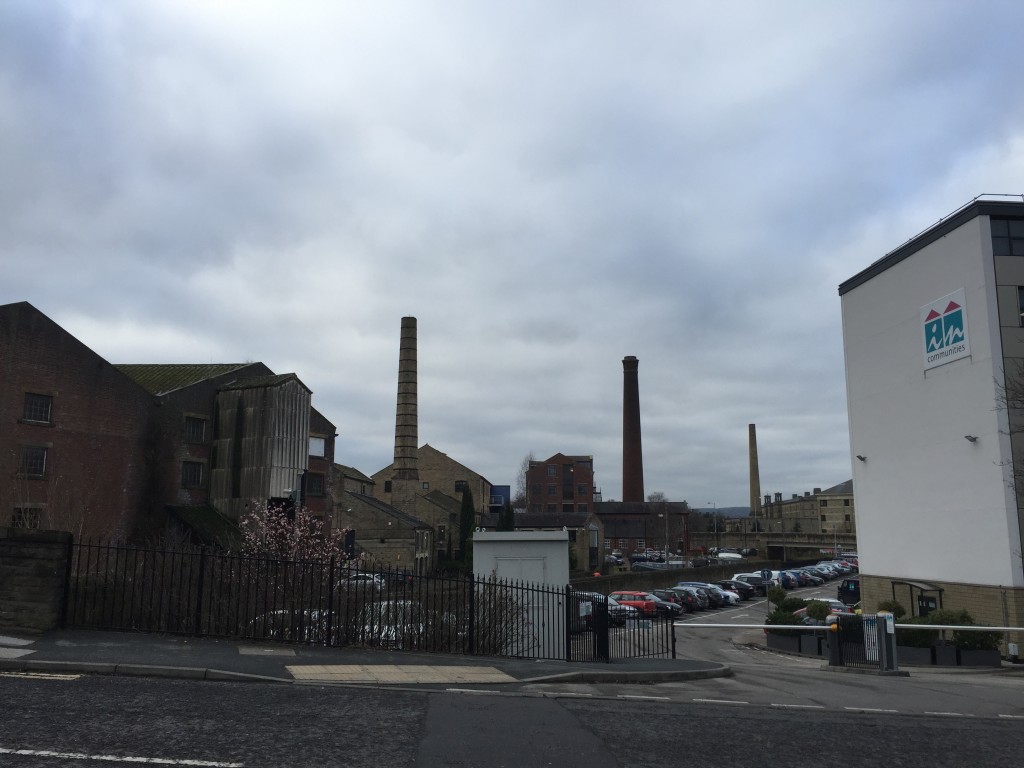
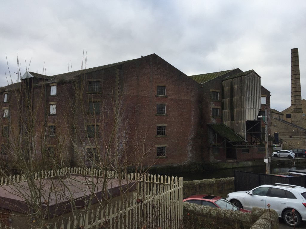
IMG_2374This is Victoria Street in the foreground, ramping up to the left of the picture as it starts to bridge the Leeds-Liverpool Canal in central Shipley. (The distinctive chimney of Salts Mill is in the distance, to the west.) One the right of the image, standing to one side of the canal, is the headquarters of In Communities, Bradford’s social housing authority. (I’ll come back to them in a minute.) On the left of the picture — and directly across the canal — is the distinctive red-brick structure of the former Leeds-Liverpool Canal Company warehouse. This pairing of buildings, old and new, facing each other across the water, sums up quite a lot about the state of modern Shipley. Let’s look first at the warehouse…

IMG_2375

If you were looking to find local examples of what President Trump was speaking about in his ominous inauguration speech — those “rusted out factories scattered like tombstones across the landscape of our nation” — well, this would be as good a place as any to start. Sure, it’s a warehouse, not a factory, but this rather beautiful edifice (which my friend Eddie Lawler has playfully earmarked as the HQ for his imaginary “University of Saltaire”) has been left to go to rack and ruin in recent decades. It’s one of many sadly neglected canalside structures, which has never been retrieved and repurposed for any “post-industrial” service industry. But the question is, what would a Trump (what would a Davies?) propose to do to remedy the situation?

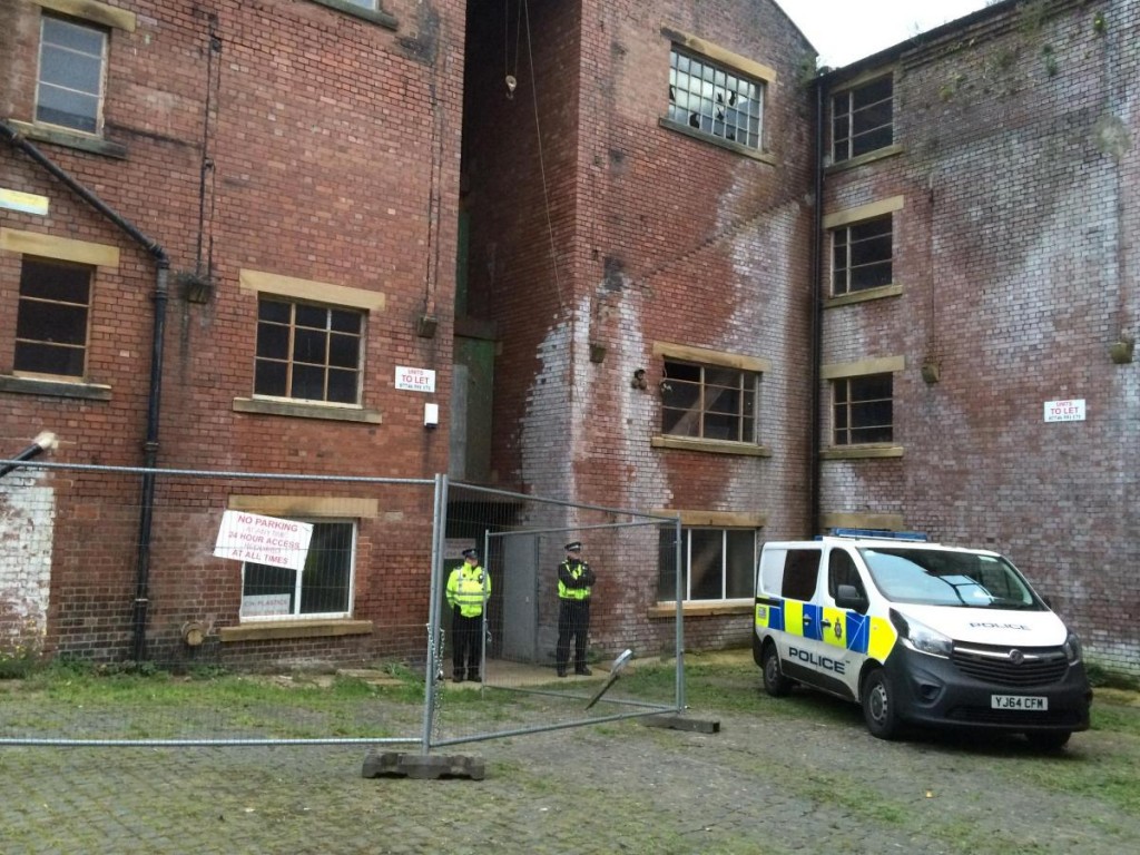
The answer promoted by most mainstream politicians, of either hue, in the UK and US over the last 30 years has been to trust the market. Private enterprise, we are told, will deliver improvements to all our lives… Well, perhaps it will in some places, but the canal company building is still there, crumbling, and last month it was raided by police officers charged with shutting down an unregulated private enterprise…

Cannabis factory at Ashley Lane, Shipley.jpg.gallery

As reported by the Telegraph and Argus , this was not the first time that the building has been squatted for the purpose of growing industrial quantities of cannabis…
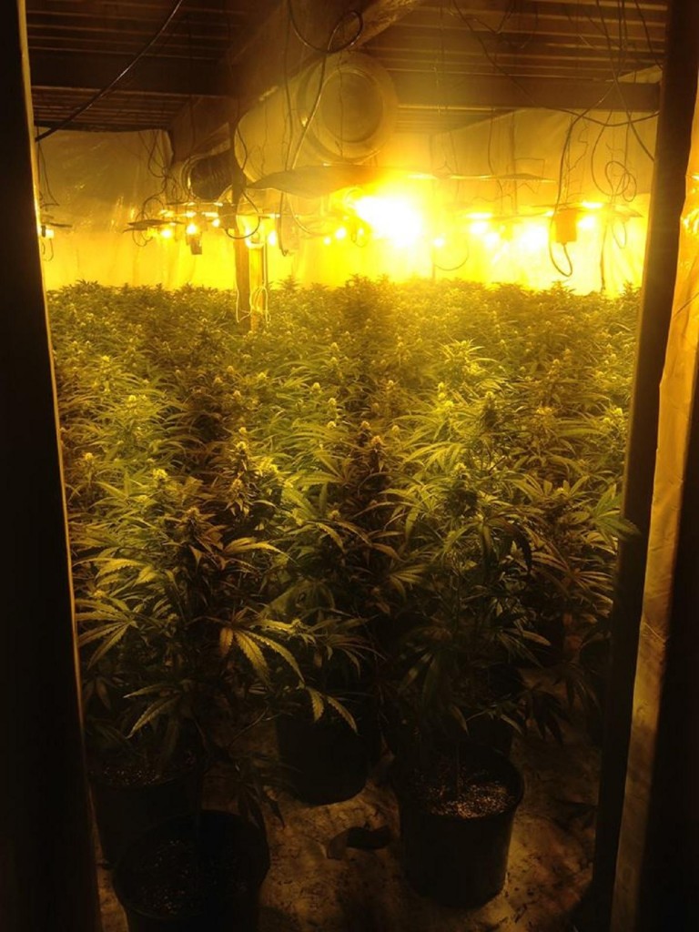
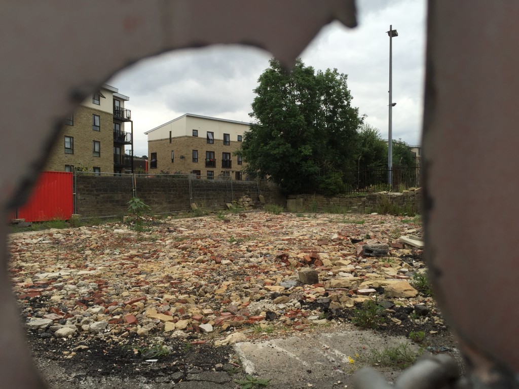
Shipley Ashley Lane cannabis farm.jpg.galleryThe spirit of free enterprise has always been about serving yourself first, even if that involves stretching the law. It’s useful for some things, but it’s not going to save the crumbling infrastructure of Yorkshire’s former mill towns, let alone the American “rustbelt” states that swung victory for Trump. And the new President, who knows a thing or two about free enterprise, knows there’s no business incentive for rebuilding in depressed areas. (Where’s the profit in that?) So instead, he is promising the biggest federal infrastructure programme since FDR’s New Deal in the 1930s. Donald the Builder wants to make more than his signature golden towers. His plans will, he promises, put thousands of ordinary Americans back in work, and it’s these promises that got him the votes he needed in Michigan, Wisconsin and Pennsylvania to win the election.

The question is, who is going to pay for all this? Because much as we’ve all got tired of mainstream politicians who seem only to represent vested interests (hence the Trump rallying cry to “drain the swamp!”), we’ve also got used to not having to pay too much in taxes. Hence Trump’s determination to make Mexicans, not Americans, pay for his most controversial infrastructure project — the mooted wall on America’s southern border (which, of course, the “Bridges Not Walls” slogan refers to). Well, good luck with that, Donald. So far the Mexicans don’t seem too impressed by your negotiation tactics.

But enough about America. Let’s get back to Shipley. Where the appeal of Philip Davies to local voters is perhaps not dissimilar to the appeal of Donald Trump. His slogan is “Your Interests, Not Self Interest”. And as I mentioned, Mr. Davies does seem to do a fair job of helping people out with their immediate difficulties, by banging heads together where he can. And yet… in this era of small-ish government and low-ish taxes, there’s little prospect of the local infrastructure being rebuilt any time soon.

For me, this realisation has become particularly apparent this last month thanks to some striking bits of local history. Paul Barrett at Kirkgate Centre recently circulated this link to Operation Progress — a 1957 documentary film, on the British Film Institute’s web player, which shows the demolition of some of Shipley’s insanitary old back-to-back houses, and the building of the spanking new council housing estates along Coach Road. You get an amazing sense, watching this film, of just how exciting and progressive it seemed at the time to build these solid new homes in green spaces on the Baildon side of the river — transplanting people from the dark, crowded streets so many had been living in before. This was “operation progress”, and it was masterminded not by private enterprise or indeed by central government, but by Shipley Urban District Council. They had a masterplan, and they carried it out, and in many ways we’re still living with the landscape they created in the 1950s. Partly because there’s been no comparable attempt at regeneration since…

IMG_1395

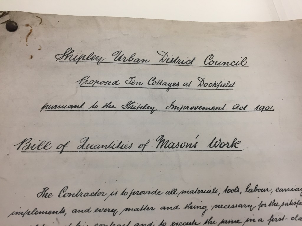
I’ve also been actively researching the history of Shipley’s Dockfield area this month (see also my last blog), and one of the striking things I’ve discovered is that here, too, it was Shipley Urban District Council that made all the difference. Not in the 1950s, but half a century earlier, when SUDC had a masterplan called the “Shipley Improvement Act of 1901”.

IMG_2158

Up til then, Dockfield had basically been the wild west (or rather east) — an area dominated by a few largely unregulated textile mills, with the only road access going under the railway via Dock Lane. The lane was in a shocking state of disrepair because the mill owners didn’t want the responsibility or cost of maintaining it. But then SUDC built Dockfield Road as a modern road link from the main Otley Road. And alongside Dockfield Road, SUDC built the row of terraced housing that still stand there. And at right angles to Dockfield Road, they also built the homes along Dockfield Terrace. Council houses all. And they made them solidly, from stone, with then-state-of-the-art plumbing and heating systems.

And at the same time they built a water treatment works in Dockfield, as the outfall to a brand new sewage main running west to east, the length of Shipley. Because decent sanitation is a basic health requirement. But left to its own devices, free enterprise was never going to provide it.

IMG_1387

All of which brings me back to In Communities. Remember them? Opposite the weed warehouse? It oversees what’s left of Shipley’s council housing stock. Of course, ever since Mrs. Thatcher introduced the right to buy in the 1980s, most council housing in the area — whether along Coach Road (c.1957) or in Dockfield (c.1908) has been sold into private ownership. There’s not much stock left, because there’s been no new drive for social house-building. Because — we’re always told — we can’t afford it. And to judge from the Comments on the InCommunities facebook page (where the average ‘star grading’ out of 5 is 2.2), the condition of much of the remaining stock is poor, and too little care is being taken about the welfare of those people having to live in them. In fact, I even made a film about this recently. But that’s another story.

My point is, if you look around Shipley, it’s easy to see why people here might — given the opportunity — vote for Donald Trump. Whether “in a heartbeat”, or just in the forlorn hope that it might change something. But my point is also that what we really need is properly resourced, properly led local government, with a new vision for the town’s future.

Is it too much to hope that we might build a bridge, on this basis, between Philip Davies and his detractors?

IMG_1404

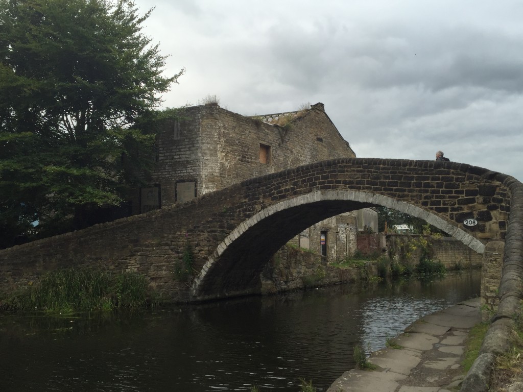
This is Dockfield’s Junction Bridge. Built in 1774 to allow horses to cross from the towpath of the Leeds-Liverpool Canal to the connecting towpath of the Bradford Canal. This is the junction – and the bridge – at the heart of Bradford’s early industrial expansion. Behind the bridge, Junction House — also built in 1774 — continues to fall into chronic disrepair…

 

The Trouble with Baildon Bridge (views from downstream…)

So this blog is in two parts. The first is a close-up, the second takes a wider angle, but hopefully it connects up. Bear with me as I tell the story, because it has a few twists and turns…  And to begin with, there’s also a

Prologue

IMG_2005

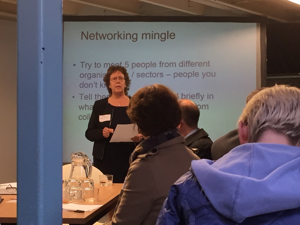
This is Councillor Judith Blake, the current leader of Leeds City Council. This week she said something very interesting indeed, from a Shipley point of view. Councillor Blake was speaking at a special networking event about future flood planning and resilience in the Aire valley, hosted this week at Open Source Arts – an unassuming enterprise unit on Kirkstall Road in Leeds. Open Source was itself flooded at Christmas, but thanks to the tireless efforts of leaseholder Phil Marken, it also became a focal point for the community relief effort and, later, volunteer river clean-up activities. It was thus a rather symbolic (as well as practical) venue for the networking meeting – which was attended by (among others) the key flood risk and drainage officers for both Leeds and Bradford. The goal is greater future co-operation along the Aire Valley catchment… But more of that in a minute. First let me jump us back to Bradford and introduce somebody else…

Part One: Northway

IMG_1965

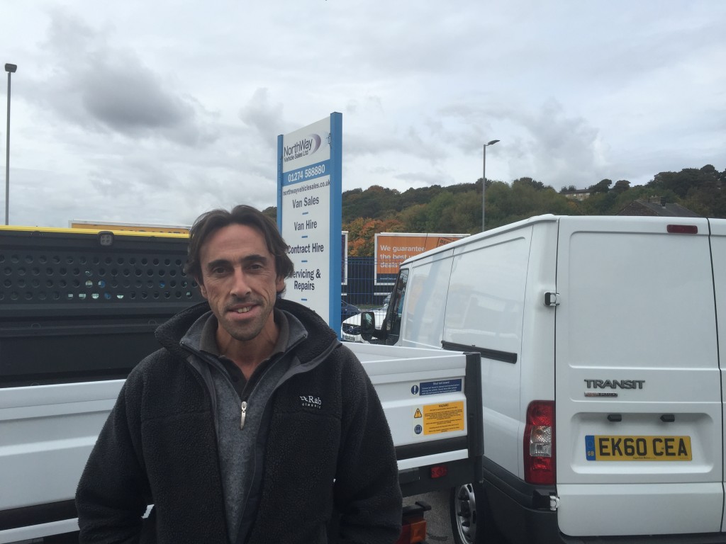
This is Brian Tuxford. He runs Northway Vehicle Sales Ltd., the van hire place on Otley Road, right next to Shipley’s Baildon Bridge. I met Brian the other week, following an introduction via our mutual friend Stewart Gledhill, and he toured me round the Northway compound and gave me the lowdown on just how badly impacted the company was by last December’s flooding. Northway lost no less than 37 vehicles to the flood water – cars and vans – one of them swept as far downstream as Denso Marston’s nature reserve, at Charlestown. Even those vehicles that Brian and his colleagues managed to save in time — by parking them around the corner up Dockfield Road — were stripped of exterior fittings that night by light-fingered visitors, who took advantage of the absence of the usual CCTV cover. Insult to injury.

IMG_1963

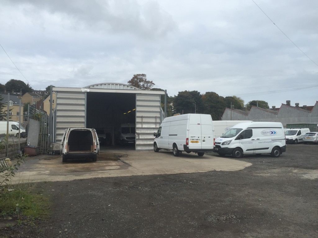
The bottom yard at Northway Vehicle Sales, just downhill from Otley Road

There was also the small matter of Northway’s workshop/garage (pictured above) having a massive hole driven straight through it by the force of the flood water — the end panels blown off. The whole thing has had to be taken down, repaired and re-erected.

Boxing Day flood was a bit of a “perfect storm” from Brian’s point of view. Normally, 80 to 90 percent of Northway’s fleet is out on hire at any given time, but over the Christmas period they’re called back to home base. So they were sitting right in harm’s way. On a normal working day, moreover, Brian would be at work at 7am, and would have been in exactly the right place to see the danger to his fleet and take swift action… Instead, he was staying over for Christmas in Huddersfield and only realised what was happening, by around 9am when the water hit, from the CCTV link on his phone. (In her talk, Councillor Blake spoke of how lucky Leeds was that the flood came at Christmas — with the city centre workforce not present, not travelling in or out… But Brian’s story is the opposite.)

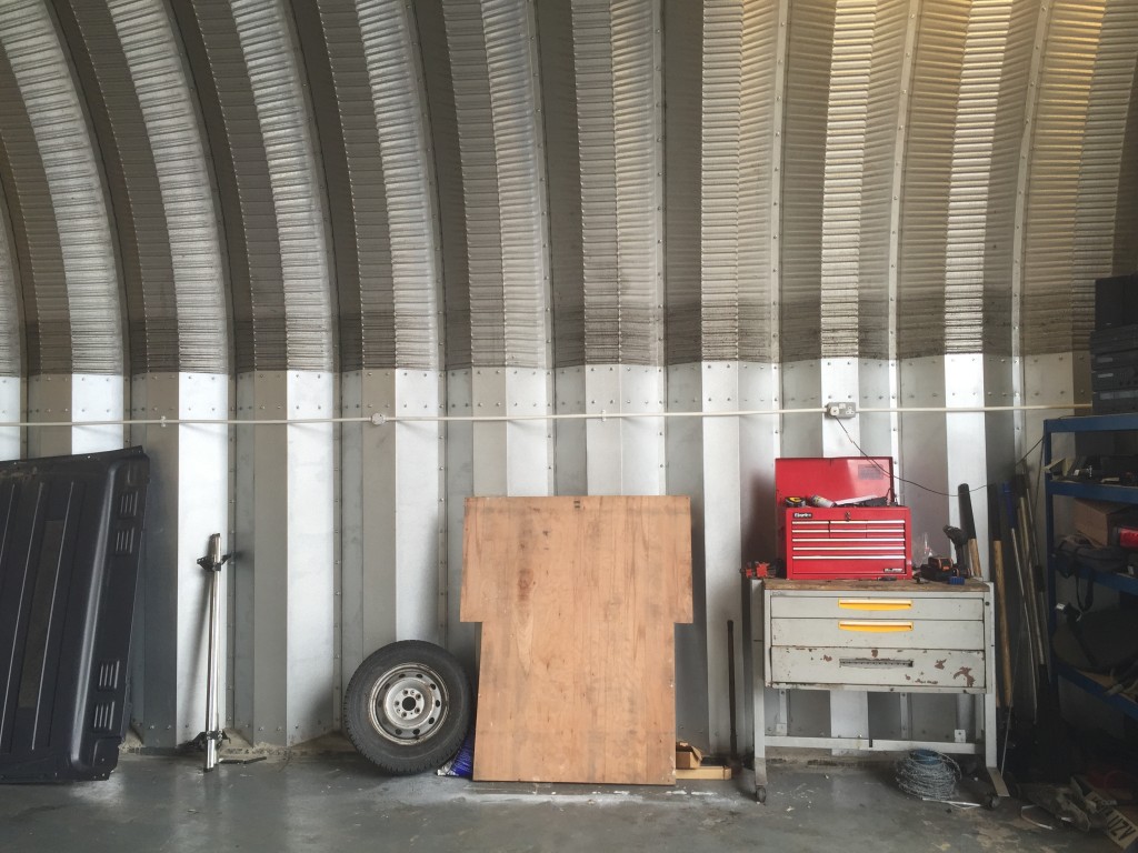
The dark line across the lower part of the roofing here, well above head height, is the high watermark from the Boxing Day flood...

The dark line across the lower part of the roofing of Northway’s workshop, well above head height, is the high watermark from the Boxing Day flood…

In the aftermath of the flood, Brian had to lay off Northway’s mechanic, who had no work because there were almost no vehicles left to service. And of course Brian couldn’t pay him, either, because there was no income from hires. It took six months for a new fleet of vehicles to be delivered (after the insurance claims, and the long lead time for ordering new high-end vehicles). In the mean-time, the loss of operating revenue pushed the company to the limit — Brian and his partner nearly had to close up. And they know they’re taking a big risk reopening, because if another flood happens, there’s nothing to stop the whole scenario repeating itself…

Media coverage of flood victims typically tends to focus on people whose homes have been hit. This is understandable, given that we can all identify with the horror of having our personal sanctuaries being swamped by filthy water. We hear a lot less about the impact of flooding on small businesses like Brian’s, and the assumption can often be, well, business is business, right? They’ll claim on the insurance and get on with it. It’s not as bad as having your home invaded. And yet, as Brian grimly observes, his entire livelihood is tied up with this business. Fifteen years of hard slog, building it up from scratch on this site by the river. And much as he might want to move the business, since the flood, he can’t readily relocate to another site. The Baildon Bridge location is key, both because of the region-specific terms of his franchise agreement, and because many of his core customers need Northway exactly where it is (Saltaire Brewery, for example, just up Dockfield Road). And yet, Brian acknowledges, if they get hit by another flood, that’ll be it. Game over.

This year, post-flood, Northway’s insurance premiums have literally doubled. That too is putting the future of the business in serious jeopardy.

Now, you might be wondering what all this has to do with the Leeds flood planning meeting I mentioned in my “prologue”. Well, Brian’s business is specifically threatened by the way that flood water hits his riverside location. As he observes, on Boxing Day the river channel itself never threatened the van hire site. The water that was coming under Baildon Bridge flowed right on past. No, the water that hit Northway was water that had re-routed itself around the bridge…. In high water conditions, the low-lying bridge structure becomes something of a dam, and the river instead heads right out across Woodbottom cricket pitch as far as Green Lane, and then surges across the industrial/retail area east of the bridge, on its way back to the main channel. This happened not just last December but also in 2000 and in 1947. And Northway is right smack bang in the path of the water. The space between the buildings, Brian notes, became like a kind of surging plughole…

All of this raises the question… could floodwater, in future, somehow be persuaded to stay in its channel? If something could be done to re-engineer the bridge, maybe, so it’s less of an obstruction…? And if some walls could be constructed upstream to protect the Woodbottom area…? Might the river just surge right on by instead of going all over everywhere? Possibly. In which case, Brian’s livelihood would be safe. Or at least, safer.

But… there are some issues here. One is, obviously, the cost of such a defence scheme. Given the relatively small number of homes and businesses that are directly in harm’s way in this area, it’s unlikely that a “cost-benefit analysis” by government would find the spend worthwhile. (And who are any of us to argue with that, if we don’t want our taxes to go up to pay for equally worthy flood schemes on this sort of scale all over the country…?) But the other key point here, which I hadn’t fully appreciated until the Leeds meeting this week, is that – strictly from a Leeds point of view – it would be just fine if Bradford has quite poor flood defences. If water ends up sitting around on the Baildon flood plain for days, during a flood incident, well that’s just fine from a Leeds point of view. Leeds doesn’t really need high water flowing straight on through Bradford, staying in the Aire’s main channel, because then — well — it all ends up in Leeds…

Part 2: Scheming for Alleviation 

This was all brought home to me as I stood chatting, during the lunch break, to Andy Judson – who is the project director for BAM Nuttall Ltd on the current, £46m Leeds Flood Alleviation Scheme (FAS). The FAS has involved building a bunch of new flood walls in Leeds city centre over the last year or so, and BAM are now in the process of constructing high-tech collapsible weirs at Crown Point and Knostrop. Mr. Judson is a very approachable, very interesting man, who is – understandably – hoping that BAM Nuttall will get another big slice of contract work on “FAS2”, the mooted second stage of the Leeds scheme for which the government offered around £60m in the wake of the Boxing Day devastation. This scheme is intended to do something to better defend Aire valley areas of Leeds like Kirkstall, which was badly hit at Christmas, but for which nothing was provided in FAS1 (which is very much focused on the city centre).

IMG_2015

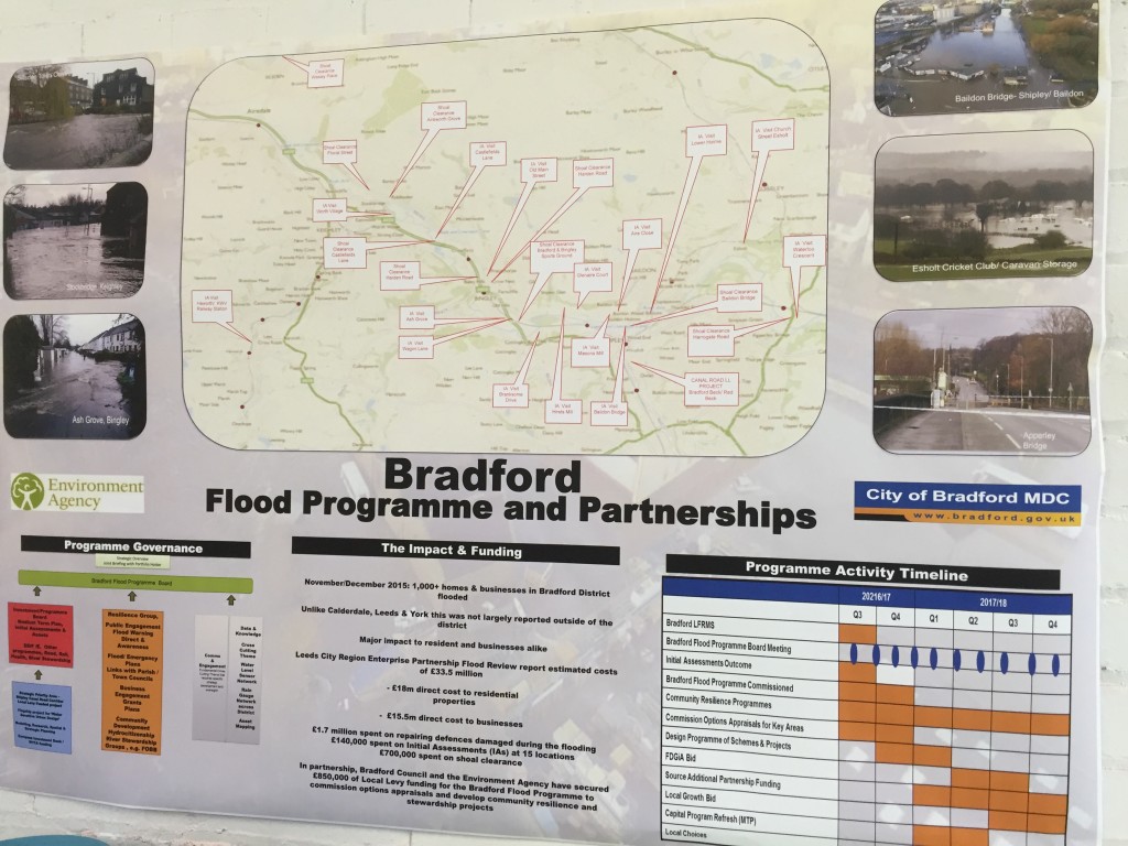
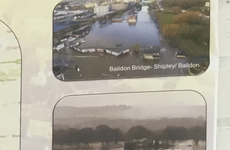
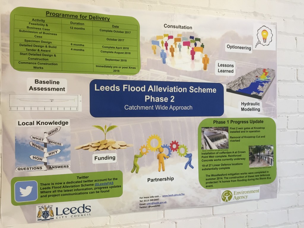
Mr. Judson and I found ourselves standing in front of this big poster about Bradford’s current flood risk planning. In the top right hand corner (see below) there’s an aerial shot of the flooding around Baildon Bridge at Christmas…. which is how we came to end up talking about it. Andy pointed out what I’ve just said about how flooding in this area, and many others upstream of Leeds, might be viewed “from a Leeds point of view”…

IMG_2015

Now, Mr. Judson’s job is to undertake the contracting work that is handed to him by major clients such as Leeds City Council and the Environment Agency. On a day to day basis, it’s not his responsibility to worry about Bradford. But this is why the networking event this week was so important. Because to give them their credit, LCC and the EA have decided to try to approach FAS2 differently to FAS1. The initial scheme has been dominated by the technical and engineering interests: a scheme was devised and proposed (by the engineering company Arup), funded (via the council, the EA, and central government), contracted out (to BAM and others) – but all in such a way that very few non-technical folk had anything much to say about it. A problem is identified (flood risk in Leeds city centre), a practical solution is proposed (build new walls, devise new weirs), and the construction juggernaut rolls into gear…
Yet the very fact of FAS2 being given a wider brief — to think “beyond” the city centre — has prompted some important reflections on exactly what the problem is that needs to be fixed by the new scheme. How far upstream – or indeed downstream – do we want to try to flood-defend? Putting the problem really crudely… Phil Marken’s Open Source Arts space on Kirkstall Road perhaps deserves better protection, but so too does Brian Tuxford’s van hire place — which is threatened by the exact same river. Viewed on a river catchment basis, the arbitrary distinctions between what is Leeds and what is Bradford are largely irrelevant – because the River Aire has no respect for political boundaries. In planning for FAS2, then, a “catchment-wide approach” is being adopted — and this includes an innovative attempt to involve as many relevant partners as possible, in order to better answer the flood defence questions (or even to establish what the questions are that need answering).
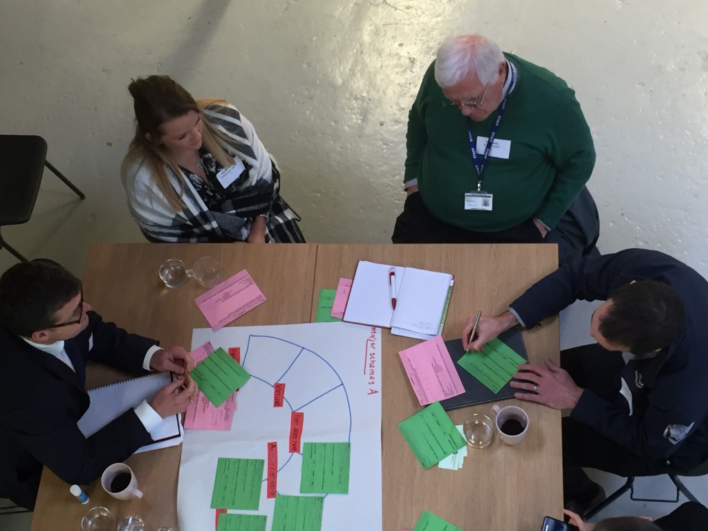
Andy Judson (BAM), Una McMahon (Environment Agency), Tony Poole (Bradford Council), and an unidentified fourth person, hard at work in a discussion group at Open Source Arts

Andy Judson (BAM), Una McMahon (Environment Agency), Tony Poole (Bradford Council), and an unidentified fourth person, hard at work in a discussion group at Open Source Arts

The workshop at Open Source Arts thus included representatives not only from the EA, the LCC, Arup, BAM, etc., but also senior planners from Bradford Council, and indeed counterparts from as far upstream as Craven (the district that includes Skipton and Malham). But the workshop also included community activists like Phil Marken and Vicki Gilbert (until lately of Yorkshire Voluntary Flood Support Group), as well as representatives from voluntary watchdogs like Aire Rivers Trust, social enterprises like Canal Connections, and even university researchers like me. Don’t ask me how the full list of invitees was arrived at – no doubt some significant people were inadvertently left out, as is the way with these things. But the point is that there was a genuine effort here to get people out of their regular boxes and comfort zones — and talking to other people with other perspectives and approaches to the flood problem. Andy Judson and I started speculating, for example, about how a natural flood storage scheme somewhere upstream of both Leeds and Bradford might provide the relief that both cities need… Exactly where or how that might happen is of course anybody’s guess (we were just talking…) but the point is that – just by having all these people in the same room – the debate had already moved well beyond the boundaries of Leeds itself. We can reasonably hope that there is going to be some serious partnership thinking going on in the coming months, which might – just might – benefit Brian Tuxford as well as Phil Marken. And, of course, many others like them.

IMG_2009

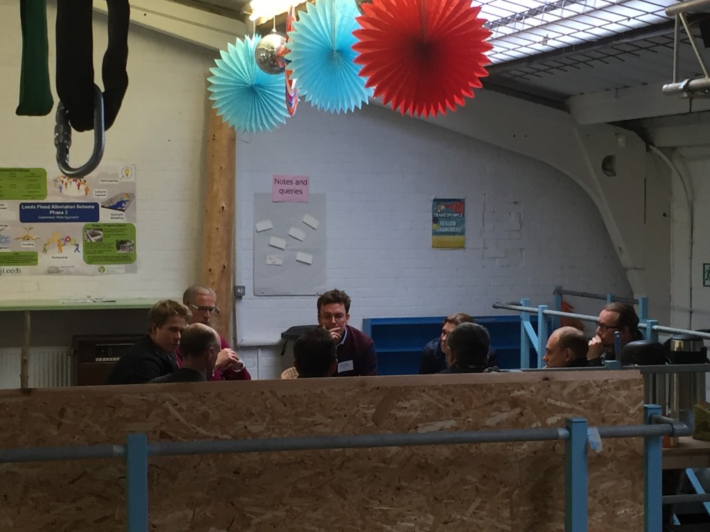
The loft level at Open Source Arts — including aerial harness and “Resilience” working group…

And this brings me back to Councillor Blake. Because at the heart of her opening pep talk to those assembled at Open Source (alongside her own personal, heartfelt reflections on the devastation of the city last Christmas) was the suggestion that community involvement has to be fundamental to the development of FAS2 and any associated initiatives. That was her word. Fundamental. This was a gauntlet, of sorts, thrown down for those present. Because flood risk managers, civil engineers and building contractors are not necessarily the kind of people best equipped or most inclined to engage with or listen to communities. But Councillor Blake was saying it unambiguously: other people need to be consulted. That’s the people of Leeds, yes, but also the people of Bradford, of Skipton, you name it… That’s the only way we’re going to arrive at the best possible solution for the greatest number.

And maybe, in the process, we’ll end up not just with more concrete walls, but better, safer, happier, greener places to live in…?

“You may say I’m a dreamer… But I’m not the only one.”

IMG_2014

Seven Bridges, Two Cities

The Shipley Street Arts Festival is coming up at the end of June (26th-28th), and this year is taking the river and canal as a linking theme. We’re delighted to announce that the Multi-Story Water project is working actively with Q20 Theatre to make this happen. In case you’re wondering whether there is any “street art” in Shipley, well lookee here…

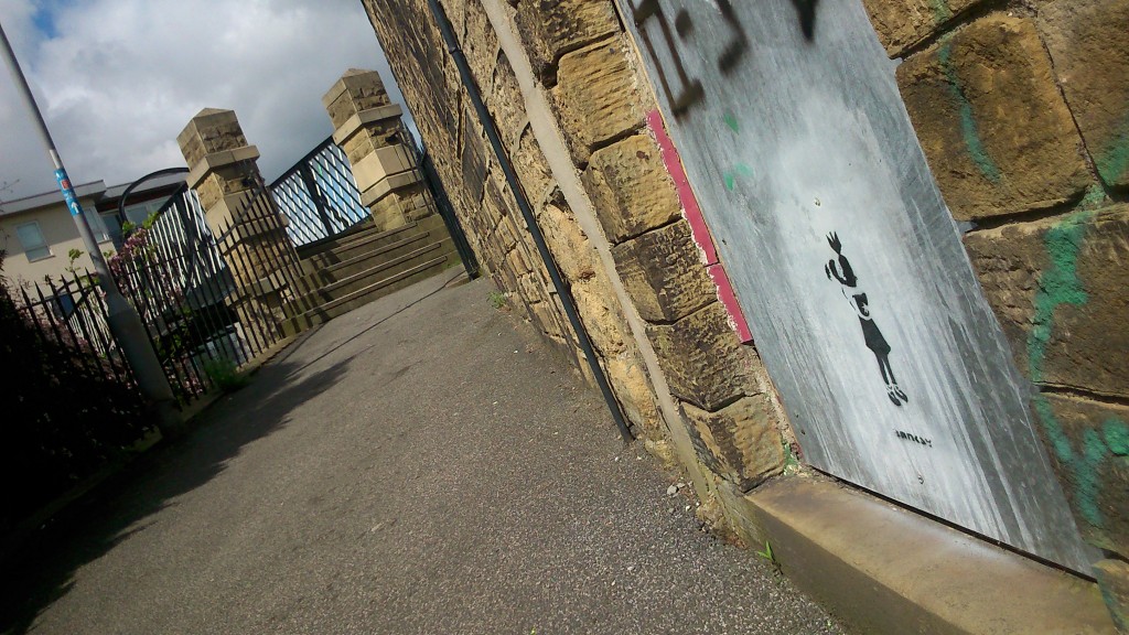
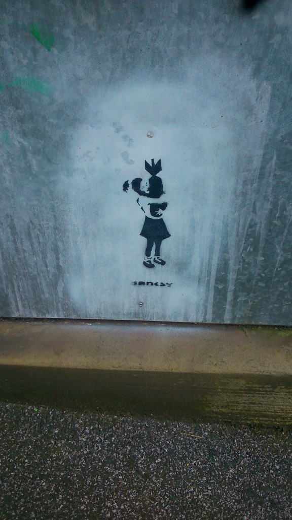
DSC_0320A genuine (as far as I can tell) piece of Banksy graffiti, tucked away on the footpath that goes up to Gallows Bridge – across the canal – just up the hill from where Aldi and McDonalds sit by Bradford Beck. In case you don’t know his work, Banksy is a famously anonymous, Bristol-based artist whose graffiti has become internationally renowned. People sometimes rip down entire walls so as to be able to flog things he’s painted on them… This particular metal panel looks like its secure enough where it is, though. I’m not sure how long the painting has been there, but it’s tucked away in this wonderfully unassuming location… Here’s the image in close-up:

DSC_0318OK, that’s all I have to say about Banksy. But Gallows Bridge will be featuring as one of Seven Bridges in the Shipley area that will be linked by a looping promenade performance that we are making for the Street Arts Festival. I’m pleased to confirm that this will be performed by David Smith and Lynsey Jones (both of whom co-created and performed in our original Multi-Story Water tours back in 2012), and will be directed by Simon Brewis (who directed them). Always nice to keep things in the family…

Meanwhile, though, we are getting delusions of grandeur. Because simultaneously with the water-themed Street Arts Festival in Shipley, the Leeds Waterfront Festival will be running the same weekend. So to provide a kind of conceptual “bridge” between the two festivals, we will also be presenting another performance — with the same title, Seven Bridges — in Leeds. If you’re really keen, you might want to see both… (!)

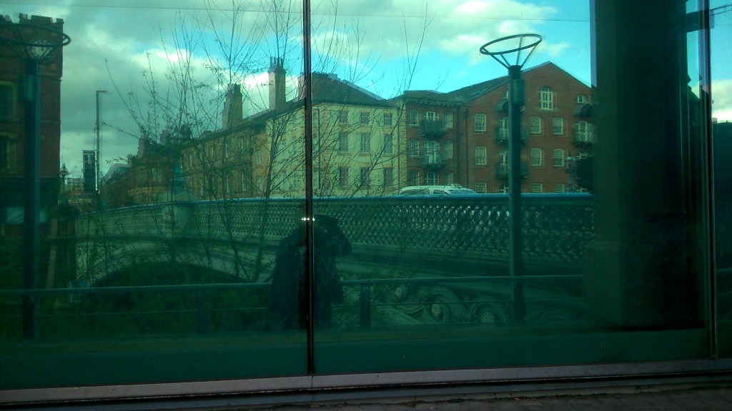
DSC_0285This is me being anonymously artsy (if not banksy) while researching the Leeds end the other week. That’s Leeds Bridge you can see reflected in the plate glass — the crossing where the city began. Leeds’s whole history was built around the river, which is why it’s so strange that the city has sort of turned its back on the waterfront: you can live there for years and barely even be aware of its existence…

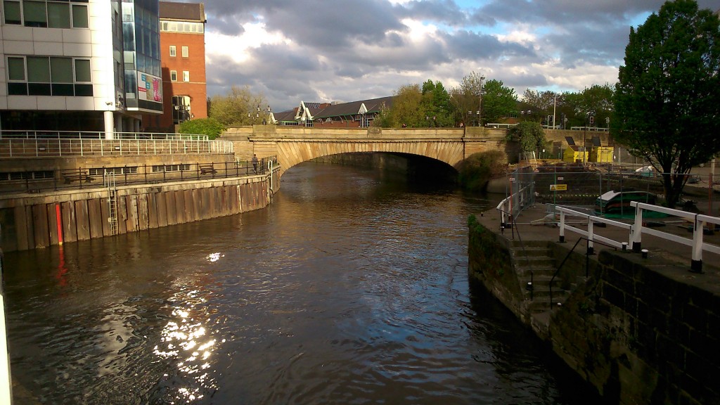
DSC_0304Here’s another of the Seven Bridges — Victoria Bridge, which was built (unsurprisingly) in the 19th Century to replace a longstanding ferry service. It’s one of the major road links to Leeds station … right beside Bridgewater Place — the unnecessarily tall building better known as “the Dalek”! But even though there’s a clue in the name — Bridge — water — place — you can drive across Victoria Bridge a thousand times and barely even notice that you’re crossing a river…

Now… notice the white, ‘canal style’ railings to the right of the shot above. That’s because this image was taken at the junction where the River Aire (aka the Aire-Calder Navigation) connects with the Leeds-Liverpool Canal. And here it is…

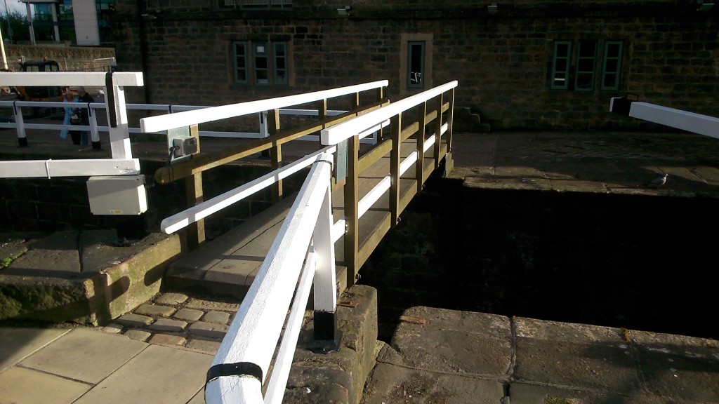
DSC_0303… the footbridge that crosses the end of Lock 1 on the Leeds-Liverpool… the very, very beginning of the 109 miles of canal, that goes through Shipley and all the way to the Mersey… Meanwhile, if you turn through 180 degrees and move upstream on the Aire a little (also in the direction of Shipley, of course…) you come to this…

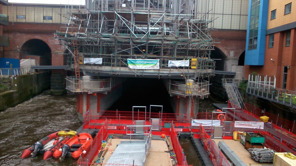
DSC_0298This is the brand new entrance to Leeds Station, currently being built by Carillion. I like the sign on it: “this is civil engineering“! (as opposed to uncivil engineering…?) Notice that because space is so tight around the station, the building materials are having to be floated upstream on pontoons (in the foreground of the shot) in order to get to the site. Notice also the angle this shot is taken from… I was standing on – you guessed it – a bridge. Granary Wharf Bridge, to be precise — quite a new, modern one… That’s the western end of our Seven Bridges route… and here’s (almost) the eastern end…

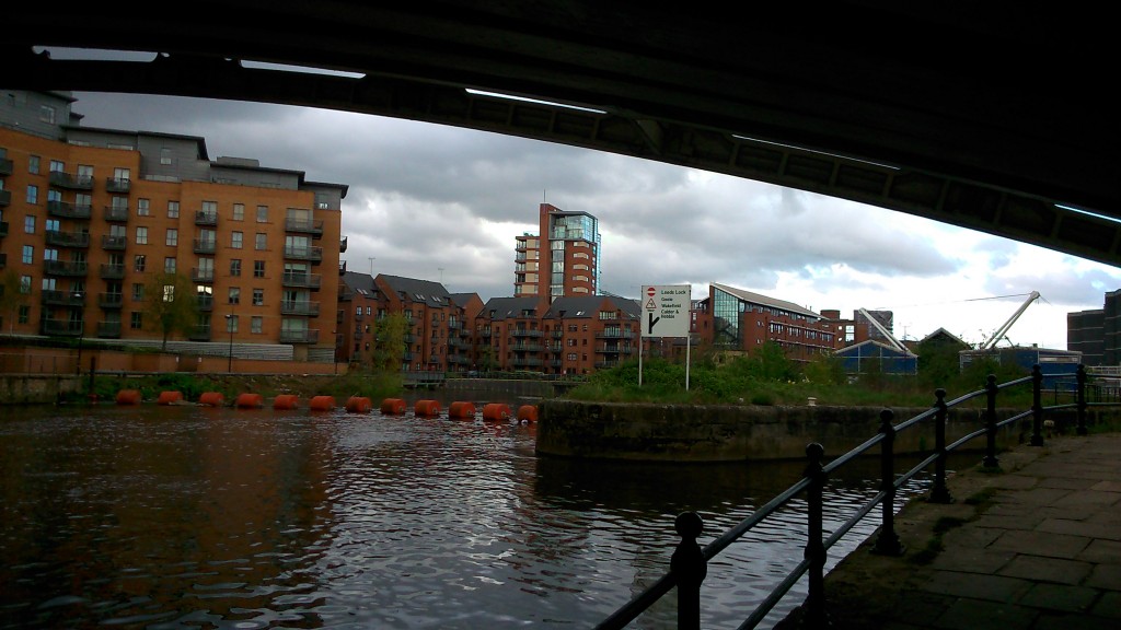
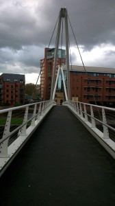
DSC_0256This is the entrance to the weir and lock at Crown Point (Clarence Dock), with the Crown Point Bridge arcing overhead… another road bridge that you can merrily drive across without ever noticing the river… And in the shot below is the weir itself, viewed a little further downstream from Knights Bridge (footbridge)…

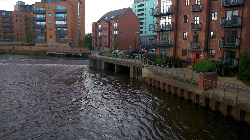
DSC_0261Notice the black holes in the middle of the shot here. Not technically a “bridge” perhaps, but this is where Meanwood Beck enters the Aire… a rather lovely beck that flows down through Meanwood Park and its attractive, surrounding valley, but then disappears into underground culverts before it gets close to the city centre (shades of Bradford…).

DSC_0259

This is Knights Bridge itself, viewed from the Clarence Dock side, and looking across to the building that operates as the headquarters for the Canal and River Trust in Leeds (hub of the CRT Northeastern partnership, if that means anything to you). Some very nice people work there… This bridge, as you can tell, is pretty modern, but I need to do some more research about it…

What strikes me here is the proliferation of white-painted metal, which even extends to these cage-like railings in front of the CRT building itself…

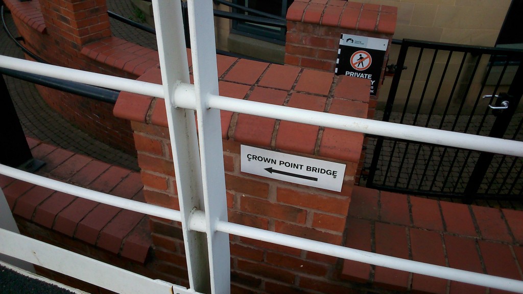
DSC_0262I like the little bit of signage here, pointing you to the next bridge (“hey, you’ve just crossed the river, fancy doing it again in the opposite direction?”). But there’s no shortage of signage in the vicinity of the river in Leeds… Check these out, for instance…

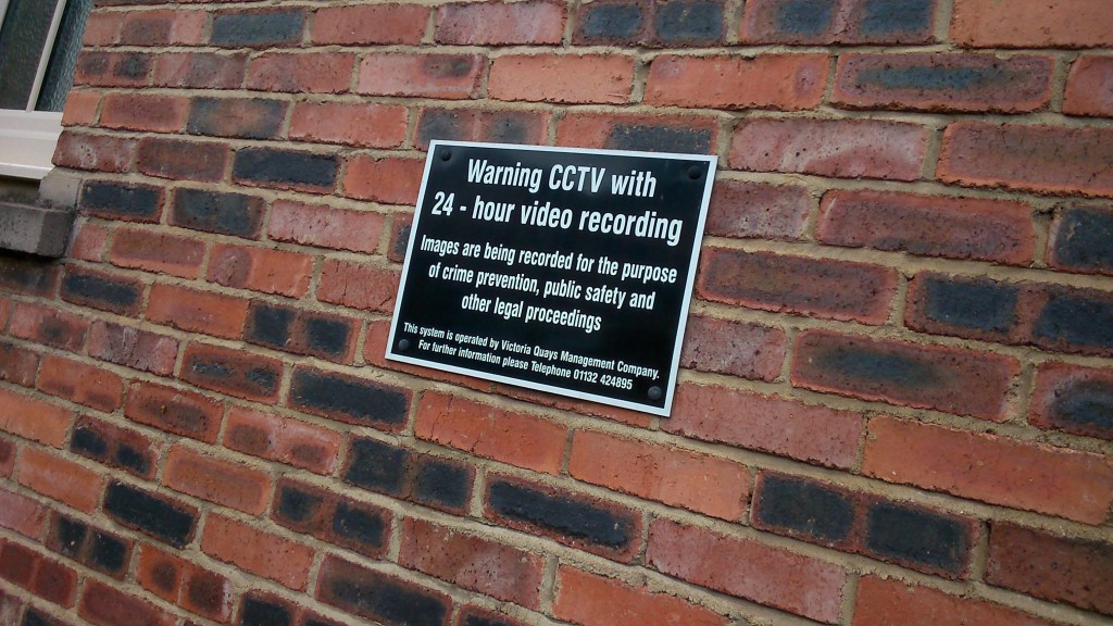
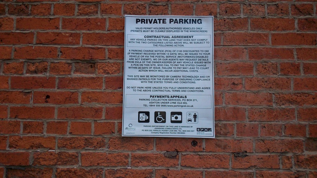
DSC_0239DSC_0242DSC_0251DSC_0272 DSC_0243Everywhere you go, it seems, you’re being warned that you’re on private property… that you are walking at the permission and indulgence of property owners… that you are on CCTV… There’s no sense in Leeds at all that the banks of a river might be public space, for anyone to walk along. The riverside paths are constantly broken up, interrupted by buildings or private spaces that you can’t enter. There is no “ancient right of way” here, in the way that there is in Shipley… And then the city wonders why people don’t engage more with the waterfront…

O Banksy, where art thou…?


Weir Today, Gone Tomorrow?

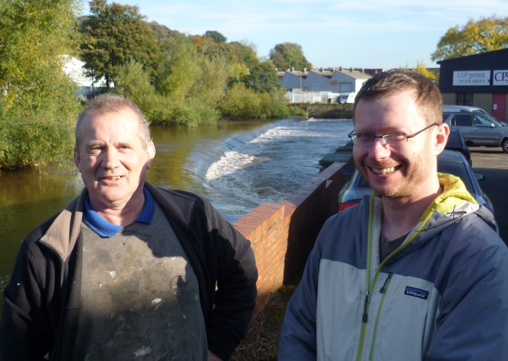
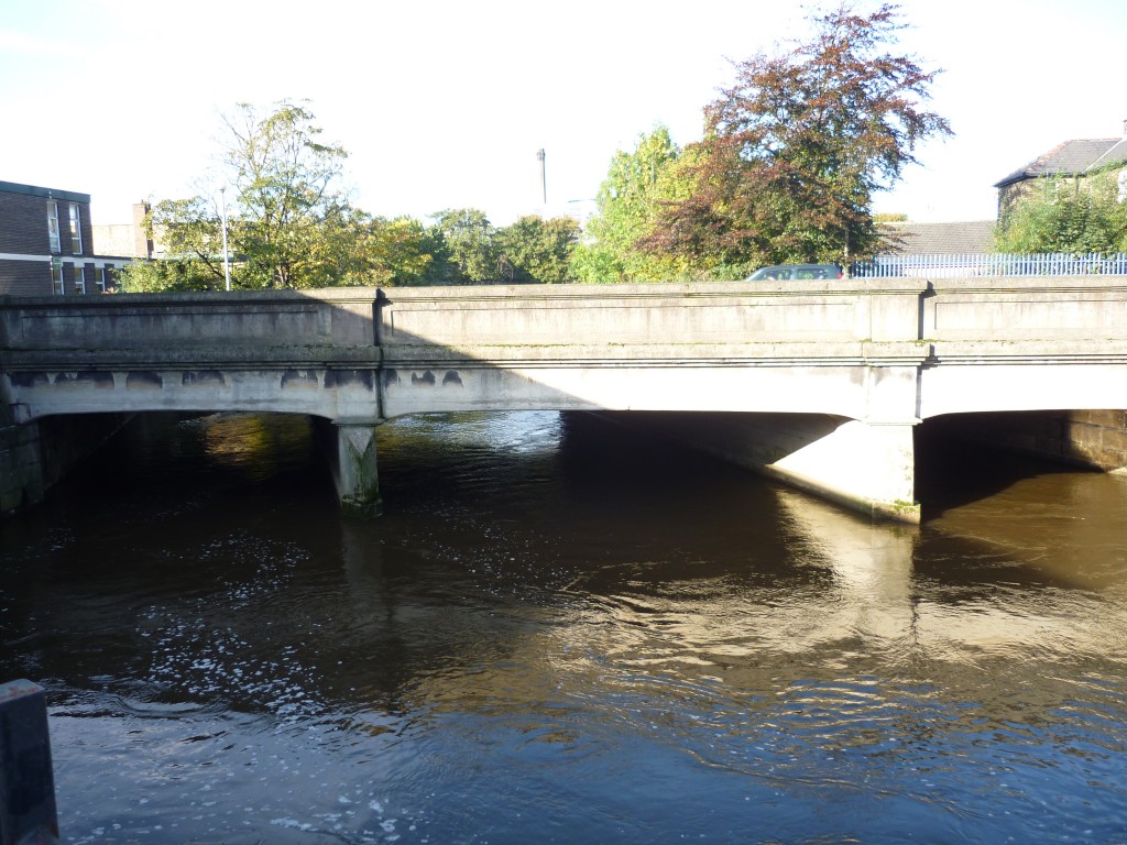
weir 24 10 13 003Today, perhaps, we may just have started something. I met with Philip Moncaster (left) and Paul Gaskell (right) at the weir just downstream of Baildon Bridge (between their heads), and we discussed the possibilities for getting the weir removed once and for all. This has long been a goal of Philip’s, who lives right on the river upstream of the bridge, and is also secretary of the Baildon Woodbottom Working Men’s Club, which stands almost next to the bridge. (Anyone who came along on the “Red Route” section of our Multi-Story Water performance tour of the area will remember that we based one of our main characters on Philip.) He believes that getting rid of the weir would significantly reduce flood risk at both the club and his home — and in all probability he’s right. Baildon Bridge is the major flooding pinch point in the Shipley/Baildon area (this was the case in both 2000 and 1947), because debris in the river can all too easily get caught around and across its thick concrete stanchions. This can create a dam effect, which the solid-walled sides of the road bridge itself only add to…

weir 24 10 13 002When the bridge turns into a dam, the water simply re-routes itself off around the club and across the adjacent cricket pitch (people were swimming on it in 2000, Philip mentioned!). But it doesn’t take a rocket scientist to figure out that if the water level going under the bridge was lower to start with, the level of flood risk would also be reduced. And taking the weir out would surely help to lower the water level, because a weir is itself a small dam that artificially raises the water level on the upstream side.

All this begs the question why the responsible authorities (mainly the Environment Agency and Bradford Council) have never done anything about this before. But for whatever reason, it simply isn’t on their “to do” list. Indeed, Philip has been told by the Council that if he wants to campaign for the weir’s removal, that is fine with them, but he would need to raise the money not only for the work, but for the consultation process that would allow the work to be done. Unsurprisingly, Philip is unimpressed with this response!

This is where Paul Gaskell comes in. Paul is based in Sheffield, and works for a charity called the Wild Trout Trust. I met him at a “think tank” workshop held this July by the Environment Agency, looking at “river stewardship”, and I learned then that one of the things Paul is particularly keen to campaign on is the removal of old weirs. For him, the major issue is not so much flood risk as the ecological health of the river itself. Weirs interrupt the natural “geomorphology” of a river’s flow, causing sediment deposits to build up on the upstream side, but conversely adding to river bed erosion on the downstream side – because water flowing over the top of the weir (minus its low-flowing sediments) tends to ‘dig into’ the bed as it comes down. All of this has consequences for the general health of the river, and of course weirs particularly affect the ability of fish to move up and downstream (hence the Wild Trout Trust interest).

Because Paul knows so much about all this — and particularly about the kinds of obstacles that get thrown up to prevent weirs being taken out — I invited him up to Shipley to meet with Philip. Maybe Paul could point Philip in the direction of the right people to help him overcome the administrative inertia. What was clear from our very positive meeting was that we can all see benefits in our putting some energy into pursuing this. Obviously, for Philip, it’s a longstanding concern, but Paul also thinks that this particular weir could make for a valuable “case study” site that might help prompt further action elsewhere. One of the blockers to action on weirs that he has often encountered is the “heritage” dimension, whereby people think that weirs represent an important part of their local industrial heritage (although apparently there are ways to remove them that still leave in a sort of ghost trace of the “heritage” structure, if desired…). With the Saltaire World Heritage Site only a few hundred yards upstream, the removal of this weir could be particularly interesting from the “cultural” point of view — and that is of course where my personal interests lie, as a theatre-maker and researcher: could we make the process of removing the weir into a “creative process” of sorts, one aimed at developing dialogue and understanding around the relationship of human heritage and the natural environment? (Perhaps, when Philip eventually gets to climb in and smash it up, we can stage a bit of a party around the action! … And yes, he’s keen to be involved in the work itself – as a builder he knows quite a bit about both construction and destruction…)

All of that said, Philip himself is not sure that local people care too much about this particular weir, or any heritage value it might be seen to have. He’s collected hundreds of signatures on a petition for its removal, and has encountered only a couple of objectors. In all likelihood, the big obstacle is going to be the red tape — the consultations around what the downsides to the weir’s removal might be. Ironically enough, Paul believes that the main issue is likely to be the bridge. The removal of the weir would probably mean water flowing downstream a little faster at this point, and there’s a chance (small!) that this might impact negatively on the bridge’s foundations. The Environment Agency, Philip notes, will also want to establish whether or not anyone downstream will be negatively affected by the weir’s removal, although it is hard to see how that could be the case.

Basically the outcome of our meeting was that taking out this weir is probably a win-win from every angle, and that it’s the red tape that will be the main problem to getting it done. Paul also noted, however, that some regulations may be working in our interests. One of the provisions of the European Water Framework Directive (WFD) is that governments and local authorities need to work towards freer movement for fish up and down rivers (for good ecological reasons besides happy fish), and indeed fines can be levied if not enough is being done to pursue this goal. This was news to Philip, who was delighted to hear that there is a stick as well as a carrot for the relevant authoritiees… In some places, Paul mentioned, fish passes have been built onto weirs to address the WFD requirements. And yet the process of designing, consulting on and building a new fish pass is vastly more expensive — and less ecologically beneficial — than simply removing a weir. Paul mentioned that a fish pass can cost around a quarter of a million pounds — as against the twenty or thirty thousand it costs to remove a weir. According to Philip, the actual construction of this weir at Shipley cost less than £400, back in the day… How times change.

So numbers were exchanged, diaries consulted, and the beginnings of an action plan agreed. We’re all very busy over the next couple of months, but hopefully our meeting will be the beginning of something… Please do get in touch if you’d like to help!

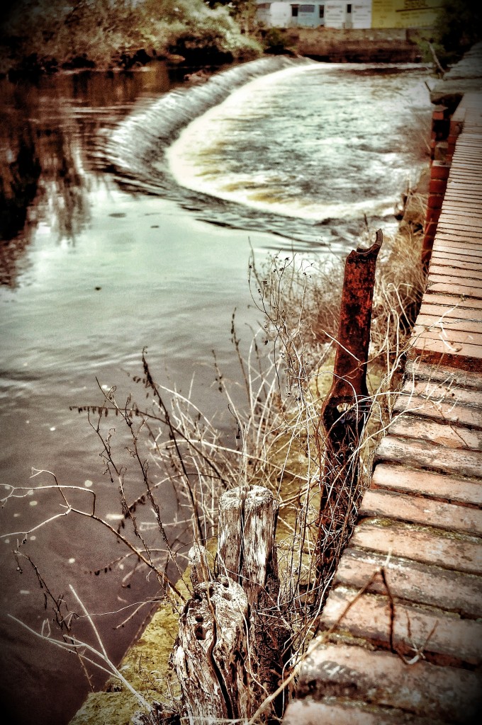
Yvonne Roberts's photographic rendering of the weir from the Shipley side.

Yvonne Roberts’s photographic rendering of the weir from the Shipley side.


Shipley before the River

[posted by Simon Brewis]

This Friday, May 4th, I had my first day working on Multi Story Water Shipley. I thought I’d start by doing a little research. Rather than head straight to the river I wanted to get some contect of place and how the river might shape local identity. So I decided to spend some time in the town itself and search for evidence of how the river might be present in the town. I was looking for pubs, hotels and road names that referred to the river. I kept my eye out for public art that referenced water. I was almost expecting that at some point I would turn a corner and there would be an embankment or some other public architecture to bring people to the river. However after an hour there was no sign of the impact of the river in the town centre.

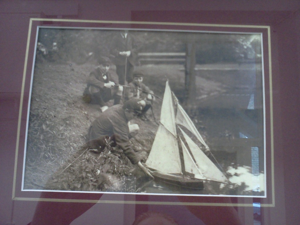
I grew up in Bedford, or ‘Beda’s Ford’ in old speak. In Bedford  the river runs through the heart of the town geographically and culturally, so i found the lack of evidence of a river a bit strange. But then I thought about my now adopted home town of Leeds, or ‘Leodis’ which means ‘people of the river’ in old speak. Now in Leeds we are barely aware there is a river even though the place is named after it! So perhaps I have come to expect too much? After an hour of searching I finally found something,  this picture on a notice board in the Town Hall:

After limited success in my first mission I decided to play another game I sometime enjoy in a new place. I search for maps of a place that are produced in that place. I like this game because I think how the local people map a place speaks volumes about it.

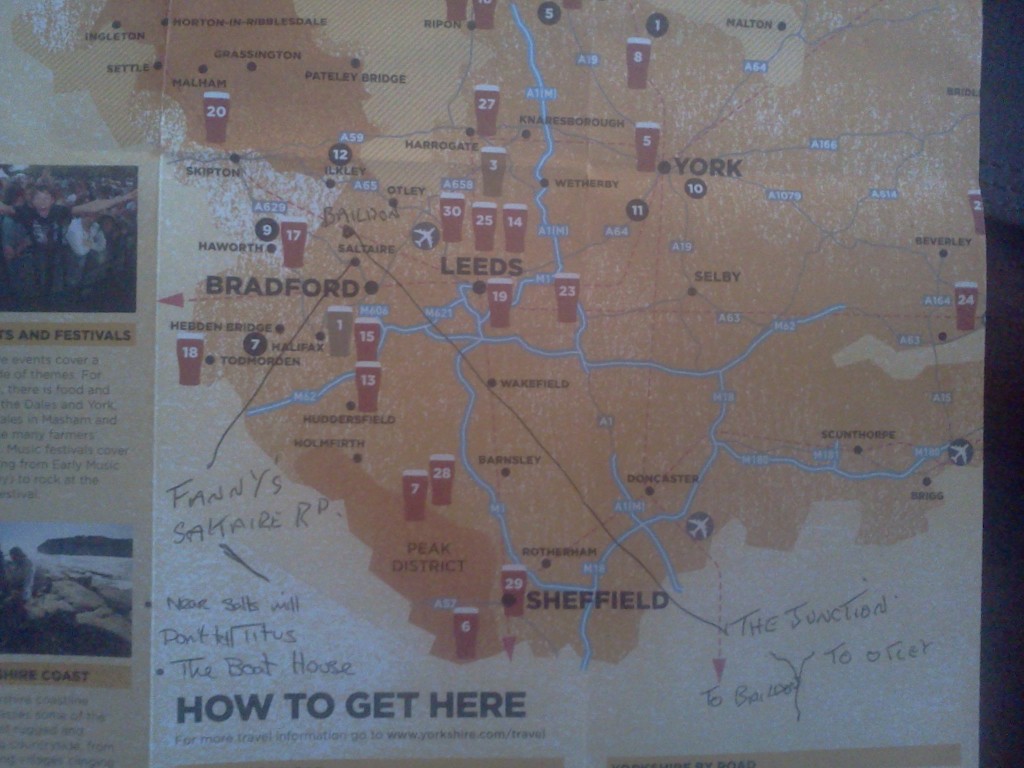
Still in the Town hall I found a brochure documenting good pubs in Yorkshire and there was a map, hooray! But no! Shipley wasn’t even on the thing! So I asked a man who clearly worked there if the map was right that there were in fact no decent pubs in Shipley? It turned out that the man was called Chris and he was the caretaker at the town hall. He was very quick to inform me that there were lots of good pubs and he corrected the map for me, here it is:

So now I know about ‘Fanny’s’ on Saltaire Road, ‘The Junction’ in Baildon, ‘Don’t Tell Titus’ (apparently named because the founder of Saltaire, Sir Titus Salt, was Wesleyan and therefore had little love for boozers…so this one was a secret)  and ‘The Boat House’. You will notice that Chris also put Baildon on the map…but he didn’t go far enough to mark Shipley on it? Apparently Saltaire was good enough? As I kept looking I started to notice a trend that in Shipley…Shipley was often was not marked on a map and that maps of Shipley were nowhere to be found. All I could find were maps and information about Saltaire!?

I braved the drizzle and went in search of the local Library, which was initially difficult to distinguish from the Asda. From what I can tell Asda might have helped build it? Is this a bit of modern day corporate philanthropy? Perhaps I will have to chase this up at some point…I met Sarah and Rebecca who were working on the counter in the Library. They seemed happy to talk, although they seemed slightly confused when I asked about maps of Shipley. However diligently they did find me one in a dusty folder under a desk, but it was still not one I could take away with me (and the river wasn’t on it).

I asked them why they thought I might be struggling to find maps of Shipley? Then I asked what, as a visitor to Shipley, what were the points of interest that I should see? The girls looked genuinely quite taken aback by the questions and one of them politely attempted to answer, and her answer contained the word I kept encountering… ‘Saltaire’. I quickly followed up by asking why when I looked for maps or points of cultural significance in Shipley that all I find is information about Sailtaire? They explained that Sailtaire is a ‘World Heritage Site’ which apparently puts it in the same league as the Pyramids!  Rebecca theorised that perhaps Shipley was a ‘cultural poor relation to Saltaire?’ My instinctive reaction was to feel a bit sorry and perhaps annoyed on behalf of Shipley. Has it had a raw deal? Has its cultural identity suffered because of what is happening next door to it?

Finally I asked Rebecca about the river and whether it was an important part of Shipley’s identity? She told me that she had lots of fond memories of the river and particularly ones that related to family outings as a child. She thought the river probably was important to people in Shipley but perhaps subconsciously rather than consciously? I thought that was a really interesting answer and something I want to find out more about. Is the river something that people appreciate without realising it? Rebecca and Sarah were really helpful and considering they are both local I hope I can find some way of engaging them with the project later on.

So as I head in the direction that Chris at Town Hall had told me the river was in I all ready have two questions to answer:

  1. Firstly, is it true that Shipley struggles with itself because of Saltaire? I spoke to a Policeman who told me it didn’t really matter because it is all Bradford anyway.
  2. And secondly, just because the river is not immediately celebrated in an obvious way is it still important to people in Shipley and if it is how is it?

If anyone has any thoughts please feel free to leave a comment.


Walking with Kevin Sunderland (Aire Rivers Trust)

I had a very enjoyable meeting today with Kevin Sunderland, co-founder and chairman of the Aire Rivers Trust  – a voluntary, charitable organisation dedicated to improving conditions in, on and around the River Aire and its tributaries — especially Bradford Beck. Kevin is a retired accountant, a keen angler, and a mine of information about these rivers and their use and history. Today, though, what he and I looked at, especially, was rubbish!

“Meet me at the back of the Aldi car park at 11am!” he told me. It sounded a bit like some dodgy drug deal or spy rendezvous, but I dutifully turned up at the appointed time and place. The car park shared by Aldi and McDonalds, in central Shipley, is skirted on two sides by Bradford Beck, as it flows towards the Aire, but you’d never know it unless you were looking for it. And what Kevin wanted to show me first was the great pile of industrial waste across the Beck from us, teetering on the edge of a sheer drop into the river. “Bit of wind or rain and that lot’ll be in the Beck!” Kevin pointed out. He’s also tried to point this out to the owners of the site, but he can’t get them to do anything about it. Perhaps the attitude to this particular bit of river is – out of sight, out of mind.

And that’s pretty much the story all over. We walked all around this bit of central Shipley… along the banks of the Beck (the bits we could get to) and also along the Aire, east of Shipley weir – where the Beck joins the main river. There are warehouses, superstores and old industrial buildings all around this area, and a lot of them seem to be run by people with little or no regard for the river they back onto – to judge by the rubbish (mostly packaging materials) strewn all over the river banks. Kevin says that, as head of a charity, it’s not his place to “name and shame” businesses, but I don’t have to be so polite, so let’s name the B&M garden centre for one… There’s cardboard and cellophane sheeting lying around all over the place at the back of their store (bit of wind, in it goes…), and we found one of their shopping trolleys lying in the Aire just downstream. Again, Kevin had phoned the manager about this, but nothing had been done. So together we fished it out and wheeled it back (covered in mud and moss) to park it outside their front entrance. That was today’s bit of environmental activism!

I asked Kevin if his concern about all this littering was primarily about trying to conserve water quality, or making life better for fish and birds, or what. Well, he said, he’s concerned with all of that — and he stresses that, generally, water quality in these rivers is a lot better than it used to be. There’s also a surprising amount of wildlife (we spotted trout in the Aire, lots of birds…). But cleaning up rubbish is as much about “aesthetics” as anything, he says. And surely a university arts professor like myself should have an eye for such things too…

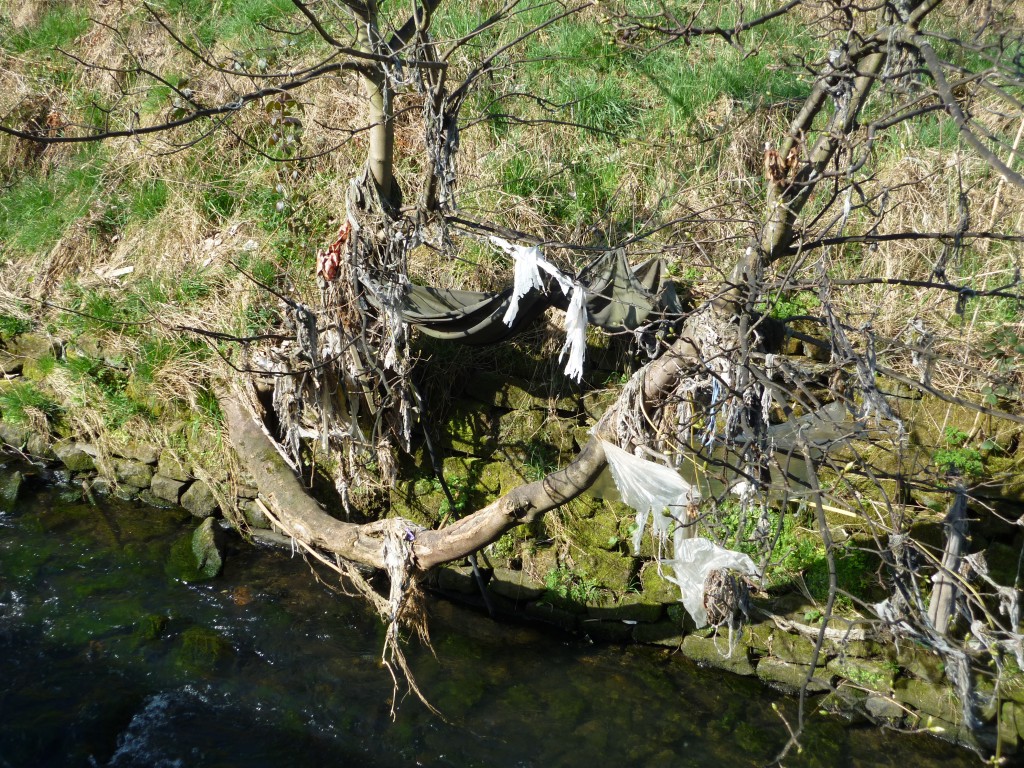
Along Bradford Beck, just down the back of Shipley rail station, we found a whole string of trees covered in debris like this, stranded on trees since the last high water event. It’s basically sewage, Kevin points out — the stuff people flush down their loos in Bradford. Most of the older drainage pipes are also sewage pipes, and sewage solids are supposed to be skimmed off before the liquids get near rivers, but in storm conditions the theory doesn’t always work in practice…  We looked for fish along here too — apparently there have been minnows on this stretch lately, but the trout that were here got killed a while back by some kind of pollutant, and they haven’t yet returned.

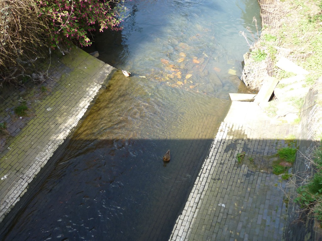
Kevin’s tour eventually took us up the Beck almost the whole way into Bradford. He pointed out, for example, some of the old culverting — artificial brick bottoming for the Beck designed to speed up the water flow and thus get all the crap out of the city as soon as possible… But this stuff is terrible for supporting any kind of river life, except the odd duck bobbing on the surface…

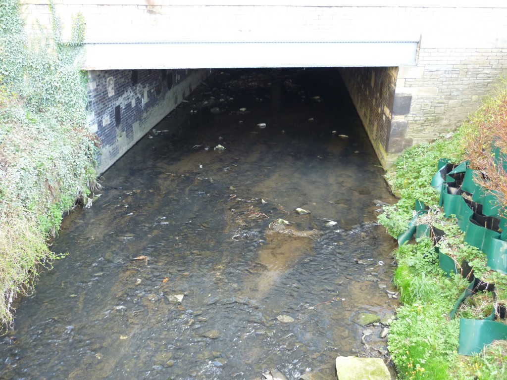
Eventually we got as far back upstream as the point where the Beck disappears under one of the old mill building (now commercial offices). It flows underground through most of Bradford’s city centre. This point where it emerges into daylight is, Kevin points out, distinctly stinky… (the people in these offices must have to combat the smell everyday!) Bradford Beck used to be known as one of the most polluted rivers in the country. It’s not like that now, but the sewage smell here is still quite noticeable…

As I say, I really enjoyed meeting Kevin. He pointed out a lot of the less pleasant aspects of the rivers here, but his enthusiasm for further improving the situation is infectious. I suspect he’ll have many other stories to tell us as this project continues…