The following “photo tour” of waterways in the Shipley area was created for this site at the beginning of our project in 2012.
Let’s begin our tour at the westernmost end of the Shipley area (which, for the sake of argument, we’ll take to include Saltaire and Lower Baildon). Here’s the weir at Hirst Mills, on the River Aire… just to the left of this image, a small downhill beck joins the river… And over to the right of the image above, along a path past the mill cottages, we find Hirst Lock, on the Leeds and Liverpool canal – which runs more or less parallel with the Aire through the Shipley area… (having accompanied it down from Bingley, where the canal features a famous, ,”five-rise” lock)
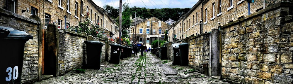
 Most of the residential properties in this area are on the north side of the river – in an estate built by Shipley Council (in what is technically Lower Baildon) in the 1950s. The Coach Road estate was built on what was then marshland / flood plain — and it’s easy to see where the land was built up – away from the river – to make it safe for building on. A wide stretch of green flood plain separates the housing from river
 In the next image (below), further down the green space adjacent to the river, you can plainly see a rise in the land which covers over one of the drainage pipes channelling downhill water into the river… The houses in the background are part of Coniston Grove – just one of many streets named after major lakes, as if in recognition of the once very watery character of this landscape!
 And here’s where that covered pipe, under the raised ground above, empties itself into the river. (Alongside a bed-head and an old TV…)
 Looking east from the estate, we can see the Saltaire World Heritage Site across the river in the near distance…
 And here’s the reverse shot (below), looking west from the Saltaire footbridge, across Roberts Park towards the homes of Park Way in the distance… You can see clearly in this picture how the river bends around the park – and why, in flood conditions, this is the first place to ‘go under’
 Let’s not forget the canal (below). At Saltaire, it sits especially close to the river, which is of course why Titus Salt put Saltaire here in the first place. The canal provided the key transportation route for the mill’s goods, whereas the river (directly on the other side of the mill building to the left) provided water power… is the river.
 Moving a little further downstream on the river, we come to the other (slightly earlier-built) part of the Coach Road estate,
 In the image below, we’re looking uphill from the river to Coach Road itself… with further evidence of the infrastructural land drainage…
 And here, a touch further downstream, we find Aire Close, four homes built right on the water’s edge… I’m told these houses were once occupied by river agency employees, which might explain why the usual flood plain precautions are ignored just here. But what a lovely spot to live!
 textA little further downstream still, past barracks and another cricket pitch, we come to Baildon Bridge, the one and only road bridge in this area – which connects central Shipley (to the left/South) with Baildon and eventually Otley. Note the debris clustering at the bridge base though — when this builds up it creates a significant blockage problem, adding to flood risk in the area. In 2000, Baildon Bridge was temporarily closed because the road itself was well underwater…
 Just past the bridge, we find a water level marker…
 textFrom the same spot, looking downstream, we can see Shipley Weir – and some of the many industrial buildings in this heavily urbanised area…
 textA little further downstream still, that industrial landscape becomes industrial wasteland. Here’s Lower Holme Mills (now abandoned), and in the distance new housing developments on the Shipley side of the river.
 To the left of the image above are the Lower Holme mill cottages, which – unlike the mill – are still very much occupied, and beautifully kept up by the residents. Here are the back doors, looking uphill away from the mill building…
 And here’s the river itself, just past this point, now edged on both sides by more commercial buildings (see blog posting “Walking with Kevin Sunderland”), as the water wends its way on towards Esholt.
 But let’s back up slightly here, and join Bradford Beck… (below) Having flowed north from central Bradford, it intersects with the Aire here — just downstream of Shipley Weir (which is just visible in the image below). The Beck is narrower than the Aire, and tends to be tucked well down at the bottom of high walls, somewhat obscured from view unless you’re looking for it…
 And let’s also not forget the Leeds-Liverpool canal, which (because it runs parallel with the Aire) literally has to cross over Bradford Beck… In the image below, we’re looking at the stretch of the canal that forms an aqueduct over the Beck. You wouldn’t guess it from this image – until you notice the Aldi in the bottom right corner, set well below the level of the canal… (Talk about “multi-storey water”!)
 Next to the Aldi is the local McDonalds, of course… And Bradford Beck flows all the way around the edge of the car park — it’s tucked away invisibly at the back of the picture below.
 The McD’s is adjacent to the main road towards Leeds, and the Beck here flows right underneath both the road and the railway, as they criss-cross each other…
 There are some beautiful old Victorian (?) arches here, supporting this transport infrastructure… Note the low water level here, in a picture taken before most of this year’s April-May rain!
 Further upstream along Bradford Beck, we come to a lengthy stretch of green space, similar to the flood plain area next to the Aire… But in the image below, the Beck disappears completely underneath the green for a short stretch…
 Here we’re adjacent with the Frizinghall area, at the southern edge of Shipley (as we move towards central Bradford), so as we head further upstream along the Beck we move out of the ‘zone’ for this project… But let’s consider one last twist in the tail here. Because somewhere amidst the architecture covering the Beck at this point (here it is again from another angle)…
 … somewhere beneath those arches, a tributary river known as Red Beck flows unseen into Bradford Beck, having flowed downhill in an underground culvert that takes it under the houses you can see in the back of the picture above. Actually, most of Red Beck is buried into the ground like this, but a little way uphill — tucked between Wharncliffe Road and Norwood Avenue — it pops up to the surface as an unexpected little urban lake…
 This ‘lake’ decants then decants itself into a narrow, fast weir that takes it down a steep incline before emerging again briefly through the little square arch in the image below… where it is joined by another small tributary (coming from don’t-ask-me-where) which is coloured a delightful shade of orange…
 And then Red Beck (having been joined by orange beck…) vanishes again, downhill towards its underground meeting with Bradford Beck… which is on its way to run underneath the canal towards its own meeting with the River Aire… Water, water, everywhere…
A really interesting tour. I have grown up seeing most of these structures but never really understanding what they were, it’s really interesting how we really only half see things, if you know what I mean. Cheers Kate
I have really enjoyed looking through all these photos of the river/canal Shipley also of Bradford brings back happy memories.