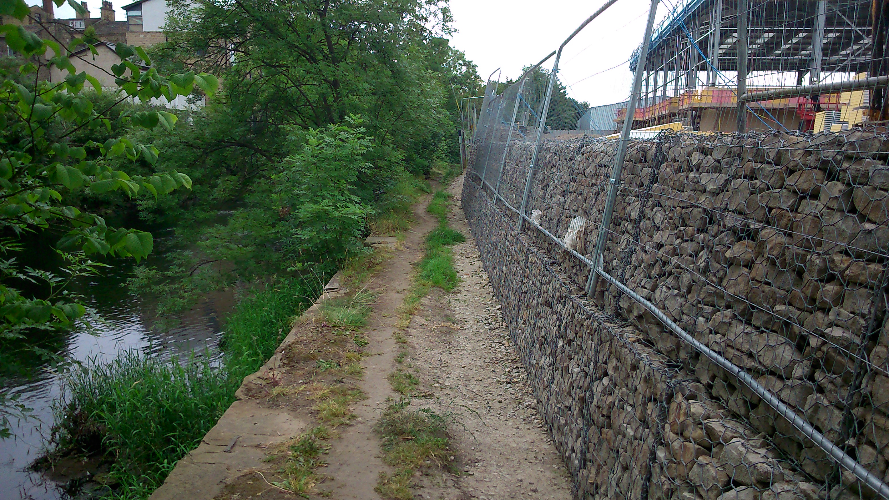
This summer we’ve seen two quite contrasting changes to the north bank of the Aire in the Shipley-Baildon area. East of Baildon Bridge there’s been new building work on the former mill site at Lower Holme — a location this blog has observed with interest for some time (see other posts categorised under ‘Lower Holme’). The long-derelict site is finally being turned into a commercial precinct with buildings and parking for Wickes and KFC, but the build was delayed for quite a while and this is part of the reason why:
 The public footpath along the river, running along the edge of the site, is now flanked by this wall of caged rubble cubes — stacked to head height. Apparently the Environment Agency belatedly insisted on this being erected as a condition of the building permit. The ground on which the Wickes building is going up (you can see the frame in the top right of the shot above) has also had to be bulked up to the height of the wall on the other side. The theory, apparently, is that this will act as a flood defence for the site. But what you can’t quite tell from this photograph is that it’s already quite a drop from the footpath to the river. According to local residents, in the floods of 2000 (the most extreme weather event in these parts in most people’s living memory), the swollen river only just topped the level of the footpath. So it would take a really pretty apocalyptic flood to get anywhere near the top of these new rubble cubes.
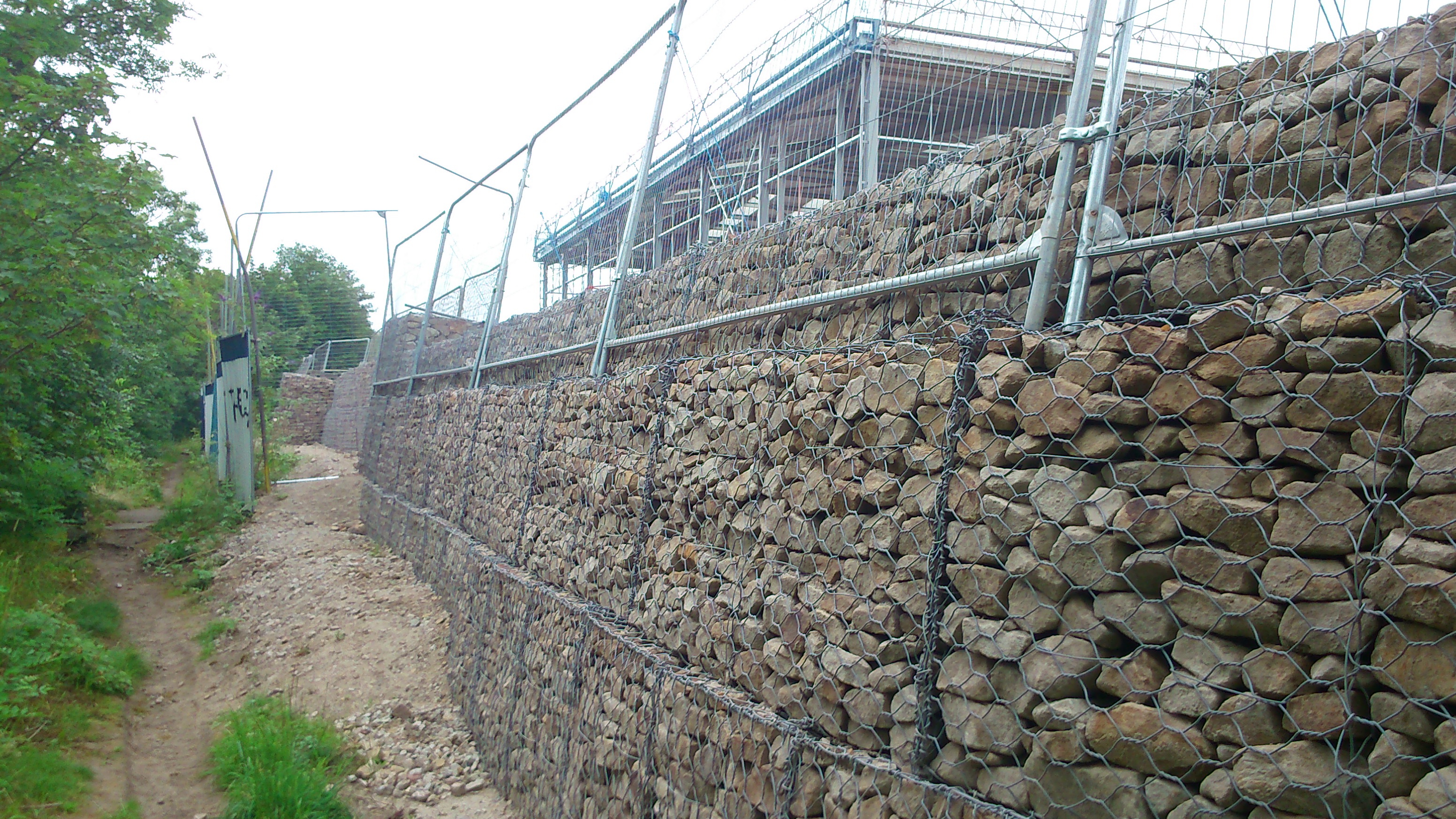
 You can see in this shot how the land naturally rose up further from the path anyway (here the footpath continues on the left of the shot, along the riverbank; the white and blue metal fencing between path and blocks is a remnant of the former site fencing put up by the previous developers, Mandale). So I can’t help but feeling this is flood defence overkill… especially when you bear in mind that the residents in Lower Holme weren’t affected by surface water in 2000 anyway, but by water coming up through their basements (and nearly reaching their electricity meters, rather scarily!). This whole area of land is right on the water table, so in flood conditions water literally seeps up through the floor, given half a chance. The ground is apparently so porous that Lynda, who lives in the end gable house nearest the river, remembers finding tiny fish swimming around in her basement during the flood – somehow they had filtered their way through the earth, even though the house is a good hundred yards from the river. A great story, and one that slightly begs the question (at least to a layman like myself) of what exactly the new defences are supposed to accomplish. They seem almost militaristic, as if the river is some assaulting army, laying siege to the land. I wonder if those tiddlers could get in between the blocks? 😉
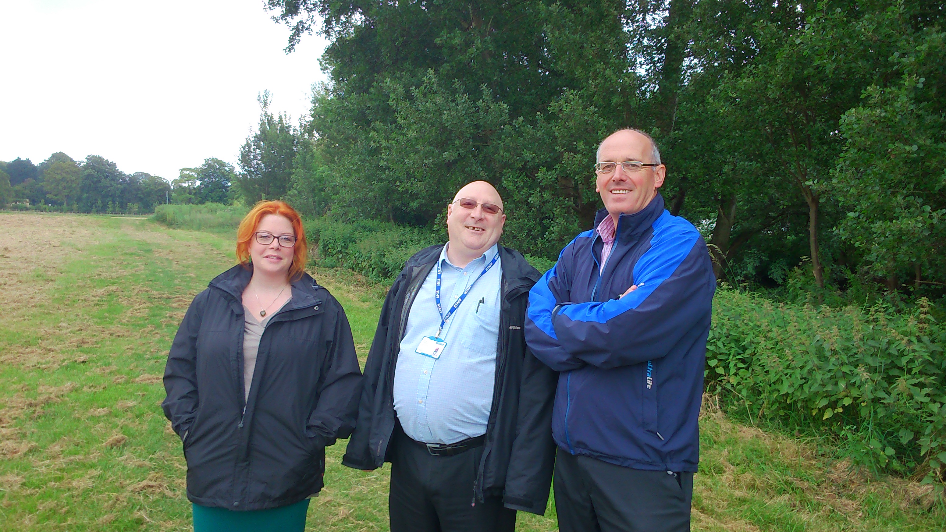
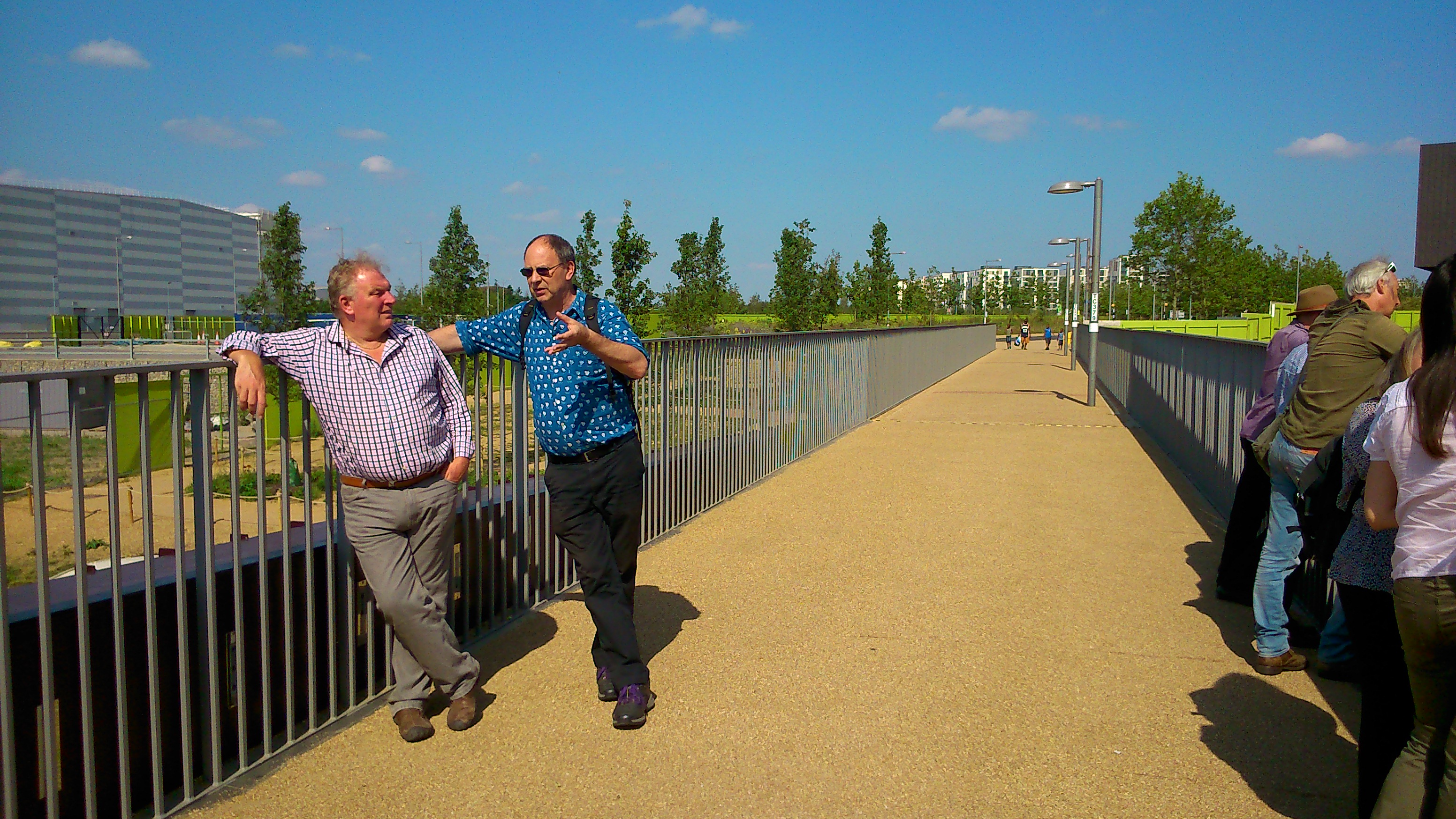
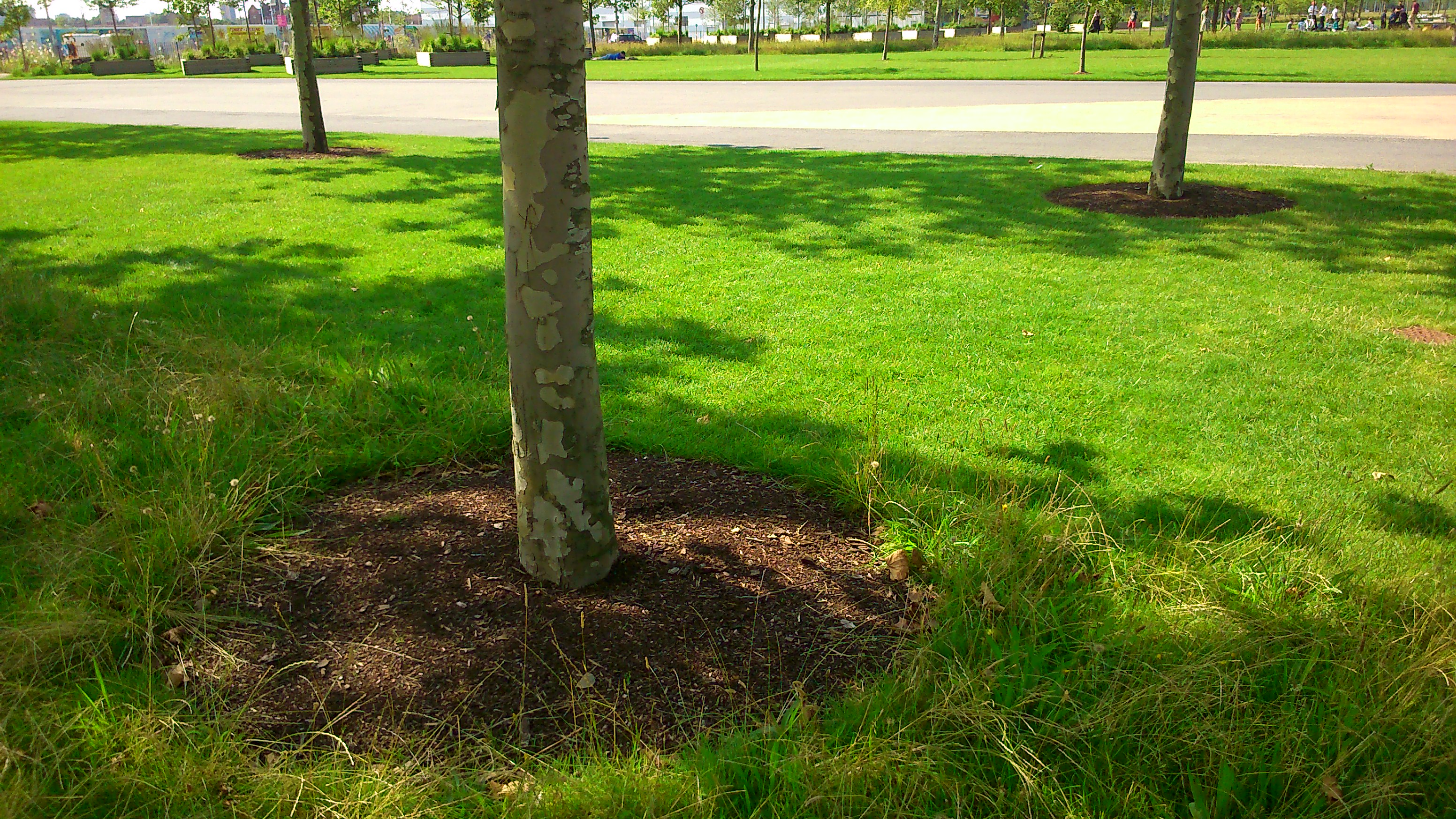
 A little upstream, at the western end of Shipley/Baildon catchment, we’ve seen a constrasting scenario… not ‘overkill’ but a kind of benign neglect. This picture is of the grassy flood plain area between the river (off to the left of this shot) and the Higher Coach Road housing estate. First posted on this blog at the end of June, the photo shows how the grass had been left to grow up into a meadow, with the only mowing occurring along the line of the traditional riverbank path, to the left of shot. (It’s not technically even a path – it’s usually just a ‘desire line’ tracked into the grass, so being marked out by mowing has almost made it seem more official.) Subsequent to my earlier post, I did look into why this long stretch had been left unmowed, because I wondered if there was some new planning rationale for it… And at the beginning of July I met on site with these lovely people:
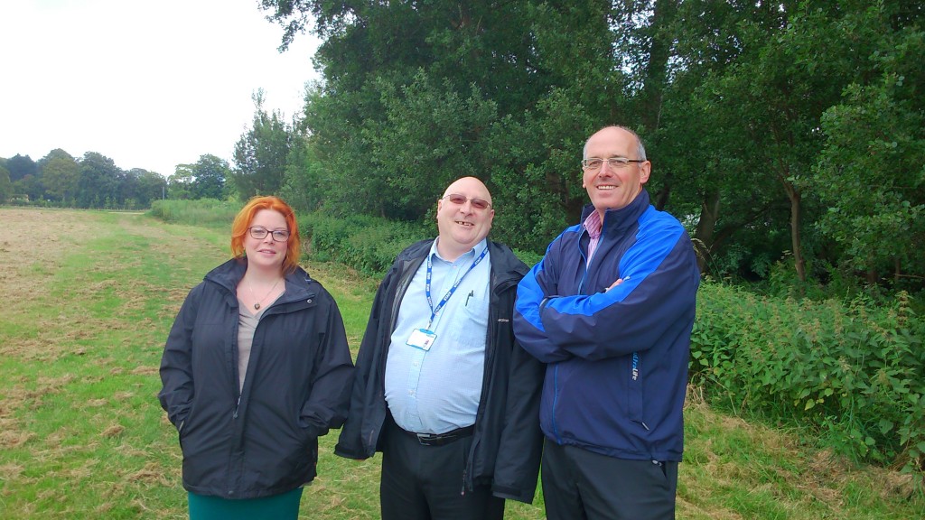 Left to right here are Lyze (pronounced Lizzie) Dudley, our new research associate on the MSW project; Dave Horsman, from the Shipley Area Committee of Bradford Council; and Malcolm Wright, who is the Council’s head of parks and landscaping in the area. Based at the Park Lodge in Roberts Park, Malcolm is – it turns out – also responsible for the grass on the estate. And the reason it didn’t get mown this year was basically because of budget cuts within the Council (it’s the age of austerity…), which mean that Malcolm only has one man to send out to mow, instead of two. And in fact, only a few days before we met, one man went to mow (went to mow a meadow), with the result that we were looking at this:
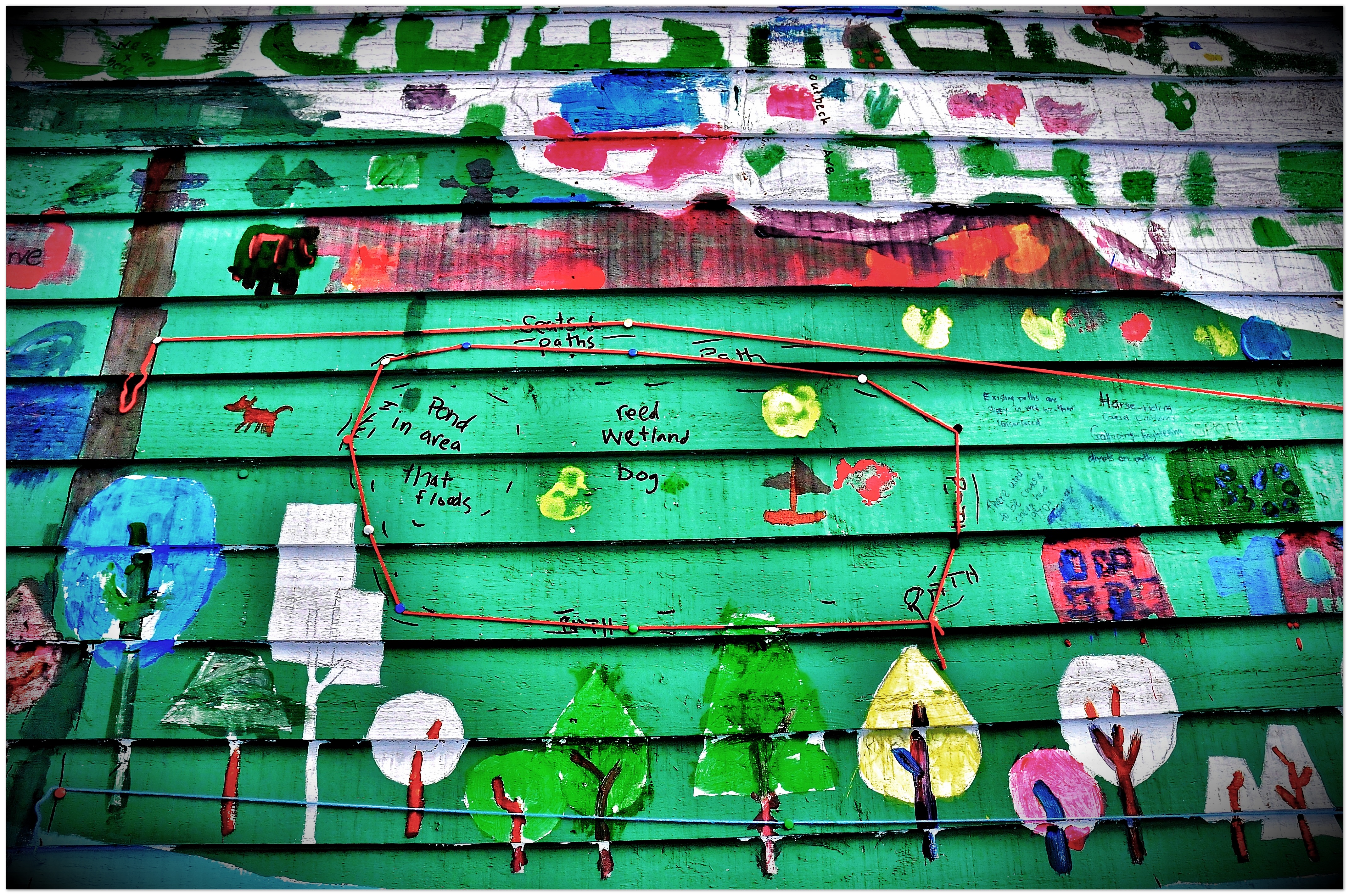
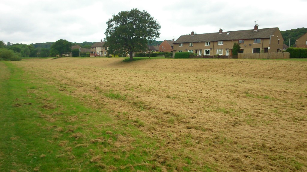 Freshly cut hay… not meadow grass… And the reason for it being cut at this point was simply, Malcolm told us, because he had received a complaint from someone on the estate about the length of the grass — so he decided to prioritise doing something about it. There are a couple of ironies at work here… One is that I’m quite sure that some other people living on the estate will have quite liked the meadow effect. (See for example the comment that was posted on the end of my June 24th blog post.) The other is that Lyze and I had arranged to meet Dave and Malcolm specifically because we were interested in the meadow grass… The main reason for this is that our research in the area in the last couple of years uncovered quite a degree of interest among residents in something more creative and interesting being done with this lumpy, uneven, often boggy grassland. Back in September 2012 we held a sort of creative consultation event (the ‘Higher Coach Road beach party‘) which resulted in a painted map of the area being marked up as follows by residents:
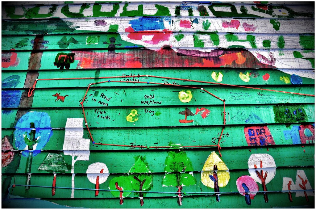 As you can see, we were presented with the idea of a “reed wetland bog”, with a “pond in [the] area that floods” (this refers to an especially boggy area of the flood plain just down the slope from Troutbeck Avenue). There was quite a bit of support for this idea (it originated with Theresa, I think, from Derwent Avenue), which would also amount to a form of ‘soft engineering’ of flood defences — since if designed right a layout of ponds, reeds, bushes and trees would enhance the flood storage capacity of the land here… whereas monoculture grass does little or nothing to prevent downhill run-off from just carrying straight on into the river and adding to the weight of water being carried downstream… Or at least, I think that’s the theory. Anyway, hopefully it’s now apparent what kind of contrast I’m trying to draw here with the questionable new ‘hard’ engineering downstream at Lower Holme.
The point here is that our earlier conversations with residents on the estate could only ever be that – conversations – since Multi-Story Water was originally only a one-year project (2012-13). But having now secured new funding for three years from 2014-17, we’re in a position to see if we can help facilitate some further discussion towards (just maybe!) actual changes. And the meadow grass had struck me as a great opportunity to kick something off, because most of the residents will have had opinions about it, pro or con (or both). A wildflower meadow is not a reed wetland, but it’s certainly a step towards more biodiversity… And I thought I had just the man to help us animate the meadow a bit, to spark debate. (See this blog page here for an account of Baz Kershaw and his ‘meadow meander’ – a temporary meadow area that he developed as a kind of theatrical exhibit at Leeds University in 2012). Malcolm Wright, the parks and landscaping chief pictured above, turned out to be very supportive of us doing something to engage residents in a discussion about how to treat this area in future — and he offered to provide us with materials to illustrate the various different types of wildflower meadow and other alternative grassland arrangments that are used in other parts of Bradford… So this would really present people with choices to consider. But…
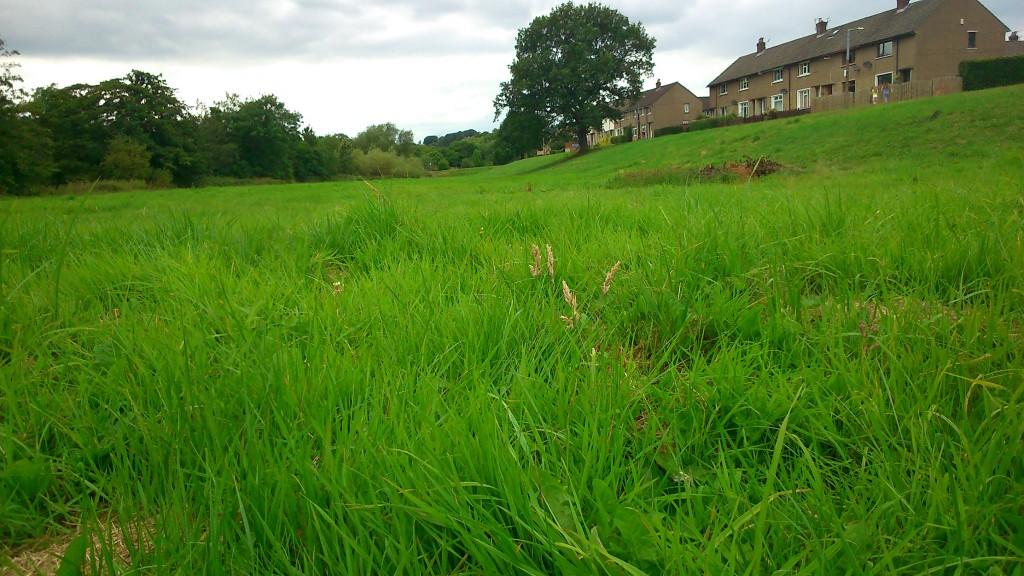 … in this photograph, taken just last week, you can see that the grass hasn’t really grown all that much in the five weeks since it was last mown. A few hay-like stalks appearing, but basically this grass is barely above ankle height. We had been planning to try to arrange an event involving Baz and others this coming September (next month). But it’s pretty clear that the grass won’t have grown into anything resembling a meadow by then…
All this brings a whole new meaning to the phrase “watching the grass grow”. But with hindsight it may be no bad thing that we’ve had to ditch our tentative plans for September. We’re now looking at planning ahead for an event next May or June, when the grass, if left, will be at its most springily meadow-like. This means that we can try to develop conversations with the residents in the run-up to this event, involving people properly in the planning, rather than simply using an event as a way to initiate conversations… It’s probably better this way round.

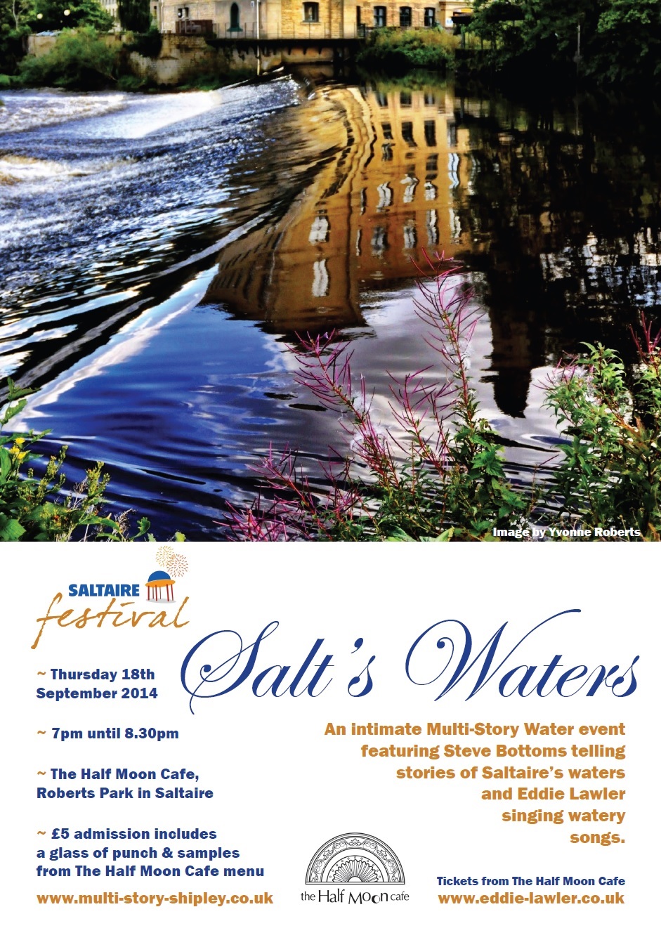 This informal performance event will feature a combination of music and storytelling… Eddie Lawler, “the bard of Saltaire”, will perform a selection of his own original songs, focusing particularly on watery ones such as “Bradford Beck” and “Bradford Canal”, and showcasing a brand new song, “Little Beck”. In case you’re wondering, Little Beck is a very short tributary river that flows into the River Aire up at Hirst Wood, after flowing down through the overgrown grounds of Milner Field — the ruined mansion near Gilstead built by Titus Salt Jr. (who had the beck dammed to create boating lake for his guests). Meanwhile, I (Steve Bottoms) will be interspersing Eddie’s songs with a selection of stories and ‘spoken word’ material, all relating to places along the way between Saltaire mill village and Milner Field (via the Aire, the canal, Little Beck and Loadpit Beck). Salt’s Waters is a one-off, ‘work in progress’ presentation of material currently being developed for a downloadable audio guide of the same title, which will take listeners on a looped tour from Saltaire to Milner Field and back.