Under what circumstances might a new-build KFC going up near your home seem like a good idea? Read on and decide for yourself…
Shipley’s history (like Bradford’s more broadly) is inextricably tied up with the history of the wool industry and its mills… A particular mill site that has interested us during the Multi-Story Water project (it’s the location for the closing scene of our ‘Red Route’ walk) is Lower Holme mill, on the north side of Aire slightly to the east of Baildon Bridge.
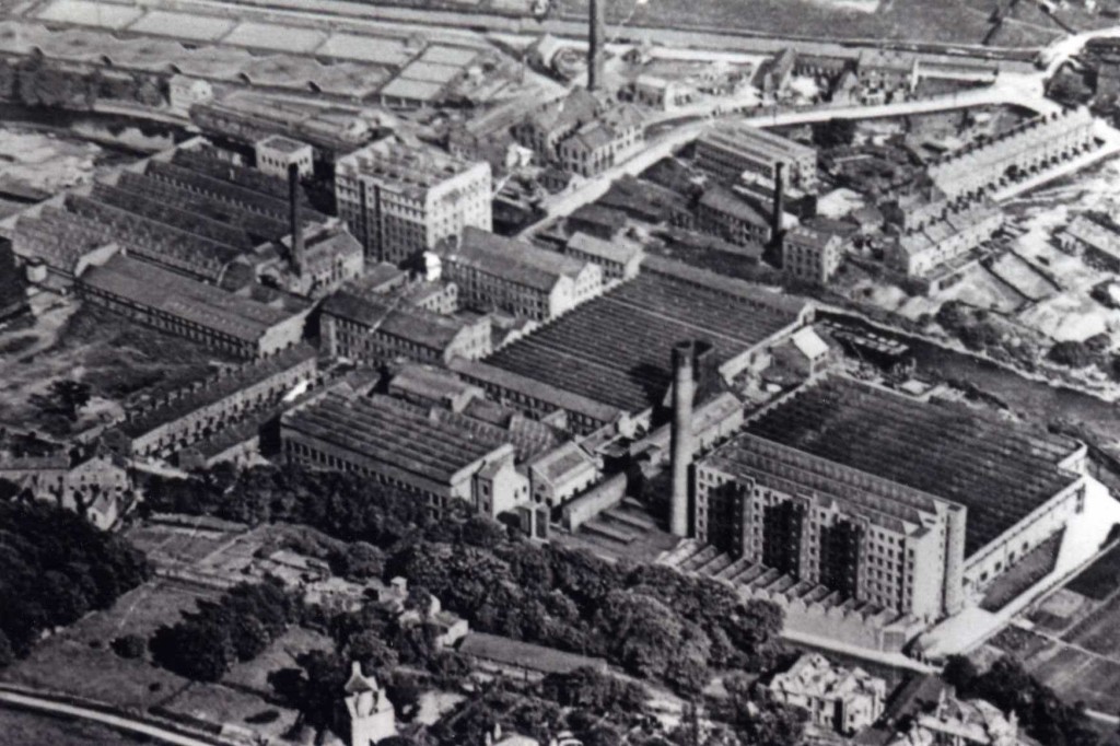
To orientate your a bit, here’s an image not of Lower Holme but of the adjacent site, when it was occupied by the Airedale Combing plant. In this shot you can clearly see the River Aire towards the bottom left – running down from the weir that used to serve the long-disappeared Baildon water mill. The image gives you an idea of the sheer scale of Airedale Combing, once one of Bradford’s most advanced mills….
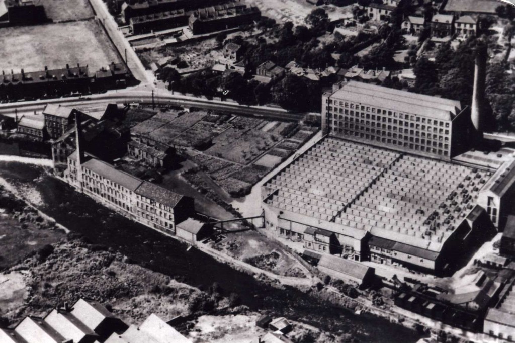 Note also in this shot the pathway that cuts diagonally across the bottom left corner of the combing plant. This is the ancient right of way along the north bank of the river – which cuts inland slightly at this point before meeting Otley Road near Baildon Bridge. That same route is still there, because it’s a protected footpath – but everything around it has since changed!
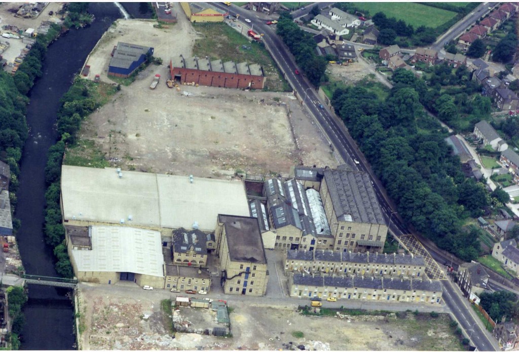
 In this shot, we’re looking from the opposite angle to the first one — so that’s Airedale Combing again on the right, with the river visible above it in the picture. And next to it is the sprawling site of the (even bigger!) Lower Holme mill… The lot it occupies was owned for a period in the 19th Century by Titus Salt himself, and local historian Ian Watson believes it may have beeen the site originally intended for Salts Mill itself (his persuasive argument is outlined in his pamphlet “The Land Acquisitions of Titus Salt in Shipley and Baildon”). But Salt never developed the site, and sold it on to C.F. Taylor in 1862. To many people, the mill site is still known simply as “C.F. Taylor’s”.
 This shot – clearly more recent! – shows Lower Holme, with a rather different set of buildings, following the demolition of both Airedale Combing (the empty site at the top of the picture — now occupied by B&M and other retail outlets) and the next mill along. Note that the line of the ancient riverside path is still clearly visible, curling between the buildings at the top of the shot (it’s now thoroughly fenced in!). Note also the two facing rows of Lower Holme’s mill houses in the bottom right of the picture. They’re the only buildings still standing today, and are still occupied by residents (about fifty-fifty private ownership and Accent Housing Association). The angle below, from the same helicopter fly-past, shows the houses prominently in the bottom of the shot…
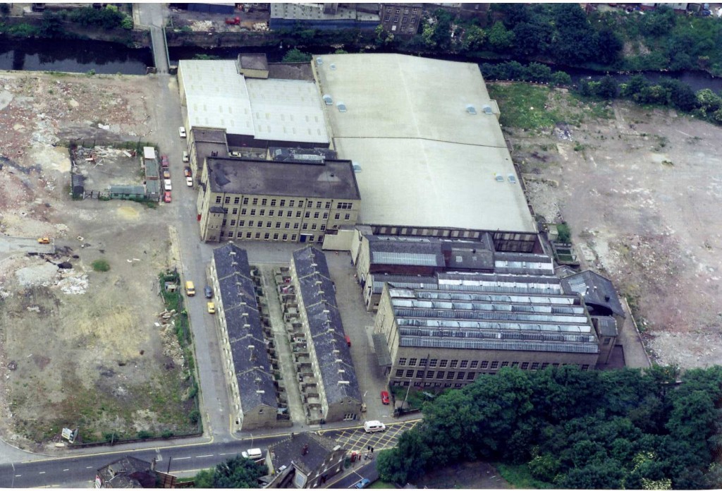 Looking at this image, it’s worth bearing in mind that – according to the Environment Agency’s flood mapping, the entire space between the river (top of shot) and the road (bottom) is flood plain… All of those houses could flood in an extreme event, although in 2000 – during the last major flooding in the Shipley area – only the first four houses on either side, nearest the river, suffered from flooding, and at basement level (water coming up through the ground) rather than flowing in at ground level.
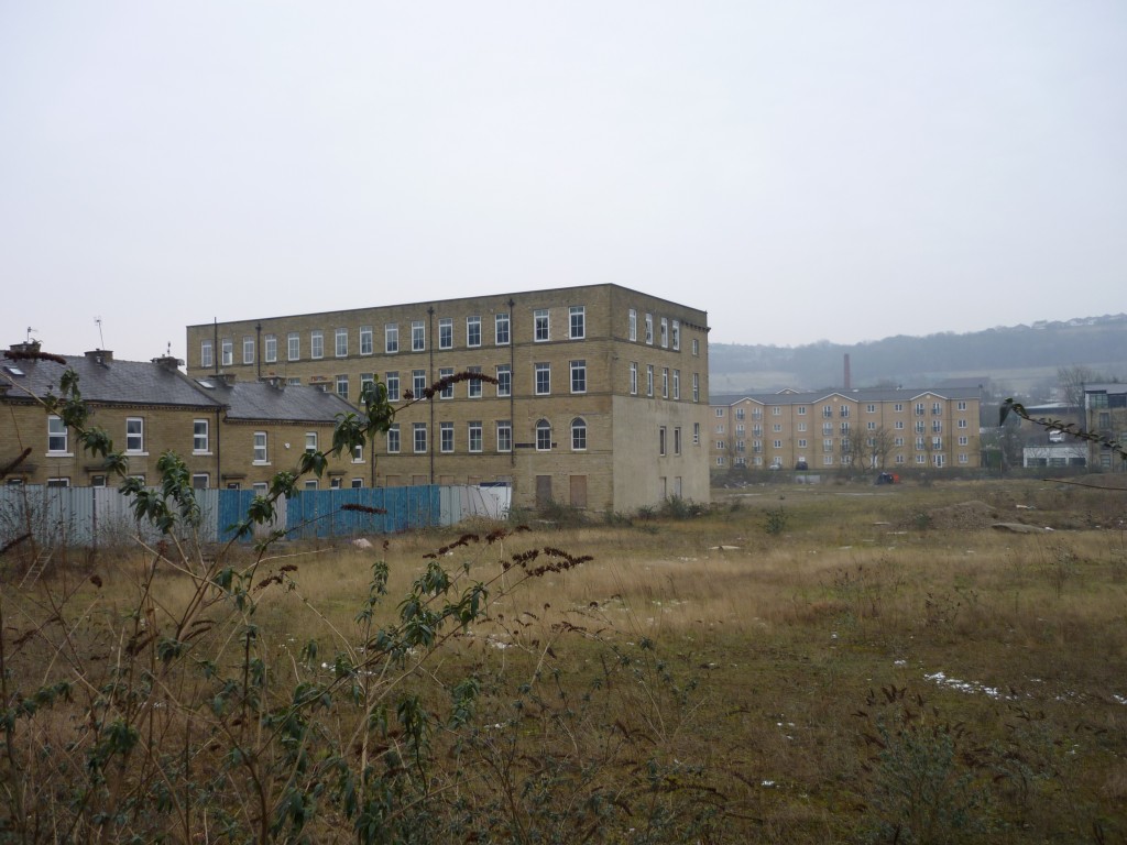 In a sense, the more serious “flooding” suffered at Lower Holme has been from economic rather than hydrological causes… Here we see the current, derelict state of the Lower Holme lot – with only one of the mill buildings surviving, just to the south of the mill houses. This was converted as flats just before the bottom fell out of the property market in 2008 – and the building remains unoccupied, with broken windows etc. Meanwhile, the new residential development planned for the cleared mill site (demolition was in 2006) never even got off the ground…
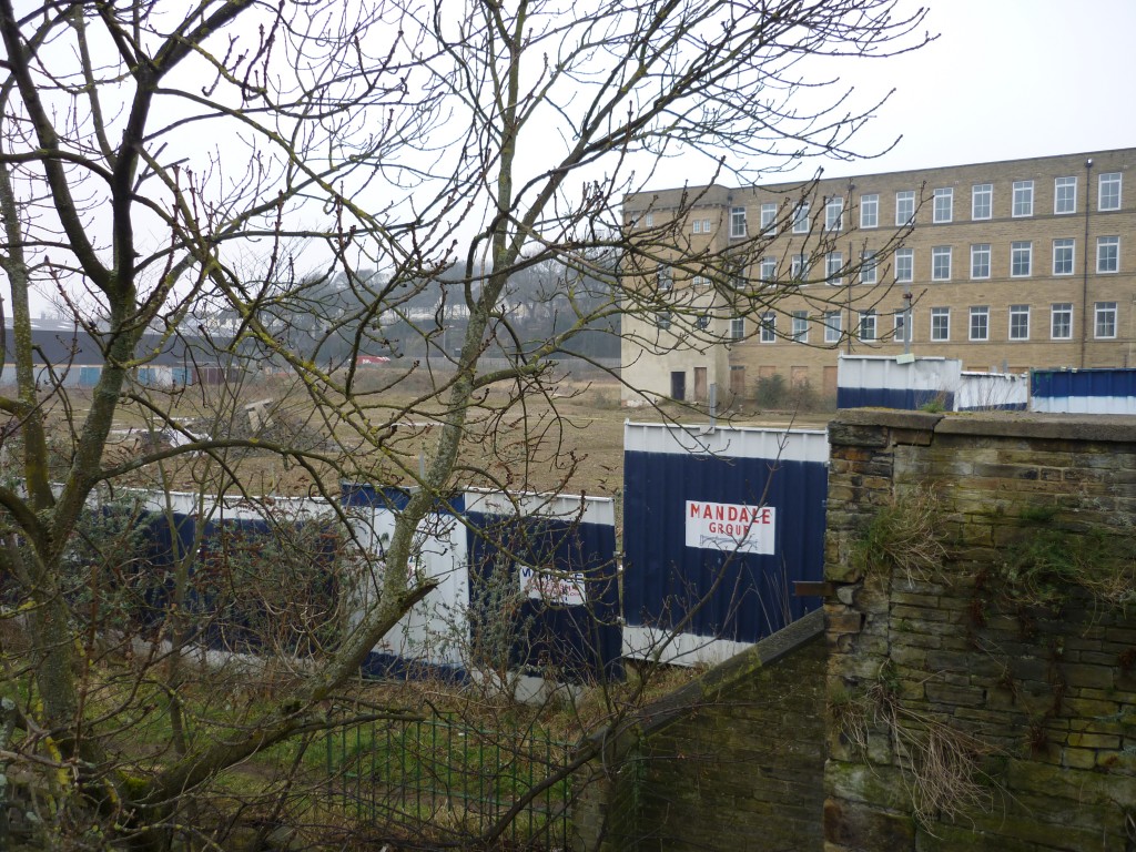 The property developers in question, the Mandale Group, have left these fetching metal hoardings surrounding the site for the last five or six years — creating something of an eyesore for residents, and arguably attracting “undesirables” to the area (as in the ‘broken windows’ theory of anti-social behaviour – if a place looks neglected and uncared for, it will attract carelessness…).
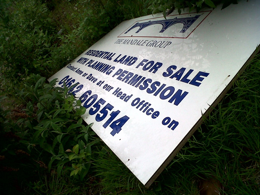 As you can see from this shot, taken a couple of months ago, Mandale have been trying to sell the site on for some time…
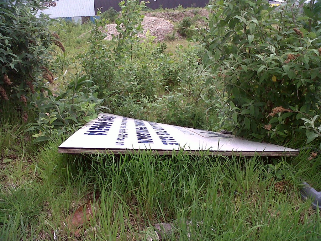 And in the absence of the developers, the riverbank itself has started to reclaim the site. One of the Lower Holme residents, Lynda, has walked around the derelict site and identified the ‘weeds’ as common riverside plant species…
The story has a new twist, though, because Mandale have recently succeeded in selling the site, to Marshall Commercial Developments. James Marshall, who is (rather intriguingly) the son of the man who oversaw the conversion of the Airedale Combing site into the current retail park area, has kindly provided the planning diagrams below, which show what he’s intending for the site… (as he says, they’re in the public domain, so there’s no secret about them – but the planning application has yet to be approved)
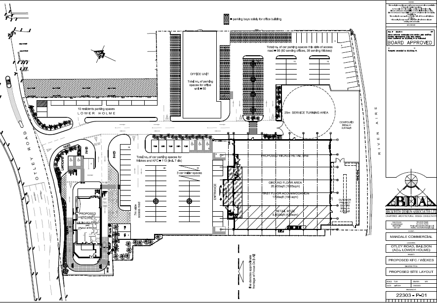 To see the picture at full size, just click on it. The eagle-eyed viewer will note that the developer named on the plans is “Mandale Commercial”: Marshalls are basically planning to move ahead with the last set of plans that Mandale had drawn up. The difference is that, where it seem Mandale was badly hit by the downturn in the property market, and could no longer borrow the money to pursue the build, Marshalls can afford to pursue the project because they don’t need to borrow. As a family firm for four generations, they have kept their assets in the company, to secure longevity (rather than stripping them out at the first opportunity). The main part of the site, then, will be occupied by a KFC – to the left of the plans, facing the main road – and a Wickes DIY store, to the right, next to the river. There’s also quite a bit of car parking space, and the old mill building is designated for “offices” (though James tells me it may end up as social housing).
Anyway, here’s what the KFC might look like, if they get planning permission…
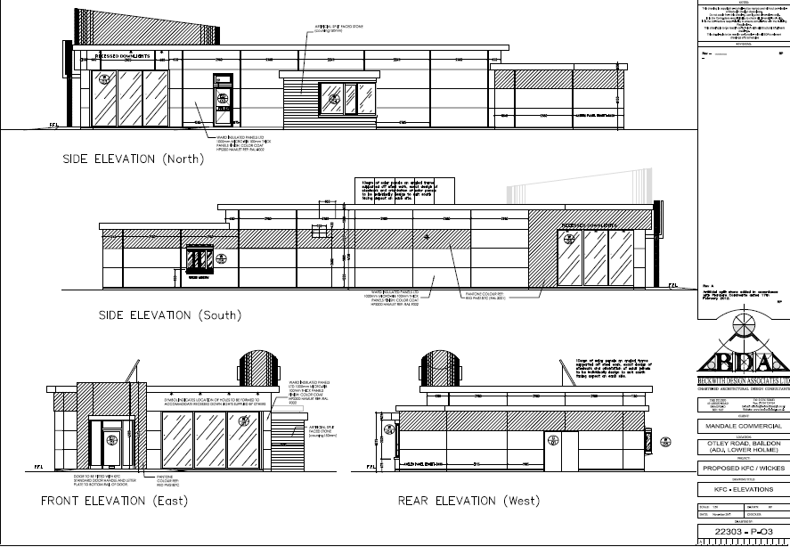 What do you think? Is the potential nuisance value of having this near your home greater or less than the current nuisance value and eyesore of having the mill site indefinitely surrounded by ugly metal hoardings….?
Lower Holme’s residents have until this week to lodge any concerns they have with the planning authorities. What would you say?
(P.S. A week on… with the planning objection deadline having passed… and I learn that not all of the residents had even been informed of the planning application! Surely insult added to injury.)


