A Bridge Over Troubled Waters?

panorama
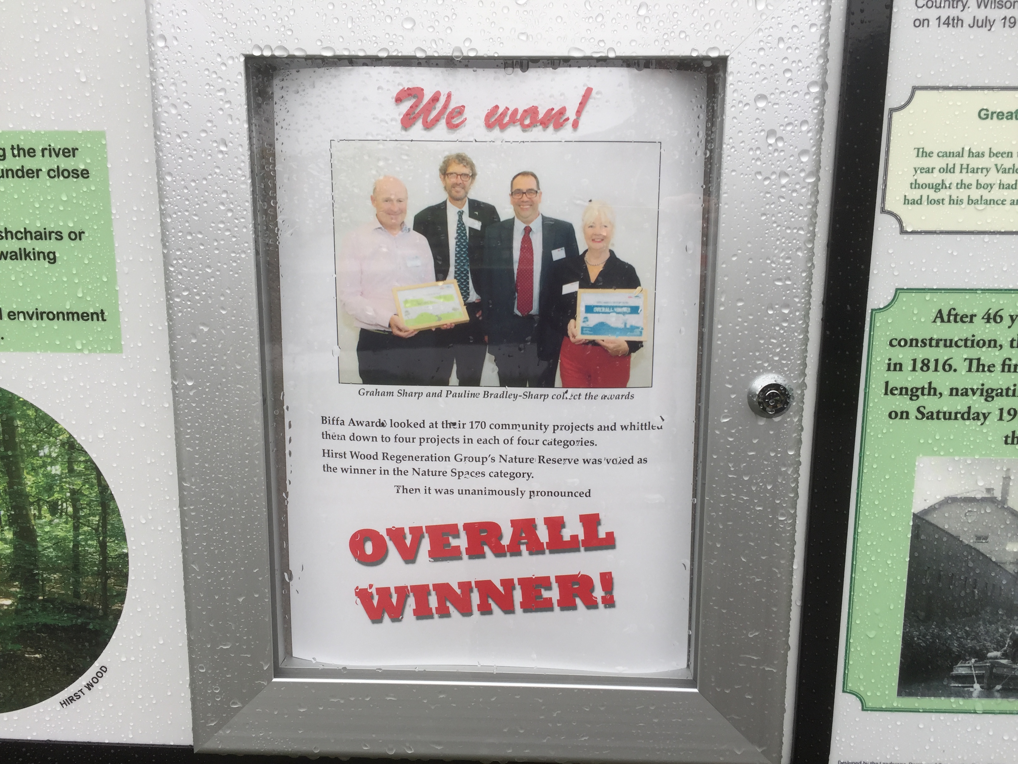
Like many people, I’ve spent a lot of time this week trying to make sense of the chaotic whirlwind that has been President Donald Trump’s first week in office. Events in Washington don’t normally have much to do with the waterways and communities of Shipley (this blog’s usual subject matter), but there was something about the Women’s March held last Saturday in Shipley town centre — in protest at Trump’s inauguration — that resonated deeply for me. Let me try to explain why.

clock tower

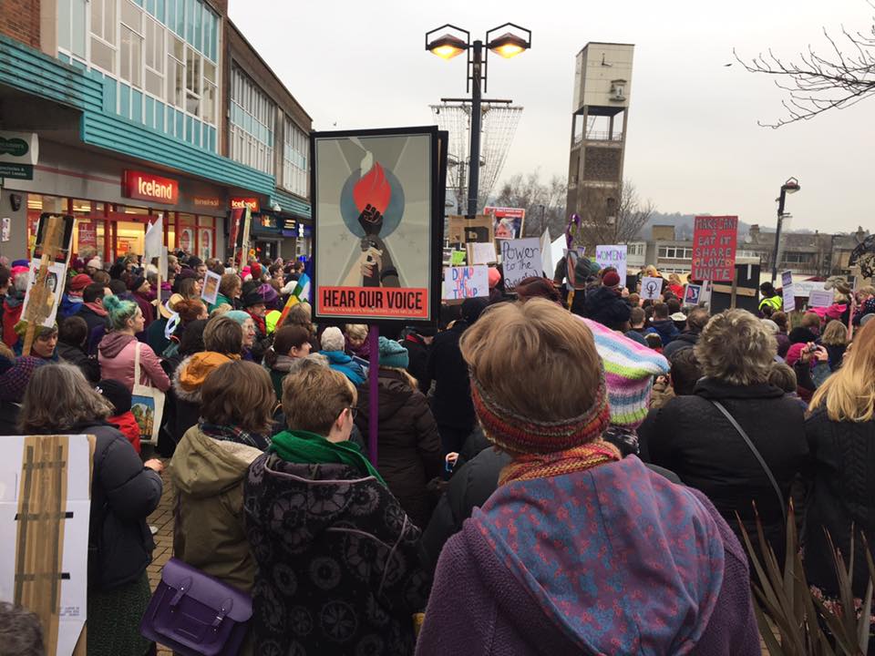
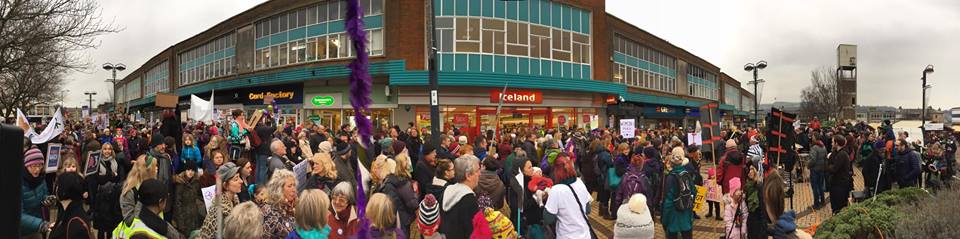
The march in Shipley was, of course, one of many held all around the world. But unlike most of the other places where this happened, Shipley is not a major city. It’s not London or Manchester or Glasgow or even Leeds. It’s a small, former mill town, and the decision of some of its citizens to march was curious enough to attract journalistic comment as far away as India. The specific, local incentive for the action was a kind of subsidiary protest against the local Conservative MP, Philip Davies, who has stated that he would have voted for Donald Trump “in a heartbeat”. But it’s not just his liking for Trump that has antagonised Shipley’s self-proclaimed “Feminist Zealots” (their name is an ironic dig at Davies’s derogatory terminology); it’s their sense that he seems similarly reluctant to treat women as equals. Davies may not have been recorded boasting about grabbing small felines, but his membership of Parliament’s Equalities and Diversity Committee is — as even he would likely admit — about as natural a fit as asking Nigel Farage to join the European Commission.

women and placards
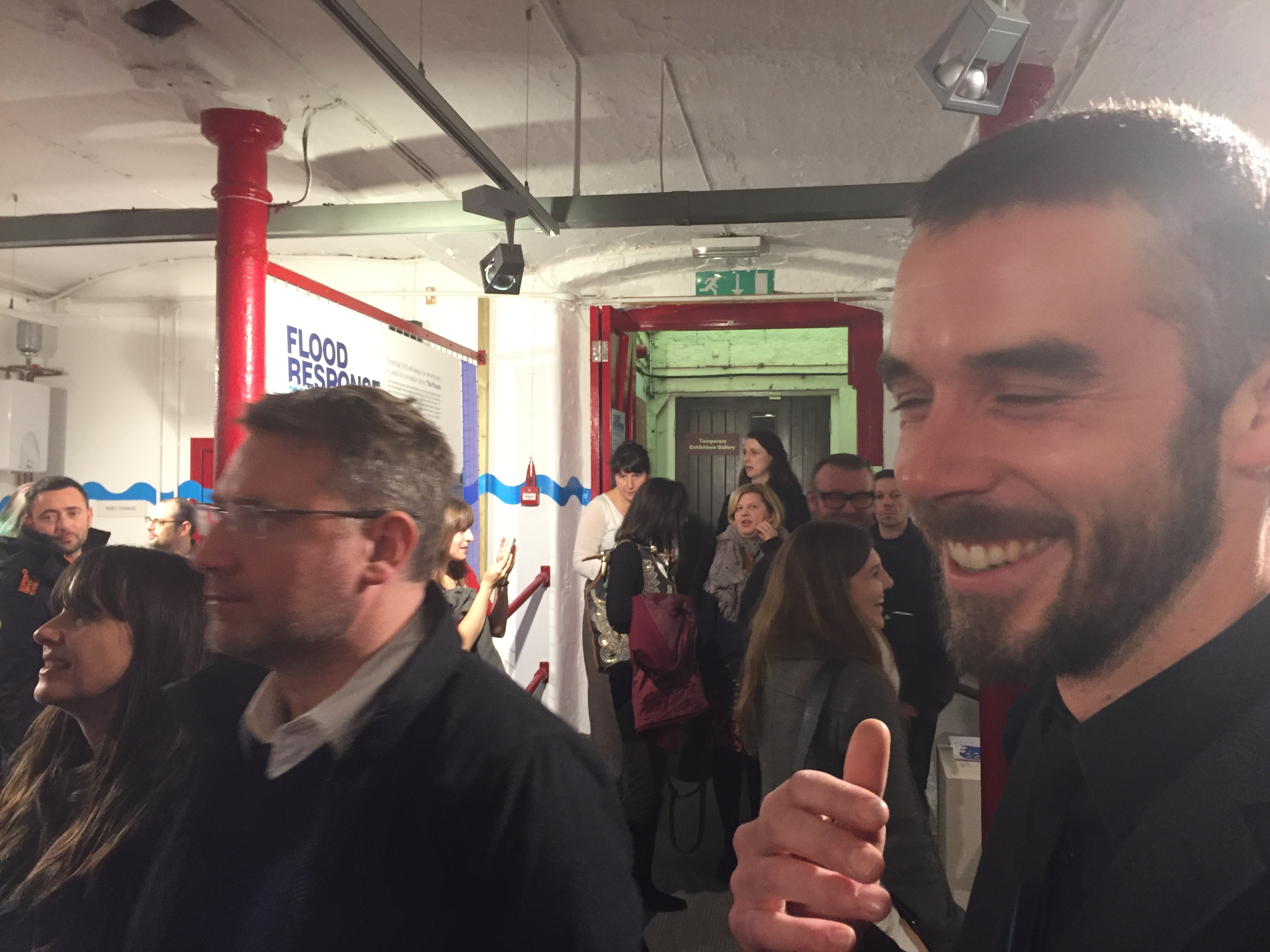
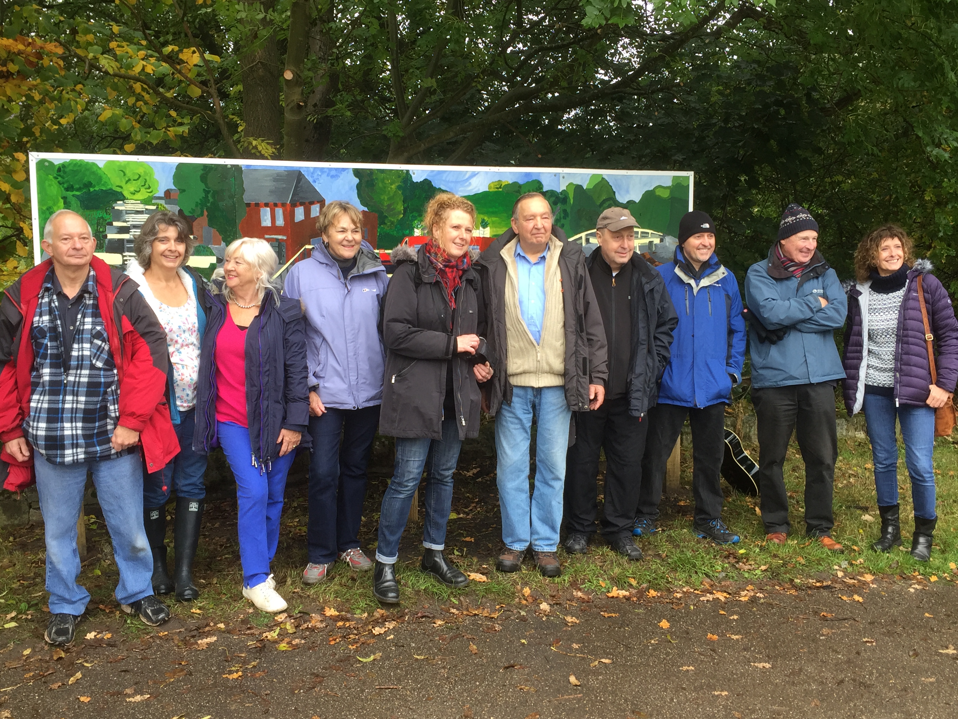
I will nail my colours to the mast and say that I whole-heartedly support the Feminist Zealots of Shipley — from whose previously ‘secret’ Facebook feed I have nicked these pictures of the march (with apologies to the photographers). But I also think it’s important to say that Philip Davies is not a man simply to be rubbished and ridiculed (despite the best efforts of, say, comedian Russell Howard). Whatever one thinks of his politics, it’s hard to deny that he is also a hard-working constituency MP who is quite remarkably responsive to the needs of constituents, regardless of who they vote for, or indeed what sex they are. I’ve lost track of the number of stories I’ve heard from local people of how he has helped them out with pressing problems to do with housing, local services, etc. Davies has earned the gratitude and respect of many, which is no doubt a big part of the reason he gets re-elected. So it was great to see that even the protest against him was voiced in a creative, generous spirit, rather than in the kind of divisive, aggressive language that Donald Trump himself has become known for:

16114177_10154540134381888_5887707022175432936_n

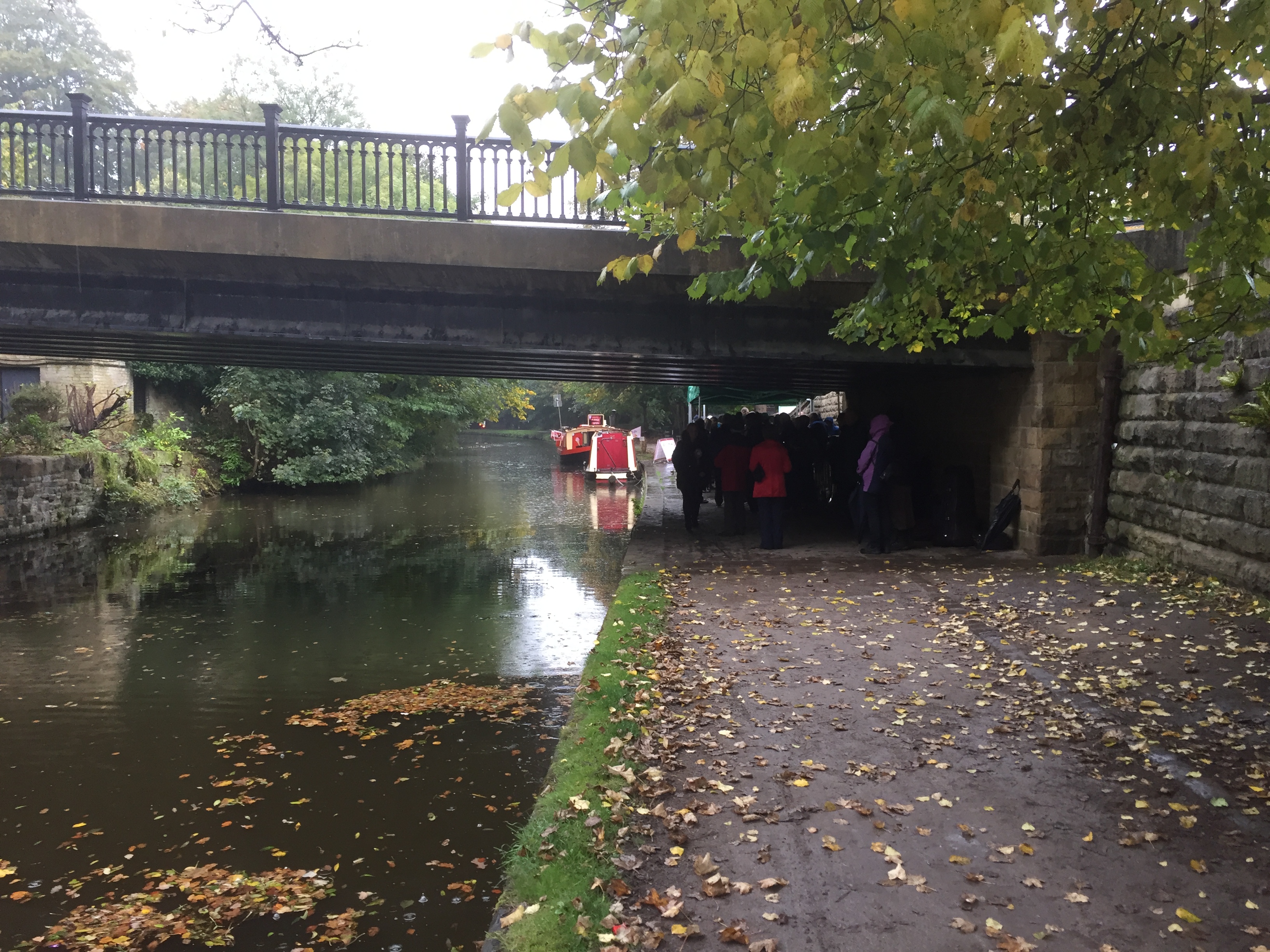
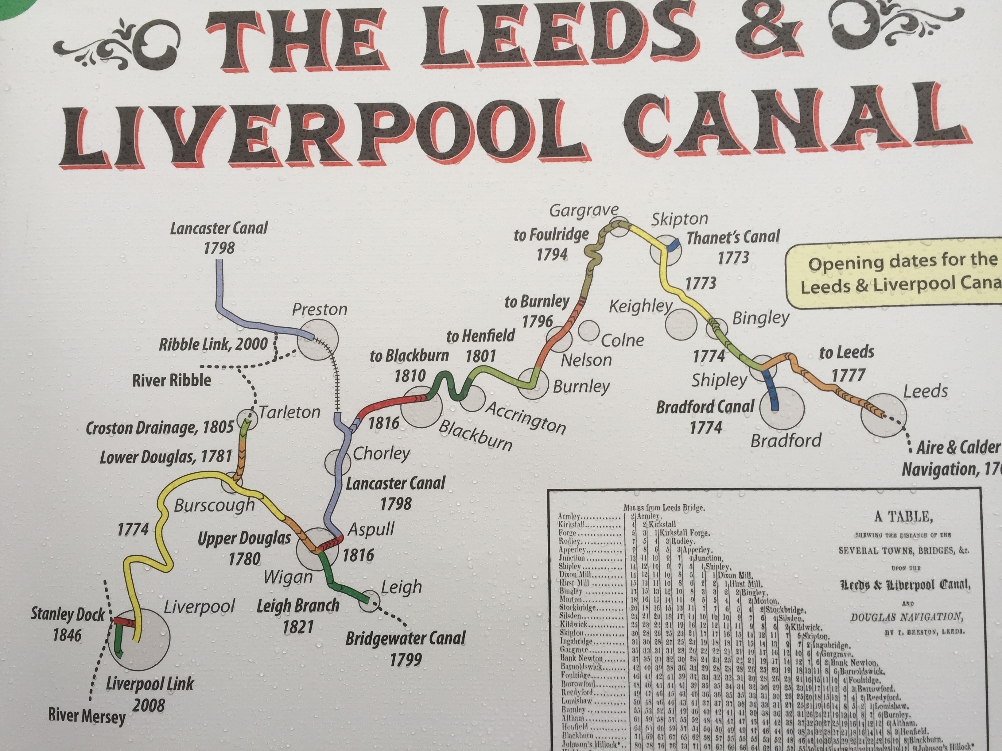
This slogan — “Bridges Not Walls” — recurred on a number of placards on the march, and exemplified the spirit of wanting to build and heal, rather than divide and antagonise. It’s also a gift to your local water-blogger, because of course Shipley has no shortage of bridges. Off the top of my head, I count seven road and footbridges across the canal between Dockfield and Hirst Wood (not including the lock gates, which you can also walk across), and a further four across the River Aire. (Of course the canal even takes a bridge of its own over Bradford Beck at one point, just to underline my point…) In short, in the Shipley area, we’re pretty good at finding our way over sometimes troubled waters. So maybe there are even bridges to be built between Philip Davies and his opponents? Before that begins to sound tritely optimistic, let’s take a closer look at one particular bridge…

IMG_2374
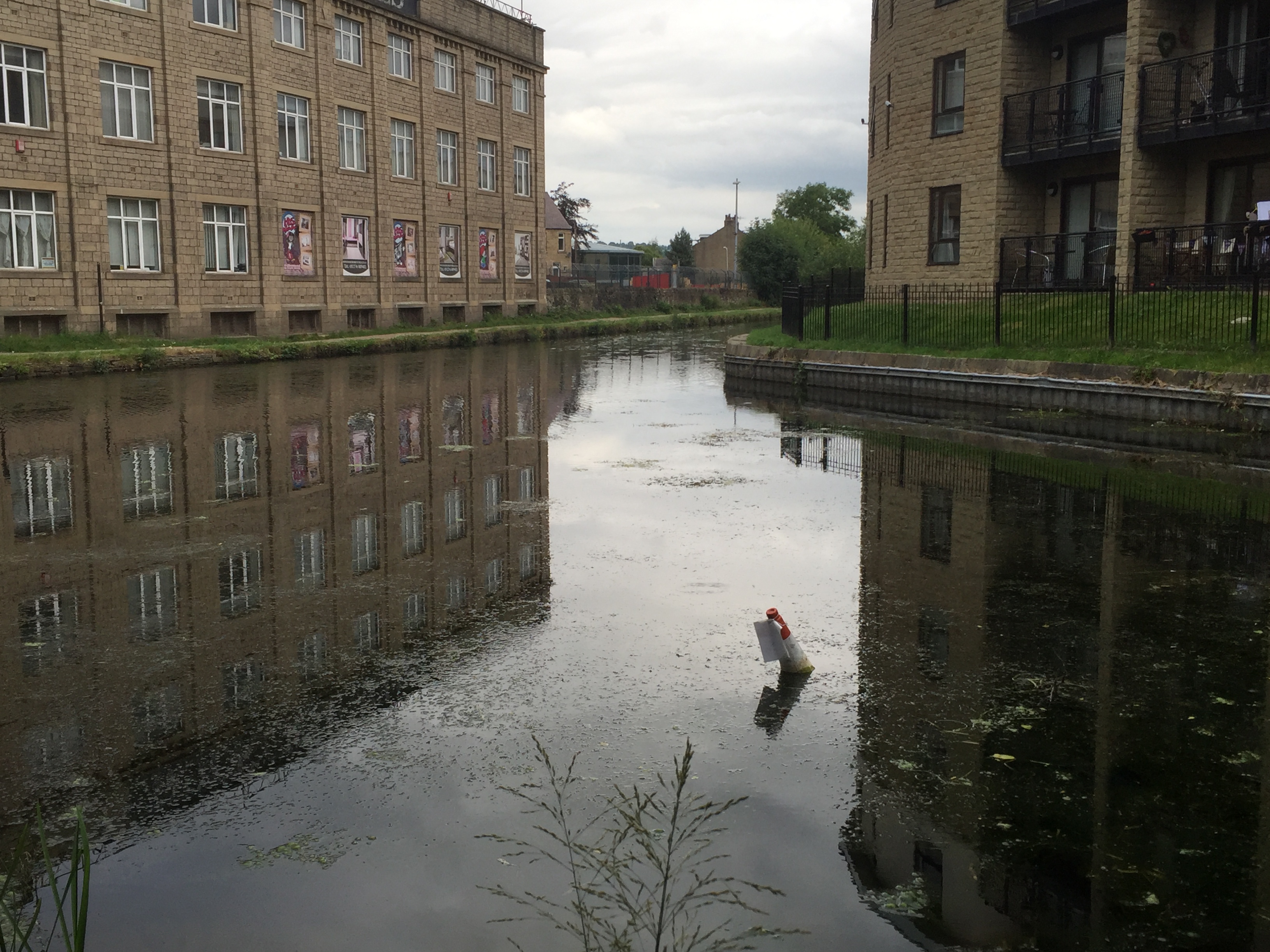
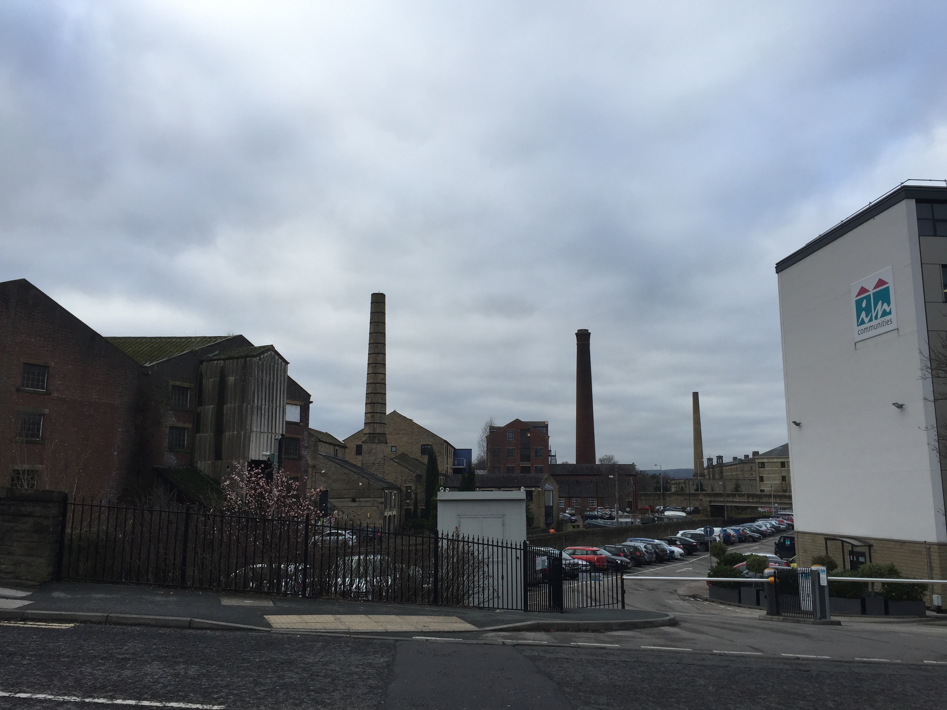
This is Victoria Street in the foreground, ramping up to the left of the picture as it starts to bridge the Leeds-Liverpool Canal in central Shipley. (The distinctive chimney of Salts Mill is in the distance, to the west.) One the right of the image, standing to one side of the canal, is the headquarters of In Communities, Bradford’s social housing authority. (I’ll come back to them in a minute.) On the left of the picture — and directly across the canal — is the distinctive red-brick structure of the former Leeds-Liverpool Canal Company warehouse. This pairing of buildings, old and new, facing each other across the water, sums up quite a lot about the state of modern Shipley. Let’s look first at the warehouse…

IMG_2375

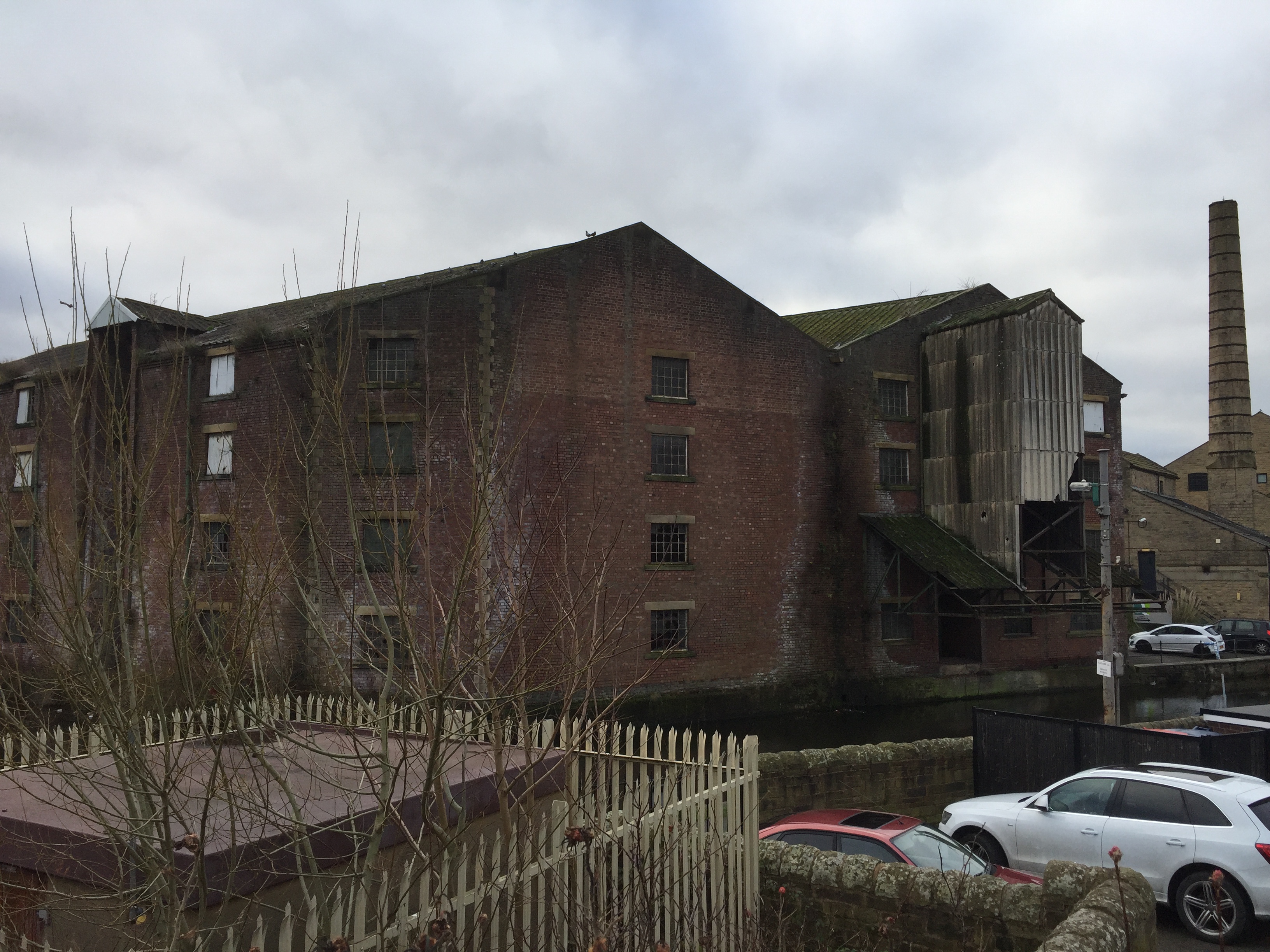
If you were looking to find local examples of what President Trump was speaking about in his ominous inauguration speech — those “rusted out factories scattered like tombstones across the landscape of our nation” — well, this would be as good a place as any to start. Sure, it’s a warehouse, not a factory, but this rather beautiful edifice (which my friend Eddie Lawler has playfully earmarked as the HQ for his imaginary “University of Saltaire”) has been left to go to rack and ruin in recent decades. It’s one of many sadly neglected canalside structures, which has never been retrieved and repurposed for any “post-industrial” service industry. But the question is, what would a Trump (what would a Davies?) propose to do to remedy the situation?

The answer promoted by most mainstream politicians, of either hue, in the UK and US over the last 30 years has been to trust the market. Private enterprise, we are told, will deliver improvements to all our lives… Well, perhaps it will in some places, but the canal company building is still there, crumbling, and last month it was raided by police officers charged with shutting down an unregulated private enterprise…

Cannabis factory at Ashley Lane, Shipley.jpg.gallery

As reported by the Telegraph and Argus , this was not the first time that the building has been squatted for the purpose of growing industrial quantities of cannabis…

Shipley Ashley Lane cannabis farm.jpg.galleryThe spirit of free enterprise has always been about serving yourself first, even if that involves stretching the law. It’s useful for some things, but it’s not going to save the crumbling infrastructure of Yorkshire’s former mill towns, let alone the American “rustbelt” states that swung victory for Trump. And the new President, who knows a thing or two about free enterprise, knows there’s no business incentive for rebuilding in depressed areas. (Where’s the profit in that?) So instead, he is promising the biggest federal infrastructure programme since FDR’s New Deal in the 1930s. Donald the Builder wants to make more than his signature golden towers. His plans will, he promises, put thousands of ordinary Americans back in work, and it’s these promises that got him the votes he needed in Michigan, Wisconsin and Pennsylvania to win the election.

The question is, who is going to pay for all this? Because much as we’ve all got tired of mainstream politicians who seem only to represent vested interests (hence the Trump rallying cry to “drain the swamp!”), we’ve also got used to not having to pay too much in taxes. Hence Trump’s determination to make Mexicans, not Americans, pay for his most controversial infrastructure project — the mooted wall on America’s southern border (which, of course, the “Bridges Not Walls” slogan refers to). Well, good luck with that, Donald. So far the Mexicans don’t seem too impressed by your negotiation tactics.

But enough about America. Let’s get back to Shipley. Where the appeal of Philip Davies to local voters is perhaps not dissimilar to the appeal of Donald Trump. His slogan is “Your Interests, Not Self Interest”. And as I mentioned, Mr. Davies does seem to do a fair job of helping people out with their immediate difficulties, by banging heads together where he can. And yet… in this era of small-ish government and low-ish taxes, there’s little prospect of the local infrastructure being rebuilt any time soon.

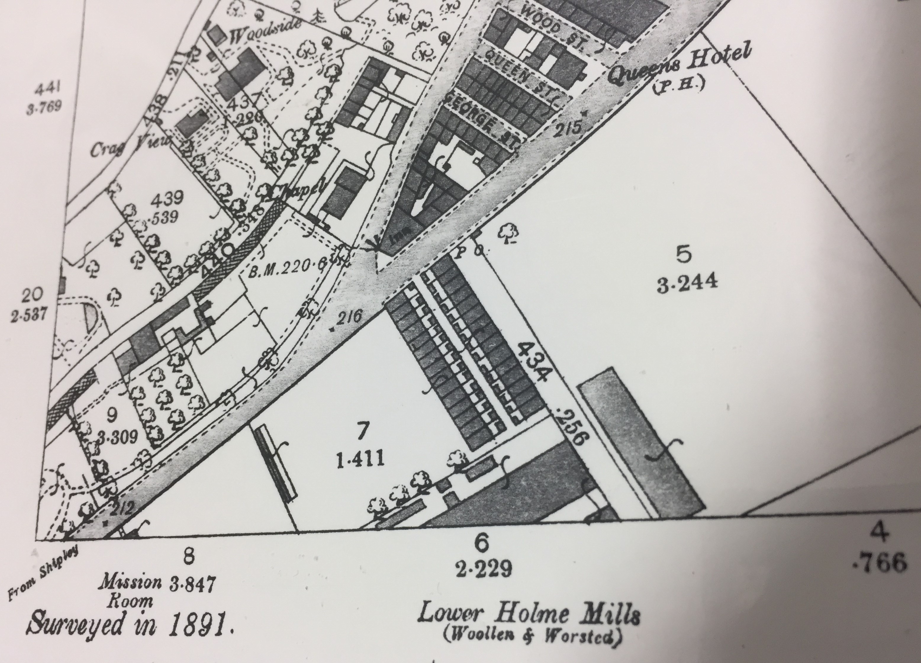
For me, this realisation has become particularly apparent this last month thanks to some striking bits of local history. Paul Barrett at Kirkgate Centre recently circulated this link to Operation Progress — a 1957 documentary film, on the British Film Institute’s web player, which shows the demolition of some of Shipley’s insanitary old back-to-back houses, and the building of the spanking new council housing estates along Coach Road. You get an amazing sense, watching this film, of just how exciting and progressive it seemed at the time to build these solid new homes in green spaces on the Baildon side of the river — transplanting people from the dark, crowded streets so many had been living in before. This was “operation progress”, and it was masterminded not by private enterprise or indeed by central government, but by Shipley Urban District Council. They had a masterplan, and they carried it out, and in many ways we’re still living with the landscape they created in the 1950s. Partly because there’s been no comparable attempt at regeneration since…

IMG_1395

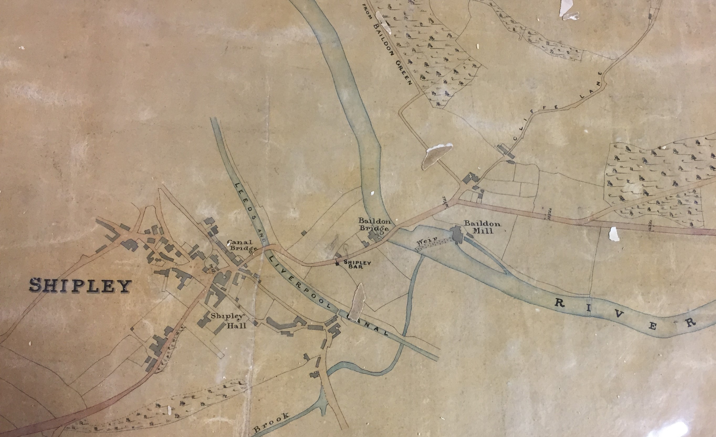
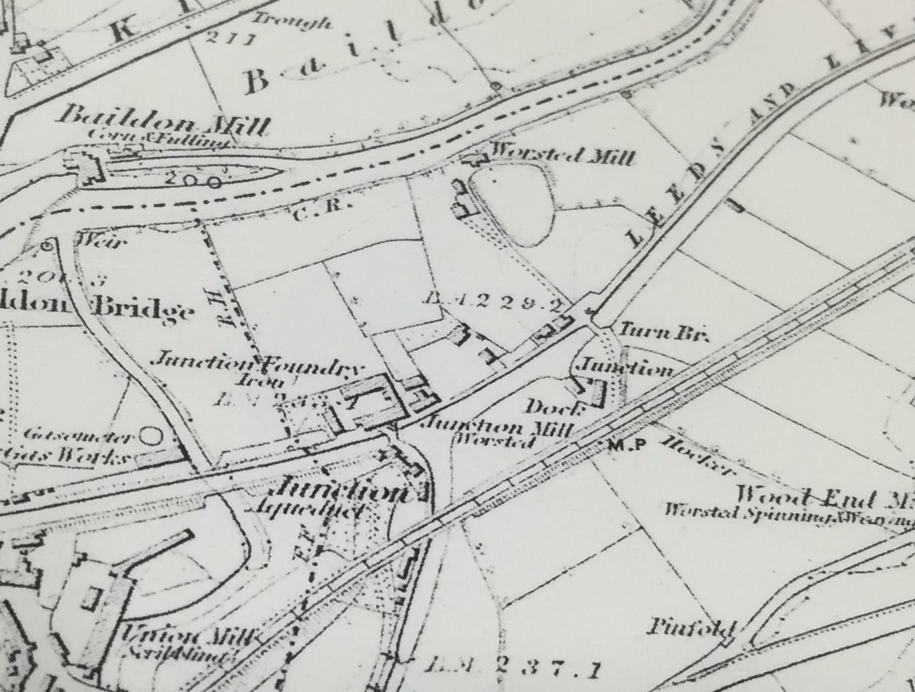
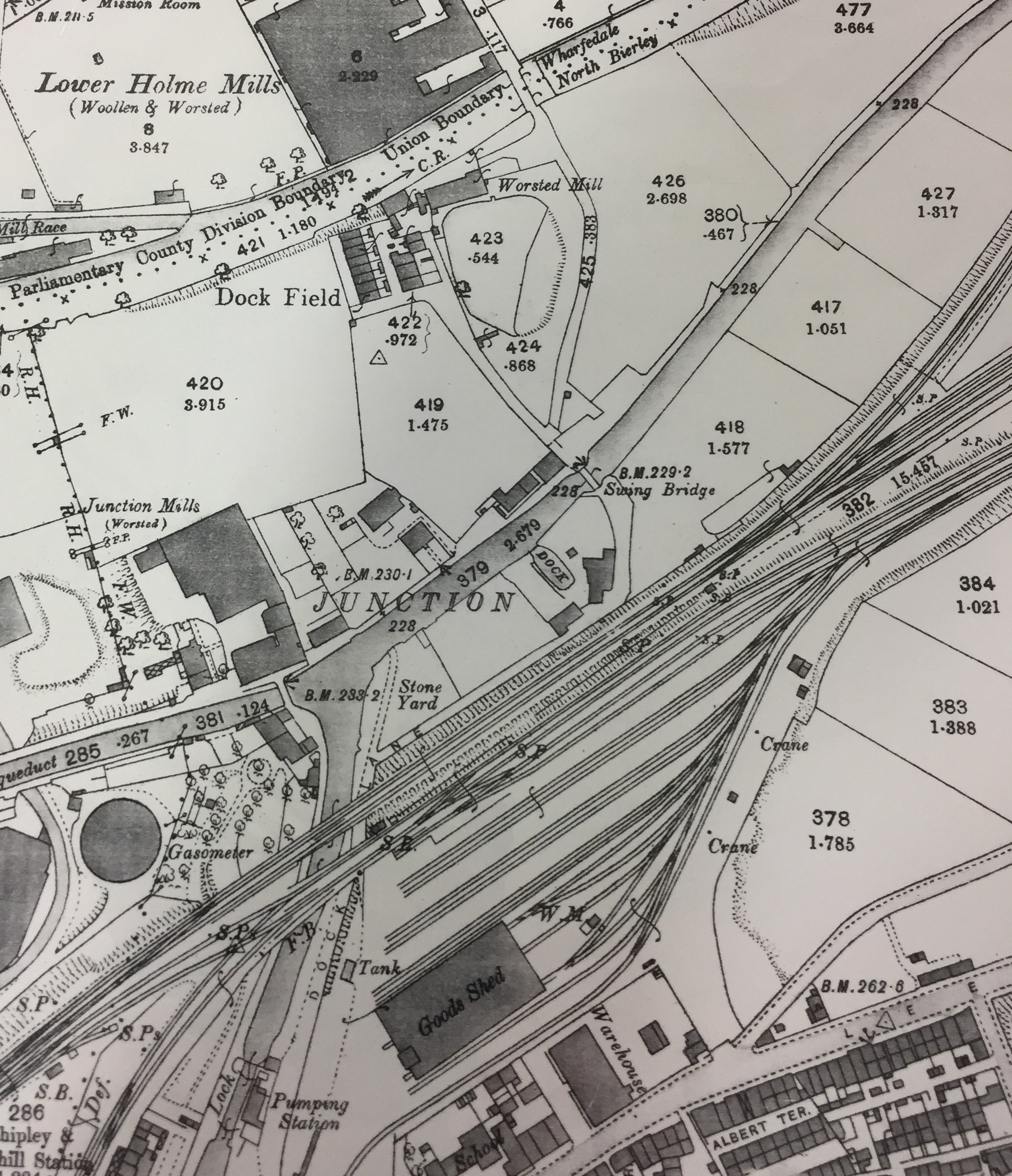
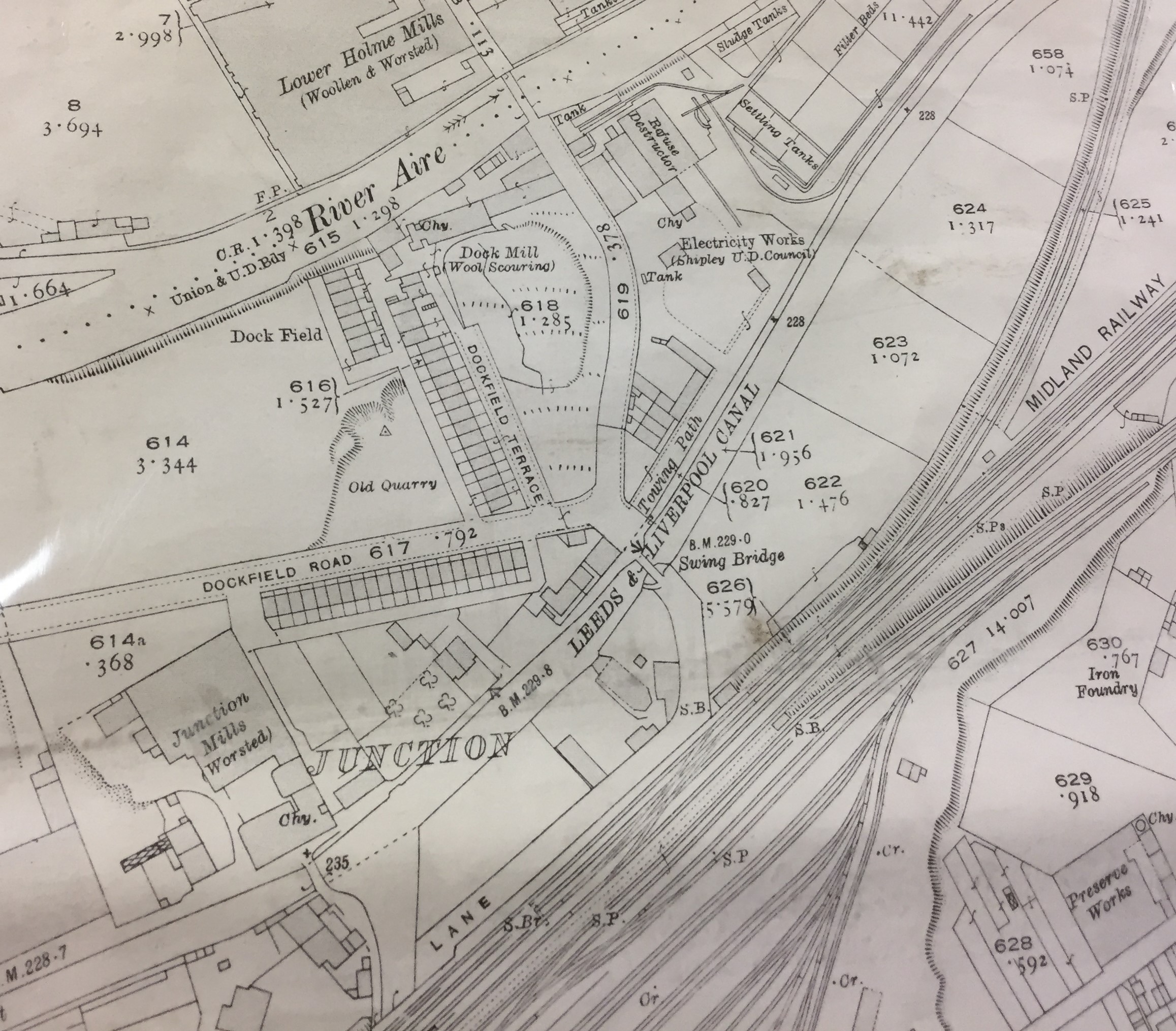
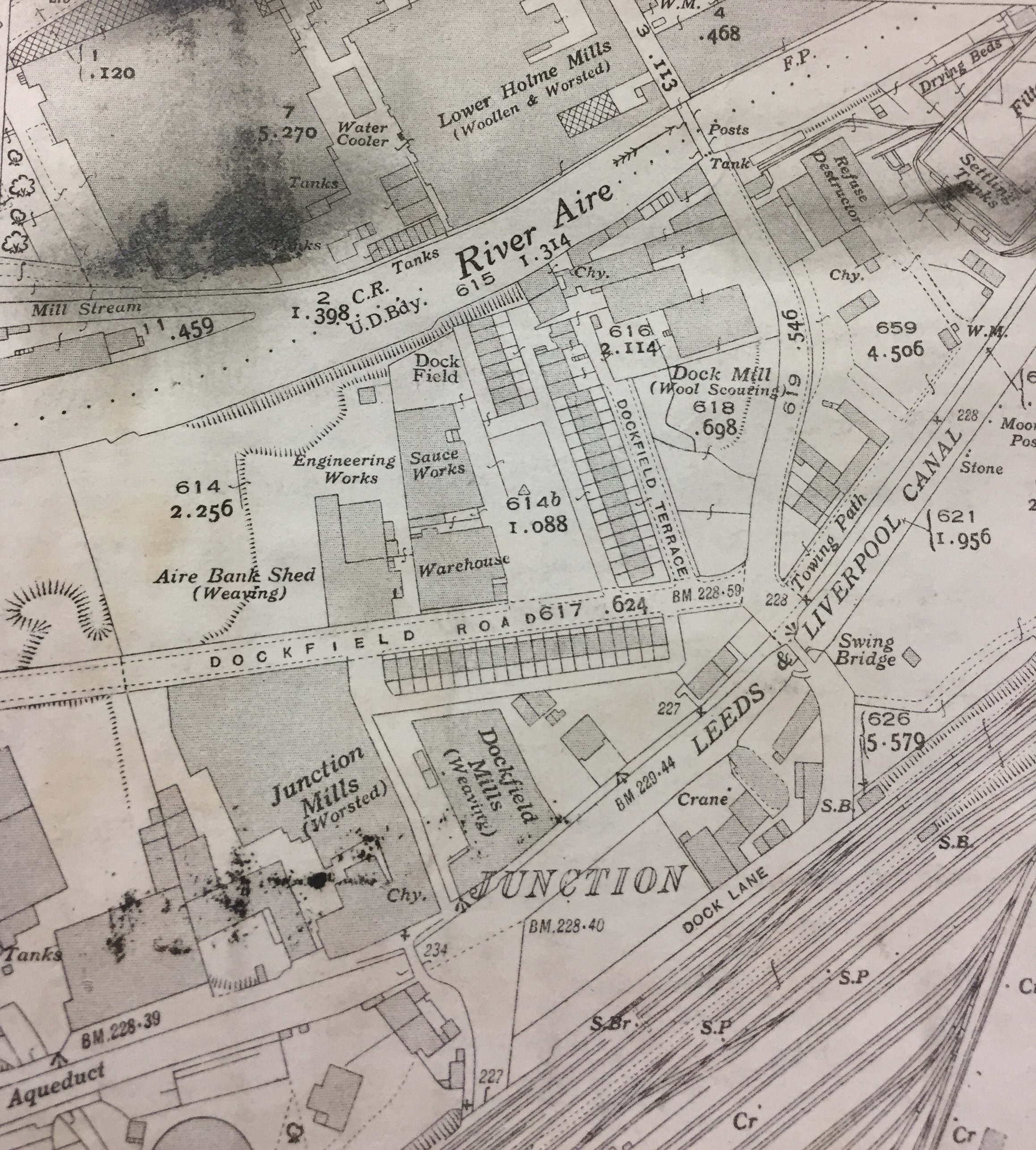
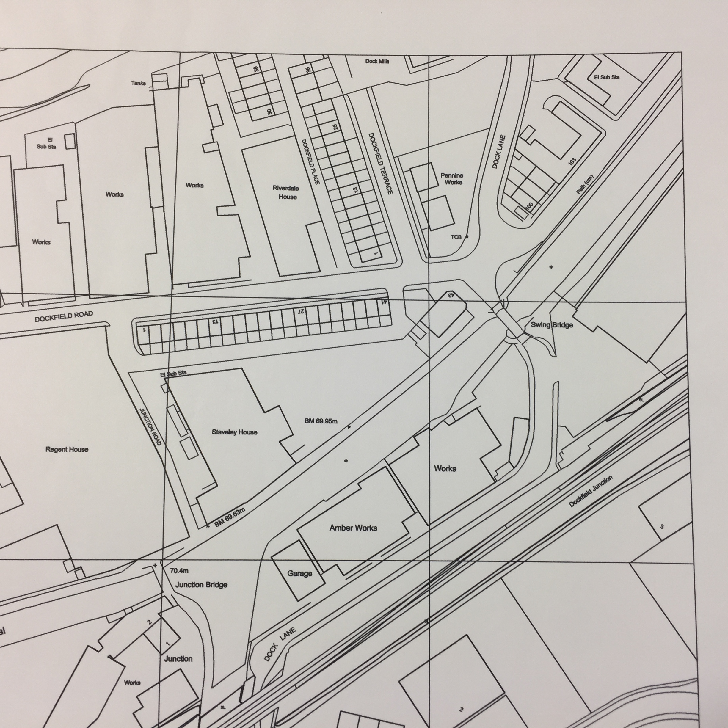
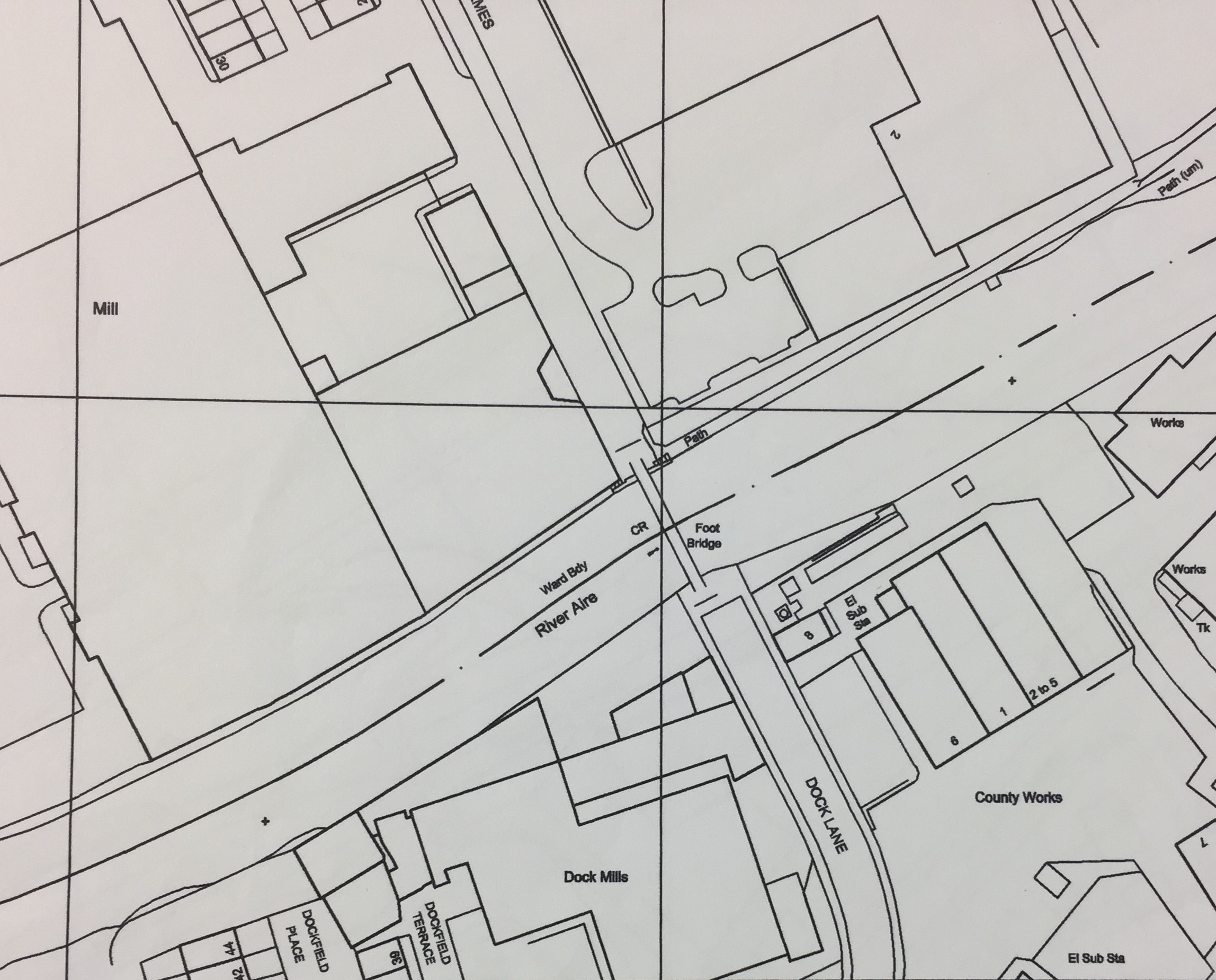
I’ve also been actively researching the history of Shipley’s Dockfield area this month (see also my last blog), and one of the striking things I’ve discovered is that here, too, it was Shipley Urban District Council that made all the difference. Not in the 1950s, but half a century earlier, when SUDC had a masterplan called the “Shipley Improvement Act of 1901”.

IMG_2158

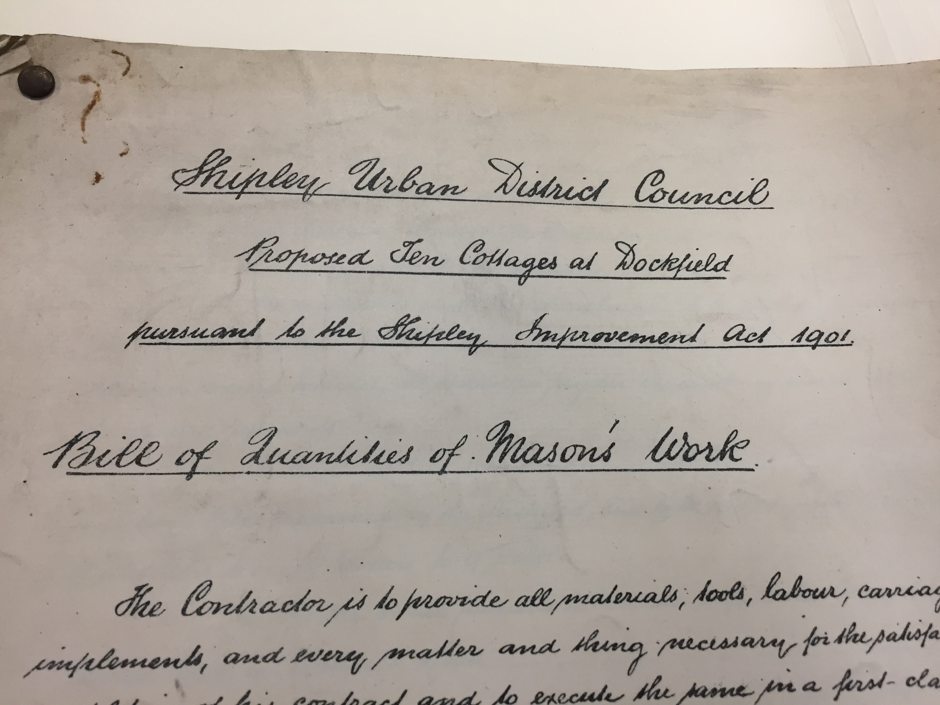
Up til then, Dockfield had basically been the wild west (or rather east) — an area dominated by a few largely unregulated textile mills, with the only road access going under the railway via Dock Lane. The lane was in a shocking state of disrepair because the mill owners didn’t want the responsibility or cost of maintaining it. But then SUDC built Dockfield Road as a modern road link from the main Otley Road. And alongside Dockfield Road, SUDC built the row of terraced housing that still stand there. And at right angles to Dockfield Road, they also built the homes along Dockfield Terrace. Council houses all. And they made them solidly, from stone, with then-state-of-the-art plumbing and heating systems.

And at the same time they built a water treatment works in Dockfield, as the outfall to a brand new sewage main running west to east, the length of Shipley. Because decent sanitation is a basic health requirement. But left to its own devices, free enterprise was never going to provide it.

IMG_1387

All of which brings me back to In Communities. Remember them? Opposite the weed warehouse? It oversees what’s left of Shipley’s council housing stock. Of course, ever since Mrs. Thatcher introduced the right to buy in the 1980s, most council housing in the area — whether along Coach Road (c.1957) or in Dockfield (c.1908) has been sold into private ownership. There’s not much stock left, because there’s been no new drive for social house-building. Because — we’re always told — we can’t afford it. And to judge from the Comments on the InCommunities facebook page (where the average ‘star grading’ out of 5 is 2.2), the condition of much of the remaining stock is poor, and too little care is being taken about the welfare of those people having to live in them. In fact, I even made a film about this recently. But that’s another story.

My point is, if you look around Shipley, it’s easy to see why people here might — given the opportunity — vote for Donald Trump. Whether “in a heartbeat”, or just in the forlorn hope that it might change something. But my point is also that what we really need is properly resourced, properly led local government, with a new vision for the town’s future.

Is it too much to hope that we might build a bridge, on this basis, between Philip Davies and his detractors?

IMG_1404

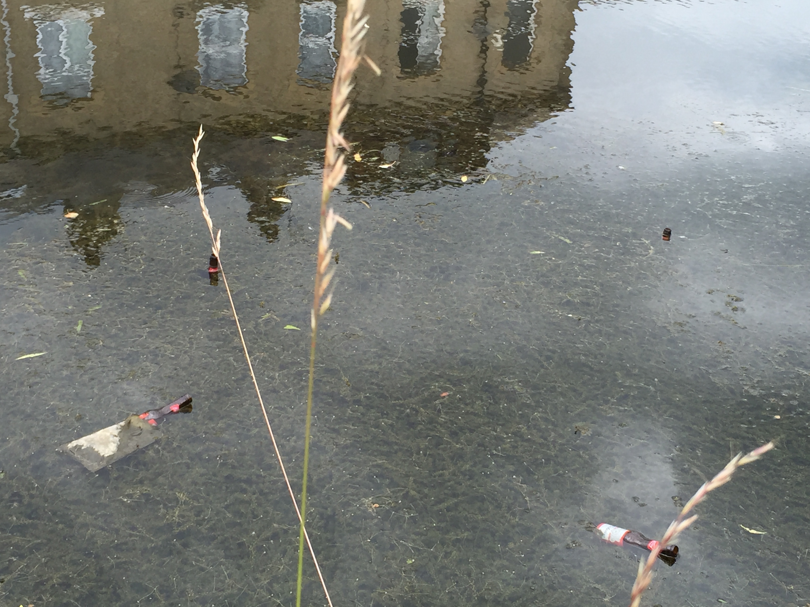
This is Dockfield’s Junction Bridge. Built in 1774 to allow horses to cross from the towpath of the Leeds-Liverpool Canal to the connecting towpath of the Bradford Canal. This is the junction – and the bridge – at the heart of Bradford’s early industrial expansion. Behind the bridge, Junction House — also built in 1774 — continues to fall into chronic disrepair…


Dockfield and Lower Holme: A story in maps

This time last year, I was trying to keep this blog updated with the crisis that was the Boxing Day flood of 2015. Thankfully, things have been a lot quieter this Christmas, so I’ve been able to devote a bit of ‘down time’ to some more historical water stories. Specifically, I’ve been puzzling over old maps, trying to figure out the history of how homes and industry developed in the Dockfield area of Shipley (and the Lower Holme area of Baildon, just across the river footbridge). It’s more fun than a jigsaw puzzle…

1837 Shipley Kirkstall turnpike plan

Dockfied is an area defined by water on all sides — the River Aire to the north, the Leeds-Liverpool Canal parallel to the south, and Bradford Beck to the west (flowing north to meet the Aire). But as you can see from this 1837 map, above, it was not even dreamed of at that point in time. Shipley was then a small town whose centre was slightly further west than it is now, clustered around the road leading off the original Canal Bridge (now Victoria Street Bridge), before the Otley Road bridge and Foxes Corner junction even existed. East of the Beck (or “Brook”, as this map has it), was simply farmers’ fields. By 1852, though — the date of this next map — there are sure signs of industrialisation…

Dockfield 1852 detail of larger Shipley mapNot far to the west, Salts Mill was nearing completion and about to open — in 1853. But here, in addition to Baildon Mill (the old water mill on the Aire, also visible in our earlier map), we can now see Junction Mill — in the spot where it still stands, directly to the east of Bradford Beck, and facing Junction Bridge — the original canal bridge that allowed horses to cross from the towpath of the Leeds-Liverpool to the towpath of the Bradford Canal (hence “junction”). Also in what’s to become known as Dockfield, there on the southern bank of the Aire, is another, as-yet unnamed “Worsted Mill“.

Neither of these two new mills would have had water wheels (or their attendant weirs). This was now the age of steam engines. But still, you need water to make steam. Junction Mill appears to have been getting its supply from the river via the “Junction Aqueduct” (Salts Mill had a similar pipeline set-up), but the smaller worsted mill had clearly opted to site itself right next to the river. This meant that it didn’t face onto the canal, as Junction Mill did, so to get access to this vital transport and haulage route, a road of sorts has been constructed between the mill and a small “Dock” on the southern edge of the canal. And a swing bridge (or “Turn Bridge”) has been installed to provide access across the canal itself. Notice that, at this stage, Dock Lane does not appear to extend any further: it is literally just a lane linking the riverside mill to the canal dock.

Taken together, the appearance of these two mills gives a clear indication of what the appeal of this area was to industrialists: you needed both the river for a ready water supply and the canal for transportation, and in the Shipley area you had both, running in parallel. Of course, rail is another transport option, and already in this 1852 picture above you can already see the clear line of what was then the Midland Railway, running roughly parallel to the canal, just to the south. But stations were fewer and further between on a railway, so the canal still had a clear appeal for its readier freight access (just as road haulage is, today, much more convenient than rail for most businesses).

Now let’s spool forward another 40 years, to the first modern Ordnance Survey map, printed in 1893:

Dockfield OS 1893 (first edition)Notice, first, the appearance of the words Dock Field on this map. The area has found its name — a name that presumably refers simply to the fact that there is a dock right there in the middle of a field… But the words actually appear next to the first row of houses in the area, which have no doubt been built to house the worsted mill’s growing workforce. These houses, now known as Dockfield Place, are still in use today. 

Notice, though, how the riverside worsted mill has now been dwarfed by the erection of the Lower Holme mill, directly across the river. This Baildon site, bought up by Titus Salt in 1850 (apparently before he decided where to site Saltaire), was sold on to C.F. Taylor in 1862, and it was Taylor who then built the large mill building next to the river (again, water supply…). He must also have been responsible for building the bridge across the river, in order to connect to Dock Lane and, thus, the canal dock. Although the present, 1960s bridge structure is just a footbridge, it must originally have been wide enough for wagons — which also explains why the road running down to it has always been full road-width (at least until the arrival of the controversial “landscaping” — aka a long row of dumped earth — that was left along the edge of the Wickes overspill car park when the site was redeveloped in 2014… still a sore point with residents!).

I can’t easily show you the Lower Holme cottages north of the mill, because in a quirk of OS mapping, there’s a key grid line that runs through here that always carves the mill and cottages onto two separate pages of the maps. So we’ll come back to the Baildon side of things at the end of this post… Sticking for now with Dock Lane, notice how — in the 1893 map above — the lane now continues alongside the railway and then underneath it by the canal junction. It then runs alongside the Bradford Canal (long since filled in, of course) to connect with the Leeds Road, just as it still does today. Finally in the 1893 map above, note also the massive expansion of railway sidings to the south of the mainline.

The next map is from 1908, just fifteen years later…

Dockfield OS 1908 revisionAt first glance you might think this looks much the same as in 1893. But notice the developments to the east of Dock Lane, between river and canal. A small row of houses has now appeared along the towpath to the east of the swing bridge — houses which still stand today on Dockfield Road (though the road did not yet exist when they were built). These houses and the other new buildings to the north have apparently been built to service the new Sewage Works that Shipley Urban District Council has recently been building. The long, rectangular in the top right of the image above will soon be more clearly delineated as sewage settling tanks. So… the outlines of the Dockfields “island” (as some residents call it) are now clearly defined: river, beck, and canal to the north, west and south, and wastewater treatment to the east…

The sewage works’ arrival was the result of developments in local government and sanitation around the end of the 19th Century. The SUDC was created from the old Shipley Local Board, and one of its main reasons for being was to bring proper drainage and sewerage to Shipley — by eliminating the old middens and cesspits, and providing new homes with proper plumbing. A new sewage main running west to east along the Aire valley through the whole of Shipley parish now emptied into these wastewater treatment works at what was then the easternmost edge of the town. Indeed, technically (as 19th C. maps make clear), the area east of Bradford Beck was in the parish of Idle, not Shipley, so in effect Shipley was dumping its waste on the threshold of its neighbour.

But Shipley Urban District Council was not done yet… Look at this next OS map, from 1922 (? ish).Dockfield OS 1922 probably

The new sewage works are more clearly labelled now. The worsted mill on the riverbank has now finally acquired the name of Dock Mill. But most strikingly, we now have the spanking new Dockfield Road, leading all the way up from Otley Road, at Baildon Bridge. The road has been built by the SUDC to provide better access to the sewage works and thus take the pressure off Dock Lane (which was no longer fit for purpose, with the mounting volume of traffic, and with that low bridge under the railway). Along Dockfield Road and the adjoining Dockfield Terrace (which links to the older homes nearer the mill) we now have two rows of early council housing — homes literally built by Shipley Council, with the very latest spec in plumbing and drainage… This was an early statement about the unsuitability of the old back-to-back homes in the Windhill area — visible in the bottom of the 1893 map above, and eventually demolished by SUDC in the years after World War II.

If we fast forward again to 1934, the full scale of Dockfield’s industrial development has now become apparent…

Dockfield OS 1934 (1)West of Dockfield Terrace, the Hammond Sauce works has now set up shop, and there’s also a weaving shed and small engineering works alongside the sauce. Dockfield Mills has now been built on the canal bank next to Junction Mills (also still standing today). Dock Mill itself has further expanded, and there are more buildings around the canal dock (presumably warehousing, to cope with the increased capacity now needed). This is Dockfield at its industrial height.

Now then… All of these map images are close-up photographs I’ve taken from the large maps on display to the public in Bradford Central Library’s Local Studies section. (There’s no indication there of any copyright issues with the maps, so hopefully I’m not breaking any laws here.) But for some reason the library’s big maps don’t go past 1934. After that we move to a different scale of OS mapping, but we also make a huge leap to 2003…

Dockfield OS 2003What’s perhaps most noticeable here, apart from the altered graphics, is just how little has changed since the 1930s. In the map above, Dock Mills is still there, and the various “Works” to the west of Dockfield Terrace. But Junction Mills has been renamed “Regent House” and Dockfield Mills is “Staveley House”. These name changes are indicative of a change in use from industrial space to office space, in this “post-industrial period” after Mrs. Thatcher murdered the country’s manufacturing base in the 1980s…

Notice, too, that at some point since the 1930s, the old canal dock has been filled in (the canal’s “super slow way” no longer being a viable freight transport option in this high speed era). More “works” have been built over the docks area, although — in 2003 — these are just about to be demolished. One of these buildings, Amber Works, will very shortly give its name to Amber Wharf, the new-build apartment complex built along the southern bank of the canal. (The first flats at Amber Wharf were sold in 2007 — right before the bottom fell out of the property market…) Dock Mills, too, will shortly disappear, to be replaced by the new-build riverside flats whose street address is still Dock Mill.

Notice that, at some point between 1934 and 2003, the OS maps also seem to have moved their grid slightly, so that the page cut-off now happens south of the river, rather than north of it… Below is the connecting page, from 2003, with Dockfield now linking clearly across to Lower Holme, via the modern footbridge structure…

Dockfield OS 2003 + Lower Holme

The Lower Holme mill has yet to be demolished (that would take another 5 or 6 years). And notice, on this map, that there are still “County Works” east of Dock Lane on the Shipley side of the river. Shipley’s sewage works were long gone by 2003, the wastewater treatment having been moved down to Esholt back in the 1950s (the land to the east that had once been an array of settling tanks and filter beds was redeveloped for more manufacturing, such as the Metal Box engineering plant that’s still there today). That said, there’s still a sewage pumping station next to the river, pushing the stuff on towards Esholt, and there are still electricity substations on this site, as on the map above. What’s changed now, of course, is that the County Works site has been sold off to the local success story that is Saltaire Brewery. Personally I’m a big fan of the Saltaire Blonde and their other beers, but next time you have a pint of theirs, it’s worth reflecting on the fact that it was brewed in a building that was once (according to the maps above) the “Refuse Destructor” for Shipley’s wastewater.

On that note, let’s cross the river again and jump back to the earlier maps for Lower Holme, across that OS boundary line…  Here’s the 1893 OS map for the area immediately north of the river, around the junction of Otley Road and Baildon Road:

Lower Holme cottages 1891The “inn” at the junction (aka the Junction pub) stands on the corner just as it does today. And south of Otley Road you can already see the distinctive twin lines of the Lower Holme mill cottages, also still standing. However, the area immediately west of these homes (where KFC is today!) appears to be green space at this point (note the little tree drawings!). The houses are separate from the mill itself, even though they’ve been built to house C.F. Taylor’s workforce. The mill is set back from the road because, as was noted earlier, it’s the water supply from the river that Taylor needs most. That and the canal access, across the river bridge.

Lower Holme cottages 1913

Jump forward to the 1913 revision (above), and the Lower Holme mill works are starting to encroach on the land west of the houses. There’s also been more development on the site to the east (also originally part of Taylor’s operation). And along the main road, notice the apperance of “Urinal” and “Trough” — all part of the public sanitation drive being pursued by Baildon Urban District Council at this time, in parallel with Shipley’s.

Lower Holme cottages 1934By the time of the 1934 revision, above, the houses are pretty much surrounded… Industry at its height! The mill buildings, of course, have all now been demolished — within the living memory of some of those still living on Lower Holme.

So all in all, this area is a story of industrial rise and fall… industries dependent on water supplies, water transport, and (arguably most important to the area’s modern development) water treatment. But if the manufacturing has largely gone, or transmuted into service-sector industries like brewing and (down Dockfield Road at Funopolis) recreation, it’s important to remember that the homes built to house the area’s workers are all still standing. None of these have been demolished, because they’re good homes… the solidly domestic legacy of a bygone industrial era.


Last Christmas: a view from the air

DCIM100MEDIADJI_0019.JPG

Tomorrow, Sunday 18th December 2016, we’re holding a Christmas party at Baildon Woodbottom Working Men’s Club for the Higher Coach Road Residents Group — and other invited members of the local community. We held a similar event around this time last year, shortly before the club was devastated by flooding on Boxing Day. That’s the club’s buildings, there, on the lower right of the photo above. The ‘proper’ river is to its right, and the lake that was Woodbottom cricket pitch is to the left. This was 27th December 2015, as the flood water was starting to recede.

DCIM100MEDIADJI_0006.JPG

Here’s a closer view of the club and adjacent caravan park… And below, another view as the aerial drone camera turns clockwise to show the rest of the club and the upstream area.

DCIM100MEDIADJI_0007.JPG

Below, moving further upstream but looking back — a higher and wider shot of the whole area. Here, the main course of the river is much clearer, just off to right of centre. The club is in the middle towards the back of the shot, and in the foreground, Baildon Rec and the local Sea Cadets hall.

DCIM100MEDIADJI_0014.JPG

Then, below… just a little further upstream still, and turning clockwise again to look west, we have the four houses of Aire Close — right next to the river — and the Victoria Mills complex on the opposite “bank”. In the distance, to the west, is Saltaire. Notice the visible watermark on the buildings in this shot, since the water is already well down on where it had been the previous day:

DCIM100MEDIADJI_0009.JPGI’m very grateful to Brian Tuxford, of Northway Vehicle Sales (on Baildon Bridge) for sharing these images with me and allowing me to put them up on the blog. I featured Brian a few weeks ago, in this blog post, but it’s taken me a while to get these images up (because the CD he gave me had got corrupted somehow, and I had to get technical support to recover the photo files). Anyway, it seems appropriate to share them at Christmas — one year on.

DCIM100MEDIADJI_0029.JPG

Above, we see the view from just downstream of Baildon Bridge, looking west. The cricket pitch etc are to the back of the shot now, and in the foreground we see the retail area east of the bridge, off Otley Road… United Carpets, and in the bottom right, the garden centre section of B&M. The river channel proper is to the left. The collection  of white vans in the middle of the shot is part of the Northway Vehicles fleet — the part that hadn’t been swept away by the flood — and you can see here just why Northway’s compound was in exactly the worst place as far as the flood was concerned… right in harm’s way as the water diverted across the cricket pitch tries to find its way back into the main channel. Below we see the same scene in reverse (i.e. the other side of United Carpets is now to the left; the river is to the right), and here you can get a very clear sense of the trajectory that would have been taken by the 37 vehicles swept downstream off the Northway lot…

DCIM100MEDIADJI_0035.JPG

The shot below gives some sense of how bright and sunny it was, on the day after the storm. Again we’re looking west, with the club to the left and the Rec in the centre of the shot. In the lower foreground is Otley Road, coming away from Baildon Bridge…

DCIM100MEDIADJI_0027.JPG

If you compare the shot above with the shot below — which seems to have been taken later in the day, when the water level had further receded — you can see how more of the road is now visible. And how the worst flooded part of it is actually around the junction with Green Lane… The bridge itself, to the left, and everso slightly raised to cross the river, is by this point comparatively dry. Which may be why the vehicle trying to ford through the flood water had thought it safe to ignore the road closure signs at the other side…

DCIM100MEDIADJI_0027.JPG

Particularly clear from this photo above is the way that the main river channel goes through a noticeable curve or bend as it comes under the bridge. Hardly surprising, then, that in high water — and with the channel under the bridge itself partially blocked by debris — the river diverts itself straight across this area, in a sort of “short cut.”

DCIM100MEDIADJI_0023.JPG

Finally, then, back to the club. And the vapour trails in the sky, reflecting in the standing water on the cricket pitch. And one, stranded blue car, which is not going anywhere fast.

Merry Christmas, one and all.


Flood Response @ Armley Mills

It was a pleasure and a privilege this last Thursday evening, December 8th, to have the opportunity to perform Too Much of Water, my one-man show about the Shipley flood last Christmas, at Leeds Industrial Museum — aka Armley Mills. The occasion was the opening of a special exhibition titled Flood Response. A single room in the basement of the museum is jam-packed with varied, colourful, striking exhibits documenting the impact of the Boxing Day flood in (mostly) Leeds. As the title implies, the exhibition looks at how communities in Leeds, especially in Kirkstall and Armley (the mill itself was directly hit by flooding), responded to the flood, often by showing a surprisingly festive spirit of resilience and co-operation, and thereby turning a crisis into a form of community-building. In the same spirit, the exhibition itself is labelled a “community exhibition”, and as such is composed largely of material donated by members of the public, rather than being professionally produced or commissioned.

IMG_2096

The curator of this rather remarkable display is Chris Sharp, pictured here on the right — his first big project for Leeds City Museums. He’s done a tremendous job (I really do recommend you visit). The exhibition was officially opened by Councillor Judith Blake, leader of Leeds City Council, pictured below during her speech, during which she spoke with real passion about the city’s response to the flood crisis..

IMG_2097
IMG_2103
To Councillor Blake’s right here is Councillor Lucinda Yeadon, deputy leader of the council and (more to the point in this context) the ward representative for Kirkstall. As such, she was directly involved in the community response to the flooding along Kirkstall Road, and she really does seem to be one of those (rather too rare) politicians who inspires the confidence and affection of her local community. The exhibition opening itself was attended by quite a diverse crowd of invitees, enough to pack out the exhibition space, but here too the spirit of inclusion was apparent. This wasn’t just the predictable collection of luvvies and bigwigs you might expect to see at an exhibition opening, but a cross-section of people from the local community who had got involved in the flood response effort, in one way or another. (And here’s a few of them…)

IMG_2099

IMG_2095

I’m very pleased to say that Multi-Story Water’s own contribution to telling the story of the Leeds flood response is on display as part of the exhibit (which will run for six months). Our promenade performance After the Flood — devised for Leeds Waterfront Festival in June — is on display in a new film version. We completed editing just in time for the exhibition opening. And OK, yes, some kind of technical glitch meant that the film file wasn’t playing on the digital screen designated for it on Thursday (i.e. the one to the left of this chap’s head, in the picture on the left), so it had to be temporarily installed on  an alternative screen at ground level. This hiccup should be resolved soon, though. And in the meantime you can also view the film online… Just look for After the Flood under the “Films” tab on the menu bar above… 

IMG_1737

This is actor Kat Martin — who you can just about see on the screen in the exhibition shot above — performing ‘live’ in After the Flood, as “Poppy”, a young woman whose family’s business on Kirkstall Road was badly affected by the flood. (The doll’s house represents the business, and the small figures are Poppy’s parents…) I’m really rather proud of this piece, made in collaboration with Simon Brewis’s Common Chorus Theatre, but on Thursday night, attendees at the opening were too busy milling and chatting to concentrate long on a video screen… Instead, after the speeches were over, they were invited upstairs to the museum’s cafe space for my live storytelling performance, Too Much of Water (both it and the ATF film were requested by Chris Sharp for the exhibition and opening – thanks for the opportunity, Chris).

Anyway, here I am, as pictured/tweeted by Geoff Roberts…

CzLAY1BWQAAtTAf

When I originally performed this piece in Roberts Park, for Saltaire Festival, it was mid-September and the Christmas tree and jumper seemed amusingly quirky. Since then, I have performed it around the country (Exeter, London, Cambridge, Manchester, Leeds), and I’m aware that by now — in December — I’m in danger of looking like I’m just trying too hard to be seasonal. Be that as it may, the performance was very well received by attendees at the opening, several of whom made a point of introducing themselves afterwards and thanking me personally (which was very nice – thankyou!).

What people find moving, I think, is the piece’s focus on some of the smaller, more human details of how people were affected by the flooding (the script draws from interviews with a number of people in the Shipley area, who are represented by the small wooden figures). I was especially flattered by the suggestion of one senior flood risk officer, who saw the piece on Thursday, that anybody who works with people affected by, or at risk of flooding (be it for the Environment Agency, local council, or whatever) ought to see this piece, because it will help them reflect on what it’s really like to be in those circumstances. High praise indeed.

On the other hand, I heard on Friday — from another friend who couldn’t attend the opening — that a couple of his colleagues at the Environment Agency, who had been at Armley Mills to represent on Thursday, had felt slightly uncomfortable watching the piece. They wondered if I was attacking the EA’s warning efforts in Shipley around the time of the flood. I’d just like to say, publicly, that I’m really sorry if they felt that way, because this was never my intention. Yes, certain details are documented in the show, as seen from the point of view of my interviewees, that might perhaps be seen as not reflecting all that well on the EA, but I was very careful in writing the piece not to make any comment either way — simply to represent the facts as best I could establish them, and let spectators draw their own conclusions. And I do make the point in the show that the Agency too, in its own way, was inundated on Boxing Day — struggling to keep up with the pace of events as the crisis unfolded in multiple towns, in multiple catchments, simultaneously. They, too, are only human.

With that in mind, I’ll close here by pasting in Scene 5 of our After the Flood film — “the Agency Man”. Hopefully this provides some sense of just how tricky the EA’s job is, in terms of Flood Response – often having to be all things to all people. In my (finite) experience, they usually do a great job, in often very difficult circumstances.

Celebrating Dockfields…

IMG_1405


The Dockfields area is at the cross-roads of Shipley’s history …

It’s here that docks, factories and homes sprang up around the junction of the Leeds-Liverpool and Bradford canals

here that an ancient right of way across the River Aire (now Dock Lane footbridge) has long provided access between Shipley and Baildon…

and here that people have lived, worked and played, with industry all around, for generations…

The Multi-Story Water arts project, working with Shipley’s Kirkgate Centre, is planning a festive celebration of Dockfields – of its communities, its history, and its future – for 2017.

This includes Amber Wharf, across the canal, and Lower Holme, across the river, as well as Dockfield Road, Dockfield Terrace, etc…

But what kind of event should this be?

We’d love to collect your ideas, and your memories of the area…

… and we’d love your involvement in making something happen!

To get the conversation going, we’re making a short play about the area, for performance in your very own living room! (it’s just two actors…)

If you’d like the play to visit you (in Jan or Feb), just let us know!

Please conact Lyze for more info on 07713 357706

Or: lyze@kirkgatecentre.org.uk

Canal Child

The recent celebrations for the bicentenary of the opening of the Leeds-Liverpool Canal were marked by all sorts of activities up and down the canal’s 126 mile length. Pasted in below is a charming document of one of these initiatives — a musical collaboration between “the bard of Saltaire” Eddie Lawler (also a good friend of, and collaborator with, the Multi-Water Story project) and the children of Saltaire Primary School. The film speaks for itself really, so I need say no more… Enjoy!

The Trouble with Baildon Bridge (views from downstream…)

So this blog is in two parts. The first is a close-up, the second takes a wider angle, but hopefully it connects up. Bear with me as I tell the story, because it has a few twists and turns…  And to begin with, there’s also a

Prologue

IMG_2005

This is Councillor Judith Blake, the current leader of Leeds City Council. This week she said something very interesting indeed, from a Shipley point of view. Councillor Blake was speaking at a special networking event about future flood planning and resilience in the Aire valley, hosted this week at Open Source Arts – an unassuming enterprise unit on Kirkstall Road in Leeds. Open Source was itself flooded at Christmas, but thanks to the tireless efforts of leaseholder Phil Marken, it also became a focal point for the community relief effort and, later, volunteer river clean-up activities. It was thus a rather symbolic (as well as practical) venue for the networking meeting – which was attended by (among others) the key flood risk and drainage officers for both Leeds and Bradford. The goal is greater future co-operation along the Aire Valley catchment… But more of that in a minute. First let me jump us back to Bradford and introduce somebody else…

Part One: Northway

IMG_1965

This is Brian Tuxford. He runs Northway Vehicle Sales Ltd., the van hire place on Otley Road, right next to Shipley’s Baildon Bridge. I met Brian the other week, following an introduction via our mutual friend Stewart Gledhill, and he toured me round the Northway compound and gave me the lowdown on just how badly impacted the company was by last December’s flooding. Northway lost no less than 37 vehicles to the flood water – cars and vans – one of them swept as far downstream as Denso Marston’s nature reserve, at Charlestown. Even those vehicles that Brian and his colleagues managed to save in time — by parking them around the corner up Dockfield Road — were stripped of exterior fittings that night by light-fingered visitors, who took advantage of the absence of the usual CCTV cover. Insult to injury.

IMG_1963

The bottom yard at Northway Vehicle Sales, just downhill from Otley Road

There was also the small matter of Northway’s workshop/garage (pictured above) having a massive hole driven straight through it by the force of the flood water — the end panels blown off. The whole thing has had to be taken down, repaired and re-erected.

Boxing Day flood was a bit of a “perfect storm” from Brian’s point of view. Normally, 80 to 90 percent of Northway’s fleet is out on hire at any given time, but over the Christmas period they’re called back to home base. So they were sitting right in harm’s way. On a normal working day, moreover, Brian would be at work at 7am, and would have been in exactly the right place to see the danger to his fleet and take swift action… Instead, he was staying over for Christmas in Huddersfield and only realised what was happening, by around 9am when the water hit, from the CCTV link on his phone. (In her talk, Councillor Blake spoke of how lucky Leeds was that the flood came at Christmas — with the city centre workforce not present, not travelling in or out… But Brian’s story is the opposite.)

The dark line across the lower part of the roofing here, well above head height, is the high watermark from the Boxing Day flood...

The dark line across the lower part of the roofing of Northway’s workshop, well above head height, is the high watermark from the Boxing Day flood…

In the aftermath of the flood, Brian had to lay off Northway’s mechanic, who had no work because there were almost no vehicles left to service. And of course Brian couldn’t pay him, either, because there was no income from hires. It took six months for a new fleet of vehicles to be delivered (after the insurance claims, and the long lead time for ordering new high-end vehicles). In the mean-time, the loss of operating revenue pushed the company to the limit — Brian and his partner nearly had to close up. And they know they’re taking a big risk reopening, because if another flood happens, there’s nothing to stop the whole scenario repeating itself…

Media coverage of flood victims typically tends to focus on people whose homes have been hit. This is understandable, given that we can all identify with the horror of having our personal sanctuaries being swamped by filthy water. We hear a lot less about the impact of flooding on small businesses like Brian’s, and the assumption can often be, well, business is business, right? They’ll claim on the insurance and get on with it. It’s not as bad as having your home invaded. And yet, as Brian grimly observes, his entire livelihood is tied up with this business. Fifteen years of hard slog, building it up from scratch on this site by the river. And much as he might want to move the business, since the flood, he can’t readily relocate to another site. The Baildon Bridge location is key, both because of the region-specific terms of his franchise agreement, and because many of his core customers need Northway exactly where it is (Saltaire Brewery, for example, just up Dockfield Road). And yet, Brian acknowledges, if they get hit by another flood, that’ll be it. Game over.

This year, post-flood, Northway’s insurance premiums have literally doubled. That too is putting the future of the business in serious jeopardy.

Now, you might be wondering what all this has to do with the Leeds flood planning meeting I mentioned in my “prologue”. Well, Brian’s business is specifically threatened by the way that flood water hits his riverside location. As he observes, on Boxing Day the river channel itself never threatened the van hire site. The water that was coming under Baildon Bridge flowed right on past. No, the water that hit Northway was water that had re-routed itself around the bridge…. In high water conditions, the low-lying bridge structure becomes something of a dam, and the river instead heads right out across Woodbottom cricket pitch as far as Green Lane, and then surges across the industrial/retail area east of the bridge, on its way back to the main channel. This happened not just last December but also in 2000 and in 1947. And Northway is right smack bang in the path of the water. The space between the buildings, Brian notes, became like a kind of surging plughole…

All of this raises the question… could floodwater, in future, somehow be persuaded to stay in its channel? If something could be done to re-engineer the bridge, maybe, so it’s less of an obstruction…? And if some walls could be constructed upstream to protect the Woodbottom area…? Might the river just surge right on by instead of going all over everywhere? Possibly. In which case, Brian’s livelihood would be safe. Or at least, safer.

But… there are some issues here. One is, obviously, the cost of such a defence scheme. Given the relatively small number of homes and businesses that are directly in harm’s way in this area, it’s unlikely that a “cost-benefit analysis” by government would find the spend worthwhile. (And who are any of us to argue with that, if we don’t want our taxes to go up to pay for equally worthy flood schemes on this sort of scale all over the country…?) But the other key point here, which I hadn’t fully appreciated until the Leeds meeting this week, is that – strictly from a Leeds point of view – it would be just fine if Bradford has quite poor flood defences. If water ends up sitting around on the Baildon flood plain for days, during a flood incident, well that’s just fine from a Leeds point of view. Leeds doesn’t really need high water flowing straight on through Bradford, staying in the Aire’s main channel, because then — well — it all ends up in Leeds…

Part 2: Scheming for Alleviation 

This was all brought home to me as I stood chatting, during the lunch break, to Andy Judson – who is the project director for BAM Nuttall Ltd on the current, £46m Leeds Flood Alleviation Scheme (FAS). The FAS has involved building a bunch of new flood walls in Leeds city centre over the last year or so, and BAM are now in the process of constructing high-tech collapsible weirs at Crown Point and Knostrop. Mr. Judson is a very approachable, very interesting man, who is – understandably – hoping that BAM Nuttall will get another big slice of contract work on “FAS2”, the mooted second stage of the Leeds scheme for which the government offered around £60m in the wake of the Boxing Day devastation. This scheme is intended to do something to better defend Aire valley areas of Leeds like Kirkstall, which was badly hit at Christmas, but for which nothing was provided in FAS1 (which is very much focused on the city centre).

IMG_2015

Mr. Judson and I found ourselves standing in front of this big poster about Bradford’s current flood risk planning. In the top right hand corner (see below) there’s an aerial shot of the flooding around Baildon Bridge at Christmas…. which is how we came to end up talking about it. Andy pointed out what I’ve just said about how flooding in this area, and many others upstream of Leeds, might be viewed “from a Leeds point of view”…

IMG_2015

Now, Mr. Judson’s job is to undertake the contracting work that is handed to him by major clients such as Leeds City Council and the Environment Agency. On a day to day basis, it’s not his responsibility to worry about Bradford. But this is why the networking event this week was so important. Because to give them their credit, LCC and the EA have decided to try to approach FAS2 differently to FAS1. The initial scheme has been dominated by the technical and engineering interests: a scheme was devised and proposed (by the engineering company Arup), funded (via the council, the EA, and central government), contracted out (to BAM and others) – but all in such a way that very few non-technical folk had anything much to say about it. A problem is identified (flood risk in Leeds city centre), a practical solution is proposed (build new walls, devise new weirs), and the construction juggernaut rolls into gear…

Yet the very fact of FAS2 being given a wider brief — to think “beyond” the city centre — has prompted some important reflections on exactly what the problem is that needs to be fixed by the new scheme. How far upstream – or indeed downstream – do we want to try to flood-defend? Putting the problem really crudely… Phil Marken’s Open Source Arts space on Kirkstall Road perhaps deserves better protection, but so too does Brian Tuxford’s van hire place — which is threatened by the exact same river. Viewed on a river catchment basis, the arbitrary distinctions between what is Leeds and what is Bradford are largely irrelevant – because the River Aire has no respect for political boundaries. In planning for FAS2, then, a “catchment-wide approach” is being adopted — and this includes an innovative attempt to involve as many relevant partners as possible, in order to better answer the flood defence questions (or even to establish what the questions are that need answering).

Andy Judson (BAM), Una McMahon (Environment Agency), Tony Poole (Bradford Council), and an unidentified fourth person, hard at work in a discussion group at Open Source Arts

Andy Judson (BAM), Una McMahon (Environment Agency), Tony Poole (Bradford Council), and an unidentified fourth person, hard at work in a discussion group at Open Source Arts

The workshop at Open Source Arts thus included representatives not only from the EA, the LCC, Arup, BAM, etc., but also senior planners from Bradford Council, and indeed counterparts from as far upstream as Craven (the district that includes Skipton and Malham). But the workshop also included community activists like Phil Marken and Vicki Gilbert (until lately of Yorkshire Voluntary Flood Support Group), as well as representatives from voluntary watchdogs like Aire Rivers Trust, social enterprises like Canal Connections, and even university researchers like me. Don’t ask me how the full list of invitees was arrived at – no doubt some significant people were inadvertently left out, as is the way with these things. But the point is that there was a genuine effort here to get people out of their regular boxes and comfort zones — and talking to other people with other perspectives and approaches to the flood problem. Andy Judson and I started speculating, for example, about how a natural flood storage scheme somewhere upstream of both Leeds and Bradford might provide the relief that both cities need… Exactly where or how that might happen is of course anybody’s guess (we were just talking…) but the point is that – just by having all these people in the same room – the debate had already moved well beyond the boundaries of Leeds itself. We can reasonably hope that there is going to be some serious partnership thinking going on in the coming months, which might – just might – benefit Brian Tuxford as well as Phil Marken. And, of course, many others like them.

IMG_2009

The loft level at Open Source Arts — including aerial harness and “Resilience” working group…

And this brings me back to Councillor Blake. Because at the heart of her opening pep talk to those assembled at Open Source (alongside her own personal, heartfelt reflections on the devastation of the city last Christmas) was the suggestion that community involvement has to be fundamental to the development of FAS2 and any associated initiatives. That was her word. Fundamental. This was a gauntlet, of sorts, thrown down for those present. Because flood risk managers, civil engineers and building contractors are not necessarily the kind of people best equipped or most inclined to engage with or listen to communities. But Councillor Blake was saying it unambiguously: other people need to be consulted. That’s the people of Leeds, yes, but also the people of Bradford, of Skipton, you name it… That’s the only way we’re going to arrive at the best possible solution for the greatest number.

And maybe, in the process, we’ll end up not just with more concrete walls, but better, safer, happier, greener places to live in…?

“You may say I’m a dreamer… But I’m not the only one.”

IMG_2014

There’s Yorkshire Life in Salt’s Waters…

It’s almost the end of October, so this is a bit slow off the mark, but I’m belatedly proud to say that the Multi-Story Water project was featured in a two-page colour spread in this month’s edition of Yorkshire Life magazine.

IMG_1993There’s a nice overview of the project here, but the piece is specifically supposed to be flagging the launch of our downloadable audio guide, Salt’s Waters, which you can find in various digital formats at this web address. You can pick up a printed leaflet with map from Salts Mill (second floor, leaflet stand by window), from Saltaire Visitor Information Centre, or from Kirkgate Centre in Shipley (or you can print your own off via the website). Frankly we haven’t done enough of a job of advertising this sound project on this blog — but Yorkshire Life can explain a little more for you…Larger versions of the text on these pages are pasted in below.

Salts-Waters-web-assets(300dpi)

Salt’s Waters is intended as an alternative heritage guide to the Saltaire area — which gets visitors out beyond the immediate confines of the mill village, and exploring the area to the Northwest via river, canal, tributary becks and numerous other water features. The circular tour takes you from the bottom of Victoria Road, up to the ruins of Titus Salt Junior’s ill-fated Milner Field mansion, and back to Saltaire via Dowley Gap. Along the way there’s narration, voices from the archive, sound effects, and original music by Eddie Lawler — including “The Ballad of Little Beck”, written especially for this Salt’s Waters (Little Beck is the stream dammed as a boating lake at Milner Field).

The guide is also intended to tell some of the less well-known “heritage” stories of the area. For example, on Track 4, as walkers head west from Roberts Park through the Higher Coach Road estate, the story turns to the building of the estate in the 1950s — showing how significant this area too is, in its own right, and how connected it is to the Saltaire story. This is a connection Multi-Story Water first explored in our “Green Route” performance tour back in 2012, so it’s nice to get it on the “permanent record”, so to speak…

You can of course choose to listen to the audio simply as a podcast, without doing the walk, but Salt’s Waters is very much designed to be experienced in situ — with your eyes providing the “live movie” to accompany the soundtrack… Do give it a try some autumn weekend, and let us know what you make of it… Thanks!

IMG_1994

IMG_1995

There’s also a side-bar that they’ve added about our short film Wading to Shipley, which has been available online for 3 years now (see under the “Films” tab above), but which the writer for Yorkshire Life seems to have taken a shine to…

IMG_1996


Rain on the Parade: Canal Bicentenary

Yesterday, Sunday 16th October, the Shipley area had a big occasion — the Bicentenary celebrations for the Leeds-Liverpool Canal. The canal was finally completed through to Liverpool in October 1816. But it’s worth remembering that its construction period dated all the way back to the early 1770s – when it was begun with cuts linking Skipton, Bingley, Shipley and Bradford… This area is key to the history of Britain’s longest singe canal.

IMG_1840To commemmorate the bicentenary, the Leeds-Liverpool Canal Society’s historic cargo boat, the Kennet is making a journey along the entire 126 miles of the canal. Having started off from Leeds on Saturday, it was coming through the Bradford area on Sunday.

Act 1: Shipley (or, The Silence…)

Getting off the train at Shipley station, in  a light drizzle, I headed past the Fox and across the main Leeds Road towards the little alley through to Gallows Bridge. Crossing the bridge to get down to the canal towpath, I then walked the short distance from there up to Shipley Wharf, expecting to see some signs of local celebrations. But the place was completely deserted.

IMG_1836

Apparently, news of the bicentenary had not, er, floated any boats in Shipley — despite the town owing much of its history to the canal. To be fair, walking from Gallows Bridge I did pass a few stray people standing around under umbrellas, who might possibly have been waiting gamely for the Kennet…

IMG_1839

… But it wasn’t until getting to the bridge under Salts Mill Road that I found the first clear sign of celebrations… a rosetted Rob Martin (former chair of Saltaire Village Society) waiting with his smartphone… His mission was to call the bell ringers in Saltaire Church as soon as he caught sight of the Kennet coming west…

Rob was sheltering sensibly from the drizzle, which was getting steadily heavier. He and I had a wee chat about what was happening in Saltaire. “You’ll find them under the bridge.” He said. “You won’t be able to get past.”

Act 2: Saltaire (or, Waiting for the Bells…)

IMG_1843

He wasn’t kidding about finding people under the bridge. This was the huddle beneath Victoria Road as I  came past Salts Mill. Didn;t look like many people from a distance, but it turns out there was a whole world under there! Hall Royds brass band were pom-pom-pomming away to try to keep everyone’s spirits up…

IMG_1847

And then past the bridge, lots of anoraked people were waiting on the towpath under rain gazebos (good bit of planning there by somebody!).

IMG_1858

I tucked in and stood around chatting. The general point of agreement was that everyone was patiently waiting for something to happen, but nobody was really sure what it would be or when. It all seemed classically English, somebody pointed out. Standing around in the rain for no apparent reason, but merrily cracking jokes about our own foolishness…

With no sign of the Kennet, still — and not even the church bells to herald its arrival — I decided to nose around the temporary signage that had been posted on the towpath, sandwich-board style, to mark the occasion… This was my favourite bit…

IMG_1848

As this colourful diagram-map confirms, we were standing alongside one of the oldest stretches of the canal (which of course predates Saltaire itself — it’s a key reason why Titus put the village here). Although apparently a stretch at the other end was also completed around the same time. It was a bit disappointing, though, that the signage (which seemed to be generic to the whole canal) didn’t do anything further to highlight the specific local history and significance of the waterway…

But never mind that — someone had convinced the Lord Mayor of Bradford that this anniversary was locally significant, and he here was now, complete with Bradford-crested brolly…

IMG_1855

And where the Lord Mayor goes, cameras also go. Just along the towpath I found a soggy-looking camera crew from BBC Yorkshire. They were there for Look North, they told me. Saltaire was clearly the scenic choice for telly…

IMG_1873

After much damp waiting from all concerned, the bells finally sprang into life and – shortly afterward – the Kennet hoved into view, heading slowly west… They looked at first as if they were going to try and moor in front of the brass band, just past the bridge…

IMG_1865… But then they seemed to decide that there were too many people huddled in there and it would be better to head a bit further along to a more open bit of towpath… Which is understandable but rather ironic given that the huddle was there to greet the boat…

IMG_1872So here’s the scenic shot, complete with Kennet, Salts Mill, and lots of brollies…

IMG_1869

The Kennet was decked out in bunting celebrating the “uniting” of Yorkshire and Lancashire through the completion of the canal. Red roses on yellow, and white roses on blue. And rather wonderfully, there was a big red and white rosette (a giant version of the ones that volunteer stewards like Rob were wearing) carefully sequestered in its own waterproof plastic bag…

The boat crew got off and the official ceremony got underway. Rather disappointingly, though, the ceremonials seemed to consist entirely of a photo op for the Lord Mayor. He duly posed for various shots with other someones, and with the costumed lady bargee to advertise the Canal Society’s Navigator beer… although to be fair I’m not sure the Mayor was quite sure what this bit was about…

IMG_1876

Anyway, the pictures were taken, the camera crew packed up, and everyone sort of drifted off. No speeches. No celebratory brass band serenade for the boat and the Mayor. Just a sort of general uncertainty as to what was happening. As I say, it all felt rather endearingly English…

Act 3: Hirst Lock (or, Something Lasting)

Drifting away from the general shuffling at Saltaire, I continued walking west, up to Hirst Lock. Here, I came across a lasting piece of signage marking the bicentenary…

IMG_1887This rather elegant noticeboard (helping to mask the eyesore view of the neglected old garden centre greenhouses beyond) has historical information about the canal’s significance in the area, and recommendations for walking routes. It’s a nice addition to the visitor offer in the Saltaire area, but it’s the work not of Bradford Council or UNESCO — but of that fantastic group of neighbourhood volunteers, the Hirst Wood Regeneration Group.
IMG_1886

Here on the lockable ‘news’ panel on the new noticeboard is news that HWRG have won, just this last week, a national award from Biffa — the waste disposal company — whose sponsorship enabled the construction of Hirst Wood’s new Nature Reserve (which opened last year on the other side of the canal). Well done indeed!

This year, HWRG have been continuing to maintain and develop the nature reserve, while also taking very seriously their “adoption” of a stretch of the canal — from Dowley Gap aqueduct, through Hirst Wood itself, Hirst Lock, and down towards Saltaire as far as the sports club. This adoption is apparent not only in the new signage and walk routes, but in strategically placed benches at intervals along the towpath, carved with the HWRG initials.

IMG_1890

These benches are a really welcome addition for walkers, enabling them to sit down and take in the surroundings for a bit. This sterling work by HWRG seemed somewhat overlooked, though, by the official celebrations. The Kennet duly arrived at Hirst Lock…

IMG_1906

…and then motored on straight past, with a few merry waves to the bystanders…

IMG_1920

Yet with the benefit of hindsight, perhaps, Hirst Lock would have been a much better place to have the official brass-band welcome and Mayoral moment — not only to acknowledge the new HWRG contributions to the canalside, but because there’s so much more space for onlookers! Instead of being crowded in a huddle on the towpath under the bridge, people could have spread out and appreciated the occasion a bit more. And the act of the boat going through the lock is also much more visually engaging for spectators than what had happened at Saltaire… But what do I know?

IMG_1922

As the Kennet disappeared off towards Bingley, the sun finally started to appear through the clouds, and Eddie Lawler rounded things up with a rendition of his beautiful new song, “Canal Child” — written specifically to mark the occasion (“I’m a canal child, born on a boat, brought up to keep the whole family afloat, for one hundred and twenty six miles…). The lyric celebrates the children who worked the canals back in the 19th Century, and the original idea was that Saltaire Primary School would sing the song with Eddie — there’s a verse or two specially written for them to sing chorally. In the event, though, not enough of the children’s parents were able to commit the time on a Sunday to bringing their kids and picking them up again, so (rather disappointingly) this plan had to be shelved. The song will instead be recorded with the kids this week, at school, as a video document instead.

Still, Eddie performed the song beautifully on his own, and against the appropriate backdrop of HWRG’s other new piece of canalside signage — a colourful mural also created with Saltaire Primary School children, under the supervision of Sharon Snaylam. It shows Bingley Five Rise to the left, Hirst Lock to the right, and canal boats in between. It’s a lovely, vivid piece of work in bold colours, which would not (at least in my view) be out of place in a modern art gallery. And it’s also fully waterproofed! 

IMG_1928As onlookers began finally to disperse, a group of the Hirst Wood Regen volunteers lined up for a celebratory group photo in front of the mural. Third from the left is the HWRG’s dynamic secretary, Pauline Bradley-Sharp — and third from the right, local Green councillor Kevin Warnes, who actively supports the group. I’m afraid I don’t know the other folk here, but nonetheless, I salute you all! Fantastic work making the canal and its surroundings seem loved and cared for. 

The Kennet will continue its journey across the Pennines all week, arriving in Liverpool next weekend. No doubt there will be more celebrations in other locations along the way. For me, though, this was a day that highlighted the value of hard work and longer-term thinking over empty ceremony. And the importance of carrying an umbrella.


“Week of Action” at Saltaire WI

This Thursday, I dusted off my one-man show Too Much of Water for the first time since Saltaire Festival last month, and presented it at St. Peter’s Church for the October meeting of the Saltaire Women’s Institute (WI)…. It was a very thoughtful, attentive crowd.

IMG_1834

I’d been invited by Ruth Simpson, who is the “Climate Ambassador” for this WI branch — a title which she herself finds rather falsely grand, but which indicates the organisation’s commitment to working environmentally, and to do what it can to mitigate climate change. Ruth gave a short but moving talk at the beginning of the meeting, to provide context for my performance — explaining that this is the Climate Coalition‘s “Week of Action” on climate change. Apparently, the coalition — in which WI is an active partner nationally — used to be called “Stop Climate Chaos” (in fact it still has that name in Scotland and Wales) but was rebranded to de-emphasise the “fear factor” implicit in the word chaos. Instead of playing on fear, the policy now is to emphasise the need for collective action on behalf of the things people love. Ruth spoke about how her own sense of engagement with these issues is motivated by a concern for things she cares about personally — the local, natural environment being prominent among them.

This is where Too Much of Water seemed to fit in well, because the performance — in telling the story of how the Boxing Day floods affected a range of people locally in the Shipley area — emphasises the kind of simple, personal, domestic details that tend to get overlooked in mainstream media coverage of flooding. It also concludes with some verbatim comments from my interviewees detailing their own conversations about how the climate seems to have changed over the years (less snow in winter, more rain, less distinct seasons, etc.). There was audible agreement from the audience on these points during the performance — and afterwards I was told by several people that, although they wouldn’t consider themselves “eco-warriors”, the piece had really made them think about how local, personal experiences connect with the big picture of the need for action on what is happening globally with our climate. This was pleasing to hear, because Too Much of Water was written with these concerns very much in mind, but — because it was originally a festival piece for the park — I also didn’t want to bang people over the head with a “message”. I guess the aim is to gently invite people to think further, for themselves, about these issues.

IMG_1830

Among the other people present on the evening were Elaine Gilligan, from Friends of the Earth, who briefly spoke to underline some of the points made by Ruth and myself, and engaged in conversation with members during the informal exchanges over refreshments that followed. I hadn’t met Elaine before, but we had a good chat ourselves, and she was very complimentary about the performance (always nice to hear!).

A number of WI members introduced themselves to me, including one young woman whose name I didn’t get, but who apparently reads this blog regularly! So hello, if you’re reading this — do make yourself known by leaving a comment below, if you like! And sorry I got distracted away from speaking to you properly.

I was distracted, I think, by Stewart and Pat Gledhill, of Higher Coach Road, who had been kindly and quietly helping to pack up my stuff, post-performance. Stewart made the wonderful little card models of local landmarks that form an important part of the performance, and since he and Pat had been unable to see the piece at the Festival (they were away in Scotland that weekend), I had invited them along to see it this evening.  I was very pleased to find that they liked the piece a lot! Stewart also took the pics included in this blog. Thanks Stewart and Pat, for everything!

IMG_1833


Too Much of Water will appear again on December 6th, at Armley Mills Museum in Leeds, and December 7th, at the John Thaw Studio Theatre, University of Manchester. I also have gigs for it in Exeter and Cambridge in November, so the Shipley/Saltaire story is travelling afar… If you’re interested in bringing it back closer to home, just drop me a line (stephen.bottoms@manchester.ac.uk).