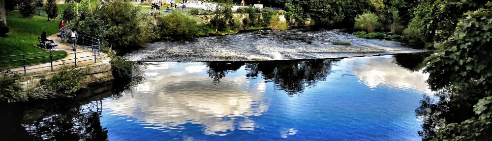
 This was the scene last night, looking across the Aire from Roberts Park towards Saltaire… And then this morning, this strangely beautiful image of Cricket Pitch Lake in the sunshine was tweeted by Saltaire Festival. Note that the path in the foreground, in front of the Boathouse Inn, is no longer under water was it was yesterday…
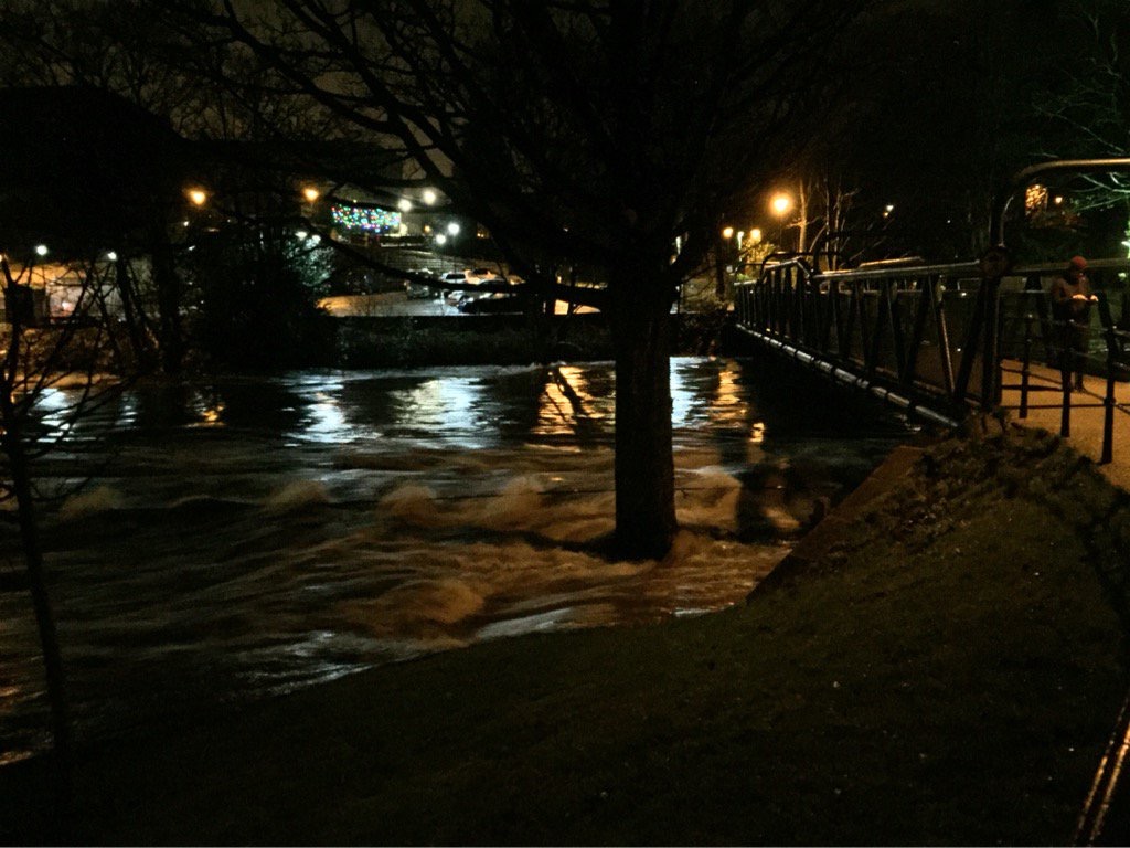
 It’s been reasonably dry today (Dec 27th), so the water has receded a bit, but it looks bad for Tuesday with more rain forecast to fall on already sodden ground. Fingers crossed.
Geoff Tynan posted this short video edit of the flooding in Shipley and Saltaire yesterday on Youtube. It really captures something of what was going on in the area. Begins with footage of Baildon Bridge’s arches completed obscured by water.
Another striking bit of video is this widely-screened BBC clip (I can’t paste it in as it doesn’t have an embed code… but you just have to click on the link). This shows the Aire just east of Baildon Bridge, flowing past the back of Wickes and up to the footbridge that runs between Dockfields and Lower Holme. A massive something is carried rapidly downstream until it crashes into the bridge with an almighty noise: the BBC say it’s a caravan but it looks to me more like a mobile burger stall or something of that sort? Anyway, this incident recalls residents’ memories of the exact same thing happening with a skip back in 2000… the fact that the river in flood flows north across the Green Lane cricket pitch and then back into the main channel via commercial/industrial properties means that some pretty big pieces of debris find their way into the river at this point. (Very dangerous!!) It can’t have come from any further upstream, because Baildon Bridge forms a barrier for large debris… as this next clip clearly demonstrates! Thanks to Rob Walsh for drawing my attention to this incident…
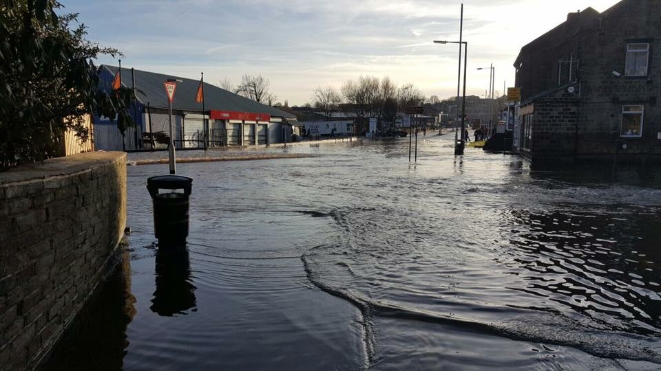
The area around Baildon Bridge was a bit calmer today, but here is an eerily silent Otley Road, at the junction with Green Lane, still covered by water in the sunshine…
 And here was the scene just to the right of here, going west up Green Lane to junction with Coach Road…
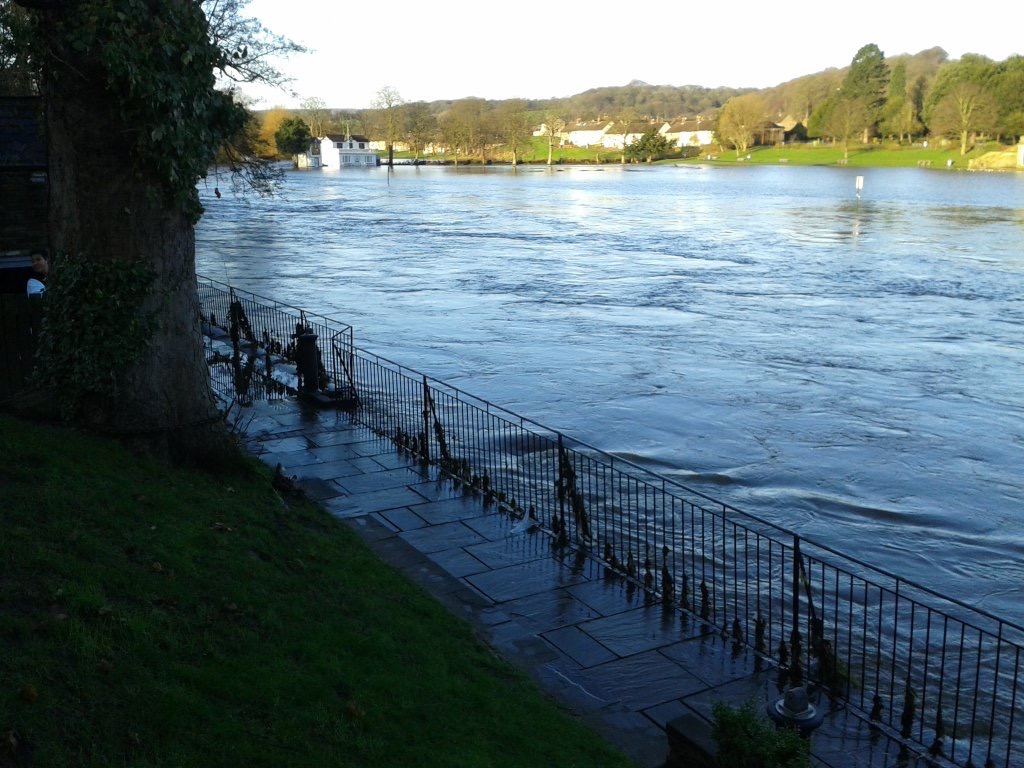
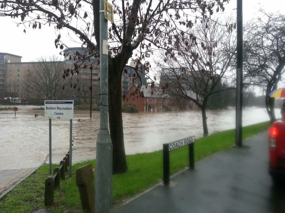 As you can see, the area outside Baildon Rec is still a lake, and the four riverside houses of Aire Close are cut off completely. We send best wishes and hope for speedy return to normal for the residents there.
Downstream in Leeds, the Aire was at the highest level anyone can remember, but interestingly the new flood walls that have been being constructed this year as part of the Leeds FAS (Flood Alleviation Scheme) seem to have been doing their job. In this next video from Moss Travel TV, look particularly at the low wall in the foreground between 2.23 and 2.31 in the time coding… that’s been built recently around the edge of the Direct Line building (across the river from Granary Wharf, south of Leeds Station) and it seems to have been just high enough…?
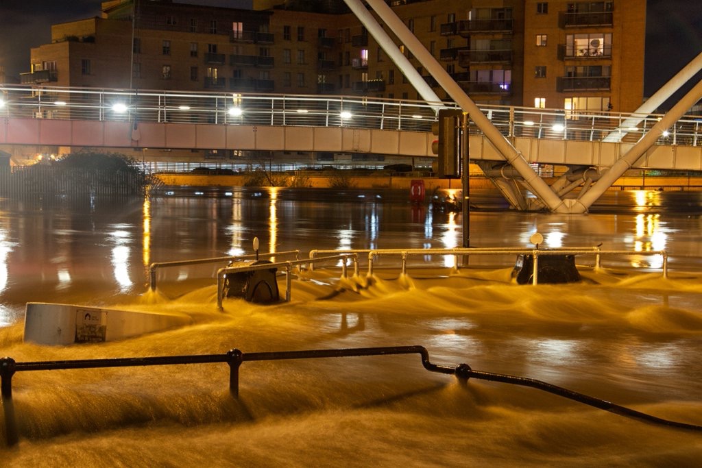
The more severe flooding problems in Leeds were further downstream, it seems, in the area between Leeds Bridge and Clarence Dock, where the new defences have not yet been completed… (they’re scheduled for completion early next year). This video by Laurie Cooper-Murray captures that area after dark last night. It’s powerful not just for the visual footage but also for the eerie quietness of the soundtrack. There’s no added music or commentary, you just hear wind and water…
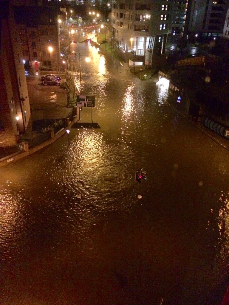
This still aerial image captures the extent of the flooding last night on East Street — a major link road just adjacent to the river on the north side (acr
 Perhaps most startling for many Leeds residents, though, was the way that Kirkstall Road turned into a river last night. This is captured in full by Lauren Potts in her twitter feed… Look especially for the eerie “morning after” video she’s posted under the heading “Unbelievable scenes down here on Kirkstall Rd – it’s like something from an apocalypse film.” Many people were perhaps unaware that Kirkstall Road runs directly parallel with the Aire at valley bottom, since you can’t usually see the river for all the buildings. Not so last night… (Random fact: Lauren Potts is a BBC journalist based in Leeds, but also coincidentally a graduate of Manchester University’s Drama department, where I teach)
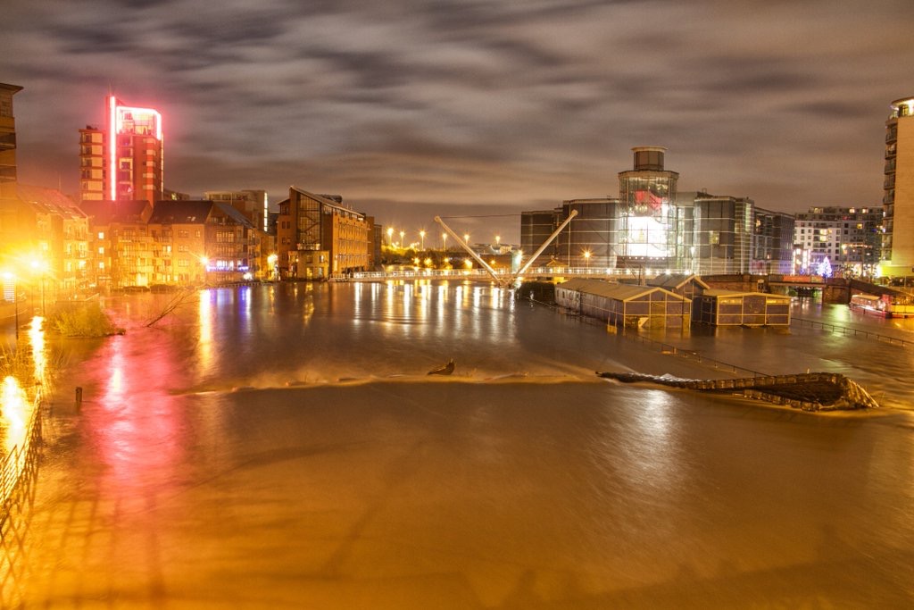
Finally for now, a couple of very artistically composed shots of the extent of flooding around Clarence Dock – and Leeds Lock adjacent to it. That’s the Knights Way Bridge in both shots. (Grabbed these off twitter… hope the photographer doesn’t mind!)
Hi Steve – here’s a link to a short clip of some shipping containers floting down the Aire and hitting Baildon Bridge, about 3.20pm on 26 December – https://www.youtube.com/watch?v=t6v30Oi2IOY&feature=youtu.be
Feel free to add it to the main blog if you like.
Rob
Thanks a lot for this, Rob! Yes, I will do…
*floating*
The container was one of about a dozen stacked at the back of a clothes charity warehouse that operates in the former Oddbins store and the former car parts store next to B&M. This backs on to Wickes.
The caravan was used as a burger van by a transport café located between United Carpets and B&M. This is the route into a bus/coach yard that cleared their buses out in time. The BBC video clearly shows a blue awning on the side of the caravan until it all wipes out on the footbridge. I’ve seen Video of the burger caravan hitting the bridge taken from a higher level in the flats on facebook.
The container that hit the footbridge is one that was in the unstable stack of containers that appears in Geoff Tynan’s video.