Community consensus?

The Multi-Story Water project, in partnership with Kirkgate Centre, has recently been working actively in three different communities in the Shipley area… These are:

(1) the flats at Crosley Woods (actually Bingley – right next to the canal just past Dowley Gap locks);

(2) the Dockfields area (Dockfield Road, Dockfield Terrace, and the flats on Dock Lane);

(3) the Higher Coach Road estate (between Roberts Park and Hirst weir).

We plan to keep blogging about all this, while also of course seeking to respect the privacy of the residents and their discussions with us. Obviously we have to be a bit careful about what is said on a public forum like this one.

It’s fair to say, though, that our most recent meeting with Higher Coach Road residents — last Saturday morning (May 16th) at Bradford Rowing Club — was a very positive one, and that those attending now seem to have arrived at a good degree of consensus about what they’d like to achieve together. So it’s worth trying to briefly summarise what was agreed on, in order to share the plan more widely. Here goes:

1. Footpath project.  There seems to be universal agreement that the riverside footpath, running alongside the estate between Roberts Park and the rowing club, should become a proper footpath rather than just a track or “desire line” in the grass. This would have multiple benefits – including providing a safer, all-weather walking route; ensuring safer access (stepped and/or ramped) to the raised footbridge area near Bowland Avenue (currently quite treacherous to get up to from the grass); and finally, filling in a “missing link” in terms of local waterside paths — so as to create better connectivity for everyone around Shipley/Saltaire/Baildon. In this document, Stewart Gledhill, of Troutbeck Avenue, presents his own views on the potential of such a plan… he imagines a hardcore path like the one that runs past the rowing club, and that could potentially be built as a community project… Stewart’s suggestions have been greeted warmly by other residents attending our meetings. Everyone seems to agree that a project like this is one that might generate engagement and support not only from other residents on the estate, but from other people in the local area generally. Of course, the tricky part will be to get enough momentum going behind this that lots of people will want to invest their time and energy in actually making this happen…

2. Wildflower meadow. The flood plain area next to the estate has traditionally been just plain old grass, and gets very boggy in wet weather. Last year this grass was left to grow into a bit of a meadow because of council cuts to the lawnmowing staff, and this has inspired some residents to argue for a more permanent, planned wildflower meadow – to make the area more attractive. This is a bit more controversial than the path idea (e.g. concerns about dog fouling in long grass?), but there was general support at the meeting for the idea of creating a small, temporary “wildflower meadow” area this summer just to get a sense of what this might be like — and spark further conversation in the community. We have been promised poppy plugs by the council’s parks people, and as a group we’re hoping to plant these shortly to see what happens…

3. General care and maintenance. The main problems with the public areas on the estate at present are to do with a certain lack of care and respect in some quarters — littering, flytipping by the river, etc. But if the whole place looks a bit more cared for and planned out (see 1 and 2 above!) then maybe this will inspire a bit more respect from all concerned? (Just as Roberts Park has been much better treated by all, since it was refurbished under the Heritage Lottery Grant.)

4. Bins, signage, etc. If the footpath is made more ‘official’, this might also create the context for better provision of bins (for litter, dog muck etc.) along the way. And what about some signs to point the way or provide some information about the estate — make it part of the ‘heritage narrative’ in the area? (There is lots to justify this… e.g. see this previous blog post.) There has even been a suggestion for putting in simple exercise equipment at intervals along the footpath, just as you find in some parks. Obviously all this would require discussion with the council, and in “austerity Bradford” it might be tricky… but if we can get some real momentum behind the campaign, some of this might be achievable?

5. One way system? Finally, moving away from the river and grass up to the road, there is much consensus that Glenwood Avenue and its linked roads get too clogged up with traffic and parked cars pointing in different directions. The remarkable Stewart Gledhill has again suggested a simple but perhaps workable solution — by proposing that you could have two one-way loops. You would enter the estate at Gorse Avenue, and then turn either right or left along Glenwood Avenue, before exiting back onto Coach Road at one end of the estate or the other. This would ensure traffic flow and parked cars were always pointing in a single direction, and so hopefully reduce congestion. Again, there seems to be general support for this idea, and it wouldn’t need to cost a lot in terms of signage etc. We are hoping to raise it with Paula Truman, the new ward officer for Bradford Council, but in the meantime we need to keep talking to other residents to see if there would be any objections to the idea that we haven’t thought of.

There’s quite a list of ideas here, and the important thing to underline here is that they are just ideas at this stage. This means that:

(a) Nothing has been finally decided on … so there is lots of opportunity for other people to make their views heard …

(b) None of this can or will happen unless we can generate enough support and interest from other residents to really get the ball rolling. All that Kirkgate Centre and Multi-Story Water can do is try to facilitate the development of that community conversation…

One way we’re hoping to get more involvement is by organising some events this summer that will create the opportunity for some fun and some discussion… So keep an eye out!


Talking and Walking (on Water)

We’ve had a busy couple of weekends, doing a lot of talking and a fair bit of walking, not necessarily at the same time. This photo was taken just this morning…

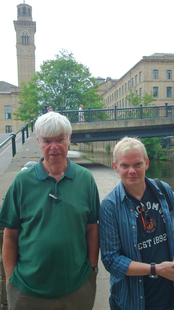
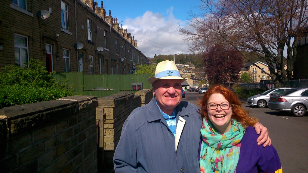
DSC_0231The location is Dockfield Terrace, and that’s my colleague Lyze (pronounced “Lizzie”, not “Lies” as one person mistakenly assumed — as Lyze says, “it’s my own fault for being pretentious”) standing with David, who kindly agreed to be photographed for this blog. David has lived in the Dockfields area since 1947 (that’s 68 years and counting), and is currently 500 pages into writing his life story — some of which we heard recounted as anecdotes! He’s one of the people who turned up to a community meeting that we organised this morning for local residents, at Q20 Theatre on Dockfield Road (thanks Q20! we are collaborating with them to deliver a river- and canal-themed version of their Shipley Street Arts Festival in June… more on that another time).

At the meeting we heard quite a few local concerns… everything from the need for speed controls on the main road (used as a rat run to avoid Foxes Corner) to very genuine concern about the wellbeing of this family of swans…

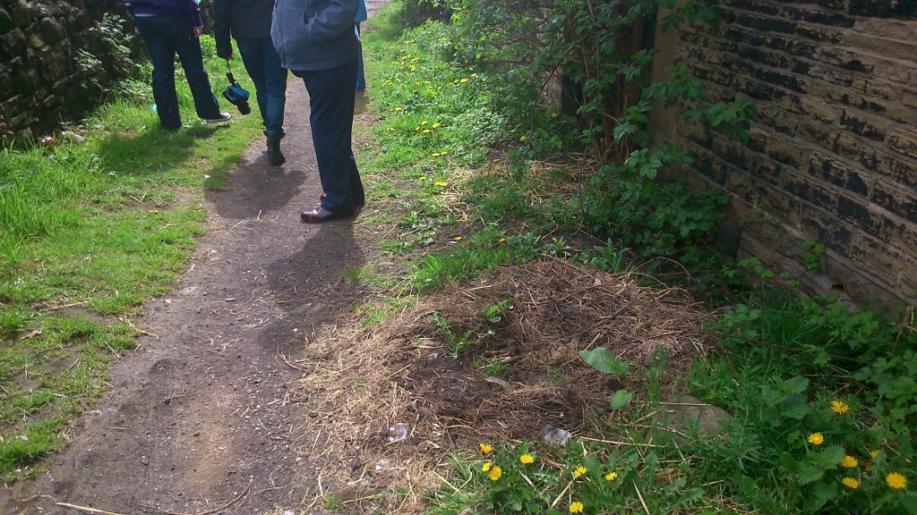
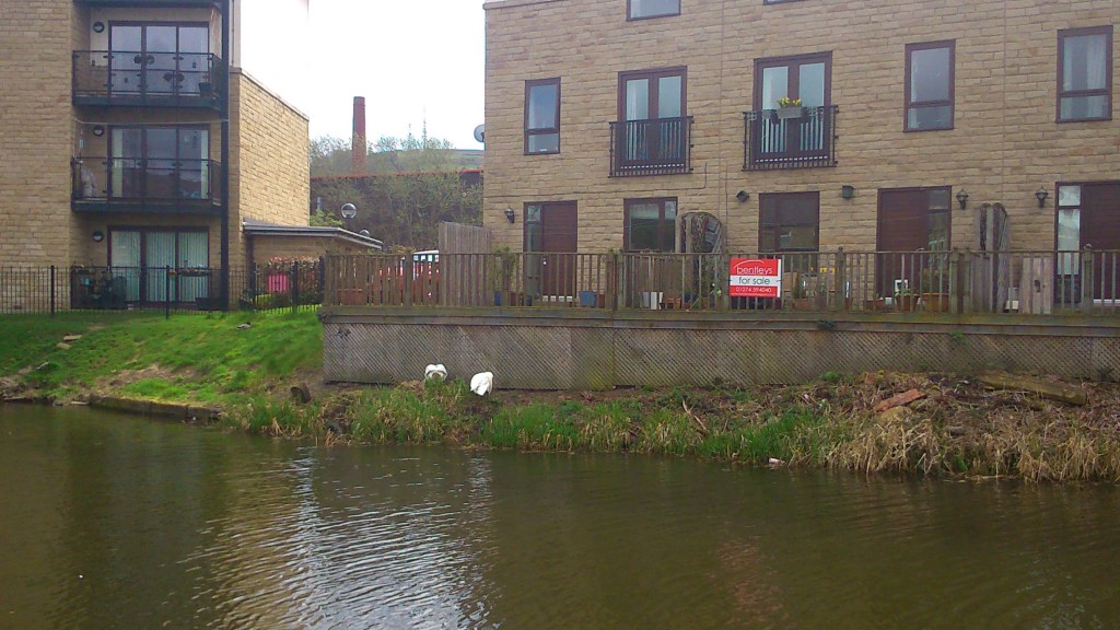
DSC_0230The swans have recently taken up residence on the canal bank above, having abandoned their previous nest — pictured below, on the track between Dockfield Road and the canal towpath…

DSC_0229… there was some debate among the residents who attended the meeting about what had happened here, but general agreement that at least one and possibly all of the swans’ eggs had been stolen by someone unscrupulous, and that the swans had been driven away from this spot in fear…  Whatever the correct story, it was striking how much the residents concerns were with the canal, and its resident wildlife, as well as with the roads, traffic, etc. Even though Dockfields is a very industrialised area with little obvious green space, the river and especially the canal give the area something special that people clearly value…  (For more on swans at this time of year, see Canal and River Trust’s page about caring for them.)

We’re working, in connection with Kirkgate Centre, to try to build community connections in the Dockfield area, with a view to ensuring that people’s concerns are listened to and acted upon. This includes understanding how their sense of connection with the local waterways might be a positive asset that can be built upon communally. We’re also working on the same process in the Higher Coach Road area, on the Baildon side of the River Aire. Last Saturday morning we had a parallel community meeting, this time kindly hosted by the Bradford Rowing Club…

DSC_0220

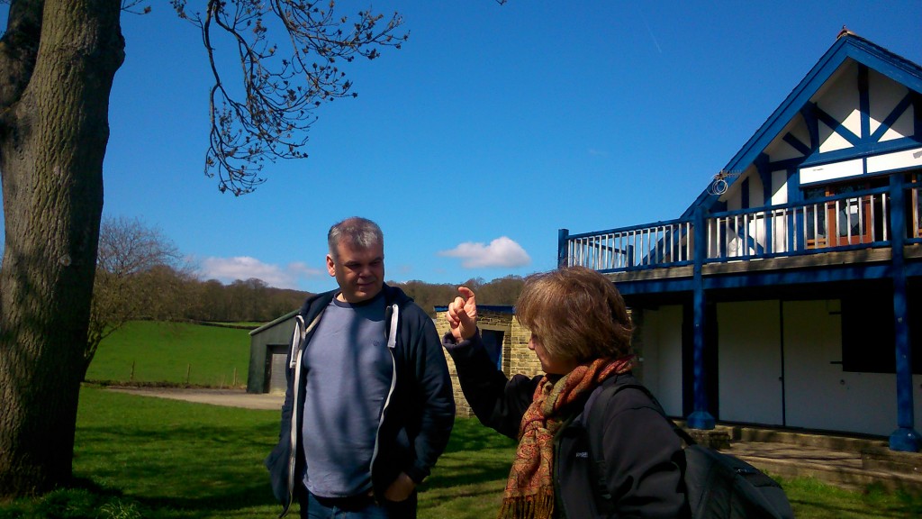
What is Maggie Roe saying to Paul Barrett? Caption suggestions please…

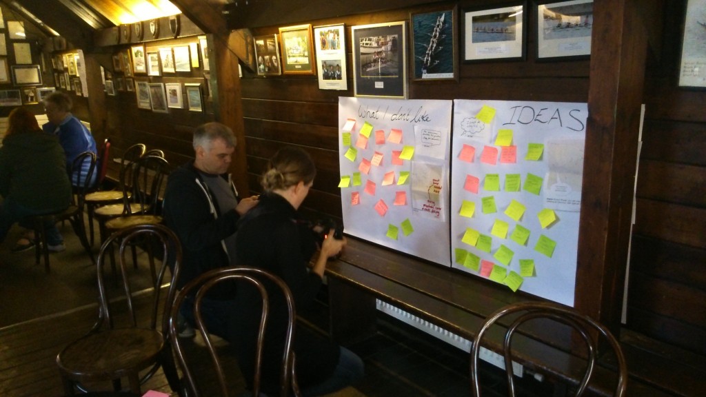
Here’s Kirkgate Centre’s Paul Barrett, pictured outside the club after the meeting (on a gorgeous, crystal clear day!), talking to landscape specialist Maggie Roe — who is very struck by the distinctive layout of the Higher Coach Road estate (see other blogs on that!). And here’s a shot from inside the club, showing the aftermath of a very positive and productive discussion with residents… I love the fact that Paul and Sara are both checking their just-taken photographs of the post-it notes!

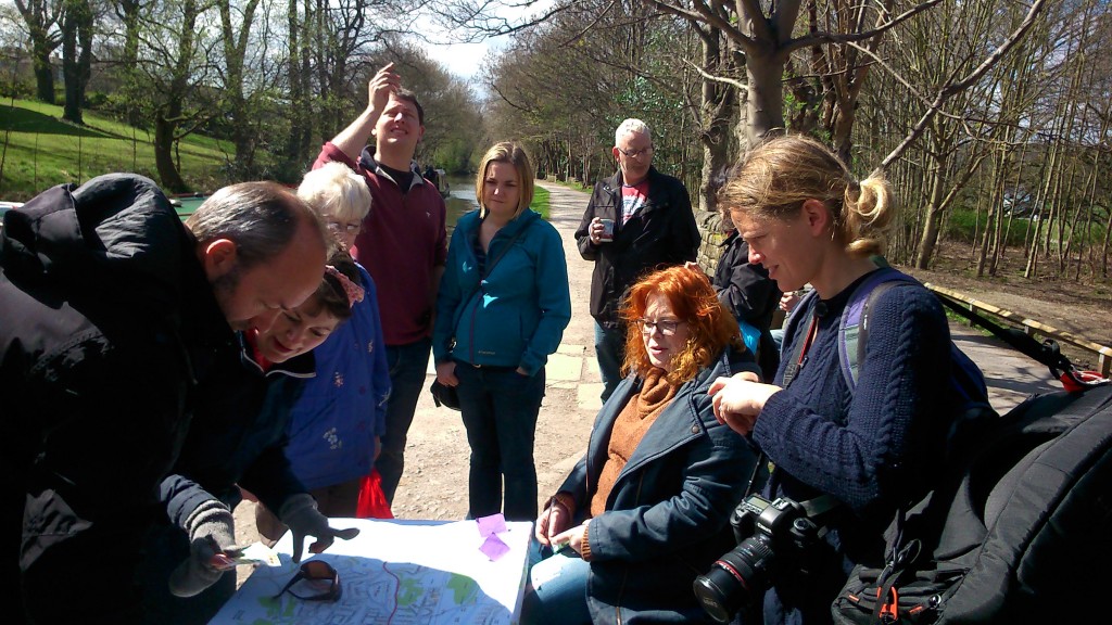
DSC_0219Sara Penrhyn Jones is a filmmaker who was visiting us for the weekend from Aberystwyth, in Wales (like Maggie, she is part of the wider “Hydro-Citizenship” research project that Multi-Story Water is now a part of). Maybe she’ll have some film footage for us to share on this blog soon. Here she is armed with cameras again the following day — Sunday 19th April — on the canal towpath in Saltaire with Lyze…

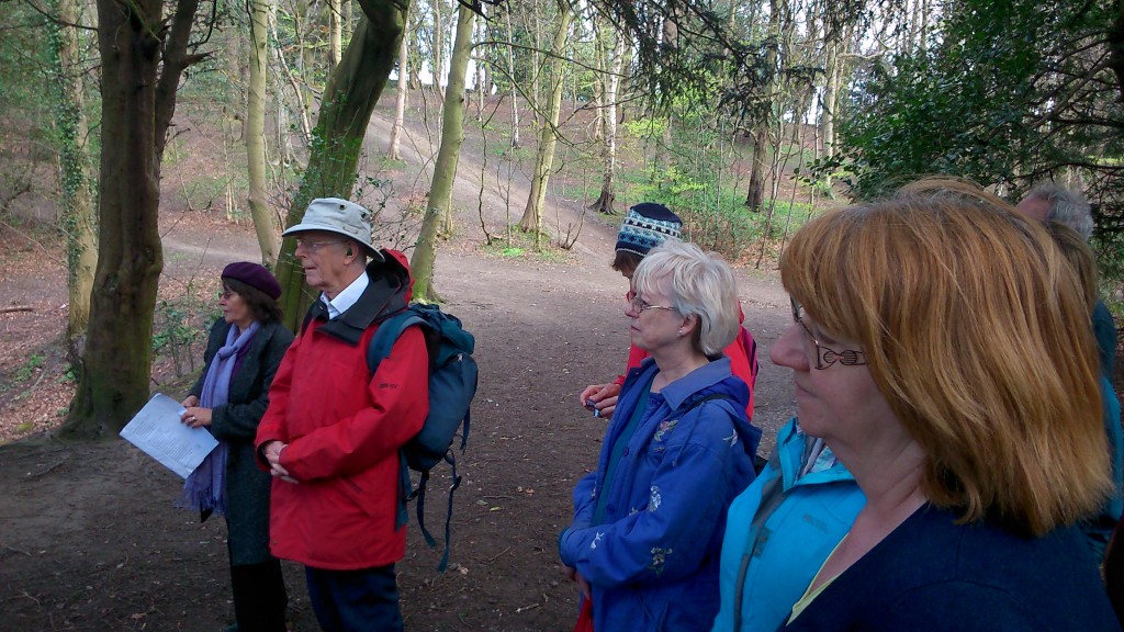
DSC_0223… the other people in shot are some of the people who had gathered to go for a guided walk with me from this spot. As part of Saltaire’s “World Heritage Weekend” celebrations, I led a version of our Salt’s Waters walk — which will soon be available as a downloadable audio guide, for anyone to undertake whenever they like… although on this occasion we went with the low-tech, interactive option. The walk goes from the bottom of Victoria Road in Saltaire, and then heads west along the Aire, via Roberts Park and the Higher Coach Road estate, before turning uphill – alongside Loadpit Beck – on the way towards what little remains of Titus Salt Junior’s Milner Field mansion.

DSC_0225

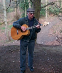
A key feature of the audio mix will be Eddie Lawler’s beautiful song, The Ballad of Little Beck – written in honour of the unassuming stream that goes runs down through the grounds of Milner Field, and was once dammed as a boating lake. Eddie came along on the walk last Sunday and performed the song live, standing on the earthworked banking that takes Titus Jr’s coach road right across Little Beck (which trickles through at the base). It was a “shivers down the spine” moment, for me at least…

I don’t have other pictures of the walk, because for the most part I was too busy conducting it — talking and walking — to be taking photographs. But the merry band of travellers who came along on the journey were a great bunch to spend a couple of hours with. As I’d hoped, moreover, they had a good few suggestions (and one or two corrections!) to feed back into our work on the audio narrative…

So a big thanks to all those who contributed to a very enjoyable afternoon. Here are a few of you, enjoying Eddie’s music…

DSC_0226

Higher Coach Road Dreaming…

If you live on the Higher Coach Road estate, you should have been invited (this week) to a neighbourhood meeting at the rowing club on the morning of Saturday 18th April, from 10.30am. Organised by Shipley’s Kirkgate Centre, in conjunction with the Multi-Story Water project, this an opportunity for residents to share their thoughts and concerns about the neighbourhood and maybe dream up some future improvements… We also have some suggestions for a bit of a community festival to take place on the flood plain area in June, which we’d really like your input on.

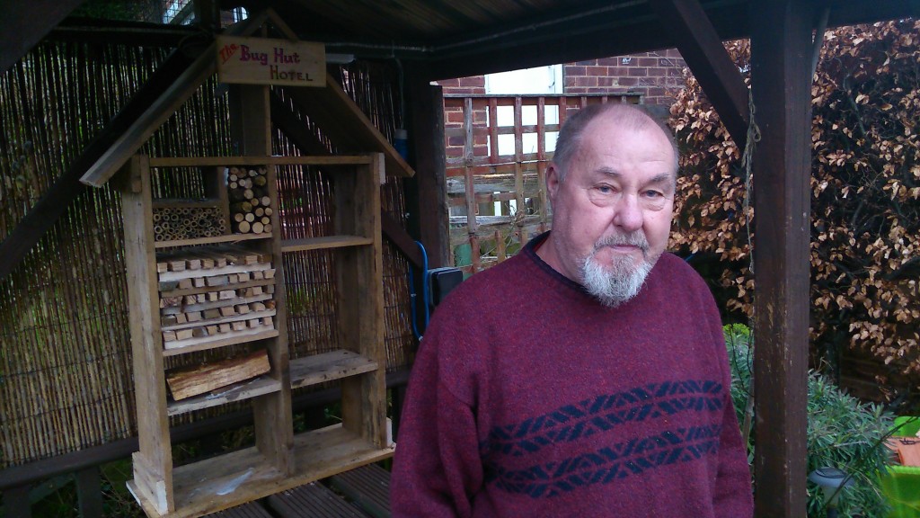
DSC_0163This is Stewart Gledhill, of Troutbeck Avenue, standing in his front garden in front of the “bug hotel” he has built for the remarkable new nature reserve that Hirst Wood Regeneration Group have been developing on the other side of the canal. Stewart and his wife Pat (of whom I also had a really good photo that has somehow got accidentally deleted!) have been actively volunteering on that project, but they have also dreamed up a solid plan for what they’d like to see happen on the Baildon side of the river. Stewart sent me a detailed letter this week, which you can read here, accompanied by a sketch diagram of the esate, which you can see here. (Uploaded with his permission.)

Responding to an earlier discussion, Stewart has come up with a proposal to turn the muddy, uneven track beside the river (running the length of the Higher Coach Road estate) into a proper path. His suggestion is to use the same impacted hardcore surface that has been used on the footpath running past the rowing club, and indeed on the paths in the new Hirst Wood nature reserve. Stewart has proposed 3 stages that this could be accomplished in, and has even come up with a rough costing. His plan is a great conversation starter… will other people want to get onside with this idea, or maybe propose alternatives?

Stewart’s plan would be to build the path pretty much where the existing track is, and not do too much to disturb the trees and bushes along the riverbank (which provide important habitat for local wildlife). Pat, though, added a suggestion for a pond area with a view of the river, near the footbridge. She points out that some of the trees on the riverbank do need managing, if they’re not to becoming hazardous. She pointed this out to me, for example…

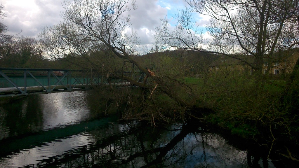
DSC_0227This tree came down, Pat says, in just the last week or so, given the high winds and rain we’ve been having. It has fallen across the pipe bridge of the Graincliffe Acqeduct (which carries Shipley’s water supply down from the moor and across the Aire at the end of the estate). If this large tree ends up in the river — as seems inevitable — it could end up causing a serious obstacle in the water … it might catching on Saltaire weir, where another tree has also lodged recently… If it got downstream as far as Baildon Bridge, it could create a serious damming hazard there (a recurring problem there, which has caused flooding in the past). The question is, though, who is responsible for clearing the tree? If it was actually in the river, it would be the Environment Agency’s job to clear it — but placed where it is, suspended on the acqueduct, it may be Bradford Council’s… One of those tricky jurisdictional issues that often don’t get solved easily. All the more important, maybe, that local community members take the initiative sometimes?

Making Space for Water?

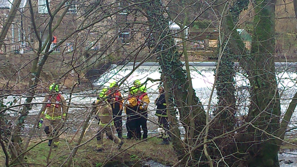
DSC_0097Spotted through the trees yesterday just downstream of Hirst Weir…  Members of West Yorkshire Fire and Rescue Service (with their big red engine parked up in the car park of Bradford Rowing Club). I’m hazarding a guess that this was a training exercise for coping with flood conditions. A couple of weeks I heard a presentation from Humberside Fire and Rescue about how poorly prepared firemen are for working in flood conditions — even though flooding is likely to become an increasing problem in coming years, with climate change. Hull, of course, has an ongoing, near-annual problem with flooding (the presenter described it as “the plughole of England”), but since flood conditions are so difficult to simulate in normal circumstances, training is an issue. Presumably this is why these WYFR folk were stomping around near the roiling waters of Hirst Weir, but in Hull they have an altogether more elaborate plan – to build The Ark. No, not Noah’s ark, but a big water simulator… a kind of theatre for flooding… which sounds quite exciting!

We don’t have any project plans on that scale, alas, but here’s a few updates on what we are up to. First off… I was passing Hirst weir on a walk with sound artist Jon Tipler, who is working with me to complete the downloadable Salt’s Waters audio-guide that will lead listeners from Salts Mill up to the ruins of Titus Salt Jr’s Milner Field house – via various waterways big and small. (This has been in development for a while, but we’re aiming to have it finished for Saltaire’s World Heritage Weekend in April.) Among other things, this guided walk passes along the grassy flood plain that runs next to the Higher Coach Road estate – and (as in our live performances of 2012-13) makes a case for seeing this 1950s estate as integral to the local heritage narrative. And in the last couple of weeks, we’ve also started to get back in touch with residents on the estate about another, related project. My colleague Lyze Dudley has been knocking on doors, chatting to people about our plans for a sort of festival event on the flood plain in June. The idea will be to try to get a real conversation going about what people would like to see done with this grassy area which gets so boggy, and which the Council now can’t afford to mow regularly either (what with the swingeing cuts they’ve had to implement). Various residents have put various dream schemes to us in previous discussions, so we’re going to see if we can facilitate any kind of agreement being reached, with a view to taking it forward. Of course, if the consensus is just to leave it alone, then we’ll do exactly that, and – as Lyze has found – there are certainly people who think that, since that area is always going to flood, it’s best just left as vacant as possible. But it’s also possible to design imaginative green spaces that are intended to flood — “making space for water”, they call it.

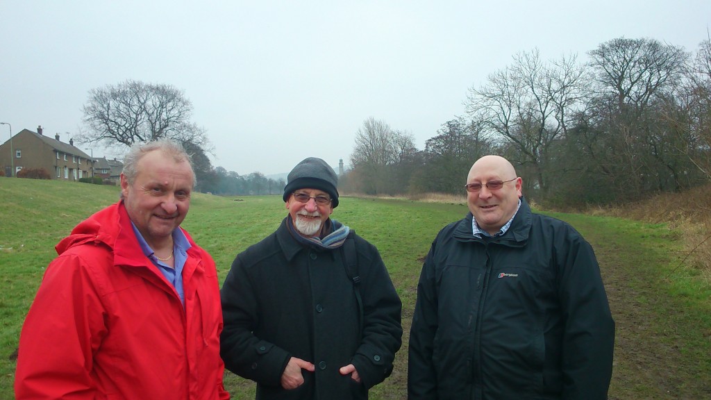
DSC_0088Here’s a picture I took last week on a walk along the flood plain in question. To the right is Dave Horsman, Shipley ward officer for Bradford Council, and to the left is John [didn’t get his surname] who works out of Northcliffe Park and is responsible for all the mowing and maintenance of Council grassland in the area. (The park keeper at Roberts Park is retiring, and – again thanks to the cuts – won’t be directly replaced, hence John now taking on this remit.) In the middle is Baz Kershaw, an old friend and colleague of mine who was visiting to look at the site, with a view to creating a “meadow meander” in the long grass as one of our events in June. It’s a sort of interactive art installation that invites you to take a maze-like walk specially prepared in areas of long grass. Baz has done this in a number of places now (he started off doing it in his own home in Devon), and it always gets great responses. We’re hoping it will help spark discussion about whether people want long or short grass, a wildflower meadow, etc.

DSC_0096And here’s another picture from a meeting last week, this time taken in the Rose Wharf headquarters of the engineering firm ARUP, in Leeds city centre. This graffiti art hoarding celebrates some of the major projects ARUP has been involved with recently – including (as you can see) the Leeds Arena, and the Rosebowl at Leeds Beckett University. (In Bradford, ARUP were also the key engineering consultants behind the City Park’s Mirror Pool.) They’re also involved with plans for the HS2 rail link (a bit controversial, that one), and are lead consultants on the Leeds Flood Alleviation Scheme (or FAS), which is now under construction, as of this month — and is due for completion in about two years. It was this that I was at ARUP to learn more about…

As you might expect, the Flood Alleviation Scheme is — at root — also based on the premise of “making space for water”. Specifically, the big old industrial weirs in Leeds central are going to be removed, and replaced by new, moveable weirs. In normal conditions, they’ll operate just like the old ones did (so that the navigation of the river using locks etc. can continue as it has done). But in flood conditions, these new weirs will basically collapse (they’ll be held up by the equivalent of deflatable air bags…), thereby dropping the water level and alleviating flood risk to the city centre. This will help obviate the need and the expense of building higher concrete walls, as in the earlier scheme vetoed by government a few years back (although there will also be some new riverside construction designed to complement the work of the new weirs).

Apparently, collapsible weirs have been used elsewhere in the world for the sake of hydro power installations, but to date they have not been used as part of a flood alleviation scheme — so this is a first. I find it intriguing, though, that this scheme basically confirms that there can be a relationship between weir removal and lowering flood risk. This is the exact same logic that our friends at Baildon Woodbottom Working Men’s Club have used to argue for taking out the weir just downstream of Baildon Bridge — so as to mitigate their own risk of flooding at the club, and to help prevent the Bridge itself from becoming impassable as it last did in 2000. To date, though, the responsible agencies haven’t seemed very interested in this weir removal suggestion… That’s another little project we’re working on, if we can get the scientific data needed to show whether or not this is a viable proposition.

So, to sum up – we have various irons in the fire at the moment, each attempting to respond to ideas put to us by people living near the river. It remains to be seen which of these strands will produce any useful results, but I guess that is the nature of an exploratory research project like this one…

Engineering the River Bank?

This summer we’ve seen two quite contrasting changes to the north bank of the Aire in the Shipley-Baildon area. East of Baildon Bridge there’s been new building work on the former mill site at Lower Holme — a location this blog has observed with interest for some time (see other posts categorised under ‘Lower Holme’). The long-derelict site is finally being turned into a commercial precinct with buildings and parking for Wickes and KFC, but the build was delayed for quite a while and this is part of the reason why:

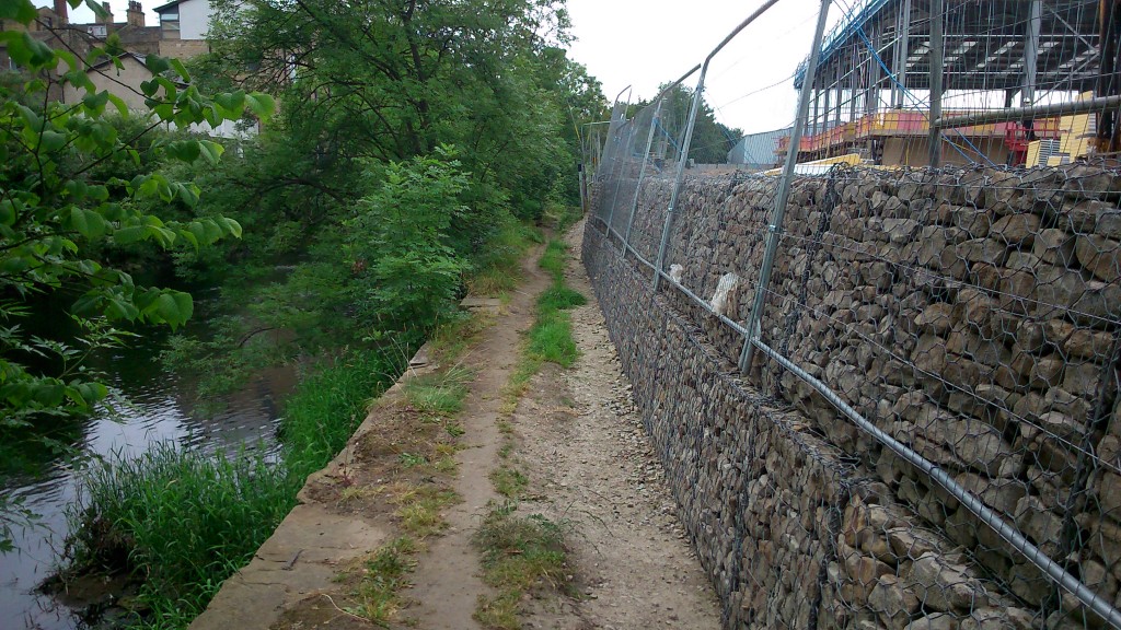
phone pics 344The public footpath along the river, running along the edge of the site, is now flanked by this wall of caged rubble cubes — stacked to head height. Apparently the Environment Agency belatedly insisted on this being erected as a condition of the building permit. The ground on which the Wickes building is going up (you can see the frame in the top right of the shot above) has also had to be bulked up to the height of the wall on the other side. The theory, apparently, is that this will act as a flood defence for the site. But what you can’t quite tell from this photograph is that it’s already quite a drop from the footpath to the river. According to local residents, in the floods of 2000 (the most extreme weather event in these parts in most people’s living memory), the swollen river only just topped the level of the footpath. So it would take a really pretty apocalyptic flood to get anywhere near the top of these new rubble cubes.

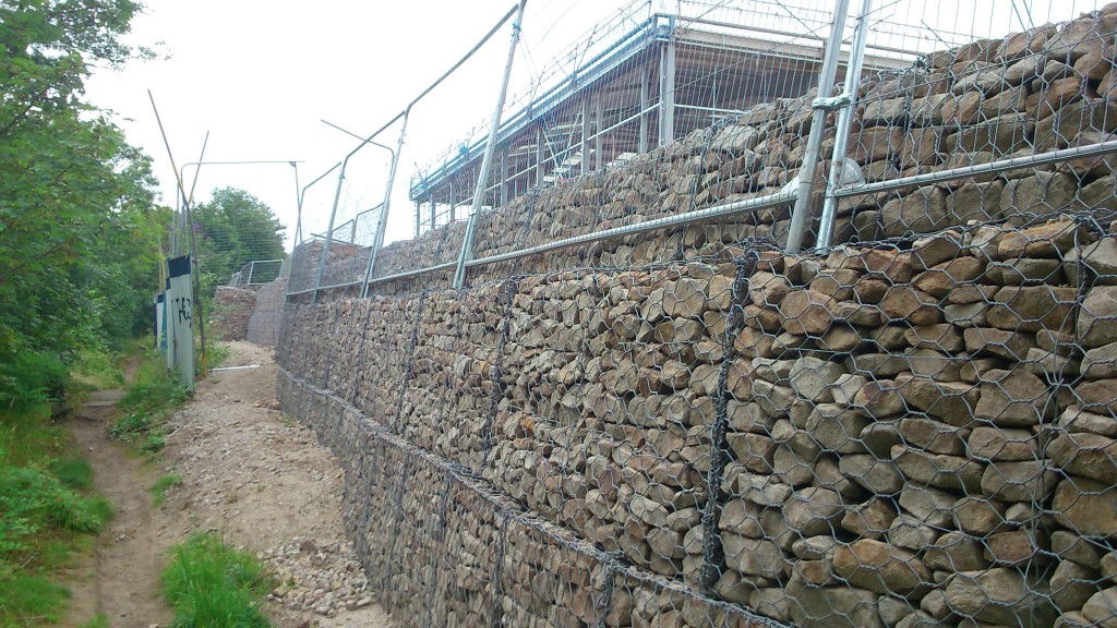
phone pics 346You can see in this shot how the land naturally rose up further from the path anyway (here the footpath continues on the left of the shot, along the riverbank; the white and blue metal fencing between path and blocks is a remnant of the former site fencing put up by the previous developers, Mandale). So I can’t help but feeling this is flood defence overkill… especially when you bear in mind that the residents in Lower Holme weren’t affected by surface water in 2000 anyway, but by water coming up through their basements (and nearly reaching their electricity meters, rather scarily!). This whole area of land is right on the water table, so in flood conditions water literally seeps up through the floor, given half a chance. The ground is apparently so porous that Lynda, who lives in the end gable house nearest the river, remembers finding tiny fish swimming around in her basement during the flood – somehow they had filtered their way through the earth, even though the house is a good hundred yards from the river. A great story, and one that slightly begs the question (at least to a layman like myself) of what exactly the new defences are supposed to accomplish. They seem almost militaristic, as if the river is some assaulting army, laying siege to the land. I wonder if those tiddlers could get in between the blocks? 😉

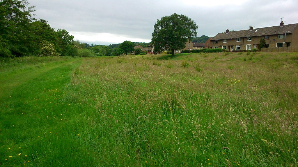
2014-06-17 11.12.23A little upstream, at the western end of Shipley/Baildon catchment, we’ve seen a constrasting scenario… not ‘overkill’ but a kind of benign neglect. This picture is of the grassy flood plain area between the river (off to the left of this shot) and the Higher Coach Road housing estate. First posted on this blog at the end of June, the photo shows how the grass had been left to grow up into a meadow, with the only mowing occurring along the line of the traditional riverbank path, to the left of shot. (It’s not technically even a path – it’s usually just a ‘desire line’ tracked into the grass, so being marked out by mowing has almost made it seem more official.) Subsequent to my earlier post, I did look into why this long stretch had been left unmowed, because I wondered if there was some new planning rationale for it… And at the beginning of July I met on site with these lovely people:

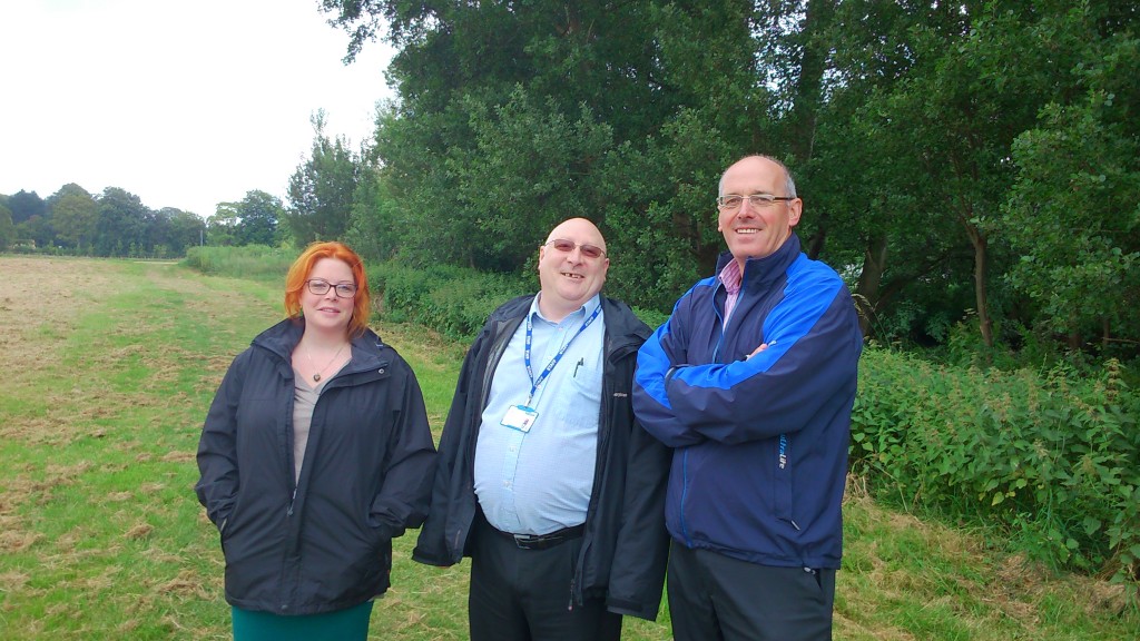
phone pics 337Left to right here are Lyze (pronounced Lizzie) Dudley, our new research associate on the MSW project; Dave Horsman, from the Shipley Area Committee of Bradford Council; and Malcolm Wright, who is the Council’s head of parks and landscaping in the area. Based at the Park Lodge in Roberts Park, Malcolm is – it turns out – also responsible for the grass on the estate. And the reason it didn’t get mown this year was basically because of budget cuts within the Council (it’s the age of austerity…), which mean that Malcolm only has one man to send out to mow, instead of two. And in fact, only a few days before we met, one man went to mow (went to mow a meadow), with the result that we were looking at this:

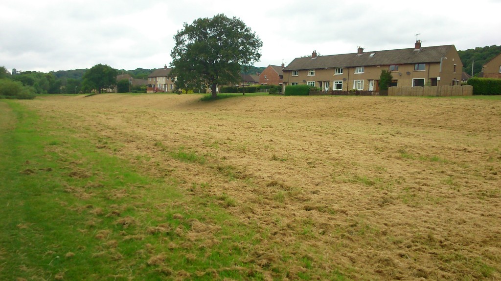
phone pics 338Freshly cut hay… not meadow grass… And the reason for it being cut at this point was simply, Malcolm told us, because he had received a complaint from someone on the estate about the length of the grass — so he decided to prioritise doing something about it. There are a couple of ironies at work here… One is that I’m quite sure that some other people living on the estate will have quite liked the meadow effect. (See for example the comment that was posted on the end of my June 24th blog post.) The other is that Lyze and I had arranged to meet Dave and Malcolm specifically because we were interested in the meadow grass… The main reason for this is that our research in the area in the last couple of years uncovered quite a degree of interest among residents in something more creative and interesting being done with this lumpy, uneven, often boggy grassland. Back in September 2012 we held a sort of creative consultation event (the ‘Higher Coach Road beach party‘) which resulted in a painted map of the area being marked up as follows by residents:

MSW CE 09As you can see, we were presented with the idea of a “reed wetland bog”, with a “pond in [the] area that floods” (this refers to an especially boggy area of the flood plain just down the slope from Troutbeck Avenue). There was quite a bit of support for this idea (it originated with Theresa, I think, from Derwent Avenue), which would also amount to a form of ‘soft engineering’ of flood defences — since if designed right a layout of ponds, reeds, bushes and trees would enhance the flood storage capacity of the land here… whereas monoculture grass does little or nothing to prevent downhill run-off from just carrying straight on into the river and adding to the weight of water being carried downstream… Or at least, I think that’s the theory. Anyway, hopefully it’s now apparent what kind of contrast I’m trying to draw here with the questionable new ‘hard’ engineering downstream at Lower Holme.

The point here is that our earlier conversations with residents on the estate could only ever be that – conversations – since Multi-Story Water was originally only a one-year project (2012-13). But having now secured new funding for three years from 2014-17, we’re in a position to see if we can help facilitate some further discussion towards (just maybe!) actual changes. And the meadow grass had struck me as a great opportunity to kick something off, because most of the residents will have had opinions about it, pro or con (or both). A wildflower meadow is not a reed wetland, but it’s certainly a step towards more biodiversity… And I thought I had just the man to help us animate the meadow a bit, to spark debate. (See this blog page here for an account of Baz Kershaw and his ‘meadow meander’ – a temporary meadow area that he developed as a kind of theatrical exhibit at Leeds University in 2012). Malcolm Wright, the parks and landscaping chief pictured above, turned out to be very supportive of us doing something to engage residents in a discussion about how to treat this area in future —  and he offered to provide us with materials to illustrate the various different types of wildflower meadow and other alternative grassland arrangments that are used in other parts of Bradford… So this would really present people with choices to consider. But…

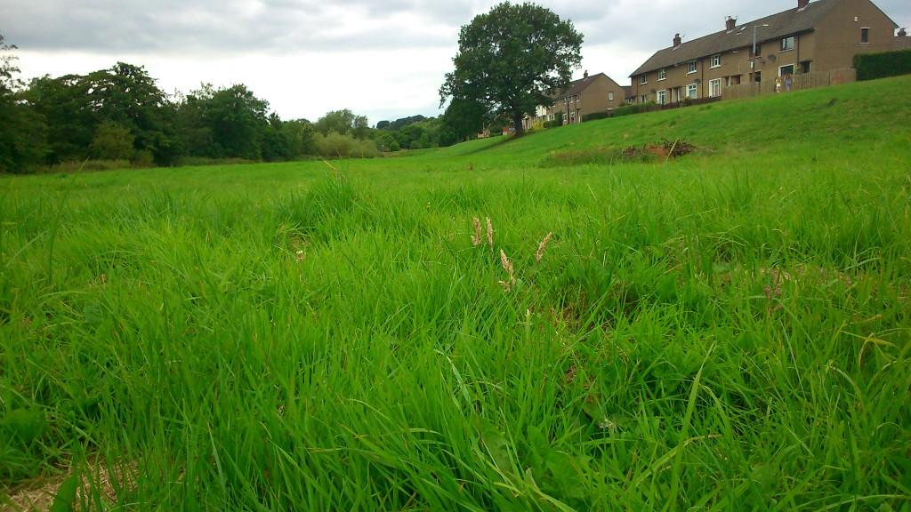
DSC_0041… in this photograph, taken just last week, you can see that the grass hasn’t really grown all that much in the five weeks since it was last mown. A few hay-like stalks appearing, but basically this grass is barely above ankle height. We had been planning to try to arrange an event involving Baz and others this coming September (next month). But it’s pretty clear that the grass won’t have grown into anything resembling a meadow by then…

All this brings a whole new meaning to the phrase “watching the grass grow”. But with hindsight it may be no bad thing that we’ve had to ditch our tentative plans for September. We’re now looking at planning ahead for an event next May or June, when the grass, if left, will be at its most springily meadow-like. This means that we can try to develop conversations with the residents in the run-up to this event, involving people properly in the planning, rather than simply using an event as a way to initiate conversations… It’s probably better this way round.


Walking Salt’s Waters

High time I updated this blog. There’s been lots happening behind the scenes, as a new phase of the Multi-Story Water project slowly swings into gear. In the last month or so there’s been planning meetings with those excellent people at Shipley’s Kirkgate Centre, plus the appointment of a wonderful research associate in Lyze Dudley (of whom, more another time), and lots more besides — all irons in the fire for what’s going to become a 3-year project working directly with various local groups and individuals to develop discussions and creative projects around the future social and environmental potential of Shipley’s waterways (please do get in touch if you’d like to know more). In the shorter term, though, there are also plans afoot for a contribution to this year’s Saltaire Festival, in September…

2014-06-17 13.03.38Here’s the ‘bard of Saltaire’, Eddie Lawler, snapped last week up at Hirst Weir (which has yet another tree straddling it…). Eddie and I will be presenting a one-off gig on September 18th at Half Moon Cafe in Roberts Park — Eddie playing his guitar and singing, me doing a little spoken word… It’s a double act we first developed on the Blue Route of our performance tours in 2012-13 (see ‘Performances’ tab), and which we both enjoy. The Half Moon event will really just be a public launch, though, for a longer-lasting but less visible performance — which you’ll be able to experience in the form of a downloadable audio guide. This will take listeners on a walking tour from the bottom of Victoria Road, in the heart of Saltaire, and north-west to what remains of Milner Field, the grand mansion built in the 1870s by Titus Salt Jr., and now just a pile of stone overtaken by self-seeded woodland…

2014-06-17 10.44.22The audio guide, titled Salt’s Waters (Eddie’s suggestion), will connect mill and ruin via various local waterways. There’s the River Aire and Leeds-Liverpool Canal, most obviously, but also Loadpit Beck (which flows into the Aire near Bradford Rowing Club, and which marks the boundary line between Baildon and Bingley land). There’s also the even lesser-known Little Beck, which passes through the Milner Field estate and was once dammed to create a boating lake for Titus Jr. and his family and guests (who included royalty, no less!). Little Beck is the chosen subject for the new song Eddie has written to be mixed into the audio guide, and which will thus have its world premiere at Half Moon Cafe. It joins other watery songs in the Lawler canon, including those dedicated to the Bradford Canal (written for Blue Route), and of course Bradford Beck — an older song which is now the unofficial theme tune of the Friends of Bradford’s Becks, and also features (thanks Eddie!) on my short film Wading to Shipley. That film, incidentally, was expertly edited by Lee Dalley, of Leeds University’s Workshop Theatre, who is pictured above with Eddie last week… (they had just met for the first time!)

2014-06-17 11.20.17Lee has generously undertaken to sound-design our audio guide — mixing my words and Eddie’s music with layered sounds of his own… So he came out to walk the route with us and record sound samples along the way. Here he is with his recorder (and Eddie) underneath the Barden aqueduct — which crosses the Aire at one end of the Higher Coach Road estate. Lee wanted to catch the echoing sound of the river’s flow, as heard just here… He also will have captured the electronic click of my phone-camera taking this shot, but when I apologised he said he loves that kind of random sound interference. Who knows, maybe the ‘pling’ will find its way into the final audio mix!

It was a thoroughly enjoyable experience, walking with Eddie and Lee up to Milner Field — so enjoyable in fact that I forgot to take any more pictures en route, and just revelled in the company and the ambient sounds of flowing water, rushing water, gurgling water, wind in the trees, multiple forms of bird-song, footsteps going over wooden stiles, bike wheels on the towpath… you name it. You notice all this so much more acutely when someone keeps shutting you up to record them! (or at least, I do…) I just hope my narrative can do some kind of justice to the sounds that walkers will be hearing both around about them and in the mix…

There is one other picture I just want to share here though… It was taken just before the previous one, as we walked through the grassy flood plain area that separates the Higher Coach Road estate from the river. I was fascinated to notice that, this year, the council’s mowers have largely refrained from cutting the grass back — except along the riverside path that is traditionally beaten out only by walkers’ footsteps. You can see that mown bit to the left of the picture here… and in the centre and right, the long meadow grasses that have grown up unhindered…

2014-06-17 11.12.23I need to find out whose idea it was to leave the grass uncut… and also what the residents make of it! One of the findings of our previous research work on the estate (expressed in our Green Route performances, that came through it) is that many of the residents have felt that the mown grass field was both: (a) a bit daft – since the council’s mowers would come and chew up the grass even in wet weather – when parts of this flood plain area just become a big squelchy puddle!; and (b) a wasted opportunity – since some other, more imaginative arrangement, like a reeded wetland area, might attract more diverse wildlife and thus also be more interesting for residents and visitors… Interestingly, this new wildflower meadow option seems to be a sort of cautious step in that direction… although it might also be purely a result of council budget cuts making mowing less frequent! I must investigate… (… he dons a deerstalker and strides off into the long grass…)


Higher Coach Road History

On Saturday 22nd September, in conjunction with our Green Route tour of Roberts Park and the Higher Coach Road estate, we held a community-facing event aimed at generating further discussion among residents of the estate about the past, present and potential futures of this riverside housing development.

The event was themed as “the Higher Coach Road beach party” – playfully referring to the “sandy bank” that older residents recall kids playing on in the estate’s early years before the footbridge towards Hirst Lock was built in 1962.


A small collection of “beach huts” was erected at the bottom of Bowland Avenue, facing the river (we wanted to put them on the green flood plain area, but it was a bit too boggy that day), and representatives from Bradford Council, the Environment Agency, and the Aire Rivers Trust were on hand in the huts to answer residents’ questions and register their concerns. There were also kids’ activities (including a bouncy castle, craft activities, etc.), a fish-and-chip stall, and a community mapper working with residents to explore how they see the area and what they might like to see in future…
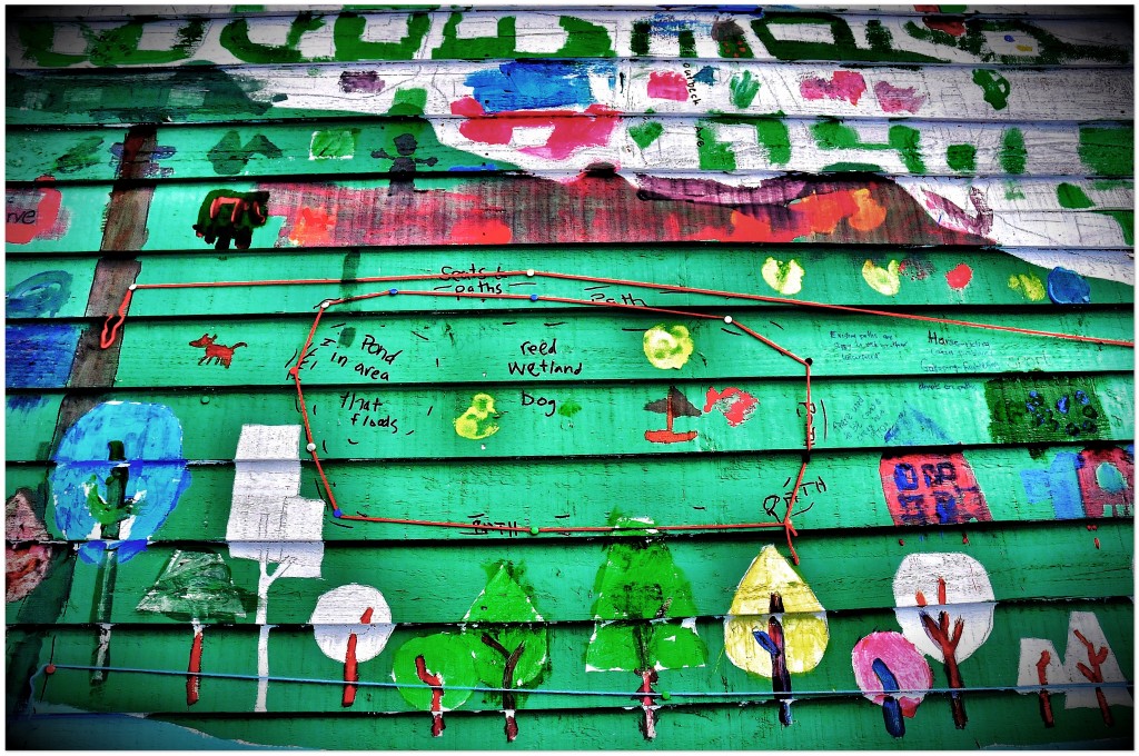
A number of residents wanted to argue for a “Denso’s”-style wetland nature reserve being established on the habitually boggy green space between the river and houses. This might be a good idea both from a ‘biodiversity’ point of view (there’d be still more wildlife for residents to appreciate) and a ‘flood storage’ point of view (wetlands hold water better rather than allowing it simply to run off towards the already over-full river in high water conditions). On the other hand, though, some residents were concerned that making a wet area still wetter, in close proximity to housing, might be a safety concern for families with children etc. This debate about possible futures was lively and (as you can see) well-illustrated!

Yet another of the “beach huts” was designated as the Higher Coach Road History Hut, and featured exhibits showing old plans for the area, from the West Yorkshire Archive Service, and a summary of what we’ve learned about the estate’s history from (a) the archive and (b) the memories of longer-term residents. In response to various requests to make this material avaialable, the key points from this historical work are re-presented below…
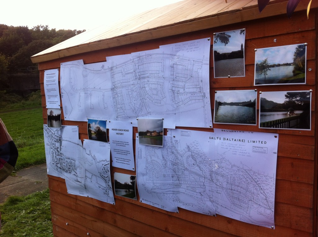
1. Shipley, Baildon or Saltaire?

The Coach Road estates were built in the 1950s by Shipley Urban District Council, on Baildon land, that had been purchased from Salts of Saltaire Ltd.  During the 1860s, pioneering mill owner Titus Salt had bought up huge tracts of land on the north side of the Aire, but apart from establishing Roberts Park, and laying down Coach Road (which led to his sons’ houses at Milner Field, to the west, and Ferniehurst, to the east), he did little with it.

The inheritors of Salts Mill still owned all this land until after World War II.  The company even drew up unrealised plans for a huge housing estate, to be known as the “Milner Field Estate”: this would have involved chopping down most of the trees in Hirst Wood, Shipley Glen, etc., in order to build on the cleared land. However, the imagined scheme never got the go-ahead.

In the period immediately following World War II, the Labour government created the modern welfare state: Aneurin ‘Nye’ Bevan, as Minister for Health, was the architect of the NHS, but he also laid the foundations for the creation of local council housing estates (as opposed to privately owned housing estates, like the one Salts had planned).  In 1952, responding to the West Riding County Planning Department’s call for new council housing in the Shipley area, Shipley Urban District Council announced its intention to buy and build on the plots of riverside land on either side of Roberts Park.

The planned new housing was intended primarily for residents displaced by the demolition of “slum” housing in Shipley town centre, Windhill, and other local areas. Shipley’s plans included building in three distinct areas. Zone 1 was the area east of Roberts Park, between Thompson Lane to the north and Coach Road to the south. Zone 2, the largest section, was the area to the west of Roberts Park, now known as the Higher Coach Road estate. Zone 3, the smallest section, was the area to the south of Coach Road on the east of the park (i.e. the housing on Tennis Way and Aire Way).

2. Baildon Council opposes the estate

All of the land in question lay within Baildon parish, and Baildon Urban District Council objected to Shipley’s plans on multiple grounds — particularly the plan to build in the previously undeveloped Higher Coach Road area. According to a June 1952 summary report from the Ministry of Local Government and Housing (in London),  Baildon Urban District Council objected to Shipley building on this land for the following reasons (quoted verbatim from the document):

  1. That the scheme is extravagant.
  2. That the [road] bridge at Salts Mill would have to be reconstructed.
  3. That the amenities of the Coach Road area, including Shipley Glen, would be destroyed.
  4. That the site is water-logged.
  5. That there is suitable alternative land in Shipley for the development in question.

Shipley successfully argued against these objections, and the Minister permitted development to go ahead, provided the natural amenities of this green-belt area were respected (see 4 below). However, a memo from the West Riding County Planning Department dated December 1951 suggests that Baildon’s real objection to the development was more fundamental:

“Baildon Council objected to the definition of land in Coach Road district for residential use, as the implication was that any large scale development would be to re-house population at present resident in Shipley.”

In other words: Baildon did not want residents from Shipley’s so-called “slum” housing living on Baildon land! However, once the scheme was approved by the Minister, Baildon began to argue for many more houses to be crammed into this area. Why? Apparently so as to head off Shipley’s stated intention of buying more Baildon land, this time in the West Lane area. This would have placed council housing much closer to the centre of Upper Baildon. Baildon Council made clear that they were hoping “that a more spacious type of development would take place [in this area] than that associated with a Council Housing Estate.” But this meant them advocating less-than-spacious developments in the Coach Road area, cramming in as many people as possible, so as to ensure that Shipley did not need more space up the hill.

3. Salts wrangling with Shipley…

Salts of Saltaire Ltd. were initially reluctant to sell their riverside land to Shipley Council, apparently because they were hoping to get a better price than the one being offered. To maximise the perceived value of the land sale, the company attempted to package in the Victoria Road Bridge at Saltaire. Salts argued that the housing estates would necessarily need road access across the river at Victoria Road. They also hoped that Shipley Council would take responsibility for fixing the bridge, which had been damaged during the war (tanks made at Butterfields in Shipley had repeatedly been driven across it to be tested on Baildon Moor, destabilising the 19th Century structure). Shipley commissioned a survey report which established that the bridge “was incapable of being made good at a reasonable expense.” Understandably, they refused to buy it, and so it was at this point that talk began of a new footbridge being built into Roberts Park (i.e. the current one). The road bridge was later demolished.

With Salts continued to drag their heels about a sale, Shipley applied to central government for a Compulsory Purchase Order. This would have forced Salts to sell the land at the District Surveyor’s valuation of just £5,800, which was significantly below what Shipley was offering! (The documentary evidence suggests that the surveyor’s office co-operated with the Council on this point…) Caught in a pincer movement, Salts decided to sell before the CPO could be enforced – and thus stated that they “could not accede to the request [from Baildon Council] that they should oppose the Development Plan.”

To avoid maximise the sale proceeds, Salts now proposed to sell off Shipley Glen and other wooded areas along with the land Shipley wanted for housing estates. Shipley agreed to the package, and bought the whole lot for £8,160.

4. Respecting the Natural Environment

In 1952, when the Minister for Local Government approved Shipley’s application to build on the riverside land (see 2 above), he specified there should be “no residential development carried out between Coach Road and the base of the wooded hills on the more westerly side.” This was a concession to Baildon’s stated concerns about protecting the “natural amenities” of this greenbelt land, and it forced a change of plans by Shipley. Their original lay-out for the planned Higher Coach Road estate involved building on Trench Meadow — land now preserved as a Site of Special Scientific Interest (so the Minister seems to have been well advised!).

To their credit, rather than simply tweaking the existing layout plan, Shipley went back to the drawing board – and sought the advice of the Housing Ministry’s Regional Architect, Mr. Williams (based in Leeds). In September 1953, following this consultation, Shipley unveiled a new layout – the one eventually adopted – which consciously sought to be sympathetic to “the pleasant rural atmosphere of the area.” So for example, the plan was to preserve open green space between the fronts of houses, rather than having the estate dominated by tarmac. Instead, car access was to be tucked away almost invisibly onto service roads leading to back doors.

As the Council’s planners noted, “the amended lay-out takes a rather novel form” – so novel, in fact, that “there are, unfortunately, no local examples of this type of development which [council] members could inspect” (in order to form their own judgement). And yet, stated the same document, “It will be noted that a very pleasing, spacious type of development is obtained which will go a long way towards minimising any harmful effect of housing development on the amenities of this particular area.” For those concerned about budgeting, it was noted that less road-building also meant “a reduction in roadwork costs per house.”

The down side was that, “inevitably there will be a reduction in density of accommodation”. That is, the carefully spaced, grassy layout at Higher Coach Road would mean that the numbers of houses to be built was considerably less than was being demanded by both West Riding Planning Department and Baildon Council (see above). However, given the role played by the Regional Architect of the Ministry of Housing in the revised scheme, there was little point in objections being put to the Ministry…

Shipley’s new commitment to blending their housing plans in with the natural environment consciously resisted the “stack ‘em high, pack ‘em deep” thinking that was common in much council housing planning in the 1950s — as was typified by building high-rise blocks of flats in other areas. Today, in 2012, many of those flats have long since been knocked down or blown up, but in the Coach Road area some of the residents who moved in during the 1950s are still living there. They have never wanted to leave this well-designed estate.

5. Building on Marshland

The land on which the Higher Coach Road estate was built is composed of soft, alluvial soil (silt deposited by the river over centuries). From the start, it was recognised that these were “Abnormal Site Conditions” for building on. The land nearest the River Aire, most prone to flooding, was left free from development, but even the higher ground was a problem. As a Shipley Council memo from 1952 noted, “surface water is liable to cause difficulty during construction and there are a number of surface springs.”

Extensive earthworks were required in order to drain the land, and to even out the undulating hills of alluvial soil. Some of the ground was flattened down, and other parts built up in order to create the largely even ground at the top of the flood embankment that we see today. Interestingly, the earthworks contract with the contractors, L.J. McCarthy, specified that they would be paid by the ton for shifting and removing soil and rock, but exempted loose boulders of “less than 3 cubic feet in size”. These were a common feature of the area: smooth, round boulders littered the area, and had probably been left behind by the movement of the glacier that had made its way down the Aire Valley during the last ice age! Since these boulders were already loose rock, Shipley saw no need to pay the contractors to move them, but as a result, the first residents moving onto the estate found them still littering the green areas! Some got buried, others did eventually have to be broken up and removed.

The houses built on this soft land had no basements. Concrete piles were driven into the ground as corner supports, but the weight of the houses had to be distributed across their surface area so as to minimise the risk of them tilting (the Leaning Tower of Pisa leans because it concentrates too much weight on soft, alluvial ground!). The floors of the houses are made of concrete slabs, or “rafts” – about 4 inches thick – which simply sit on a prepared bed of hardcore, and are topped by a layer of asphalt/bitumen (visible under people’s carpets!). The raft design helps spread out the weight of the houses, allowing them – in effect – to “float” on the soft surface of the land.

The houses on the Higher Coach Road estate were built by Shipley Direct Labour Force – a multi-skilled task force put together by the Council – in the years between 1956 and 1962. According to archival records, the total building costs came to £386, 515.

6.   When is a garden not a garden?

The original design of the estate made no provision for front gardens. Residents were to have back yard or garden spaces, but between the fronts of the houses there was to be open, communal green space (the grass was originally kept long, as a kind of meadowland, in keeping with the previous character of the area). From the outset, Shipley Council was aware that “some adjustment in outlook and living habits on the part of tenants will be called for” in order for this sharing of communal spaces to work in practice. It appears, however, that nobody thought to explain this to the new tenants!

In 1956, very first new residents on the estate moved in, on Park Way and Windermere Avenue, at the east end (the rest of the streets were still to be built). And by September of that year, the tenants had already begun requesting permission to erect fences separating their “front gardens” from the estate’s footpaths. This was because “sheep who have been used to grazing on this ground still wander over the gardens,” and were eating any plants and flowers sown in them.

Shipley Council responded by insisting that planting out should be reserved for people’s back gardens: “the houses facing greenswards should not have fences or hedges which would spoil the open aspect intended to be achieved.” In short, there were no front gardens: the areas between the houses and the footpaths were intended to be treated simply as grass verges, consistent with the central meadow spaces. At the same time, though, the Council had to acknowledge that some of the new residents had “put a considerable amount of work into their gardens” (even though they weren’t supposed to be gardens…).

The Council attempted to solve the problem by penalising the local farmers who were still allowing sheep to graze on the estate. They wrote to farmer J.H. Denby, for example, to inform him that  “complaints are now received at the Town Hall on an almost daily basis”, and that “whatever steps your shepherd informs you he is taking appear to be almost entirely ineffective.” Despite these efforts, though, complaints about sheep and horses straying onto the estate continued for over a decade! This letter, for instance, dates from 1967:

To Mr. J. Bell, Hope Farm, Baildon.

Dear Sir,

I understand that sheep owned by you are straying onto the Council’s land adjoining the Higher Coach Road Housing Estate and grazing there. I shall be glad if you will ensure that the trespass will cease immediately.

Yours faithfully,

Clerk & Solicitor, Shipley Urban District Council.

Needless to say, with the grazing continuing to be a problem, residents on the estate continued to take matters into their own hands with respect to fencing off their “verges” as gardens. Today, it is difficult to imagine that these front garden areas were ever intended to be anything else!

***

Well, that’s it for now, on our trip through Higher Coach Road’s early history as an estate. We hope you’ll agree that it provides an intriguing insight into the various debates around urban planning in the 1950s and 60s… Today, the estate sits across the river from what is  now a World Heritage Site (Saltaire), and indeed within the WHS buffer zone restricting new development. What if we were to make a case that this area, too, is worthy of notice as part of the local heritage narrative…?

 

A Midsummer Night’s Dream…

The other night, Monday June 25th, I had the opportunity to join David Robinson and his dog Oscar on their evening walk up to Shipley Glen from the Higher Coach Road estate. Despite having spent a lot of time now, working on this project in the vicinity of the river, I hadn’t previously been up the hill for want of someone to show me the way around. David generously offered to do the tour – and we just happened to pick what turned out to be an utterly glorious evening of midsummer weather…

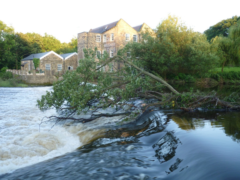
Our luck with the weather was all the more remarkable given that, only a few days earlier, the miserable rainy conditions we’ve experienced during much of June resulted in flood warnings across the county. Although the worst of it was in the Calder Valley rather than the Aire, the high water here was still more than apparent at the swollen Hirst Wood weir just yards upstream from David’s house (which faces directly onto the river). In the image above, a tree has been carried downstream and caught on the weir – it’ll have to be cleared by the Environment Agency, I presume.

David told me that he received an automated call from the EA on Friday night advising him to take precautions and move personal items upstairs because the Aire was about to burst its banks. Despite having never previously received such a call (he didn’t even realise he was in the system), David “ignored it and went to bed” – quite confident that there was no danger of the water coming anywhere near his house. Sure enough, the Aire did break its banks that night, but did not encroach far up the green flood plain.  Which sort of begs the question of who the “experts” in these circumstances actually are…

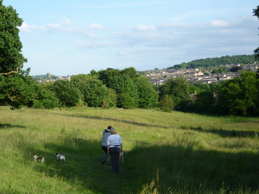
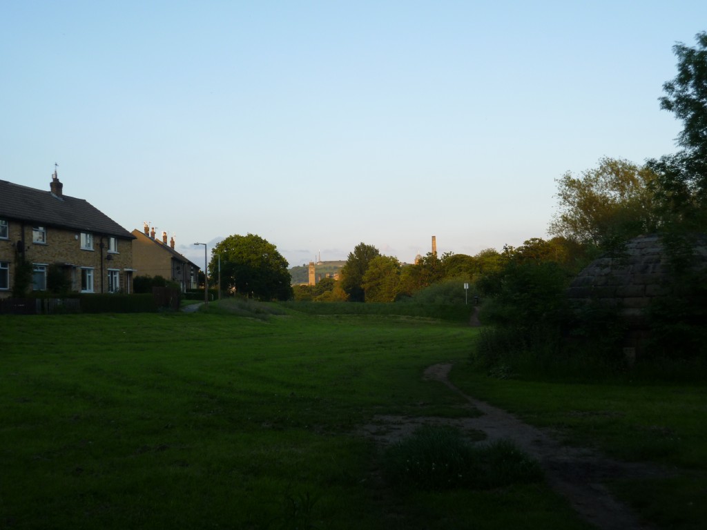
David’s walking tour took me up the hill from his riverside estate, walking initially through a meadow which can’t be farmed as it’s preserved as an SSSI (site of special scientific interest). Popular with dog-walkers, and on a night like this rendering great views of Shipley and Saltaire across the river – that’s the Shipley parish church to the left.

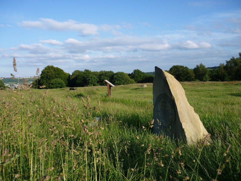
We made our way up through the steeply rising oak woodland of Shipley Glen, up to the plateau area at the edge of Baildon Moor (above), where the Victorians used to flock for fairground attractions. Traces of the old downhill Toboggan ride (early roller coaster!) are still apparent in rocks where postholes and some old ironwork survive.

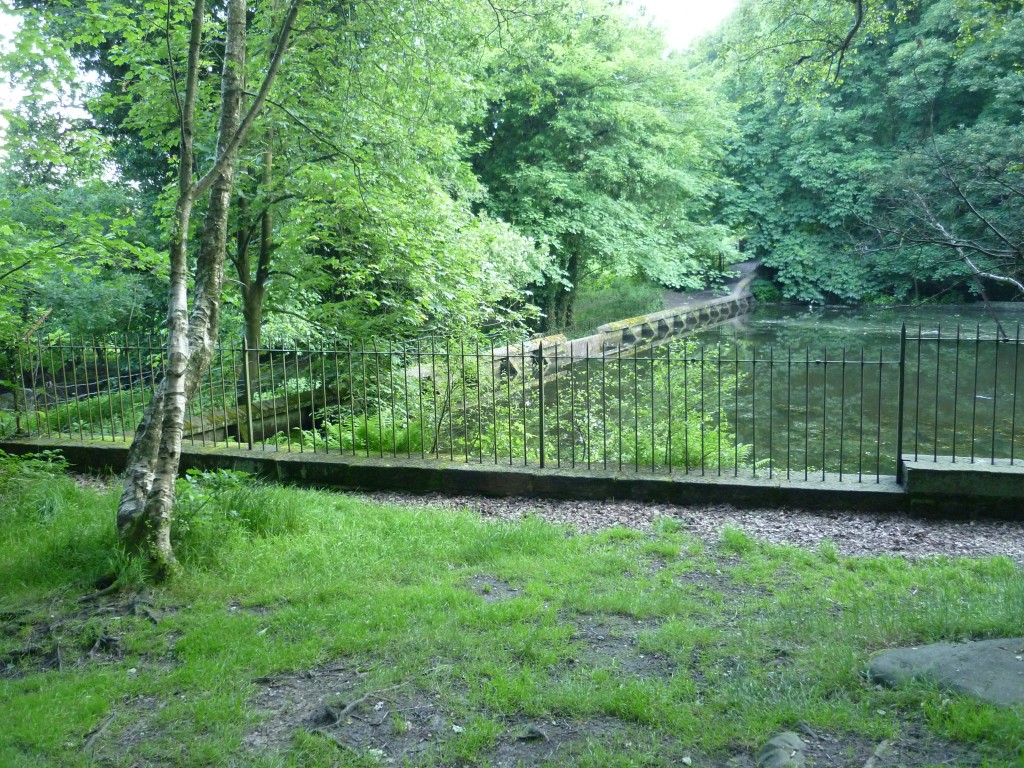
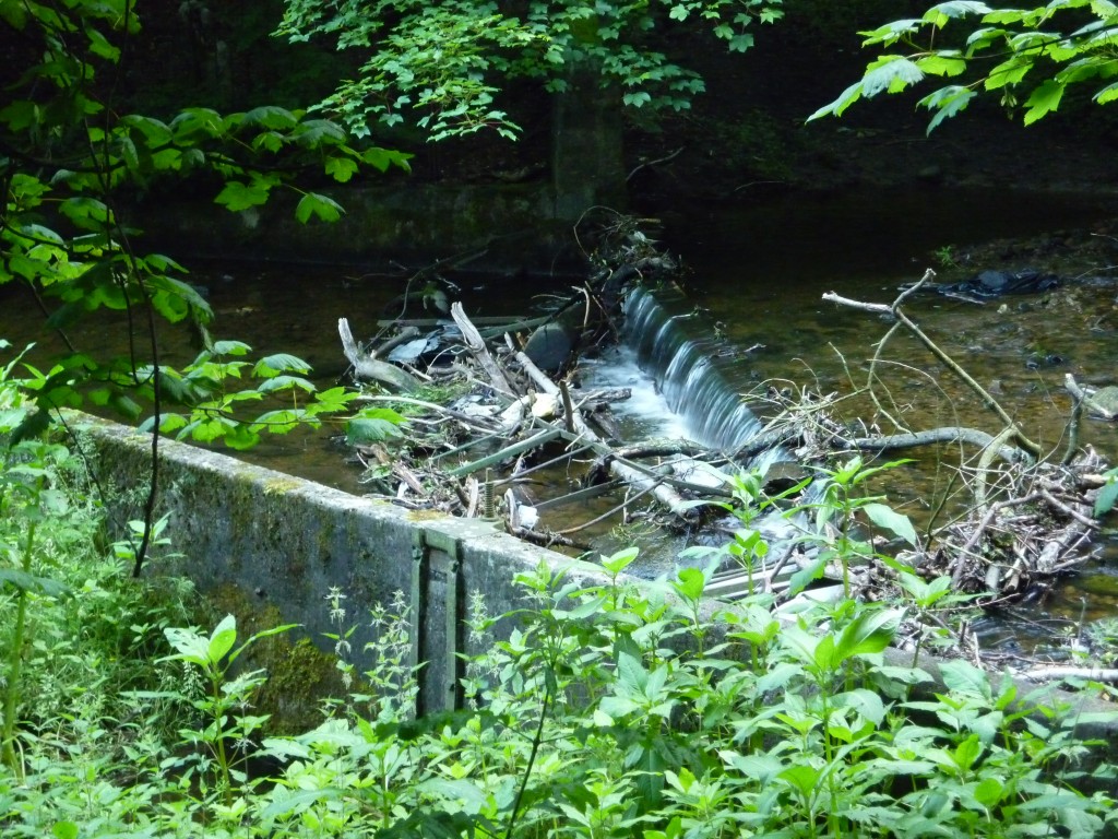
We encountered a much more intriguing Victorian relic, though, when heading back down through the woods and West towards Milner Field. Here’s the small reservoir (above) that was built by Titus Salt to siphon water from the Trout Beck (the stream that meets the Aire just yards from David’s house). According to David, this provided Salts Mill with a back-up water supply in order to sustain its own dying operation. And it’s the water channelled from this reservoir which is then pumped across the Aire by those dome-shaped pumping stations near the weir. Around this now-neglected reservoir there’s an intriguing set of engineered channels, again showing evidence of the recent high water… David said that the debris caught in the image below was not there the last time he’d walked this way, only days previously…

A little further to the west, and we entered through the neglected gateway to the Milner Field house and estate built by Titus Salt Jr. to show off his family’s wealth… There’s a long, winding road – largely overgrown – lined on both sides with many non-oak trees that were clearly planted as a kind of botanical avenue en route to the house. But the house itself is long gone… Salt’s Mill and its industrial village survive as a World Heritage Site, but his son’s grand house is nothing but ruination, lost in the undergrowth of the oak woodland that has reclaimed the site…

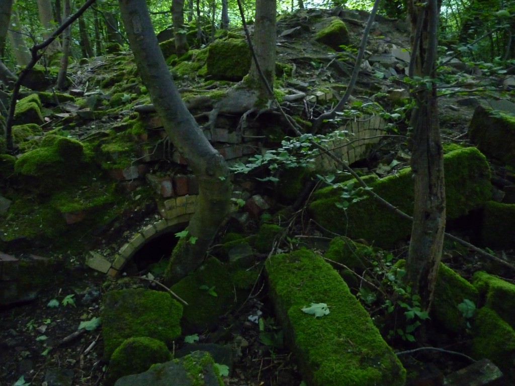
In the image above you can see traces of low archways (perhaps once the mouths of ovens??), amidst many other mossed-over loose stones. Wandering around this site is like finding a stately home as a disassembled jigsaw, strewn all over the place. You try to puzzle out what part of the house might have been where, but there’s very little to go on.

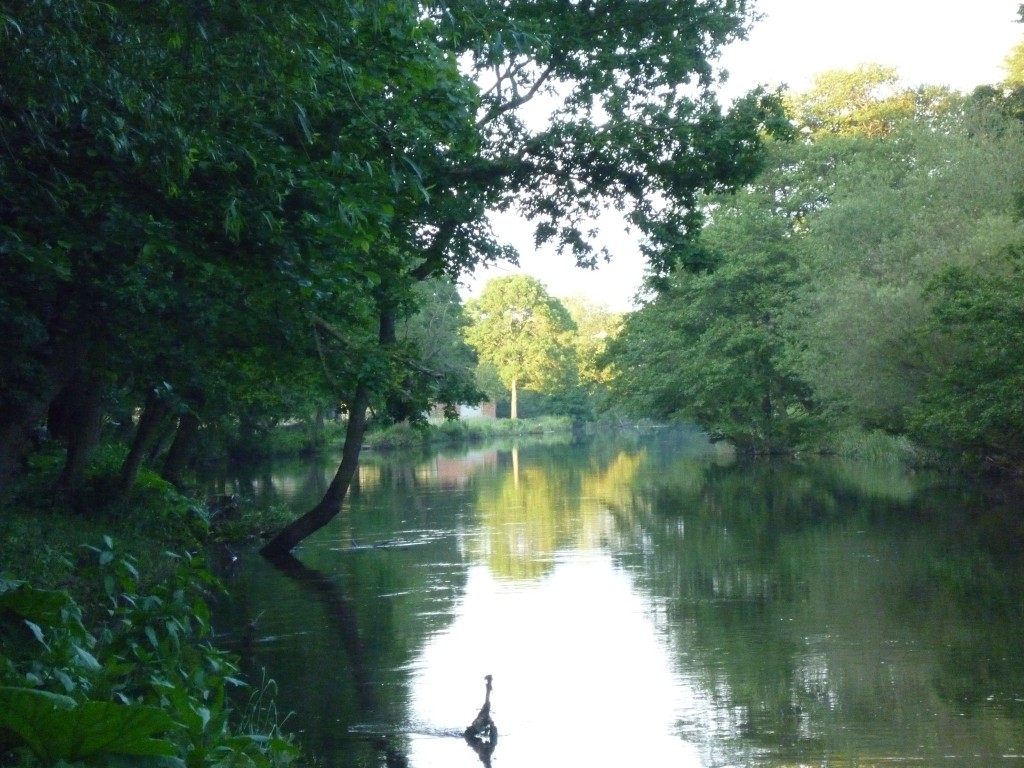
Following the gothic mystery tour, we made our way back along the river through Hirst Wood, in positively idyllic conditions as the evening sunlight showcased individual trees in glorious colour. The water is high, but this only adds to the sense of a wooded landscape blending and almost merging with the waterscape….

And finally, back towards Saltaire and the train back to Leeds – the sun still setting at 10pm… Thankyou David Robinson, for a really inspiring, intriguing evening.

Wet and Wild

Well, today we started our carefully planned attempts to start talking to members of the communities on the north of the River Aire in Shipley/Baildon. The best laid plans of mice and men are often frustrated by fate, of course — so there’s a certain irony in the fact that the day we’d chosen to start talking about “multi-story water” also happened to be the day when the Environment Agency ended up issuing 21 separate flood warnings across the country! OK, they were mostly in the south, but even here in the north it threw it down for much of the day… leaving our team of intrepid outreach workers traipsing around in the wet and periodically returning to the HALE bus (hired for the day) to try and warm up a bit. Then the generator on the bus broke down, and we were really stuffed!

Inclement conditions no doubt accounted for why many people didn’t open their doors when they were knocked on. No doubt, also, a lot of other people were just out at work and were better called on in the evening (by which time we were sodden!). But what was actually really encouraging from my point of view was that so many of the people who did open their doors — to what were basically cold callers (and wet callers!) — seemed happy to talk and were really responsive to the project. First impressions: people in this area of really proud of where they live, love the river and the green space around it, and aren’t in any hurry to leave. Indeed, I met several people who have lived in the Higher Coach Road area since their estate was constructed in the 1950s, and are still happy here today! And these people (in their late 80s and early 90s now) have vivid memories of past events in the area that are really worth hearing… How the council raised the level of the land, from the flood plain, by pile driving the land to make it fit to build on. How the river itself, when it’s flooded in 1947, or 2000, or 2008 (?) has come right up to the lip of these raised areas… (On Aire Close, which is actually right on the river, I heard about how the floods of 2000 produced four feet of flood water in the living room!) There were also some amazing stories of people’s other river experiences: there was one man who, during World War II, was among the engineers who actually built the bridge over the River Kwai (and no, he wasn’t making this up – he ended up in a Japanese PoW camp, an experience which he does *not* talk about). So, in short, even on a wet and miserable day like this, it became clear to us there’s a gold mine of stories to be dug up here… I wonder what’ll be next!