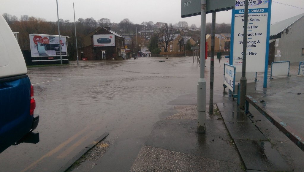
Just a few days ago I blogged about recent high water on the Aire through Shipley, and concerns about Baildon Bridge getting flooded. Well, here is a photo taken on Baildon Bridge today, looking across to the Baildon side and Otley Road’s junction with Green Lane… The whole place is underwater.
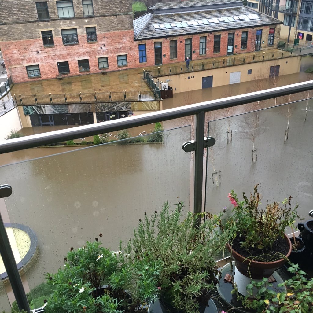
I haven’t been in the area today (I’m safe and dry in Manchester), but what follows is a collection of images that – like the one above – have been culled from twitter feeds (if anybody wishes to assert copyright, please let me know!). This next one is from a resident of Victoria Mills – immediately upstream on the Shipley side of the river. Here, the courtyard area at ground level has become a lake (with the bar completely submerged)…
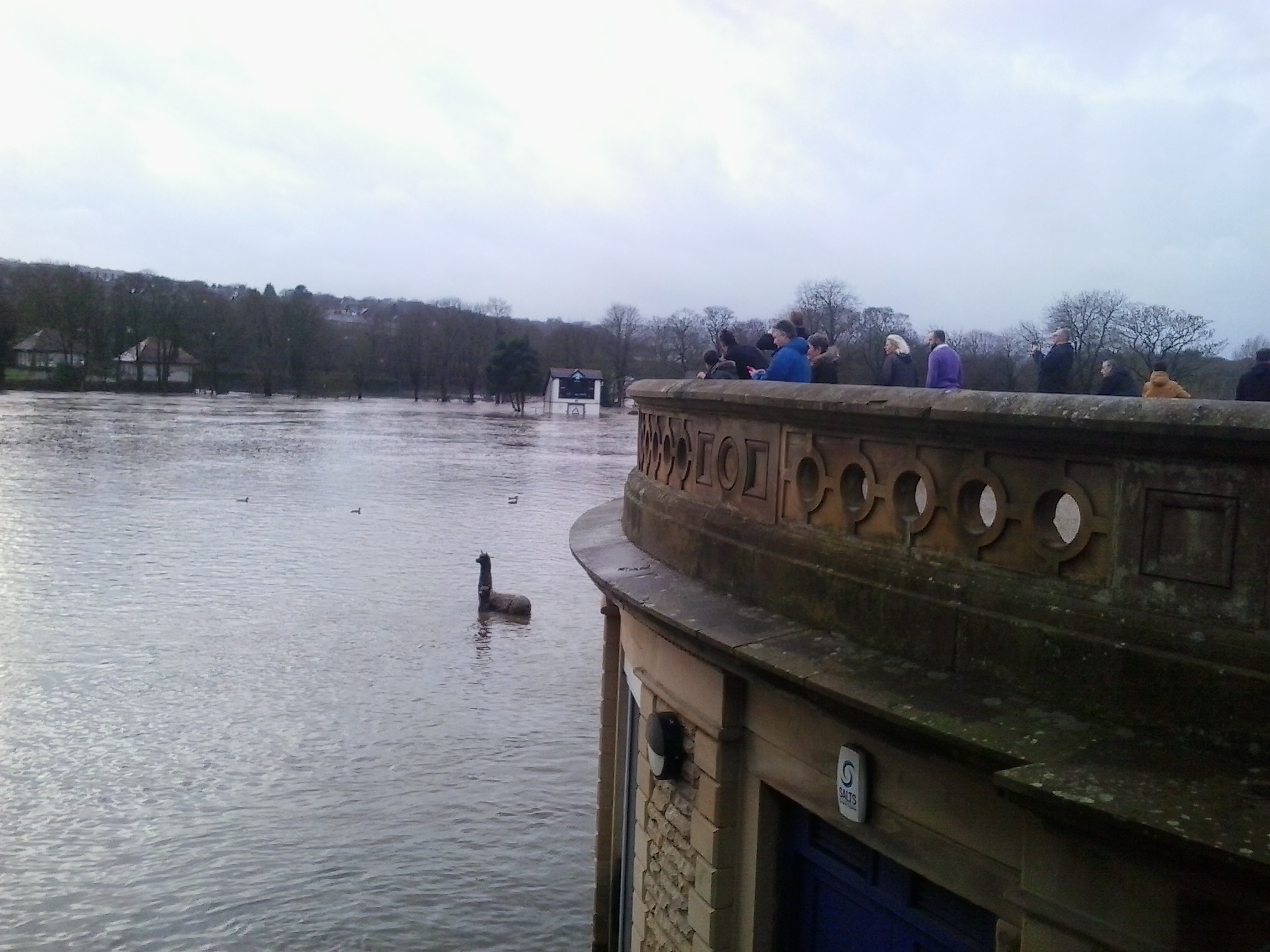
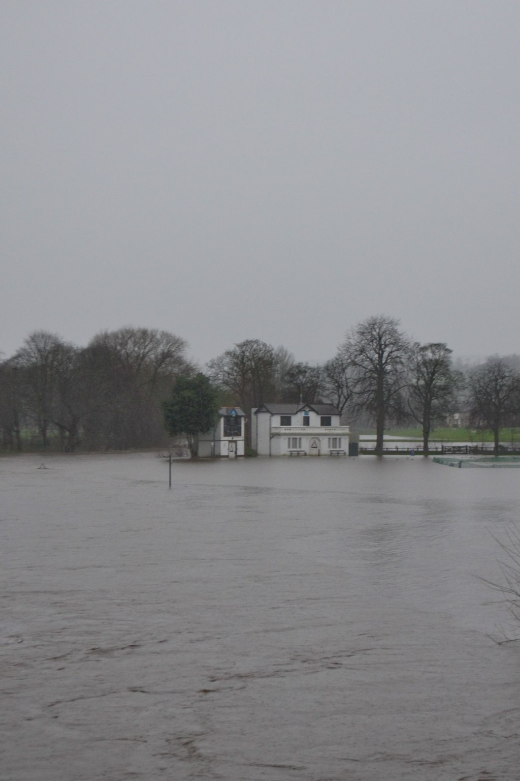
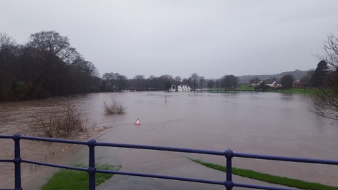
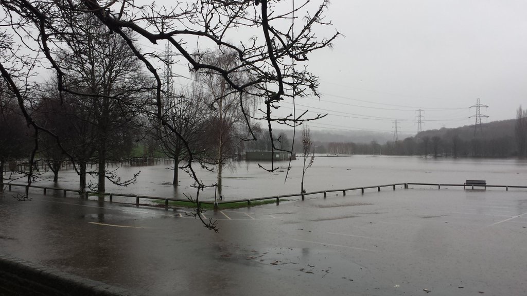
A lot of the most spectacular images have, unsurprisingly, been taken in the Saltaire area, where there’s a clear view of the river from the park… Here is the park viewed from the roof of Half Moon Cafe… as in October 2000, the cricket pitch is completely submerged, and has become a lake… The ornamental llama looks like some kind of Loch Ness Monster parody… (this picture courtesy of my good friend Eddie Lawler)
 The cricket pavilion, visible in the distance of the shot above, as seen more directly…
And just across the river at the same point, of course, the Boathouse Inn…
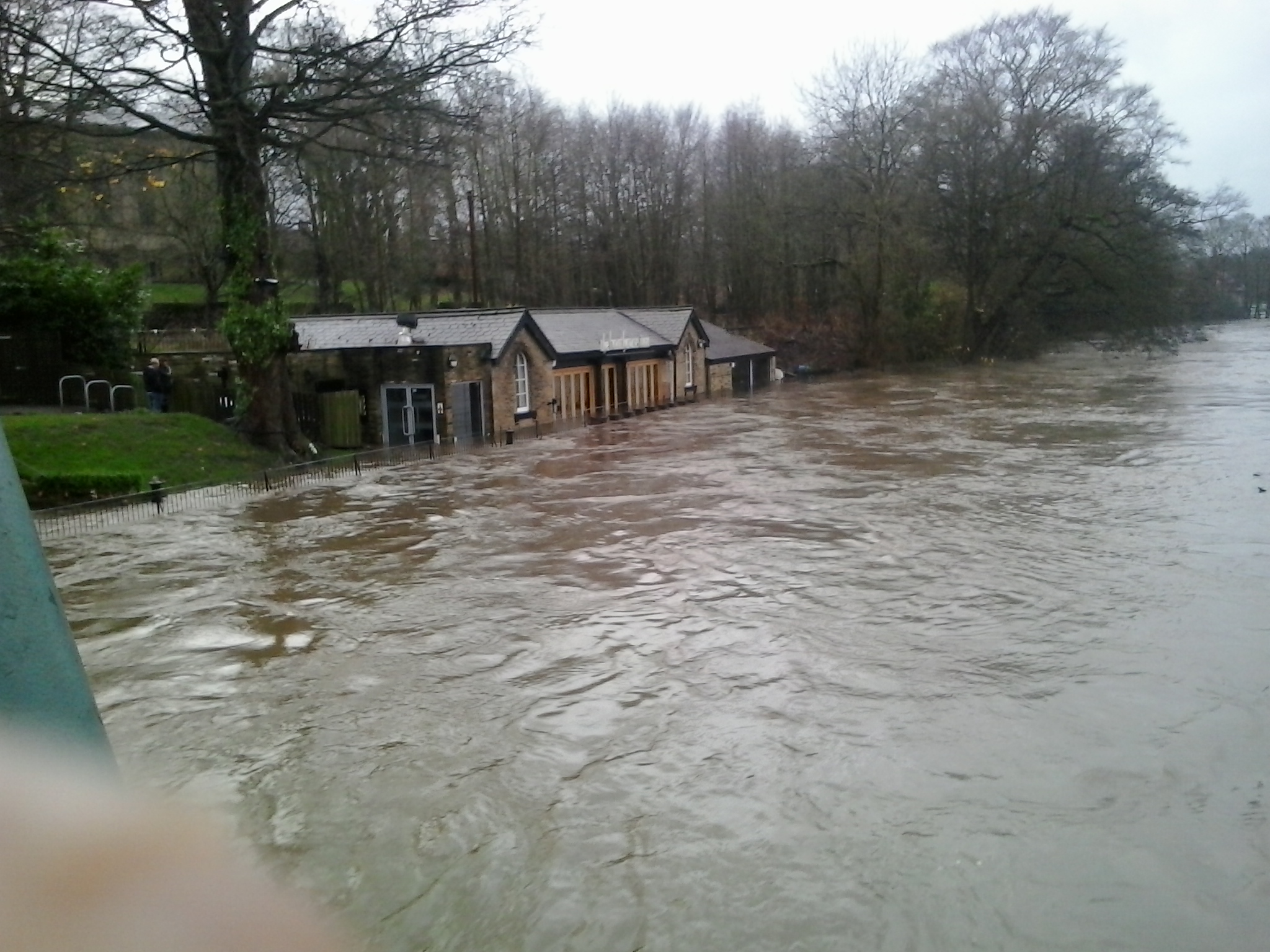
 Note, in the shot of the Boathouse below, a little triangular flood warning sign… this is the same one visible in the shot of the park directly beneath. You really can’t tell where the river ends and the park begins. It’s all one.

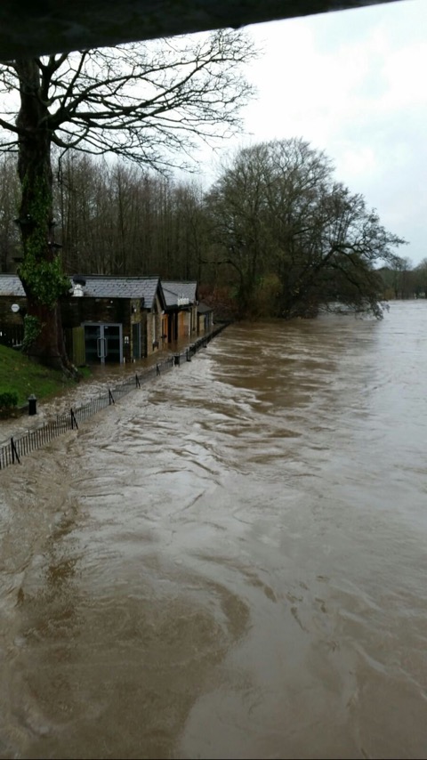
But note also that there is a distinct difference between the relatively static water lapping around the edges of the park, and the main flow of the river under the footbridge… See the blue litter bin in the foreground of the last but one image…? Here it is again in the foreground of the shot below, taken a little later in the day (again by Eddie Lawler).
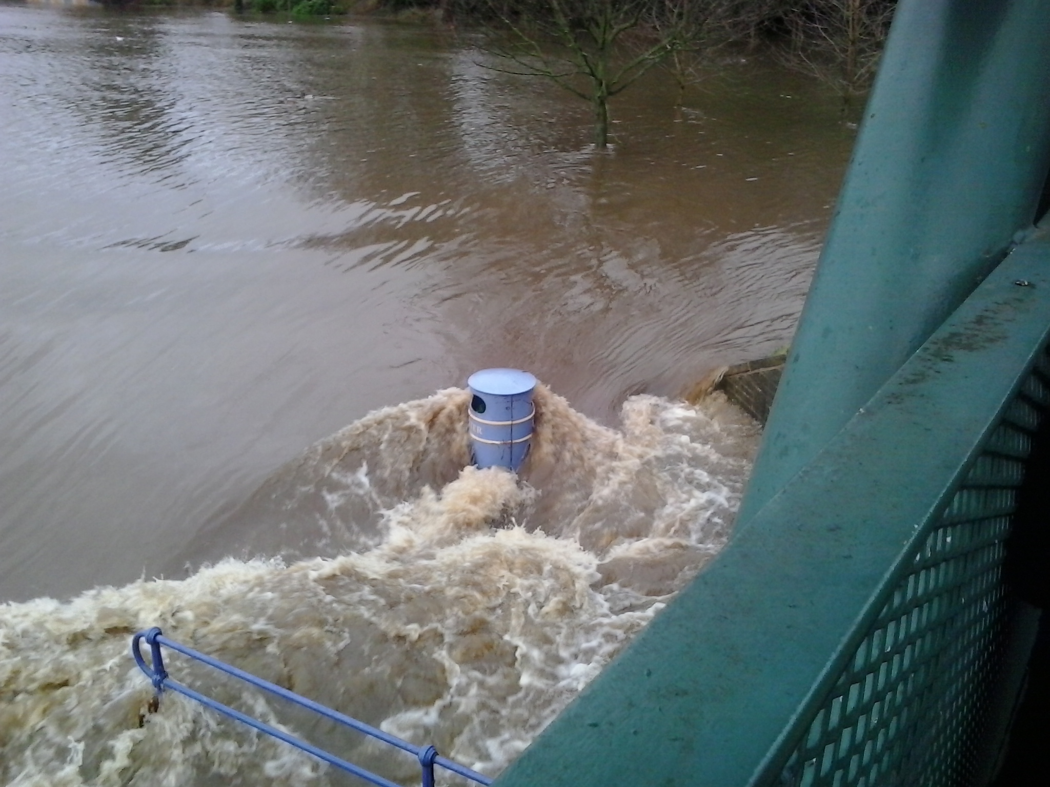
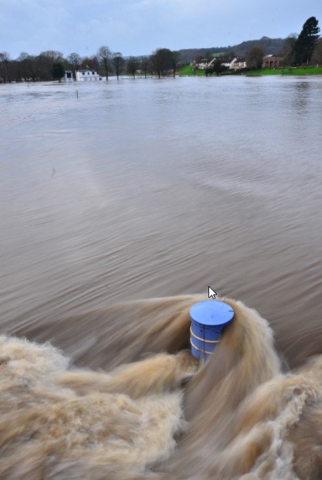
And here’s the same litter bin yet again, a little further under…This really gives a sense of the force of the water going by…
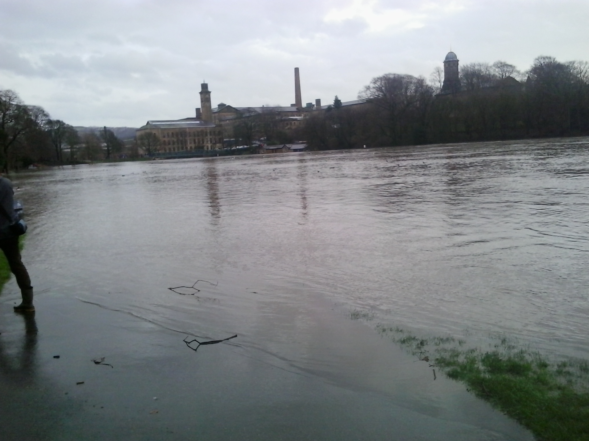
Another image of Eddie’s gives us the view of Salts Mill, looking back across from the park…
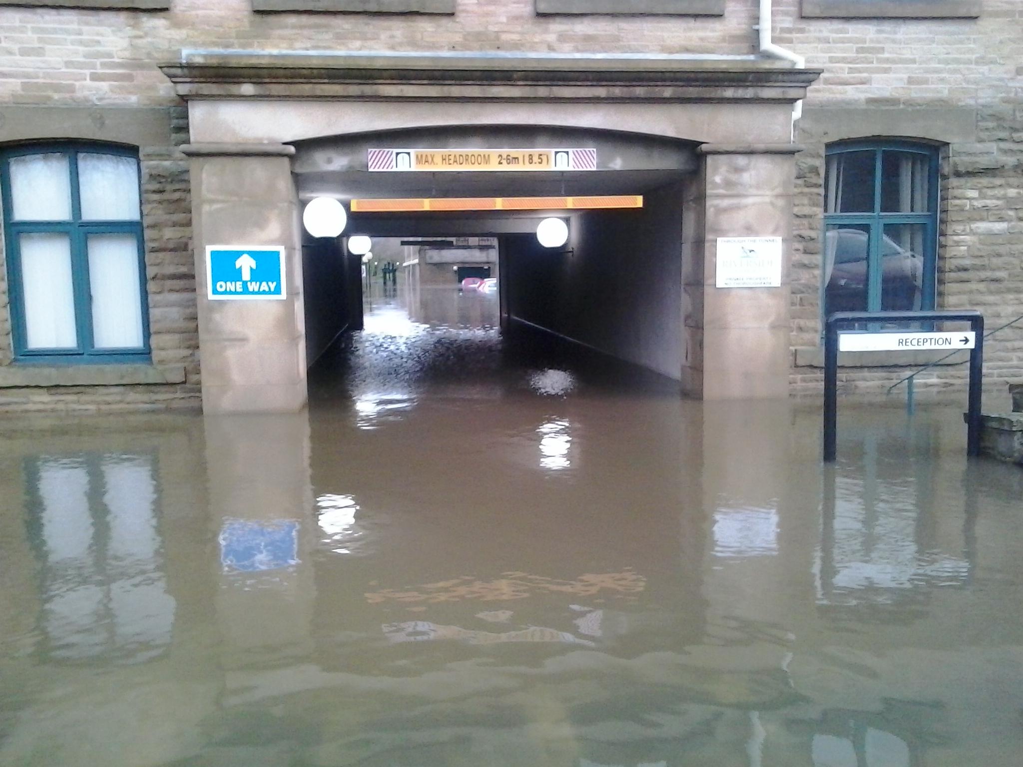
And here is the entrance to Salt’s New Mill, completely underwater… (Eddie again)
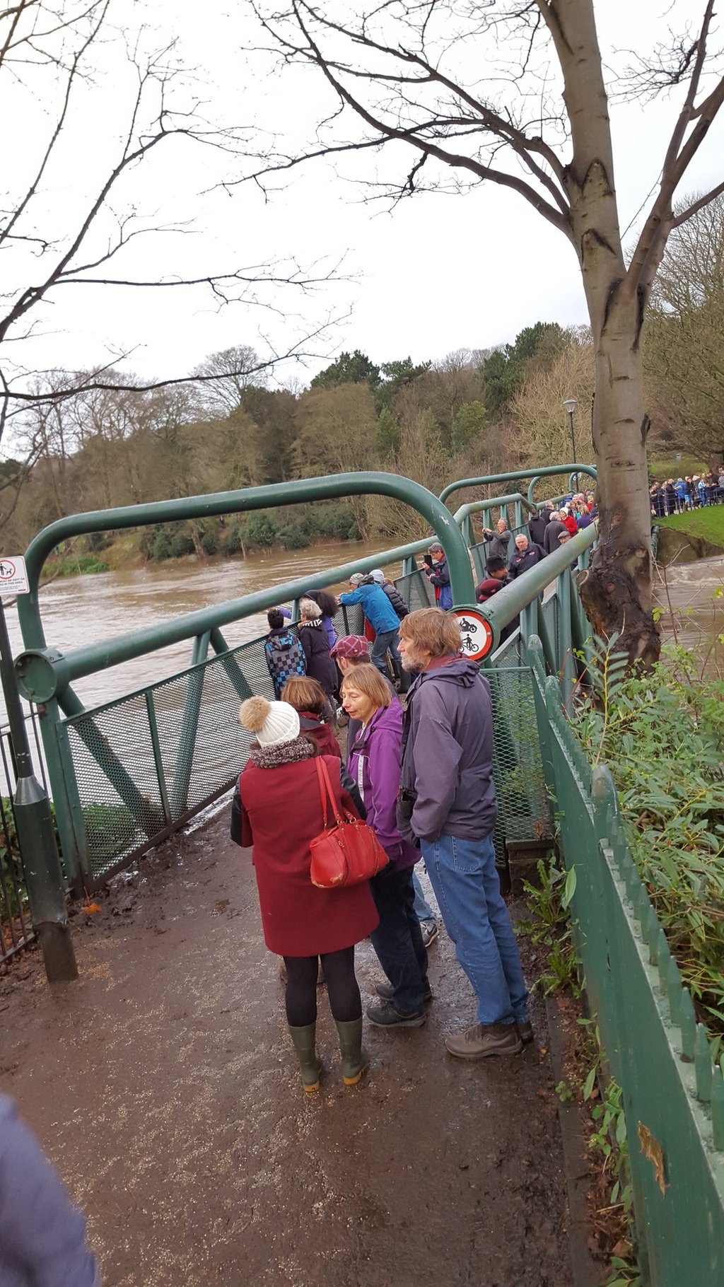
It’s quite a spectacle, of course, and who can blame people for turning out to look at it … (Although the safety warnings would advise against getting too close to fast flowing flood water.)
Meanwhile, downstream at Apperley Bridge, this was the view of the Aire…
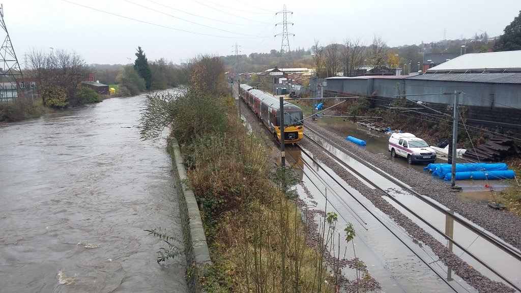
Coming into Leeds, where the railway runs alongside the river through Kirkstall, the flood defences are better but the river was just barely contained…
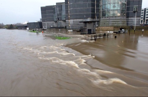
And in the city centre, at the iconic Royal Armouries, this was the scene… The Leeds Lock in the foreground (and in the next picture), which is the first lock on the Aire/Calder Navigation, is completely submerged — as is the island that runs between the lock cut and the main river…
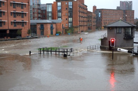
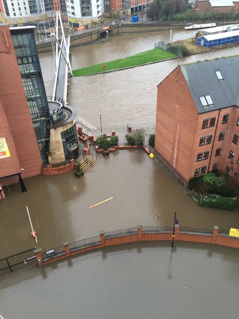
xThis next, aerial image, shows the same location from the other side of the river.. entrance to Clarence Dock in the top of the shot, the river and (submerged to left) island, and in the foreground the Canal and River Trust building at Fearns Wharf, with its car park totally submerged. So too was much of Neptune Street leading up to it…
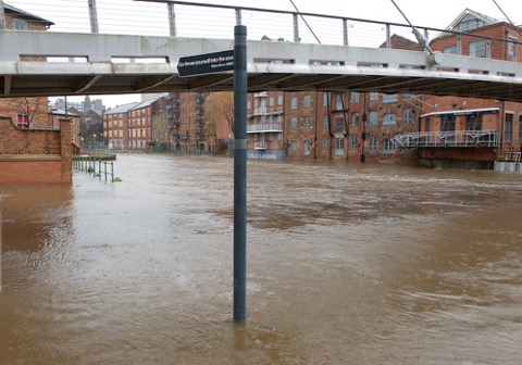
Just upstream from here, looking back towards Crown Point Bridge (and the Armourites beyond it) you can see that the riverside pathway outside Brewery Wharf, to the right, is completely submerged also.
This next shot is from more or less the same spot, but looking upstream, underneath Centenary Bridge. Let’s hope those new flood defences at this spot were doing their job.
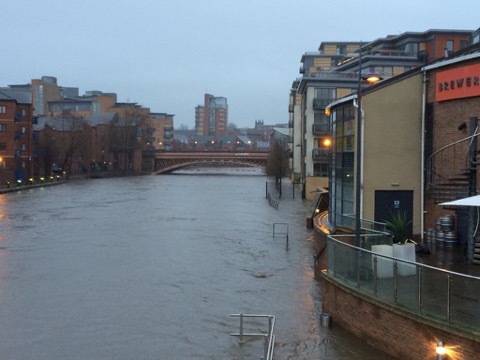
Just upstream again, the Aire at the highest I’ve ever seen it through Leeds…note how the drop that normally exists between the main river and the pond (former dock) in Victoria Quays, to the left, has been wiped out…
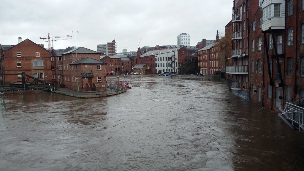
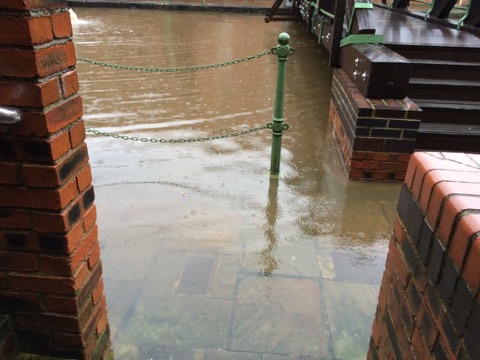
And this is a close up shot from Victoria Quays, with the footpath visible under the water, but no identifiable line between path, pond and river…
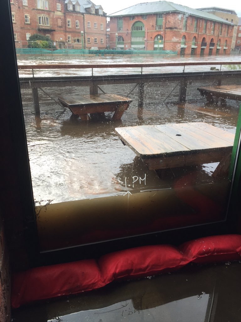
Finally, a shot from inside the Aire Bar, just across on the north side of the river from Victoria Quays… As you can see, the staff have improvised a flood marker on the window for the level the water had reached at 1pm this afternoon — at which point they abandoned the bar to the river, because the sandbags against the window were achieving little…
Tomorrow I’ll collate some more. Let’s hope the river will have subsided a little by then…