I had a very productive day in Shipley-Saltaire-Baildon today, with a series of meetings with interesting people. First off, at the bakery in Saltaire, I met Neill Morrison, energy manager at Bradford Council, who is responsible for the Saltaire hydro scheme, for an update on progress with that (it’s gone to planning, and there were no objections arising as a result of last autumn’s consultation at Shipley library). Next I was off to Troutbeck Avenue, on the Higher Coach Road estate, to catch up with Stewart and Pat Gledhill (Stewart is a part-time pirate, battle re-enactor, wood bodger, you name it…). Then it was back into Saltaire, this time downstairs from the bakery at the Victoria tea room, to meet Carol Buchan from the Canal and River Trust (and, briefly, Helen Thornton, the World Heritage Site officer). Lots of ideas being discussed although nothing solid enough to report here yet. Finally, though, I went to visit Margaret Wright and Heather and Les Moxon, residents of the former mill cottages at Lower Holme…
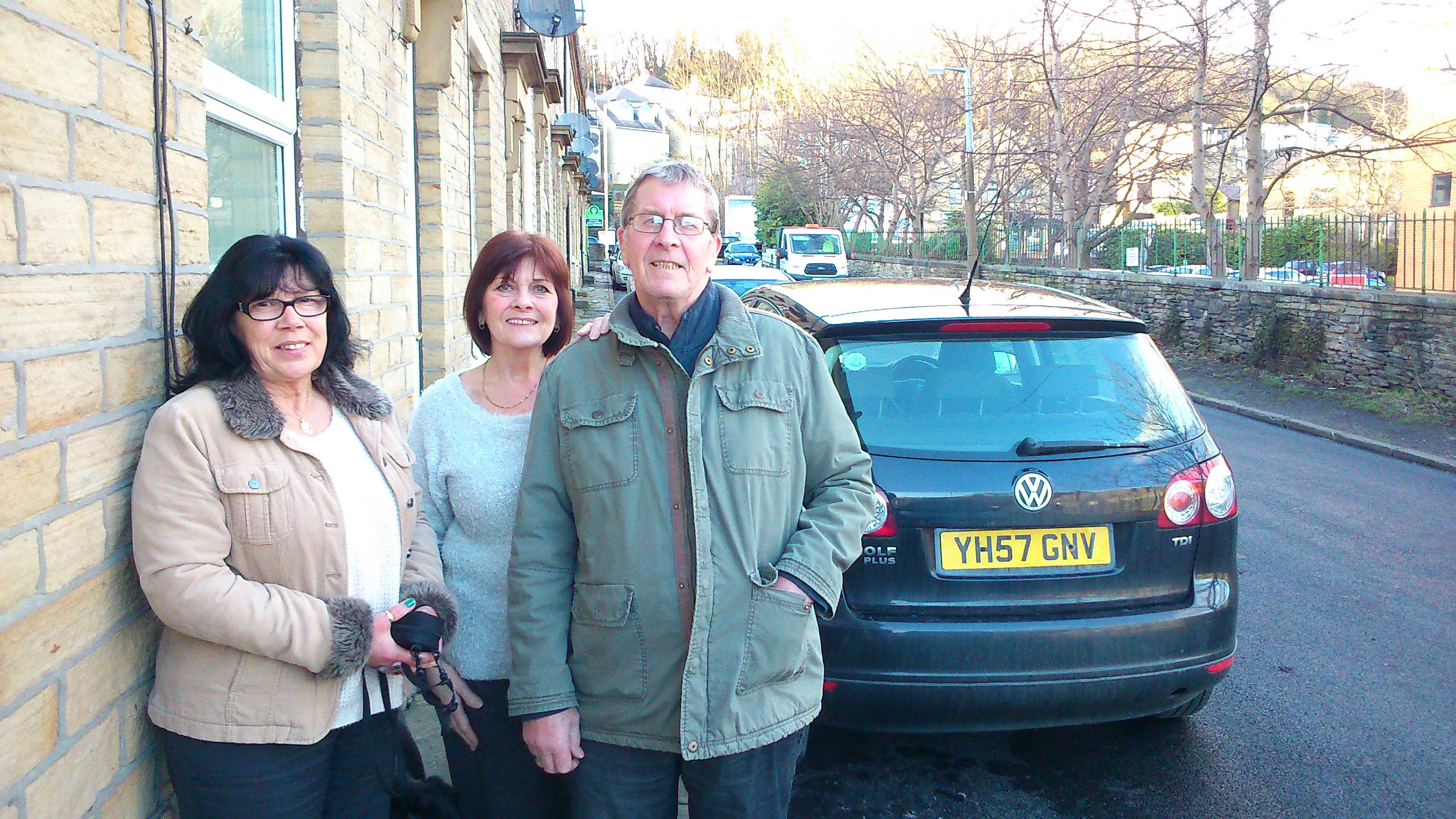 Here’s Heather, Margaret, and Les (left to right), standing outside Margaret’s house, next to the street that has been newly tarmacked by the property developers, CDP, who recently redeveloped the former mill site. The residents are grateful for the tarmacking, which was essentially a gesture of goodwill on the part of CDP’s James Marshall — since the actual ownership of and responsibility for this bit of road remains a source of contention (Bradford Council refuse to adopt it, but since the terraced cottages are now partly private owned, partly run by a housing association, it is legally unclear whether the road is the responsibility of the residents or the mill-site owners (now CDP). That said, though, the residents are more than a little concerned that the tarmacking appears to have been carried out rather hastily — with the result, for example, that one of the drains in the road has simply been tarmacked over. Drainage has always been an issue here — on a site classified as flood plain — and that issue looks particularly unresolved when one looks south from Margaret’s house towards the river…
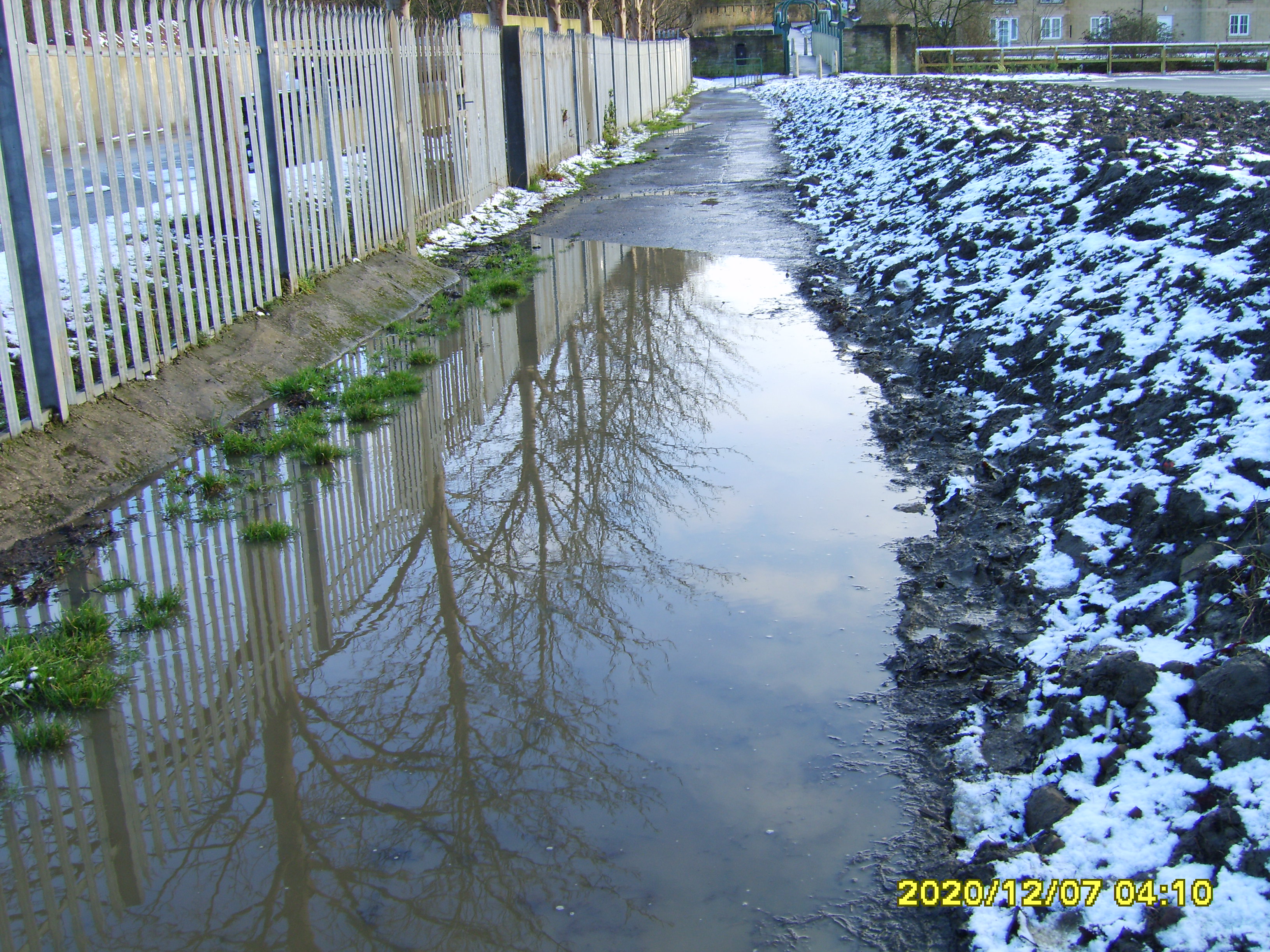
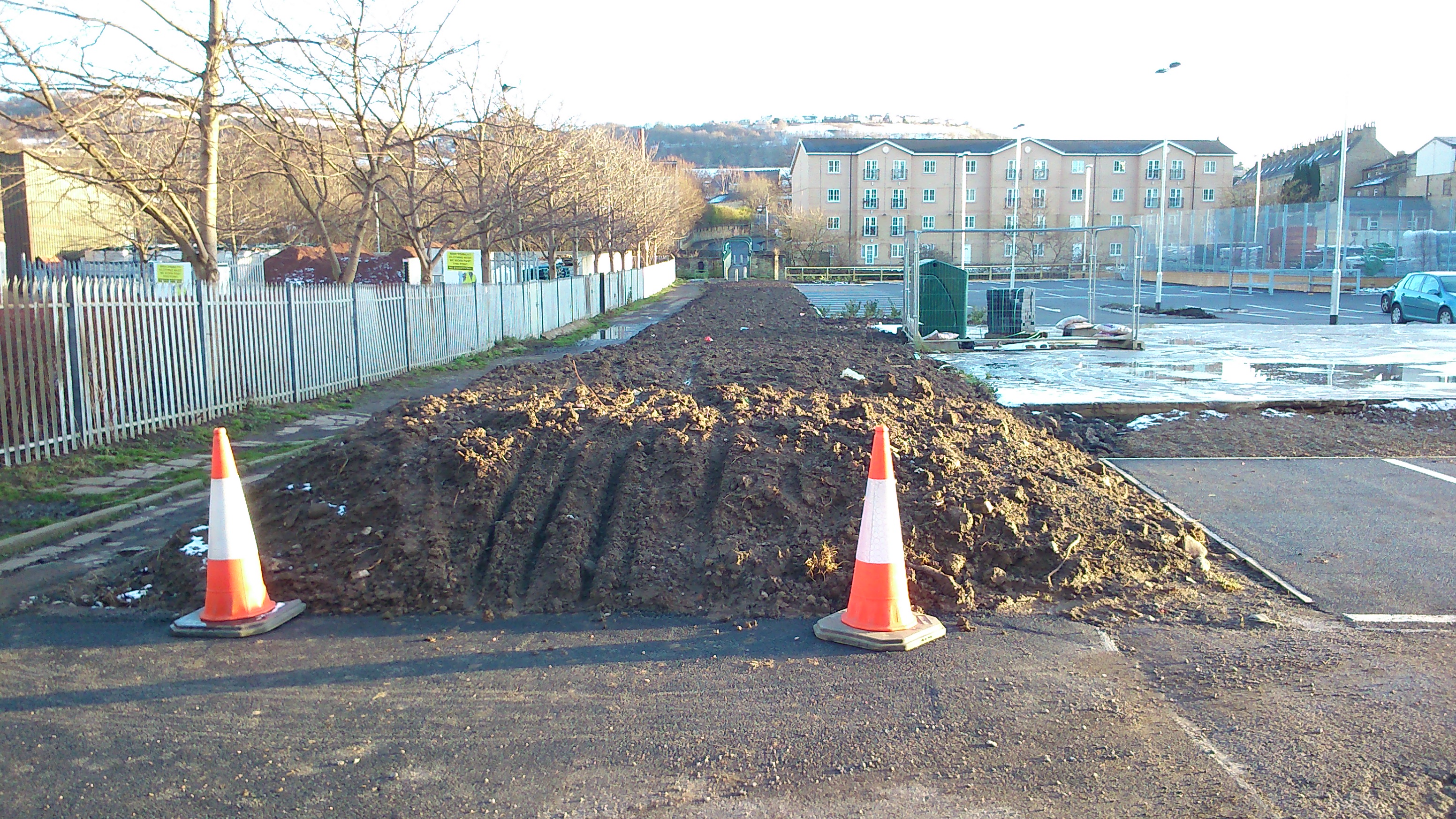 To the left here you can see part of the (still unadopted) road that leads down to the footbridge (at the end of the row of trees — the modern-build flats you can see are on the other side of the river). This road has to be left clear because it provides a public right of way across the river, but as you can see, a large part of it is currently covered by a massive earth pile that has been left by the developers — with no clear indication as to when it will be removed. The narrow navigable path to the right (only about half the width of the full road) is prone to surface flooding — you can see a big puddle there and it wasn’t a wet day today — and this is being exacerbated by the earth pile since it is effectively channeling run-off into the narrow pathway. Heather sent me this picture taken a few days earlier [the date signature is misleading] which shows how bad it can easily get… This is basicaly impassable unless you have wellies on…
 So who is responsible for sorting this out? Well, clearly a large part of the problem would disappear if that soil stack was removed. The longer term solution is less obvious though. Heather and Margaret recall promises having been made to properly tarmac the whole road down to the river, and they are upset that CDP’s James Marshall denies this. However, reviewing my own account on this blog of earlier meetings between Mr Marshall and the residents, I found this diagram from autumn 2012, which indicates that the limit of the area he had offered to tarmac (marked in pink) was indeed around the houses, and not down to the river… (which is off to the right of this image)
 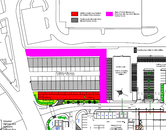 That said, this same diagram indicates that the road would be left clear to its full width, not left covered with a mound of earth. Moreover, this diagram clearly indicates two planning commitments that have not been carried through on by CDP. The first is the area in red, which is designated as representing the old cobbled street surface that would be retained for heritage purposes. The key on the diagram (if you can read it) states that the cobbles will be repaired/replaced where necessary. But this is what has actually happened:
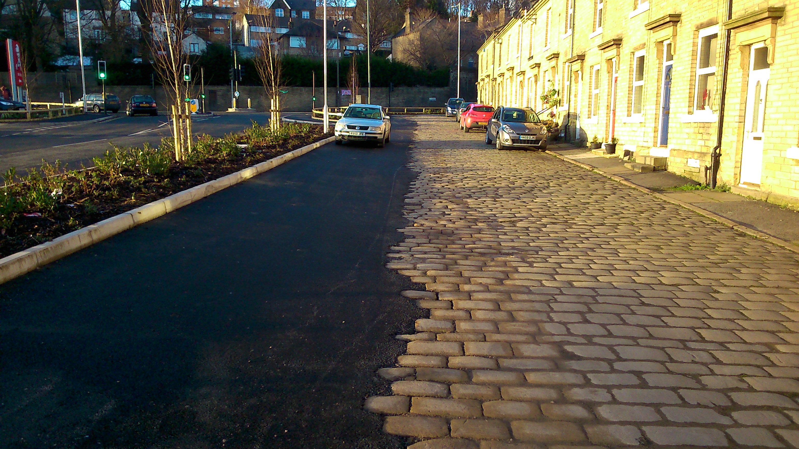 The extant cobbles have been left in place, but the remaining width of the road has simply been blacked over in a manner that looks — quite frankly — bizarre. One can well imagine why residents are not happy about this. What had been discussed and agreed was that the cobbling here would be restored by removing the remaining cobbles from the road running across the bottom end of the houses (since this was to be “pink” = tarmac). But as you can see from this photo taken next to Margaret’s house, those cobbles too have been left exactly where they were, and the new tarmacking has simply skirted around them in a very unsightly way…
 This kind of finish is clearly not what was agreed. But then nor is the image below… If you’re looking out from the front doors of the even-numbered houses on Lower Holme, what you’re looking at is KFC…
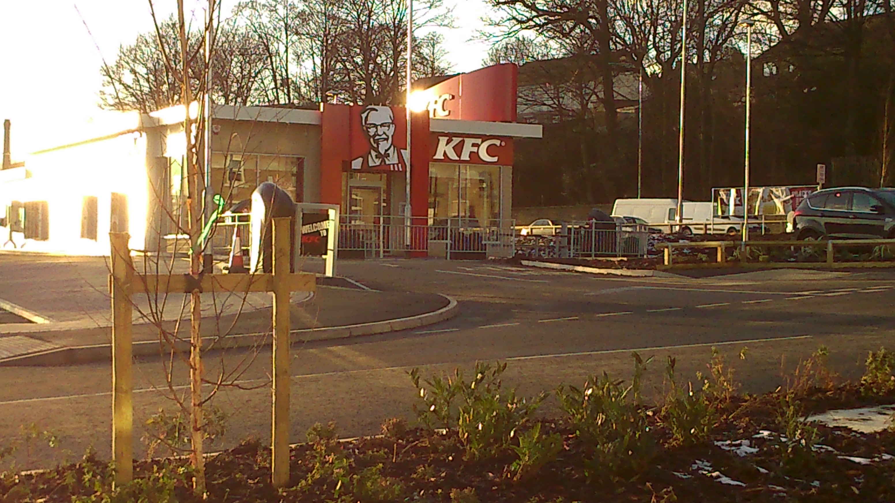 The small shrubs planted in the dividing area, and the few spindly trees, do not in any way constitute the masking hedge that was promised by CDP. That “hedge” is clearly marked on the diagram above, all nice and thick and bushy (!), and I specifically recall promises from James Marshall at the meetings recorded on this blog that this masking (to consist of trellising with climbing plants, as I recall it) was to be at least six feet high — to prevent residents having to look at KFC, and indeed to prevent KFC patrons from staring across into the residents’ homes. This has not happened. A particularly distressing consequence of this lack of effective masking is that residents are left exposed to the full glare of KFC’s massive night-time halogen lamps…
 Again, my record of the 2012 meetings clearly indicates that residents raised concerns very early on about light pollution as well as stray litter from KFC. James Marshall gave what I documented as “sensible” assurances that these issues would not be a problem, because of measures planned in. But despite these assurances, both light pollution and litter are already an issue for the residents… Indeed, note Heather and Les, something about the way the wind blows around the site means that KFC litter has begun accumulating outside their own front door, even though they live on the odd-numbered side, facing away from KFC…
The good news is that many of the concerns residents have can still be effectively addressed. The earth pile can be removed. Proper fence masking can still be installed. Signage can still be put up at either end of the residential street to indicate “Residents Only” (at present people are driving around it as a rat-run, just as had been feared). Decent locks can be installed on the KFC bins to stop lids coming off and stuff blowing around (the litter Heather has retrieved has included the blue hairnets worn by staff… clearly not dropped by littering pedestrians!).
But of course, the tarmacking and cobbles issues are altogether harder to remedy at this point. And that road down to the River Aire, the most neglected part of the site, which CDP apparently never planned to do anything about – on the grounds that it is someone else’s responsibility – remains neglected and too easily flooded. Come in Bradford Council, your time is up…