“Working with nature” on Higher Coach Road


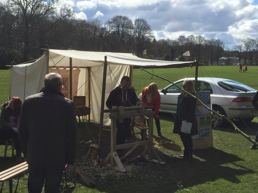
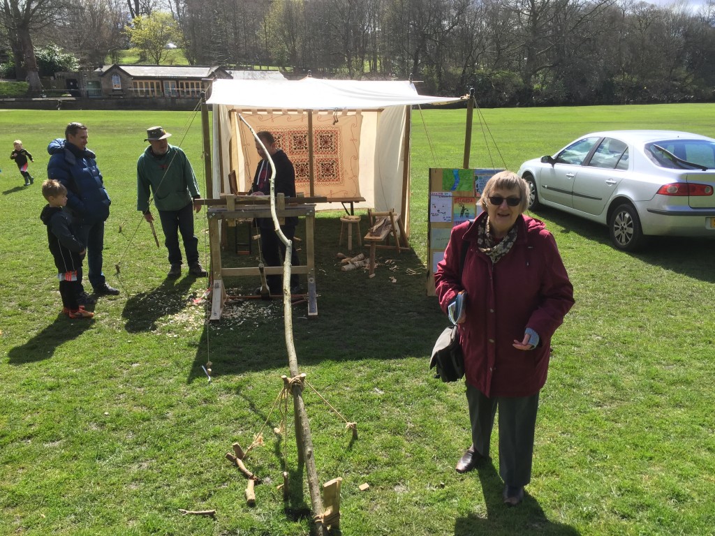
This was the scene in Roberts Park, yesterday, as members of the Higher Coach Road Residents’ Group contributed to Saltaire’s World Heritage Weekend with a demonstration of the traditional skill of wood turning…

IMG_0828

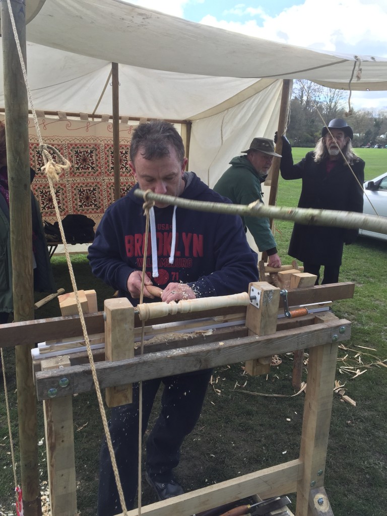
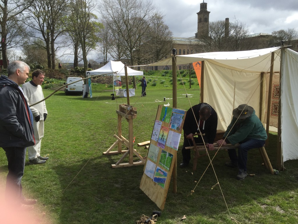
That’s Craig at the pole lathe, which is powered entirely by manpower (he’s working a pedal that pulls down a carefully sprung wood branch — in shot here — to turn the pole back and forth rapidly. Behind Craig is Stewart (HCRRG’s Chairman) who spent the afternoon at the “bodger’s bench” (see below), rough-cutting sections of wood for Craig to work on the lathe. That rather refined looking chair leg had started out earlier as a rough lump of wood retrieved from leftover timbers. (Also in shot above is Rob Martin, of Saltaire Stories — one of the organisers of World Heritage Weekend.)

IMG_0815Here Stewart and Craig are observed by Paul (Kirkgate Centre) and Steve (also from the residents group). Located alongside the Canal and River Trust’s display of dummy mooring posts (for practising roping off), the wood-turning demo attracted a steady stream of interested passers-by during the afternoon.

Untitled from Steve Bottoms on Vimeo.

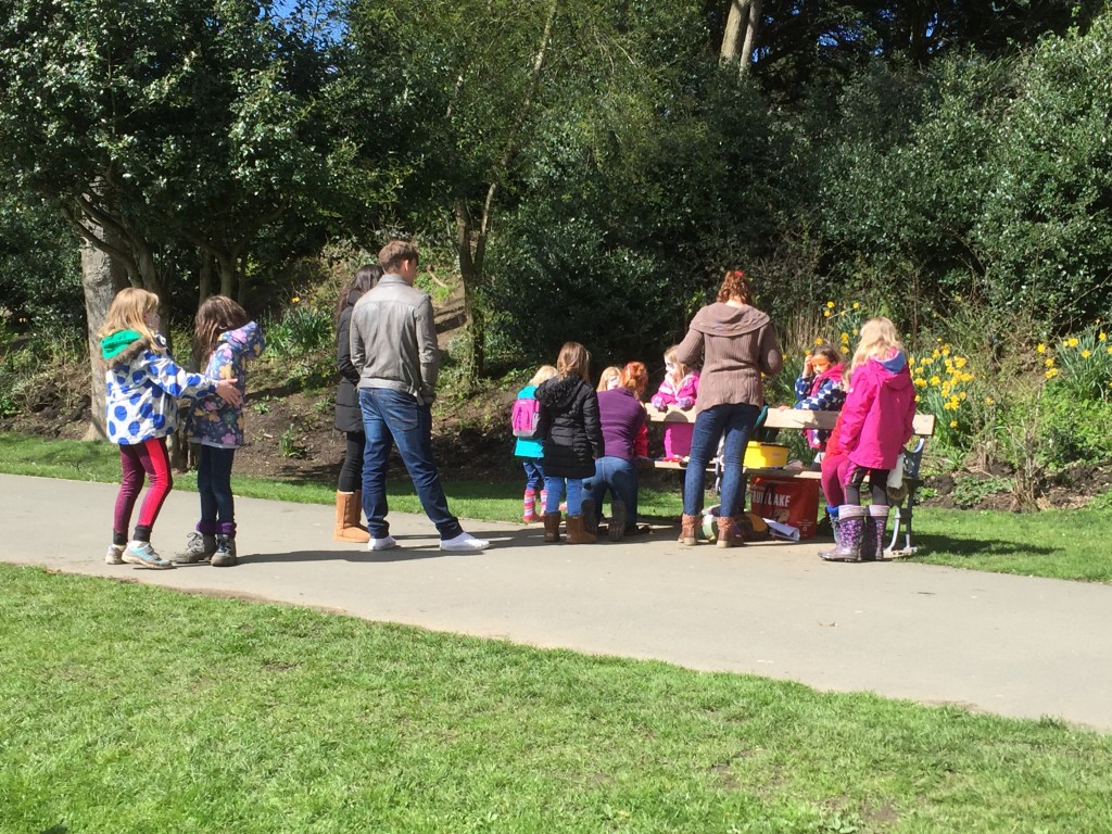
IMG_0833The idea here was to showcase an older piece of local “heritage” than is normally on display at the Heritage Weekend (which is, quite rightly, dominated by Saltaire’s Victorian-era legacy). As Stewart says, skills of this sort would have been used in the Aire valley for many centuries, as people worked with the available resources — wood, water, and so forth. Complementing the craft display, local storyteller Irene Lofthouse (on the left below) presented some traditional myths and legends for an audience of intrigued children – and some of their parents – while musician Eddie Lawler and I worked up verses to a song that only had a chorus (“Welcome to Our Airedale Home”) by asking passers-by for ideas.

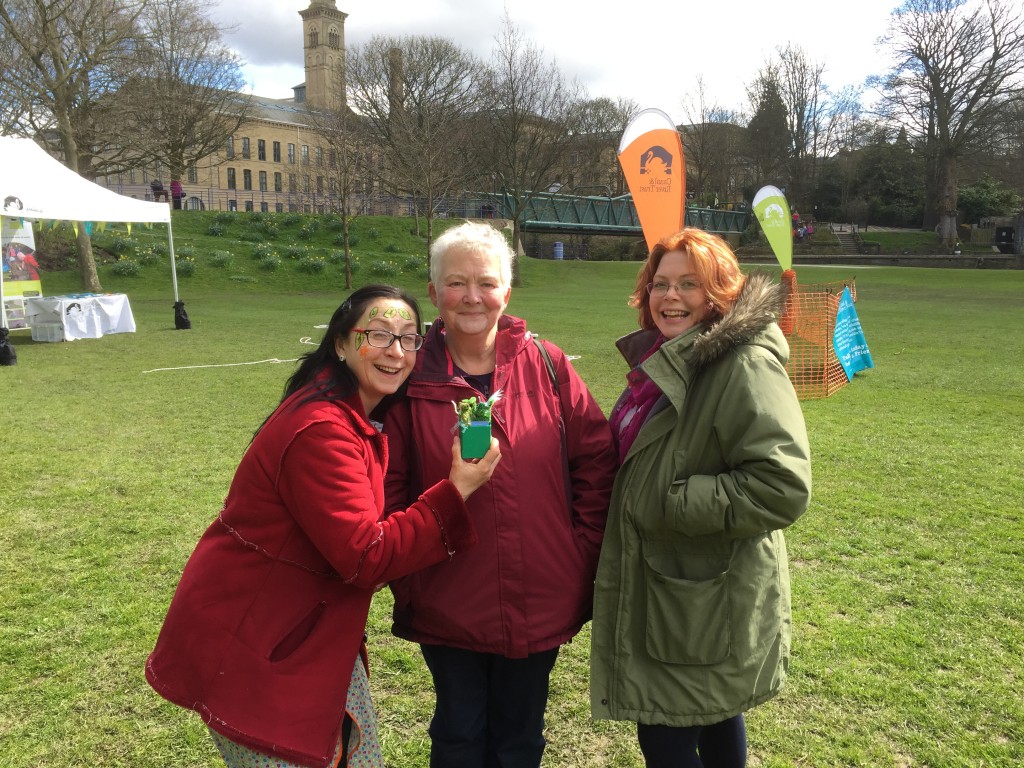
Irene Lofthouse, Pat Gledhill, Lyze Dudley

Irene Lofthouse, Pat Gledhill, Lyze Dudley

As you can see from Irene’s face, we also had face painters on hand for the kids – specialising in designs on the theme of woodland and water… Steph and Lu, friends of HCRRG’s Facebook page convenor Ruth, have just started up in the face-painting business, and they certainly had plenty of custom yesterday!

IMG_0831

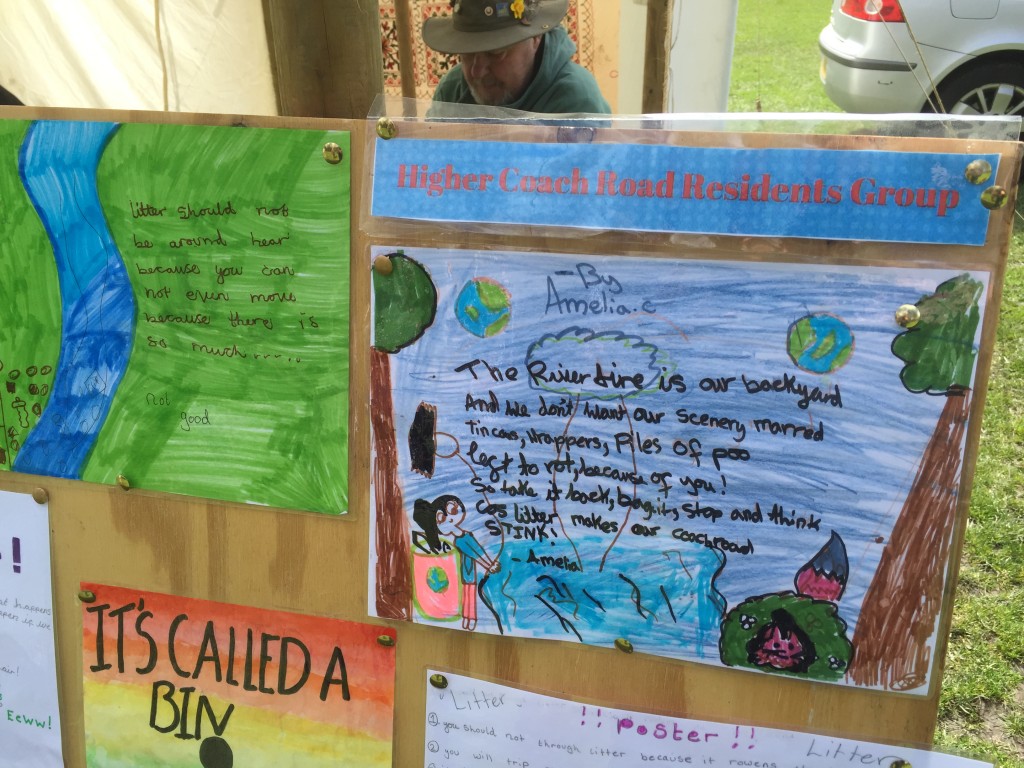
Meanwhile, some of the children from the Higher Coach Road estate were also represented by a display of anti-litter posters they had designed for a competition arranged by Ruth. Since the posters featured both artwork and words, they were judged by Irene (a published poet) and Saltaire artist David Starley, who was also on hand. Amelia’s entry, below, was my personal favourite…

IMG_0810

Later in the afternoon, when we had packed up in the park, I took a stroll west along the flood plain area next to the park — and adjacent to the Higher Coach Road estate — where some intriguing changes have been taking place lately.

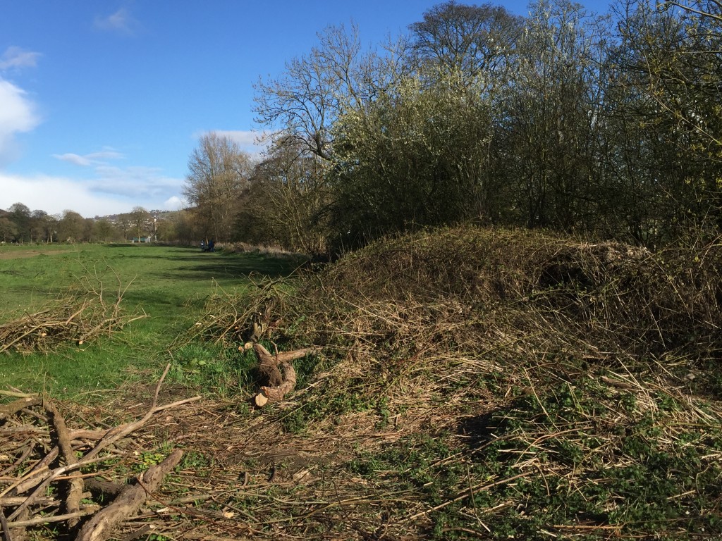
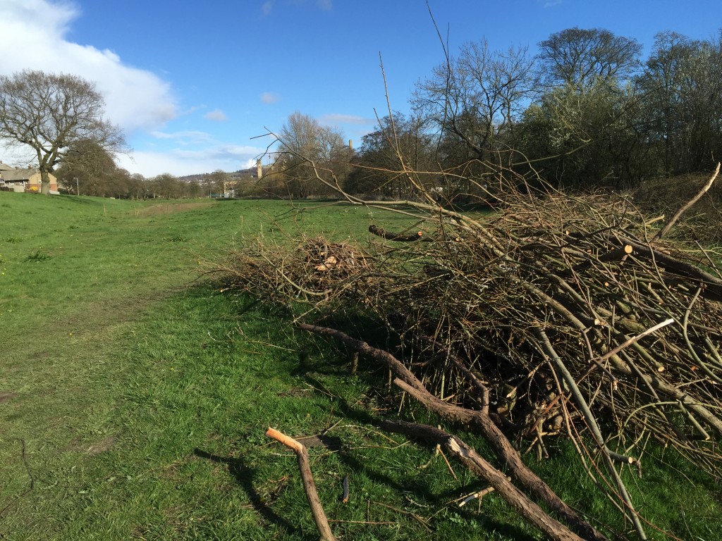
At the behest of the HCR Residents Group, horticulture students from Shipley College (course leader, John Baker) came in to work on an overgrown mass of riverside willow – near the footbridge – that had been left to its own devices for years. Under the supervision of Samantha Yates, the students neatly coppiced sections of the undergrowth, and cut and cleared others.

IMG_0853

There’s quite a lot of wood debris to be cleared away, but John Dembecki (Bradford Council parks service) has apparently promised that it will be gone by next week. In the meantime, it sits on the grass as evidence of just how much work needed to be done here!

IMG_0866

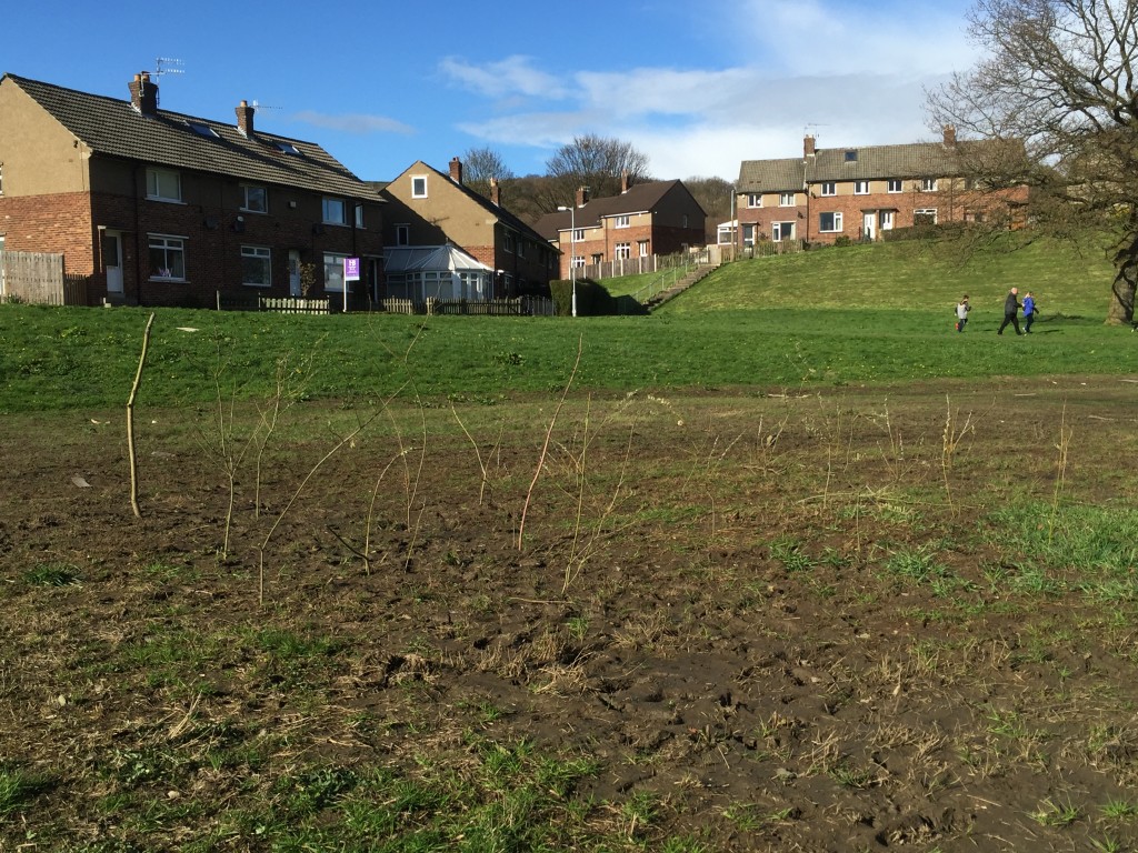
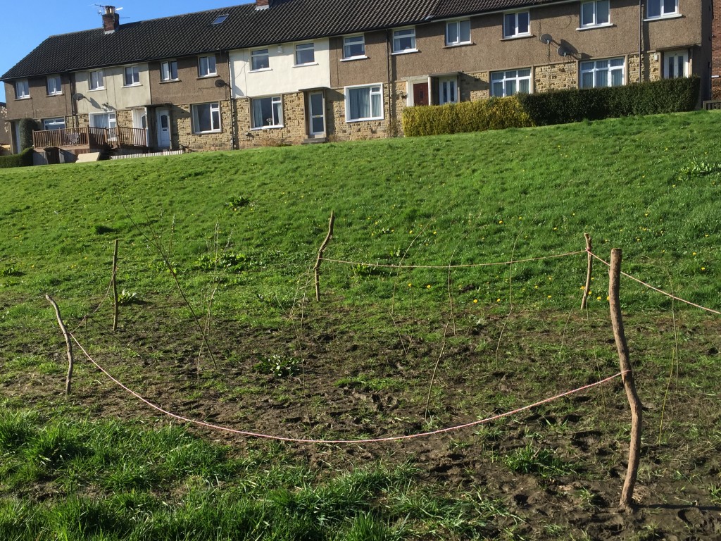
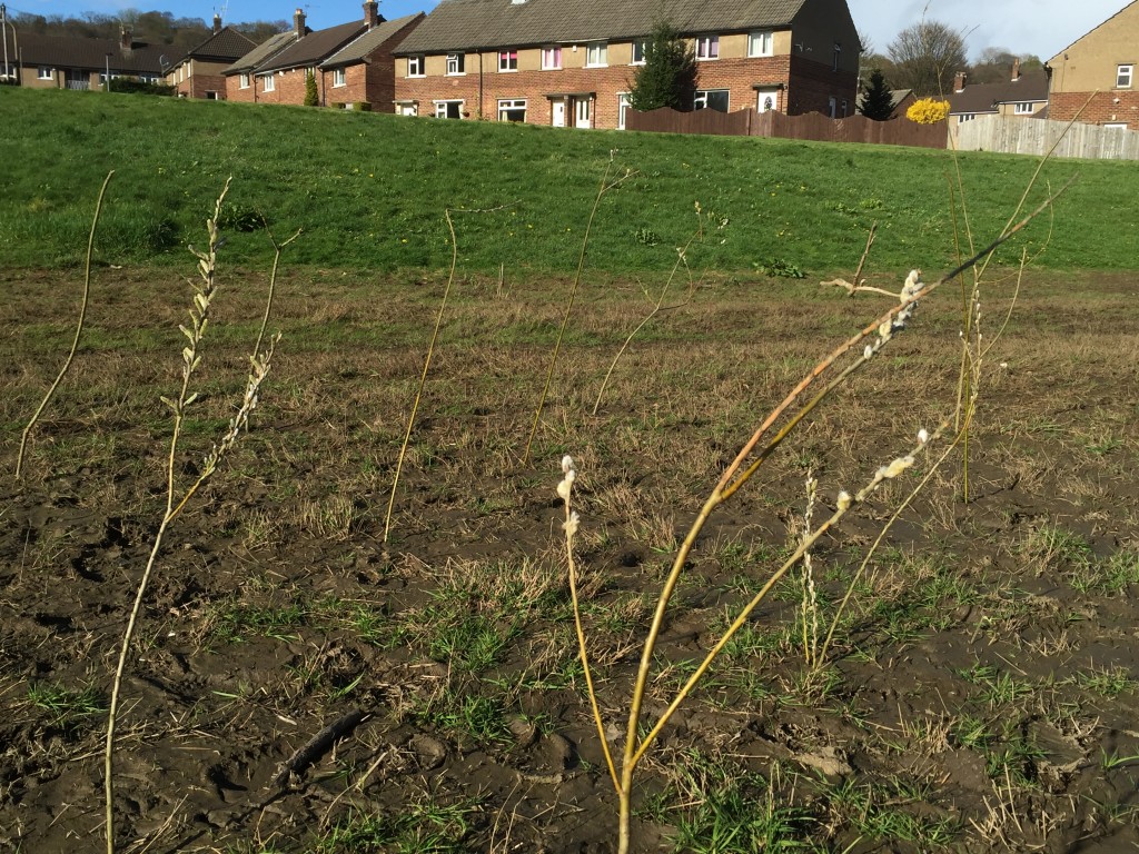
Intriguingly, though, this is not just a story of overgrown willow being cut back. With advice from Graham, of Hirst Wood Regeneration Group, members of HCRRG have taken saplings from amongst the cleared wood, and planted them in the flood plain area itself, in a series of neatly grouped areas…

IMG_0839

IMG_0849

Admittedly, these newly planted trees don’t look like much just yet, but they will — because it’s clear that a good many of them have “taken” in the soft ground, and are already starting to bud.

IMG_0844

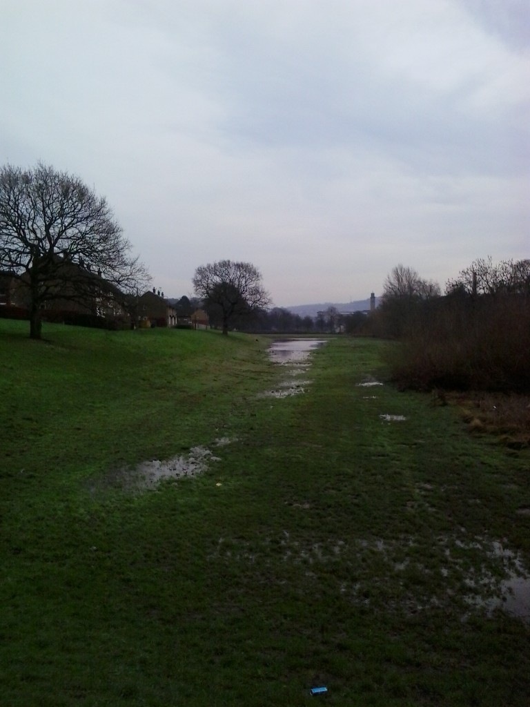
The idea here is not only to add a new visual feature to the grassy flood plain, but to bring a little further assistance to the ground’s water retention. Until very recently, the muddy area you see in the picture above was still a giant puddle, retaining water that had built up during the exceptionally wet weather of November and December (the puddle was there before the Boxing Day flood, and long-outlasted it!). But tree roots will help to soak up some of the moisture, and hopefully to further stabilise the ground.

IMG_0870

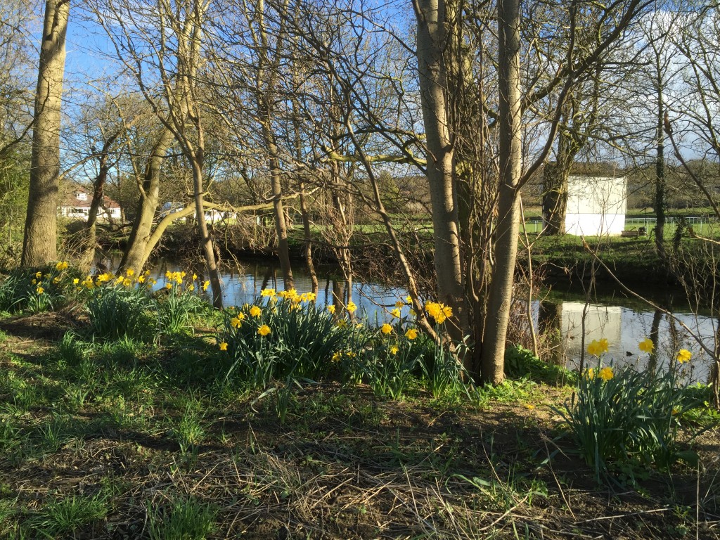
Yet another “new” feature along this riverside stretch is the “host of golden daffodils” that have sprung up this spring, along the banks of the Aire itself. These were not planted by HCRRG, but appear to have grown up from dormant bulbs that must have been in the ground for years. The reason they have come up now appears to be that the Boxing Day flood swept away a large amount of dead brushwood from the riverbank, leaving the ground clear for new growth.

I joked to Pam Ruppe (HCRRG’s treasurer – pictured below in the park) that nature seemed to be lending a hand with the work that the group has been doing recently. “Well,” she responded, “you could say that we’re working with nature.” And indeed you could — whether it be coppicing, willow-planting or Craig and Stewart’s “sustainable” woodworking, this does seem to be the theme to a lot in a lot of the group’s activities. Although less than a year old, Higher Coach Road Residents’ Group has already established a clear sense of purpose and identity.

IMG_0822

“It was a beautiful day…”

We’re two months on from the post-Christmas flood, and in 3 weeks time (20th March) the Multi-Story Water team will be hosting a special event called After the Flood at Kirkgate Centre, Shipley… a community conversation to discuss what happened on Boxing Day and what has happened since in terms of the very positive public response. Official details are in the previous post to this one… But this blog reflects a little on the theme of after the flood, by presenting some images taken on the day after Boxing Day — December 27th….

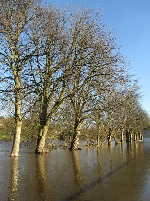
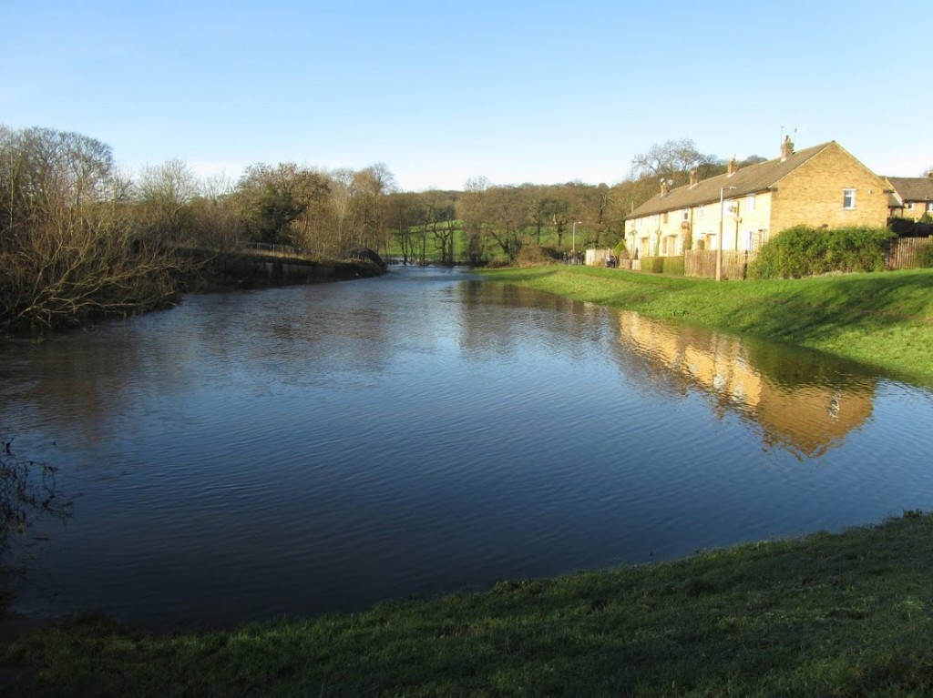
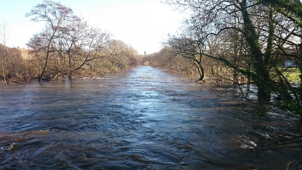
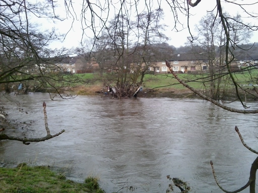
IMG_4531The pictures here were all taken by Martin Spiers, who lives on Bowland Avenue – on the Higher Coach Road estate – and are shared with his permission. The shot above shows the riverside trees along that stretch, suddenly standing in the middle of a much wider river. And the shot below looks back to the row of houses where Martin lives…

IMG_4492As in the shot of the trees, the blue sky, sunshine and reflections in the now-calm water make for quite a beautiful picture. Discussions about the flood have – quite rightly, focused on the miserable conditions in the days and weeks leading up to it – but it is worth remembering, too, that on December 27th the weather was stunning. I’m reminded of a lyric in U2’s song “Beautiful Day” (with its glancing reference to the story of Noah’s Ark): “See the bird with the leaf in her mouth / After the flood, all the colours came out…”

DSC_0042

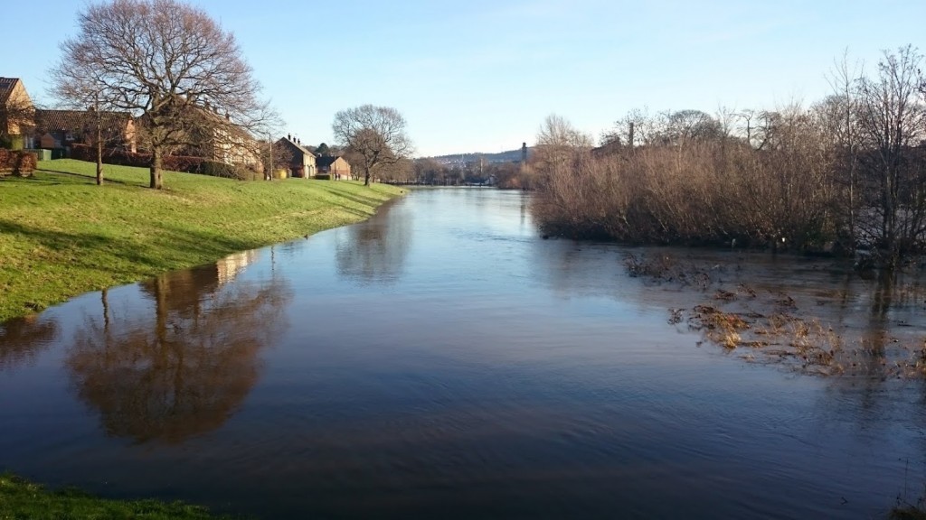
(This shot is the reverse view to the one above, looking east towards Saltaire….)

Let’s not underestimate just how much difficulty the flood caused for some. But it is worth remembering, too, how “the colours came out” — not just literally but metaphorically, as local people showed their best colours, and voluntary flood support groups spontaneously organised themselves through social media, both in Shipley/Baildon and just upstream in Bingley…

DSC_0077

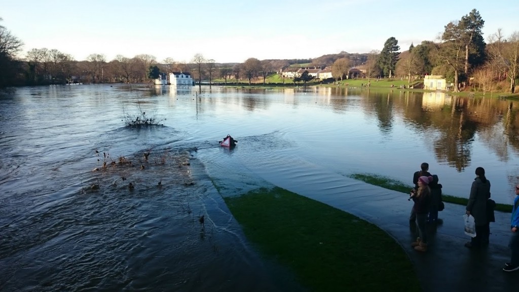
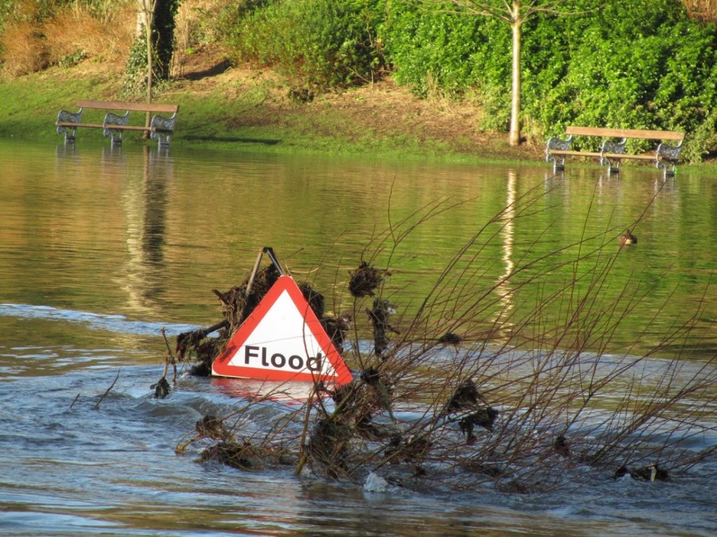
This was the view downstream in Saltaire, looking out over the Roberts Park cricket pitch. Rather wonderfully, there was even a strategically placed sign, stating the obvious… But I choose to read this is as further evidence of that general urge people had to help and inform each other…

IMG_4617

Below is another, oddly romantic view across the cricket pitch, this time taken from the other side of the river, looking over towards Half Moon Cafe (which the day before had been several feet under).

IMG_4589


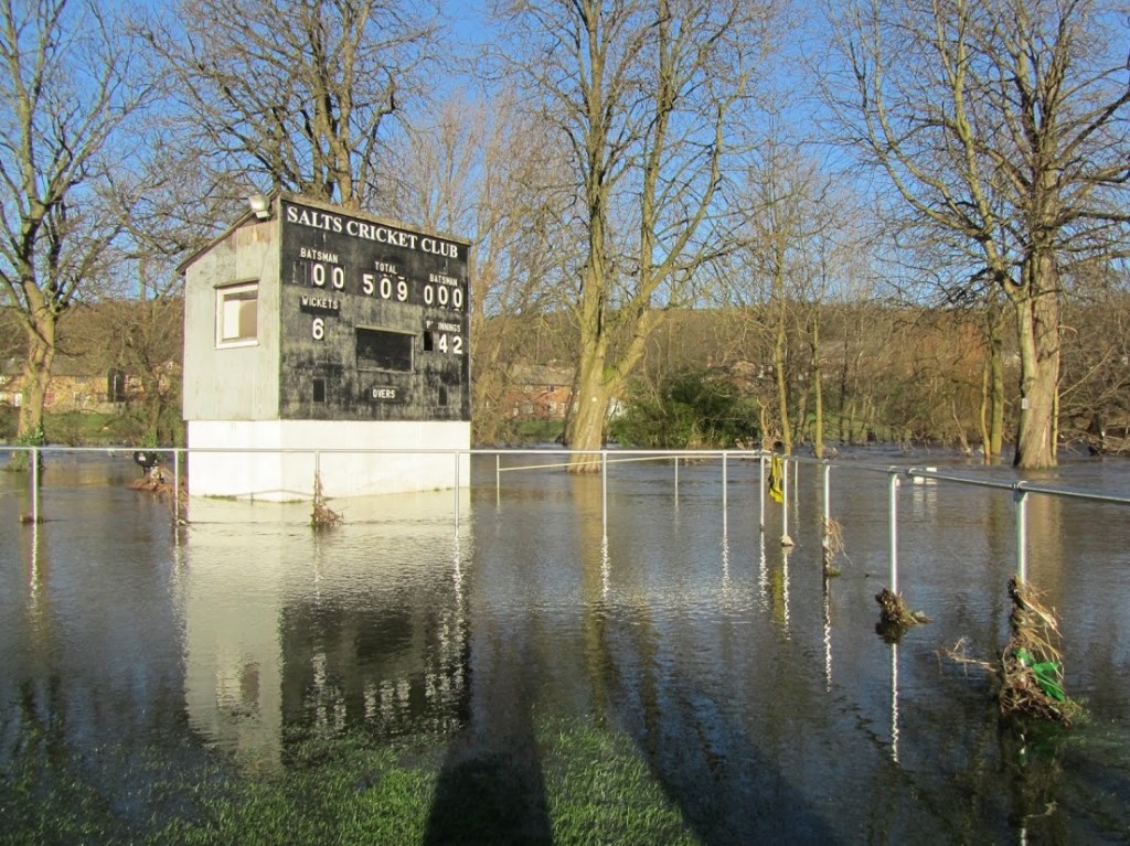
Further along on the south side of the river, heading back west, the Salts Sports cricket pitch was also still under water on December 27th…

IMG_4542

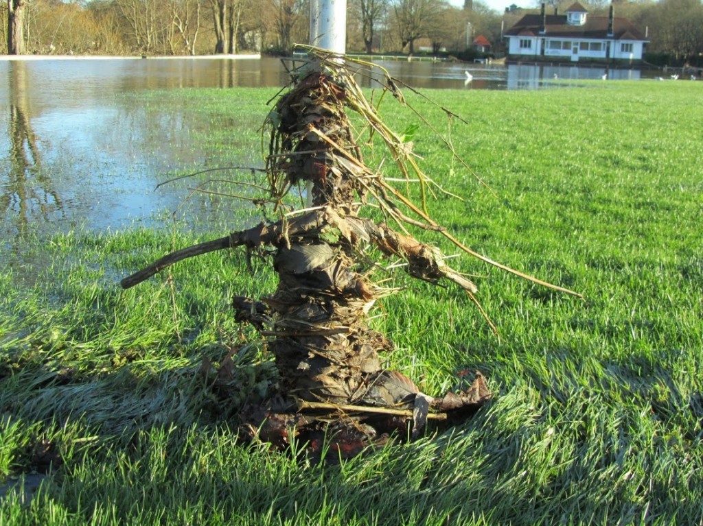
… But notice the debris that had collected on the railings to the right of the picture above… Martin also snapped the fantastic picture below, of one particular railing where the an almost human figure seems to have been created by the flood. Let’s call it Denis… (the Water-man)

IMG_4543Maybe the flood has made us all water-people. If you believe the scientific predictions for climate change, this kind of thing is going to happen more frequently in future. The question is how we respond… And in many ways the public response since the flood has been amazing — in the way people have volunteered not just to help the people worst affected by the flooding, but to pitched in with clean-ups of the debris left by the water. Can this kind of energy and enthusiasm be sustained in positive ways into the future?

“It was a beautiful day… Don’t let it get away…”

DSC_0044


Hirst Weir and Debris Removal Initiative: updates

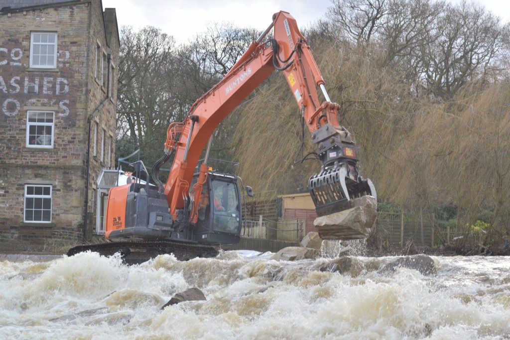
A short-ish post this, to keep the blog up to date on some recent developments… Further to my post about Hirst Weir a couple of weeks back, work is now well underway on repairing the breach, as this photo nabbed from a recent Telegraph and Argus story shows…

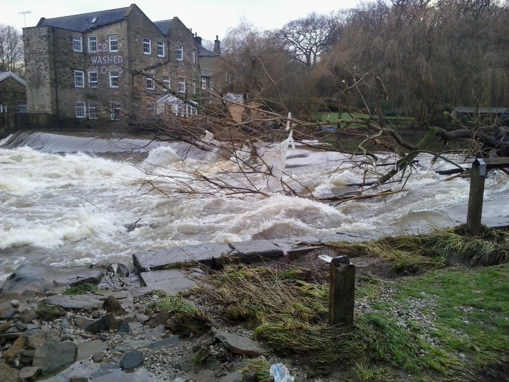
Hirst Weir repairs wAnd as you can see, the heavy machinery is in, er, full flow. In my previous post on this, I erroneously suggested that — because the breach in the weir is out in the middle — it was too far out for excavators to get to, and that the repairs would have to be handled manually. But the repair scheme is (of course) much cleverer than that. As Geoff Roberts, of the Aire Rivers Trust, explained to me a couple of days ago, the approach being adopted involves gradually working the machinery out into the river by laying big rocks ahead of it, onto which it can then move. They are constructing a massive “rock ramp” (with massive rocks) downstream of the weir, a full-river-width extension of the temporary repairs carried out on the Baildon side in 2012. This means that the river will flow more gradually downhill after coming over the weir lip, rather than crashing down on the river bottom. By building the rock ramp first, the contractors can then get themselves in a position to fill the actual breach in the weir itself as the final stage of the repair (using a more nuanced version of the same “stick in some rocks” strategy).

Geoff and the Aire Rivers Trust have been working over recent weeks with Bradford Rowing Club, which owns the weir, on two key things:

(1) to raise the money as quickly as possible to carry out the repairs. Between them, they raised the shortfall of £30,000 in two weeks flat, partly through crowd-sourcing. Amazing!

(2) ensuring that the new rock ramp weir will be laid so as to allow fish to travel upstream by slipping between the rocks. This is instead of a more heavily engineered fish pass solution, but is also much cheaper and, arguably, more “natural”. Geoff told me that the Rowing Club’s much more expensive plans for a permanent design solution to the weir, for which they were raising money last year (target: £600,000) have basically been shelved and superceded by these emergency repairs, but he seems confident that the new solution might even work out better in the long run.

Geoff also mentioned that Buntons, the contractors carrying out the work on the weir (who also did the 2012 repairs), are doing so on a costs-only, not-for-profit basis. This is just one more example of the amazing spirit of generosity and community co-operation that has characterised so much of the public response to the recent flooding. Speaking of which…

12640453_1269057376443563_3066255554316192284_o

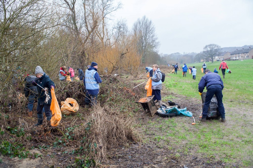
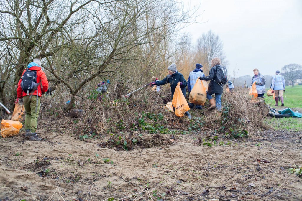
This was the sight last Sunday, January 31st, on the Higher Coach Road stretch of the Aire riverbank (downstream of Hirst Weir). Thanks to the tireless cajoling and publicising of Mat Holloway and his Aire Debris Removal Initiative (ADRI), around 75 people from all around the district turned out on a damp morning and — starting from the cricket pitch at Roberts Park — worked their way west for two hours with litter pickers and rubbish bags supplied by the Council…

12605429_1269057369776897_5035669100109396234_o

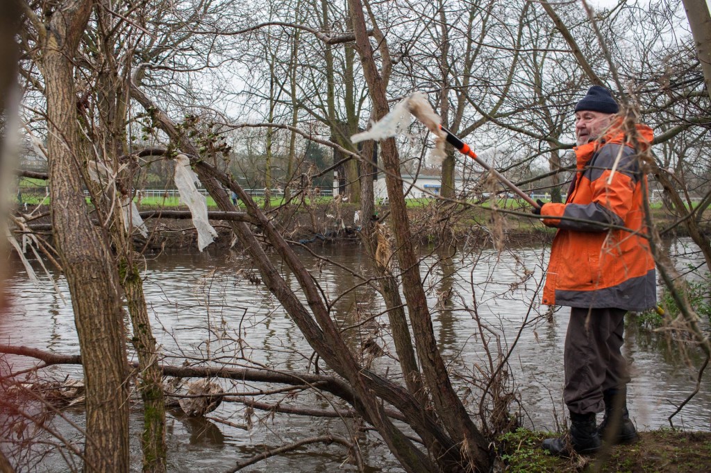
These pictures are taken from ADRI’s Facebook page, which is very active and full of images and news updates (I can’t keep up with them!). And there are new connections forming too, between different groups… Pictured below is Stewart Gledhill, chairman of the recently-established Higher Coach Road Residents Group, plucking a particularly large piece of plastic debris from the riverside trees…

12628399_1269057383110229_4738135556817538399_o

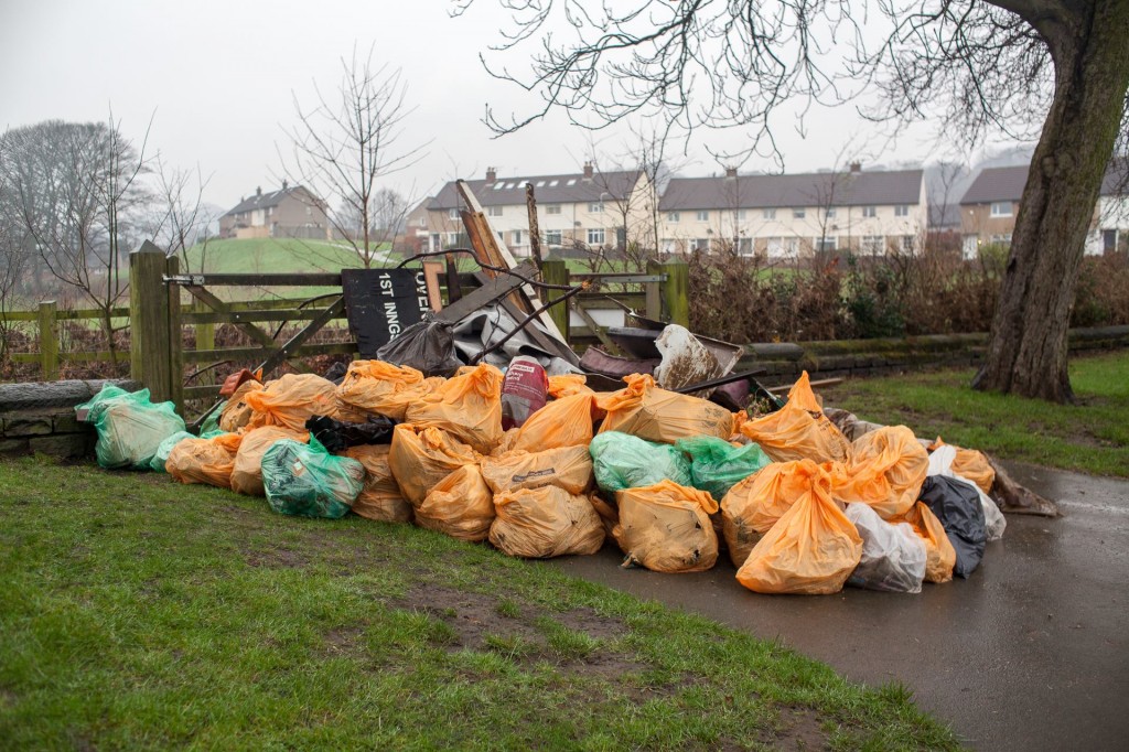
In a matter of just over a couple of hours, the Debris Removal task force collected over 100 bags of debris! Here’s a bunch of it left for collection at the Roberts Park end…

12615442_1269057646443536_6128792064856253518_o

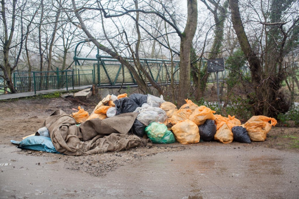
And here’s a bunch more left for collection at the far end of the Salts Sports site, by the footbridge across the Aire…

12604849_1269057593110208_5406968391414570274_o

All of the bags were then swiftly collected by the Council trucks, and a job had been well done! Well done to everyone involved (I’m just sorry I couldn’t be there myself), and good luck to Mat and ADRI in organising further clear-ups. Unfortunately, the session scheduled for today, Sunday 7th June, down in the Buck Wood area near Denso Marstons Nature Reserve has been cancelled as a precaution, due to the persistent rain this weekend making the ground soft and treacherous underfoot. But hopefully the momentum can nonetheless be maintained into future weeks…

One month on – Flood recovery in Lower Baildon (pt. 2)

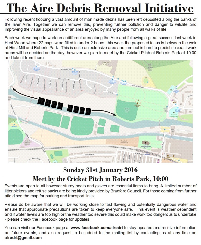
So part 1 of this blog entry (posted yesterday) was mainly concerned with the area just upstream of Baildon Bridge. This one moves further upstream to the Higher Coach Road area — where tomorrow, Sunday 31st January, weather permitting, the “Aire Debris Removal Initiative” will be leading a clean-up along the riverbank…

ADRI jpeg

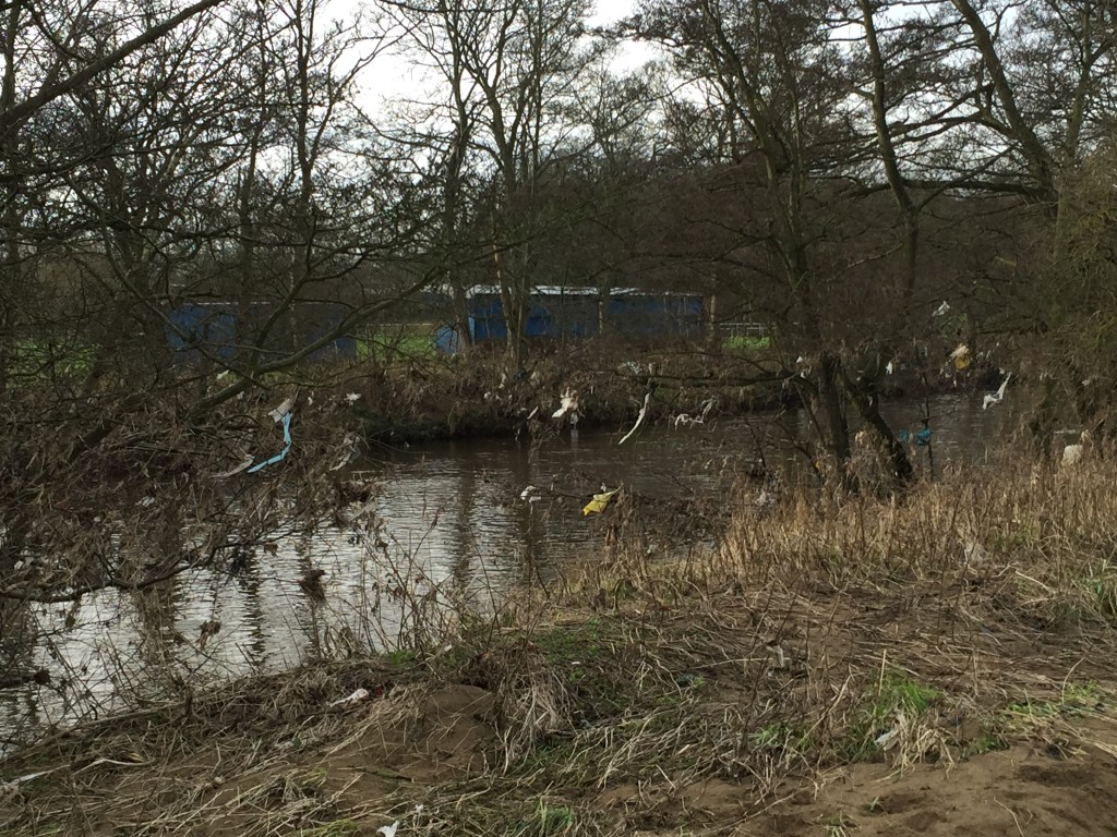
One of the really remarkable things about the public response to last month’s flooding has been the way people have used social media to self-organise support groups and now clean-up groups. And the riverbank on this stretch certainly needs some TLC. At present it is littered with debris that was carried by floodwater and caught on trees and bushes — in fact you can clearly see the line that the water came up to…IMG_0507The tricky part here, of course, is that a lot of the debris is caught in branches and suspended out over the river itself, making safe retrieval quite challenging. Let’s hope that AireDRI has some appropriate picking equipment (possibly loaned by the Council, who are also keen to support these voluntary initiatives with appropriate resources). I’ll be keen to talk to some of the organisers of this initiative, as part of Multi-Story Water‘s gathering of thoughts and reflections on the flooding (a process we’ve begun over the last week or so — see previous blog post). There is also some excellent reporting going on elsewhere of course, such as this “one-month on” piece in the Saltaire-run Bradford Review (which features the thoughts of, among others, the wonderful Billy Ricketts, volunteer groundsman at Saltaire Cricket Club… starting point for tomorrow’s clean-up).

IMG_0499

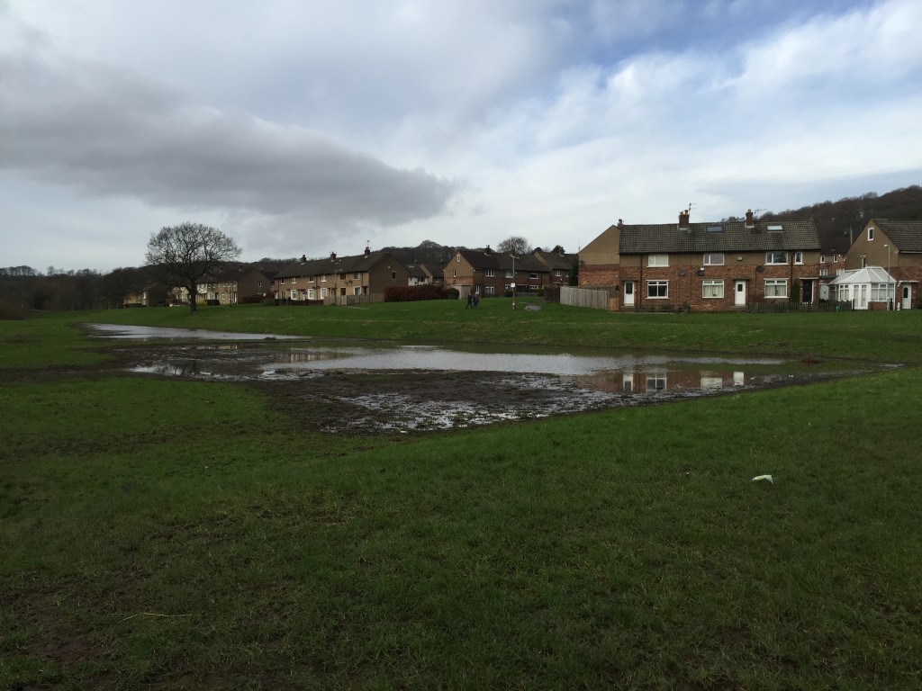
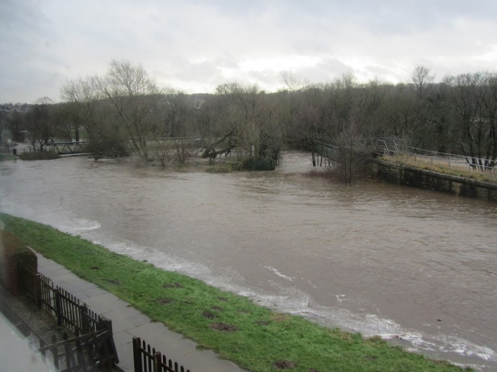
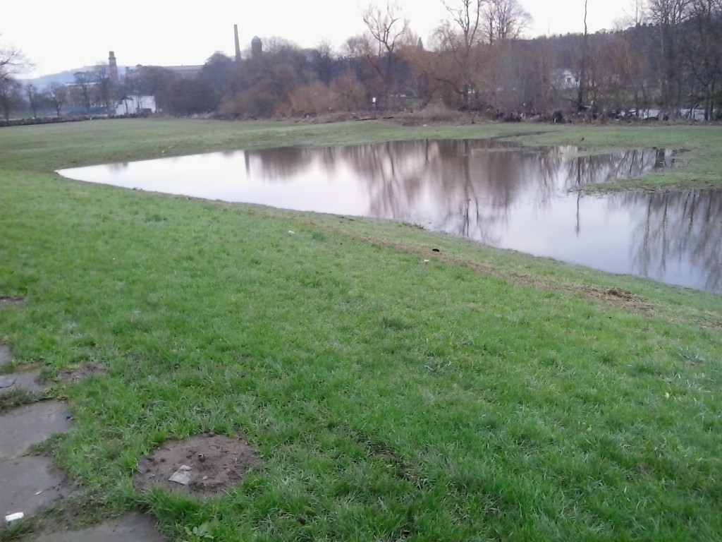
There is still quite a substantial quantity of water sitting on the grassy flood-plain area next to the river at Higher Coach Road. The field was looking like this through much of December though, so this water is not – as such – a remnant of the Boxing Day flood. Rather, it’s indicative of just how wet the ground was, and remains, and why the excess water at Christmas thus had nowhere to go but places it wasn’t wanted. This is, of course, still a risk if we have further severe weather.

Thankfully, though, the residents of the HCR estate remain pretty confident that they won’t be directly affected in their homes, at least. On Boxing Day, just as during the last major floods of October 2000, the water came up almost as far as the fronts of people’s houses on Bowland Avenue — at the furthest, westerly end of the estate — but did not actually make it to their front doors. And since these houses were built, quite deliberately, with no basements, there is no damage there either. As Ruth Bartlett, who lives in one of the houses on Bowland, remarks: “I’m really very grateful to the people who built these houses [in the 1950s], because they knew what they were doing. The water stays where it’s meant to — on the field.” This was the view from Ruth’s bedroom window at 1.45pm on Boxing Day, when the water level was still rising…(with many thanks to her for sharing)

Like others I’ve spoken to, Ruth had been away for Christmas Day and returned to her home on Boxing Day, unaware of the chaos awaiting her. Her first indication of trouble was when she found Baildon Bridge closed to traffic, and had to go all the way round via Apperley Bridge (which was also later closed) in order to get home. On Boxing Day evening she simply went to bed upstairs hoping for the best, and woke up the next morning to find the waters, thankfully, receding…

DSC_0035

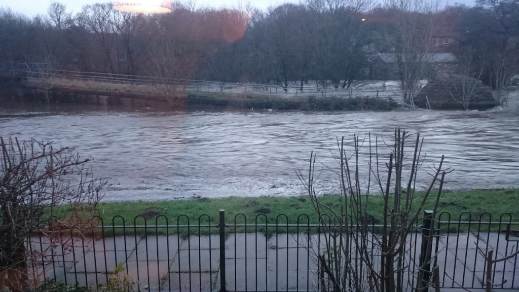
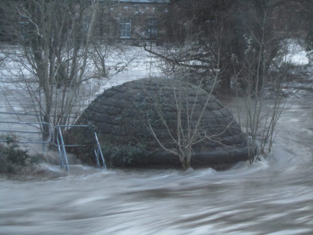
This was the view from a few doors further along Bowland Avenue — taken by resident Martin Spiers. You can see just how close the water was coming to the front gate… In the background is the dome base and curving structure of the Barden Aqueduct, which pumps water over the River Aire towards Bradford. This closer-up shot of the dome really captures the force of the water…

IMG_4402

And this wider shot from Martin’s house also shows how Barden Aqueduct, the adjacent Graincliffe Aqueduct, and indeed the footbridge across the Aire had all become simply structures sticking out of one huge, swollen mass of water…

IMG_4367

By the following morning, the sun had come out rather beautifully over the same spot… Here Martin is looking back to the houses on Bowland, from the path to the footbridge.

IMG_4492


In this next shot, we’re looking back towards the same buildings (and the ones behind them), but this time from the opposite direction — over at Bradford Rowing Club. Just look at this fence, thick with flood debris…

DSC_0116Tomorrow’s clean-up is much needed (and further work will be still be needed), but interestingly Ruth has quite mixed feelings about the volunteer groups that have been sprung up to address the various effects of the flood. The pro-active community spirit, she says, is brilliant (and Ruth is herself an organiser in other voluntary causes), but she also worries that it might be allowed to simply substitute for action that local and central government should be taking to protect and support communities at risk. Is this what David Cameron’s “Big Society” looks like? Will flood-threatened areas simply be expected to rely on their own initiative and resilience in future…?


After the Flood: Higher Coach Road and Salts Sports

Saltaire 28 Dec 15 025

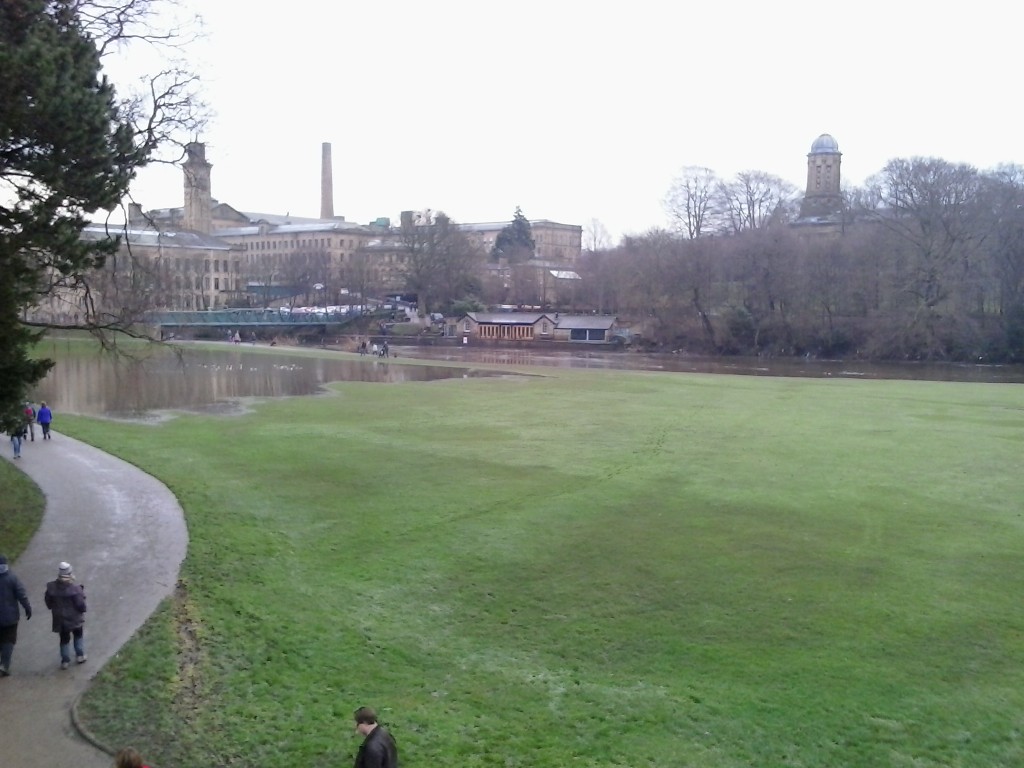
This was the scene this morning in Roberts Park, Saltaire. The Cricket Pitch is no longer a lake, with the river having returned to its normal boundaries… There’s just a great big puddle on the slightly lower ground nearer the footbridge. Much the same is true to the west of the park, on the Higher Coach Road estate…

Saltaire 28 Dec 15 022

Saltaire 28 Dec 15 013All of the pictures in this post were taken by Eddie Lawler, who asked me if there was anything I’d particularly like pictures of. I said that, amongst all the images I’d gathered for this blog in the last couple of days, I hadn’t really seen any from Higher Coach Road… so off he went! Thanks Eddie. (I’m in Manchester and it hasn’t really been safe to travel to do my own eye-witnessing…)

The high watermark for the flood is pretty clear from the lines of light debris left behind on the banking up to the estate’s houses…

Saltaire 28 Dec 15 021

Thankfully, it looks like the water didn’t get as far as the houses, although at the far end, the houses on Bowland Avenue (physically the lowest on the estate) had a close shave…

Saltaire 28 Dec 15 014

Note the line of mole hills that appear immediately above the waterline… The moles have clearly been pushed uphill by the water! And that water keeps on coming… The river is back within its bounds, but look at the flow rate over Hirst Weir…

Saltaire 28 Dec 15 017

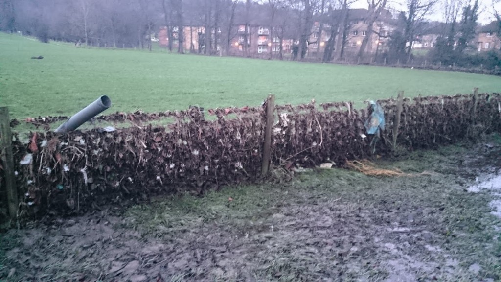
Note the debris in the tree here, and the snapped fence post…

Crossing the footbridge to the other side of the river, Eddie made his way back to his home in Saltaire via Salts Sports. This is the view back to the Coach Road estate from the far side… again, lots of debris in trees.

Saltaire 28 Dec 15 012

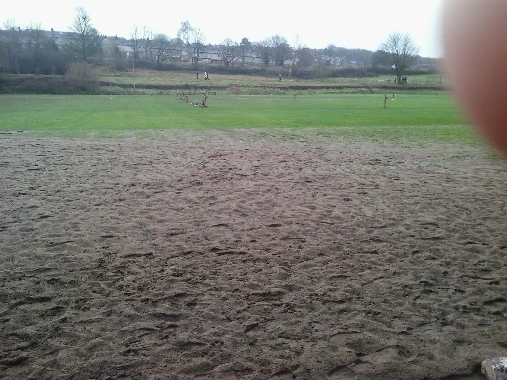
But turning around,  and looking up towards the canal, just look at what’s been left on the Salts Sports Cricket Pitch!

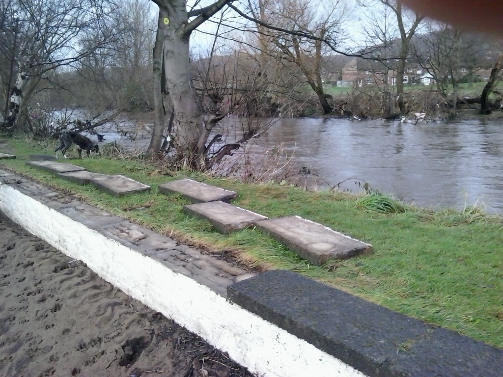
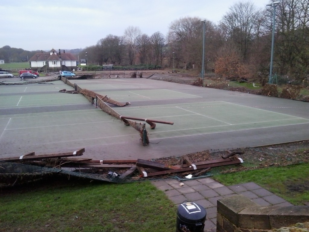
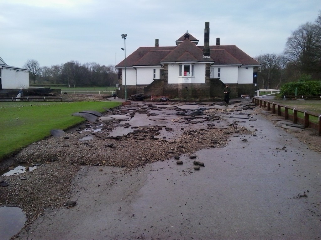
Saltaire 28 Dec 15 010That’ll clearly take some time and expense to clear up, but the more serious damage for Salts Sports has been done to the harder infrastructure. I’ll let the following images speak for themselves, noting only that the first one shows concrete slabs having been lifted off the wall and then dumped by the river…Saltaire 28 Dec 15 009Saltaire 28 Dec 15 001Saltaire 28 Dec 15 008

Of course, Shipley/Saltaire has got off lightly by comparison with some other places in this week’s flooding (Hebden Bridge and Mytholmroyd just keep suffering over and over, it seems). But for everybody’s sake let’s  just hope that the further rain forecast for the next couple of days doesn’t bring a reprise of the Christmas chaos.


Season’s Soakings

Well it’s less than a week until Christmas, and it is mercifully dry outside… and oddly mild for this time of year. The whole country is enjoying a little welcome respite from the seemingly relentless onslaught of rain and storms over the last few weeks, that resulted in particular devastation in Cumbria just 2 weeks ago. The town of Cockermouth, we learned, has now experienced “1 in 100 year floods” a total of three times in the last ten years. Something up with the maths there… and all this as “climate change” was again in the news as the nations of the world met in Paris at “COP21” to try to agree how to apply a sticking plaster to a self-inflicted wound.

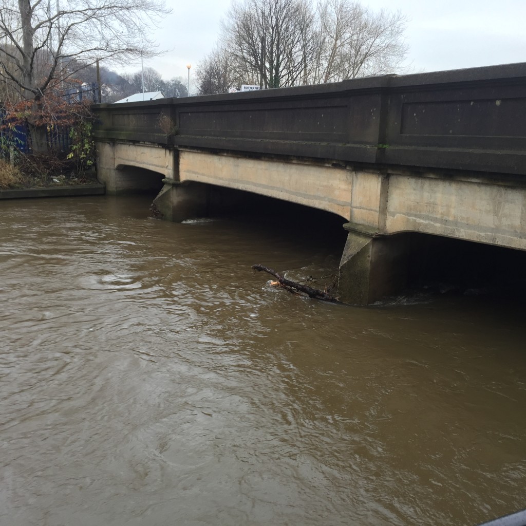
Closer to home, here’s a picture I snapped on my way to Baildon Woodbottom Working Men’s Club (for a Christmas party for Higher Coach Road residents — of which, more in a minute). Note how high the River Aire was, under Baildon Bridge right beside the club… (what you can’t tell, in a still photo, is just how FAST the water was moving!)
2015-12-13 13.38.27 HDR

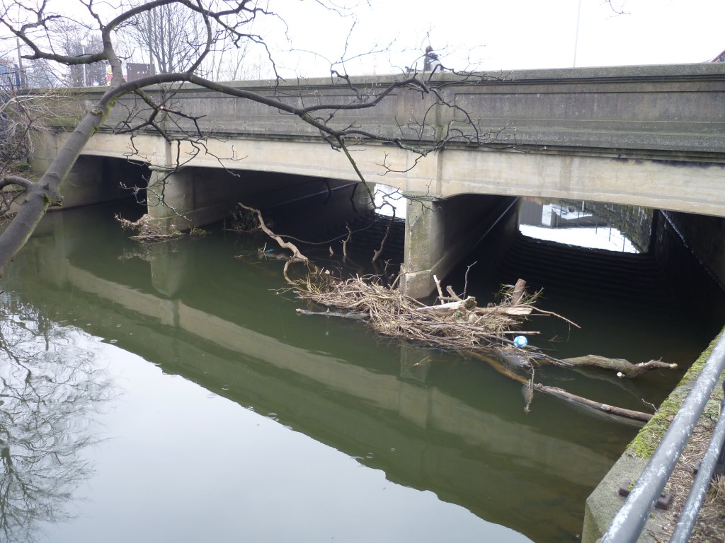
For the purposes of comparison, here’s an earlier photo of the river at normal flow levels, where a whole extra layer of the bridge stanchions is visible…
shipley & frizinghall 007

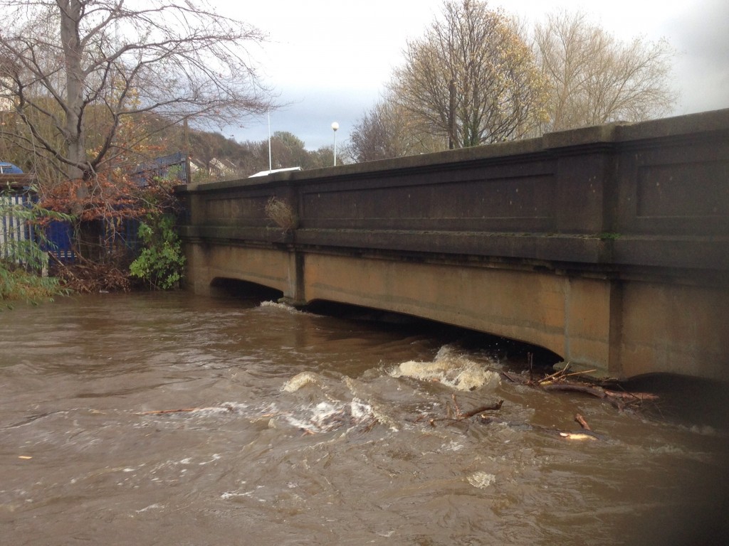
But club secretary Philip Moncaster assured me that the water level last Sunday had actually receded from where it was at the end of November. Here’s a shot of his own from back then, kindly donated for this blog…
Phil M image (3)

As Philip says, as soon as the river gets as high as the main bridge, there is big trouble, because that solid concrete wall acts as a kind of dam, forcing the river elsewhere. This was the major flooding pinch point in the Shipley area, in both 2000 and 1947 (the big historical flood incidents in living memory). And circumstances could have been worse, recently, if the debris in the river had been in greater quantity– as this can contribute to the damming effect across the archways. In heavy rain, of course, the softening of the riverbanks upstream contributes to the risk of older trees becoming dislodged and falling into the river…

Philip is a real “hydro citizen” (to use the term attached to our current research project) because he has taken upon himself the responsibility of trying to get the (supposedly) “responsible agencies” to, er, take responsibility for clearing debris from the bridge… He copied to me a series of emails he has sent recently, from which the following are the edited highlights:

NOVEMBER 30 (to John Anderson at Bradford Council): For several years now I have had problems contacting Bradford Council regarding clearing of debris from under Baildon Bridge Otley Road. Your staff are unaware that the council are responsible for this problem and I am constantly told to contact The Rivers Authority or Yorkshire Water or The Environment Agency. Your emergency planning team told me to contact The friends of The River Aire. I rang cleansing today who told me to ring Yorkshire Water but I was not prepared to be fobbed off again so I asked to speak to a supervisor. I was connected to Sarah Clark who told me The council were not responsible but I insisted she was wrong and eventually I was given your name (Sarah Clark was very helpful and very pleasant to deal with and she returned my call as promised). I was told that you have had ‘Jaggers’ of Halifax recently to clear trees from the bridge although I have been watching since my club flooded on 22nd November and nothing has moved since then. A large tree is wedged under one of the three tunnels of the bridge and is collecting debris all the time. This obviously restricts the flow of the river and causes me sleepless nights at this time of year.

Philip had clearly been given the run-around by ill-informed Council staff, although to his credit, John Anderson replied the same day:

NOVEMBER 30: Philip, The responsibility for clearing debris off bridges is not clear. Responsibility lies somewhere between the riparian owner (Bradford Council if debris is under the bridge) and Environment Agency (responsible for ensuring free flow). That said, Bradford Council’s Highway Structures Unit do clear the bridges on the River Aire and have done so for many years. I have asked our Bridge Inspector to visit the bridge and have arranged with Jaggers to remove the tree as soon as it is safe to do so.

Understandably concerned at Mr. Anderson’s admission that “the responsibility . . . is not clear”, Philip wrote to Shipley’s three Green councillors about this, and received the following from one of them, Kevin Warnes:

DECEMBER 11: I agree that the lack of clarity about who is responsible is ridiculous. We’ll check with officers and come back to you.

Meanwhile, Philip also wrote to the Area Manager at the Environment Agency:

DECEMBER 7:  FAO  Mark Scott Heres a copy of John Anderson’s reply to the email I sent last week. Is it true that the environment agency are responsible for ensuring free flow ?

No response…

DECEMBER 10:  Did you receive my email sent monday 7th dec? Your comments would be helpful.

This prompted a response of sorts…

DECEMBER 10: Dear Mr Moncaster, thankyou for your emails to Yorkshire Area Manager Mark Scott dated 7 and 10 December 2015. He is looking into your email and you will receive a response within 10 working days, which will be by Monday 21 December 2015. Many thanks, Deborah Broughton, Customer and Engagement Officer

To be fair to Mark Scott, of course, if he is the EA’s Area Manager for “Yorkshire” as a whole, then he has probably had bigger crises to address than Baildon Bridge in the last couple of weeks! But part of the problem here is the question of accountability and communication. A concerned citizen such as Philip should be able to establish more easily who to contact about such locally significant issues, and the EA surely needs public-facing staff who are promptly responsive to such enquiries (in the way that a local councillor like Kevin Warnes is).

DECEMBER 15:  F.A.O. Mark Scott. I understand from your admin’ people that you intend to reply to my emails by 21st Dec. I guess you must be busy. While you consider your response I would like to share with you my thoughts regarding flooding at Baildon Bridge on the river Aire. Last week’s floods in the North West prompted great T.V. coverage and interviews with plenty of experts who all shared the opinion that water cannot be compressed and therefore flood defences in one area, causes problems further down stream. Blocking flood plains with large walls must in my novice opinion cause water to flow faster and deeper down stream (which is what all the experts were saying about Carlisle). Your office told me this was not the case on the river Aire! What about all the defence work at Stocksbridge etc? We have in recent years experienced a much more common ‘near flood’ experience and I suggest the above work has had some influence on that very worrying problem. Recent high water levels have seen Baildon Bridge almost at capacity, at the point where it becomes a dam. I would like my proposal to remove the wier at Baildon Bridge to be considered as a flood defence scheme that would have no detrimental effect down stream as regards causing potential flooding elsewhere.

This is, I think, an important instance of what they call “citizen science”: Philip’s personal observation, living beside the river, is that near-flood incidences have risen over recent years — for whatever reason (and he proposes one — the Stocksbridge flood defences). He also reiterates his conviction, previously discussed on this blog, that the removal of the weir immediately downstream of the bridge might help reduce flood risk by lowering the flow level of the river going through the bridge (since a weir is a low-level dam).

Now then, is there any scientific validity in either of these suggestions? We might be about to find out, because I have finally found a water engineer who is willing to assess the flow data for us… He’s a colleague of mine at Manchester University, and is doing this assessment “pro bono”, as it were (given that professional consultancy fees are exorbitant). The raw data, I’m pleased to say, has been provided to our project free of charge by the EA. This is thanks to the fact that I now have built up personal contact with some very responsive, very helpful people there… Let’s see what happens… (report ready around February)

[update: as of December 22nd, Philip had still received no reply from Mark Scott]

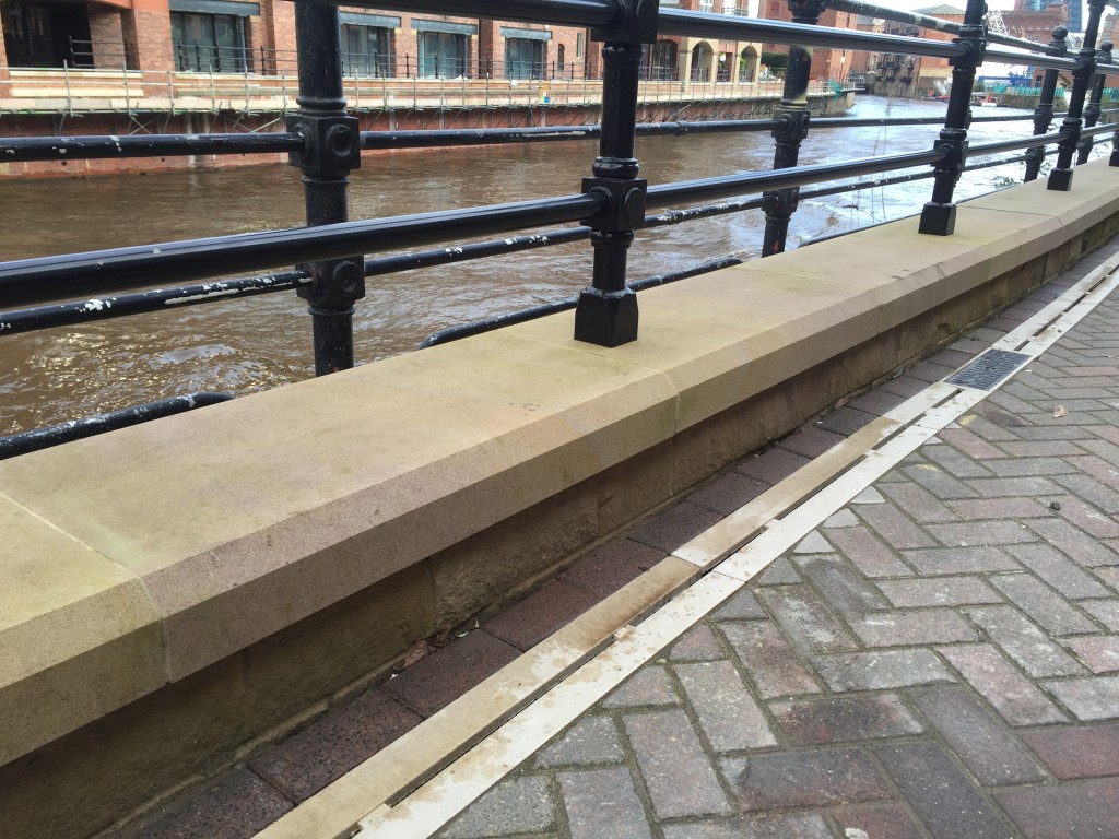
And meanwhile, let’s take a look at some of the EA’s newly installed flood defences downstream in Leeds (picture taken at the beginning of this month)…
2015-12-02 10.25.14

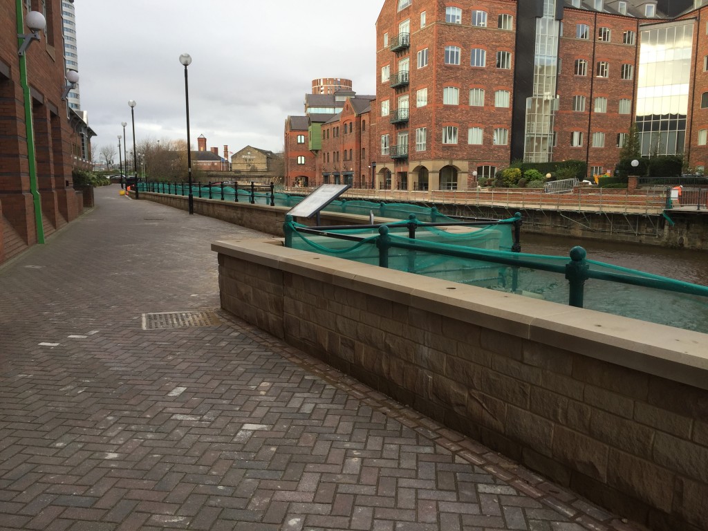
That’s right, folks… along this stretch of the Aire, just outside the big Asda headquarters east of the Neville Street bridge, they have built a new flood wall that’s about, um, 10 inches high? And as you can see, they’ve put new railing on this new wall, without removing the old railings … so that when someone comes to do that, they’ll have to work around the new fence (or hang off the river wall…?). I came across a workman scrubbing mortar off the walkway by the new wall, who worked for “Heritage Masonry” – subcontracted to install true Yorkshire stone along this stretch (at no small cost), whose private opinion was that the costs of building this very low wall seem disproportionate to any potential benefits it might provide… Now, admittedly I’m being a bit naughty here… if you follow the walkway a bit further down, you get a better perspective:
2015-12-02 10.31.14

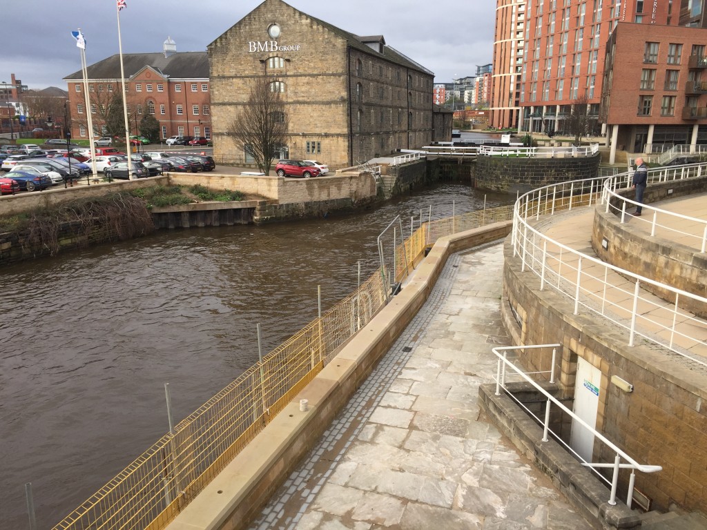
As you can see here, the top of the new wall stays at a constant level, while the walkway itself does not. Hence the very low bit, as well as the more respectably “wall-like” bit here. What you really notice, though, touring the works along this city centre stretch of the river, is that the priority areas for defence seem to have been outside major corporations like Asda and Direct Line (whose new bit of wall is pictured below)… I expect that the City Council has been lobbied by these major players for better future defences… but that again begs the question of just who is listening to the concerns of ordinary citizens and riverside residents (especially those downstream of these works).
2015-12-02 10.22.58

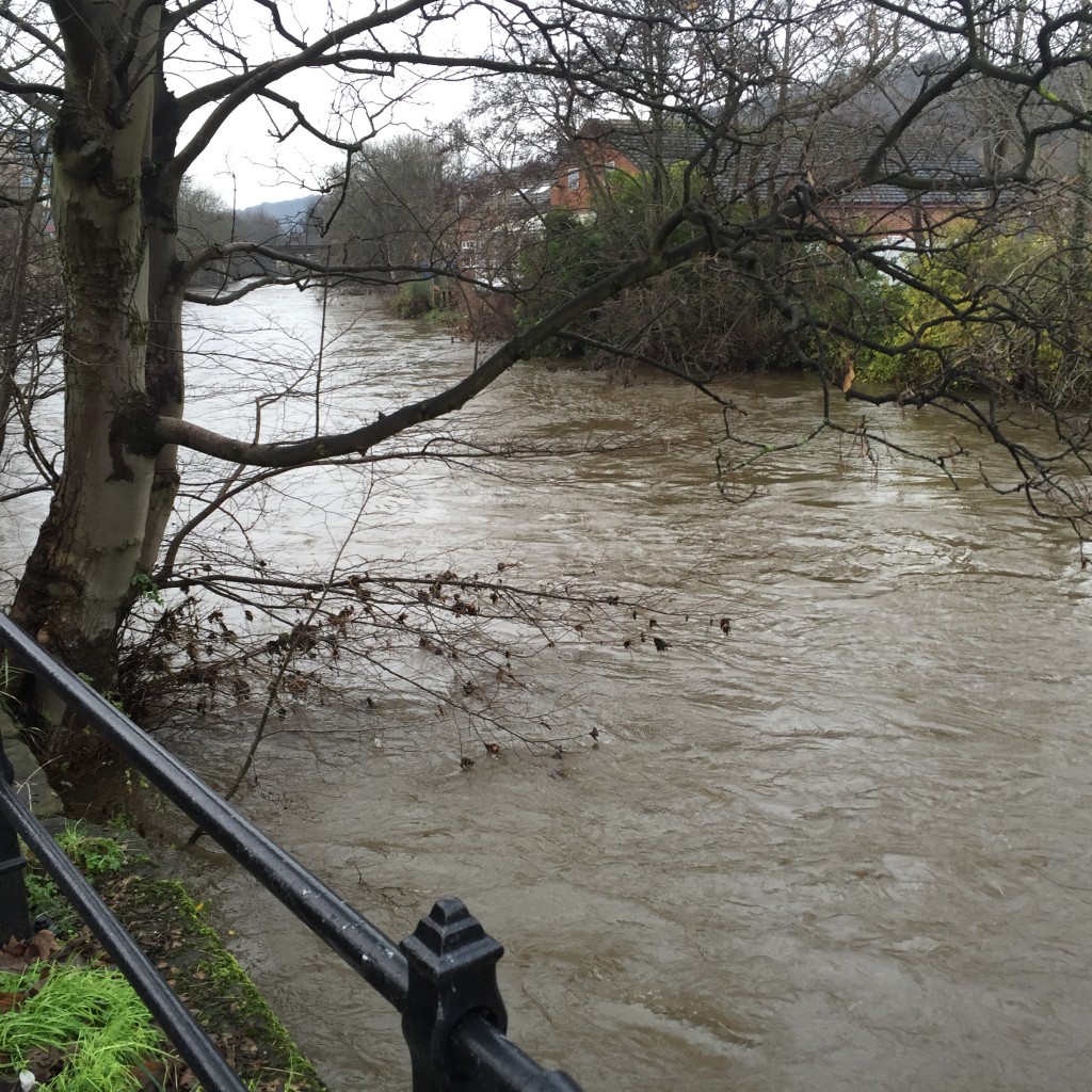
Back in Shipley…. Here’s the very swollen-looking River Aire immediately upstream of Baildon Bridge, looking across towards Woodbottom club just before last Sunday’s party…  The club’s basement had again been flooded just the night before….
2015-12-13 13.38.36

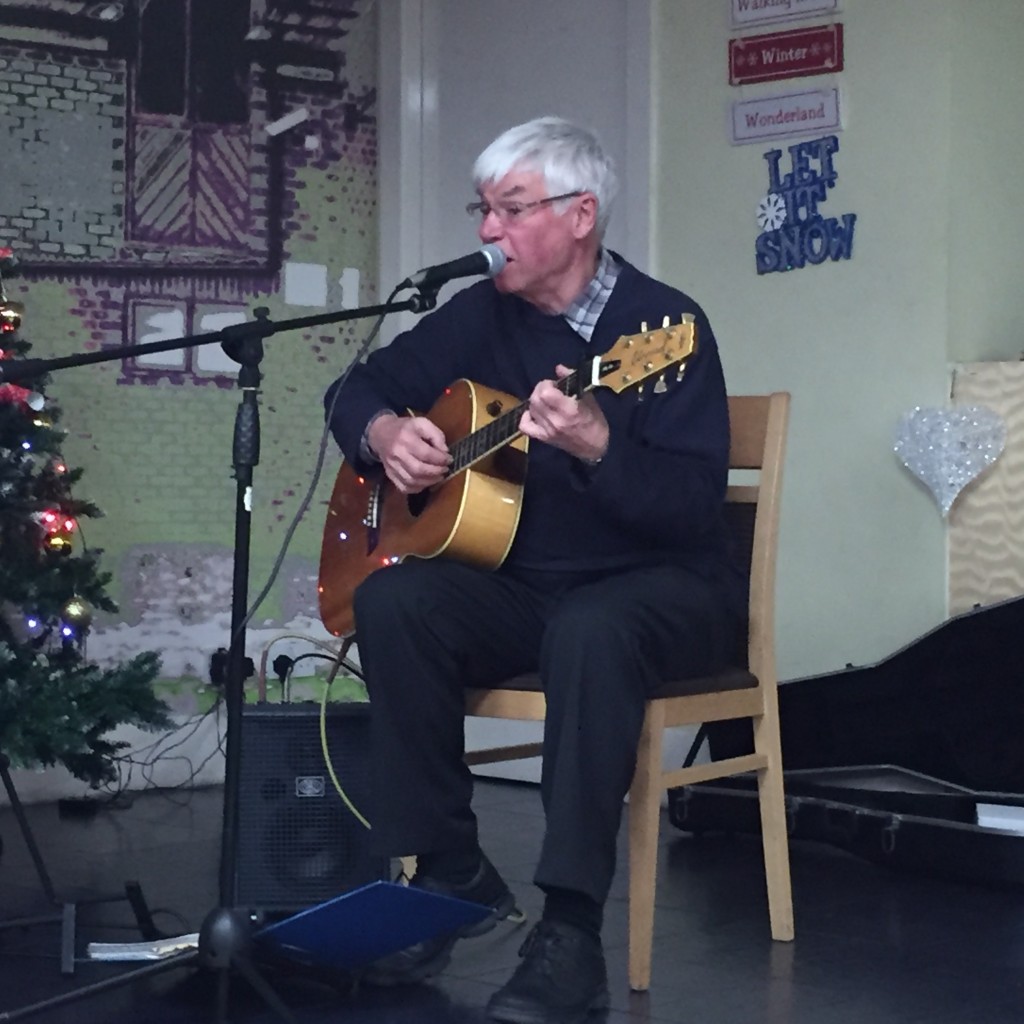
On a wet, cold, dark winter’s evening we were pleased that so many people made the effort to come down Coach Road to join our community party. We were also joined by some friends from some other areas such as Hirst Wood and Lower Holme. Our oldest guest was Margaret, who recently turned 90, our youngest was Maisie, at 4. The entertainment included a pub quiz, brilliantly hosted by Philip, and a short, well-received, perfectly-judged set by singer-songwriter Eddie Lawler (note the seasonal decor!):
2015-12-13 15.39.10

Thanks to everyone who turned out, thanks to Philip and the club for hosting us, thanks to the Rocking Rudolph seasonal beer for – um – rocking us… and hats off especially to Stewart and Pat Gledhill, and to Pam Ruppe, the hardworking organisers behind both the party and the evolving Higher Coach Road Residents’ Action Group (H-CRAG!). Stewart told me that there are a number of new volunteers for the group and its committee, and we’re hoping this community initiative will continue to develop in the new year. Meanwhile, merry Christmas to all!
2015-11-11 21.10.45

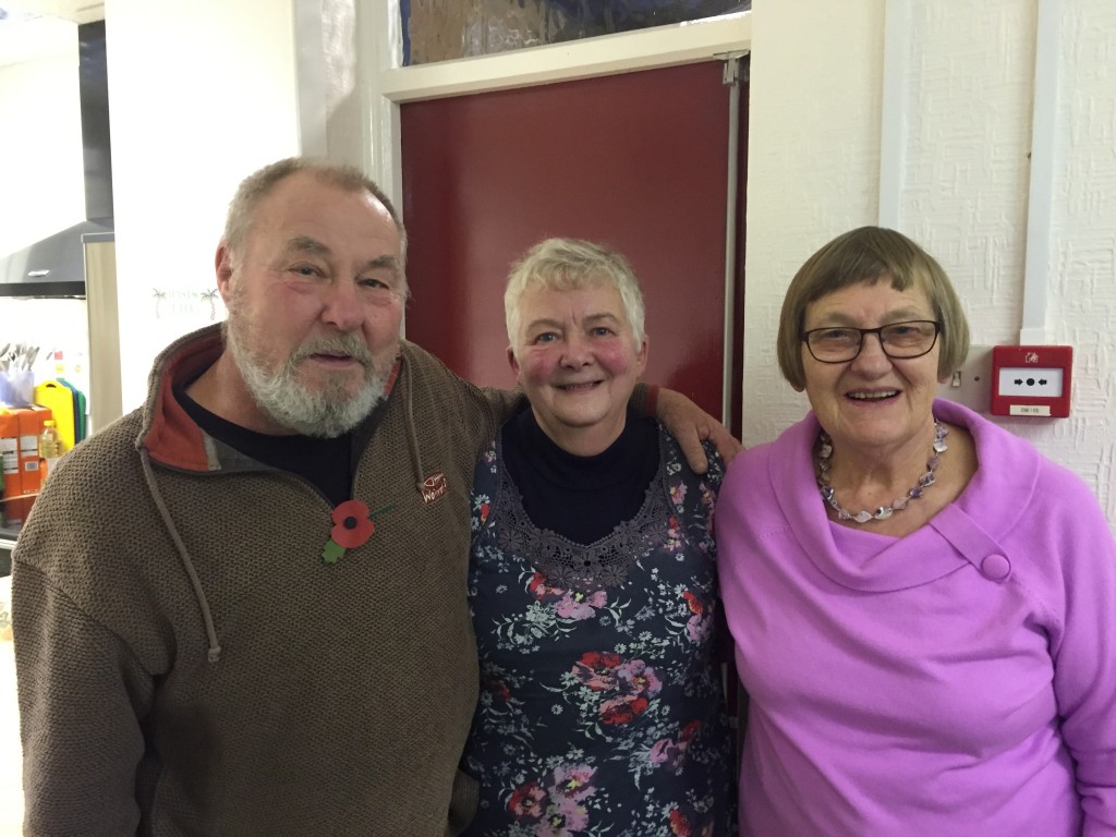
Stewart, Pat and Pam, pictured last month at the H-CRAG meeting hosted at St. Hughs, to which all 3 of the local Green councillors turned up in support!
 

Join us at the Saltaire Festival this coming week…

So the annual Saltaire Festival is almost upon us, and this year the Multi–Story Water project has two contributions to the festivities — we hope you’ll be able to join us.
PVSgraffiti

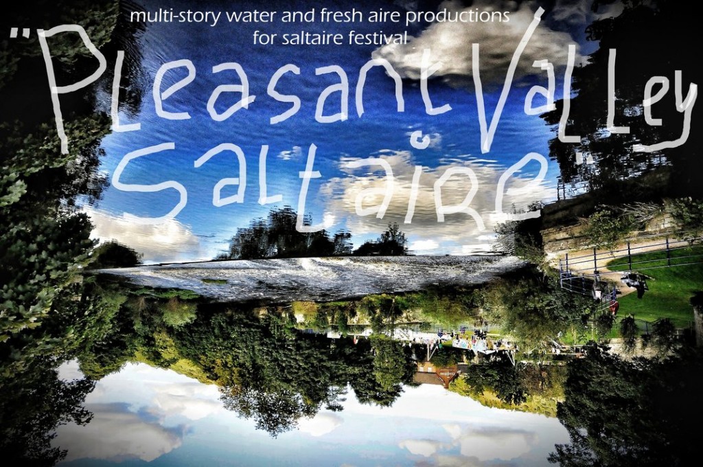
First up is Pleasant Valley Saltaire, on the opening weekend of the festival — Saturday 12th and Sunday 13th September. Billed as a “magical mystery tour”, this is a collaboration between MSW’s Steve Bottoms and local poet and storyteller Irene Lofthouse (Fresh Aire Productions). It also features various surprise guests along the way. Led by a mad professor and a water sprite, the performance maps out a gentle, circular walk through Saltaire village and out into some of the surrounding Aire valley neighbourhoods (Hirst Wood, Higher Coach Road). There’ll be some non-threatening audience participation, and some interventions both natural and supernatural! The journey starts at 2pm from outside Saltaire Visitor Information Centre. And it’s free! All welcome.
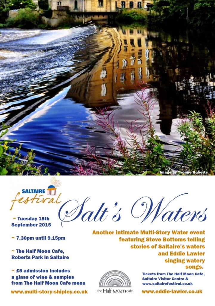
Then, on the evening of Tuesday 15th September, at Half Moon Cafe…

salts watersThis is a follow-up to a successful event with the same title that Eddie Lawler and I did for last year’s festival. We were asked to do it again, as an opportunity for Half Moon Cafe to again show off their tasting menu… We’ll be presenting some of our stories and songs from last year, and also some new material in a new “mix”. Please do join us for an intimate, atmospheric evening…


A statement of intent at Higher Coach Road

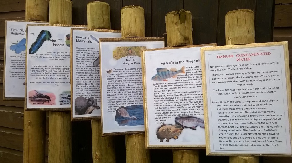
WP_20150823_14_58_05_Pro

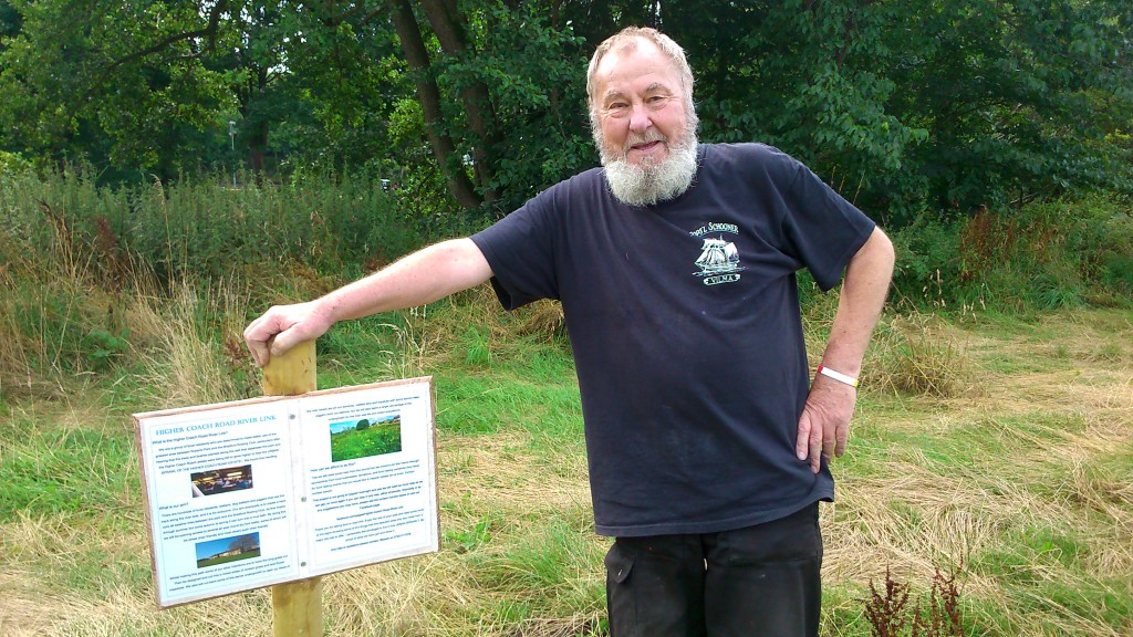
In July we had an event on the grassy flood plain between the River Aire and Higher Coach Road. It involved a “meadow meander” for which we acquired a number of stake-posts to mark out the space used. Those posts this week went back into the ground, now re-purposed to carry the signs pictured above (just before they went out). They’re the work of Stewart Gledhill, of Troutbeck Avenue, who did both the carpentry and the notices/artwork. Here’s Stewart with the first of the posts, after we post-creted it into the ground, close to the start of the riverside path leading from Roberts Park…

DSC_0015

Stewart is shortly to get that beard shaved off — he’s been growing it for sponsorship. (The jury is out on whether he looks more like Captain Birdseye or Uncle Albert from Only Fools and Horses…). Anyway, this first post — which will be mirrored by a similar one at the other end of the estate, when we get round to purchasing a couple of additional stakes — tells the story of why they’re here…

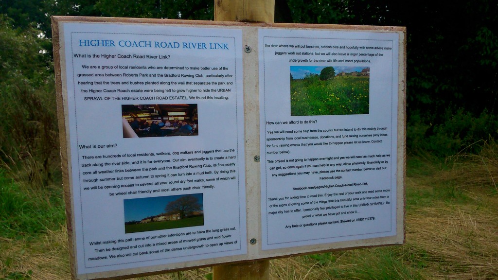
DSC_0016

You can enlarge the picture to read the full text, but the gist of it is that Stewart is now chairing a group of estate residents who want to campaign for better use of this stretch of riverbank next to the estate. It tends to be neglected or ignored from the outside (in fact Stewart’s statement opens with a protest at the estate being “screened out” from the park…). But what if this riverside path could become a properly laid link route between the park and Hirst Wood? What if the field could become an attractive feature to walk through with, for example, wildflowers amongst the grass, and occasional river views cleared through the bankside undergrowth?

DSC_0020

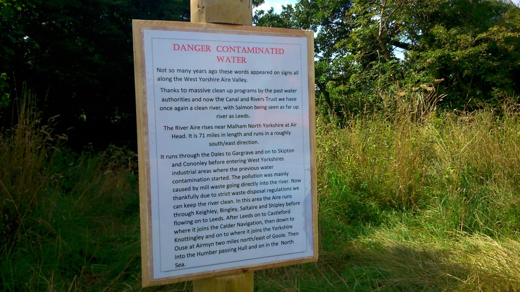
In this next notice, next to which you can glimpse a bit of the river, Stewart has included a statement about the Aire — its source and destination, and about the way that the water quality has improved over the years, a change he has observed first hand…

DSC_0018

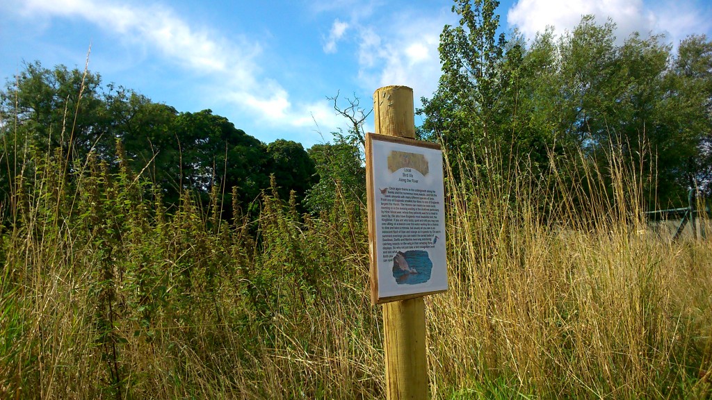
Most of the other notices — like this one, about riverside bird life — then draw attention to aspects of the natural world surrounding us in this area, which we so often overlook as we march past… Look closer, Stewart seems to be suggesting.

DSC_0011

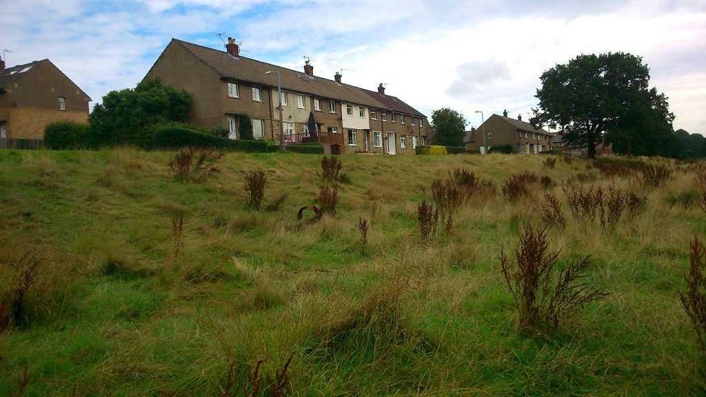
Now of course, at present, a closer look at this field doesn’t really inspire. Bradford Council, facing massive cuts, has stripped back its manpower and mower provision, and this particular area of green has been left to grow wild all summer. For a while it looked rather lovely, with buttercups and long green grasses (see this previous post), but now the field has been taken over by these rapidly spreading, browning dock plants, which make it look almost apocalyptic. Simply leaving nature to take its course isn’t necessarily a great idea if the bits of nature already present are going to go to war like this. There needs to be a plan, and some careful stewardship, if mowing really is going to be less frequent in future years.

That said, even as we were post-creting these notices in, we got chatting to passers-by (both residents on the estate and walkers-through) who were commenting on the benefits of leaving the grass to grow. For instance Peter, from Park Way, was telling me about the swirls of swallows he’s seen diving down on the field outside his window — many more than in previous years — who have been drawn by the plenitude of insects living in the grass (bird food!). With a little care from residents and other interested locals, and a little co-operation from the responsible authorities, maybe a plan can be found that gives the best of both worlds… making the field look tended, cared for and attractive, while also leaving sufficient leeway for grass and plant growth to attract the wildlife people like…

There’s a new facebook page — Higher Coach Road River Link — about this campaign. Do please visit it, and ‘Like’ it! Thanks.

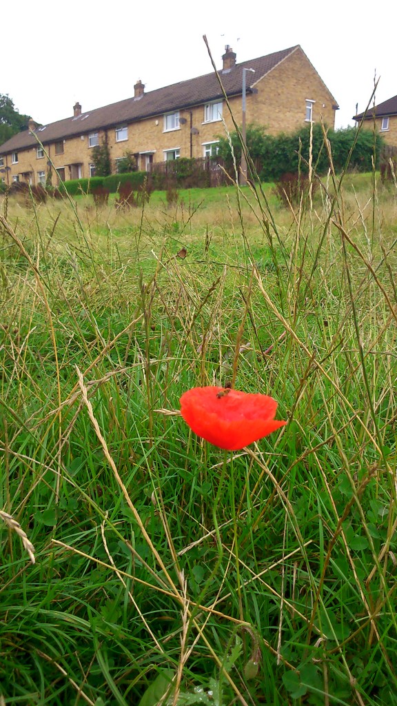
To finish with, here’s an image that sums it up. A single poppy, one of the flowers that a group of residents sewed earlier in the summer as an other small gesture towards future intent… It stands alone, but it’s growing strong — a flash of colour at ground level as you walk by. And as you can see from this image, it’s also of interest to insects… who are of interest to birds… and so on. A small intervention into the great cycle of life…?

DSC_0002


Meadows and Bridges (…Looking back on a very busy few weeks…)

The Multi-Story Water team have had an extremely busy few weeks, so this blog has got a little behind with updates… We’ve had two big weekends — this last one, July 11th-12th (of which more shortly), and a fortnight before that, June 26th-28th, we were involved with two simultaneous water-themed festivals — in Shipley and downstream in Leeds.

The Shipley Street Arts Festival, co-ordinated by our friends at Q20 Theatre on Dockfield Road, was an ambitious attempt to combine traditional street entertainments in Shipley’s town square (jugglers, stiltwalkers, and the like) with a thematic emphasis on the town’s rivers and canal… So a second ‘hub site’ for the festival was down on the canal towpath beside the Ibis Hotel. Here’s what it looked like with the big letters SHIPLEY on display…

Picture1

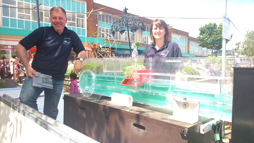
Multi-Story Water was involved in various aspects of the festival — for example, there was a successful screening of our short film Wading to Shipley at the Ibis on the Sunday, and we’d also arranged with JBA Trust (based at Salts Mill) to display their water flume in the town square… It demonstrates different forms of water flow, when you place different kinds of constructions or obstacles in a channel. On one level quite technical, it’s actually really interesting to watch, and there was a lot of curiuos interest from passers-by…

DSC_0028

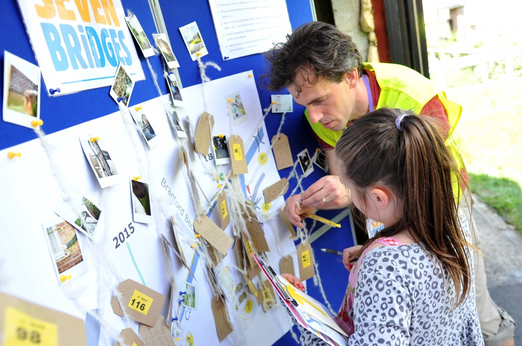
Our main contribution to the festival, though, was an interactive performance piece called Seven Bridgeswhich used the Ibis as its starting point. Spectators (participants, is probably a better word) toured themselves east along the canal towpath towards Dockfields in groups of 4 or 5, and along the way they were given some game-like challenges to complete. They also would encounter various performers. Here’s David Smith, for example, as a heritage tour guide from three hundred years in the future (2315), dressed as an ordinary canal buff from 2015 (geddit?), and pontificating about the significance of the “art” (aka graffiti) on Otley Road Bridge:

Shipley Arts Festival. 28.06.15

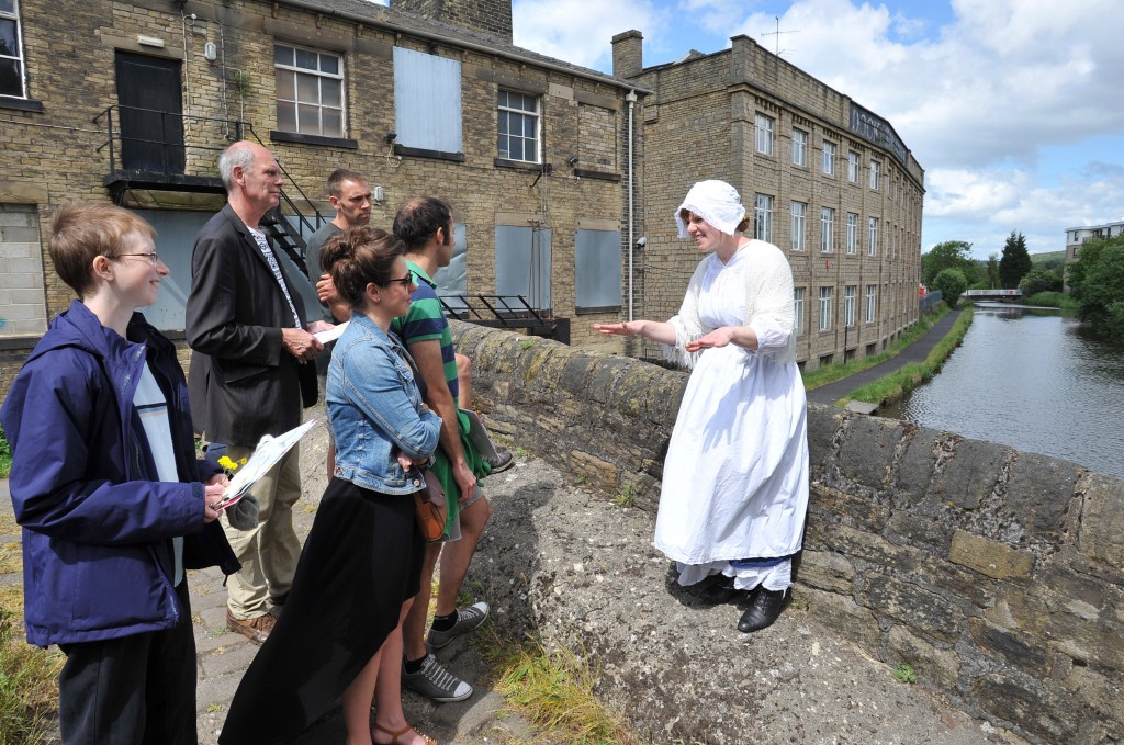
And here’s Lynsey Jones, as a Victorian lock-keeper’s wife (who did all the work opening the locks…), talking to spectators on Junction Bridge…

Shipley Arts Festival. 28.06.15Participants would make their way as far as the old Bradford Canal pumphouse, on Dock Lane, where they would share what they had gathered en route, before returning the way they had come, accompanied by the performers…

Shipley Arts Festival. 28.06.15

There’s more pictures and documentation of Seven Bridges (Shipley) if you look under the “Performances” tab on our menu bar… But for now, let’s turn our attention to its partner piece, Seven Bridges (Leeds)which we presented on the same dates at the Leeds Waterfront Festival. The idea was to “bridge” the two festival locations, upstream and downstream, if only conceptually… Obviously the Leeds version was on a bigger scale, with bigger bridges, and this one took the form of a guided tour rather than a self-led journey… Here’s musician Eddie Lawler (on a day out from his home in Saltaire) kicking the piece off at Clarence Dock (with Crown Point Bridge in the background) with an old canal song about the founding of the Aire and Calder Navigation, which turned Leeds into a “seaport town” in 1700…

DSC06079

But Eddie was just the “local colour” wheeled in to warm the crowd up by Don Freshwater (played by Steve Bottoms, below in the suit)… Don is a both little sinister and a little nuts… he claims to be the CEO of something called the “Leeds Re-Development Corporation”… As Don explains below (in front of Knights Way Bridge and Clarence Dock on the far side) the audience has been gathered as “consultants” to help decide how to redevelop the waterfront… The “ordinary people of Leeds” were never consulted in the past about these matters, so Don wants to consult them now… except that he doesn’t really, because he likes the sound of his own voice too much.

DSC06149

Again, there’s more photos and more detail on this slightly barmy performance (with a serious edge to it) if you look under the “Performances” tab above. Both versions of Seven Bridges were very well received, and pointed us in some interesting directions for future work.

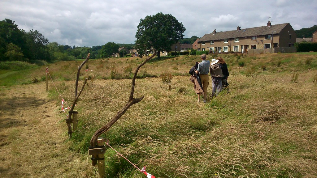
But in the interests of catching up with ourselves, let’s turn our attention now to this last weekend, spent in the flood plain meadow between the River Aire and the Higher Coach Road estate, west of Roberts Park (is it Saltaire, Shipley, Baildon..? you decide – there’s a case for all three). Preparations for the weekend began, in fact, a week earlier, when we sledgehammered a series of fence posts into the field in a rectangular pattern…

DSC_0030

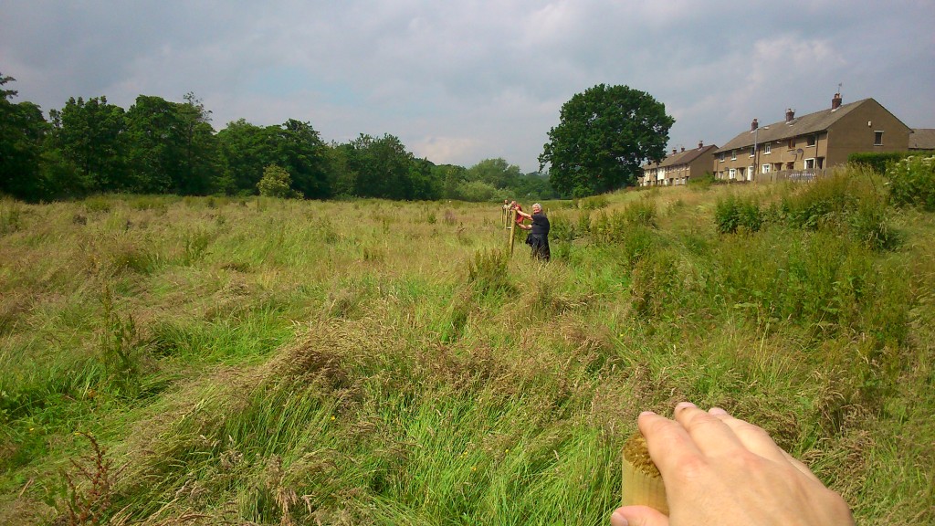
Three fenceposts in a row… that’s Steve’s hand in the foreground, Pat Gledhill with the second one, and Matt Blakeley with the third, obscured by Pat because our line was so straight! (well…)

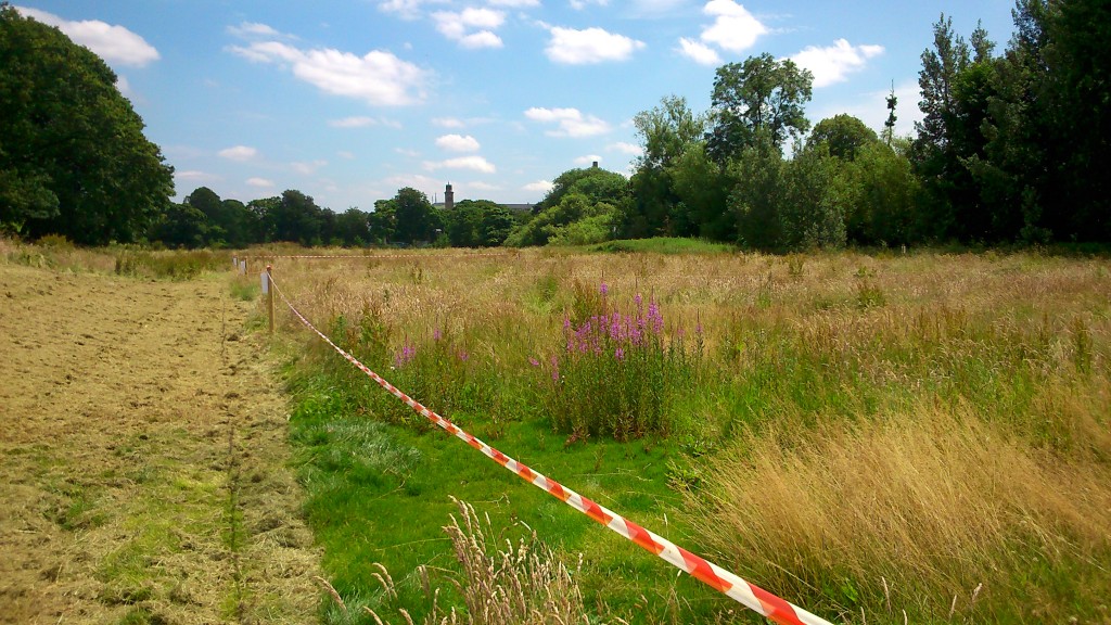
Notice how much longer the grass is than even last month (see previous post, “Meadow Madness”, where it’s much shorter and greener, with more buttercups visible). Basically Bradford Council have said that – with austerity cuts and the resulting loss of manpower and mowers – they will not cut the grass in this field as often as they used to. They did, however, oblige us by at least sparing the time to cut a swathe around our staked-out rectangle, so that by this last weekend, it looked like this:

DSC_0043On Saturday afternoon (July 11th), in the cleared area on the outside of the staked-out rectangle, we held a community barbecue for residents on the estate – with conversation, games for the kids, etc…

Picture2


This was part of our ongoing engagement with residents here, as we (and our colleagues at Kirkgate Centre) work with them on developing some plans for this riverside field… People would like to see a proper footpath, for instance, and other improvements, but the main focus today was the grass… Some residents, understandably, think it’s a disgrace that the grass has been left to grow this long — they feel it looks scruffy, and embarrasses the neighbourhood, and want us to pass on their anger about this to the Council. Others, though (perhaps a majority of those we spoke to this weekend?) seem to think that, if this is to be a meadow in future, then perhaps something more could be made of it — by planting colourful wildflowers, for example, and cutting at least some areas so that it all looks a bit more intentional and a bit less scruffy…

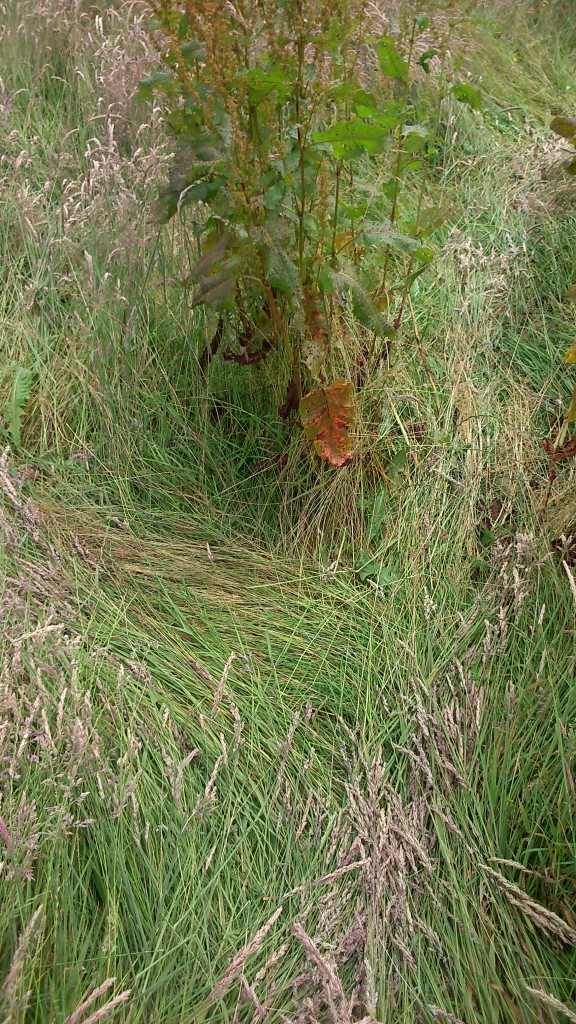
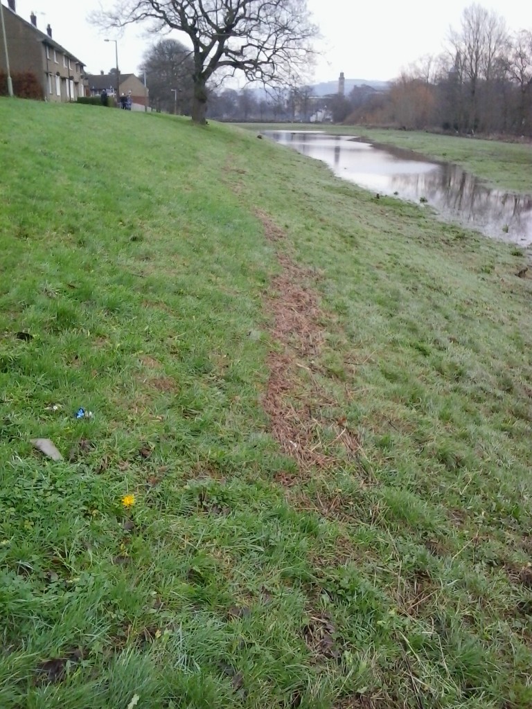
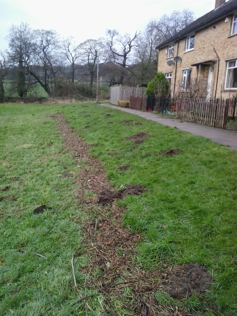
In an attempt to help focus this discussion, by drawing attention to what long grass is actually composed of up close, we created “A Meadow Meander” within the fenced off area. This is a mazy walk created by treading the grass down into a carefully planned set of looping pathways… So for example, in the picture below, you can make out a “Y” junction, where the “lie” of the grass could take you in one of two directions.

DSC_0040

As this picture also starts to suggest, left to their own devices, there are a LOT of different kinds of grasses and other plants growing in the field, and they merit some close up attention… “A Meadow Meander” is the creation of artist Baz Kershaw, and his Earthrise Repair Shop. Baz has created similar installations in various other UK locations, and for this one he had placed a series of jars on small plinths, to be discovered as you move around the maze…Picture3

Each of the jars contains a secret to be puzzled out — just as the winding paths in the grass also follow a particular pattern that visitors are invited to guess at… Baz calls it an “open secret”, because if you’ve done the meander, he’ll happily tell you what the pattern represents… but sorry, if you’re just reading this blog, we’re not going to tell you! The only clue we’ll share is that it might have something to do with the way that long grass looks a little like waves when it is played with by the wind. The River Aire, alongside this meadow, is not the only reason why the meander was appropriate for “Multi-Story Water”…

DSC_0044A Meadow Meander was presented both on the Saturday, along with the barbecue, and on the Sunday, when we put the entrance on the other side of the rectangle, right next to the riverside path. This meant that, where on Saturday it was mainly residents in the meander, on Sunday it was mainly passers-by — walking between Roberts Park and Hirst Wood. We wanted to get their ideas too, on the great meadow debate…

DSC_0052

A big thankyou to everyone who made the events described happen… and especially — on the Higher Coach Road estate — a huge thanks to Sarah Muller and to Stewart and Pat Gledhill for so enthusiastically helping to create (and indeed dismantle) the meadow meander… The fence posts are at Stewart and Pat’s as I write, and we have some future plans in store for them…

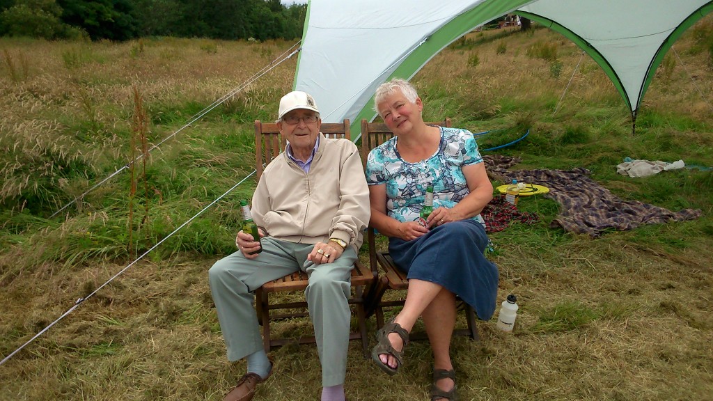
Pat Gledhill, with her Troutbeck Avenue neighbour Eric -- who kindly donated alcohol to the cause!

Pat Gledhill, with her Troutbeck Avenue neighbour Eric — who kindly donated alcohol to the cause!


Meadow madness!

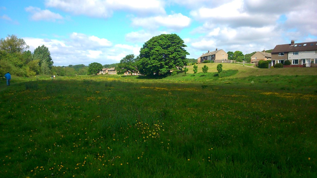
The Higher Coach Road estate in spring/early summer…

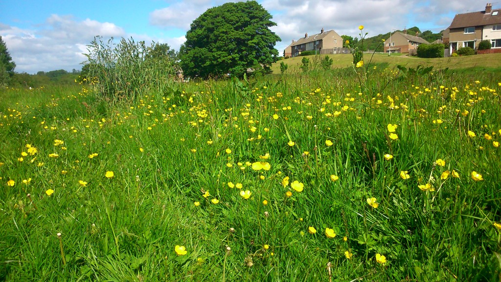
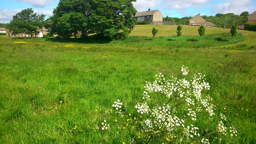
DSC_0001This grassy flood plain next to the river (the riverside path is where that man in blue is walking to the left) has traditionally been mowed fairly regularly by Bradford Council. But in an age of austerity, they’re letting the grass grow… The buttercups have taken the opportunity to add a sprinkling of yellow to the “monoculture” green…

DSC_0003And there are larger wildflowers, too, growing up tall because they haven’t been annihilated at birth…

DSC_0005Recent meetings at the rowing club with residents from the estate have led to the idea of campaigning to turn this into a “real” wildflower meadow — seeded with poppy and cornflower, perhaps — to bring vivid colour to the area. It’s an approach that has already been applied up at Northcliffe Park. And the other weekend, by way of kicking this off, a group of us got together to do some planting…

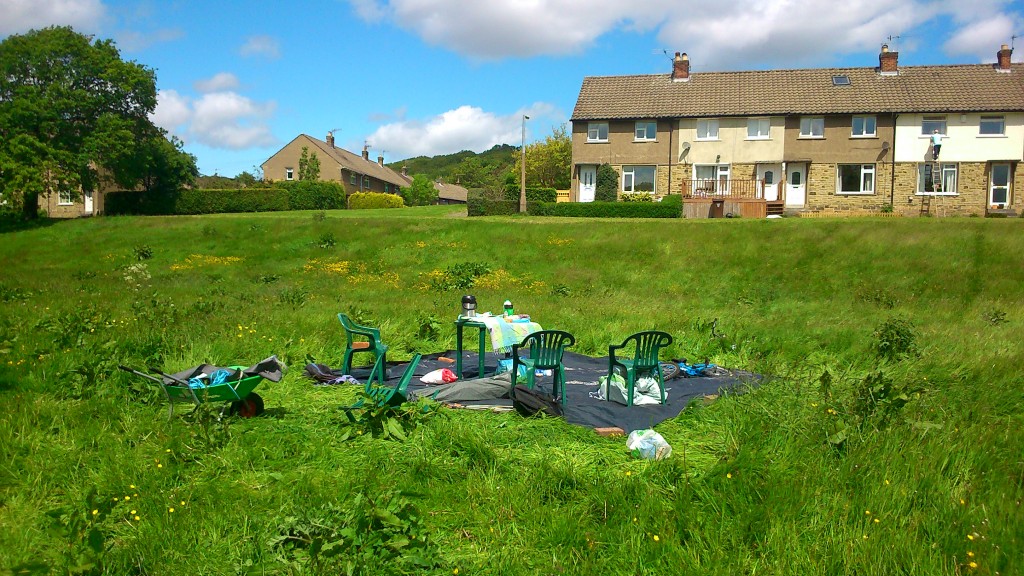
DSC_0021Here’s the remains of the gazebo tent we put up for shade and as a refreshment area. The wind was too strong for it so we had to take it down again… an outcome indicative of how our whole plan started to go a bit south! The Council had provided us with some “plugs” to plant amid the long grass, to provide colour… but in the event it turned out that the plugs were too small, and the grass too long, to plant in the “meadow” proper. Nor, in fact, were they the promised poppy plugs… they turned out to be begonias!

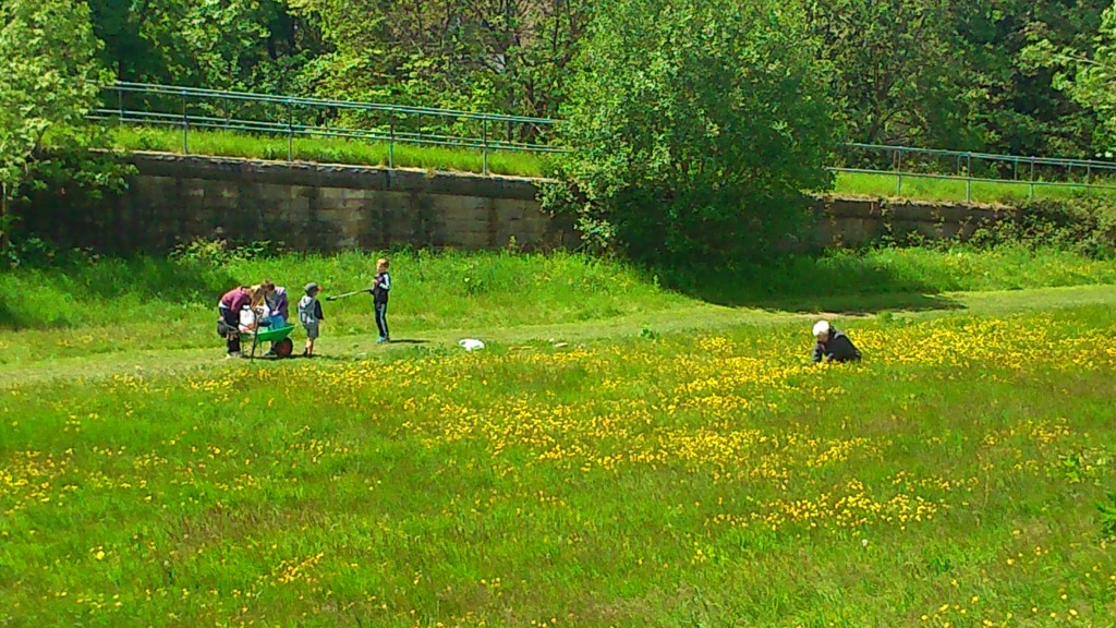
Anyway, we made the best of the situation by electing to plant the plugs in the shorter grass at the edge of the riverside path (the path is the one bit of the field that is getting mown!). This in the hope of creating a little avenue of yellow to greet walkers coming by. And meanwhile Irene (below, accompanied by some local children who joined us to help out) found got some poppies from her own garden and determinedly planted them in the field outside her house on Bowland Avenue!

DSC_0022

So, not exactly the day we’d had in mind, but from small seeds grow great, er… well you get the idea! Fun was had by all, plenty of jokes shared, and I was treated to a beer by Irene’s neighbour Ruth when we packed up. The campaign continues! 🙂